|
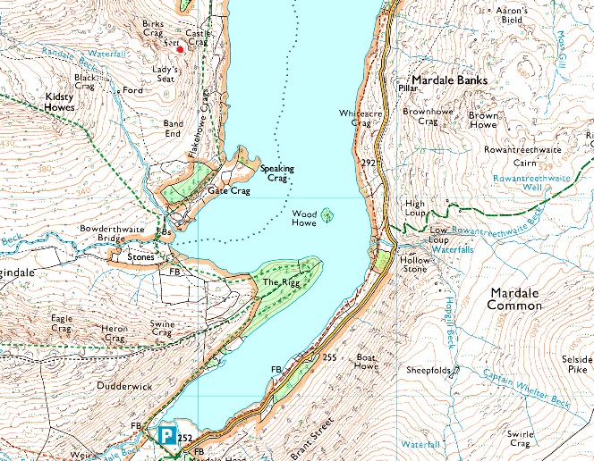
Castle Crag, Mardale |
 |
 |
Overview |
 |
|
| Height: |
1.296 Feet - 395 Metres |
| Grid Ref: |
NY 469 127 |
| Area: |
Far Eastern |
| Group: |
E/HST |
| Ordnance Survey: |
OL5 |
|
| |
|
Map and Photo Gallery |
|
|
|
| |
|
Walks including Castle Crag, Mardale are:- |
|
|
A Riggindale Round |
|
|
 |
|
26th August 2017 |
| ASCENT: |
2,770 Feet - 844 Metres |
| MILES: |
10.6 |
| WAINWRIGHTS: |
5, High Street - The Knott - Rampsgill Head - Kidsty Pike - High Raise (Martindale) |
| ROUTE: |
Mardale Head - The Rigg - Rough Crag - Caspel Gate - Long Stile - High Street - Straights of Riggindale - The Knott - Rampsgill Head - Kidsty Pike - High Raise (Martindale) - Low Raise - Castle Crag (Fort) - Randale Beck - Riggindale Beck - The Rigg - Mardale Head |
|
| |
|
A Riggindale Round |
|
|
|
|
12th October 2014 |
| ASCENT: |
2,960 Feet 902 Meters |
| MILES: |
8.5 |
| WAINWRIGHTS: |
5, High Street – The Knott – Rampsgill Head – Kidsty Pike – High Raise |
| ROUTE: |
Mardale Head – Rough Crag (Riggindale) – Caspel Gate Tarn – Long Stile – High Street – Straights of Riggindale – The Knott – Rampsgill Head – Kidsty Pike – High Raise – Low Raise – Castle Crag (Mardale) – The Rigg – Mardale Head |
|
| |
| Back to top |
 |
|