 |
High Scarth Crag |
 |
 |
Overview |
 |
|
| Height: |
1,598 Feet - 487 Metres |
| Grid Ref: |
NY 215 043 |
| Area: |
Southern |
| Group: |
W/ESK |
| Ordnance Survey: |
OL6 |
|
| |
|
Map and Photo Gallery |
|
|
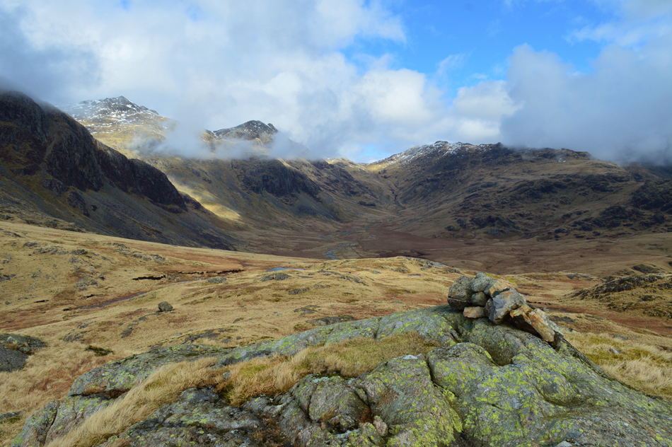 |
| Cam Spout Crag, Scafell Pike, Pen, III Crag, Esk Pike and Great Moss from High Scarth Summit. |
| |
|
| |
|
Walks including High Scarth are:- |
|
|
Hard Knott, Cam Spout Crag & Slight Side from Jubilee Bridge |
|
|
 |
|
17th July 2021 |
| ASCENT: |
3,578 Feet - 1,091 Metres |
| MILES: |
10 |
| WAINWRIGHTS: |
2, Hard Knott - Slight Side |
| ROUTE: |
Jubilee Bridge - Hard Knott Pass - Hardknott Roman Fort - Border End - Hard Knott - Yew Bank - Lingcove Beck - Great Moss - River Esk - Cam Spout - How Beck - Cam Spout North Ridge - Cam Spout Crag - Long Green - Slight Side - Traverse Below Horn Crag - High Scarth Crag - Scale Bridge - Taw House - Brotherilkeld - Jubilee Bridge |
|
| |
|
Walking the Birketts - Upper Eskdale Round |
|
|
|
|
24th March 2018 |
| ASCENT: |
2,798 Feet - 853 Metres |
| MILES: |
8.8 |
| BIRKETTS: |
7, Border End - Hard Knott - Yew Bank - Throstlehow Crag - Scar Lathing - High Scarth - Silverybield |
| ROUTE: |
Top of Hard Knott Pass - Border End - Eskdale Needle - Hard Knott - Yew Bank - Lingcove Beck - Throstlehow Crag - Scar Lathing - River Esk - High Scarth - Silverybield - Damas Dubs - Scale Gill - Scale Bridge - Taw House - Brotherilkeld - Hard Knott Pass - Hardknott Fort - Top of Hard Knott Pass |
|
| |
| Back to top |
 |
|
