|
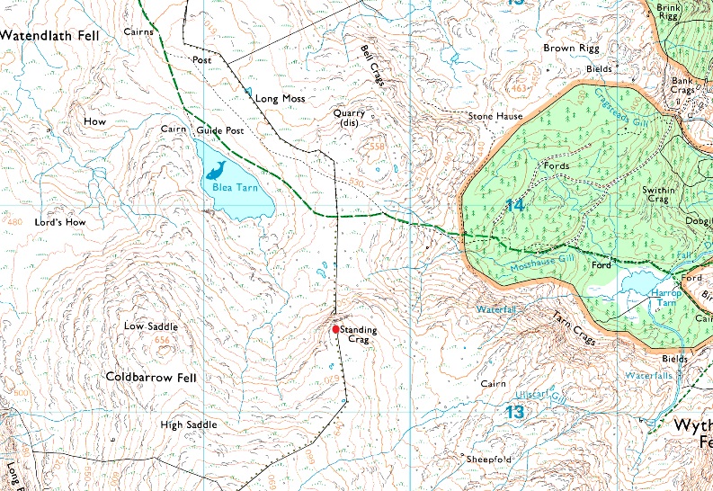
Standing Crag |
 |
 |
Overview |
 |
|
| Height: |
2004 Feet - 611 Metres |
| Grid Ref: |
NY 296 133 |
| Area: |
Central |
| Group: |
W/DER |
| Ordnance Survey: |
OL4 |
|
| |
|
Map and Photo Gallery |
|
|
|
| |
|
Walks including Standing Crag are:- |
|
|
Ullscarf to High Tove via Wyth Burn |
|
|
 |
|
5th October 2024 |
| ASCENT: |
2,483 Feet - 756 Metres |
| MILES: |
11.7 |
| WAINWRIGHTS: |
3, Ullscarf - High Tove - Armboth Fell |
| ROUTE: |
Wythburn - Wyth Burn - Wythburn Head - The Bog - Middle How - Greenup Edge - Ullscarf - Standing Crag - Bell Crags - Long Moss - High Tove - Armboth Fell - Armboth - Road West of Thirlmere - Thirlmere Dam - Turnip Corner |
|
| |
|
Great Crag to Eagle Crag via Watendlath |
|
|
|
|
8th June 2024 |
| ASCENT: |
3,156 Feet - 962 Metres |
| MILES: |
12.2 |
| WAINWRIGHTS: |
4, Great Crag - Ullscarf - Sergeant's Crag - Eagle Crag |
| ROUTE: |
Stonethwaite - Lingy End - Dock Tarn - Great Crag - Watendlath - Above Bleatarn Gill - Blea Tarn - Standing Crag - Ullscarf - Greenup Gill Head - Sergeant's Crag - Eagle Crag - Greenup Gill - Stonethwaite |
|
| |
|
The Wythburn Fells |
|
|
|
|
23rd November 2012 |
| ASCENT: |
798 Metres, 2,618 Feet |
| MILES: |
9.6 |
| WAINWRIGHTS: |
4, Ullscarth – High Raise – Calf Crag – Steel Fell |
| ROUTE: |
Wythburn – Birk Crag – Harrop Tarn – Mosshause Gill – Standing Crag – Ullscarth – Greenup Edge – Low White Stones – High Raise – Sergeant Man – Deep Slack – Brownrigg Moss – Steel Fell – Steel Fell North Ridge – Steel End – Wythburn |
|
| |
| Back to top |
 |
|