|
|
24th March 2018 |
| ASCENT: |
2,798 Feet - 853 Metres |
| MILES: |
8.8 |
| BIRKETTS: |
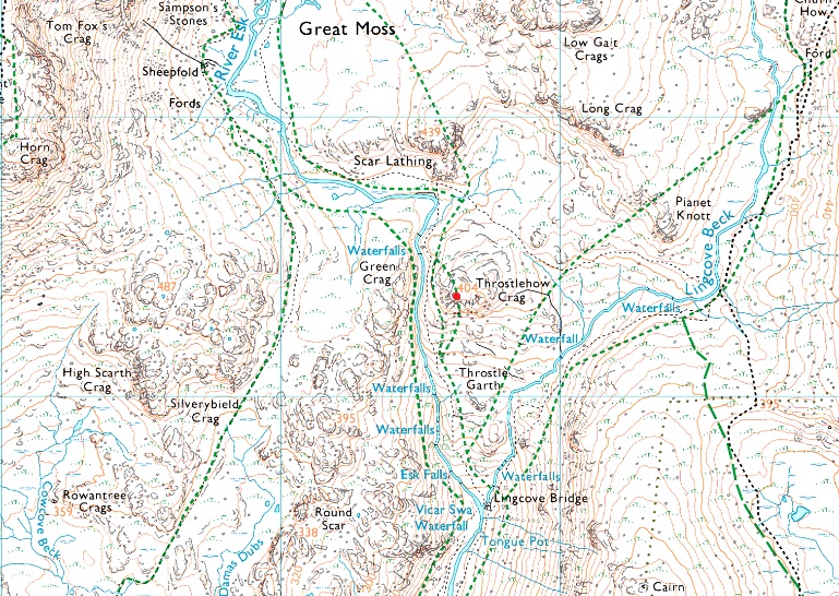
7, Border End - Hard Knott - Yew Bank - Throstlehow Crag - Scar Lathing - High Scarth - Silverybield |
| ROUTE: |
Top of Hard Knott Pass - Border End - Eskdale Needle - Hard Knott - Yew Bank - Lingcove Beck - Throstlehow Crag - Scar Lathing - River Esk - High Scarth - Silverybield - Damas Dubs - Scale Gill - Scale Bridge - Taw House - Brotherilkeld - Hard Knott Pass - Hardknott Fort - Top of Hard Knott Pass |
|