|
Parking Information for - Parking Spaces, Rannerdale Farm |
 |
 |
Parking Details and Map |
 |
|
| Nearest Post Code: |
CA13 9UZ |
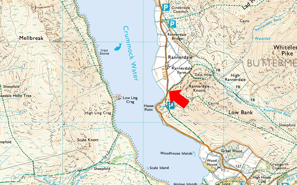
| Grid Reference: |
NY 163 118 |
| Notes: |
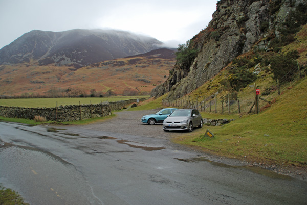
The parking spaces are owned by the National Trust and are found just off the B5289 along the shore of Crummock Water below Rannerdale Knotts and are perfectly positioned for walks up onto Rannerdale Knotts or to visit the Rannerdale Bluebells between April and May where you may find parking quite difficult if you aren't early. There is room for around ten cars and parking is free. |
|
| |
|
Photos |
|
|
|
| |
|
Walks starting from this parking place |
|
|
|
Grasmoor & Neighbours |
|
|
 |
|
7th February 2025 |
| ASCENT: |
3,900 Feet - 1,188 Metres |
| MILES: |
9 |
| WAINWRIGHTS: |
7, Whiteside - Hopegill Head - Grasmoor - Eel Crag (Crag Hill) - Wandope - Whiteless Pike - Rannerdale Knotts |
| ROUTE: |
Lanthwaite Green - Liza Beck - Whin Ben - Whiteside - Hopegill Head - Sand Hill - Coledale Hause - Grasmoor - Eel Crag (Crag Hill) - Wandope - Thirdgill Head Man - Whiteless Edge - Whiteless Pike - Low Bank - Rannerdale Knotts - Rannerdale Farm |
|
| |
|
Walking the Birketts, Grasmoor to Whiteless Pike Circuit |
|
|
|
|
23rd March 2019 |
| ASCENT: |
3,040 Feet - 927 Metres |
| MILES: |
6.4 |
| BIRKETTS: |
6, Lad Hows - Grasmoor - Wandope - Thirdgill Head Man - Whiteless Pike - Rannerdale Knotts |
| ROUTE: |
Rannerdale Farm - Squat beck - Lad Hows - Grasmoor - Wandope - Thirdgill Head Man - Whiteless Edge - Whiteless Pike - Low Bank - Rannerdale Knotts - Rannerdale Farm |
|
| |
|
Walking the Wainwrights in 30 Walks - Walk 29 Rannerdale Knotts to Barrow |
|
|
|
|
27th August 2016 |
| ASCENT: |
5,898 Feet - 1,798 Meters |
| MILES: |
15.9 |
| WAINWRIGHTS: |
13, Rannerdale Knotts - Whiteless Pike - Wandope - Grasmoor - Whiteside - Hopegill Head - Grisedale Pike - Eel Crag (Crag Hill) - Sail - Scar Crags - Causey Pike - Outerside - Barrow |
| ROUTE: |
Rannerdale Farm - Rannerdale Knotts - Whiteless Breast - Whiteless Pike - Whiteless Edge - Wandope - Grasmoor - Coledale Hause - Sand Hill - Whiteside - Hopegill Head - Grisedale Pike - Coledale Hause - Eel Crag (Crag Hill) - Sail - Scar Crags - Causey Pike - High Moss - Outerside - Barrow Door - Barrow - Braithwaite |
|
| |
|
| |
| Back to top |
 |
|