|
Parking Information for - Roadside Spaces, Castlerigg Stone Circle |
 |
 |
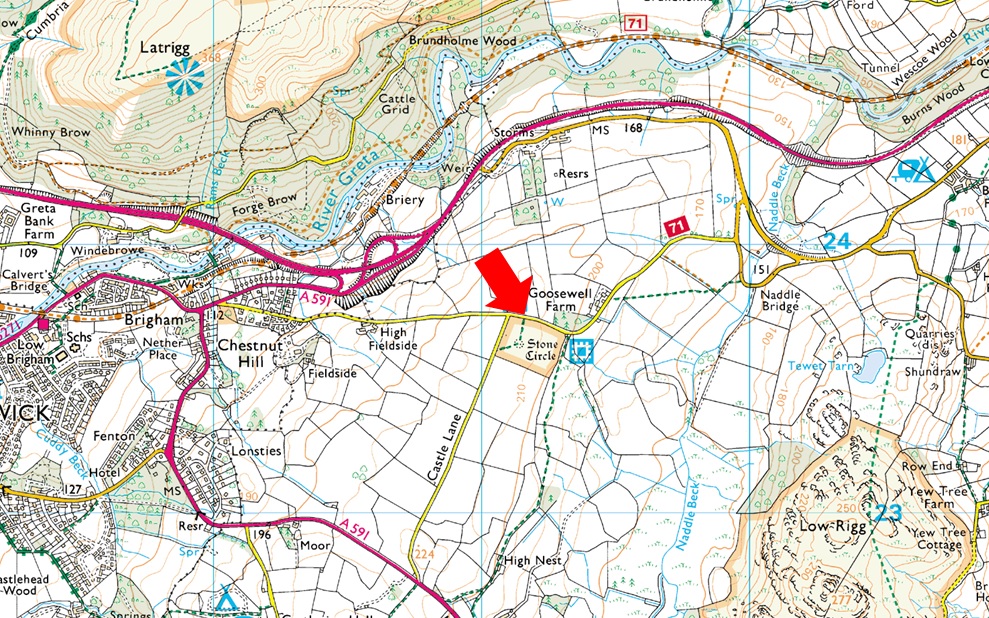
Parking Details and Map |
 |
|
| Nearest Post Code: |
CA12 4RN |
| Grid Reference: |
NY 291 523 |
| Notes: |
Castlerigg Stone Circle is a popular parking spot for those not only wanting to explore Castlerigg Stone Circle but for those who want to take in the excellent views over Blencathra from the ancient stones. Due to the popularity of Castlerigg finding a place to park during the height of Summer can be difficult therefore my advise is to arrive early. Castlerigg is the type of Lakeland hotspot which attracts thousands of visitors each year, not all of whom who visits stays more than one hour which can open up car spaces throughout the day. The lane is quite narrow but there is room for upto twenty cars at a time. Parking is free. |
|
| |
|
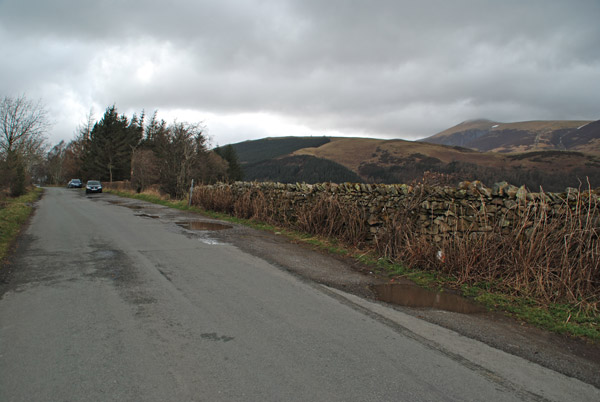
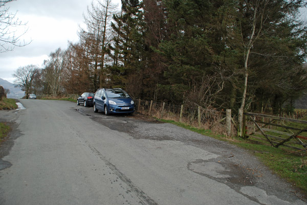
Photos |
|
|
|
| |
|
Walks starting from this parking place |
|
|
|
Walla Crag to High Rigg via Bleaberry Fell |
|
|
 |
|
11th March 2017 |
| ASCENT: |
3,540 Feet - 1,079 Metres |
| MILES: |
11.7 |
| WAINWRIGHTS: |
4, Walla Crag - Bleaberry Fell - Raven Crag - High Rigg |
| ROUTE: |
Castlerigg Stone Circle - Castle Lane - Rakefoot - Walla Crag - Bleaberry Fell - Dodd Crag - - Shoulthwaite Gill - Forestry Path - Raven Crag - Thirlmere Dam - A591 - High Rigg - Low Rigg - Naddle Bridge - Goosewell Farm - Castlerigg Stone Circle |
|
| |
|
Walking the Wainwrights in 30 Walks - Walk 5 The Central Ridge |
|
|
|
|
3rd March 2016 |
| ASCENT: |
2,238 Feet - 683 Meters |
| MILES: |
12.8 |
| WAINWRIGHTS: |
6, Walla Crag - Bleaberry Fell - High Seat - High Tove - Armboth Fell - Raven Crag |
| ROUTE: |
Castlerigg Stone Circle - Castle Lane - Rake Foot - Walla Crag - Bleaberry Fell - High Seat - The Pewits - High Tove - Armboth Fell - Forestry Track - Raven Crag - Forestry Track to Shoulthwaite Farm - A591 - Nest Brow - Castle Lane - Castlerigg Stone Circle |
|
| |
|
Raven Crag & Castlerigg Stone Circle |
|
|
|
|
7th September 2014 |
| ASCENT: |
2,215 Feet – 675 Metres |
| MILES: |
9.7 |
| WAINWRIGHTS: |
2, Raven Crag – High Rigg |
| ROUTE: |
Castlerigg Stone Circle – Castle Lane – A591 – Nest Brow – Brackenrigg – Shoulthwaite – Shoulthwaite Gill – Castle Crag (fort) – Raven Crag – Thirlmere Dam – A591 – St Johns Beck – High Rigg – St Johns-in-the-Vale Church – Low Rigg – Tewit Tarn – Naddle Bridge – Goosewell Farm – Castlerigg Stone Circle |
|
| |
|
Raven Crag from Castlerigg Stone Circle |
|
|
|
|
9th June 2013 |
| ASCENT: |
2,215 Feet, 675 Metres |
| MILES: |
9.6 |
| WAINWRIGHTS: |
1, Raven Crag |
| ROUTE: |
Castlerigg Stone Circle – Castle Lane – A591 – Nest Brow – Brackenrigg – Shoulthwaite Gill – Castle Crag (fort) – Sippling Crag (The Benn) – Raven Crag – Thirlmere Dam – A591 – St Johns Beck – Sosgill – Rake How – St Johns-in-the Vale Church – Low Rigg – Tewit Tarn – Naddle Bridge – Goosewell Farm – Castlerigg Stone Circle |
|
| |
|
Castle Rigg Stone Circle to Raven Crag |
|
|
|
|
15th October 2011 |
| ASCENT: |
2,200 Feet, 670 Meters |
| MILES: |
9.5 |
| WAINWRIGHTS: |
2, Raven Crag & High Rigg |
| ROUTE: |
Castle Rigg Stone Circle Castle Rigg Lane A591 Bracken Rigg Raven Crag Thirlmere Dam High Rigg Low Rigg Tewit Tarn |
|
| |
|
| |
| Back to top |
 |
|