|
Ben Nevis (Bienn Nibheis) |
 |
 |
15th May 2010 |
 |
|
It all started roughly about Jan 2010, three workmates on the shop floor chatting about something mammoth in what shall we do next, you know what I mean, the kind of chit chat that gets forgotten after a brew, we’d done Helvellyn, we’d done Scafell & the Manchester to Blackpool bike plus ride all 63 miles of it (also on schedule for July 2010), plus various other projects, so come on I chirps up lets do Ben Nevis, lets get winter well & truly out the way & climb Nevis, a long pause & a couple of strange looks in my direction “you know what Paul I think we should” When do you reckon? (butterflies whizzing round my stomach!) May’s a good month & after a look at the calendars in our mobile phones it was decided it would be the 15th & unless the Highlands were going to get hit by some huge tidal wave & of course the Highlands wasn’t under 10Ft of snow then nothing was stopping us.
The original plan right up until two weeks prior was to drive up to Fort William on the Saturday & do the climb on the Sunday having a whole 8hrs sleep & being more than ready the following morning,..now for me that was a good idea, until Lee added to the fact “look if we drive up to Fort William, then check into the B&B you know full well we’ll spend the rest of the day & night in the bar” Lee had a point, we’d be wrecked come midnight & be in no fit condition to tackle the highest Mountain in the UK, so the plan changed, drive up, head straight for Fort William, find the car park & kit up, in theory it sounded a whole lot better than being tanked up & then having to drive the 320 or so miles back to Wigan, I’m so glad we had the nonce to change the plan, a lot of the people i’d spoke to having climbed Ben Nevis did our original plan but then again a lot of people can’t control there beer urges like the six of us cant :-) Joking aside we made the right decision, all we had to do now was tackle the ever changing weather the Scottish Highlands decided to throw at us.
|
| |
|
Overview |
|
|
| Ascent: |
4,409 Ft 1,344 Mtrs |
| Munro's: |
1 Ben Nevis |
| Weather: |
Lows of 6 Degrees, very varied & interchangeable, out breaks of sun & showers, sleet & snow Above 900Mtrs, with sometimes 30Mtr visibility, lows of 1 Degrees’ but felt like –9 along with very strong winds on the summit |
| Parking: |
Glen Nevis Tourist Information Car Park |
| Area: |
Scottish Highlands (Western) |
| Miles: |
10.3 |
| Walking With: |
|
| Ordnance Survey: |
41 (1:50) |
| Time Taken: |
7 Hours (Four up, Three Down) |
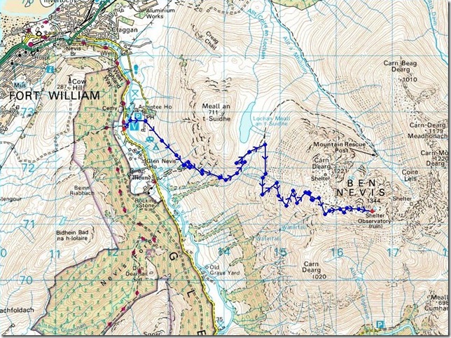
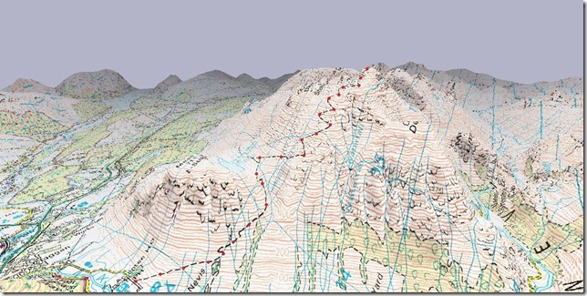
| Route: |
|
|
| |
|
Map and Photo Gallery |
|
|
 |
| |
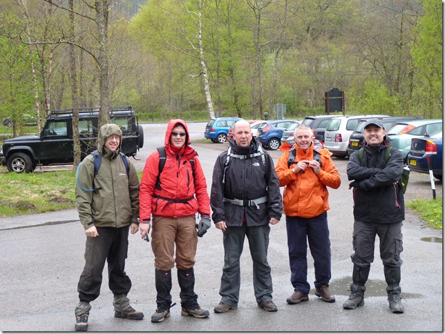
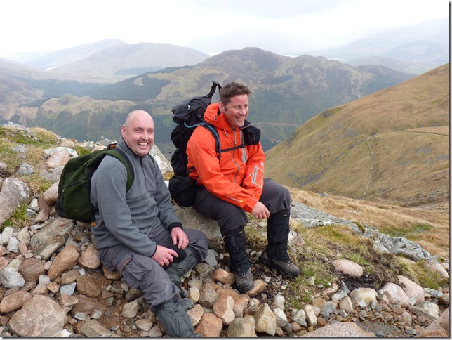
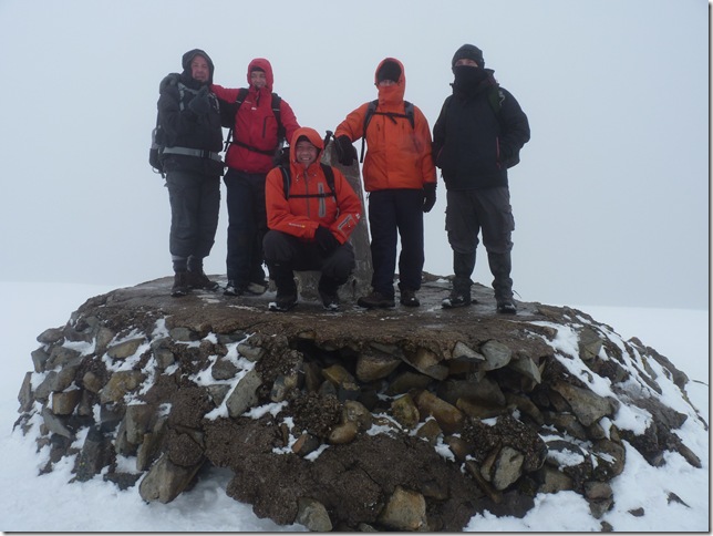
The gang, L to R, Lee, Neil, Ste, Alan & Ste looking surprising chuffed with himself! |
 |
| |
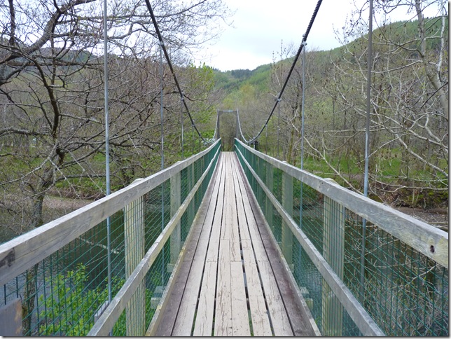
The suspension bridge over aptly named River Nevis . |
 |
| |
And now flanking the slopes of Meall an t- Suidhe (The tourist path), we’d only been walking 20 minutes or so & by that time we’ve already had our fair share of soakings & all the time it was quite muggy, so it was on/off with the weather proofs until the weather got a hold of itself . |
 |
| |
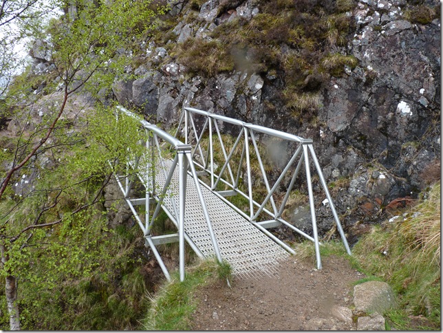
Looking back on one of the many steel bridges crossing the gully’s & waterfalls. |
 |
| |
Looking up towards the mass of the summit nearing Red Burn, for now our path takes us slightly eastwards away from the summit & towards Loch Meall an t- Suidhe & will eventually take us across the Hugh gully seen centre, & finally take us the steep zig zags path summit bound, but for now that is along long way away . |
 |
| |
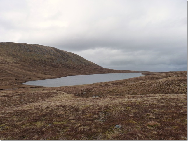
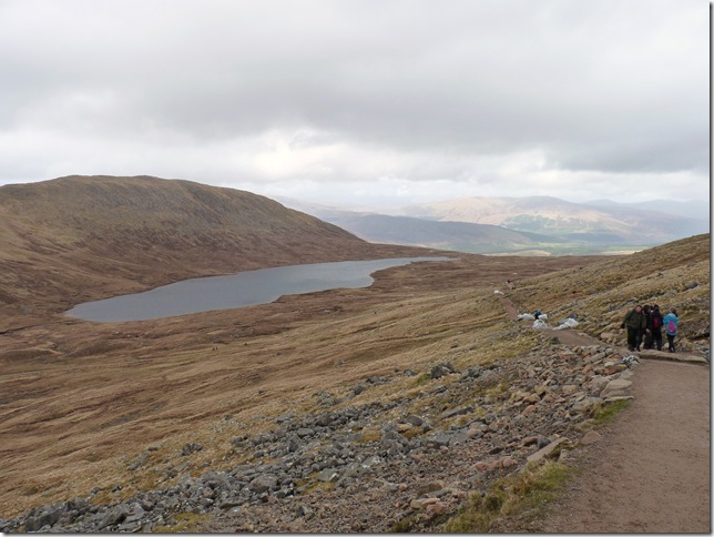
Loch Meall an t- Suidhe. |
 |
| |
Red Burn, & a steady steep climb now ensues before we get to the zig zags that will eventually take us towards the summit. |
 |
| |
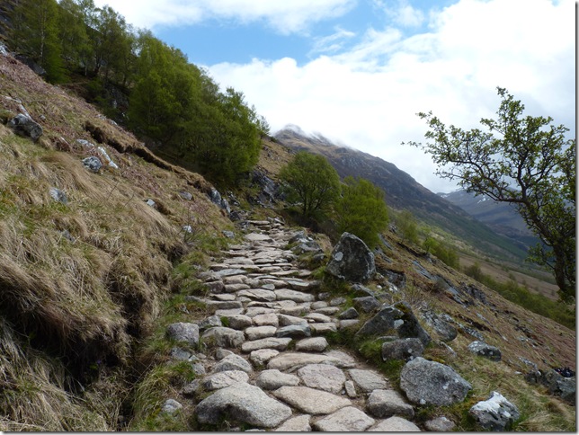
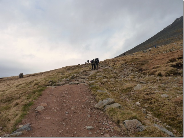
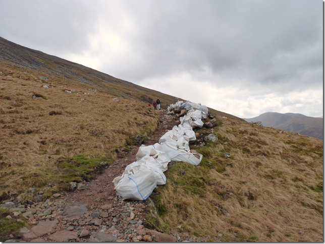
Repair work to the main path,I suppose after 100,000 visitors each year it must take its toll out on the path, but in sections I can only describe it as pretty dismal & not very pleasant under foot at all, especially for the return journey. |
 |
| |
| Is that a cap head your donning Sharkey? er, yes, yes it is |
 |
| |
Looking back on Loch Meall an t- Suidhe from a little higher up. |
 |
| |
And heading for the gully seen in picture five, you can just make out its impression where both paths seem to disappear. |
 |
| |
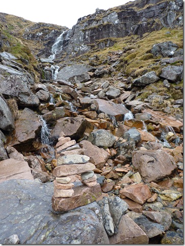
The gully & waterfall seen in picture five, & roughly marking the half way point. |
 |
| |
Looking back on ground covered, the green valley is our starting point, here we have Loch Linnhe (centre) & loch Eil background together with the summit of Meall an t-Suidhe (711Mtrs) |
 |
| |
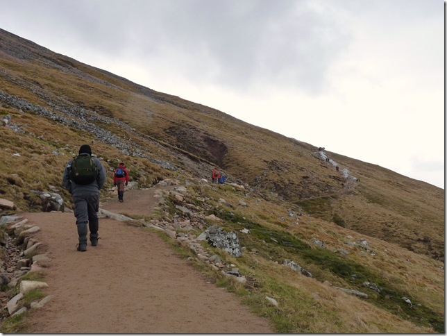
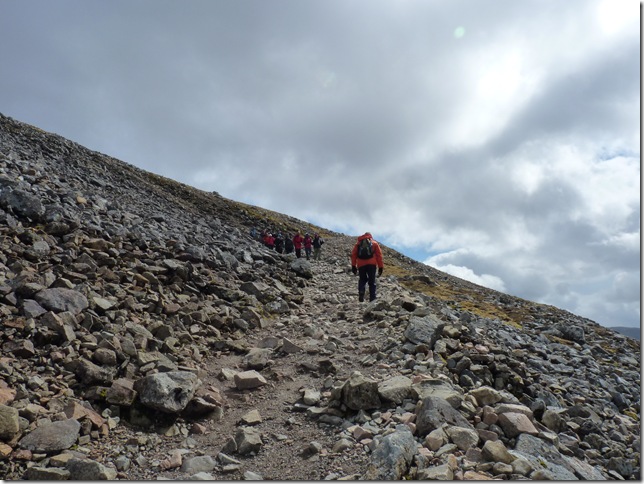
And just about to hit the first of about 8 zig zags summit bound. |
 |
| |
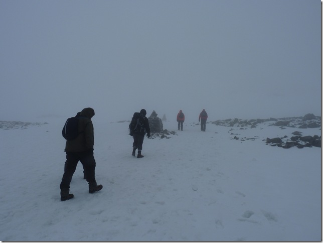
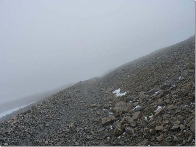
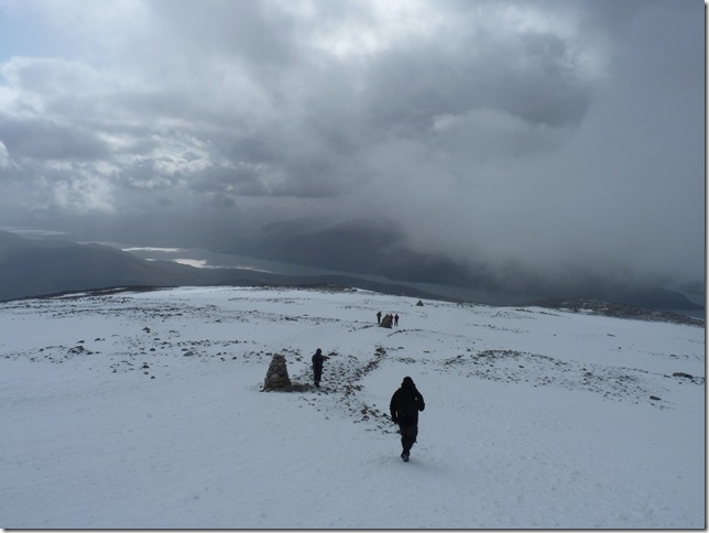
And from here on in this is what was to be expected, so its stay together slowest at the front because the route also takes us within meters of Ben Nevis’s north face & a very scary Five Finger Gully, both could end in disaster if we came off the path in cloud. |
 |
| |
The summit is in sight, still roughly about 200 Mtrs or so to go & with tired aching limbs these cairns, about half a dozen in all don’t half come in handy for navigation . |
 |
| |
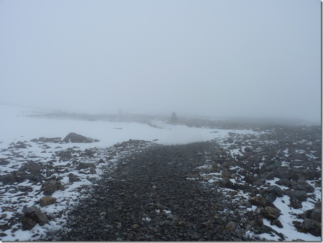
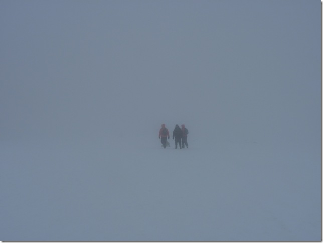
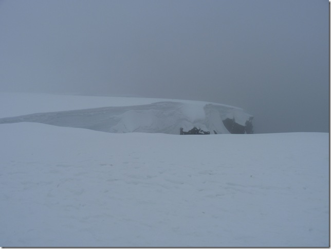
Wow!! wait for me, ..we’d just spoken to a nice chap warning us to stick to the cairns as he’d made the mistake of slightly wondering off track trying to find fresh snow to dig into, all fine & well as we was doing the same, what we were completely unaware of was the hidden snow cornice in the low visibility. |
 |
| |
Doesn’t even bear thinking about, no zoom here you can see fresh (not ours I might add!) foot prints six Ft or so away from the edge, I wonder if the people making those knew exactly how close to the edge they actually were? I guess not, if you cant see it its not there right! only one way to find out, I think the definite rule here is stick to the cairns like we did. |
 |
| |
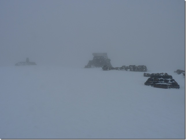
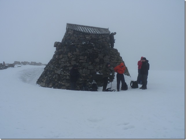
| The summit Trig Point & the old ruined observatory coming into view |
 |
| |
Elation
No higher point within the United Kingdom than we are right now, I think my face says it all . |
 |
| |
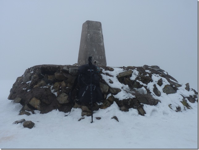
And of course, the trusted backpack & pole shot. |
 |
| |
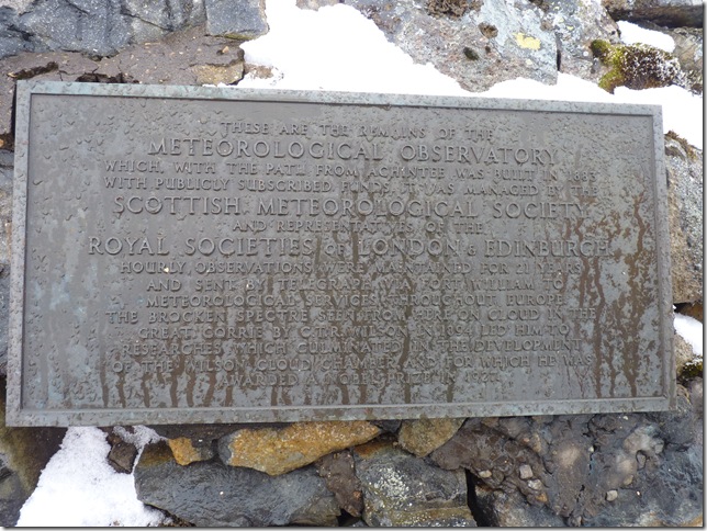
Build in 1881 for weather observation the “Observatory”, all that is left is 15tf of the tower, this place was actually manned until 1904. |
 |
| |
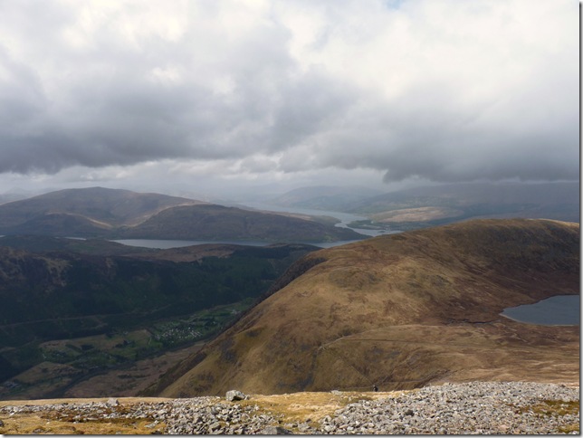
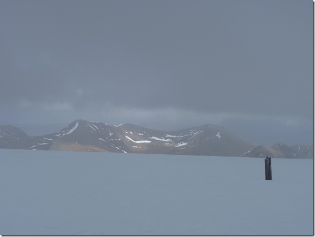
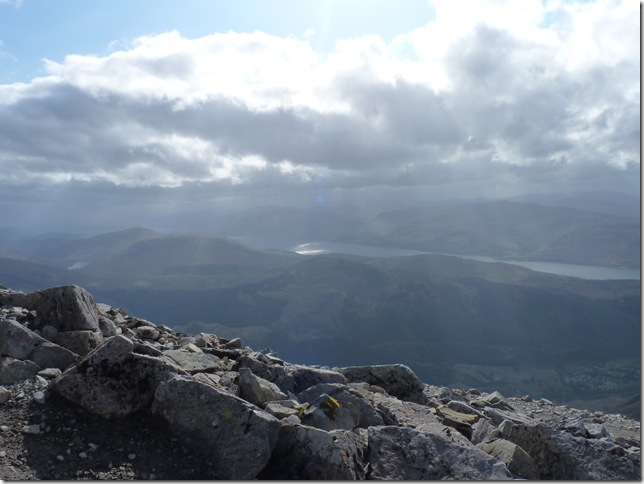
A glimpse of the view southwards as the cloud lifted. |
 |
| |
Rumour has it the summit is cloud free one day in ten, could we get lucky? |
 |
| |
Not really that much time to find out, as the biting wind was freezing through my gloves , my fingers caught the most, I actually remember losing my rag at the guys to get off the summit as I couldn’t stand the pain in my right middle finger any longer, I was almost sure I was experiencing first stage frost bite, infact both me & Lee were in a great deal of pain & the only remedy was to clinch & un clinch the hand & drop down out the wind as quick as possible. |
 |
| |
Just dropping out of the wind made a whole lot of difference, fingers still numb but thankfully nothing serious, within half an hour or so the pain went & I was able to move my fingers quite freely, just the tips experiencing the thud of blood circulating & heavy pins & needles. |
 |
| |
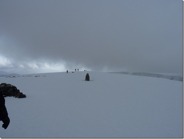
Still over a 1000 Mtrs up & I think we’d missed a cloud free summit by a matter of minutes . |
 |
| |
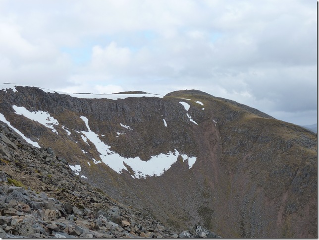
A clearer view of Five Finger Gully & Carn Dearg Summit. |
 |
| |
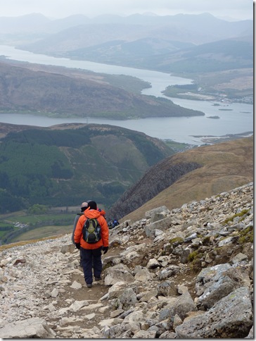
Elated, tired legs aching limbs as we head down . |
 |
| |
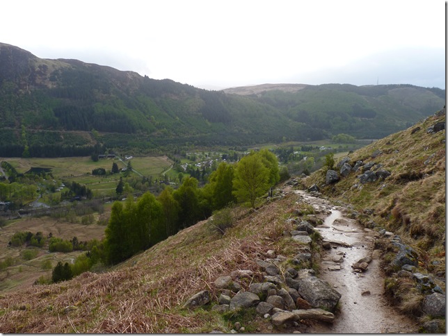
Almost back at the Glen, not before another Highlands shower soaking us through !
It had taken us a seven hour round trip to conquer the highest peak in the British Isles at almost 7.30pm we were more than ready for a good meal & a pint, sadly unbeknown to us our B&B had stopped serving dinner & we were left to our own devices to feed our hunger (which in fact came in the way of a takeaway in Fort William!) so it was a quick shower, change, & out for a rather unexpected kebab & pizza!!
Nothing, absolute nothing could of spoiled this day for me |
|
| |
| Back to top |
 |
|