Brock Crags, Rest Dodd & The Knott

28th November 2010

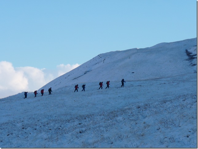
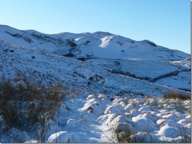
It’s been a difficult week weather wise, my original plan for today was to walk the Kentmere Round from Kentmere but from around midweek I knew I had to shelve the plan with all the weather warnings & that. My feeling’s were I didn’t want to be against the clock on such a long walk, drudging in & out of kick holes, you get the idea, so it was to be a bit more low key & somewhere I’m a bit more familiar with after all during the week I’m making plans for summating & probably no views even up until the previous night I had no idea what the weather had in store for me all I knew it was going to be a cold one.

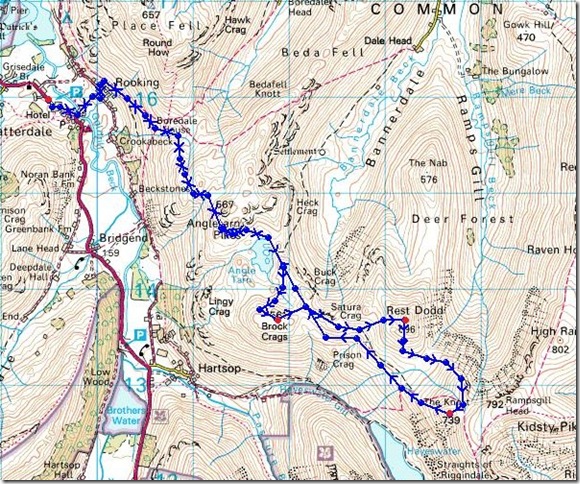
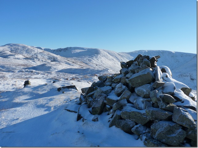
My original plan for this walk was to tackle Brock Crags from Hartsop, then Rest Dodd then go on to summit The Nabb flanking Rest Dodd to summit on the return then finally summit The Knott, I don’t know who’s boots I was wearing when I planned this route but I think I certainly under estimated the route in between Rest Dodd & The Nabb  really is a tough  section & to be honest I don’t think today I had the energy nor the time in fact I’m certain on the latter.

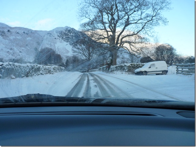
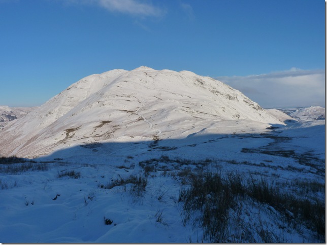
So going back to my route from Hartsop was a bit tricky to say the least, not my  route I might add,but  the road conditions, driving along the Ullswater Road (A592) had had a recent dusting of snow the previous night It was probably a couple of inches thick but enough to obscure driving conditions, the cheeks’ were definitely getting a bit twitchy as the car struggled & swayed up minor  hills & all of the road that was visible was the centre broken white lines. I made it in to Glenridding thinking ‘Paul’ you may have to turn round & head home, next came Patterdale & the road just got worse, a 4X4 Police car lights blazing overtook me & that was when I decided I couldn’t go any further, I might make it down the hills in the snow but a return up them I had no chance & the Kirkstone Pass wasn’t even an option to drive home after the walk, I found a suitable space & turned the car around & headed back in the direction of Patterdale.

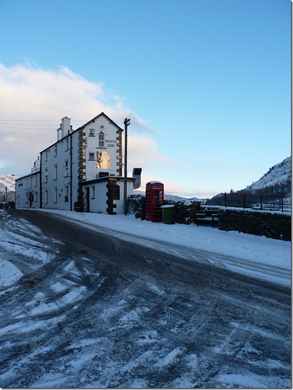
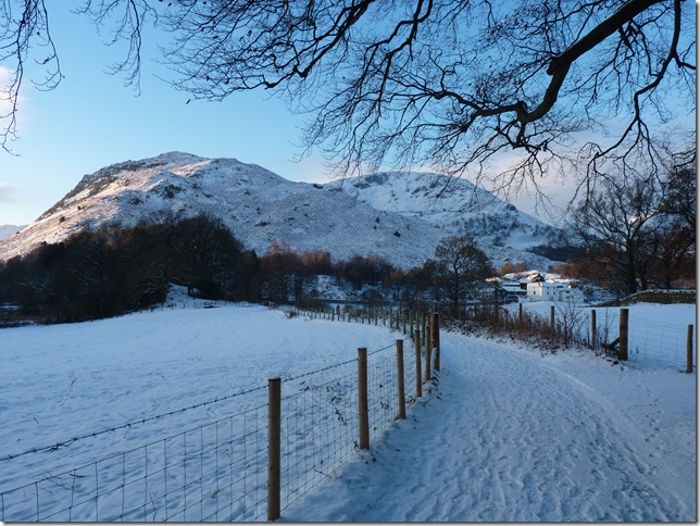
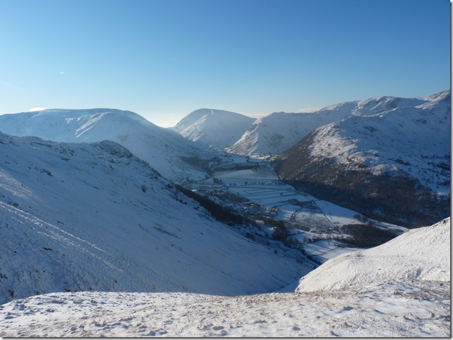
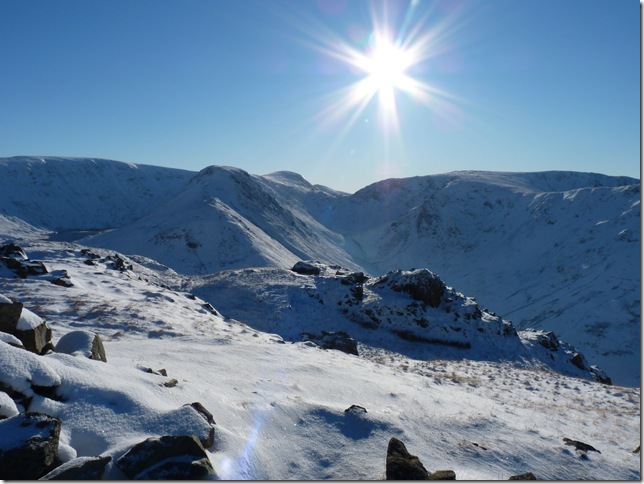
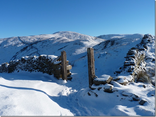
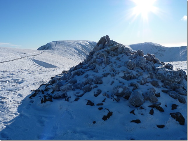
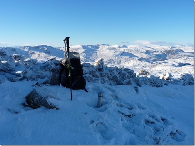
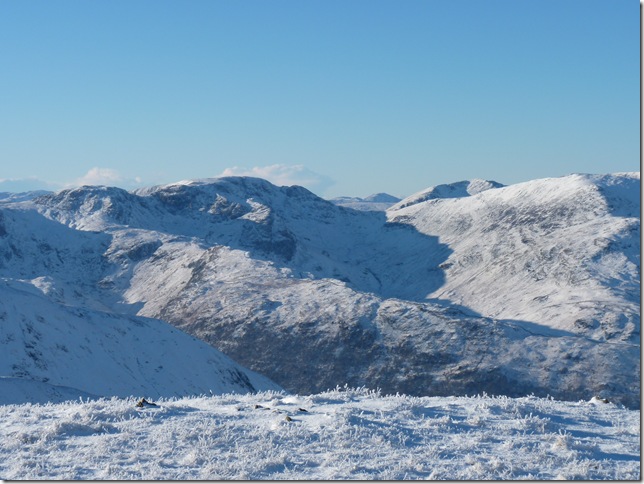
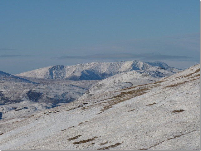
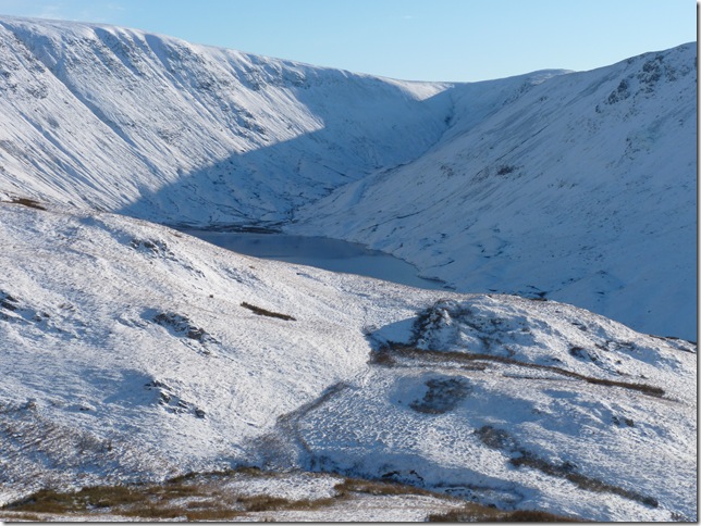
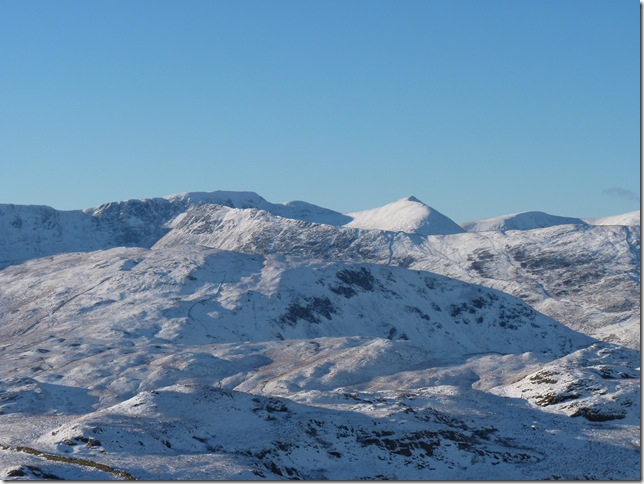
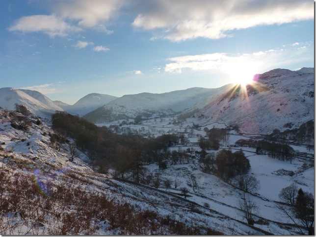
From Patterdale it was to be, and I wasn’t to be disappointed.

 
Wainwright Guidebook
The Far EasternFells


Overview
Ascent:

2,423 Ft 738.5 Mtrs

Wainwrights: 3, Brock Crags, Rest Dodd & The Knott
Weather: Lows Of -6°With Clear Skies , Little To No Wind, Highs Of -4
Parking: Off Road Parking  Patterdale
Area: Far Eastern
Miles: 8.7
Walking With: On my own
Ordnance Survey: OL5
Time Taken:  
Route:  
 

Map and Photo Gallery


A mere five minutes drive to Cow Bridge car park near Hartsop & here I decided me & the car had had enough.


The White Lion Pub in Patterdale & probably one of Lakelands most photographed pubs.


A wintery scene if there ever was one, now as I head for Rooking & Boredale Hause.


Looking back along the path with views of Birks & Birkhouse Moor.


Boredale Hause, the path getting up to here was really a pleasant surprise, the soft powdery snow from the previous nightfall had landed on hard compact snow which gave that reassuring crunch as you walked over it.


Looking over towards the Eastern fells with Helvellyn’s summit just under a wisp of cloud.


Did I mention it was clear today?


Looking back on Place fell & Boredale Hause.


Just magnificent, the Fells, LtoR are Caudale Moor, Red Screes, Middle Dodd, High Hartsop Dodd & Hartsop Above How, taking centre is Brothers Water.


Blazing my trail.


Angle Tarn, this place really is special to me which is why today I will miss summating Angle Tarn Pike just behind me, the reason why? Angle Tarn was my first walk up a Lakeland Fell  way back in August 2006,  so for that reason I have choosen this special Fell also to be my last Wainwright to summit.


Cutting through the snow as I head for Brock Crags.


Brock Crags summit with Rest Dodd & The Knott in the background, here I take time to adjust myself, the cold was setting into my back so I tucked my fleece & under layer into my walking trousers,. meanwhile my left leg had just taken a drowning calf deep through some peat bog which now left me with one nice & warm foot & one squelchy foot, great news if your only on your first summit!


Gray Crag & Thresthwaite Cove from Brock Crags, to the left of the picture is a glimpse of Hayeswater.


Its only taken ten or so minutes for the lower half of my trousers to freeze solid.


Rest Dodd from Satura Crag.


The large group I saw earlier has passed me as I summated Brock Crags.


Rest Dodd summit & I half expected to pass the group here but they must of pressed on.


As I leave Rest Dodd I catch sight of them again hitting The Knott direct, now I’ve been here  before & I know its a real struggle, If you have Cramp-Ons here’s the place to use them.


Zooming back out & I’ve got wise or a least I thing I have, the footsteps lower left of the picture is my route which basically flanks the direct route it is slightly longer but at least I wont be cursing every footstep.


Looking back on Rest Dodd & The Nab.


Here I’ve now rejoined the main path towards the summit, right at the wall Paul.


‘Through the wall’ The straight’s Of Riggindale & High Street.


The Knott Summit & time for a sandwich & a hot drink.


Looking towards Hartsop Above How, Fairfield & St Sunday Crag from The Knott.


And a close up of Blencathra.


Twice in one day!!


How the hell did you miss that? clumsy that’s how!


A brief glimpse of Hayeswater from my descent back to Angle Tarn.


Looking towards Dollywaggon Pike, Helvellyn, Striding Edge & Catstye Cam.


Brock Crags from Angle Tarn.


The sun catching reflections on Brothers Water.


Low sun behind Hartsop Above How.

Today has been a classic winters walk with unimaginable beauty all thrown into one, And to think the weathermen were trying to get us to stay indoors this weekend…


Back to top