|
Mellbreak And Hen Comb |
 |
 |
4th May 2011 |
 |
|
Today’s walk wasn’t planned at all, On this day 37 years ago I was born, & as tradition I had a day off work, I’ve been so busy as of late on & off the fells that it never came to thought to kit up, make plans & be the usual organised self..That all changed about 3pm the previous day, what was I to do with my day off? The wife’s in work the kids are at school, I don’t do lie in’s I’d just be bored at home flicking through the stations.
What other perfect way could I have chosen to celebrate my birthday than to spend it out on the fells in wall to wall sunshine. |
|
Wainwright Guidebook |
 |
| The Western Fells |
In west Cumberland, where Mellbreak is a household word (largely through long association with the Melbreak Foxhounds (spelt with one ‘l) the fell is highly esteemed, and there have always been people ready to assert that it is the finest of all. This is carrying local patriotism too far, but nevertheless it is a grand hill in a beautiful situation with a character all of its own and an arresting outline not repeated in the district.
There is only one Mellbreak. |
 |
|
| |
|
Overview |
|
|
| Ascent: |
2,300 Feet, 701 Meters |
| Wainwrights: |
2 , Melbreak & Hen Comb |
| Weather: |
Warm & Sunny, High Cloud, Little To No Wind, Highs Of 19° Lows Of 9° |
| Parking: |
Parking Spaces, Loweswater |
| Area: |
Western |
| Miles: |
6.2 |
| Walking With: |
On my own |
| Ordnance Survey: |
OL4 |
| Time Taken: |
|
| Route: |
|
|
| |
|
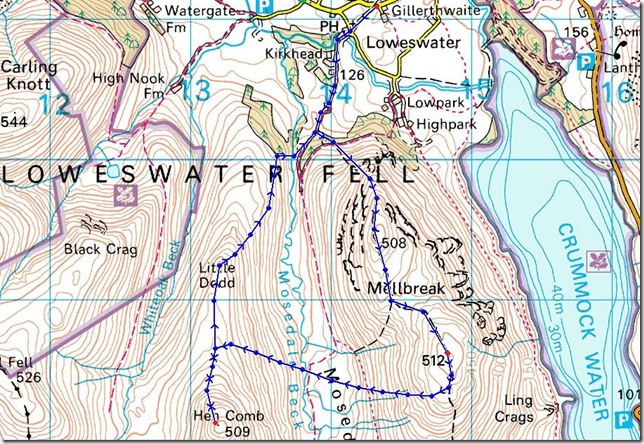
Map and Photo Gallery |
|
|
 |
| |
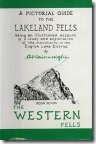
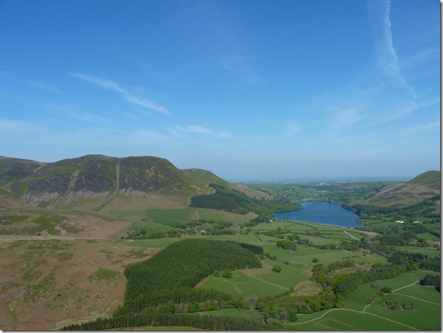
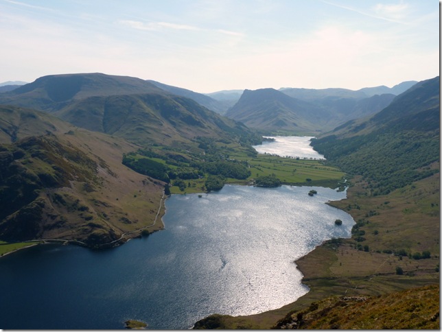
Mellbreak from Loweswater, I couldn’t have asked for a more pleasant morning & was quite looking forward to stretching the legs on the quiet farming lanes before I join the main path that will lead me onto Mellbreaks steep slopes. |
 |
| |
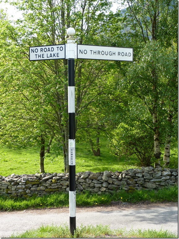
Wainwright didn’t quite understand this sign post either, he referred to it as ‘a negative’ |
 |
| |
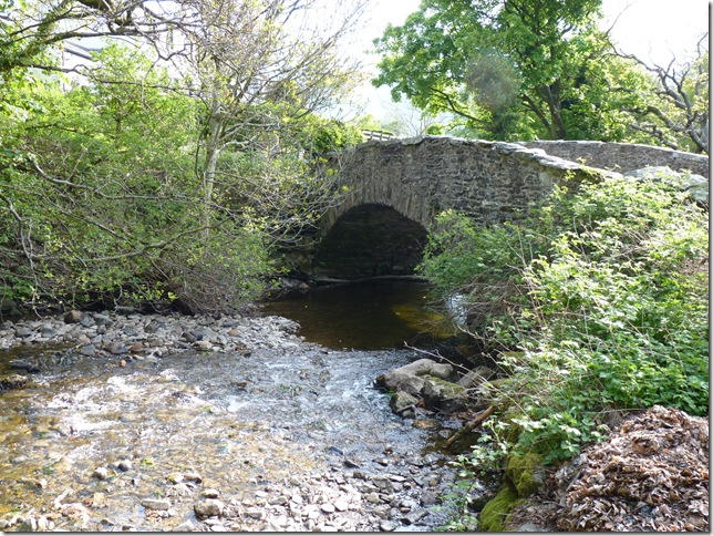
Crossing Church Bridge next to the Kirkstile Inn, and another gripe from AW ‘why not call it Kirk Bridge? |
 |
| |
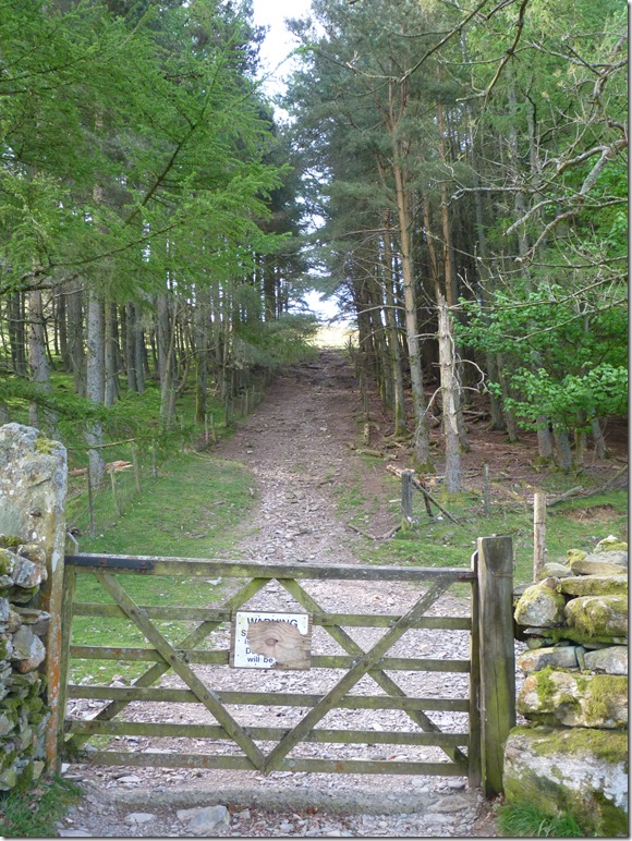
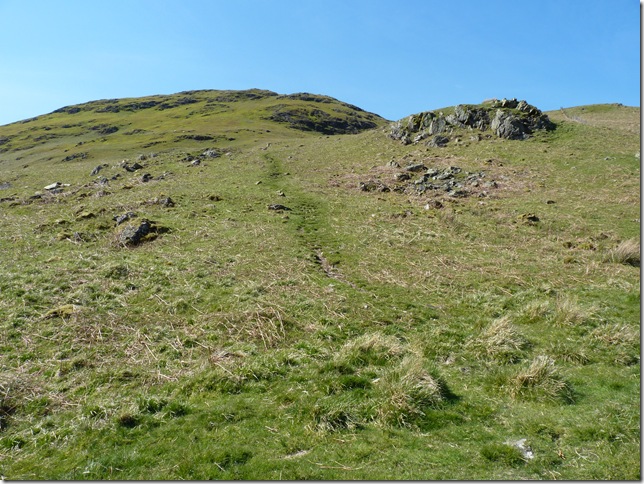
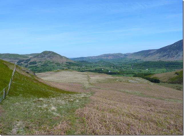
Towards the end of the twisting farm lanes ahead & through this gate is the main path that will lead you onto Mellbreak, the steep slope here getting your legs ready for the main event. |
 |
| |
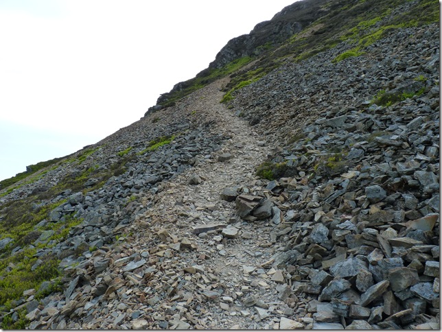
Leaving the steep grassy slopes behind & now on the scree section, despite the approach from the north (Loweswater end) I had in mind some back breaking ascent, the path here is steep but more than manageable which in turn winds its way through its crags just perfectly. |
 |
| |
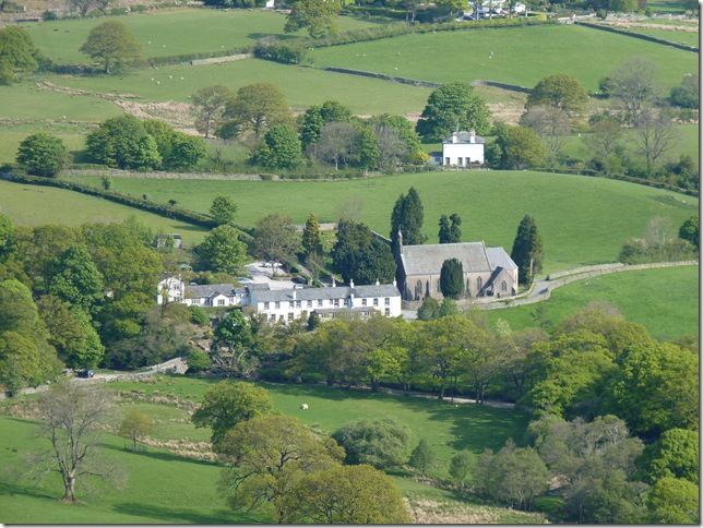
Zooming in on St Bartholomew’s Church Loweswater, circa 1884. |
 |
| |
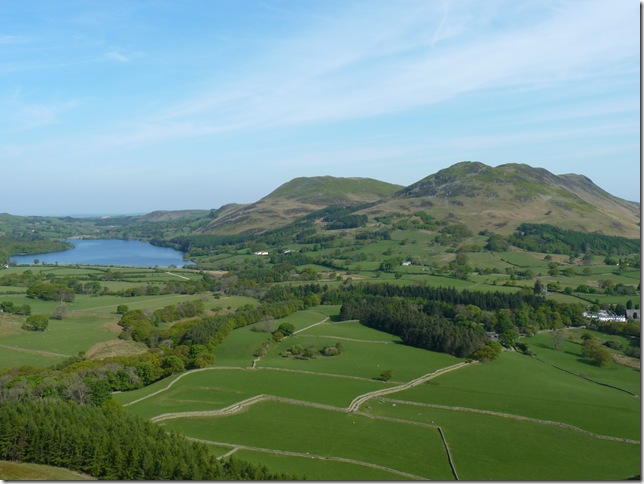
Over the patchwork stone walls looking towards Loweswater, Darling Fell & Low Fell. |
 |
| |
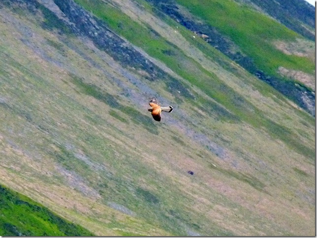
A male kestrel, & a big thank you to http://beardedgit.com/for taking his time to help me ID this bird of prey. |
 |
| |
| Carling Knott over looking Loweswater |
 |
| |
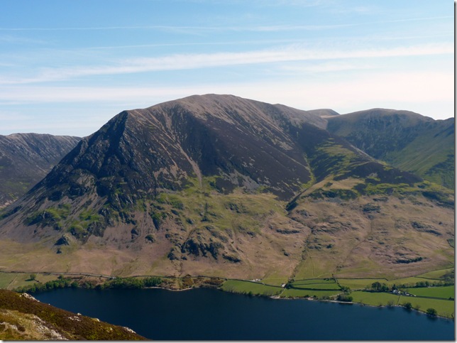
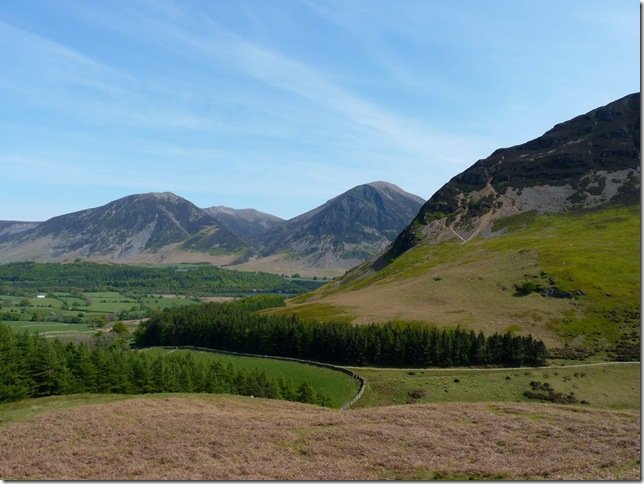
Over the Loweswater End of Crummock Water looking towards Whiteside & Grasmore. |
 |
| |
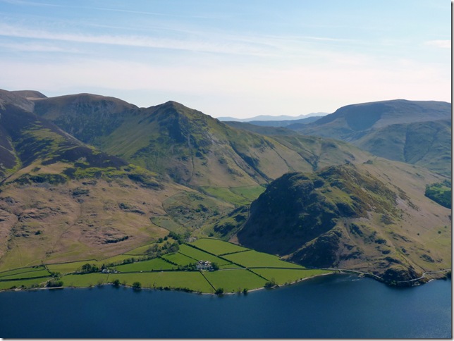
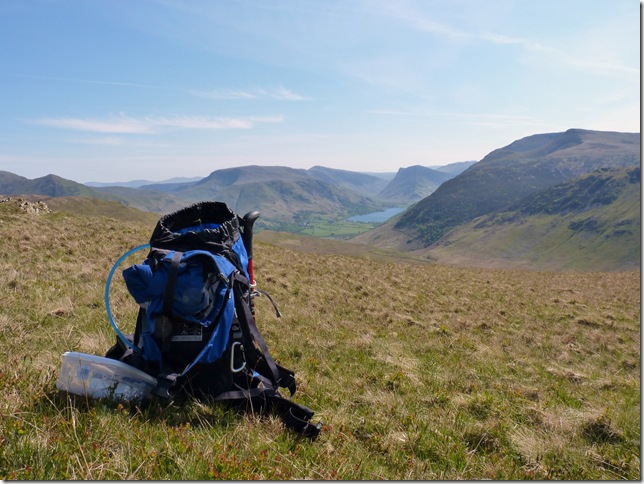
A close up of Rannerdale Knotts & Whiteless Pike on the left, ahead is Fleetwith Pike & just for scale Buttermere is 1.8 miles in length. |
 |
| |
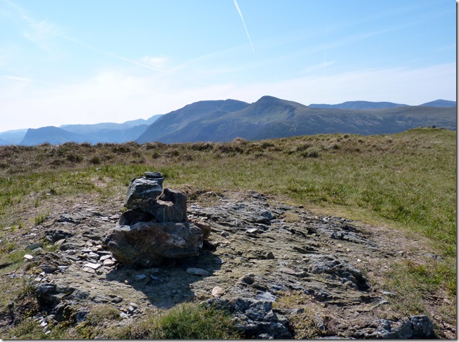
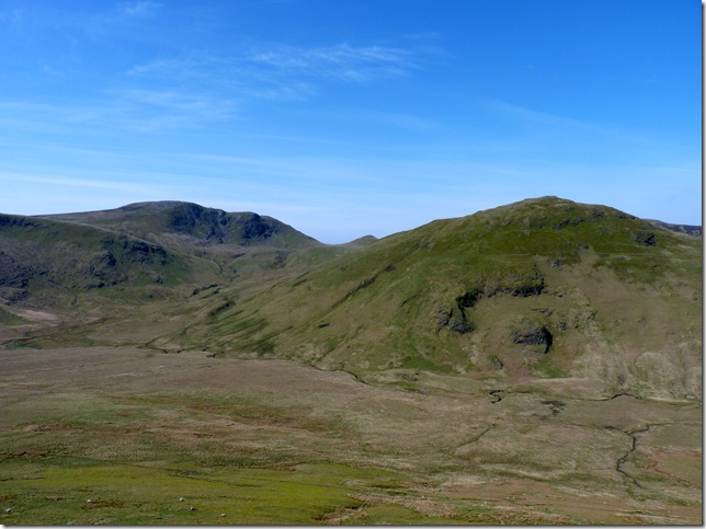
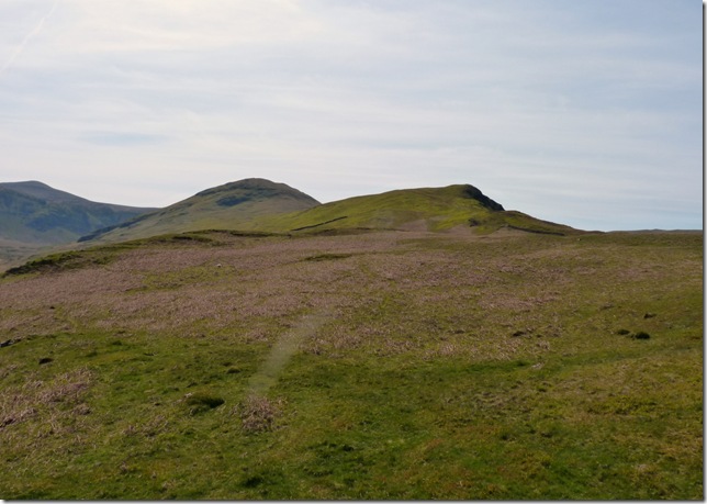
The backbone of Mellbreak from the north cairn, this is a place I have always wanted to visit, the main summit is on the south part of the ridge ahead & although it looks lower than the north side it is actually higher by just 4 meters. |
 |
| |
Approaching the south cairn with Red Pike & High Stile in the background, the ridge walk in between the north & south cairn gave me that feeling that I was walking on a free standing Fell. |
 |
| |
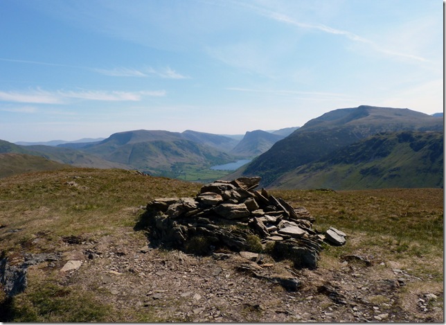
Mellbreak south summit cairn. |
 |
| |
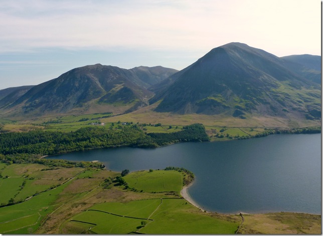
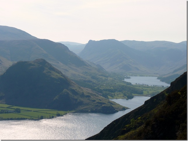
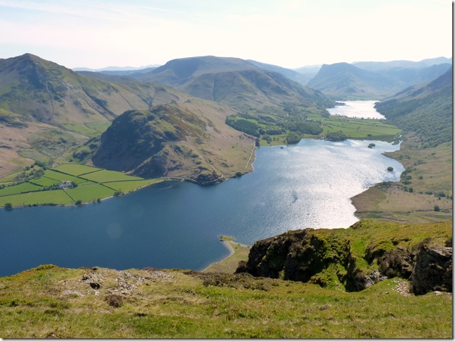
Commanding views over Crummock Water & Buttermere, this really is a beautiful spot. |
 |
| |
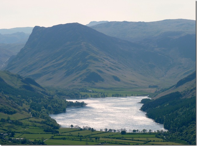
Views over Crummock Water & Rannerdale Knotts with Whiteless Pike & Wandope in the background, the ridge on the very far skyline is the Helvellyn Range & The Dodds. |
 |
| |
And to the left, Grasmore. |
 |
| |
A close up of Fleetwith Pike & Buttermere. |
 |
| |
Its so difficult to put the camera down with views as good as this. |
 |
| |
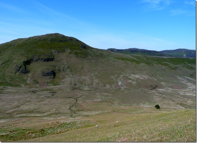
After a while on the summit it was time to head over towards Mosedale & Hen Comb, but first I had to find a reasonable route down from Mellbreak, after leaving the summit I headed right & basically blazed my own path avoiding the little crags & the steeper slopes, I made it down in one piece in search of something special. |
 |
| |
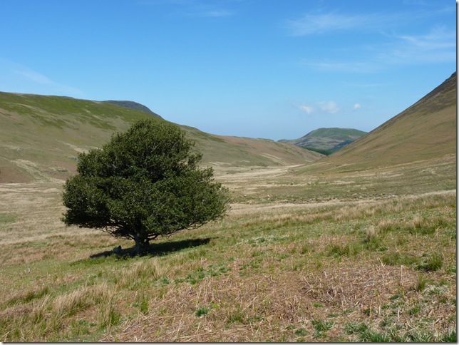
With Hen Comb in my sights I wanted to pay a visit to the Mosedale Holly Tree, to the right of the picture, it stands alone in the valley of Mosedale & for that reason it gets its very own place on the Ordnance Survey Map Listed as ‘Mosedale Holly Tree’ Wainwright wrote about the landmark in his pictorial guide.
This is the only single tree in Lakeland so honoured. Oddly it is not a rowan nor thorn, which might possibly expected, but a holly, a healthy and flourishing holly, moreover, and a conspicuous landmark. AW. |
 |
| |
The Mosedale Holly Tree. |
 |
| |
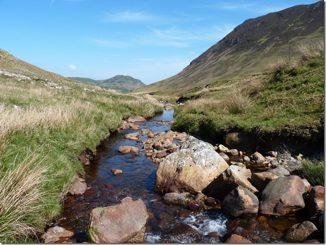
Crossing Mosedale Beck before I head for the steep slopes of Hen Comb. |
 |
| |
I first headed for a fence that continued up & towards the main ridge, then the path leaves the fence line & continues over some very steep grass, this I thought is bloody hard work! Stopping for camera breaks more commonly known as ‘trying to get ones breath back’ |
 |
| |
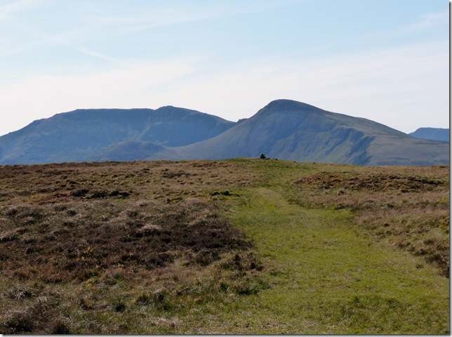
Hen Comb summit cairn with beautiful views over the western fells. |
 |
| |
Classic views with a bite to eat. |
 |
| |
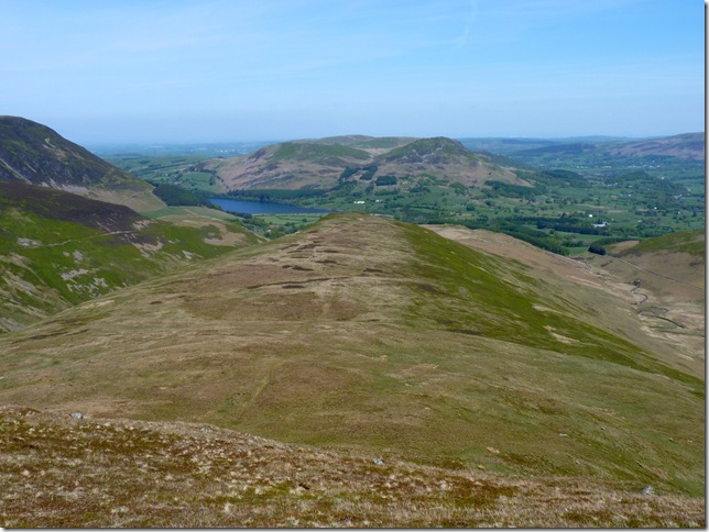
Time to head down the ridge from Hen Comb towards Little Dodd. |
 |
| |
Making my way from Little Dodd, it was here I jumped over the fence & made my way down to Mosedale Beck for the second time today. |
 |
| |
Looking back up the ridge towards Little Dodd & Hen Comb. |
 |
| |
The steep north path of Mellbreak with Whiteside & Grasmore in the background, it was such a shame to leave the fells behind today but in all honesty I think I should head home & let the family see the Birthday boy. |
|
| |
| Back to top |
 |
|