|
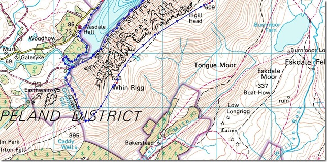
Whin Rigg & Illgill Head |
 |
 |
23rd October 2011 |
 |
|
It goes without saying that I’m a stickler for keeping to agenda’s, I cant help it, that’s just me. With my completion date set back a month, I didn’t really want it to spill over into November, not that I have any problem…hang on, you do Sharkey, it’s that obsessive compulsive disorder you’ve carried from being a teenager, I guess what I am saying is, I don’t like to change stuff around too much once I’ve laid them out in my head, that’s just normal isn’t it?…or maybe not? could be.
Anyway, on paper last week’s walk on which I’d fantasised about Shoulthwaite & all its greatness would of been ideal for the weather I had today, in fact I received a text about it, Paul, you should of done Illgill this weekend…And I can see where my good friend Tim is coming from, leave the low level walks for the bad weather, easier said than done, Illgill & Whin Rigg where always going to be my finale, I set them in stone over twelve months ago & as stubbornly as it sounds, I wasn’t going to move them for man nor weather.
Christ I can be stubborn.
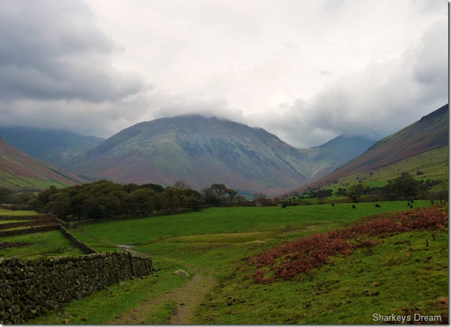
Today would of been a dreamers walk, Cast upon the great English peaks surrounded by England’s deepest lake, Wast Water. And If I’m perfectly honest, not too much ascent. I’ve always looked at Whin Rigg & Illgill head from the shores of Wast Water with admiralty in my eyes, I don’t think I’ll ever look at any other two fell’s the same as I do, as these two’s vast spectacle’s, for you see these two aren’t just Whin Rigg & Illgill Head.
This is The Wast Water Screes.
CCXII CCXIII |
|
Wainwright Guidebook xxx |
 |
| The Southern Fells |
Illgill Head is known to most visitors to Lakeland as Wastwater Screes, although this latter title is strictly appropriate only to the stone-strewn flanks that falls so spectacularly into the depths of Wast Water. Much of this north-western slope , however is bracken-covered and grassy, the screes descending only from the actual summit and its southerly continuation to Whin Rigg. It is here that the fellside from top to bottom , down even to the floor of the lake 250’ below the surface. is piled deep with stones lying on there maximum angle of rest, 35°-40°, through a vertical height of almost 2000’. The top of the fell is a smooth sheepwalk; these many acres of loose and shifting debris must therefore have resulted from the disintegration of crags that, ages ago, rimmed the top of the fell: some rocks remain still in a state of dangerous decay. The screes, when in the light of the evening sun, make a picture of remarkable colour and brilliance: a scene unique in this country. |
 |
|
| |
|
Overview |
|
|
| Ascent: |
2,500 Feet, 762 Meters |
| Wainwrights: |
2, Whin Rigg & lllgill Head |
| Weather: |
Low Level Cloud, High Winds & Rain, Highs Of 14° Lows Of 11° |
| Parking: |
Road Side Parking, Wast Water |
| Area: |
Southern |
| Miles: |
9 |
| Walking With: |
On my own |
| Ordnance Survey: |
OL6 |
| Time Taken: |
|
| Route: |
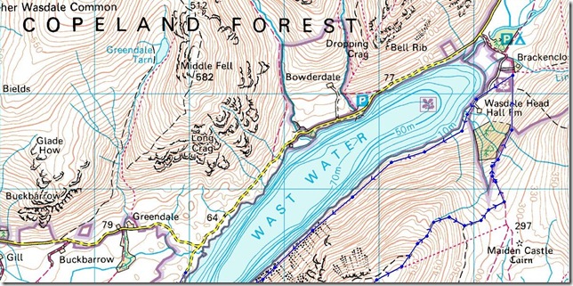
Wast Water Low Wood Lund Bridge Greathall Gill Whin Rigg Illgill Head Brackenclose Wasdale Head Hall Farm Wast Water Screes |
|
| |
|
Map and Photo Gallery |
|
|
  |
| |
| |
 |
| |
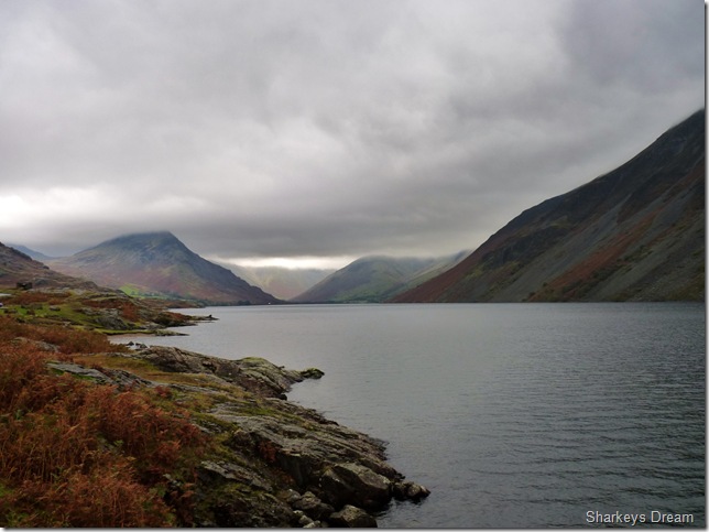
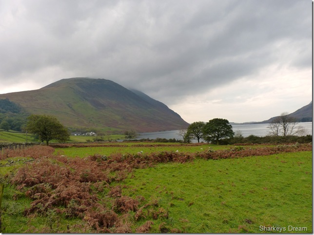
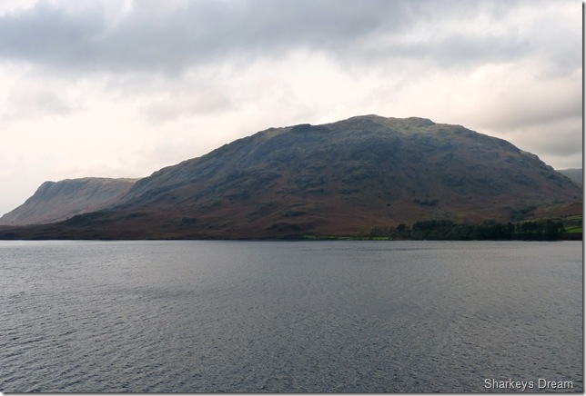
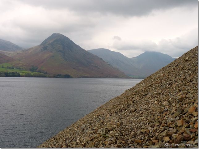
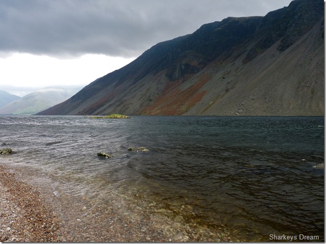
Looking up towards Wasdale Head, Yewbarrow & Lingmell from a Wast Water shoreline.
It really was a tedious drive into Wasdale this morning, the sun never shone all the way in so I had to rely on the headlamps turning them off only as I reached the shoreline here. The rain had stopped somewhat, enough for me to think about ditching the waterproofs, but I am all to familiar with Lakeland & twenty minuets later I was glad I stuck to my instinct.
It was just me & me alone kitting up at the shoreline, I had passed a local woman jogger together with what looked like her two daughters on little mountain bikes dog in tow, they all smiled at me as I kitted up besides the car, a welcome if you will.
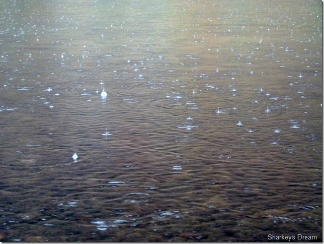
Being in such a place, as even just the shoreline of Wast Water for me is enough to set the butterflies going, I could of happily never set foot on fell today & left Wasdale a happy man, this is what Wast Water does to me & I’m guessing its not just me. The whole geography of the Screes diving straight down, a whole 258 feet (79 meters) to the lake floor, incidentally 164 feet (50 meters) of that dept is actually below sea level, these little facts & figures never cease to amaze me.
Regular readers of my blog will know that while crossing the Dam at Thirlmere last weekend I dropped the biggest clanger imaginable & lost my SD Card (by accident of course) so that until payday, leaves me without my GPS, I would like to take this opportunity to thank all those who tried their best in their own time to get my GPS uploaded with new maps. |
 |
| |
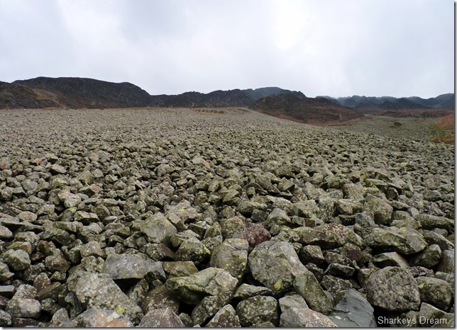
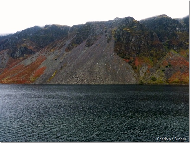
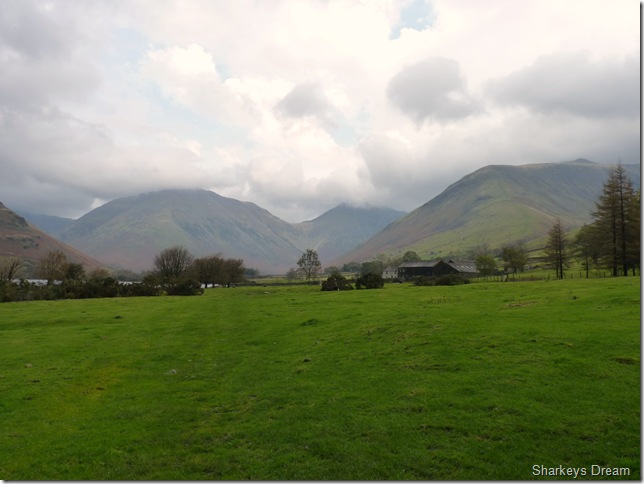
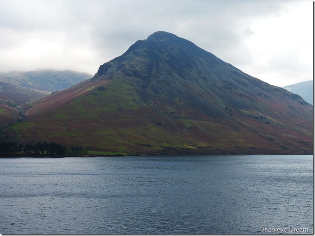
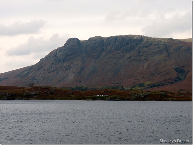
The formidable Wast Water Screes.
With the contents of OL6 folded away in my map case I now head for Low Wood and…. |
 |
| |
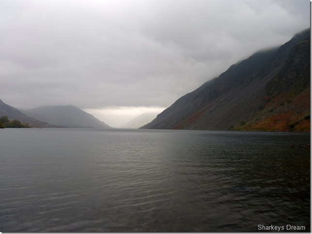
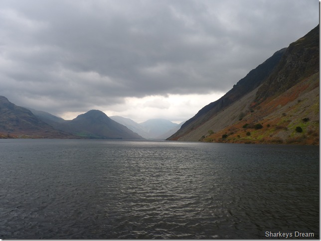
Britain’s best view.
This famous spot was the reason I chose to start my walk at Low Wood & not Brackenclose, In my heart of hearts, knowing the cloud was low I thought at least I may get that break in the clouds to get that one shot, but sadly it wasn’t going to happen today, the cloud mushroomed itself above anything over 400 Mtrs & pretty much stayed there for the rest of the day.
I am not so down hearted as I reach for the hood & pull in the strings, I say to myself, “this is still a wonderful place to be” |
 |
| |
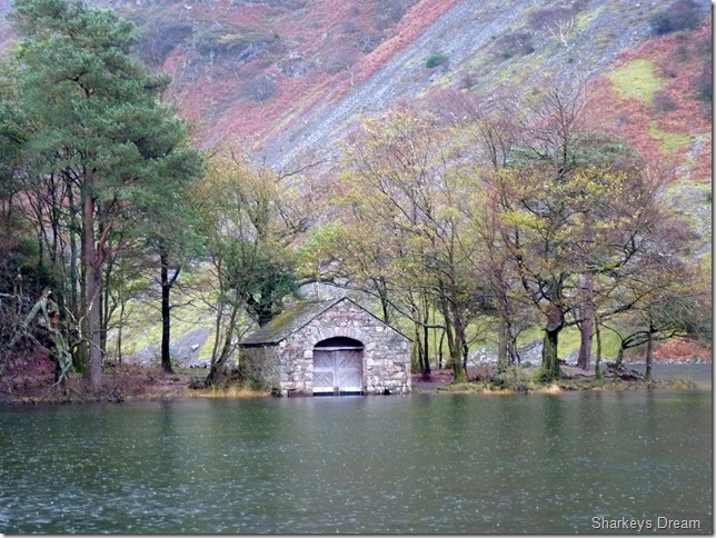
The Boat House on the edge of Low Wood. |
 |
| |
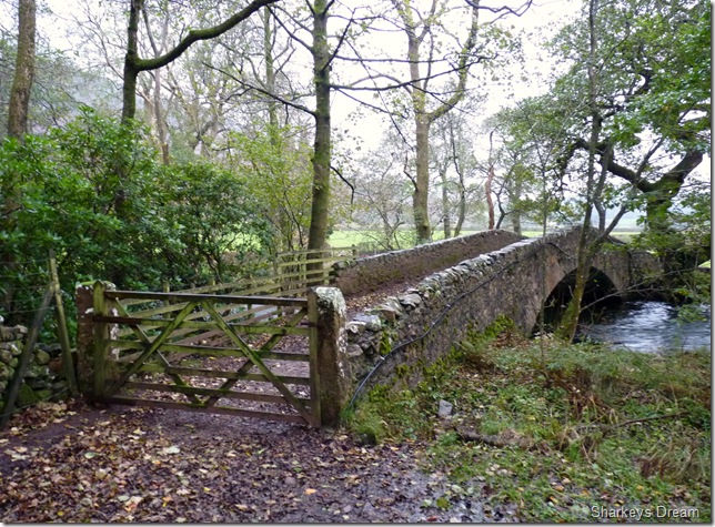
Its a left over Lund Bridge & the River Irt. |
 |
| |
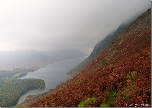
Looking down on Wast Water from the my steep ascent.
These were to be my last views for the next hour & a half, by now I’m really starting to feel the brunt of the wind & rain as I take in a juicy Satsuma & take a short rest before I head for the Col at the top of Greathall Gill. |
 |
| |
The cairn found at the top of Greathall Gill.
A welcome sight if there ever was one, whilst on the last leg of the descent I note a couple of short cut paths to my left cutting across the flanks of the fell side, On any given day I would of made for these, but not today, today, I shall be mostly sticking to the cairns!
The path here is domineered by cairns all along the way, some, only as far apart as thirty meters, they where a welcome sight & kept the confidence up.
I’m so used to having the GPS at hand in scrapes such as this, I guess in it doesn’t matter if you are walking a half ridge such as I, or traversing open moorland for open miles, your mind still plays tricks on you, you simply wouldn’t be human if It didn’t, the trick is to take simple compass bearings, stay focused & most importantly trust your instinct. |
 |
| |
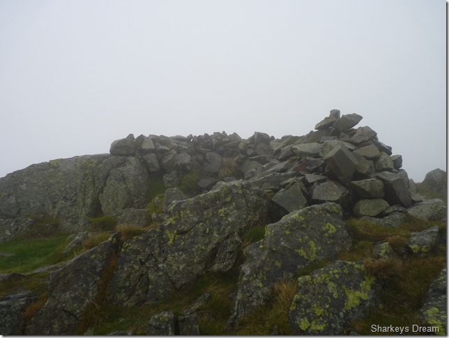
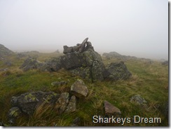
Whin Rigg summit shelter & cairn.
I didn’t hang around the summit to long at all, the wind was at its strongest here so for the first time this year, I take off my pack & take out my beanie & gloves, reminiscence of a winter Lakeland quickly came flooding back as I squeezed my wet red-raw hands into my technical Extremities Wind Stopper gloves, I donned the Beanie, & again fastened down the pull strings on my hood & headed back into the cloud. |
 |
| |
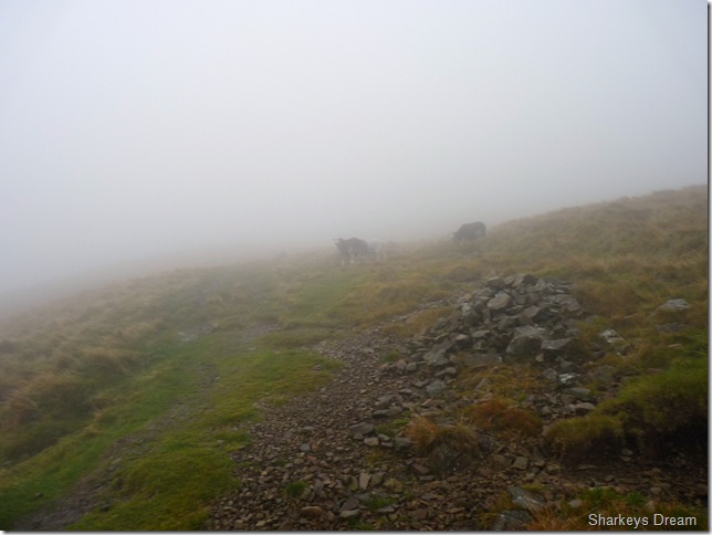
At least for now I had some company.
The weather can play tricks on your mind especially when the cloud is so low, I think a slight fear mixed with a chunk of adrenalin is a fine cocktail for when walking by yourself in conditions such as this, I never seem to have the time to think these days, life is so rush rush, run here run there, its times like these your mind wonders & you soon forget the battering your taking from the elements & stop on the spot, take a look around you, nod your head with a smile & just…
well, Ill leave that to your imagination.
Not long after taking this photo I hear voices in the cloud, I cant see them but I hear them, I’m half expecting some ghostly like figure to appear through the cloud, wind & the rain, & then it draws silent again, surely I didn’t just make the voices up in my head, I mean, it wouldn’t be un-heard of! then through the cloud I hear a shout “come here, come here” I spot a Chocolate Labrador charging at me “come here Sampson!! get here, down” by now Sampson & I where more than acquainted as he jumped up at me with this “I’m gonna slather that face look” etched into his eyes, Then out of the cloud I spot Sampsons owners, A father & his two sons, all upto their necks in waterproofs, “its just us stupid enough is it” I quipped, he looked a lot more serious than Sampson did, “I shouldn’t of come out today” its just not nice is it” I spot a Garmin GPS much like mine hooked to his chest strap & I think “at least you have the comfort of your GPS & your boys are save, not much older than my own son of 11yrs” we Speak in terms of when the wind was low enough for conversation, his boys, maps hooked around there necks are quiet & listen to the conversation, its much the same & all about the weather, he asked me my route & I his, we are both doing the same route in reverse of one another, except as I’m trying to stop Sampson licking the hell out of me & mudding my Rab Latock Jacket he quips, I’m going to make to Whin Rigg & come back the same way, well, I say your about twenty minutes away in that direction, enjoy your walk as I smile & start to walk away, I grab my camera to take their picture walking in the cloud but they have already disappeared. |
 |
| |
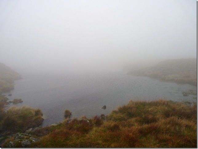
On a half ridge such as this on a clear day I should be able to see the Isle Of Man, in terms of my conditions this un-named tarn found in between Whin Rigg’s summit & Illgill Head was a much needed position fix.
Sadly here I am missing out on some of Lakelands greatest views, for here lies two of the gully’s found at the top of the Wast Water Screes & no doubt excellent viewing points down the whole of Wasdale. |
 |
| |
| The 604 cairn (main summit cairn) |
 |
| |
| And close by the 609 cairn |
 |
| |
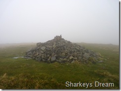
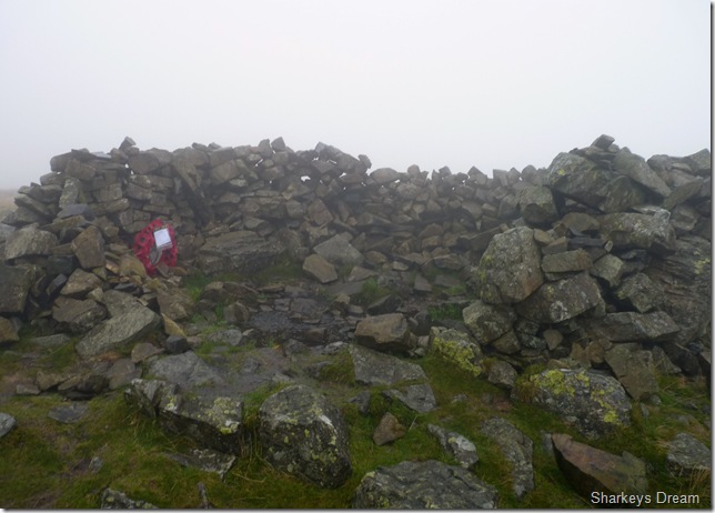
Illgill Head summit shelter.
Again, the wind was howling right through the centre of the shelter so I paused here only to read the reef, it read…
The Royal British Legion, Isle of Oxny, Three Peak Challenge.
I pause for thought, then wonder off back into the cloud. |
 |
| |
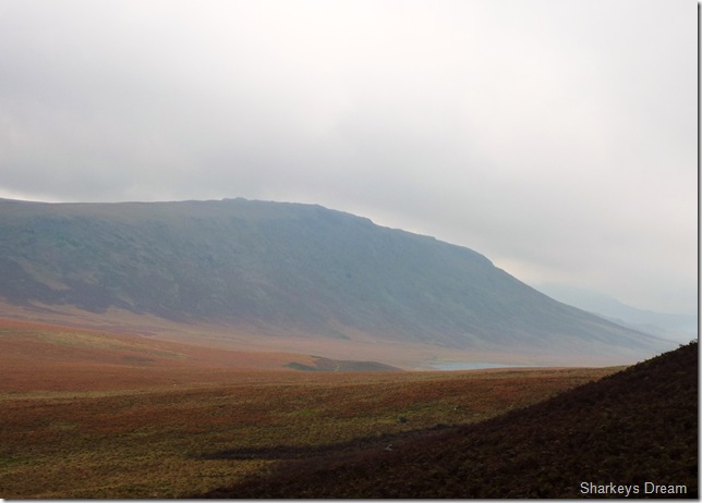
It wasn’t too long after I dropped out of the cloud & had views towards Burnmoor Tarn & Eskdale Fell. |
 |
| |
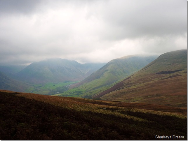
Cloud lifting over (LtoR) Kirk Fell, Lingmell & Sca Fell.
It was nice to be out of the cloud, I took a massive forty or so shots here from these mountain tops engulfed by cloud to the picture you see before you, I just couldn’t help to get giddy with the camera after not seeing an object for over an hour. |
 |
| |
Kirk Fell & Great Gable summits just couldn’t shake the cloud today.
During my descent I have come to the conclusion that I need to take more away than I already have, feeling slightly disappointed with my viewless summits I ponder on the idea of a return via The Wast Water Screes.
By now I look like nobody owns me, as walkers take haste of the newly opened up views on there route to Scafell in their nice & clean attire I, however need to make something of the train wreck I now resemble, So while I ponder at the screes I make my way through Brackenclose & stop at the bridge crossing Lingmell Gill. Its off with the rain soaked laden jacket & out with the Tuna sandwiches, I am oh so hungry as I shoulder pack having made my decision. |
 |
| |
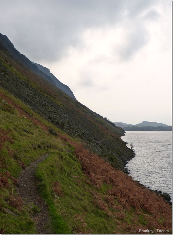
Illgill Head from the start of the Lakeshore path.
There’s no two ways about getting back to my car parked nearly three miles away, I could take the long & boring tarmac road, or I could take the Lakeshore path, a beautiful grassy path passing through the idyllic Wasdale Head Hall Farm.
At this point I just needed more, I just couldn’t leave Wasdale having not taken my two penath out.
The Wast Water Screes beckoned. |
 |
| |
Looking back at Wasdale Head Hall Farm, Kirk Fell, Great Gable & Lingmell.
I have just passed a young couple holding hands & I just know by the look on the guys face here comes a “good morning” said so jolly he looked at the top of the world, I try to return his compliment but I cant, my mouth is full, in fact my cheeks are full of tuna, so much so I cant even close my eyes, gowd.. I mutter what must you flaming look like… |
 |
| |
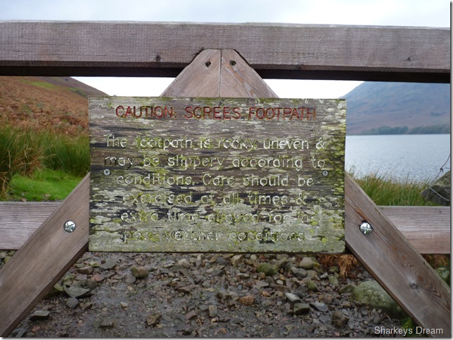
I think Wainwright could of put this sign so much better.
From Wasdale Head Hall the lakeside path starts innocuously as a broad avenue in the bracken, and although it soon climbs a little and narrows to a track the way continues quite easy, even when the first Screes are reached and for a mile beyond, during which section the path now returns almost to the lakeside, crossing successive bands of stony debris which cause no trouble. Then just as the walker who has been forewarned of the difficulties of the route is beginning to wonder what all the fuss is about, and with the end almost in sight, there comes a vicious quarter-mile compared with which the top of Scafell Pike is like a bowling green-here the Screes take the form of big awkward boulders, loosely piled at a steep angle and avoidable only by a swim in the lake, it has been impossible to tread out a path here despite a brave effort by somebody to cairn a route.
This section is really trying and progress is slow, laborious and just a little dangerous unless the feet are placed carefully; ladies and indeed many a gentleman pedestrian must have suffered nightmares in this dreadful place and looked with hopelessness and the envy of the people striding along the smooth road on the opposite shore.
Wainwright wrote a lengthy piece at detail describing the lakeshore path & didn’t really have anything remotely promising to say about this arduous route, In all my experience, the Edges the Gullies I have undertaken, never before have my boots taken such a hammering as they did while I traversed the Wast Water Screes. |
 |
| |
Middle Fell & Buckbarrow from the lake path. |
 |
| |
Yewbarrow dominates the route. |
 |
| |
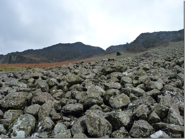
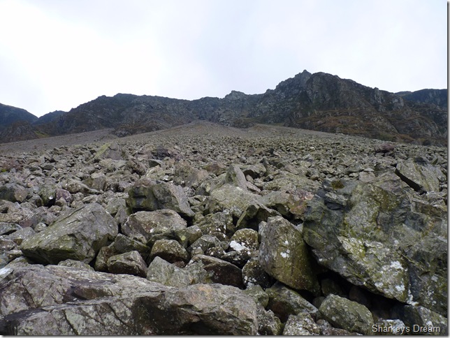
Wondering just what all the fuss is about, as I approach the first section of Screes. |
 |
| |
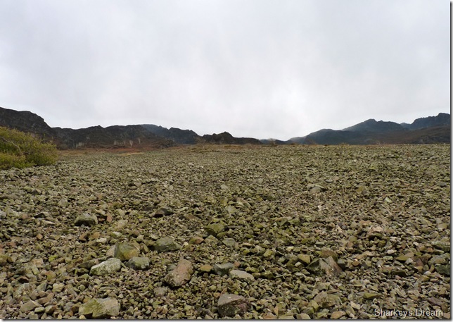
It is extremely difficult to describe how one feels once in this vast vertical scape of shattered pulverised rock, so for once, the next succession of photographs are for you to ponder at & come up with ones own conclusion because right here, I am lost for words. |
 |
| |
Yewbarrow, Kirk Fell & Great Gable from the second section of Screes. |
 |
| |
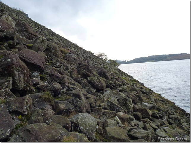
Buckbarrow from the second section of Screes.
Its been a tough arduous slog across the Screes & I can see the end is in sight, I follow paths which then of course disappears into boulders the size of footballs, wheelie bins & even small cars, I negotiate all this with extreme care as the Limestone is rough in texture giving me much needed grip, its the small crevices that you find yourself in that are really frightening, I slip & regain composure more times than I care to mention, I adopt a mountain goat ego then slip again, its a tough one as I sweat & swear my way across the boulders, especially when I can see my car parked on the opposite shore, its a target, but right now its a long way away, for I haven’t reached the final part of the Screes yet. |
 |
| |
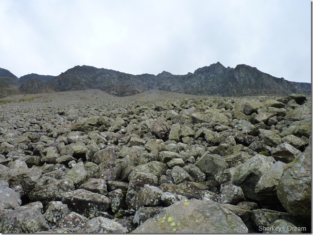
A vertical backdrop of the third section & toughest part of the Screes. |
 |
| |
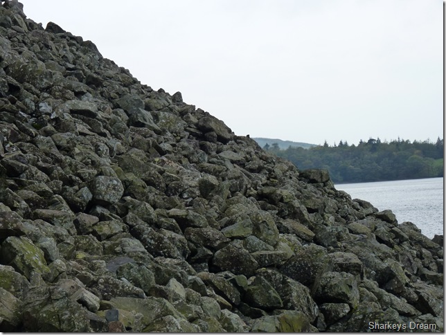
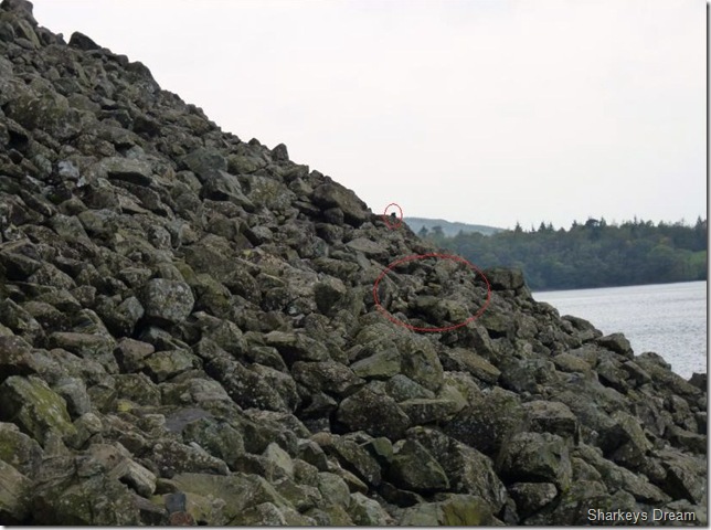
Spot the cairns?
See the next picture but do have a go! |
 |
| |
The cairns were few & far between, they kept a constant altitude around about 30 feet above the water line, & although they look difficult to see in the picture, once on the Scree slope & your eyes have adjusted to the contours of the fell side they stick out quite prominently. |
 |
| |
It has taken me an incredible two hours to get this far & I am worn out beyond belief, I have pulled pelvic muscles I never knew I had, but at the same time this route is just as exhilarating as Jacks Rake or even Striding Edge, my buzz & adrenalin fuelled episode is almost coming to an end as I hear voices again above me, I look up & spot two guys, I wonder have they seen me then I hear the Hi!! I return the compliment with not as much enthusiasm, I know what they have to come…I then spot two women & a young girl again, on the higher boulders above me all wearing wellington boots… I say nothing.
The little girl is playing I Spy with her mother, P for Pony which then leads me to remember a comical game of I Spy I played with my own son Owen when he was much younger, kids go through I Spy phases, I guess I don’t need to tell every parent & grandparent out there this is a game you can not escape, I shall be quick-going back to my game of I Spy with Owen while walking our westie through some wooded area near our house, after the obvious T (trees) G (grass) S (Sky) Owen quips up with “I spy with my little eye something beginning with QWER? have you got it dad? have you got it dad? have you got it dad? I’m lost, I say “go on I give up”
Qwerockodile (Crocodile!!)
Fits of laughter ensues, & I never to this day will ever let him forget it |
 |
| |
Nearing the final section of the Screes.
I don’t really want to be getting into the situation about telling parents about the dangers of the Screes but wellington boots? I hoped the parents saw fit to return to the comfort of the grassy paths before they possibly knew they were in way over there heads in danger & a possible rescue. |
 |
| |
Britain’s best view? Its getting better. |
 |
| |
The Wast Water Screes.
It goes without saying that I have enjoyed myself immensely on this walk today, from the gut wrenching zero visibility to the steep boulder strewn path I swore I never would return too, Wasdale & south Lakeland is on a different capability to the rest of Lakeland, you either love it or loathe it, if not for its beauty, then just the sheer ruggedness about the place.
You have to be inspired by the place, if only you visit every once in a while.
Next week I shall be completing my journey, my goal, my ambition to summit & trample every Wainwright summit, it hasn’t hit me just yet although I do admit the nerves are building,
Be sure to be here when it finally hits me |
|
| |
| Back to top |
 |
|