|
Thornthwaite Crag via the Ill Bell Ridge |
 |
 |
10th December 2011 |
 |
|
This walk was planned wholly around Tim my walking buddy, Tim is about to top his 100th Wainwright & today was about getting him as close to triple figures as humanly possible. As ever the date was put aside within Tim’s tight schedule a while ago, so come what may; we were walking today. It goes without saying as you may well know that in doing this tight schedule malarkey you are scripted to whatever the weather is going to throw at you, its December so gone are the thoughts of any big blue skies & in come the thoughts of dreary low cloud & grey as far as the eye can see.
We had initially set out to conquer the Kentmere Round, an eight hour walk with only seven hours daylight, this could bag Tim eleven new Wainwright’s bringing his total to 101 & yes, I know the idea was a little more than adventurous, even as a veteran these days, my mind still cannot connect with my boots. Tim threw some plan B routes my way & me his, what we came up with was the Greenburn Round, or easier known as the Helm Crag to Steel Fell Round, then on the Friday evening at around 8:20pm, I gave Tim a quick call, Tim was still in work finishing paperwork off, I threw seven Wainwright at him, the call was quick & brief.
This walk is the result of a one & a half minute phone call. |
|
Wainwright Guidebook |
 |
| The Far Eastern Fells |
The walker who toils upto the top of Ill Bell may be pardoned for feeling that he has achieved a major climb that has played a part of some consequence in mountaineering history, for he finds himself confronted by an imposing array of fine cairns that would do credit to a Matterhorn. And in fact this is a real mountain-top, small in extent and very rough; it is one of the most distinctive summits in Lakeland. |
 |
|
| |
|
Overview |
|
|
| Ascent: |
3,780 Feet, 1,152 Meters |
| Wainwrights: |
7, Sour Howes, Sallows, Yoke, Ill Bell, Froswick, Thornthwaite Crag, Troutbeck Tongue |
| Weather: |
Overcast & Wintery Showers, Some Snow, Mostly Hail, High Gust On Ridges, Highs Of 4° Lows Of -3° |
| Parking: |
Church Bridge, Troutbeck (foc, Room For About Six Cars) |
| Area: |
Far Eastern |
| Miles: |
11.6 |
| Walking With: |
Tim Oxburgh |
| Ordnance Survey: |
OL7 |
| Time Taken: |
|
| Route: |
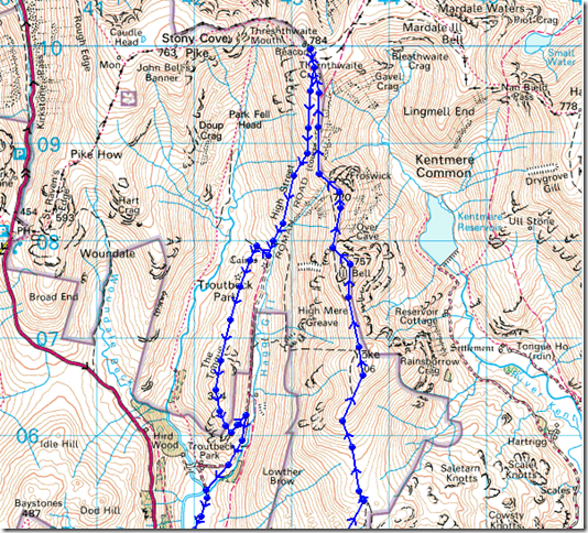
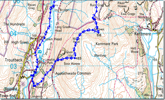
Troutbeck Church – Garburn Road – Sour Howes – Garburn Nook – Garburn Pass – Yoke – Ill Bell – Froswick – Thresthwaite Mouth – Troutbeck Tongue – Ings Lane – Truss Lane – Troutbeck Church |
|
| |
|
Map and Photo Gallery |
|
|
 |
| |
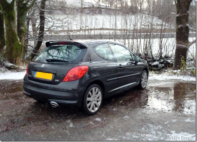
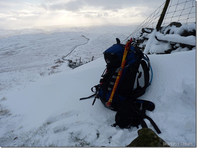
A shameful plug of the new car. |
 |
| |
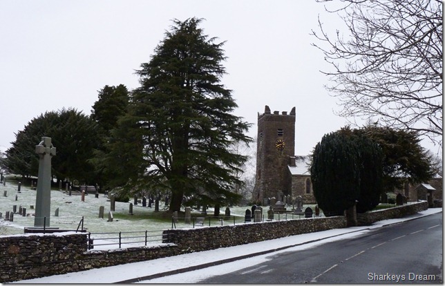
Jesus Church, Troutbeck
Its 8:12am & a snappy -3° as we kit up at Church Bridge CP, as you can see in the photo Lakeland has had a dusting of snow over night causing me to drive with caution along the A591 and equally along a small section of the Kirkstone Pass, this however does not stop other road users from behaving like blithering idiots in over taking me, ok I’m in my new car & I don’t want to trash it before I’ve made the first payment.
Tim heads off leaving me to lock the car, I shoulder pack realising my car keys are still in my pocket & not in my pack where they should be, I unclip my pack again making sure I don’t lie it on the ground covered in wet snow, I re-shoulder & walk away from the car only to notice my stylus pen isn’t looped in my chest strap (I always use a stylus pen together with my GPS) I lose these quite often so I’m thinking it must of worked its way loose & is still in the boot, off with the pack again & by now I note Tim is a couple of hundred feet away taking snaps of the Church & generally waiting for me to get a move on. Again I hold my pack aloft searching for the car keys & unlock the car & find my stylus pen in the boot, right, third time lucky, lock the car, don the hat & the gloves, I scoff a couple of Fruit Pastels & make my way over to Tim. |
 |
| |
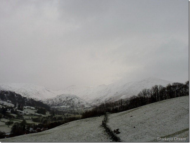
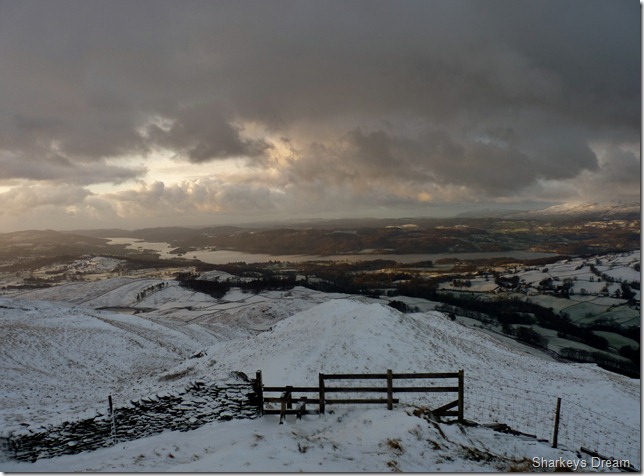
Looking towards our route with Troutbeck Tongue (C) & the Ill Bell Ridge (R) from Garnburn Road.
The weather forecast was taken with a pinch of salt, we had sporadic cloud all around us & although we had only been walking for a matter of ten minutes we had already had our first wintery shower. |
 |
| |
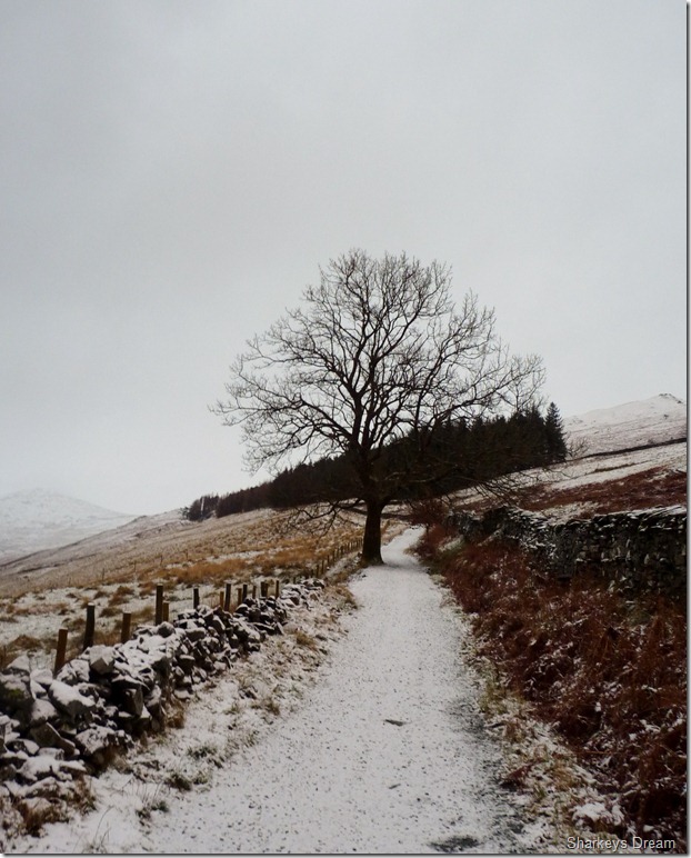
The Garburn Road (leading onto the Garburn Pass)
We followed the track for just under a mile before we headed off right over a sty just before we reached the pines ahead. |
 |
| |
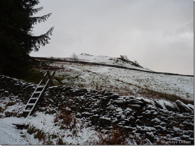
Crossing the sty at the pines, or a number of stys, three in total, you can just about make out the second along the stone wall & the third is just behind that and another stone wall is out of shot. |
 |
| |
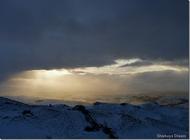
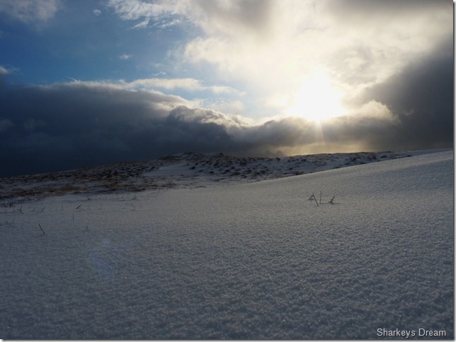
Looking towards Dubs Reservoir & keeping an eye on the weather, the light all around is really menacing & beautiful at the same time. |
 |
| |
Ambleside under siege.
We traced this huge storm cloud as it passed over the Langdales, right about here we are taking hailstone from its outer reaches but nothing too menacing, it was just wonderful to watch the different light aspects, that was until it unleashed itself over Lake Windermere & no doubt the Christmas shoppers in Ambleside. |
 |
| |
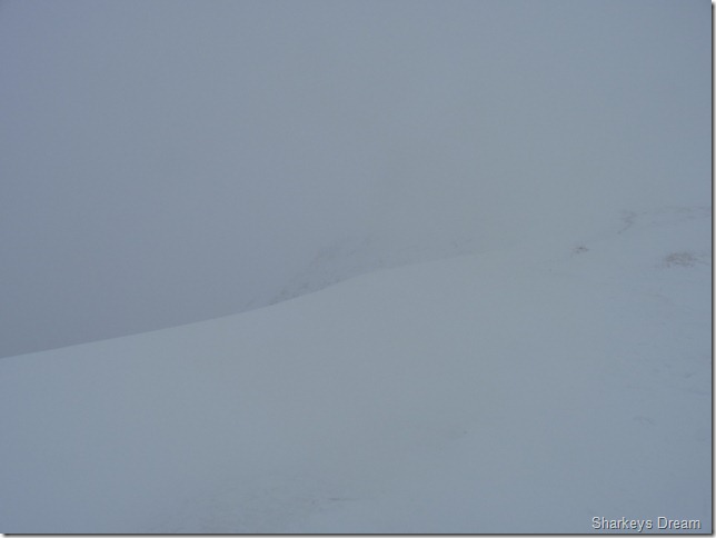
Our route for now is remaining quite clear, but don’t speak to soon.
Here we have the Ill Bell Ridge on the right & over to the left we have Caudale Moor, then far left we have Red Screes & finally Troutbeck Tongue taking centre. |
 |
| |
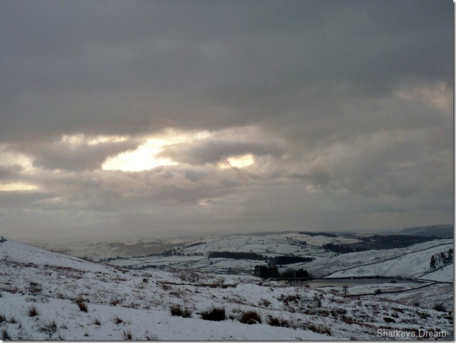
Looking down after the storm had passed at a full length view of Windermere & south Lakeland. |
 |
| |
More sporadic sun burst, this time in the direction of Kendal. |
 |
| |
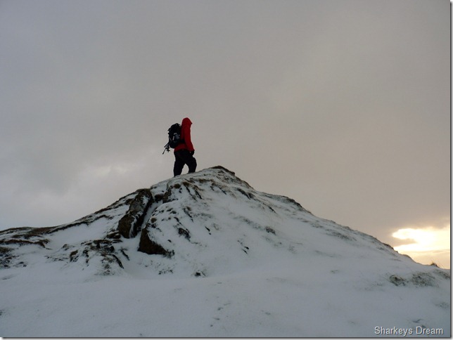
Tim taking Sour Howes summit.
This being my second time at Sour Howes in a little under four months, I was more than pleased with just how easy we found the summit today. If you have never been here before & you find yourself in thick low cloud as I did that September day, you will know exactly what I mean in when I say that Sour Howes was probably the most difficult Wainwright summit to find throughout my whole Wainwright campaign, In clear weather such as this, finding the summit was easy…
And this puts a smile on my face |
 |
| |
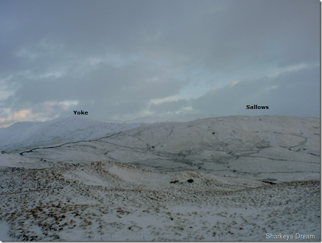
Our route ahead.
As we leave the summit of Sour Howes we get this clear view of our route ahead. The walk over to Sallows was possibly up there with the best part of the days walking, the ground underfoot was a crisp virgin powdery snow as we make for the stone wall that hugs the path all the way to the summit of Sallows, we both agreed that if the cloud was to come down now that we had both been lucky enough to capture Lakeland both physically & emotionally at her rawest. |
 |
| |
We follow the wall to this gap & this sty, here the path crosses from left to right and then from here its just a short walk to the summit of Sallows. |
 |
| |
Sallows summit.
Sallow is un-be-knowingly fast becoming a favourite summit of mine. Its summit is marked by a lay of rock horizontal in length & for this my third visit, I have never seen a cairn here. |
 |
| |
For now the weather is on our side as we leave Salllows for the Garburn Pass, ahead the real work starts as we set ourselves for Yoke & the Ill Bell Ridge. |
 |
| |
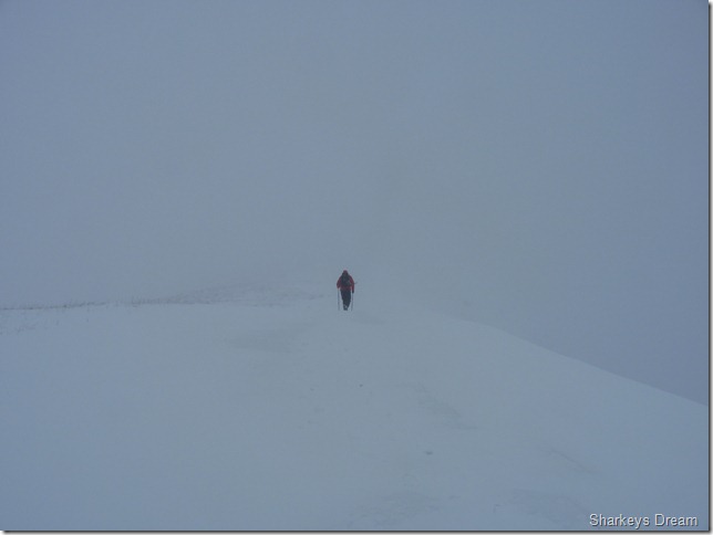
What a difference twenty minutes can make in Lakeland.
We’ve not long been on the pass & we were still quite a considerable way of Yoke’s summit when the cloud came down on us, the cloud seemed to wait for us to join the pass & noticeably at the same time, the wind got stronger & the chill got colder. |
 |
| |
We ditch the packs just above half way & take a small rest on the other side of stone wall out of the wind, Tim cracks open a boiled egg, while I sit crossed legged on a small rock trying to keep my bum out the snow! |
 |
| |
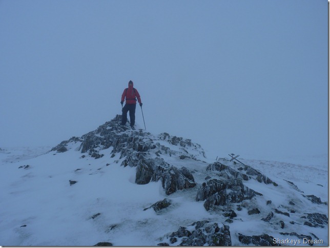
Yoke’s summit, & Tim on his 93rd Wainwright.
I guess from here on in this was the view in every direction, the time spent at the summit was brief to say the least, we press onto Ill Bell. |
 |
| |
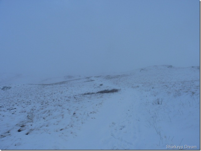
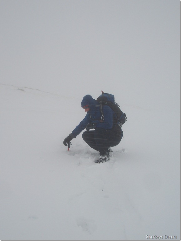
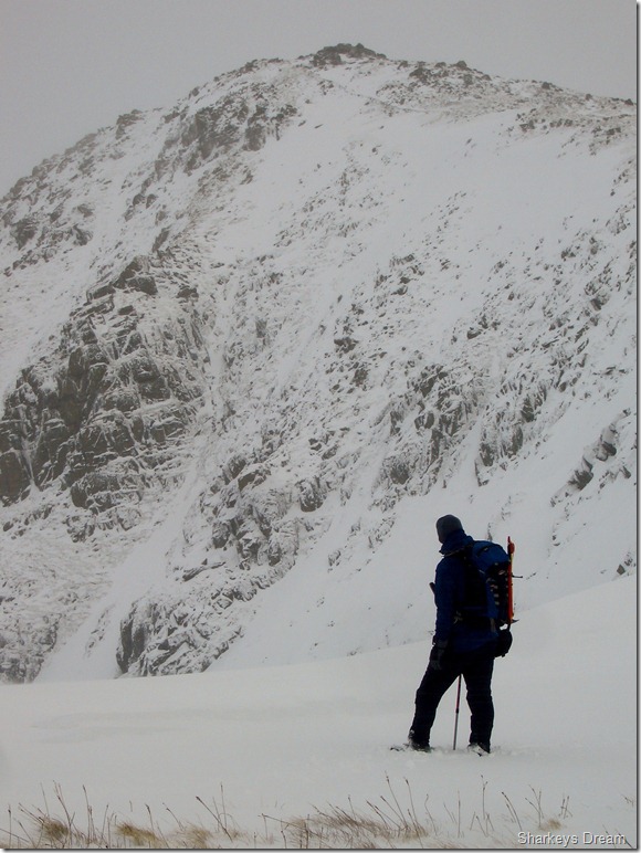
With strictly limited views safety now becomes paramount, just to the right of the picture is the edge & some very dangerous snow cornice, the first of many we would see today, I check our position & momentarily as more of a comfort more than anything. The snow is deep along the path sometimes up to four feet in places as I later found out… It would be much easier to walk along the grassy tussocks seen on the right but way to dangerous, here I am reminded of my ascent on Ben Nevis over three years ago & the white out we faced that day, I “step out the box” as I stride through the deep snow & remind myself, even though I cannot see any of my surroundings I know exactly where I am, consciously I pick out Sallows behind me, Troutbeck to my left & Kentmere Pike to my right, this small exercise is great brain fodder & keeps my mind active of my otherwise vacant surroundings. |
 |
| |
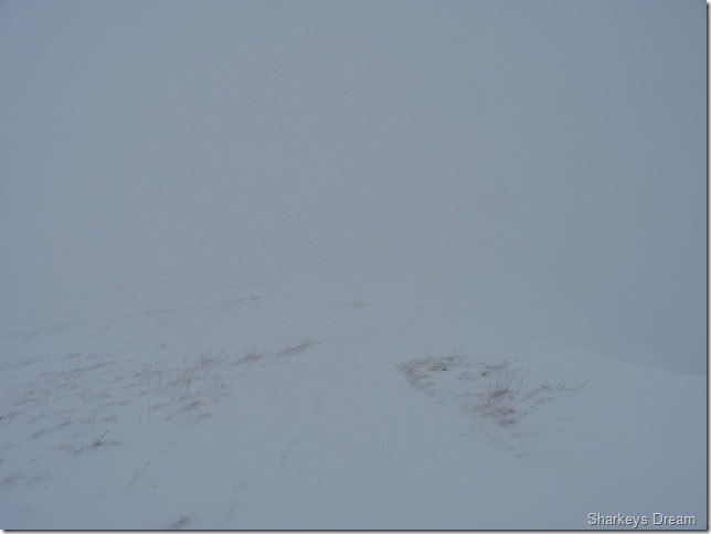
Disappearing with my walking pole.
Is exactly what I nearly just did, from memory I think there are two culverts that run along the path here, I miss judge the path as my pole is swallowed up by the deep snow drift. |
 |
| |
Equally frightening is the snow cornice & total lack of visibility. |
 |
| |
We press on for Ill Bell. |
 |
| |
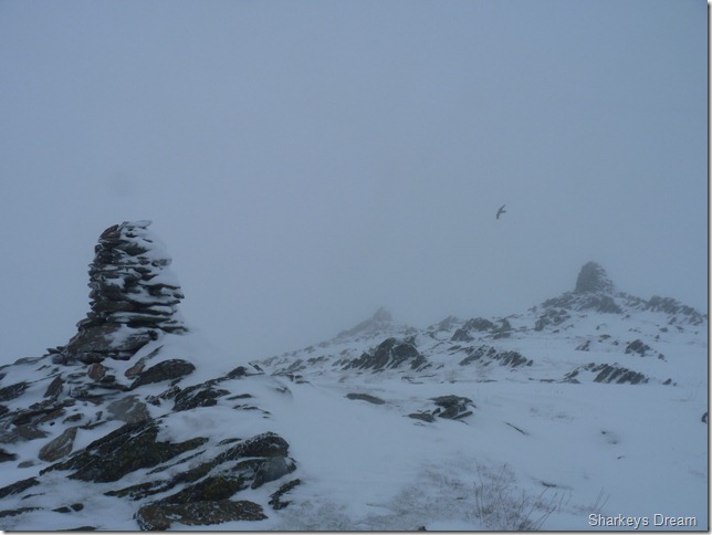
A solitary Raven hovers on the updrafts as we reach Ill Bell summit & its impressive three cairns.
Again, the time we spend at the summit is brief, I recall Tim’s words of “Lets get outta here” at least we are both thinking on the same wave length. |
 |
| |
Tim descending Wainwright number 95.
The descent here can be a little tricky in the best of weathers, as the snow wasn’t compact & still quite powdery, I felt it just wasn’t right for the Crampons just yet, but I wouldn’t of thought any a less if I had seen someone wearing them along this ridge. |
 |
| |
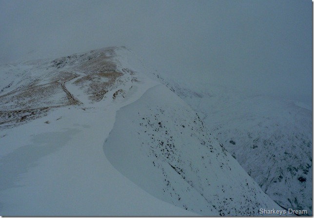
I leave Tim negotiating the descent & have a wander over to a small outcrop of rock to take this shot of Froswick & this mass of snow cornice. |
 |
| |
Looking back at Ill Bell. |
 |
| |
This shot of Ill Bell taken from a little further shows the cornice from a different angle. |
 |
| |
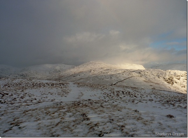
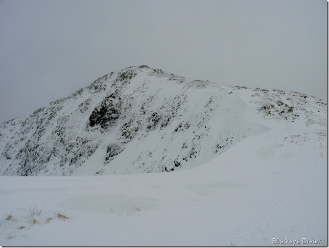
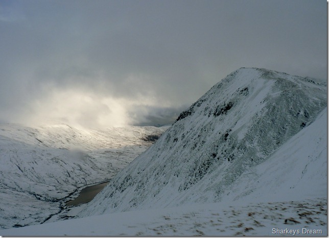
Thorthwaite Crag & Caudale Moor taken from the summit of Froswick.
It was a tough slog to gain the summit, notably the pair of us had slowed down whether this be due to the deep snow or slight fatigue kicking in or maybe a mixture of both, seeing Thornthwaite Crag, indeed seeing a “fixable” object was a very welcome sight. |
 |
| |
Ahead, Thorthwaite Crag.
With more cornice on our eastern flanks, here we both give the cornice a wide berth, maybe too wide if you was following our footsteps, but it was better to be safe than sorry. |
 |
| |
Looking back on Froswick & views towards Kentmere Reservoir. |
 |
| |
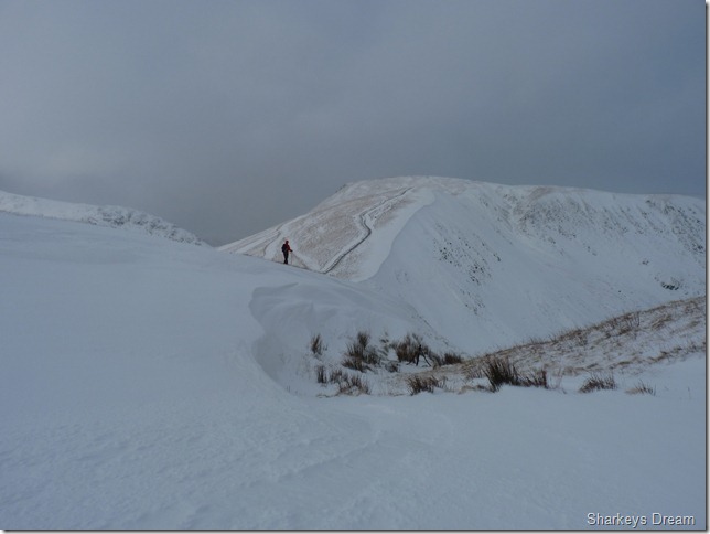
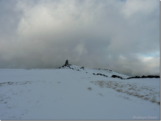
Trudging through the deep snow when Thornthwaite Beacon comes into view.
It is here I remark to Tim “that there is always someone” at Thornthwaite Beacon, but sure enough we cant see a soul, as me & Tim head over the last few yards we spot a gang of walkers heading over from the direction of High Street. |
 |
| |
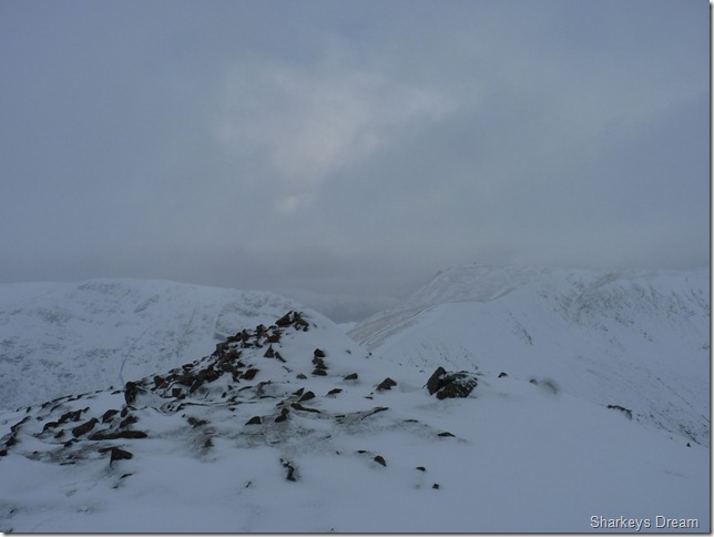
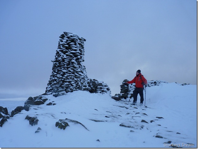
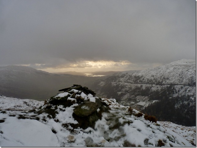
Thornthwaite Beacon.
I make for some shelter behind a wall & a nicely built up snow drift, here we are out of the wind as I eat a couple of tuna mayo sandwiches, It came as no surprise that the bread had frozen & the tuna might as well of been back in the Bering Sea! nevertheless I need food in my stomach. Tim is offering out Cola Bottles as he gives me a handful, by now I & we are ready to go as he tips them out in my glove, I eat about as many as can fit in my mouth, the rest, I keep in a fist within my glove thawing out |
 |
| |
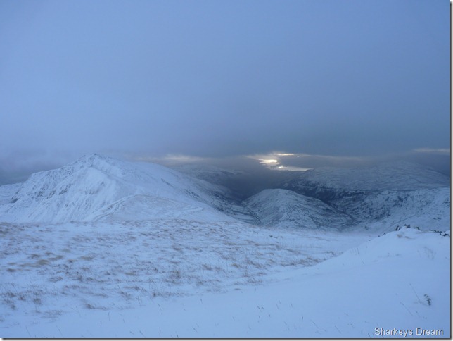
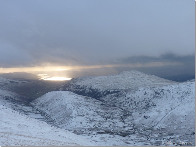
Looking back at our route & ground covered from Thorthwaite Crag, to the left we have the Ill Bell Ridge incorporating Froswick & Yoke, the centre of the picture is our next destination of Troutbeck Tongue & beautifully lit up by a low evening sun is Windermere.
Our descent down to Troutbeck would follow the (Course of) High Street’s Roman Road. |
 |
| |
Troutbeck Tounge, Wansfell & Lake Windermere.
With Windermere goring at us like a sparkling pot of gold we make no haste in descending down into Troutbeck, it almost feels like dusk is up on us, indeed It may well be, yet it is only 2pm in the afternoon, the descent is met by more deep snow as strange as it may seem, it is only as we reach the valley of Troutbeck does the snow become scarce underfoot. |
 |
| |
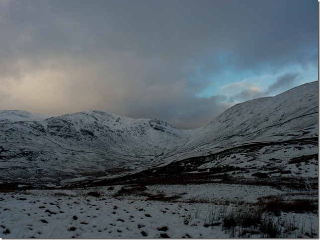
Looking back at Thresthwaite Mouth, Stony Cove Pike (Caudale Moor) & Thornthwaite Crag. |
 |
| |
Sour Howes, Windermere & Wansfell from Troutbeck Tongue.
The light is fading as the hail & snow gives way for what can only be described as “Lakeland rain” a vertical consistent downpour ensues, as like the Roman Soldiers who roamed Troutbeck a few thousand years ago we spur our last spouts of energy in blitzing the last mile in reaching the summit, we are a little down beat with the rain soaking us through, when all day it has kept itself at bay.
Its a long way back to Troutbeck & the CP, just over two & half miles to be exact, after leaving the summit we slip (well I do) most of the way down the grassy slopes now covered in deadly mix of wet grass, slush & snow, I fail at trying to look somewhat athletic as the now five times that I‘ve literally gone head over heels down the hill side, I am met with “Paul, you ok mate?” to silence or fits of laughter! your head twisted right back then! I guess as comical as I may have looked, after a full days walking in whatever was thrown at me, it was the little fell of Troutbeck that saw me on my cold arse!
Its a silent two & half mile trek back, not silence in a bad way, but silence in the sense of achievement on both our parts, Tim has his seven new Wainwrights, and me, I scoff at the fact this route was devised by myself in less than one and a half minutes map in hand.
The silence is broken as our rain soaked bodies occasionally splash through deep puddles as we take in Truss Lane, if not only to clean our boots. Our feet are frozen & I must smell like something in the field at the side of me. I cant feel my arse cheeks but I am content at another fantastic winters day on the fells I love. |
|
| |
| Back to top |
 |
|