|
Wetherlam & The Old Man Of Coniston |
 |
 |
22nd January 2012 |
 |
|
This walk was really touch & go, my heart took over my mind & here, all of a sudden, I find myself just outside the wonderful village of Coniston. I’ve had a bit of a tough week health wise (my own musings) the Flu saw me wounded at home, stricken like a boat with no sail playing Xbox, hankies & empty coffee cups lay around my barely lifeless corpse during the first part of the week & eventually during the second half, I started to resemble sub-human again.
During this time I found myself at the hands of Memory Map & indeed OL6.
It is true, I have a fondness for the Far Eastern, Eastern & Northern Fells, every Fell walker has a favourite section of Lakeland & these are mine, I never really give the Southern half of Lakeland the attention it deserves, because so easily, I find myself wondering about the three I have just mentioned.
So why is this?
Because after today I shall be asking myself why Paul? This route from the start did that very thing to me… you know, that tickety butterfly feeling you get when you know something’s good is about to happen. I get this feeling with some walks, not all, just some. This walk I got that butterfly feeling from the pit of my stomach to the tops of my shoulders, I just new this was new territory to me, this I thought, was the walk that could bring back so many great memories. The times when I clung to new surrounding’s & devilled at what was around the next corner. The times when I had only climbed half my Wainwrights.
Its odd really isn’t it? I’ve been doing some fell/soul searching for months with what & where to climb next, when really I just needed to climb where the butterflies took me.
Ok that’s not right Paul, I’m a bloke grunt!! grunt!!
But you do get my drift? |
|
| Wainwright Guidebook |
 |
| The Southern Fells |
- The Old Man of Coniston:
The Coniston Fells form a separate geographical unit. They are almost entirely severed from the adjacent mountainous parts of Lakeland by the Duddon and Brathay Valleys, with the watershed between the two, Wrynose Pass, 1270’ providing the only link with the other fells. The whole of the Coniston group lies within Lancashire, the two valleys mentioned containing the boundary’s of Cumberland (Duddon) and Westmorland (Brathay).
Whilst the characteristics of the Coniston Fells are predominantly Lakeland, with lofty ridges, steep and craggy declivities, lovely waterfalls and lonely tarns and general scenic charm so typical of the district, there has been a great deal of industrial exploitation here, principally in copper mining (now abandoned) and quarrying (still active), resulting in much disfigurement.
Many people, indeed, will find that the decayed skeletons of the mine – workings add an unusual, and if explored an absorbing, interest to their walks. |
 |
|
|
| |
|
Overview |
|
|
| Ascent: |
3,720 Feet |
| Wainwrights: |
4, Wetherlam, Swirl How, Brim Fell & The Old Man Of Coniston |
| Weather: |
Overcast & Showers am, Winds 50mph Plus On Tops, Turning Brighter pm Highs Of 9° Lows Of 8° |
| Parking: |
Road Side Parking, Silver Bank Cottage, Coniston |
| Area: |
Southern |
| Miles: |
7.9 |
| Walking With: |
On my own |
| Ordnance Survey: |
OL6 |
| Time Taken: |
|
| Route: |
Silver Bank – Miners Bridge – Coppermines Valley – Red Gill – Red Gill Head Moss – Wetherlam – Prison Band – Swirl Hawse – Swirl How – Brim Fell Rake – Brim Fell – The Old Man Of Coniston – Low Water – Boulder Valley – Miners Bridge – Silver Bank |
|
| |
|
Map and Photo Gallery |
|
|
 |
| |
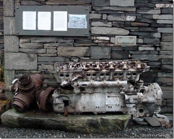
V12 Merlin Aero Engine.
This engine now resides at the Ruskin Museum, Coniston, it was recovered from the summit of Great Carrs by a Chinook Helicopter in 1997 after years spent at the summit when during October 1944 a Halifax Bomber crashed bursting into flames sadly killing all eight Servicemen on board, Seven Canadian & one British.
Remarkably this engine, one of three remains in out standing condition considering the time spent in the harsh environment.
You can read more about the Ruskin Museum & indeed the history of Coniston |
 |
| |
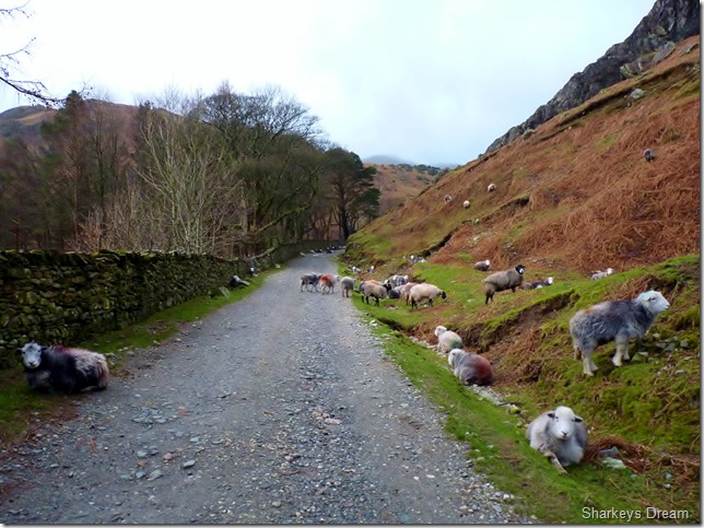
If I had a pound coin for every bad look I got while walking through here!
I made great time arriving in Coniston at 8:10am so much so I kitted up during an overcast sunrise to the howl of a winter wind, there was no second guessing my kit this morning, it was all winter.
After stopping at the Ruskin Museum not two minutes away from my solitary parking spot, the road laden with fallen tree branches from a previous storm…
The time spent kitting up here gave me my bench mark for what to expect during the next five hours,.. its going to be a rough one today Paul. |
 |
| |
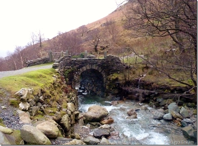
Miners Bridge & Church Beck.
I make my way past more sleeping sheep & more bad looks until I reached Miners Bridge, a significant landmark in my route, as I would be crossing this beautiful pack horse bridge on my return. |
 |
| |
The row of ten cottages as I gain the path. |
 |
| |
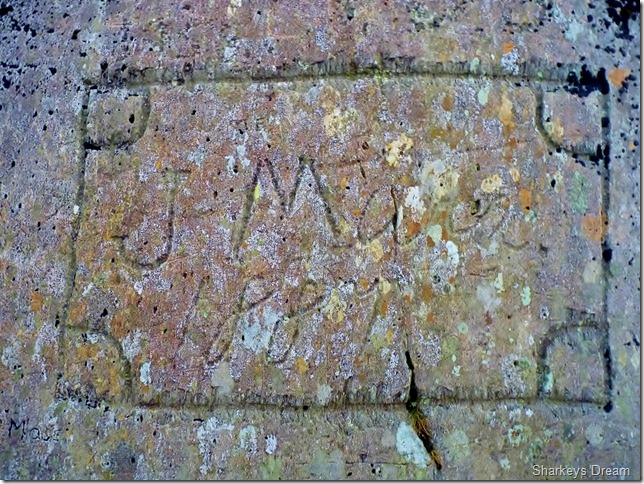
Victorian Graffiti.
Within minutes of leaving Miners Bridge I stumble across a huge slab of near vertical rock where I can only assume the miners of the 1800’s used to subscribe ones name. The whole area was dotted with names going back well over 200 years, J Mann 1887 (presumably) being the more substantial than any other. |
 |
| |
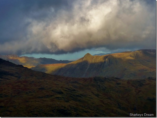
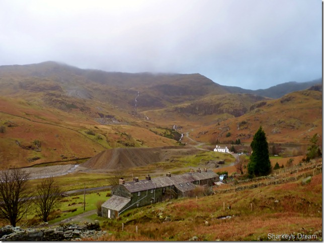
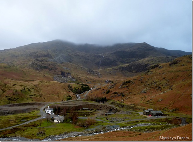
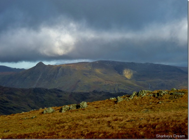
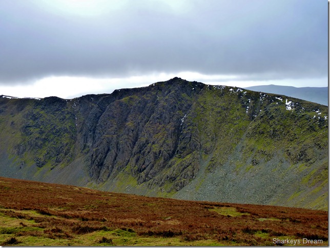
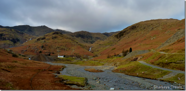
The Coppermines valley with Coniston Old Man’s summit under a blanket of cloud.
The industrial heartland of Lakeland throughout the eighteenth, & nineteenth centuries. |
 |
| |
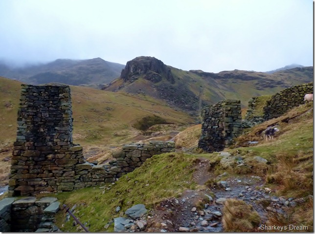
Heading for the valley of Red Dell, not before passing these two stone towers with the Old Man & Kennel Crag in the background. |
 |
| |
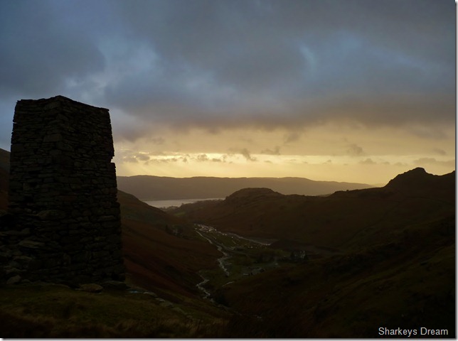
Looking back at a glimpse of Coniston Water & The Bell (R) as the sun still rises. |
 |
| |
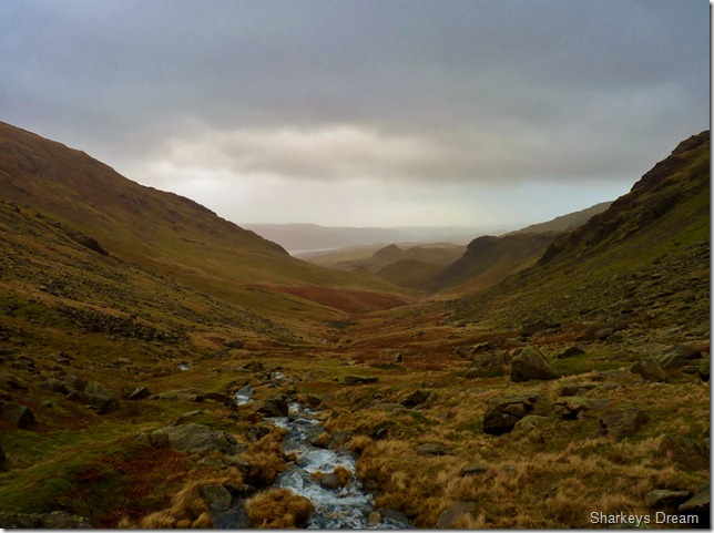
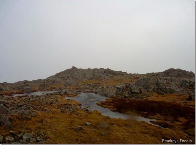
Red Dell valley & Red Dell Beck.
Ahead lies Wetherlam but first, I have an extremely wet Red Dell Moss & boulder field to negotiate.
The path here varies in many ways, after leaving behind Coppermines valley where the ground underfoot was gravel & pleasant, here I pick my way over scurried sheep track, often I may stumble across something passable for us humans. For its ruggedness & beauty, Red Dell comes in bucket loads, which I often reminded myself, when up to my ankles in swollen peat bog.
Then there was the wind, which was altogether a different fight in itself.
Blighted, I press on. |
 |
| |
Looking back over the Red Dell valley from Red Dell Beck.
Not long after this picture was taken I sense a downpour, not only am I surrounded by fierce wind, I seem to be sitting in the eye of the storm & hurriedly de-pack, I am calm sitting in this neat little window but I know any minute now its going to come my turn.
I take in my surroundings as I carefully ease my Berghaus Trousers over my boots & zip down. I turn around just in time as I feel the drawing pins like prick of each rain drop hit my now raw face, I tie my hood down so much so, my hood peak now blocks my view, so I soldier on looking at my boots feeling quite optimistic & joyous at the fact that I out did this rain storm… |
 |
| |
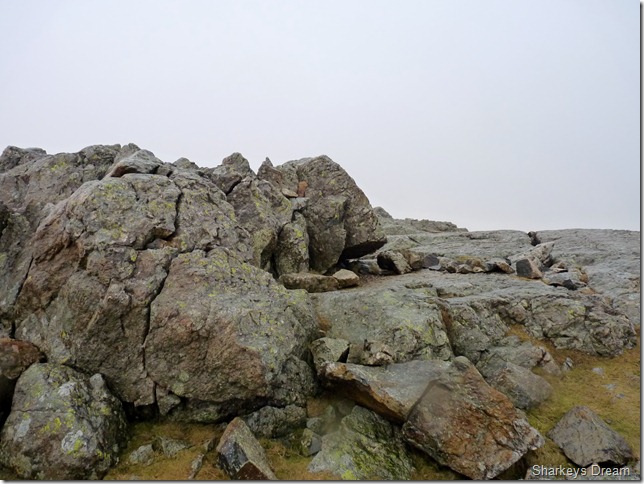
Almost at the summit of Wetherlam.
I battle the wind over small sporadic snow pact, my only aim was to bed down at the summit shelter, the last time I was here, was over two years ago, so this involves a little search as the wind gets stronger & stronger. |
 |
| |
Wetherlam summit shelter.
It was only a matter of twenty minutes in between this & the last photo, but that twenty minutes had sapped a lot of my energy reserves, by now visibility is now 50/60 metres & I cant fix on Wetherlam Edge nor Swirl Hawse.
I sit out the gust & driving rain perched on the rock you see, I am thankful to be out of that gale, If anyone who has walked with me can vouch at the fact that I normally walk past a summit with only a photo in mind then this might give you the affects the storm & winds were having on me right about here, I even think about calling it a day but then this happens… |
 |
| |
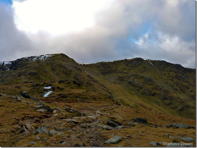
I pop my head over the shelter & get my view of my route ahead, Swirl Hawse.
Its truly amazing what ten minute’s can do during a storm in Lakeland. |
 |
| |
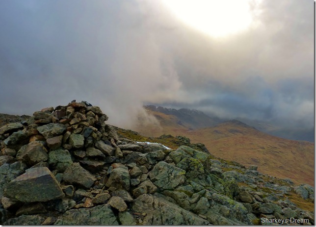
Brief views over towards Bow Fell & Crinkle Crags from the summit cairn.
I have a second spur & while in the shelter I make all available kit at hand, I swap my now soaked Wind Stopper Gloves for my Mountain Ski Gloves, undoubtedly, not as easy to use with my camera but by now, my red raw fingers more than need the warmth they will provide. I take off my hat & pull on my neck gaiter, making sure I cover my ears, I then replace my hat, there, snug as a bug.
My nose is uncontrollably watering by now, this & the brain freeze I can do nothing about, one last piece of equipment are my Bloc Billy sunglasses, to at least try & protect my eyes from the wind.
I am now ready to leave the comfort of the shelter, I stand in the face of the wind & WHACK!! I am caught in my blistering cold lips by a strap from my pack, for the second time this year I do recall, this time though, I press on with a thick lip. |
 |
| |
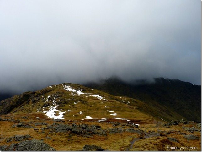
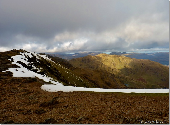
Views now opening up towards the Langdales from Swirl Hawse.
Despite its beauty, I really am struggling with the camera here |
 |
| |
And here…
Swirl How & Great Carrs from Swirl Hawse. |
 |
| |
And here…
Brief views towards the Scafells. |
 |
| |
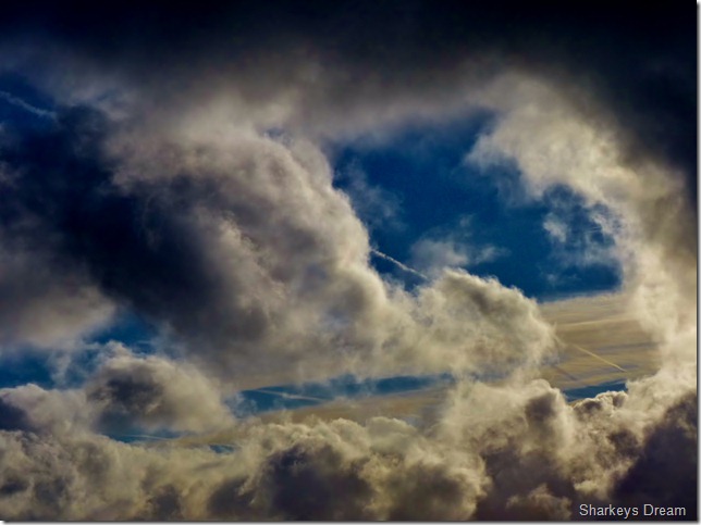
| It just doesn’t make much sense up there today |
 |
| |
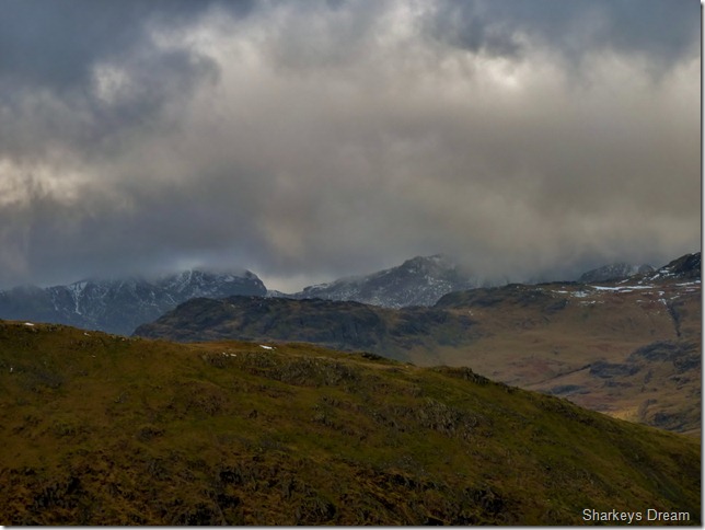
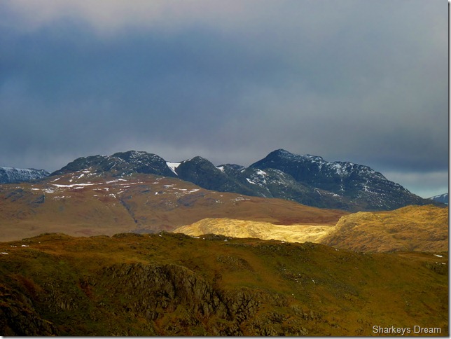
Crinkle Crags & Bow Fell.
The high winds are doing a fine job of getting rid of the cloud (for now at least) |
 |
| |
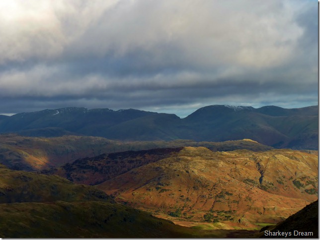
Looking over Little Langdale towards Fairfield, Seat Sandal & the Helvellyn range. |
 |
| |
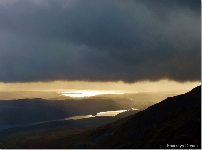
Coniston Water & Morecambe Bay from my ascent on Swirl How.
I guess by now I really am patting myself on the back, ok I’m still getting knocked of my feet, but the views that are now opening up are simply amazing. |
 |
| |
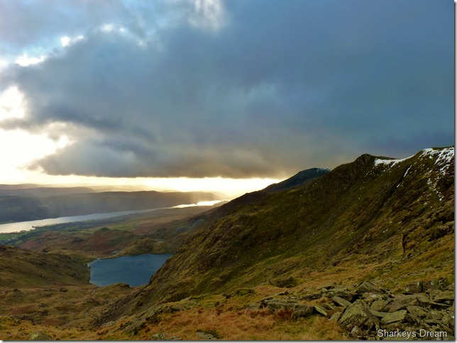
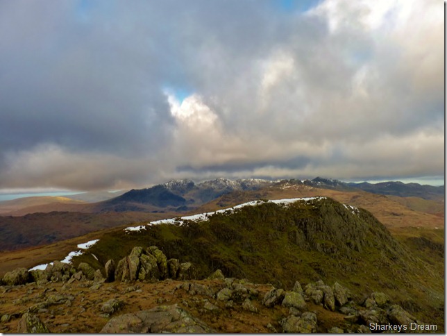
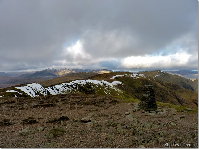
Levers Water, Brim Fell & my final objective, Coniston Old Man at the far end of the ridge. |
 |
| |
Great Carrs & the Esk Fells from Swirl How summit. |
 |
| |
Grey Friar from Swirl How. |
 |
| |
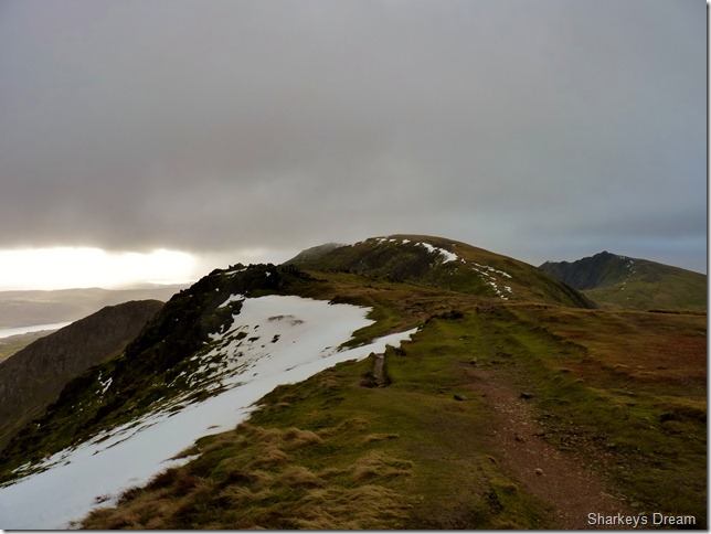
Ahead, Brim Fell & the Coniston Old Man, to the right of the picture is the prominence of Dow Crag, both the Old Man & Dow Crag are separated by Goats Hawse, easily attainable from here. |
 |
| |
Levers Water & in the distance Coniston Water.
Towards the left of the picture is the valley of Red Dell, ahead is the Coppermines & Coniston. |
 |
| |
Brim Fell & Coniston Old Man from Levers Hawse, towards the right is Dow Crag. |
 |
| |
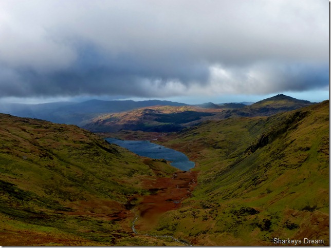
During a brief rain spell I wander over to the opposite side of the ridge to get this shot of Seathwaite Tarn & Harter Fell upper right.
It was here I finally succumb to the wind as it bowls me over like a rag doll, caught un-aware I semi slip on wet rock & the wind takes care of the rest, knocking me over to my left side, only a slice of left over snow cushions my blow as I get up & wipe myself down.
No harm done I press on towards Brim Fell. |
 |
| |
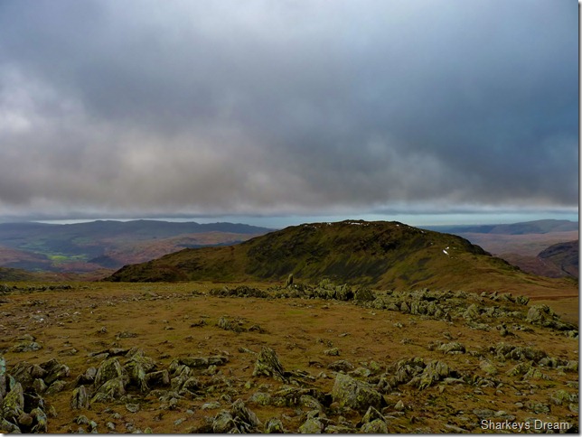
Wetherlam & Black Sails from Levers Hawse, The Red Dell valley cuts between both ridges. |
 |
| |
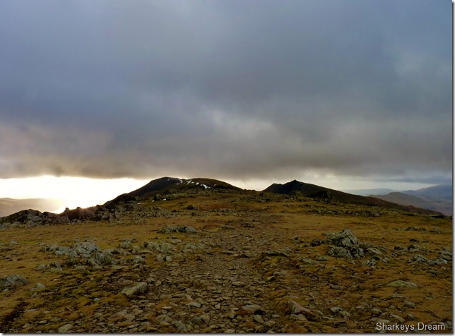
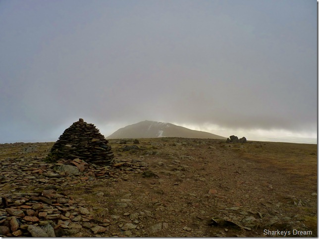
Coniston Old Man from Brim Fell & Brim Fell Top.
I’m on the last straight now & at this point I’m looking forward to getting down to Coniston Old Man via the tourist route, this a part of the walk I savoured the most. |
 |
| |
Dow Crag. |
 |
| |
Looking back on Wetherlam from just beneath the summit of Coniston Old Man. |
 |
| |
Brim Fell, Swirl How & Great Carrs from the summit of Coniston Old Man. |
 |
| |
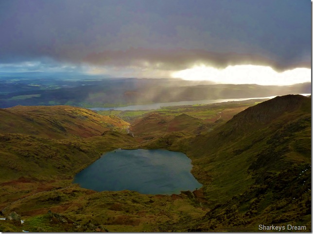
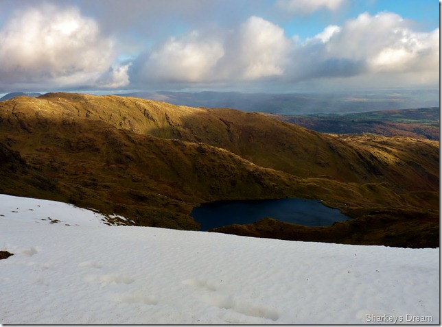
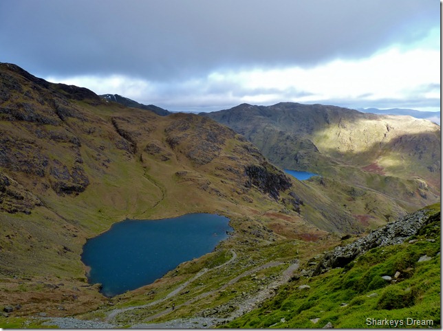
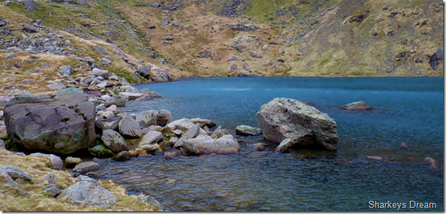
Two Tarns in one shot, Here we have Low Water & Levers Water from the tourist path.
It is here I de-kit, off comes the Neck Gaiter & the waterproofs, I am going to enjoy this descent in relative comfort & being out of that wind for the last four hours or so makes the descent that more enjoyable. |
 |
| |
Low Water.
While on the descent I pass over a dozen walkers on their way up, I am still wearing my Bloc Billys as I get the strange stares coming in my direction.
I think, you can find out yourself why I’m wearing sunglasses in January |
 |
| |
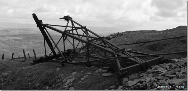
Remains of a crippled rusting steel tower that once conveyed trucks full of Copper Ore between the top & bottom of the Mountain side. |
 |
| |
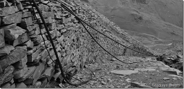
More cable lies abandoned at the lower end of the mine. |
 |
| |
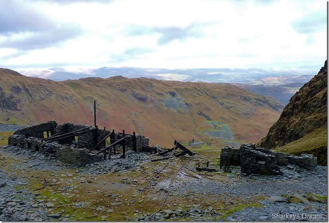
The derelict huts that once homed the Coniston Copper Miners. |
 |
| |
Coppermines Valley from Church Beck.
I make my way back towards Coniston, content I once again, have found my walking boots, the reason I walk is for days like today, Ill take the wind, the sodden socks the chapped lips & the blisters after days like this. |
|
| |
| Back to top |
 |
|