|
The Wet Sleddale Horseshoe |
 |
 |
18th March 2012 |
 |
|
The Wet Sleddale Horseshoe has been a burning desire for quite some time now, & there’s a valid reason why I kept putting it off, for you see, to get the most out of Wet Sleddale it really has to be the right time of the year, that sadly has passed during the long cold winter months, when what was needed was a hard solid frost underfoot, big blue skies & possibly; a extra hours daylight.
The name kinda gives it away…
The frost never came for me, or if it did, I missed it through work & other commitments, this doesn’t go to say that the Wet Sleddale Horseshoe was wiped from memory, on the contrary… It just needed to be the right time. Keeping my eye on the weather was looking promising all through the week, It would look like I was going to have my day on the Shap fells after all, this a day what could of been spent on the higher fells in any other given case, it was a pick your walk kind of day, no restrictions at all & although it was immensely tempting to go & wander off to Langdale or Wasdale I stuck to my guns & kept with my game plan.
I had all intentions to let my hair down this week, Wet Sleddale would see me, or what would seem a million miles away from anything.
Wet Sleddale did not disappoint & gave time for the mind to wander at free will, some of my walks are designed around so many things, stunning scenery, edges & traverses ones own physical fitness & pure determination, this walk wasn’t, on this walk I was going to let my hair down, but you see, Wet Sleddale wasn’t going to give in that easy, there was a fight & a struggle & some cursing going on.
Please read on… |
|
| Wainwright Guidebook |
 |
| The Outlying Fells |
Wet Sleddale, although wholly within the National Park, is relatively little known. It bisects Shap Fells, running northeast away from Lakeland to the lime stone uplands beyond. The main road A.6, the motorway M6 and the railway all pass near the entrance to the valley, but it is a dead-end for traffic and its mile-long ribbon of tarmac has no signposted attraction to divert speeding motorist. Indeed, its visual appeal has been diminished in the past decade by the construction of a massive dam, for the valley has been taken over by Manchester to augment the water supply to Haweswater. The dam is large but the reservoir is small, and beyond the drowned area with its sad relics and ruins the head of the valley remains unchanged, copses and woodlands reviling the drab backcloth of grassy fells. In the valley bottom the ancient deer enclosures, unique in the district, are safe from engulfment; a new feature nearby is an attractive packhorse bridge built to replace an old one lower down the beck and within the maw of the reservoir.
The hills are unaffected, and they always have been: wild, desolate, even lonelier with the closure of farms. |
 |
|
|
| |
|
Overview |
|
|
| Ascent: |
2,300 Feet, 702 Metres |
| Wainwrights: |
2, Grey Crag, Tarn Crag (Longsleddale) |
| Outlyers: |
7, Sleddale Pike, Great Saddle Crag, Great Yarlside, Grey Crag, Tarn Crag (Longsleddale), High Wetner Howe, Seat Robert |
| Weather: |
Clear Blue Skies With Scattered Cloud For The Latter Of The Day, Little To No Wind, Highs Of 9° Lows Of 3° |
| Parking: |
Wet Sleddale Reservoir Dam (FOC) |
| Area: |
Far Eastern |
| Miles: |
14 |
| Walking With: |
On my own |
| Ordnance Survey: |
OL5 |
| Time Taken: |
6 Hours 50 Minutes |
| Route: |
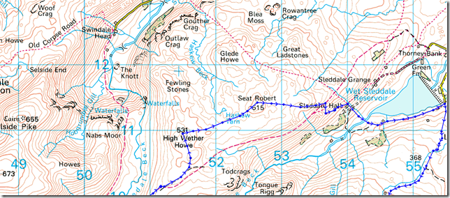
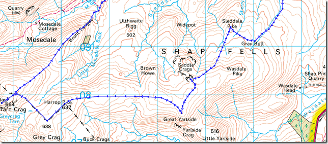
Wet Sleddale Reservoir Dam – Lunch House – Gray Bull – Sleddale Pike – Great Saddle Crag – Great Yarlside – Harrop Pike – Grey Crag – Tarn Crag, Longsleddale – Brunt Tongue – Mosedale Beck – Scam Mathew – High Wether Howe – Haskew Tarn – Seat Robert – Willy Fold – Sleddale Hall – Wet Sleddale Reservoir Dam |
|
| |
|
Map and Photo Gallery |
|
|
 |
| |
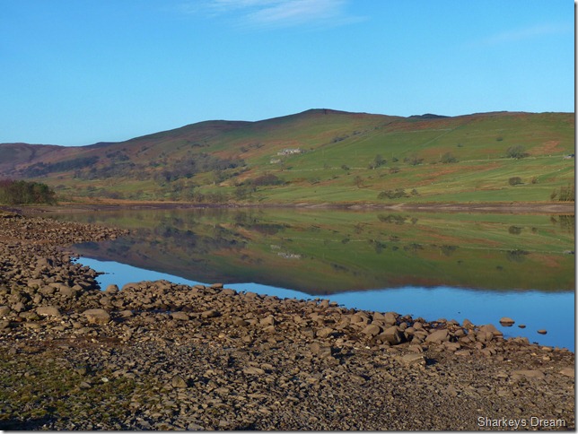
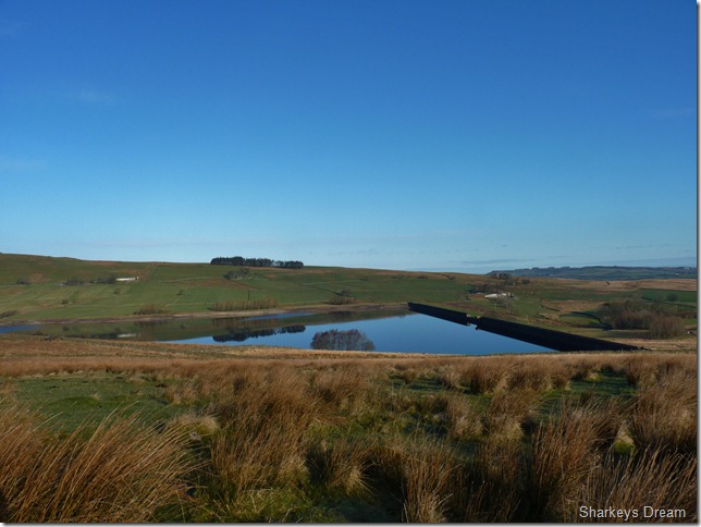
Seat Robert across Wet Sleddale Reservoir.
3° 07:43am
I disturb the silence of the Shap Fells as my car rattles over the many cattle grids on route to the car park situated at the end of a dead-end-road. Its me & me alone as I kit up at the car park, although the A6 roars not just a five minute drive away, I could be forgiven for being in the middle of no-where. I take it upon my self – I am in the middle of no-where, for these are the Shap Fells, isolated from the arêtes & traverses of Lakeland for rolling grassy slopes steeped in history and slutch, & lots of it. |
 |
| |
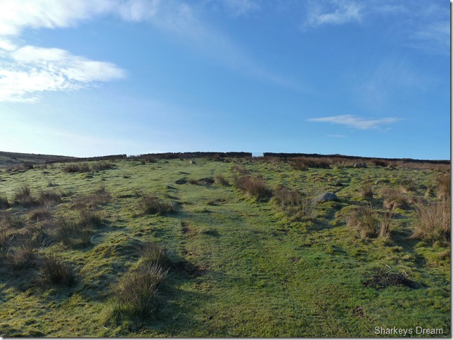
I leave the car park behind me & head south on to the moor tops laden with Grouse Butts, I’m not a big fan of shooting game for sport, so I pay them no attention.
The walk starts of beautifully, the ground underfoot for now is scorched with a light frost, it won’t last because the sun is out & already warming things up including myself, I make note, today is my first walk of the year I start with just my Rab soft-shell leaving my jacket tucked away in my pack for the whole duration of the walk, I guess spring is well & truly here. |
 |
| |
Looking back on Wet Sleddale Reservoir.
Triangular in shape the dam wall measures 600 meters in length & is 21 metres in height & just like its neighbour in the next valley; Haweswater. The dam was built to supply Manchester with drinking water & completed only as late as 1966.
Mental note: the dam is looking quite dry around the edges, its not just the South of England that has lacked rainfall this winter, so has one of the wettest places in England. |
 |
| |
Ahead lies with its prominent peak sits Wasdale Head, a far cry from the Wasdale we all know & love but still the same in that; both names can claim they are within an area of outstanding natural beauty.
The paths, or lack of them are sketchy at best & one should concentrate on the ground underfoot & most importantly your direction & surroundings, a good path here is equivalent to a sheep track, getting lost in low cloud here doesn’t bare thinking about!
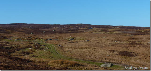
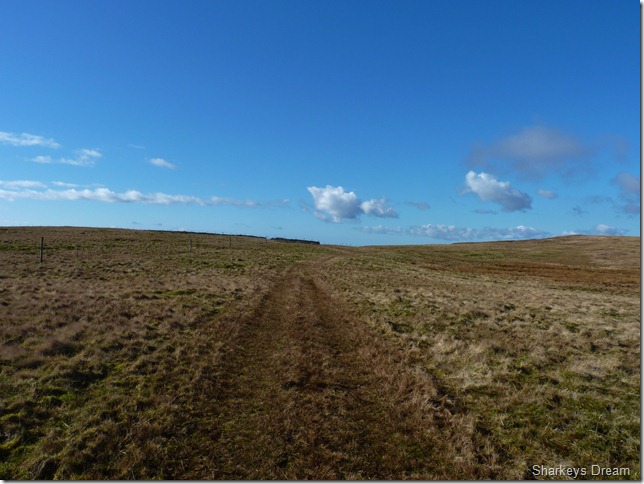
I make for a tractor track seen in the centre of the photo which is great guidance & will lead me all the way to the prominent land mark that is the Lunch House, its a wee while away yet so I take in my surroundings with a smile un-be knowing the hard work still lies ahead. |
 |
| |
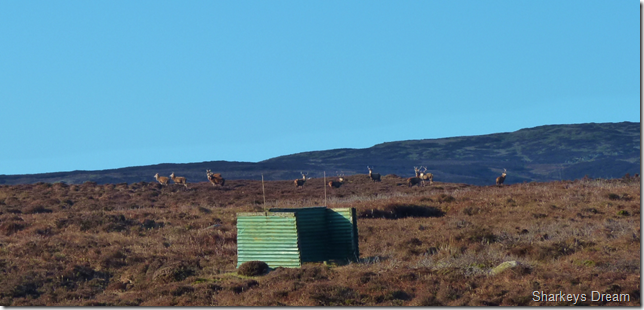
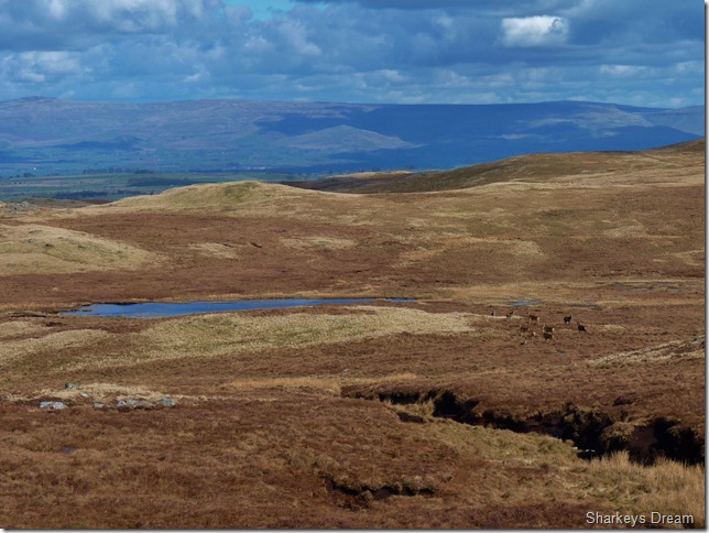
A heard of wild Deer grazing amongst the Grouse Butts.
I spot the wild deer & my heart races, I am too far away for a decent shot, here using full zoom on my camera, I figure I am around 900 yards away. The deer have all eyes on me as I creep along the track using the grassy sides to disguise my foot steps, to no avail the Deer bolt & for now, I do not see them again. |
 |
| |
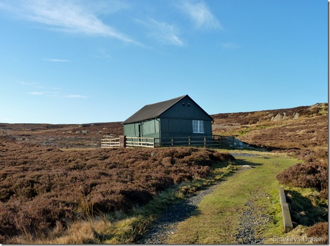
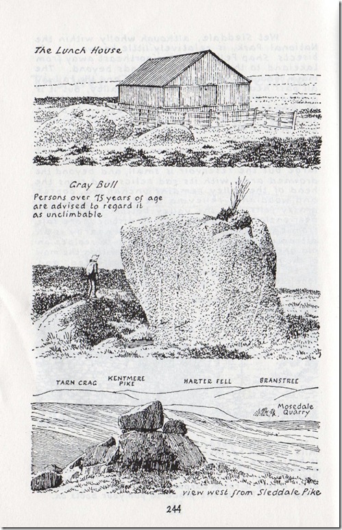
Keeping with the tractor track the Lunch House soon comes in to view (C R), a landmark such as this is highly appreciated even on a good day such as today. |
 |
| |
The Lunch House.
The Lunch House was used for the many folk using the Grouse Butts, I’m not to sure if its still in occupancy by man, as the pigeons seem to have taken a like to it too.
This is where the glamour of the track underfoot ends, from here on in Sharkey, your on your own! |
 |
| |
Looking back along ground covered, its only been a short while since I left the comforts of the tractor track & the Lunch House (C L) In between where I stood to take this photo & the outcrop of rock in the foreground flows Howe Gill, keeping the Gill to my right offers me some guidance before I come to my next feature of the walk, Gray Bull.
Its difficult to see in the photos, but the ground is exceedingly marshy from here on in, every footprint leaves with a slurp of some sort, I had trouble adapting to this at first, despite me still wearing-in a new pair of boots, my socks after only a short while of walking are wet & the blister I have on my left heal is starting to open up.
Gray Bull is a short while away & something I was looking forward to seeing, so this keeps the momentum up. |
 |
| |
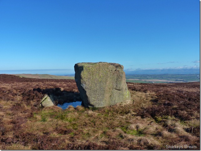
Gray Bull.
A Nine Foot cube of pink granite left here by the previous Ice Age. |
 |
| |
‘Persons over 75 years of age are advised to regard it as unclimbable’
(note the small tree growing out of the top was removed sometime during the 1970’s) |
 |
| |
Sleddale Pike.
I leave Gray Bull & make for Sleddale Pike, its an awkward tussle over wet bog & seamlessly ending grassy tussocks, here the cursing starts… |
 |
| |
Wet Sleddale Reservoir from the summit of Sleddale Pike. |
 |
| |
Great Saddle Crags from Sleddale Pike.
It is here I hatch a game plan, I tell myself to stop moaning about the peat bogs & the sponge like ankle snarling grassy tussocks.
With my game plan now in place I simply have to get myself from A to B, there is no simple way to describe this simple notion, ahead out of view lies four in-line wooden post about a metre in height that stretch across the bog & end at the ridge top just left of the summit, situated at the foot of the post is a food bucket sunk into the ground for grazing sheep alike, put here by the farmer to locate his buckets when supply’s run empty. I use these wooden post as markers, so as not to de-tour as one would & end up walking a mile & a half when its only a mile as the crow flies.
Naturally the higher I climbed the less wet it became underfoot & this made Paul a happy boy. |
 |
| |
Summit spotting as I make my way onto Great Saddle Crags.
Just above the patch of Pine trees you see lays my exit route of Burnt Tongue, this will lead me onto my final fells of the day of High Wether Howe & Seat Robert but that’s around three hours away yet. |
 |
| |
Great Saddle Crags & Little Saddle Crags. |
 |
| |
Sleddale Pike from Great Saddle Crags summit. |
 |
| |
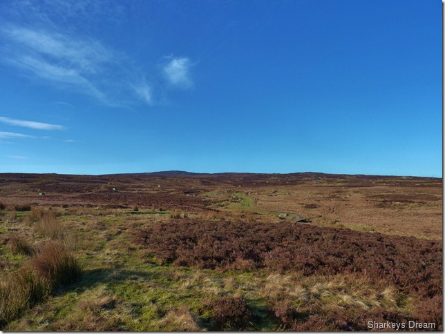
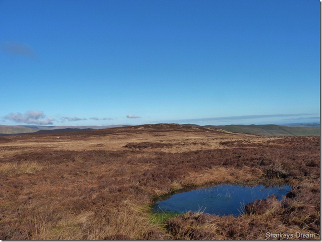
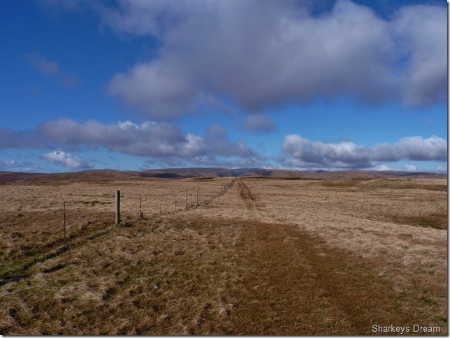
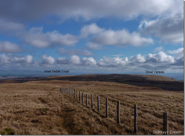
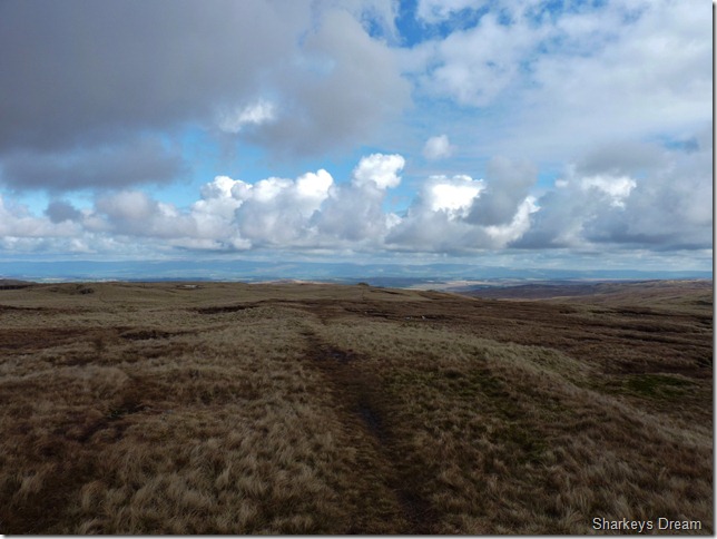
The given scene for the next few hours, ahead lies Great Yarlside, not normally associated with the Wet Sleddale Horseshoe but I have included it into this walk because of features such as this, the peat bogs are behind me & long forgotten, this is why I came here today.
The paths along here are pretty well kept & maintain a good course way in between summits, again, I wouldn’t be saying that in bad weather, but as you can see today the path here is simple to follow all the way onto Great Yarlside. |
 |
| |
Once the wall is reached keep to the right to obtain Great Yarlside’s summit. |
 |
| |
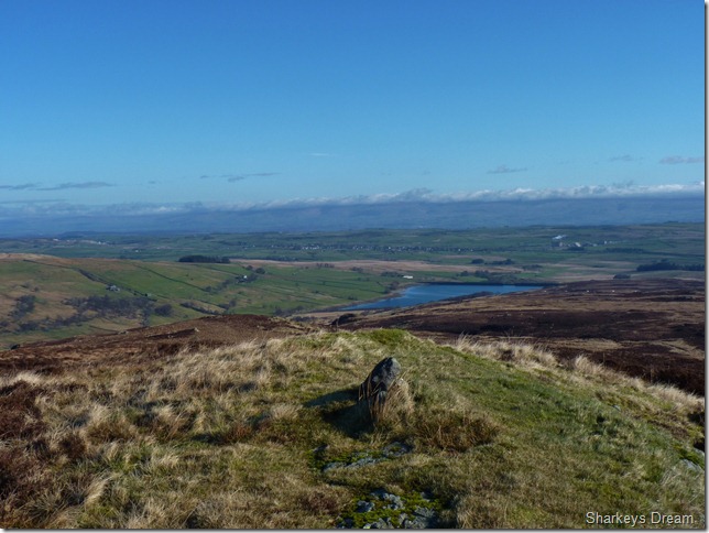
Looking west from Great Yarlside’s summit cairn towards the Mardale Fells. |
 |
| |
Not far away is the sunken circular trig point.
It is while at the summit I eat breakfast, I take off my pack & take out two breakfast bars & an apple, I rarely eat whilst climbing but for some reason I seemed to have worked up an appetite!
The grass is dry enough to sit on as I listen to the birds above, with not a breath of wind & a soul for miles I could of stayed here a lot longer than time would allow. |
 |
| |
Crookdale & Crookdale Beck from my perch. |
 |
| |
Fantastic terrain as I head for my favoured but not very popular summit of Harrup Pike just over to the left of the picture (above the fence post) |
 |
| |
Looking back on ground covered. |
 |
| |
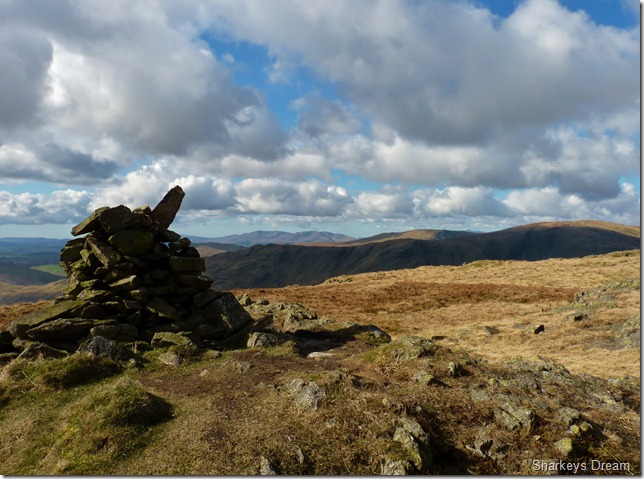
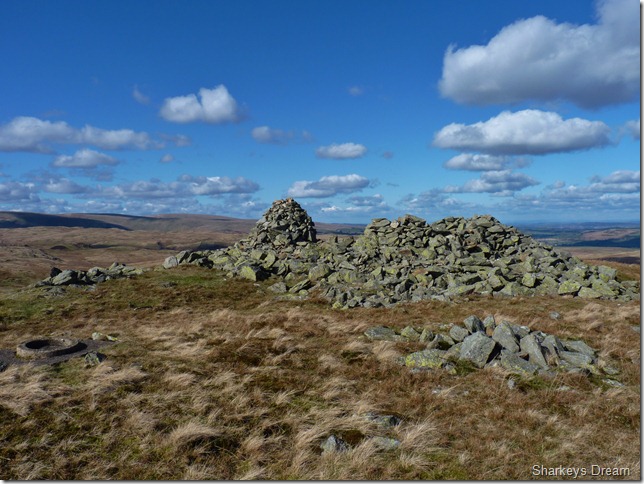
Harrup Pike summit cairn.
As I gained more height a chill had descended so here I roll back down the sleeves & make for my fifth summit of Grey Crag. |
 |
| |
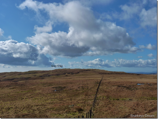
Grey Crag is just a short walk from Harrup Pike’s summit & would be only my second visit, it is here I have to negotiate more peat bogs! |
 |
| |
Grey Crag summit cairn with Kentmere Pike & Shipman Knotts in the background. |
 |
| |
Tarn Crag (Longsleddale) & Grey Crag Tarn (no open water) |
 |
| |
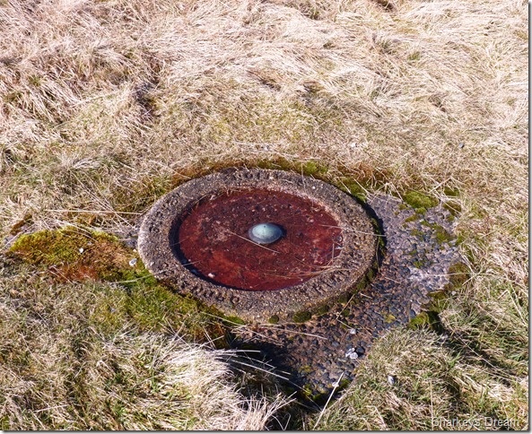
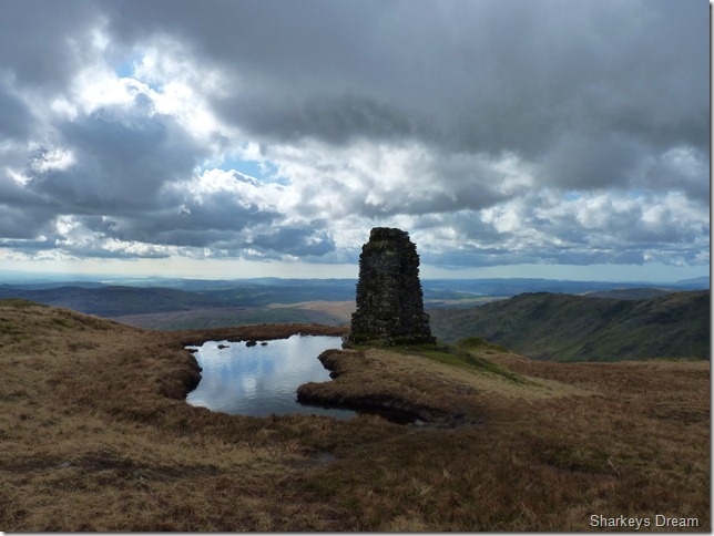
Tarn Crag Survey Pillar,
Left behind by Manchester Corporation during construction of the Haweswater Reservoir.
As you can see the cloud is starting to settle as I approached midday but thankfully it isn’t to last. I am met at the summit by a young boy clodding chucks of earth at the survey pillar, he isn’t dressed for the fells wearing a pair of jeans & a bright yellow jumper tied around his waist, as I get closer he spots me & shouts Hi, I return his gesture & cant help wonder who this lad; no-more than twelve years of age is doing here? he runs off in what I can only describe a twelve year old boy would & I’m thinking…
Is this his playground? |
 |
| |
More summit spotting as I have a wander around Tarn Crag’s summit.
I turn around after a series of pictures & the young lad had gone, where to I don’t know, he’s probably hurtling down the fellside in an old shopping trolley! |
 |
| |
Heading for Burnt Tongue as I shake my fist at the big black cloud that has enveloped the sun.
I have just under two miles in descent from here from where I will drop into the Mosedale Valley, this was a very lonely stretch of the walk, its a good job I am happy with my own company at times.
The path here is made up at best & I descend through more peat bogs but as I have the height still, thankfully underfoot it remains dry (ish) |
 |
| |
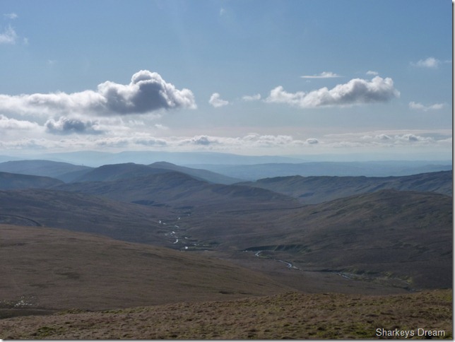
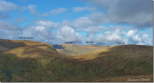
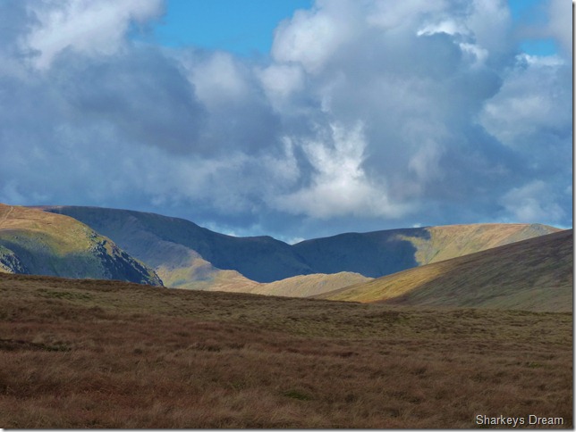
High Street & Kidsty Pike from Burnt Tongue.
Who needs company with views like this, this really was a pleasant surprise during the descent. |
 |
| |
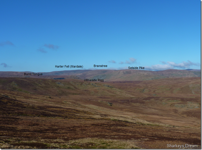
This time with Harter Fell (Mardale)
I was so made up to see my favourite fell of High Street from this angle. |
 |
| |
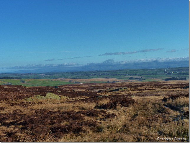
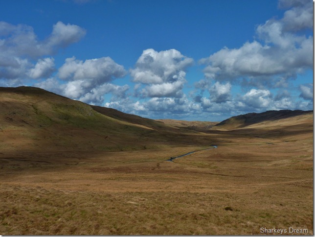
Wet Sleddale & in the far distance the North Pennines from Burnt Tongue.
I still have a while to go until I reach my next fell seen with the pointy peak (C L) of High Wether Howe, at least for now the sun is back out & I can recall just what an amazing day this is turning out to be. |
 |
| |
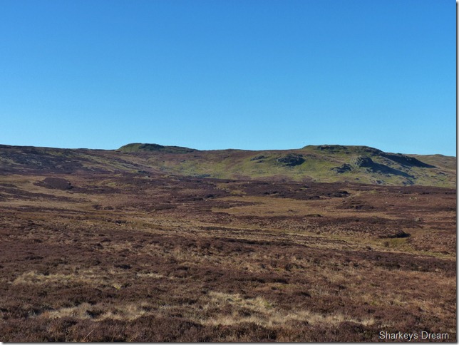
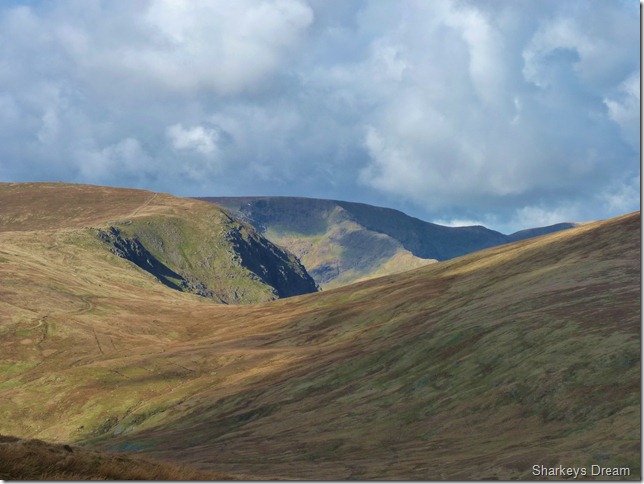
Here looking North towards Swindale Common & Mosedale Beck, the fell in the shade on the left is that of Nabs Moor & on the right we have at the head of Swindale is The Knott (Swindale) |
 |
| |
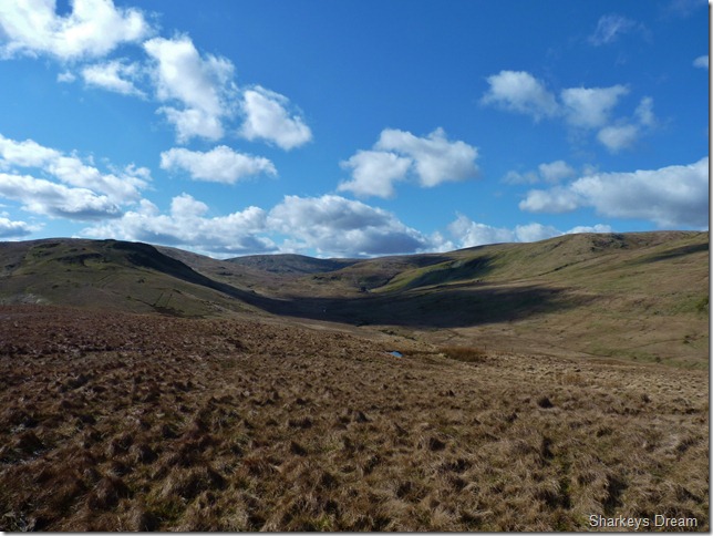
The Mosedale Valley.
Looking back towards Mosedale while on the left is my descent route down Burnt Tongue while at the head of the valley lies Kentmere Pike just over three miles away. Sadly my shots of the remote Mosedale Cottage (in the shadow) didn’t turn out as good as I thought, oh well, better luck next time. |
 |
| |
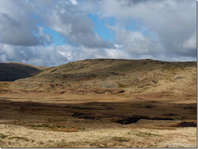
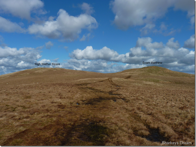
The last push towards two out of three of my last summits, heading into the sixth hour my legs were telling me to stop, joints ached like never before so I made a point of stopping a short while at Nether Howe’s summit.
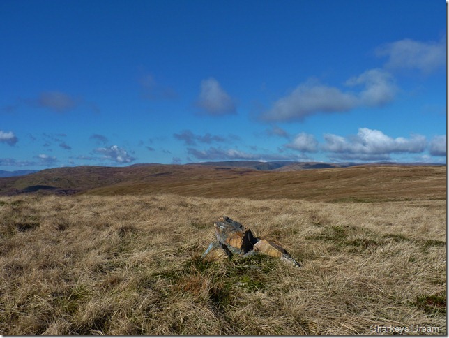
You don’t have to summit the bump they named Scam Matthew as a path flanks its lower reaches, I loved the name so much & despite the now aching legs, I made it my prerogative to reach the fell top, where their lies no cairn. |
 |
| |
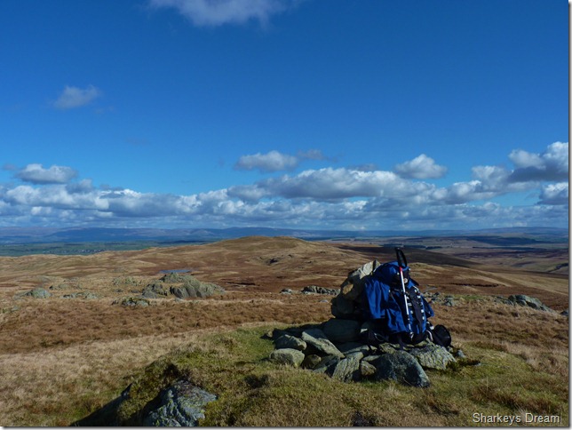
Seat Robert from High Wether Howe summit.
It was time to finish off my lunch as the belly was squawking & making all sorts of noises. Panoramic views greeted me in every direction & after only a short while I shoulder pack & head off for my last summit of the day Seat Robert. |
 |
| |
Haskew Tarn.
I was treated to more sightings of wild deer as I passed Haskew Tarn, much like before their instinct saw, heard & judging by my pong, smelt me coming from miles away, this time they do not bolt, they gingerly trot to the far side of the Tarn. |
 |
| |
Seat Robert summit cairn & circular trig point.
Seat Robert holds dear to me, in the relatively short time I have spent on the fells, Seat Robert to me is & was to me now'; what Great End was to me in the early years, put simply, never in a million years did I think I was ever going to grace their summits.
I can hold my head up high at the fact that I have now reached not just a fell with nothing more than 515 metres to its wonderful name but a personal goal has been crossed here today. |
 |
| |
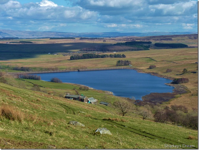
Wet Sleddale Reservoir with the seventeenth century Sleddale Hall in the foreground.
Sleddale Hall was the setting for the famous cult film Withnail & I staring Richard E. Grant. Filming took place back in 1986 & ownership has been passed from United Utilities to its current owner, Tim Ellis of whom he now leases the property as a working farm house.
As you can see Sleddale Hall is under restoration & is due to be completed in August of this year. Being a private property a fence has now been placed around its holdings, which is such a shame as I wanted to do a little exploring to end the walk.
The Wet Sleddale Horseshoe is a classic Lakeland walk only to be attempted in good weather to take away the best from it, do as I didn’t & don’t fight the ground underfoot, don’t let it make you cross & curse at every given opportunity, this is not a walk in Borrowdale or Grasmere, where Tea Shops line the pavements, this is the Shap Fells, this is Wet Sleddale, there is nothing here but un-spoilt, un-touched scar less fell side.
Spend seven hours as I did, you will never look at Lakeland the same, you may never go back to the Lakeland you know. |
|
| |
| Back to top |
 |
|