 |
The Loweswater Fells |
 |
 |
31st March 2012 |
 |
|
Its not very often come mid-week that I don’t have an objective in hand for the weekends walking, I like to plan ahead & I’m pretty anal at it too. All I knew was I would be walking with Tim somewhere in & around Mellbreak. My working week was busy not to mention a few hours spent each evening doing some house work on this here Blog. Thursday came & I still hadn’t heard from Tim, so I kept a check on the weather reports for the planned day in question; which at the foremost of our recent run of dry humid weather was about to come to an end sometime around this weekend, It turned out we just caught what would seem like the last dry spell because while on the top’s above our heads, gathered something that I had not seen in over a fortnight… Dark grey clouds.
I received a text from Tim the Thursday evening with a proposed route, I could tell that from the text Tim was eager to get boot back on to fell, this route required no tweaking whatsoever, well maybe the exit route but that was it. Tim had text me the route for a circuit of the Loweswater Fells.
This walk is the result of that late evening text. |
|
Wainwright Guidebook |
 |
| The Western Fells |
-Blake Fell:
Blake Fell (locally known as Blake) is the highest of the Loweswater uplands, overtopping the others considerably and asserting this superiority by a distinctive final upthrust that makes it prominent in views of the group. A long high shoulder, Carling Knott, extends towards Loweswater, hiding the main summit from that valley, but on the opposite western flank, facing industrial Cumberland, a scree-covered declivity drops immediately from the summit-cairn to the hollow of Cogra Moss and encircling arms comprise many subsidiary tops, of which the chief is the shapely peak of Knock Murton.
The fell, by reason of its fringe situation, gives the feeling of belonging of more to West Cumberland than to the Lake District; more to Lamplugh, where everybody knows it, than to Loweswater, where Mellbreak is favourite. |
 |
|
| |
|
Overview |
|
|
| Ascent: |
3,295 Feet. 1,004 Metres |
| Wainwrights: |
5, Mellbreak, Hen Comb, Gavel Fell, Blake Fell & Burnbank Fell |
| Weather: |
Bright Fresh Start Turning Cloudier During The Afternoon, Fresh Winds On Tops, Highs Of 11° Lows Of 6° |
| Parking: |
Road Side Parking, Loweswater (Next To The Red Phone Box-Room For Four Cars-FOC) |
| Area: |
Western |
| Miles: |
9.2 |
| Walking With: |
tim Oxburgh |
| Ordnance Survey: |
OL4 |
| Time Taken: |
|
| Route: |
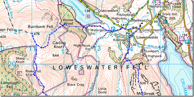
Loweswater – Kirkgate Farm – Melbreak – Mosedale – Hen Comb – Whiteoak Moss – Gavel Fell – Fothergill Head – Blake Fell – Burnbank Fell – Holme Beck – Holme Wood – Watergate Farm – Maggie’s Bridge – Loweswater – Kirkstile Inn |
|
| |
|
Map and Photo Gallery |
|
|
  |
| |
| |
 |
| |
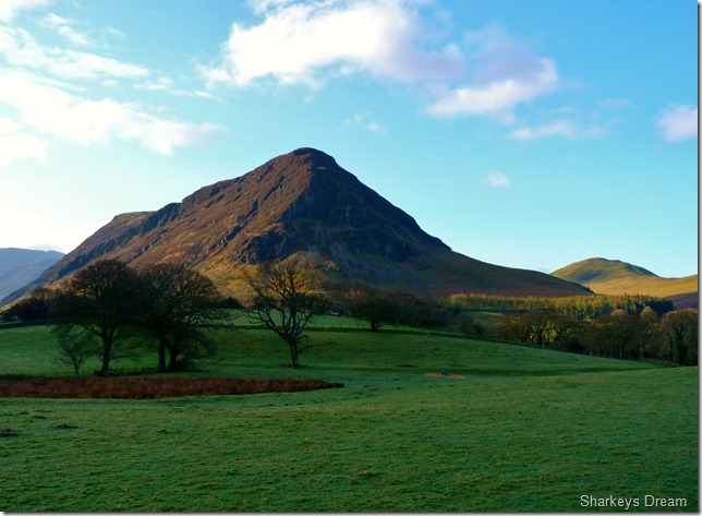
Mellbreak 6°
It was a cool, crisp & clear morning as we kitted up at the old red phone box to the sound of a morning chorus from the surrounding fields & hedgerows. We are first to arrive at around 8:08am. On the ground lies a covering of dew sure to evaporate within the next few hours, but for now the morning dew just adds to the wonderful ambience about the place.
Behind the car park stands a steel gate & within that steel gate is a herd of sheep. Bleats arise over the sound of the morning chorus, for within the last hour no-doubt, a mothering sheep had just given birth to a lamb, the lamb is un-sturdy as it spreads all four legs wide beneath its fragile body, furiously wagging its tail back & forth as it suckles from its mother.
For reasons as I’m sure you’ll understand a new born lamb is possibly the cutest sight within the animal world, so when I say this lamb was born within the last hour, you may imagine what was still attached to both mother & spring lamb, hence no pictures.
Still, a warming scene from mother nature within the beauty of morning Lakeland. |
 |
| |
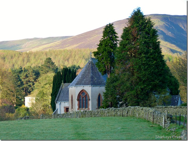
St Bartholomew’s Church Loweswater, Circa 1884.
As we leave the car behind & head for Church Bridge, firstly passing by the beautiful chapel of St Bartholomew’s do we pass the Kirkstile Inn with its beer garden & many wooden tables overlooking Lorton Vale & our first objective of Mellbreak. Simultaneously we say… Pint there later, oh yes. |
 |
| |
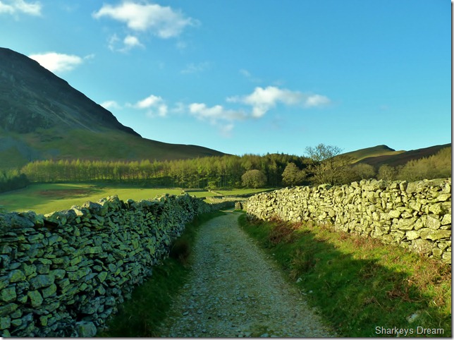
Continuing along the dry stone walled track making a bearing for the copse of trees ahead. |
 |
| |
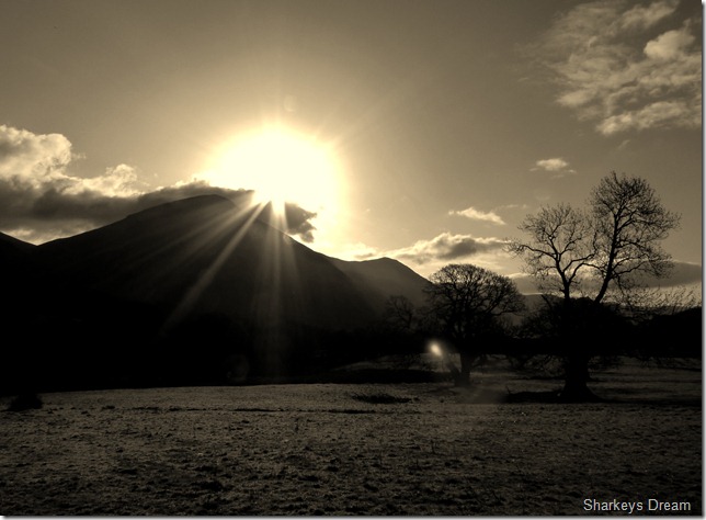
Between leaving the car & this path; ahead the sun is rising to our east just above Whiteside & the surrounding fells, all the while as how a powerfully and beautifully image this was, I am unable to capture with my camera through sun-glare. |
 |
| |
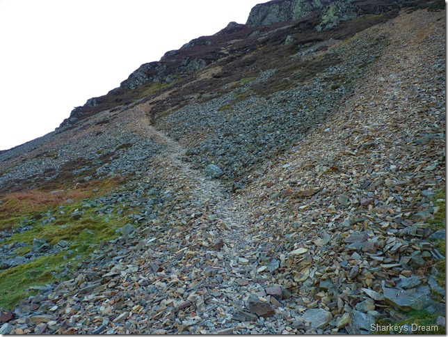
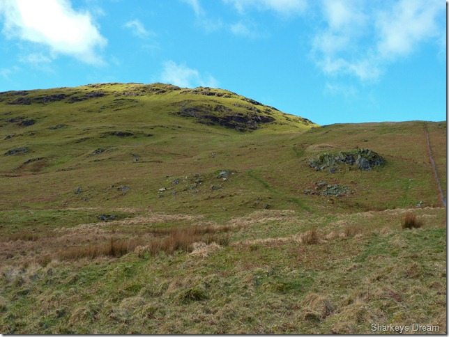
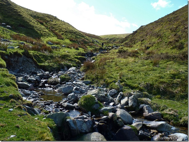
On reaching the scree slope on Mellbreak’s Northern base do I try to convince Tim that this ascent is no-where near as brutal as it seems, yes Mellbreak from the Loweswater end seems excessively steep, but this scree path is possibly one of the finest in Lakeland at taking away some back breaking ascent. |
 |
| |
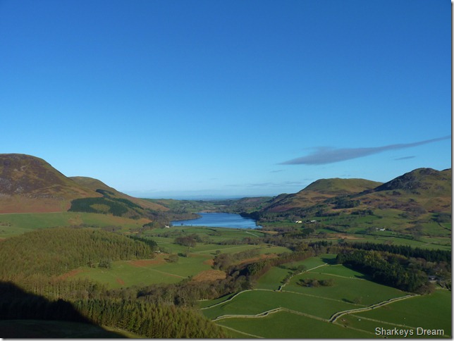
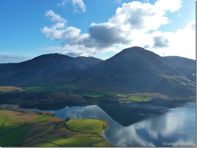
Looking back on Loweswater, to the left of the Loweswater we have Carling Knott & Burnbank Fell (our descent route) to the right we have Darling Fell & Low Fell.
Walking in the shadow of Mellbreak’s north ridge path are we treated with shade for much of the ascent, this comes as a small respite as the warm morning sun was soon to get the temperature rising. In huge contrast to my last weekend on the fells when I regretted my decision not to wear shorts for now at least, I am confortable in the shade with long trousers & my Rab soft shell mid layer. |
 |
| |
Gaining more height as Whiteside, Hopegill Head & Grasmoor come into view. |
 |
| |
Tim pointing out the Hopegill Head route that we used just over a month ago, when sadly through low cloud we couldn’t see twenty feet in front of our faces. |
 |
| |
Lorton Vale from the top of Big Gully. |
 |
| |
Loweswater, Darling Fell, Low Fell & Fell Fellbarrow at the far end of the ridge from our ascent. |
 |
| |
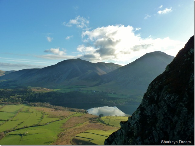
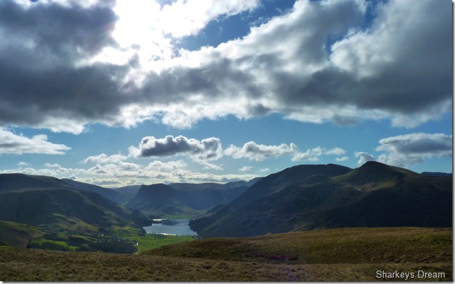
Crummock Water reflections.
It was getting more & more obvious the more height we gain the more chill we felt, here I zip up to the neck, while my ears & the tips of my fingers deal with the fresh chilly winds. |
 |
| |
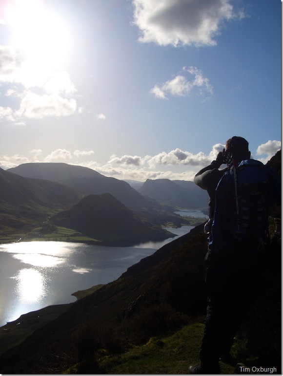
The surprise view on Mellbreak’s ascent.
On reaching the first of the surprise view points that capture both Crummock Water & Buttermere it is here we both take in the views & take shot after shot, sadly again my cameras inability to deal with sun-glare is shown here as I take around a dozen pictures from this beautiful platform.
Taking pictures directly into the suns path is a gamble, sometimes you can come away with beautiful shots of silhouetted landscape & sometimes as I did here, you may come away with absolutely nothing. Both Tim & I remarked that if it was to chuck it down now at least we had these set of pictures, It was only when I loaded the pictures once I got home, then did I realise that not one shot had turned out.
Oh well, its not all about the pictures! |
 |
| |
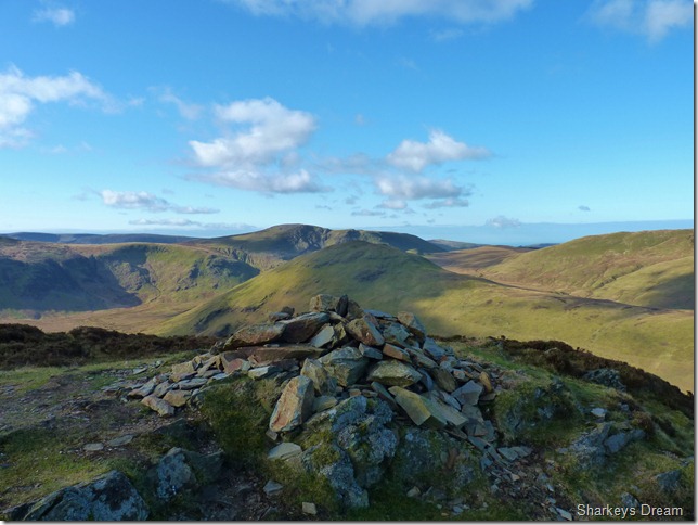
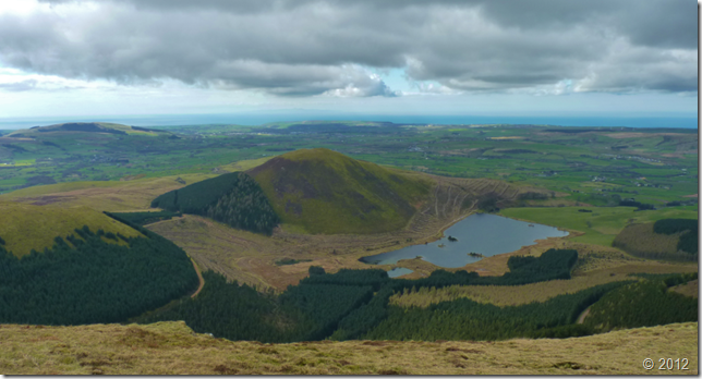
Hen Comb & Great Borne from Mellbreak’s north top summit cairn. |
 |
| |
Leaving Mellbreak’s north top as we head across this depression along the summit backbone, the summit is just over half a mile away & only four metres separate both summit tops, with the north top at 508 Metres & the South top at 512 Metres. |
 |
| |
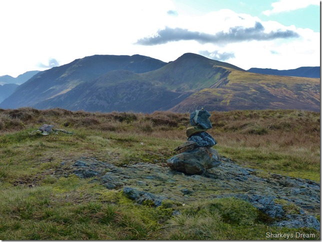
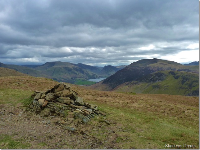
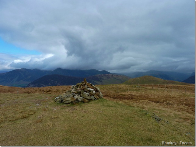
The south & main summit of Mellbreak depicted here by this ever so carefully stacked cairn, In the distance we have Red Pike & High Stile. |
 |
| |
As forecasted the clouds start to roll in obscuring the sun leaving a exceptionally fresh wind, In my eagerness to leave the house this morning, I left behind my breakfast bars, so here I take it upon myself to eat lunch at 9:27am. |
 |
| |
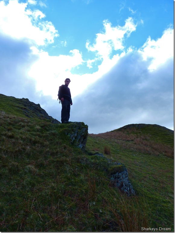
Tim descending Mellbreak.
We chose to make a direct descent or a ‘Paul descent’ as Tim calls it, direct has always been my figure of observation!
There are places in Lakeland well remembered for small things, the memories trans-fixed in time sometimes good, sometimes bad & as guessed its the bad ones that normally out-weigh the good ones.
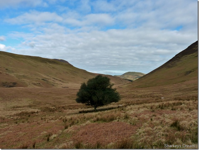
Looking down into the Mosedale valley below us stands Mosedale’s one & only tree, its a beautiful Holly Tree planted by Gods hands himself, but to counter-act this Godley act, he then created Hen Comb, Ascended from Loweswater you are met with a gentle steady grassy incline to reach its summit, yet to obtain the summit from the valley floor of Mosedale; its a half hour of steep grassy ascent, the kind of ascent when one should take the extra camera breaks while not holding onto a camera, but holding onto ones hips gasping for breath! |
 |
| |
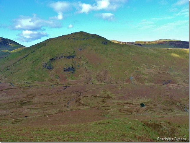
Hen Comb & the Mosedale Valley as we bare down on the Holly Tree.
Our ascent on Hen Comb lays in direct (there’s that word again) with the Holly Tree, once Mosedale Beck has been crossed at the flanks of the fell, then did we make with our ascent via a wire fence shown vaguely at the lower fell side just to the right of the grey patch of scree. |
 |
| |
The fine specimen that is the Mosedale Holly Tree. |
 |
| |
The summit is in sight as we crest the second of the two false summits, here the path leaves the comfort of the wire fence for a more grassy-steep…approach. |
 |
| |
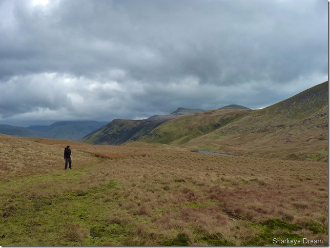
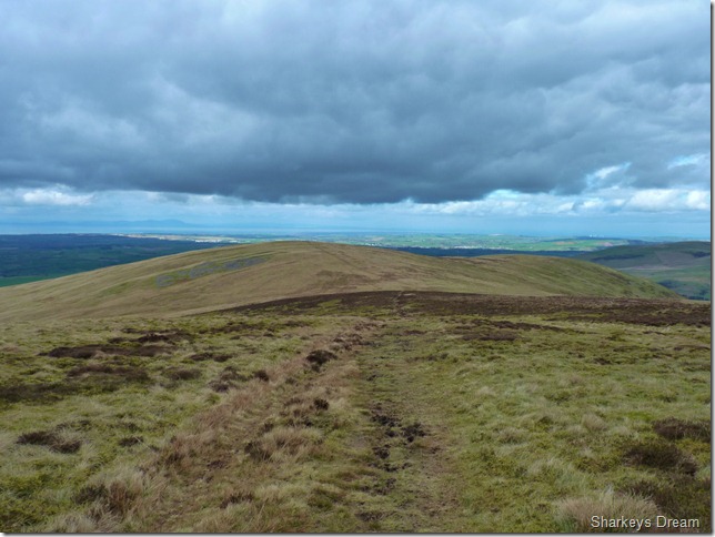
A whole host of north & north western fells from the summit cairn of Hen Comb. |
 |
| |
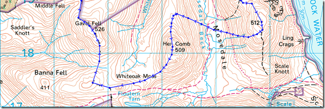
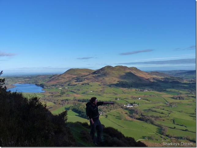
| Gavel Fell lies directly to our right as we leave the summit of Hen Comb via a grassy path down to Whiteoak Moss, however our path would take us around the small hill named Floutern Cop (reasons will become more apparent for this odd little hills name the closer we get to it) over towards the left of the picture, it does seem quite a diversion in order to reach Gavel Fell even by my standards but there is a good reason for this & it begins with a B & ends with a OG |
 |
| |
Looking back on Floutern Tarn & the High Stile ridge as we flank Floutern Cop, just out of shot towards the back of where Tim is standing.
This area, especially Floutern Tarn brings back great memories from a couple of years ago when I traversed the High Stile ridge from High Stile to Great Borne. |
 |
| |
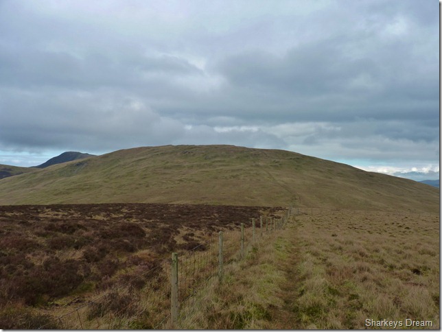
Gavel Fell with a distant Blake Fell over towards the left of the picture, finding the path & sticking to it was easy as all we had to do was simply follow the fence all the way, not just to Gavel’s Summit but Blake Fell summit too. |
 |
| |
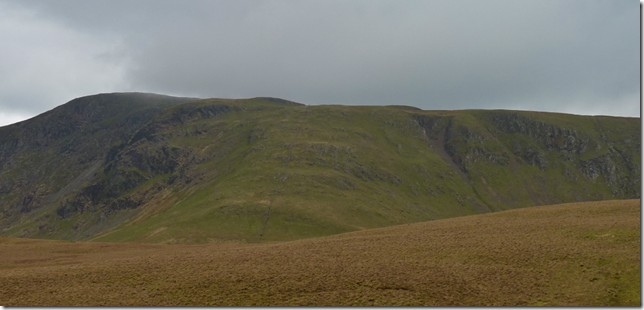
Looking back on Great Borne from our ascent on Gavel Fell.
Great Borne marks the end of the High Stile ridge, it was here I decided a couple of years ago to descend the summit via the gully you see towards the right of the picture, I laugh now but that gully comes very close to Lords Rake on Sca Fell. I don’t know why I chose to descend this way as a perfectly good path lay on what would of been my right; seen here marked by a fence running through the centre of the picture, I guess everybody has to learn sometime & If we get it wrong then that is a lesson learned in my books.
This however did not stop Tim howling in fits of laughter. |
 |
| |
The low cloud as promised is just covering the top of Red Pike, towards our East every visible fell top above 600 Metres has also disappeared. |
 |
| |
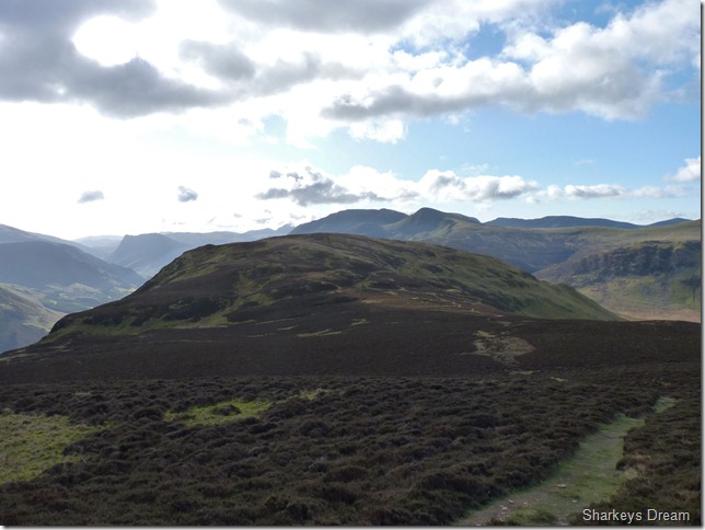
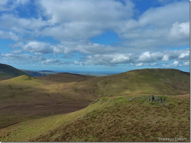
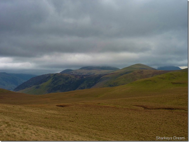
Looking back on Mellbreak & the north western fells from the summit of Gavel Fell. |
 |
| |
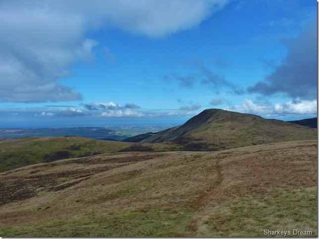
Leaving Gavel Fell for Blake Fell & taking the sunshine with us. |
 |
| |
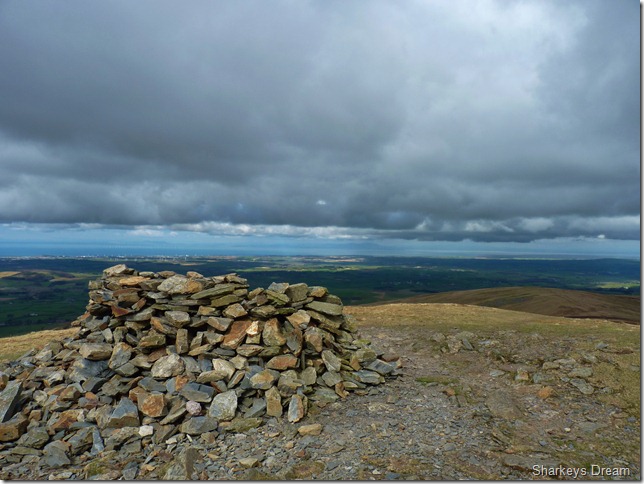
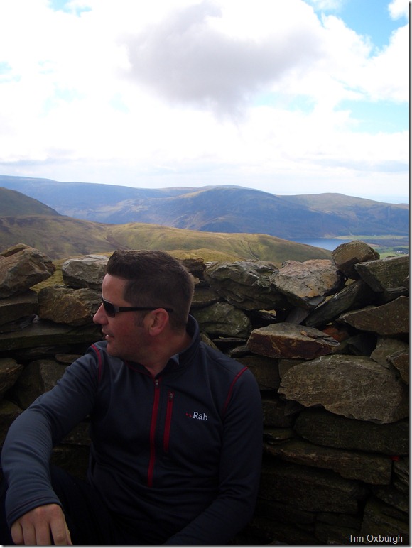
The north west coast from the summit shelter on Blake fell.
It was here we decide on our only second rest stop of the day. |
 |
| |
We take off packs once again rest assured the cold wind will not freeze the sweat that has engulfed the whole of my back, we chat on how good the legs felt & how well were doing with time. From the direction of Carling Knott a couple appears as we are starting to pack up, it looks like they need a little respite out of the fresh wind too, we chat on our routes & discover that he has only just started his walk & is aiming to get over to Starling Dodd, we however have nearly finished our walk short of one fell. |
 |
| |
Views down the face of Blake Fell towards Knock Murton & Cogra Moss, the recent tree fell cutting really is making the place look so unattractive which is such a shame. |
 |
| |
Burnbank Fell lies dead ahead & our exit route just in the null in between Burnbank Fell & Carling Knott disappearing off to our right, it was here a silence takes over & I guess were both thinking the same, its bloody damn frosty crossing between these two fells! |
 |
| |
Zooming in over open sea at the Snaefell Mountain range on the Isle of Man. |
 |
| |
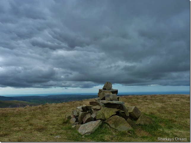
Dark protruding skies greet us at the summit of Burnbank Fell. |
 |
| |
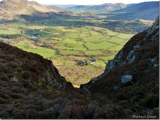
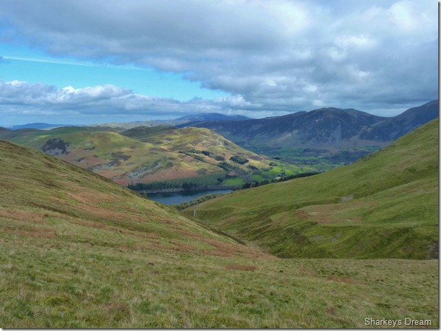
Our exit route.
We leave the summit chill of Burnbank Fell & are instantly engrossed in the warmth of the sun as we head for Holme Beck & Holme Woods (C R) the descent was tricky & traction was scarce while negotiating grassy tussock’s & bog underfoot, Tim calls this ‘Paul’s direct route’ I mean, Tim planned the route & I was left to plan the exit, I think I even muffled the mortal words ‘who’s bloody plan was it to descend this way?’
Yours Paul was my answer! |
 |
| |
Holme Beck & ahead the col at where we left Burnbank Fell. |
 |
| |
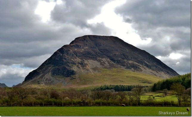
Mellbreak from Maggie’s Bridge.
After a careful descent through Holme Wood we reached the shoreline at Loweswater, I pitched around for a descent shot of Loweswater but was obscured by passer by’s. I really cant complain with views in the other direction such as the wonderfully imposing Mellbreak. |
 |
| |
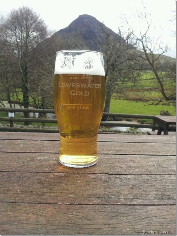
As promised…a pint of the local brew.
This walk was a fantastic route I have Tim to thank for that, it is a little arduous at times, but well rewarding not to mention, the pot of Gold at the end of the rainbow. |
|
| |
| Back to top |
 |
|
