|
Dow Crag via the South Rake |
 |
 |
34d May 2012 |
 |
|
Today I find myself back on the southern fells in as much as many walks, yet this time I am on the old Lancastrian-Cumberland border, this is Coniston country…
This walk was devised a number of months ago & saved to rest in the draft section of this here website, only for the fact that I just didn’t want to let slip; Dow Crag’s South Rake.
Right up until Monday of this week I still hadn’t a plan on one where to climb towards & what would be the last walk of my week long holiday, Pillar took far too much of the grey matter for me to think past it, then when I finally did I remembered this draft.
The draft lay there over the latter of the winter months with me knowing that one day, when the diary’s empty & the weather is good enough for a scramble that said draft will finally become published.
Today was that day. |
|
Wainwright Guidebook |
 |
| The Southern Fells |
The crag is the preserve of rock–climbers, but walkers may visit the base of the great cliff by taking the climbers path from the outlet of Goat’s Water. A simple traverse to the right across a scree slope then leads to the ridge just above Goat’s Hause. This route although involving boulder hopping, is much more interesting than the usual way up to the Hause on the eastern slopes of the tarn.
Easy Buttress, Easy Gully and Easy Terrace are by rock–climbing, not walking, standards. Rock – climbers don’t seem to know the meaning of easy. True, most walkers would manage to get up these places if a mad bull was in pursuit, but, if there is no such compelling circumstances, better they should reflect soberly…and turn away.
There is however, a cowards way to the top of the crag. From the lowest point of the cliff turn left past the striking entrance to Great Gully and more roughly up to the foot of Easy Gully, which is chocked with stones. Here unexpectedly, (it is not seen until reached) a straight ribbon of scree in a shallow gully goes to the left (at a right angled tangent to Easy Gully) – this route, although steep and loose, leads directly to the ridge above all difficulties. Climbers often use this as a quick way down, and it is comfortably within the capacity of most walkers. Lacking a name, but deserving one, SOUTH RAKE is suggested. |
 |
|
| |
|
Overview |
|
|
| Ascent: |
2,627 Feet, 801 Metres |
| Wainwrights: |
3, Dow Crag, Brim Fell, Coniston Old Man |
| Weather: |
Warm & Sunny, Clear Skies With Distant Haze, Highs Of 16° Lows Of 8° |
| Parking: |
Car Park At The Top Of Walna Scar Road, Coniston |
| Area: |
Southern |
| Miles: |
5.6 |
| Walking With: |
On my own |
| Ordnance Survey: |
OL6 |
| Time Taken: |
|
| Route: |
Walna Scar Road – Boo Tarn – The Cove – Goat’s Water – Dow Crag South Rake – Dow Crag – Goats Hawse – Brim Fell – Coniston Old Man – Coniston South Ridge –Boo Tarn – Walna Scar Road |
|
| |
|
Map and Photo Gallery |
|
|
 |
| |
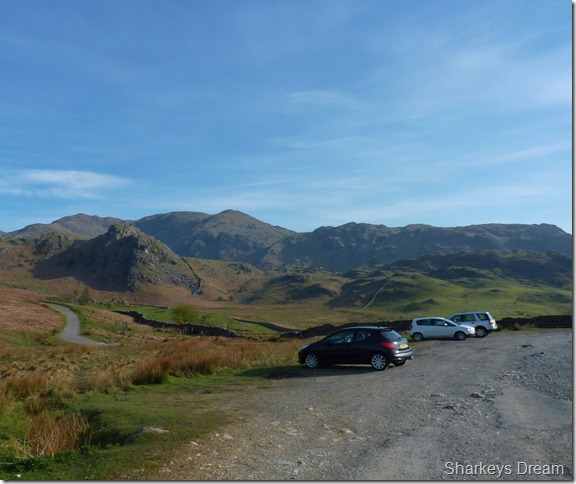
Walna Scar car park, 7:54am 8°
I arrived at Walna Scar under big blue skies & this put a smile on my face seeing as that today for the first time this year I shall be wearing shorts. The early morning trip along the A591 was uneventful, but this all stopped as I arrived in & around Windermere, here I was to follow a CO-OP truck through the narrow lanes of Clappersgate, Skelwith Bridge, Yewdale & Finally Coniston, behind me lay a string of traffic at a snails pace, also behind me was the silver car at the far end of the car park. |
 |
| |
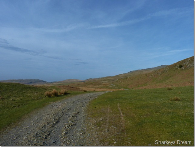
Leaving the car park along the Walna Scar Road, the pointy fell ahead is a distant Stickle Pike.
The Freelander that had parked at the far end of the car park which arrived at the same time as me belonged to a local man, a man born & bread in Windermere, a man with almost sixty five years of walking the Lakeland fells under his belt, a man named Don Greaves.
Kitting up didn’t take long at the car park, in conditions such as this it was just a case of lacing up the boots & throwing the pack over ones shoulder, Don commented on the fantastic conditions & asked what were my plans for today? Dow Crag I reply, well’ I’m going that way myself before I head over the top of Goat’s Hause, I’ll join you if you don’t mind. |
 |
| |
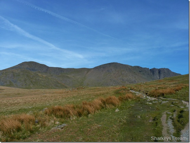
Brown Pike, Buck Crag & Dow Crag over towards the right of the picture.
We set of for Goat’s Hause at a steady pace, which is remarkable as Don is recently recovering from a hip replacement, Don now walks with a slight limp which I only noticed after he told me, ‘yeah in a comical fashion’ the X-ray revealed a big gap of light in between my hip joint, Doc says I have to have it replaced.
Within six weeks of the operation Don was driving again, within ten, Don was circuiting Tarn How’s weekly on crutches to regain his fitness, now at the age of seventy five Don is heading for the Coniston Old Man. |
 |
| |
As we approach The Cove over towards our left Don explains about the times he has searched unsuccessfully for the grave of ‘Charmer’ a fox hound killed in 1911 from a fall of Dow Crag, his owner fittingly marked the spot with a memorial somewhere around this area – I think its down there(pointing at the bog like ground that sits directly beneath the Dow Crag ridge) but I cant find it Paul.
Striding Edge found it a couple of months ago did you see it? I did Don; I read Sean’s report & I can’t blame Sean for not revealing the grave’s location on his website, not after what happened to Sean’s dog Angus – who’s memorial to Angus was stolen from the summit of Coniston Old Man some years ago.
I don’t blame Sean one bit for keeping it to himself. |
 |
| |
The Cove, Charmers grave is out there somewhere? |
 |
| |
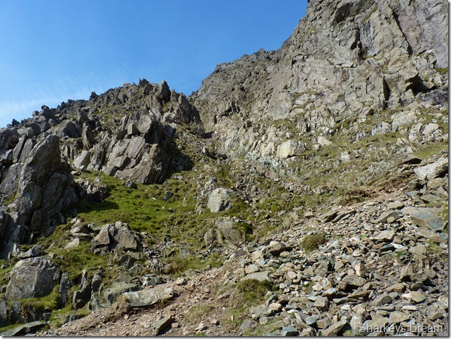
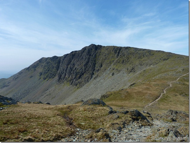
Dow Crag as we round the cove towards the outlet of Goat’s Water.
Don & I are still in conversation as I gaze up at Dow Crags rocky buttresses. I was a little nervous in locating the South Rake but I see it clearly; the path & the bottom of the rake from here so I carry on chatting before we depart at the tarns outflow. |
 |
| |
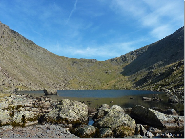
Goat’s Water & Goat’s Hause from the outlet stream.
This is the place I say goodbye to Don, with a firm handshake I watch Don as he heads of over Goat’s Hause wondering if I’ll be as fit & head strong as Don when I’m seventy five years of age. |
 |
| |
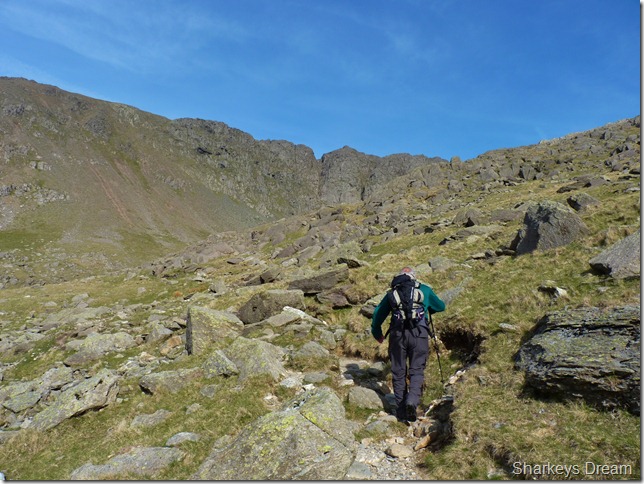
My route depicted by the red outline up the steep scree path.
Crossing the boulders with care I then made my way to the bottom of the scree, from here I could make out the start of the South Rake as the start lies right at the bottom of Great Gully, otherwise known as The Stance, from here the rake becomes more clear – but you can’t see it from down here, its hidden behind the rocky buttress on the left hand side.
I just need to get up there. |
 |
| |
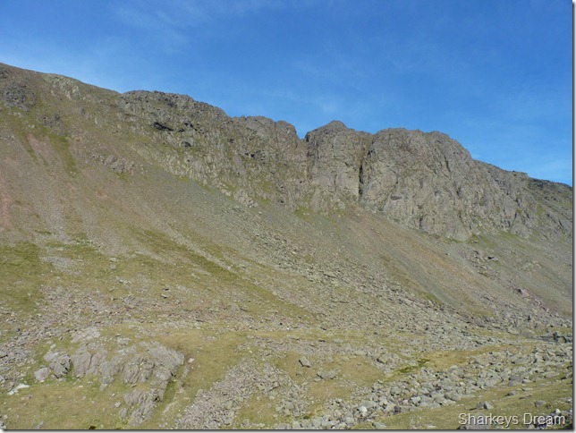
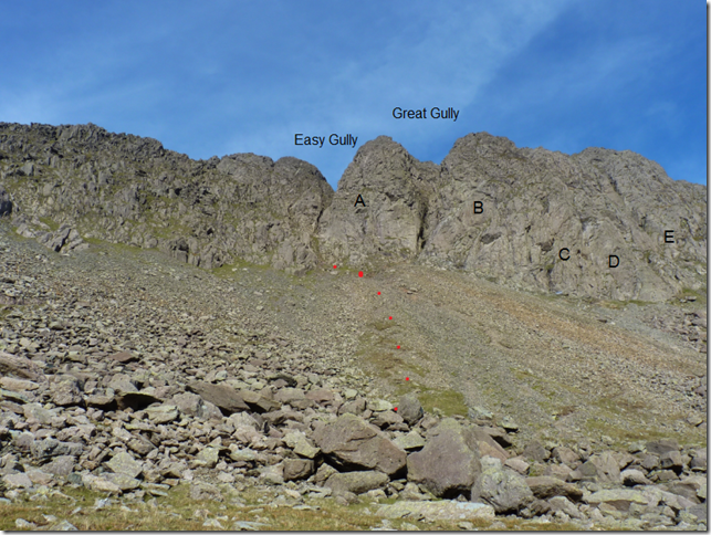
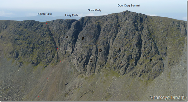
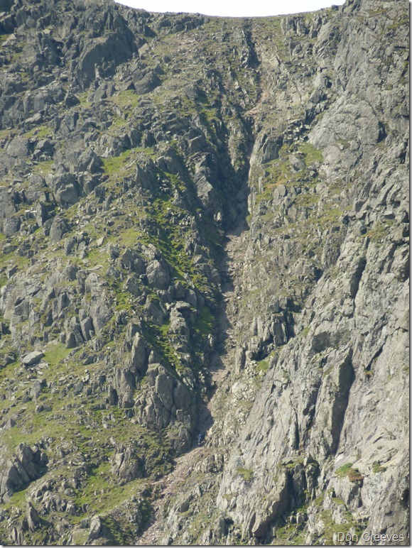
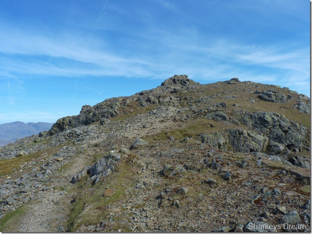
Later, taken from Coniston Old Man – A much clearer view of the South Rake.
The Buttresses are alphabetical & go left to right. |
 |
| |
A & B Buttress domineer the whole scree climb. Head for the gap in between these two buttresses & you wont go wrong in locating the start of the South Rake.
The climb was steep but not as steep as I’d had in my head, by now its around 9:20am & while the sun is bright – it is early enough not to give me so much trouble on the steep scree. I use my trusted pole to pick my way across the zigzag path & within twenty minutes I find myself at The Stance at the bottom of Great Gully. |
 |
| |
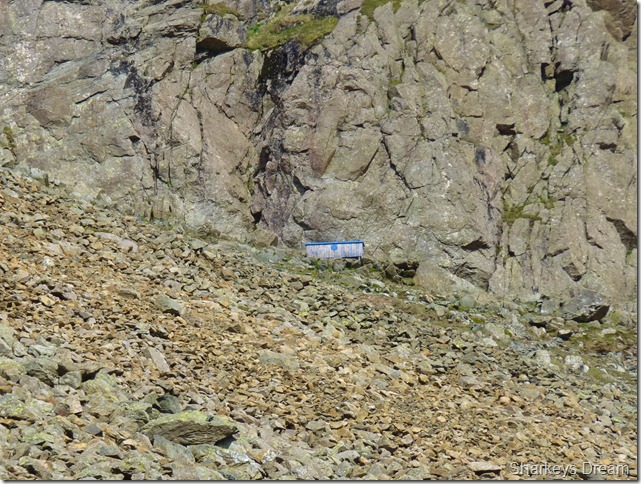
A close up of the Blue Stretcher Box situated at the bottom of B” Buttress. |
 |
| |
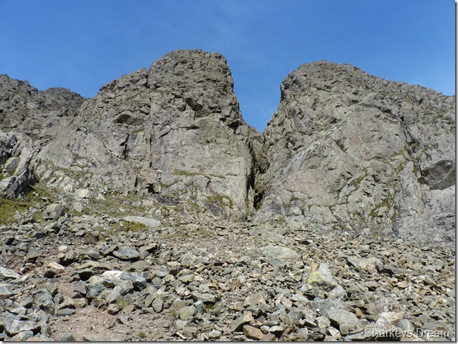
The Stance.
As I reached the bottom of Great Gully, was I then treated to a rush of butterflies, this is what today is all about. |
 |
| |
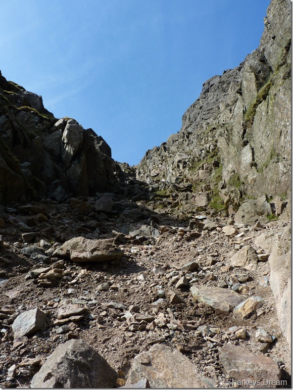
Looking down the steep scree path towards Goat’s Water.
It is here I am joined by two other walkers (bottom right) or more so climbers, depicted by their helmets strapped to their packs. Initially I think they are heading for the South Rake but they stop & kit up at the bottom of Great Gully. |
 |
| |
Starting the climb.
The start of the climb was met with dry loose rock which could be easily avoided if it started to shift underfoot, initially I head towards the right of the Rake but was somewhat forced left the higher I got due to large boulders difficult to negotiate.
Going back to the conversation with Don earlier, I remembered him saying that; not just here, but most Rake’s have these large un-avoidable boulders that are swallowed up by the scree over time, you just can’t ever comprehend this happening but that’s nature for you. |
 |
| |
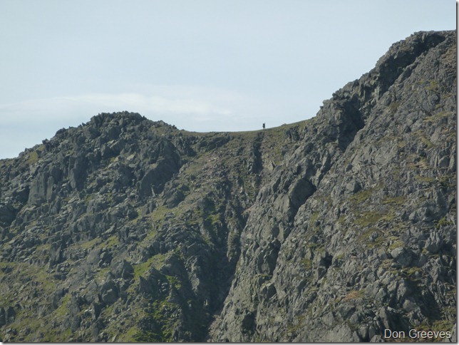
I was luckily enough for Don to email me some shots of me climbing the rake. A tiny spec at the bottom of the rake. |
 |
| |
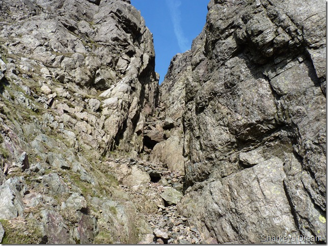
After a short scramble up the rake do you then pass the entrance for Easy Gully, from here I thought to myself that this wasn’t beyond my means, that was until I viewed the exit from the top a little further on.
I think I’ll stick to what I know! |
 |
| |
A little further up. |
 |
| |
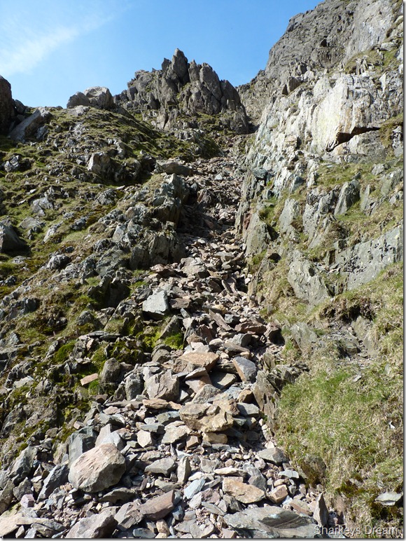
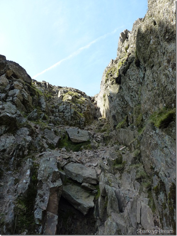
Taken from about half way up the Rake as the gully gets narrower towards the top.
It was around about here I start to have little concerns about the rock situation around me, I’ve been in Gully’s & Rakes such as this many times, yet what never ceases to amaze me is just how un-stable; what would look like a boulder or a rock that has been settled for so long & as soon as you place your hand on it it shifts, I’m not just talking about the rocks or boulders you see in this picture I’m talking about well routed rock, the rock boulders submerged within the walls of the rake.
Careful footing & a clear eye of the route was undertaken from here on in. |
 |
| |
This being just one of many that I came across, anyone unsuspecting might use this as a foothold & drop a metre or so, a metre is nothing when your on the ground but in here?
I take out the rock with ease & place it away in a safe place, this foothold has seen its days. |
 |
| |
Feeling pretty chuffed as I near the top of the Rake. |
 |
| |
Looking back down the Rake as I near the ‘narrow bit’ near the top. |
 |
| |
The narrow bit.
It’s quite clear that this section of the Rake doesn’t get much sunlight, here I stick to the right of the path & scramble over the rock as averse to the left hand side of the gully which was covered in wet moss. |
 |
| |
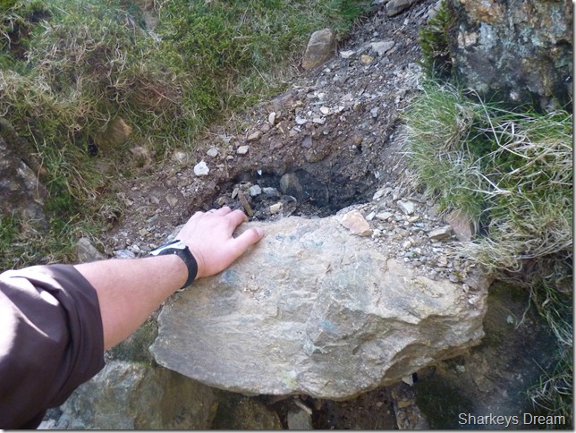
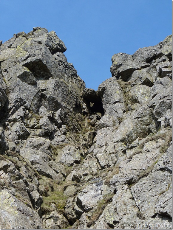
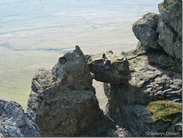
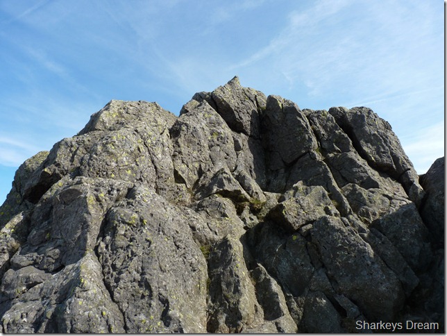
I took this photo of this Chock Stone situated a couple of metres short off the top of the Rake off to my right hand side, this buttress of rock forms Easy Gully & I’m sure the rock climbers out there have a name for it.
I took this picture as I rounded the top of Easy Gully which shows the stone in a more clearer aspect a little further on in the walk. |
 |
| |
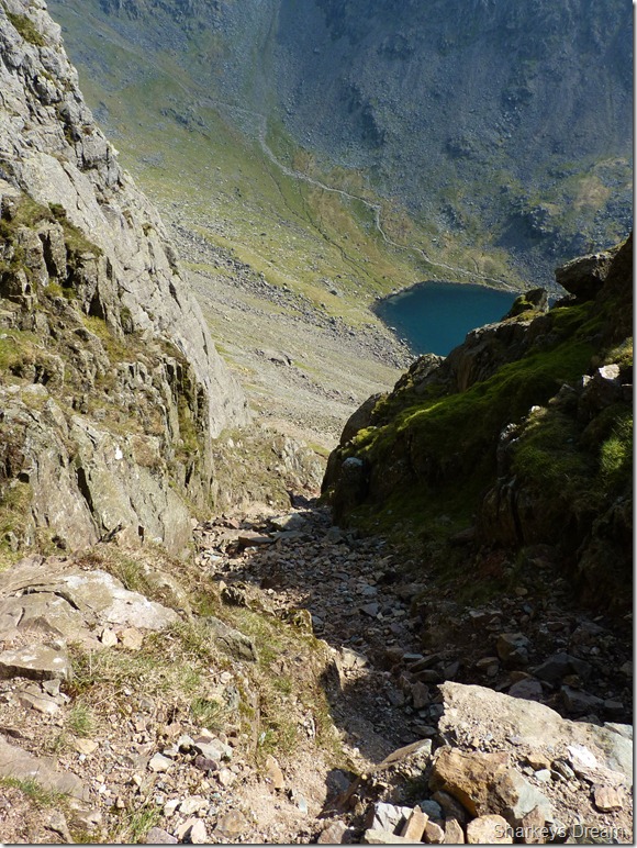
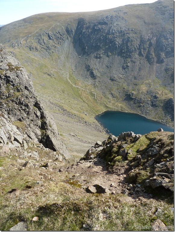
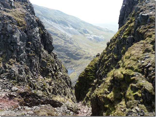
Looking down South Rake towards Goat’s Water & Coniston Old Man from the top of the gully. |
 |
| |
Emerging from the top of South Rake.
Thank you for the photos Don |
 |
| |
One day this chock stone has to come down, just hope I am not around when it does! |
 |
| |
This shot I took while I crossed the top of Easy Gully. |
 |
| |
And a little further around, Great Gully.
Time to head for Dow Crag’s summit which wasn’t too far away by now. |
 |
| |
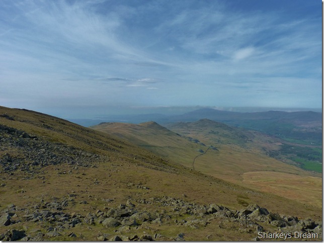
As I crested the ridge I took this photo looking back on Stickle Pike & the Dunnerdale Fells. |
 |
| |
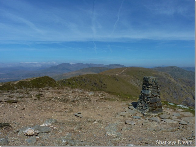
Dow Crag summit. |
 |
| |
Dow Crag summit.
The summit of Dow Crag is reached by yet another small scurry over rock, you haven’t reached the summit until you touch the top, which is just what I did next. |
 |
| |
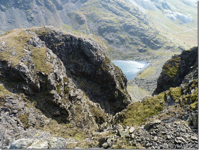
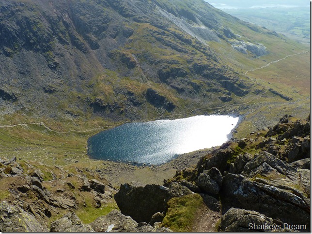
A sun lit Goat’s Water from Dow Crag. |
 |
| |
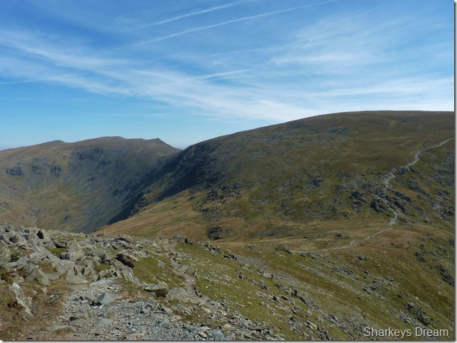
Great Cars, Swirl How & Brim Fell as I descend into Goat’s Hause.
It was here I was met by a couple & their dog, a West Highland Terrier just like the one I have at home, except mine is more than likely curled up in her basket dreaming of her bacon rasher treats & her over pampered lifestyle. The Westie here gives out a little bark as it see’s me & I just couldn’t help but smile |
 |
| |
Looking back on Dow Crag over Goat’s Hause. |
 |
| |
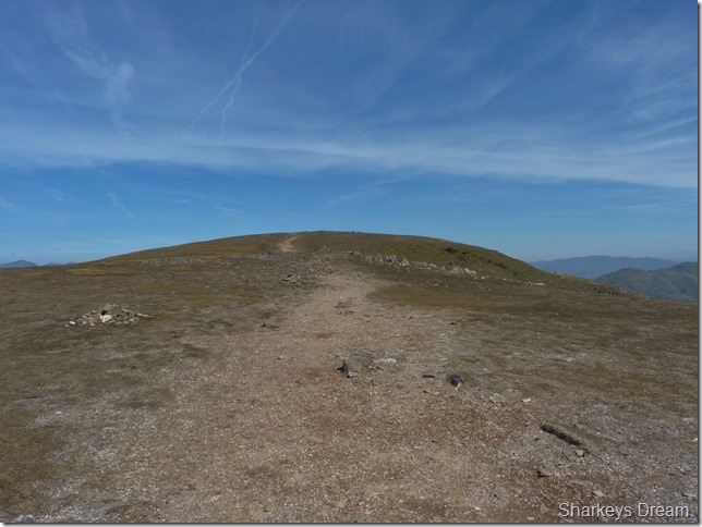
I take the path you see in the previous picture, then gain the ridge in between Coniston Old Man & Brim Fell.
I had two choices as I got near the top of the path: I could head right & summit the Old Man or I could head left & take in just a short stroll over to Brim Fell, it would be just rude not to! |
 |
| |
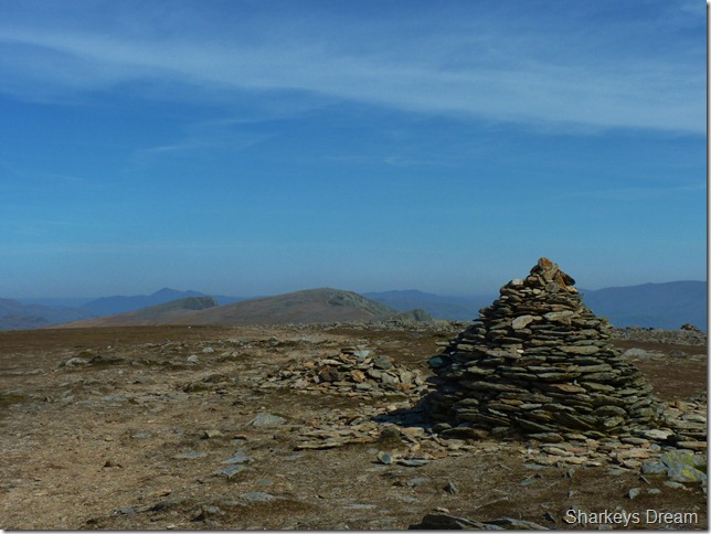
Brim Fell summit cairn with Swirl How & Great Cars in the distance.
The haze continues throughout the week in Lakeland, as today I am surrounded with panoramic views in every direction I look, that is I might add, for a distance of around three miles, in saying this, I would much rather have haze than rain & low cloud & I’m sure all of you would agree! |
 |
| |
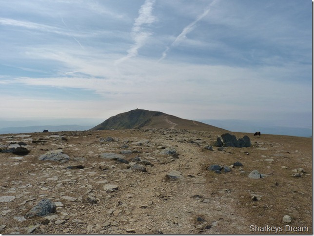
In reach of Coniston the Old Man as I turn heel & head for the summit, not before I have a wander over to the Goat’s Water side of the Old Man, where I took the detailed photo of Dow Crag earlier in my report. |
 |
| |
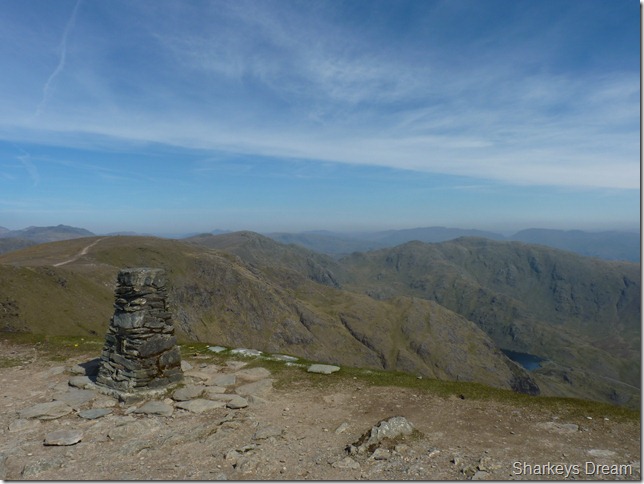
Coniston Old Man summit & Trig Point.
The only problem I have about the ridge in between Brim Fell & Coniston Old Man is that it just isn’t long enough, its a fine walk but over too soon.
In the distance we have the Esk Fells & the un-mistakable outline of the Scafells. |
 |
| |
Wetherlam, Great How & Swirl How from the summit of Coniston Old Man.
It was while approaching the summit am I buzzed by the sound of Jet engines around the whole Duddon Estuary, any minute now I am expecting to witness a Jet buzz the Old Man, so in earnest I am ready with the camera, the engines roars echo around the valleys bouncing of the fell side but to my dismay I can only hear, yet cannot see one, these Jets are testament to the Royal Air Force as the pilots who use the Lake District as a training ground, the Jets in question are usually BA-HAWK T1’s
You cant miss them, they usually appear as a deafening roar follows by a black streak! |
 |
| |
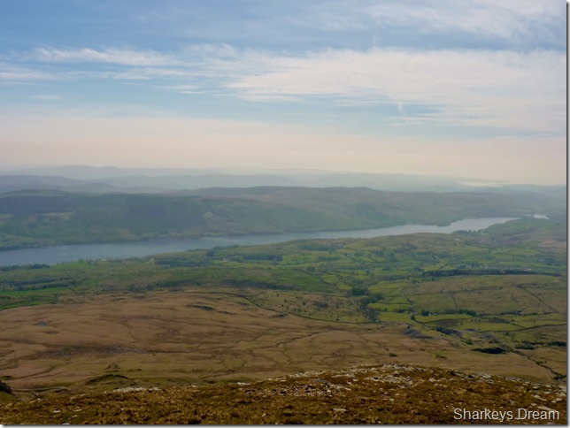
Coniston Water as I leave the summit.
A couple of hours earlier as Don & I chatted we passed the bottom of the south ridge path, I noted to Don that this was a path I have never used before ‘its easy Paul to find from the summit’ said Don, point towards this direction (or the lake) & head directly down, you’ll be sure to pick it up.
Well I had all intentions of leaving the summit via the day trippers route as Wainwright would describe. The fancy handbag & pointy toenails brigade, the Boy Scouts & lets not forget the grandmothers, (this a route I commonly use to descend the old man!) I thought I’d give the south ridge a try & I wasn’t disappointed.
The track leaves the summit south where you are met with a pleasant grassy stone path, lets not forget that you are at some height – so this path in places is steep. The path conveys you across the south (or back) of the fell & in places the path can be easily missed (don’t I know) with views of the whole length of Coniston Water, Coniston & Torver & not least to forget the Walna Scar Road. I guess even in bad weather, you always have something to aim for, as I reached the dirt path of Walna Scar it was here I kicked my toes back into my feet (you get the gist of the path!) |
 |
| |
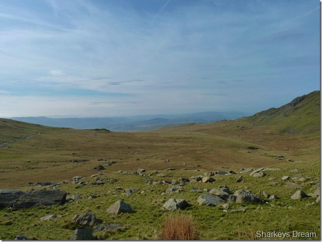
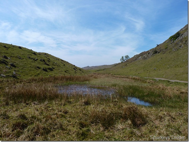
Boo Tarn.
The path lead me directly above Boo Tarn (a small reedy pool) where I then joined up with a very short section of the main path – I was somewhat dis-shelved as I stood to take this picture of what is probably one of the more adverse names given to a Lakeland Tarn.
I still love that name though… |
 |
| |
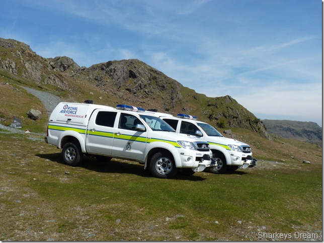
Royal Air Force mountain rescue.
It cant be just coincidence with all the Jet activity could it? I’m not too sure why they are here but I’m hoping its just for training purposes. |
 |
| |
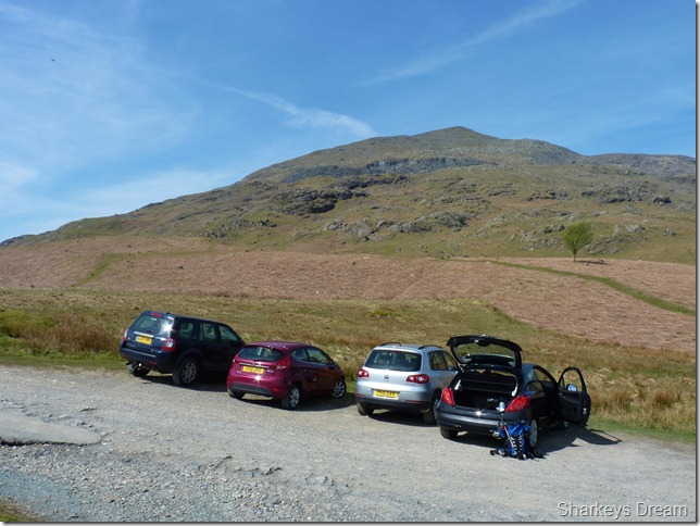
Coniston Old Man from Walna Scar car park.
I arrive back at a bustling car park at around 12:15pm & I’m ready for lunch, here I wind down the windows to let the car cool down before I head home, I sit on a grassy spot eating my sandwiches watching the people come back down the fell side & back to their cars. I spot Dons car & I’m hoping he is having a great time on the fells & not over doing it too much.
I think I can safely say that today was one of the best three hours I’ve ever spent in Lakeland, short the time may have been but the memories of the South Rake & the time spent at the beautiful outflow of Goat’s Water.
Don Greaves, there’s a bloke ‘I’ll never forget, thank you If you read this – for sharing your time & your stories of which this walk just wouldn’t of been the same, I couldn’t help but carry on the walk after listening to your lifetime on the fells forever within your shadow. |
|
| |
| Back to top |
 |
|