|
Sharp Edge & The Hall’s Fell Ridge |
 |
 |
12th May 2012 |
 |
|
With a limited window this weekend I saw fit to do something that I haven’t done in over two years, which was to travel to Lakeland after a short morning shift in work, this coincided well, especially with the weather as this day was the best from the weekend, but in arriving late in Lakeland you are also met with one or two disadvantages; the main one being parking…but I’ll get to that a little later on.
Without going into detail its been a tough week, ok – I’ll go into a little detail as I know this is a Blog & maybe sometimes besides the fells you may or may want to know what is going through my mind. Well I’ll make it easy & you can add your own personal feelings. Anyone familiar with my Blog over the years, may or may not know that my Mum (I can never call her mother, she’ll kill me!) is struggling to cope with her aneurisms of which she has six lodged within her brain, the aneurisms cannot be removed at all, final. So with this, my mum & my family have to live day by day & watch them slowly eat away at her. This week especially, has affected me & my family the most.
Not only right now am I’ & we, are struggling to cope with my mums illness – as the great man that he is; my father-in-law is also struggling with ill-health, two people how I love deeply have deteriorated so much in the last six weeks that right now, well you know… its hard on everyone concerned.
That’s all I’m going to say on the matter.
Ok; I’m going to leave it there & let the fells; & my beloved Lake district do the talking…
It seems pretty desperate to run & leave your problems behind, if only for a few hours, but Lake land is my fix, my solution to blow some cobwebs, you can’t buy it in a bottle. You have to live it.
So you kinda know where I am right now…
Back to the walk.
I had put together a hasty plan to leave Wigan around 12:30pm & good willingly arrive in Lakeland around 2 ish, well, I might of been a little over optimistic as it was actually 14:20 & that was with a slight heavy pedal on the drive up too. The walk in question was very hastily but together. Clough Head, that’s it. That was my walk plan, not like me to give it some extra thought but there you go, I just wanted to get there, saddle up & walk.
I only gave the parking theory slight thought; I just guessed I’d get lucky. You see my destination was Wanthwaite on the B5322 just off the A66, well-within St Johns-in-the-vale, a hamlet fit for two, maybe three well parked cars. Lucky Paul? yes you’d need a lot of it my friend.
I arrived in Wanthwaite not knowing what was around the corner, I’d guessed other walkers just like I would, would be returning to their cars around mid-afternoon, I was wrong, my heart sank as I rounded the bend & witnessed three vans oddly enough, packing the narrow verges.
With a slight panic & with no real plan, I span the car around at the crossroads & looked upon Blencathra.
This walk is the result of that slight panic. |
|
| Wainwright Guidebook |
 |
| The Northern Fells |
Sharp Edge is the highlight of this walk, shining like a beacon on what is otherwise a dreary line of approach. The route has a long-established reputation and is deservedly popular.
Sharp Edge is a rising crest of naked rock, of sensational and spectacular appearance of breaking wave carved in stone. The sight of it as close quarters is sufficient to make a beholder about to tackle it forget all other worries, even a raging toothache. The crest itself is sharp enough for shaving (the former name was Razor Edge) and can be traversed only a cheval at some risk of damage to tender parts. But, as on Striding Edge, an easy track has been worn just below the rim of the north side; using this, rock-handling is kept to a minimum. There is one awkward place, calling for a shuffle off a sloping slab on to a knife-edge: countless posteriors have imparted a high polish to this spot. |
 |
|
|
| |
|
Overview |
|
|
| Ascent: |
2,703 Feet , 823 Metres |
| Wainwrights: |
1, Blencathra |
| Weather: |
Warm & Sunny, Overcast At Times, Slight Gust On Tops, Highs Of 17°C Lows Of 14°C |
| Parking: |
Road Side Parking, Scales (FOC) |
| Area: |
Northern |
| Miles: |
4.7 |
| Walking With: |
On my own |
| Ordnance Survey: |
OL5 |
| Time Taken: |
3 Hours 15 Minutes |
| Route: |
Scales – Sharp Edge – Atkinson Pike (Hall’s Fell Top) – Blencathra – Hall’s Fell Ridge – Scales |
|
| |
|
Map and Photo Gallery |
|
|
 |
| |
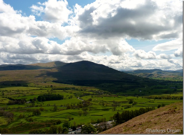
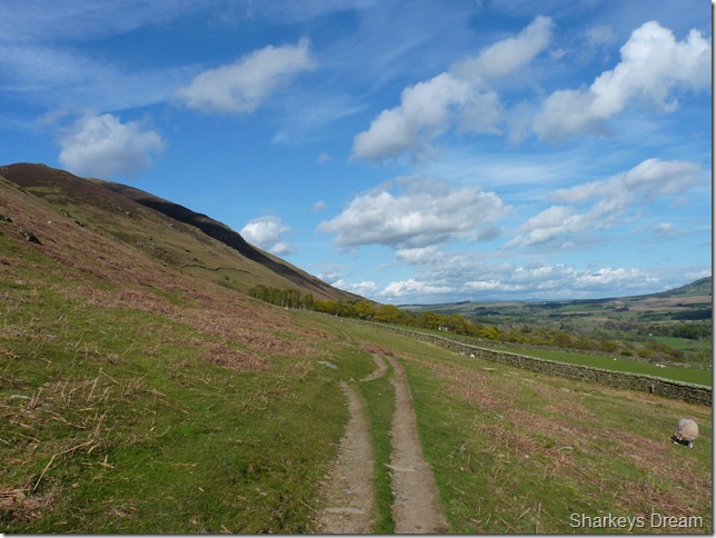
Clough Head & Great Dodd from the start of the walk.
By now its 14:44 & a lovely 14°C with a cool breeze blowing around the lower slopes of Blencathra. From here the traffic is noisy, as bike after bike opens up along the A66, but I don’t care, I’m were I wanted to be.
Being as this was a late start, all I had to do back at the car was shoulder pack & I was away – I took it upon myself to wear my boots on the drive up sparing time kitting up at the road side, this wasn’t as uncomfortable as it may seem as my boots are pretty light weight anyway.
I left the car pointing east along the A66 & I knew the moment I left it, a decision I was later to regret after the walk but that was some time off. |
 |
| |
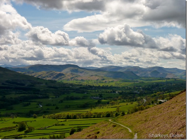
Looking back along the narrow track towards central & north west Lakeland.
I hit the fell side with all guns blazing but the steady climb soon stole my glory as minute by minute I slowed down eventually stopping, heaving for breath, this is stupid Paul, what are you doing – just take your bloody time. |
 |
| |
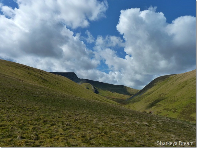
The Lakeland frontier that is; Great Mell Fell.
Feeling a little more composed as I now contemplate my route ahead but not before… |
 |
| |
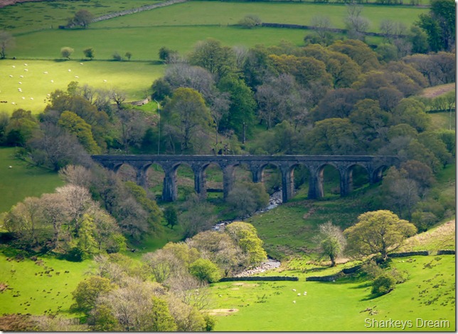
Taking this close up of the Mosedale Viaduct.
Built from Penrith stone to carry the Carlisle to Keswick railway back in 1864, sadly it was 1972 that saw the Viaduct decommissioned along with the whole Keswick – Carlisle line. |
 |
| |
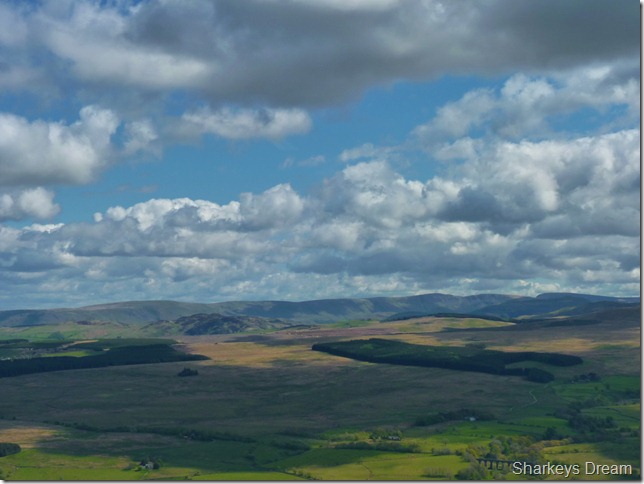
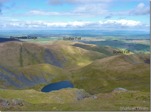
Great views & big skies looking towards the eastern fells.
The skyline you see ahead are that of the High Street Roman Road from Loadpot Hill across to High Street itself. |
 |
| |
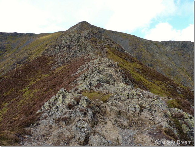
Sharp Edge lies ahead.
I wont lie to you in saying that not only was Blencathra over my shoulder not over an hour ago while I tried to park up in Wanthwaite, but so was thoughts of not just one of Lakelands finest arêtes but one of the UK’s finest ridges walks.
Its been well over three years since I last set foot on Sharp Edge & back then as a novice it terrified me, I always said that I had done Sharp Edge & that I needn’t do it again, well that was then & this is now & right now I’m pumping myself with adrenalin.
Today I’m going to face some demons of old & get myself back on Sharp Edge. |
 |
| |
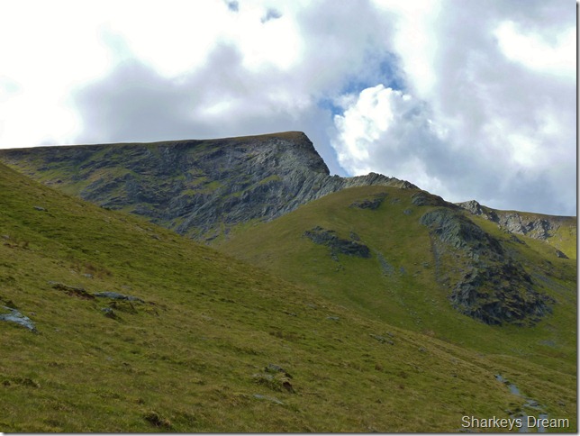
A close up of Sharp Edge & Burnt Knott.
I had only one concern at this point & that was a gale that was now blowing down the valley, its a notorious spot for a wind tunnel from this approach even on a good day such as this. |
 |
| |
Crossing Scales Beck.
The wind right about here was enough to get me thinking of a slight change in plan, not enough to bowl a man/woman over but enough to keep them on their toes. |
 |
| |
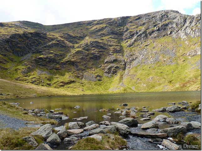
Scales Tarn & Tarn Crags from the tarns outflow.
I knock around Scales Tarn to get some pictures, in doing this, it is here I make up my mind to go ahead with the traverse over Sharp Edge. |
 |
| |
A close up of Sharp Edge from Scales Tarn.
I have a good feel about the place as I take a few pictures around the tarn, here I spot three people on Sharp Edge focusing on this guy as he picks his way across the arête, the other two are on an ascent on Foule Crags just to the left & out of shot. |
 |
| |
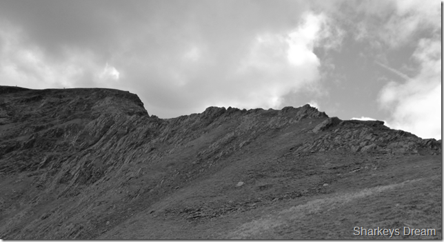
Sharp Edge.
I make my way up the steep rocky path noting that the sun has been hidden by a huge grey cloud, this takes the warmth out of the climb away, as I get nearer to the start of Sharp Edge I also notice that the wind has dropped so this keeps the confidence up. |
 |
| |
Sharp Edge in mono. |
 |
| |
The start of Sharp Edge.
It is here I take a gulp from the Camelbak & itch up my shorts & pull down my mid layer which by now as usual, was half way up my back! |
 |
| |
Just under half way when I stopped to take this picture looking back.
The path or course of, is varied in-between a narrow ledge to the left of this picture which comes to an abrupt stop, given no choice, here you have to climb onto the top of the ridge as I did here, pointing the other way is …. |
 |
| |
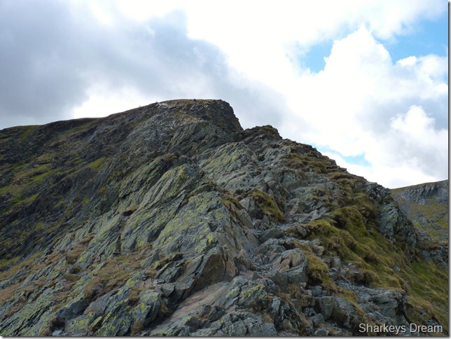
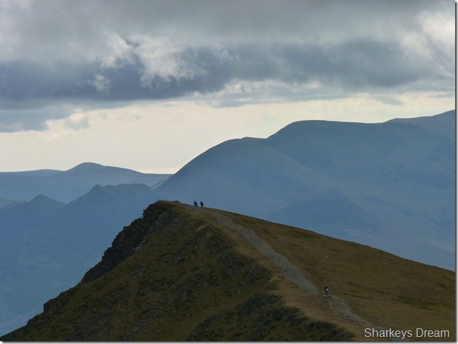
The most exposed part of the ridge & Foule Crag.
This part will always get the nerves going for any fell walker me included, you can see another part of the path to the right of the picture, again giving you no choice other than to gain the ridge, if you like a good scramble & have a head for heights Sharp Edge is the ultimate in what Lakeland can offer. |
 |
| |
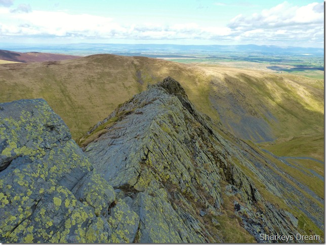
Looking back along Sharp Edge.
I wont lie to you here, memories came flooding back as to why I’ve kept away from Sharp Edge for so long, keeping composed & sighting your route across the Edge is key, always being one step ahead holds great & keeps up the confidence. |
 |
| |
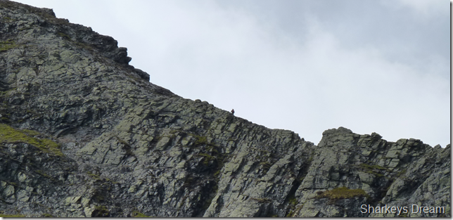
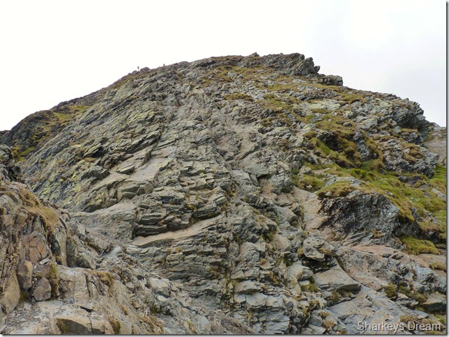
Nearing the end of the traverse when the vastness of Foule Crags come intimidatingly into view.
Just for scale on how high this wall of rock is when you pick out the two people centre left at the top of the crags.
However, the scramble up Foule Crags is no-where near as daunting as it looks in this picture, a short scramble to the right of Foule Crags which then diverts you left across the face is the safest route up which turned out to be quite a fun scramble. |
 |
| |
Looking down on Sharp Edge from just beneath the summit of Foule Crags.
With the climb over I had in mind something a little more spectacular to end the route, but that’s a little while on across the summit plateau, but first I had to reach Blencathra’s summit. |
 |
| |
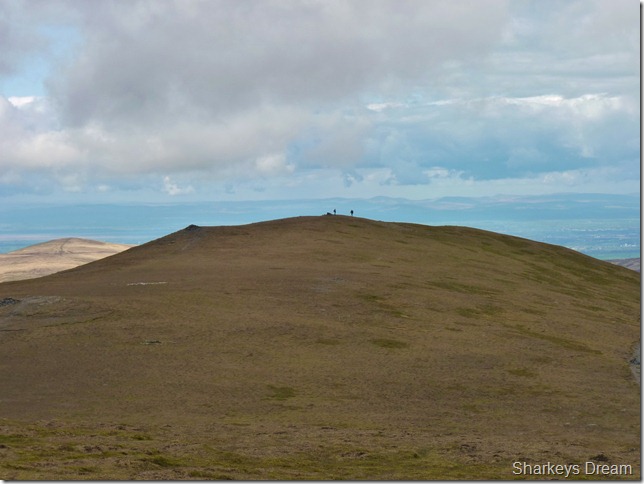
Heading across the Saddle of the summit, the couple ahead are the two you saw in the previous photo at the top of Foule Crag. |
 |
| |
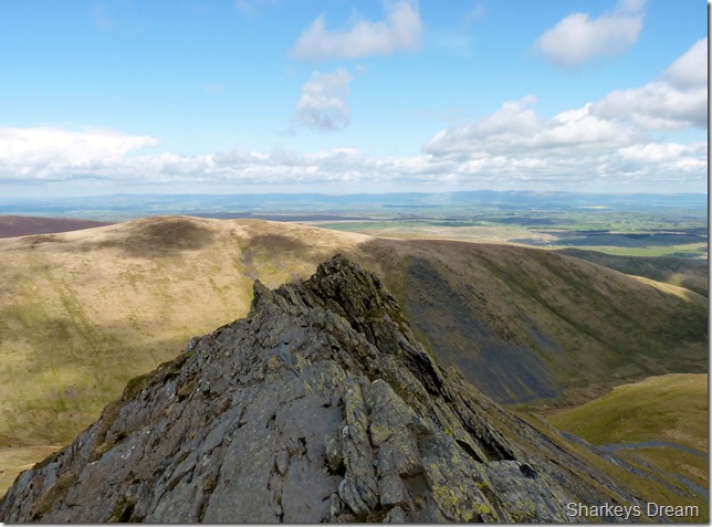
Looking west on some favourites of mine, the sky is now blue again & this reflects in Scale Tarn below. |
 |
| |
Looking back across the Saddle with the white quartz stone cross monument just to the left of the picture. |
 |
| |
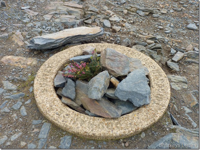
Blencathra’s unusual circular stone trig point.
While the flowers add to the summit – I’m not to sure about the pile of stones that people are adding daily. This is a trigonometry point & not a cairn which in fact is just near by.
Rant over, time for some pictures as there are spectacular views all around |
 |
| |
Looking over Gategill Top & Gatefell towards Derwent Water & Lakeland from north to south. |
 |
| |
Looking further north towards Skiddaw Little Man & Skiddaw’s Summit. |
 |
| |
Gategill Top.
Within minutes the thickening cloud had obscured the sunlight dusking Lakeland in mono. |
 |
| |
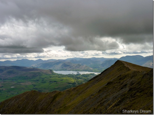
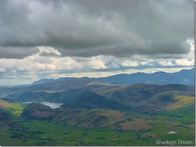
Looking down on a clouded Lakeland with Thirlmere, Low Rigg & High Rigg in the foreground, Tewit Tarn is other there on the right with the southern fells on the skyline. |
 |
| |
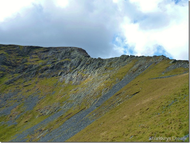
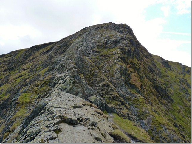
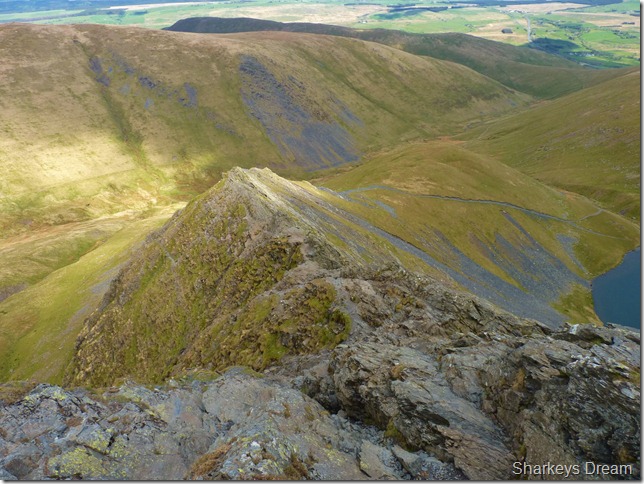
My descent route: The Hall’s Fell Ridge.
Hall’s Fell Ridge can be found directly in front of the circular trig point at Blencathra’s summit & fittingly this ridge descent would be a perfect way to end the walk (it was also the most brutal on the knees!)
I had scaled The Hall’s Fell Ridge back in January of this year when the climb up was met with low cloud which obscured the views, with no chance of that today I start to head down. |
 |
| |
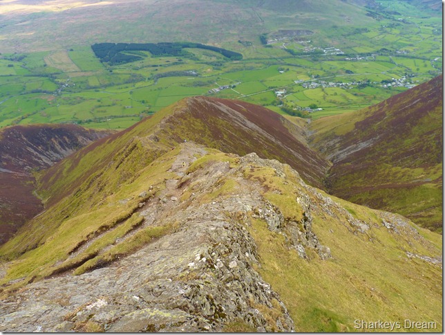
Looking down on Hall’s Fell narrow edge.
I will go to say that the Hall’s Fell Ridge is most definitely best ascended rather than descended which only exception to my bad knees, both feel healthy but hurt from the crunching descent, ahead I spot four walkers along the ridge, the first two are two women in front of the crags below talking to a guy on his way up, in any normal circumstances I would probably overtake other walkers while on a descent, it seems what Sharp Edge didn’t do to my knees – the Hall’s Fell Ridge is now, making light work of it! ouch. |
 |
| |
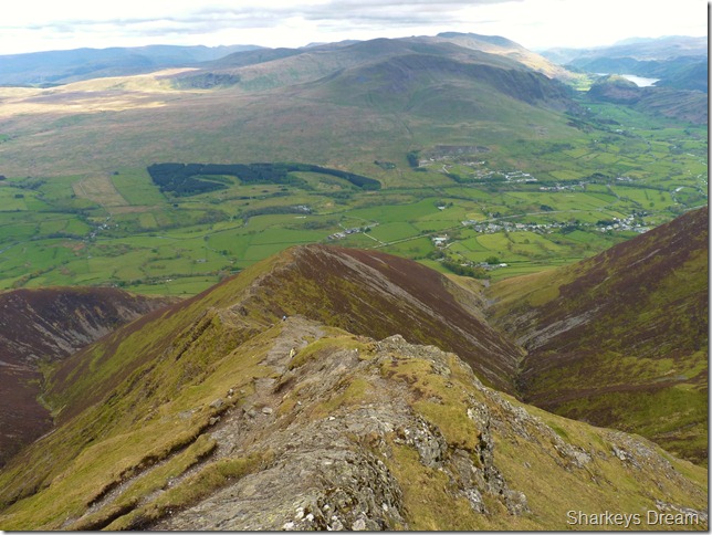
Looking back up Hall’s Fell Ridge.
Parts of the descent I remembered well from January & parts looked completely new to me as they were obscured by cloud, so it does give that feeling of never been here before aspect to it. |
 |
| |
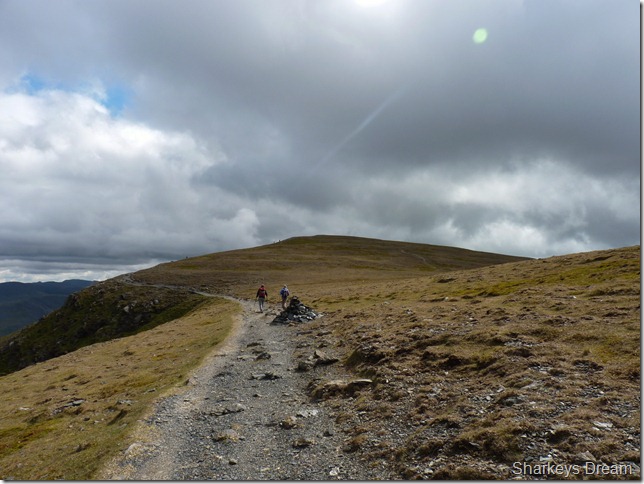
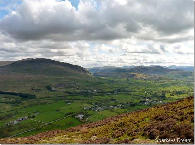
Threlkeld Common, St Johns-in-the-Vale & Clough Head domineer the final part of the ridge.
I have to wonder whilst I gaze upon Clough Head for much of the descent, that would I have had the day as I have had today, as it turns out I don’t think I would have. |
 |
| |
I make a left turn as I get to the bottom of Hall’s Fell & head for Scales, its just under a mile, so here I take advantage of the pleasant track underfoot, it is here I also finish off my lunch as T-time.
The track here makes its way through past the trees in the distance & over… |
 |
| |
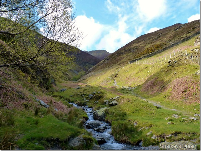
Doddick Gill.
That’s Blencathra’s summit you can see in the distance.
I thought I had the ascent behind me, that was up until I reached this crossing, the path then diverts you up by the stone wall & up one very steep last push.
The next patch of water I cross would be Scaley Beck & that was even trickier. |
 |
| |
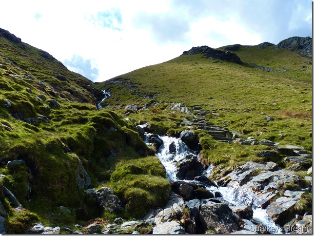
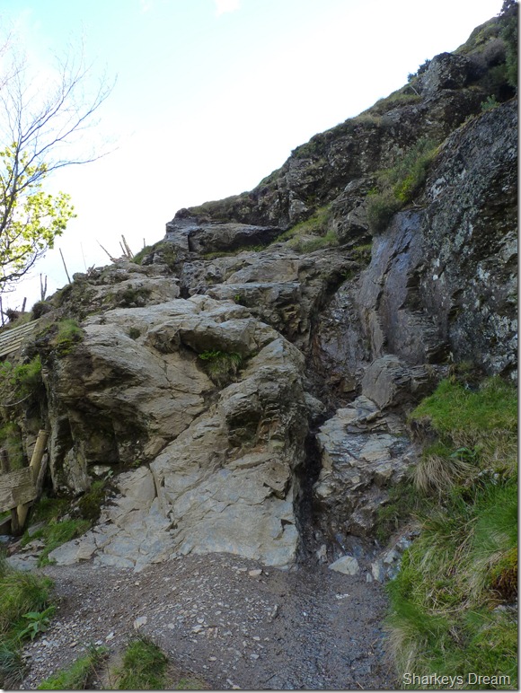
Scaley Beck.
As I crossed Scaley Beck did I had to negotiate a sudden drop to get down to the river bottom, this was gained by lowering myself sometimes with my arse I might add down some mighty steep wet rock, I kid you not, my heart fluttered more on this wet tricky 15 foot descent that it did on both the arêtes & ridges I had traversed today!
This also was met by another steep scramble over wet polished rock before I re-joined with the main path. |
 |
| |
Difficult & dangerous? I tend to agree & not to mention, totally unexpected. |
 |
| |
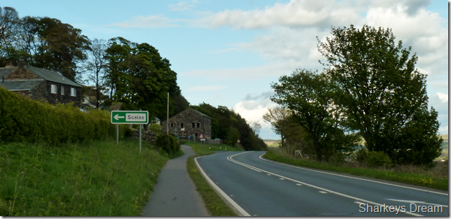
The White Horse Inn, Scales.
Within minutes of my last few scrambles do I find myself back at the gate where I started my walk a little over three hours ago. I look & indeed smell like I’ve had a bloody good day on the fells feeling content that Lakeland has done its job yet again.
Time for a bath, a few beers & some precious time with my family. |
|
| |
| Back to top |
 |
|