|
A day in the clouds, Great End to Scafell Pike |
 |
 |
14th July 2012 |
 |
|
Broad Crag was the fell of the day if there is ever such a thing, I had yet to grace Broad Crag & not through want of trying I might add, twice I had been beaten by the weather, once I cleanly walked right past her in low cloud back in September 2010. I had always been stumbled as to why Wainwright hadn’t claimed Broad Crag as one of his own, too close to Scafell Pike or the magnificent Great End? Maybe; it is its proximity to Scafell that was maybe its own downfall? a shoulder of the highest fell in England but I do not think this is so.
Its not very often I wouldn’t agree with the great man but I have just the two disagreements with Wainwright when upon my day of reckoning we shall discuss these over a pint in the place they call heaven.
Two mountains worthy of the great man that will niggle me until the day I die – no matter what was wrote about them are that of Great Knott (Langdale) & the intrepid Broad Crag.
At least today I may be able to put some thought as to at least one of these grand mountains & come up with my own musings, but I failed in doing this. Instead I was treated to Lakeland live & raw, I simply cannot betray this with the means of a camera nor notepad, a camera on a day such as today was hardly any bearing on a walk in conditions such as I had today. |
|
Wainwright Guidebook |
 |
| The Southern Fells |
Grains Gill is a beautiful approach to the high fells of the Scafell group.
Great End dominates the walk up the valley, almost oppressively so by the time Ruddy Gill is forded to join the Langdale – Wasdale path, and from this point it is difficult to believe that the top of the great wall of rock towering directly in front can be reached by the simplest of walking; but this is so, and in fact the steepest climbing is already at an end at 2’000
Nobody will regret a day that includes Great End in its itinerary: it is a magnificent mountain, scarcely inferior to the pike, and, in some respects, to be preferred. |
 |
|
| |
|
Overview |
|
|
| Ascent: |
3,400 Feet, 1,035 Metres |
| Wainwrights: |
2, Great End & Scafell Pike |
| Weather: |
Overcast & Muggy, Some Heavy Showers – Little Wind, Some Bright Spells, Highs Of 16°C Lows Of 11°C |
| Parking: |
Roadside Parking Seathwaite Farm, Borrowdale (F O C) |
| Area: |
Southern |
| Miles: |
10 |
| Walking With: |
On my own |
| Ordnance Survey: |
OL4 & OL6 |
| Time Taken: |
6 Hours 10 Minutes |
| Route: |
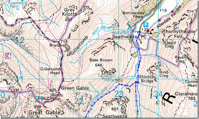
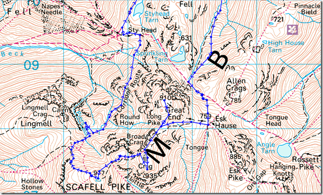
Seathwaite – Stockley Bridge – Grains Gill – Ruddy Gill – Esk Hause – Calf Cove – Great End – Ill Crag – Broad Crag – Broad Crag Col – Scafell Pike – Lingmell Col – Corridor Route – Skew Gill – Styhead Tarn – Stockley Bridge – Seathwaite |
|
| |
|
Map and Photo Gallery |
|
|
 |
| |
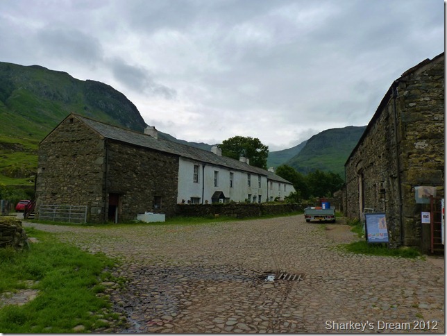
Seathwaite Farm 7:56am 11°C
I knew Lakeland had that sporadic kind of feel to it from the drive in, spots of rain hit the windshield as the grey cloud remained high above the fells. Despite it only being around 11°C in Seathwaite it is muggy & feels much, much warmer.
I arrive & park with ease & I’m putting this down to the fact that it is still quite early & the crowds have yet to arrive – although I am not alone as I kit up by the car. In front of my car is a little Peugeot with two occupants kitting up inside the car as I get a nod through the windscreen, then as I am about to lock my car, two blokes arrive & park behind me, here too I get the morning nod.
I keep the jacket tucked in underneath my pack hood as usual for the summer months, but I have a feeling I may be needing it sooner rather than later.
With this I head through Seathwaite & for Stockley Bridge. |
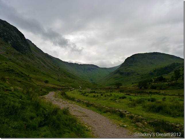 |
| |
Seathwaite Fell from the path.
Today I shall be walking through the valley following the River Derwent until it merges with Grains Gill somewhere along the left flanks of Seathwaite Fell ahead.
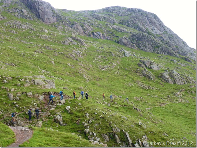
I set a steady pace & soon overtake the walkers you see ahead on the path, I know for a fact that I have some excess energy to burn today, the pace wont last but gets me past the crowds so to speak. |
 |
| |
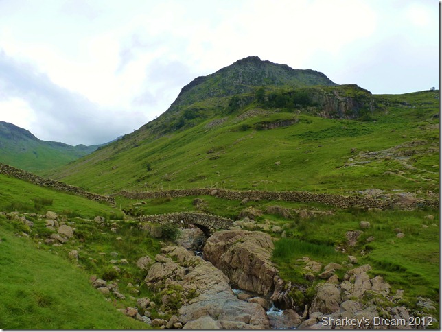
Crossing Stockley Bridge.
My route follows Grains Gill from here on in, here I cross Cockley Bridge then pass through a gate a take the path on the other side of the stone wall.
I have a number of walkers on my tail & I feel lucky at the fact that they don’t follow me – & head for Styhead Pass on the other side of Seathwaite Fell, there’s nothing like seclusion, something that I’m craving for at the moment. |
 |
| |
Looking back down the valley to a distant Seathwaite.
Considering that this is my first time along here I cant help but enjoy this route & indeed this path immensely, great care has been put into the path as the rock underfoot eases the gentle gradient away, this I now consider to be one of thee finest paths in Lakeland. |
 |
| |
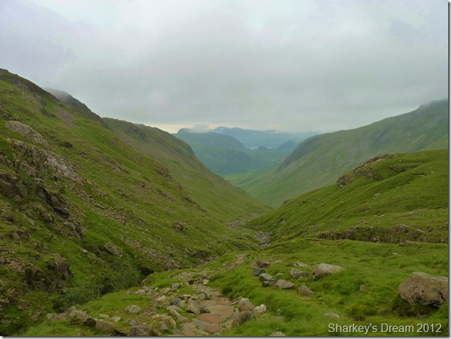
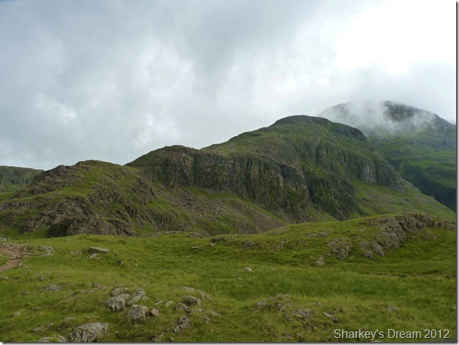
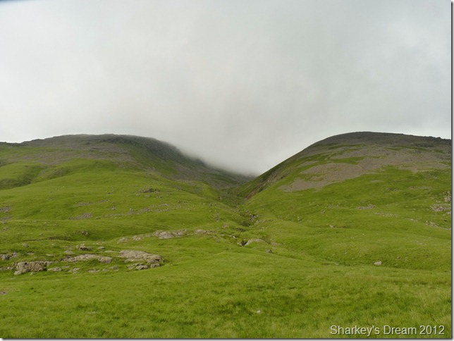
My first sighting of Great End with its summit partially obscured in cloud.
This, a point I remembered from the map was this little bridge crossing over Grains Gill. The path from here gets slightly steeper but not much & not worth worrying about.
It is also here that I feel spots of rain hit me, by now the humidity is high as I sweat profusely from my hair & forehead, at this point the spots of rain are more than welcome. |
 |
| |
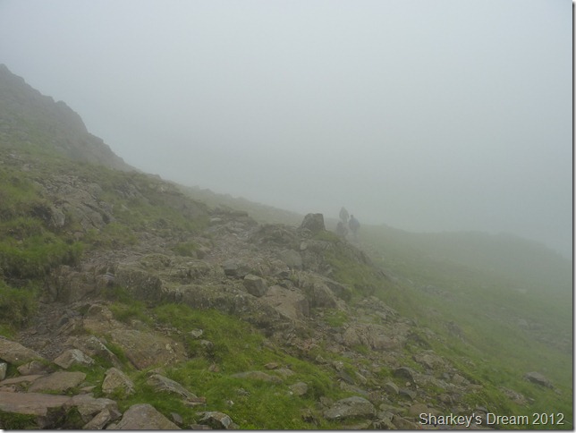
Passing two walkers heading down.
I’m not too sure why this young chap is walking down with a George Cross flag strapped to his back, his girlfriend looked rather embarrassed as I passed on my good morning, perhaps the sign of things to come? more later… |
 |
| |
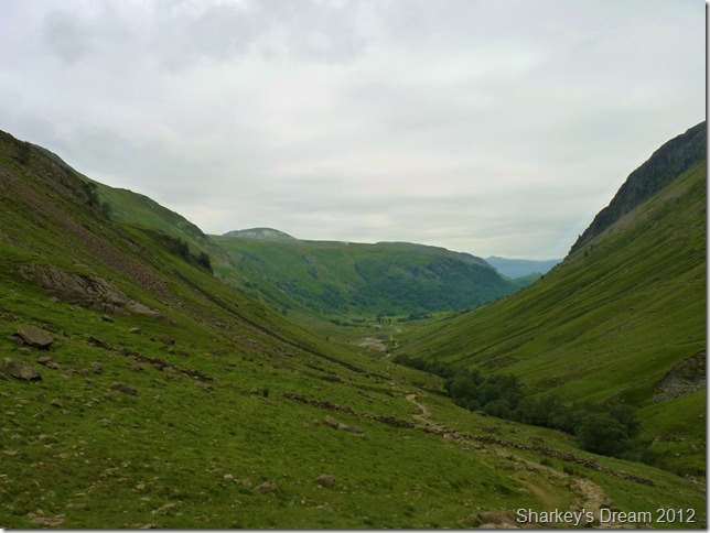
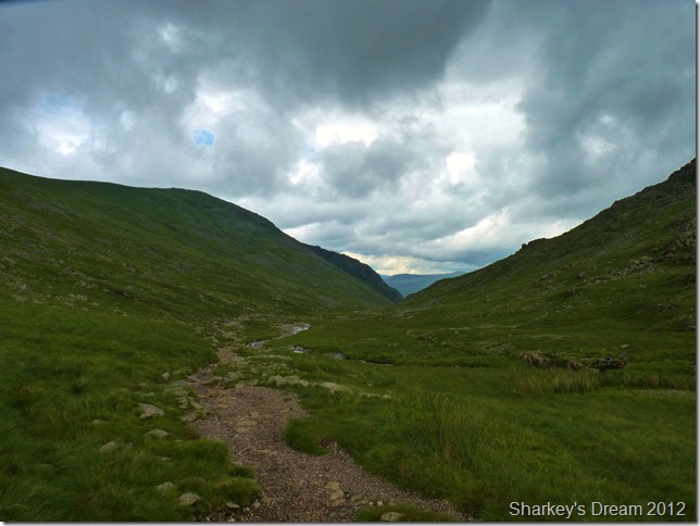
A long distant view from the top of Grains Gill.
By now I have had to succumb to the jacket – only through fear of walking the rest of the day in wet clothing, I leave the jacket un-zipped & just use the hood to keep my head dry (ish) Right now what I need is one of those cow-boy like hats to keep the vertical downpour off that is ensuing me.
The humidity is stifling & there is no happy medium at the moment! |
 |
| |
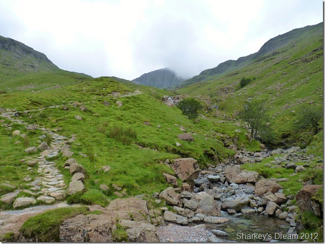
Ruddy Gill Fords.
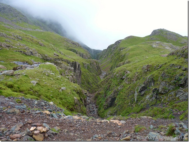
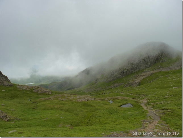
By the time I reach Ruddy Gill the cloud lies as a blanket what seems like just above my head. Great End has completely disappeared to my right & thoughts of seeing its many gullies have long since gone, a little down hearted I press on for Esk Hause. |
 |
| |
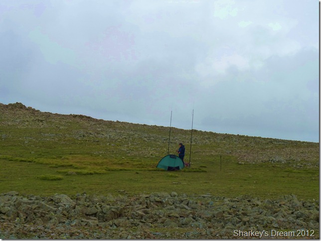
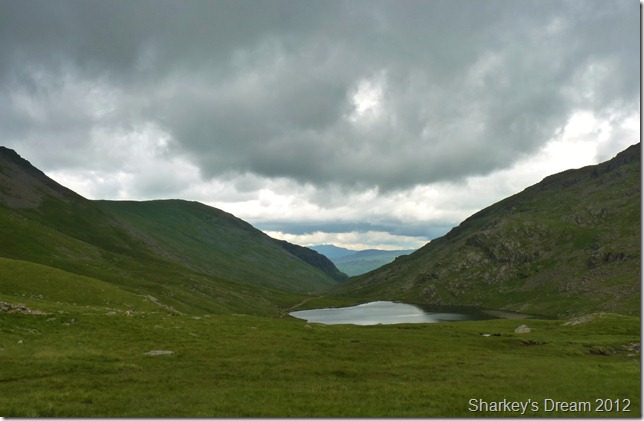
The cloud looms just above Sprinkling Tarn & Seathwaite Fell,
Those of you with an over keen eye may spot the red tent just above the shoreline at Sprinkling Tarn. |
 |
| |
Looking across to Allen Crags as I leave Esk Hause.
Esk Hause being the point where the Landgdale, Eskdale & Borrowdale paths converge, sadly the cairn marking Esk Hause is just out of shot over on the right.
I do that dreaded thing that I haven’t done for a short while & that is toy with my route plans, despite the weather I feel the urge to include Scafell Pike into todays walk, as quickly as the thought had crossed my mind it was already too late & Scafell Pike was on the agenda. |
 |
| |
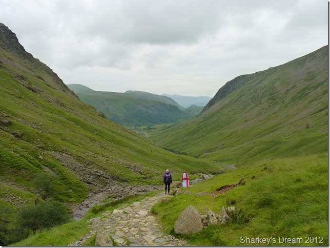
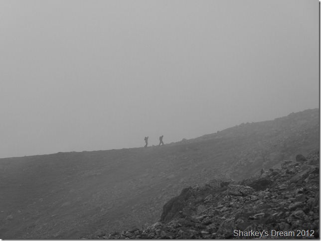
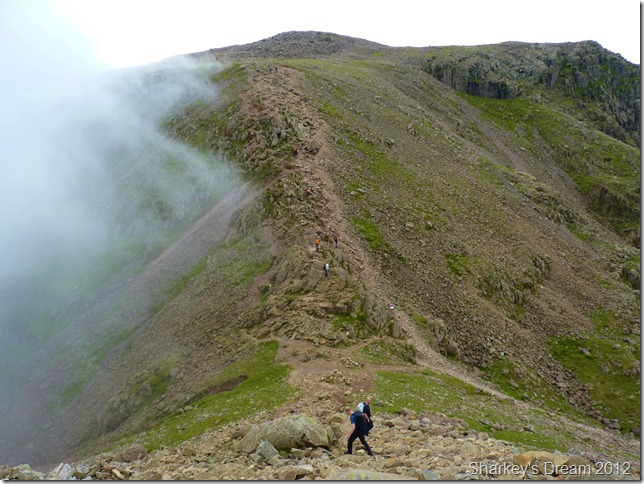
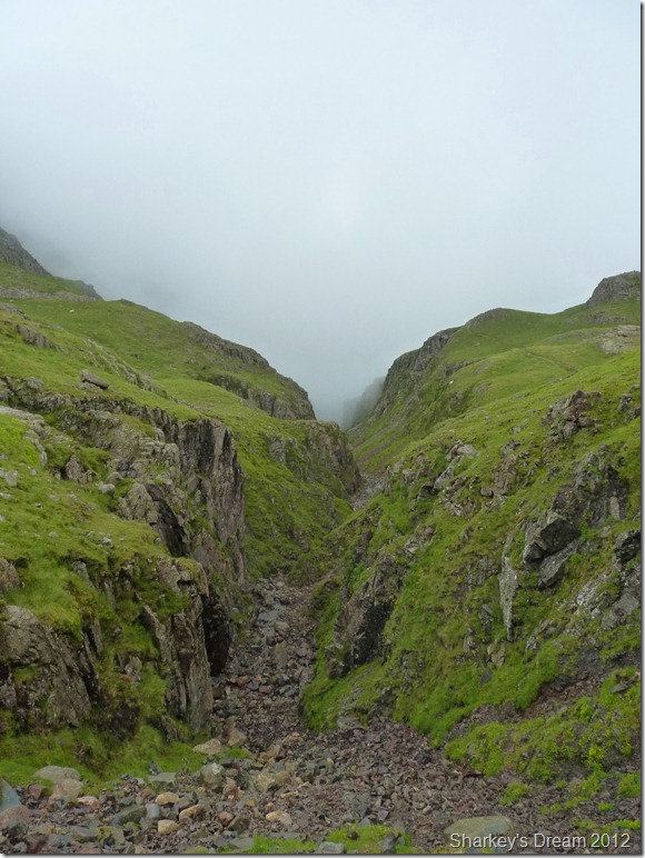
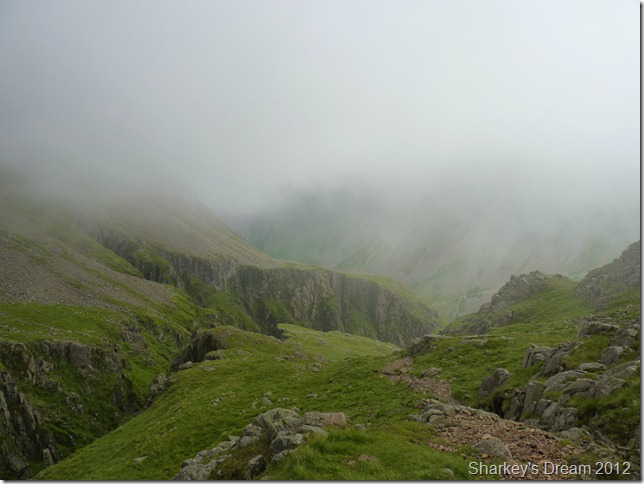
Two walkers head towards Great End summit as the cloud rolls in once more. |
 |
| |
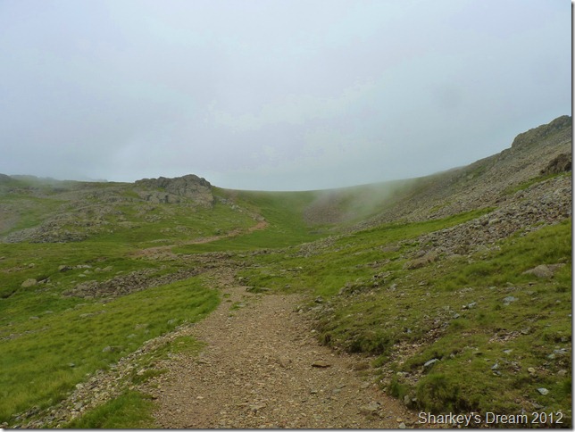
Calf Cove.
As I reach to the top of Calf Cove I will use the col in both directions, first I need to take a right to reach Great End’s summit, then I will return via the same route & cross the Col diagonally left towards what is commonly known as the motorway, or to me & you; the path to Scafell Pike. |
 |
| |
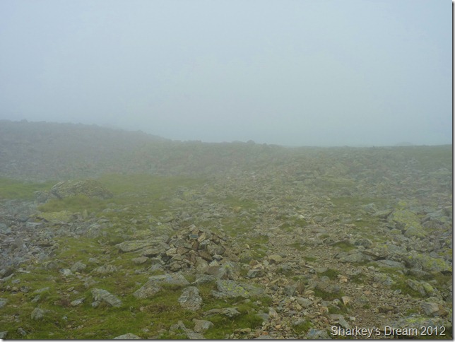
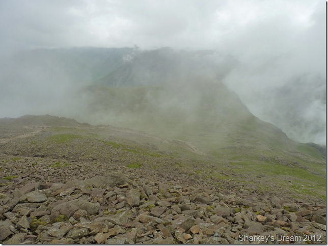
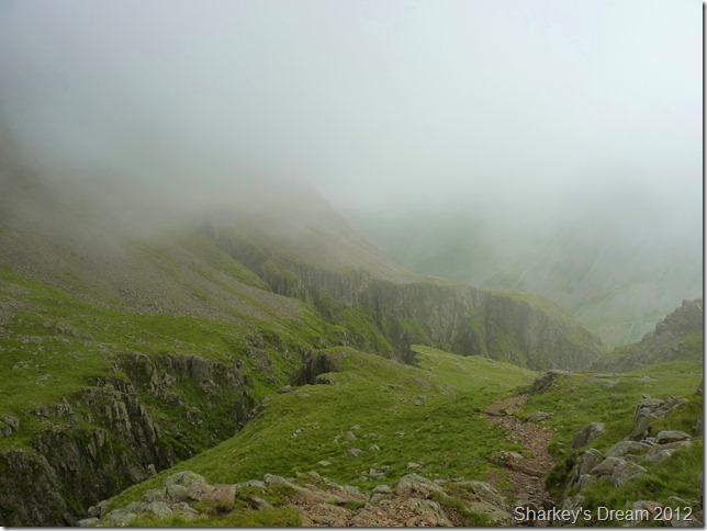
Back into the clag as I head for Great End summit.
Its a nice & easy pull from Calf Cove even in conditions as I have today, with no real strain underfoot & the low cloud adding to the ambiance as the summit looms out of the mist; this was a real favourite part of the walk for me.
Despite its domineering presence in south Lakeland, Great End has got to be one of the most easily obtainable mountain tops in the whole of the district. Okay, I guess that’s easy for me to say & even going back to my early days when just the two words “Great End” petrified me more than the “Scafells” I guess back in those early days I never thought I’d find myself at its summit, now this is my fourth visit & the mountain still has the pull for me & long may it continue. |
 |
| |
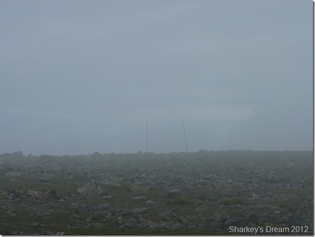
I spot these two poles as I near the summit, but what could they be? |
 |
| |
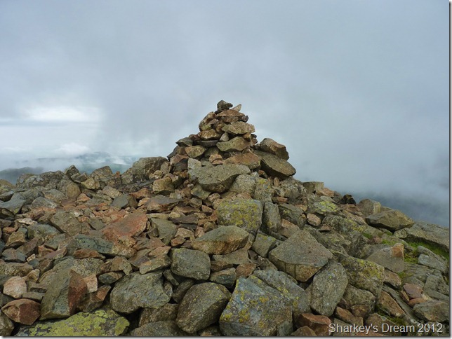
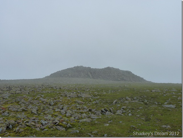
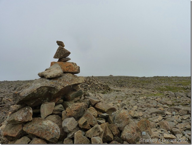
Great End summit cairn.
Sadly with not much to see I took this less inspiring shot of the cairn, but I guess all I have to do is wait a wee while for the views to open up. |
 |
| |
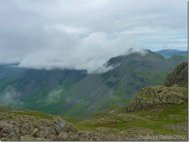
Truly fantastic when this happens.
The cloud broke while at the summit to views of Lingmell, Broad Crag & in the distance Scafell Pike. |
 |
| |
Ahhh right! that’s what the poles where.
I pass on my good morning to the woman, obviously by the looks of things she has spent the night at the summit, I plan to have a walk over & ask how her night went – then she takes a call from the CB radio, she is talking to a male on the other end but I can’t really grasp what the conversation is about, more of a “do you copy me over? kerch “loud & clear, over” the woman replies, and so on…
For that kind of equipment I’m thinking its got to be involved with search & rescue? |
 |
| |
Back at Calf Cove col.
After retracing my steps, next I aim to get to Ill Crag, which is just out of shot behind the rocky peak you see in the left of the photo. Broad Crag is over on the right with Scafell Pike in the distance, it seems for now the cloud has broken but don’t speak too soon Paul, enjoy it while you can! |
 |
| |
Great Gable summit can be briefly seen but is only momentarily. Kirk Fell behind however is not so lucky. |
 |
| |
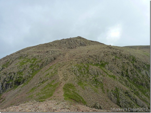
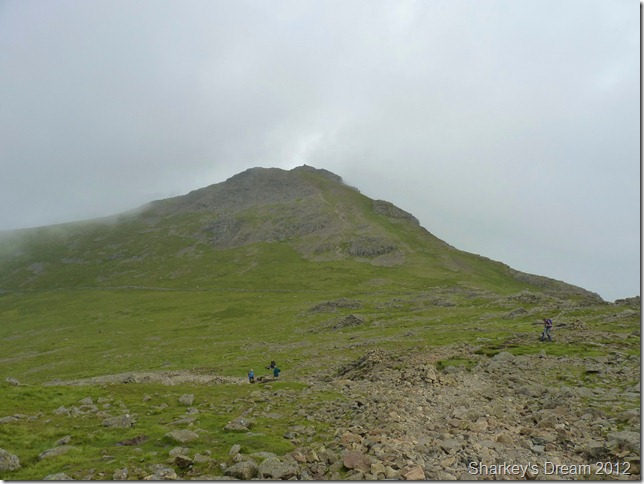
Heading for Ill Crag.
Its not un-common for the walker in search of reaching the summit of Scafell Pike to totally by-pass Great End, Ill Crag & Broad Crag without ever knowing it. |
 |
| |
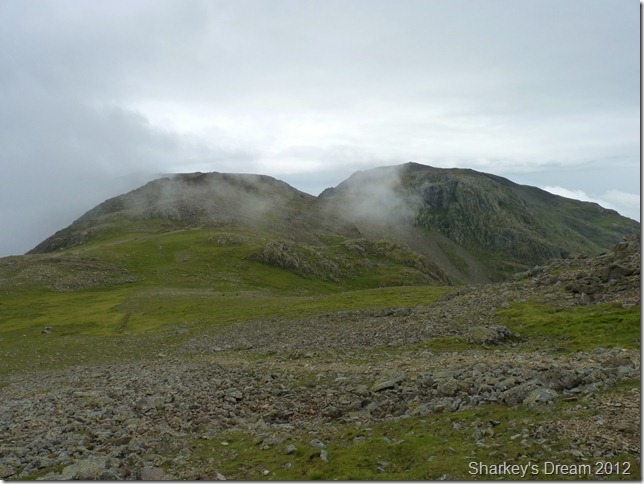
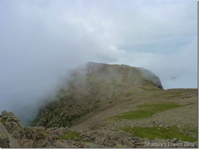
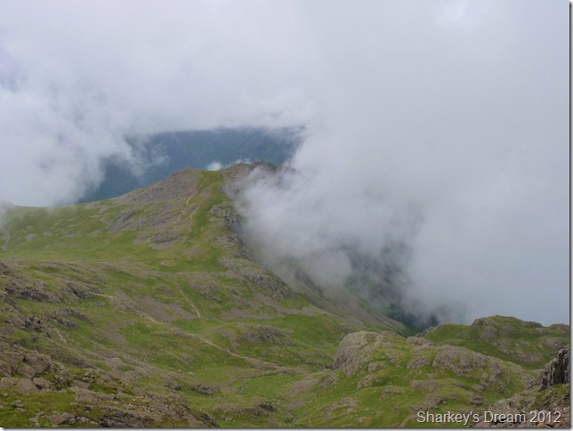
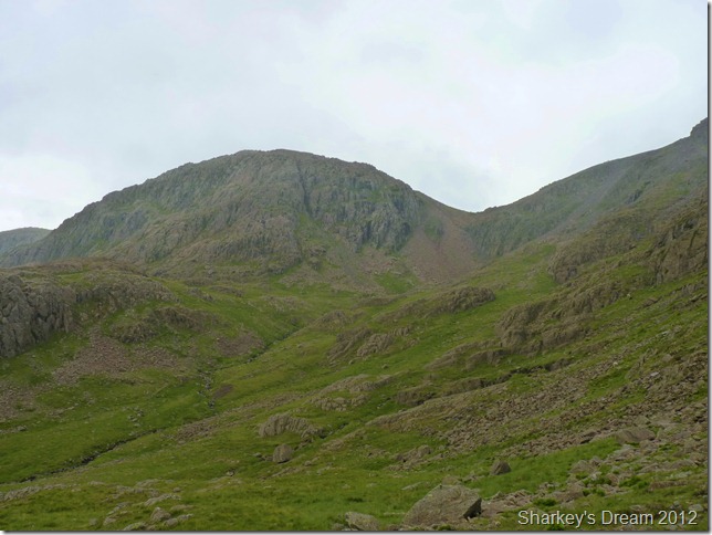
Broad Crag from Ill Crag Summit.
The walk after leaving the main path for Scafell is a little treacherous underfoot yet short, so care was needed to negotiate the rock strewn path, then all is needed is a little scramble to reach the summit of Ill Crag.
On any given day views from the summit are spectacular with views of Bowfell Esk Pike & the Langdale Fells, not to mention Scafell Pike & Great Moss. But sadly a bank of cloud block my views in every direction bar one. The magnificent Broad Crag. |
 |
| |
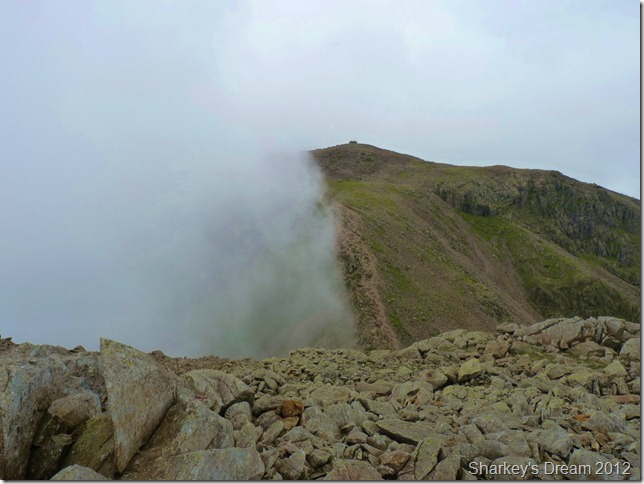
Scafell Pike from Broad Crag summit.
This column of cloud acts like an up-draft as it rises above Broad Crag col, never passing over, it looms menacingly, just adding to the dramatic scenery up ahead.
Below me half a dozen walker pass me by, as I left the main path for Broad Crag two walkers follow me over heavy boulders only to turn back knowing that this was not the path for Scafell Pike, I smirk a little, mentally I go back to Wainwrights notes; “Yet not one person in a thousand will reach for its summit”
Broad Crag maybe on the shoulder of England’s grandest mountain, but this also makes Broad Crag the loneliest & I quite like that. |
 |
| |
Looking back across the boulder strewn summit on Broad Crag. |
 |
| |
Broad Crag col.
To the left of Broad Crag col is Little Narrow Cove & to the right, my would be exit route onto the Corridor Route, my legs feel fresh & I don’t second glance my decision to include Scafell Pike, I get in amongst the numbers of walkers & head for the summit. |
 |
| |
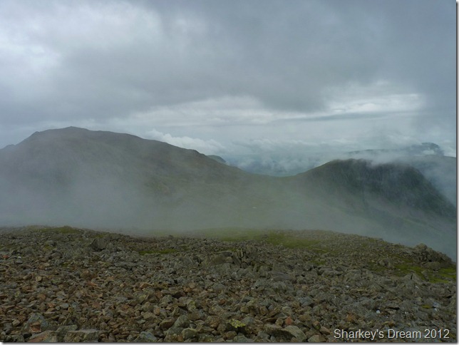
Looking down on Lingmell, Lingmell col & the Corridor Route from Broad Crag col.
Sadly the cloud obscure all views down onto Little Narrow Cove. |
 |
| |
Broad Crag from my ascent on Scafell Pike.
I have caught up with the two fellows who initially started to follow me up on Broad Crag, in-line with around half a dozen other walkers we all head for the summit & the slow(ish) pace gives my legs a little respite. |
 |
| |
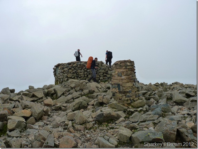
Scafell Pike summit trig point & shelter.
This rough & desolate summit is, after all, just as it should be, and none of us would really want it different. A smooth green promenade here would be wrong. This is the summit of England, and it is fittingly that it should be sturdy and rugged and strong.
Alfred Wainwright.
I find somewhere to sit & take out a sausage roll from my pack, it is around 11:30am & I’m not quite ready for lunch just yet.
Being back on Scafell Pike summit after just two months is a fantastic feeling, I sit here alone while others sit in groups with the sense of achievement etched across their faces. After five minutes or so I shoulder pack & head in search of Lingmell col via a descent by the tourist route. |
 |
| |
The tourist route.
Things are about to get more “touristy” |
 |
| |
Heading down for Lingmell col while Lingmell & indeed Kirk Fell are just about visible through the cloud.
It rains the heaviest during this descent & I was glad that when I left the summit I decided to put the jacket on, during the whole descent I am met by walkers on their way up, some looking non phased by the legwork & a downpour thrust upon them. |
 |
| |
Lingmell & Lingmell col.
Just to the right of the photo where you see a walker is the start or End of the Corridor Route, it takes in some dramatic scenery & that is one reason why I chose to descend this way.
Moments before I took this photo I pass two walkers, could of been father & son even, totally kitted out including a map, compass & GPS.
As I pass them, the elderly gent asked? can someone tell me where we are? well I guess there’s only me around so I oblige, pointing out his location on his map I tell him you are here, seeing as he was stood still when I passed him I wasn’t quite sure if he was heading up or down the mountain – which way are you heading? we need the Corridor Route, your in luck I reply, your right on it, ok great thanks he replies, if you like I’m heading along the Corridor Route, you can follow me until the path becomes more obvious.
I find it an honour to be asked for directions now-a days but a little more planning was all that was needed here.
From here, I do have slight grievance with the Corridor Route of which you will read upon the next few photos… |
 |
| |
But first, Broad Crag & Broad Crag col from the Corridor Route. |
 |
| |
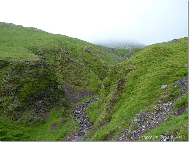
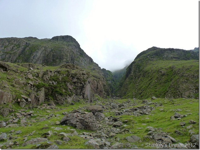
The top of Piers Gill where the Corridor Route passes over.
It is here it starts to rain again but I do not care, in my plans – it was here I decide to eat my lunch whilst perched a little above the path, so as not to cause obstruction.
I sit in awe with cupped hands staring into Piers Gill as the rain pelts my face, this dinning table is fit for a king.
Three walkers pass this section & although I get a Hi, they do not turn their heads & walk past Piers Gill as if it was not there, as if they did not see this giant crack in the earths crust.
A while later & the cloud seems to back as it creeps up the Gill, within what seems like seconds Piers Gill is gone. I shoulder my pack & head of into the rain & cloud along the footpath you see in the right of the photo.
I need to see more. |
 |
| |
Piers Gill. |
 |
| |
I throw my pack on the ground & safley wander as close as I dare to the edge, it is no use, to see deep within the walls of the Gill you need to be almost on top of them & that is just too close for comfort.
Piers Gill is one of thee most dangerous accident hot-spots in the whole of Lakeland & I am not about to become another statistic. |
 |
| |
I hang around to take a few shots, waiting for the cloud to rise in this eerie place. It was hypnotic, silent & thrilling.
I dare not follow the path any further so I turn tail & head back for the Corridor Route, as quickly as the cloud rose It came back down again. |
 |
| |
Re-joining with the Corridor Route.
I pass three Scotsman heading for Scafell, I take it we are on route to Scafell one of them asks? yes mate you are, not less than a hundred & fifty metres that way, you’ll soon see the path, its very busy I reply with a smile.
Oh thank you mate, have a good day, you too I reply.
Again, it is great to asked, I guess they knew that they were on the right path, they just needed to be told & this security does wonders for the soul, we’ve all been there correct? |
 |
| |
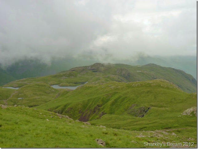
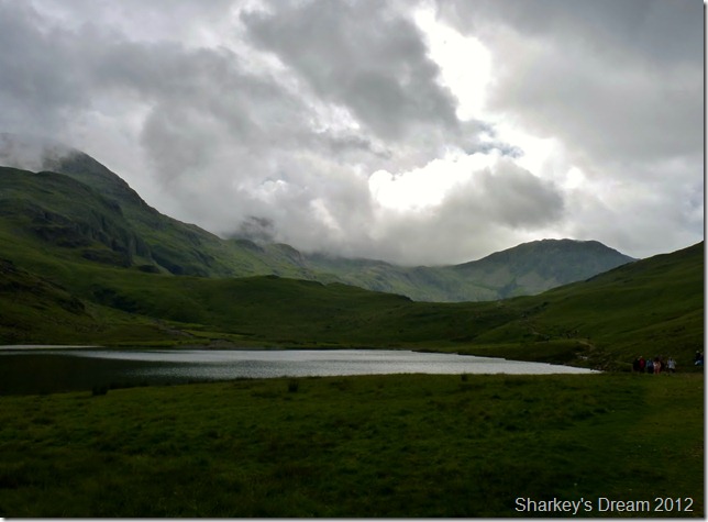
Round How & a glimpse of Styhead Tarn from the path. |
 |
| |
The scenery along the Corridor Route really is second to none, given the fact that I have just witnessed at first hand Piers Gill & still there is more to come, but that is a little further down.
I pass a couple changing into Jackets & as I approach them I hear the woman under her breath say to her husband ask him, ask him, I smile & say Hi as the husband makes himself look busy. |
 |
| |
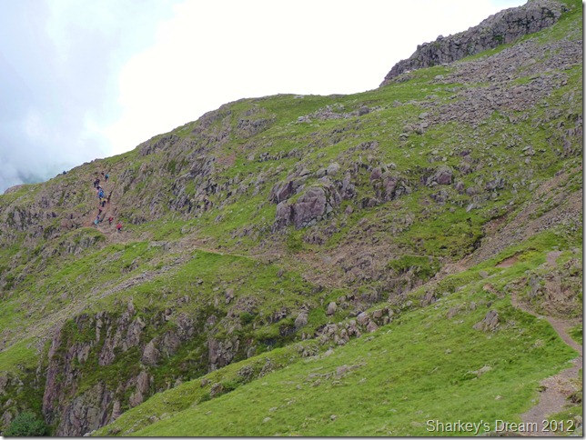
More people heading along the route.
There is a slight dip in the path just to the right of the picture, it is here I meet a fellow much the same age as me, we comment on the weather & that how he had just got round this group of walkers descending the crag you see in the left hand of the picture.
Did you manage a way around then? yeah I got fed up with waiting & picked my way down, there is a woman there & to want to put a word on it, she seems a little crag fast.
It takes me around five minutes to reach their position & they are all waiting on the woman about half way down. |
 |
| |
I arrive at the bottom of the crag & wait patiently for them all to descend safely, the woman is talked down by an elderly walker, me being there just added to her insecurities I guess, the walker who had helped the woman down thanks me for my patience, he out of the eleven walkers is the only one to do this.
Ignorance I have no time for.
Time taken from where they are stood now (where I first saw them from) & where I am now, was thirty five minutes!
Next I meet four young girls & I have to write this, very attractive, again on another section I await as one by one they negotiate a particular steep descent in turn, I, boy like hold my hands in my pockets not knowing what to say until one chirps up?
Is that Scafell? pointing way yonder at Lingmell.
Erm, no, you need to follow this path, what’s this path? er, this is the Corridor Route I explain, oh that’s what we wanted int it!!
How far to Scafell then? its about a mile & a half along this path, your cheating the girl replies, you’ve got that thingy referring to my GPS.
Ok, so I’ve just answered all your questions & you consider me to be a cheater because I have a GPS, with this the last girl is down & their attractiveness goes with it, I head up the crag hoping to not see another soul but this is not going to happen!
I trundle around the last section of the route when I pass another party of girls in around the age of thirty, know how I know this? because this is a birthday bash up onto Scafell, boob tubes flat plimsolls & shorts all complaining that “this is too hard” with their feathery scarfs I kid you not, they head up the Corridor Route.
Ok I think I’ve seen enough for one day. |
 |
| |
Lingmell & Piers Gill.
How can a sight such as this be associated with my last paragraphs! it beggars believe, but this is just one other reason why I chose this route.
The other… |
 |
| |
Skew Gill.
This is a navigable route & indeed may appear in my itinerary some day. Wainwright wrote he tried Skew Gill numerous times only to be beaten back.
He returned unbeaten with a length of rope & with the help of his then publisher made it to the top.
A climb AW referred to as “not for decent people” |
 |
| |
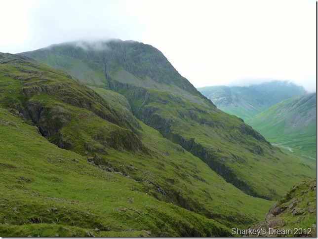
The cloud around the summit of Great Gable doesn’t lift all day & I kinda felt sorry for those on its summit. |
 |
| |
The Band.
The Band marks the south ridge of Great End & this is the first time I have been up close & in person, I have for sometime wanted to link both Great End & Great Gable in one days walking, The Band is my link – so I paid it some well deserved attention. |
 |
| |
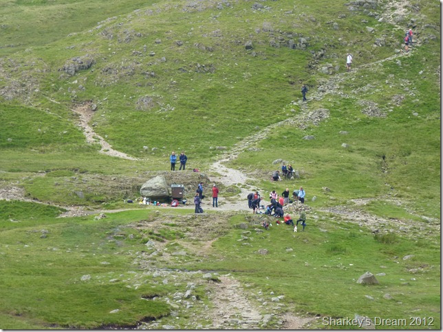
The Stretcher Box situated at the top of the Styhead Pass.
Wanting to get a photo of the Stretcher Box was going to be proved impossible, so I sulk a little & make hast of the short-cut I used to re-join Styhead Pass. |
 |
| |
Styhead Tarn & my exit route. |
 |
| |
Moody Styhead Tarn.
Cloud cover is becoming a threat as humid as it still maybe I even feel a thunderstorm in the wings, this thankfully does not happen yet the rain did come one last time, big blotches of the stuff drenching me for my exit route, this is welcome rain & there was no way I was reaching for the jacket. |
 |
| |
Passing Aaron Slack along the way.
Aaron Slack linking Green Gable on the left with Great Gable under cloud on the right. |
 |
| |
All paths lead to Seathwaite. |
 |
| |
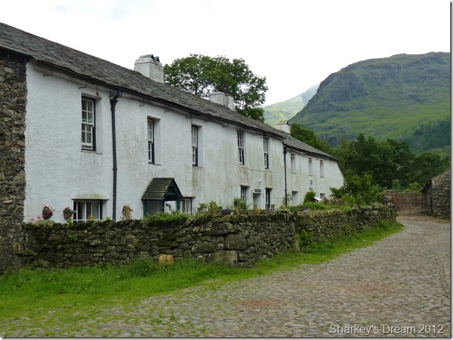
Back at Seathwaite Farm & its neat little cottages.
Have I had a great day on the fells? you bet I have! Do I have an opinion about the Corridor Route? yes I do, use it to your hearts content, do not be put of by ill-prepared Saturday afternoon peak baggers, the Corridor Route offers more in content with its spectacular views & crevices than the people you are likely to bump into.
I enjoyed the Corridor Route immensely, I like to be asked for positions because that means I have the look of content across my face, me the sad lone walker with only a GPS for company at times, out of the hundreds I saw today, it was only I & a handful of walkers who had admiration & respect for the fells, you cant walk up in a drunken skewer & decide to climb Scafell Pike can you? please tell me this is not what goes through these youngsters minds knowing that rescue is only a phone call away? please tell me this is not so because after today it seems this was all I witnessed & this makes me sad.
This route however despite my Victor Meldrew claims couldn’t come highly recommended enough, but not as I did, on a Saturday.
Choose a weekday & make your own mind up, trust in me you will not be disappointed. |
|
| |
| Back to top |
 |
|