 |
Souther Fell & the Bannerdale East Ridge |
 |
 |
8th September 2012 |
 |
|
House move, Full Stop.
Now that that is out of the way, lets get back to Lakeland because I have missed you, forgotten about you, at times you felt so far away, I paused at the fact will I ever redeem my passion for you, packs & equipment were left lifeless, unattended & vacant even as boots were packed & lost within the mayhem.
Where’s my boots? I’ve lost my boots, oh they’re there, in that box where you so caringly left them.
In between all the mayhem a walk needed to be planted & I can’t tell you why I choose to walk in the northern quarter of Lakeland, it just seemed right, tensions needed to be lifted & north Lakeland has it by the bucketful.
Souther Fell, pronounced (Souter Fell) although at a height of only 1,712 feet (522 Metres) has is moments, its a steep little bugger with paths that criss-cross through thigh high bracken & wild foxgloves. Its a tester for the walker, never mind the walker who needs that extra something to forget about cardboard box’s & countless trapes up & down staircases, & the fact that now, we now have a new crisp cupboard, but can I find it?
I figured I climbed Everest last weekend…
It was a gamble, northern or eastern Lakeland? This also conveniently coincided with the weather report as much of the rest of Lakeland would be under thick cloud rising at some points, no more that the tree tops, this I can confirm… So with my heart of hearts I chose northern Lakeland, it just beat my favourite of them all – the eastern fells by the narrowest of margins.
Why?
Please read on. |
|
| Wainwright Guidebook |
 |
| The Northern Fells |
The most direct route and the one recommended, is that via the easy ridge – the obvious key to the ascent of the mile long escarpment. Towards the end this becomes a grand scramble in an impressive situation – a bit of real mountaineering. |
 |
|
|
| |
|
Overview |
|
|
| Ascent: |
2,360Ft, 719 Metres |
| Wainwrights: |
3, Souther Fell, Bannerdale Crags & Bowscale Fellll |
| Weather: |
Overcast To Start, Warm & Muggy, Highs of Of 19°C Lows Of 16°C |
| Parking: |
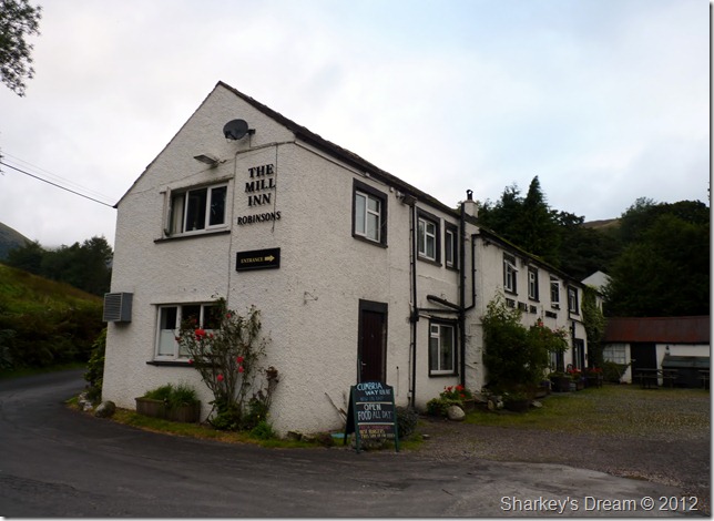
The Mill Inn, Mungrisdale Village (£2 minimum donation fee) |
| Area: |
Northern |
| Miles: |
8.4 |
| Walking With: |
On my own |
| Ordnance Survey: |
OL5 |
| Time Taken: |
5hr 10 minutes |
| Route: |
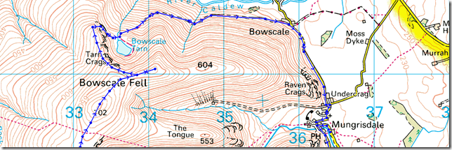
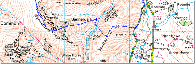
Mill Inn – Souther Fell – River Glenderamackin – Bannerdale Crags East Ridge – Bannerdale Crags – Bowscale Fell – Tarn Crags – Bowscale Tarn – Bowscale Township – Mungrisdale Village – Mill Inn |
|
| |
|
Map and Photo Gallery |
|
|
  |
| |
| |
 |
| |
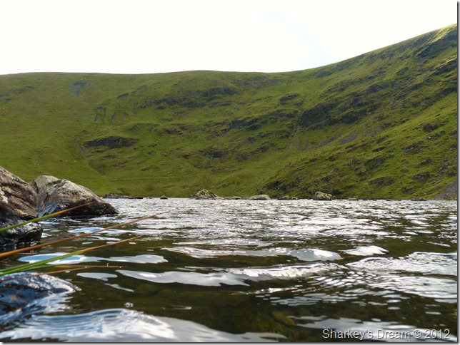
The Mill Inn, Mungrisdale 07:34 16°C
Sceptical at what I would find as I left the M6 for the A66 laid heavy on my mind, for you see I had driven the last thirty or so miles along the M6 in dense fog, the conditions didn’t hinder the butterflies hustling around in my stomach, for I was heading for Lakeland, I just wanted to get boot on fell.
Tim text me during the null & the fog lights, it was exactly 6:55 am, Weather looks great. Enjoy it buddy where ever you go. T
My reply to Tim…
Thanks mate, just passed Jct 37in dense fog, god I’ve missed this! – today isn’t about the camera
Pleasant, very pleasant it was as I spied the likes of Clough Head & the Mell Fells as I drove for my destination of Mungrisdale along the A66, the band of fog had redeemed itself for what seemed like the Howgill’s & the Shap Fells, Lakeland was clear (ish) & that most certainly brought a smile to my face.
I arrive at the outskirts at one of the most beautiful, tiniest of villages in Lakeland of Mungrisdale, the sun is over my shoulder way west & is trying hard to break the clouds, but for now that’s a fight that will continue throughout the morning. The car park is empty as I kit up, there is an air of autumn, so oddly enough at a mild 16°C I throw the jacket on & cross the river Glenderamackin via a wooden footbridge perched high above the river & make for the Mill Inn, it is here I pick my path up for Souther Fell. |
 |
| |
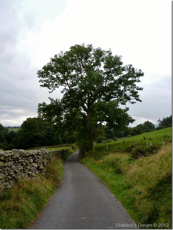
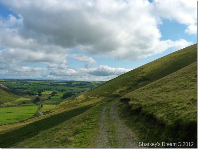
The road linking Mungrisdale with Scales.
As I leave behind Mill Inn I pick up this side road that will eventually lead me onto the fell side, following this road as I did until you pass through an iron gate is the best & easiest way to reach the summit path, although if you did choose to continue along the road, more options are available at reaching the fell side. |
 |
| |
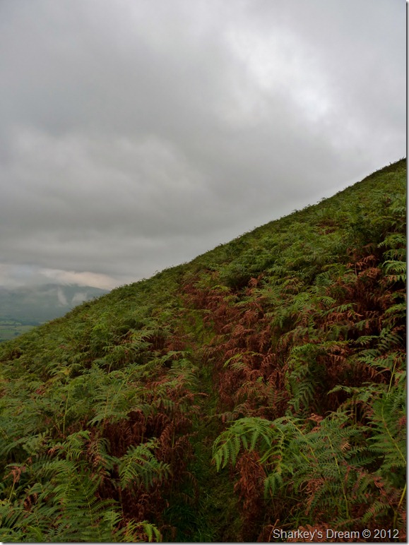
Wading through the dying bracken on the lower slopes of Souther Fell. |
 |
| |
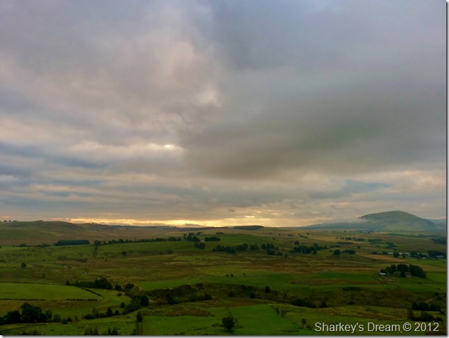
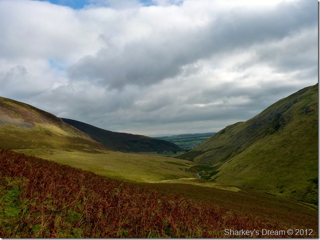
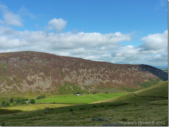
Sunrise over the north Pennines.
Its quite difficult to describe what was going on with the weather, overhead banks of dark brewing cloud cloaked the northern skies as the sunrises over the Eden valleys, you could be forgiven for mistaking this scene for the depths of winter, that is with exception of just how warm & clammy it is, off comes the jacket for the duration of the walk, by the way, that’s Great Mell Fell on the right. |
 |
| |
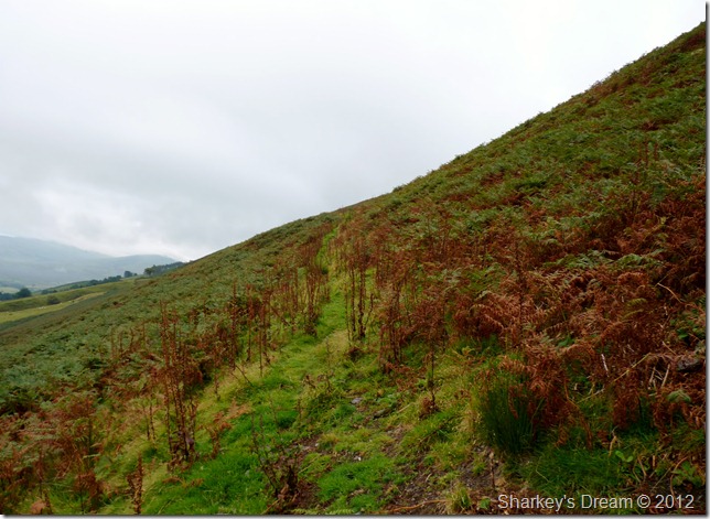
Locked in battle with the bracken.
I don’t mind the odd ascent through bracken, especially as it starts to lose its greenery & turn this wonderful red, I even have the added value, that the bracken is dry, but there is one virtue & one that spooks me while walking through here & that is; spiders webs. |
 |
| |
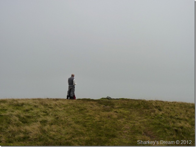
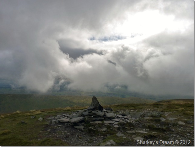
Souther Fell summit.
I arrive at the summit at the same time as this fellow walker, we get chatting & exchange our routes, I explain that I am on my way to Bannerdale Crags via a stroll along the river Glenderamackin after leaving the summit & he is on a similar course, except his next summit is Mungrisdale Common, I note that Mungrisdale Common is one of my favourite summits in Lakeland & as always, I get that odd look!
With the chit chat over we head across summit plateau in search of spooky goings on… (well I do anyway) |
 |
The ghostly procession at Souther Fell |
For a few years in the middle of the eighteenth century, this fell side on the eastern edge of Blencathra was the the site of spectacular scenes.
The first sighting was on Midsummer’s Eve in 1735. A servant of Mr Lancaster watched a procession of ‘soldiers’, some on foot, some mounted, progress across the fell. He reported his sighting, but was widely abused. Two years later, Mr Lancaster himself, with other members of his family, witnessed the sight; on this occasion, they noted that the procession was five men deep, with mounted ‘officers’ riding around to keep them in order. No one believed Mr Lancaster’s report, either.
On Midsummer’s Eve in 1745, no less than 26 people observed the ghostly procession. This time it included carriages, which could not possibly have managed the steep incline. The line of men, horses and carriages was half a mile long, and took several hours to traverse the fell. The 26 witnesses swore their account to a magistrate because this was the time of the second Jacobite rebellion and Cumberland had every reason to worry about large gatherings of men hereabouts. After this, some other people came forward and said that they had seen the same gathering two years earlier, in 1743.
These accounts were recorded in detail in The Gentleman’s Magazine in 1747 and by Harriet Martineau in 1855.
Source: Cumbrian History And Folklore.
Described by witnesses as no legend, this is the solemn truth. Attested by 26 sober & respective witnesses. The only explanation was that it could have been a mirage caused by the sun as the rebels of Prince Charles marched across headland on the west coast of Scotland.
My head tells me that this occurrence is a noble tale of years gone by, my heart however feels that there is some truth in the story, I cant help but imagine the legions on horseback each time I drive along the A66 keeping a keen eye on Souther Fell. |
 |
| |
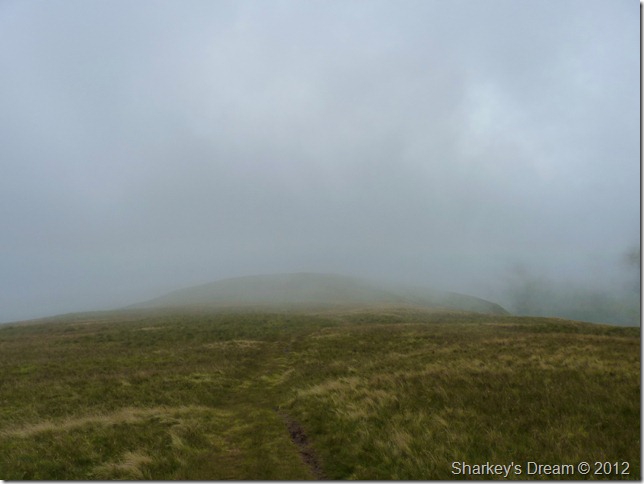
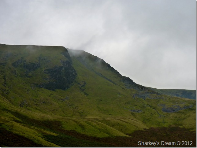
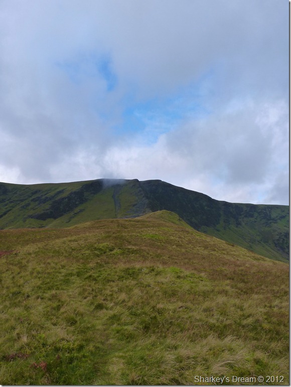
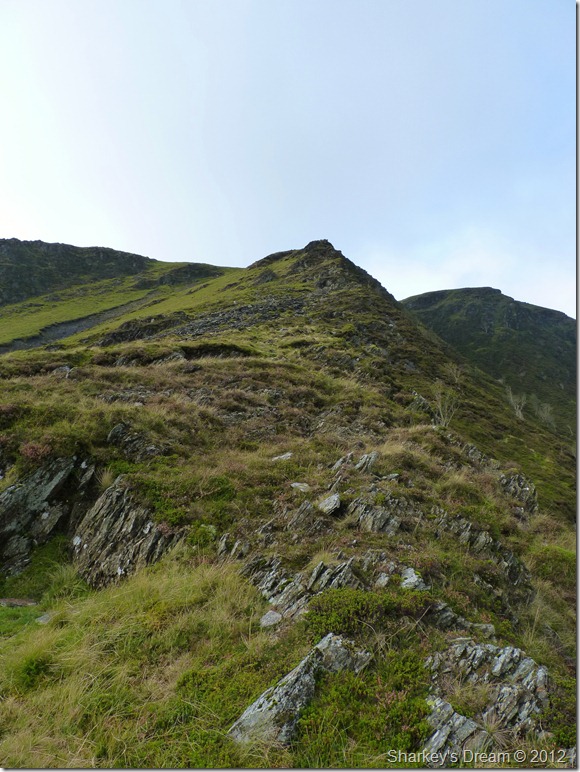
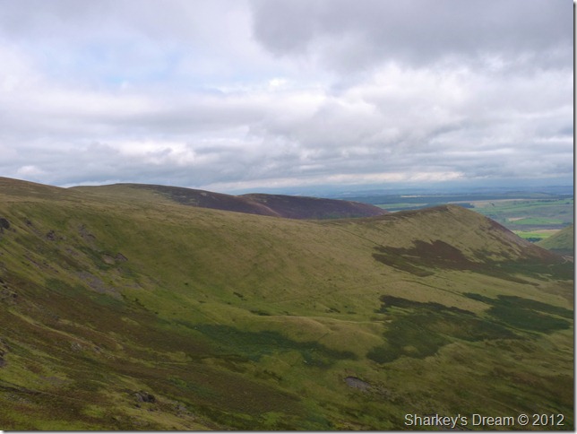
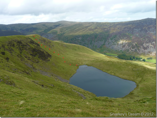
Bannerdale Crags & Bannerdale Crags east ridge.
I carry on chatting with my fellow walker spread twenty feet apart on two separate paths that run parallel along the summit top, that was until I spied Bannderdale Crags east ridge, thump!! went my heart, I have to give the east ridge a try.
I catch up with the walker who by now has travelled a distance away by now, I’m heading down I explain (after sharing my intended route not five minutes ago) I’m heading for the east ridge & I’m going to gain the summit that way, he smiles & replies, I’ve done that last winter, enjoy!
I had only one problem… |
 |
| |
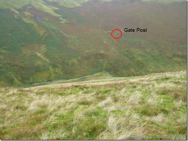
Getting down.
Its a steep affair which ever way you tackle it Paul, I spy a gatepost above the river Glenderamackin, but between me & it - is a lot of steep fell side to descend, oh well, its not going to descend itself, as I do this in a zig-zag fashion, slowly but surely I make it to the river, it is here I kick the heal of my boots so I can feel my toes again, that descent hurt!
The gatepost gave me two options, not so clearly shown are the paths that lead through the bracken, but up here I have a birds eye view & I can easily pick my route out, the easiest & quickest option would be to head towards the top of the picture & pick up the east ridge from there, but, I wanted that whole ridge feel, so I head right – towards the end of the ridge & make my ascent there.
It’s a times like these I’m happy to walk alone, decision making on the last minute is becoming one of my traits, I’m sure If I explained my intended route to a mate with me today I may end up with a walking pole up my @rse! |
 |
| |
From my descent, a close up view of Bannerdale Crags east ridge. |
 |
| |
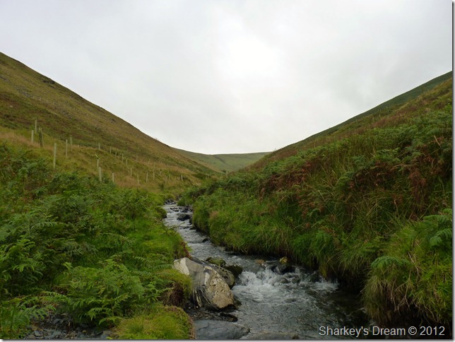
Looking towards Mousthwaite Comb from the river Glenderamackin.
The river crossing went without incident for once!
Time to get me that gatepost. |
 |
| |
But first, an unusual aspect of Souther Fell western flanks. |
 |
| |
Bannerdale Crags & Bannerdale’s Crags east ridge as I wade through more bracken to reach the gatepost.
If you pick up the ridge & follow it (R) (the light bit of fellside) well, that’s my indented route along its ridge, it stretches about 3/4 mile in the same direction. |
 |
| |
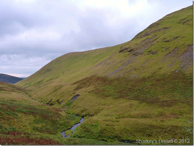
Bannerdale.
The sun is now fighting fit & this mornings dismal start seems a distant memory, glorious skies & light winds make the ascent onto the ridge that bit more enjoyable despite more bracken! |
 |
| |
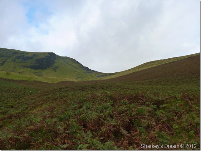
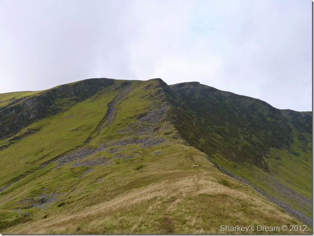
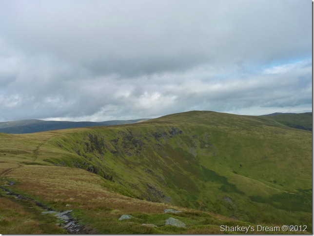
Bannerdale Crags east ridge.
This scene was the inspiration for the sudden change in plans & who could blame, Lakeland at her best. |
 |
| |
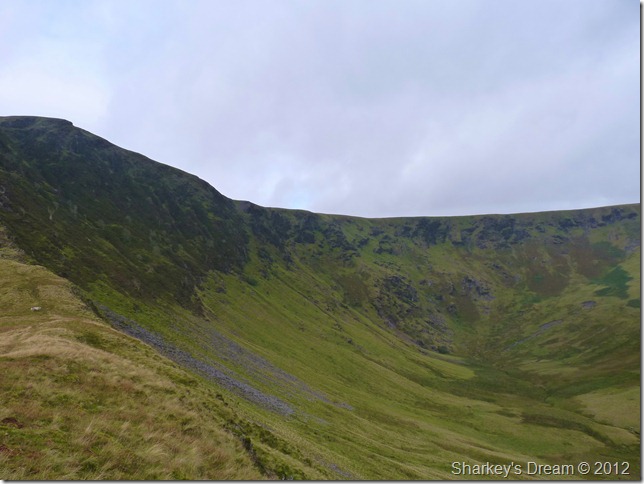
Bannerdale head & its crater like rim. |
 |
| |
Bannerdale Crags east ridge.
This is a lovely way to take in the ridge as I eye various routes up the ridge towards the summit, from Souther Fell I could clearly pick out a path that ran to the left of the ridge in zig-zags more or less in conjunction with the grassy area on the left, yet as I near the ridge I spot two or three paths snaking there way up the central spine of the ridge, until I get closer I am yet to choose which one is for me, but in my heart of hearts I’ve already made my decision. |
 |
| |
Taken from just beneath the ridge.
My decision is made & I’m going to take one of two paths that run up the spine of the ridge, a quick scurry around the mound in the foreground pictured will lead you onto two well presented paths, not to mention a third path far left that avoids the scree & is ascended via the grassy section seen upper left. |
 |
| |
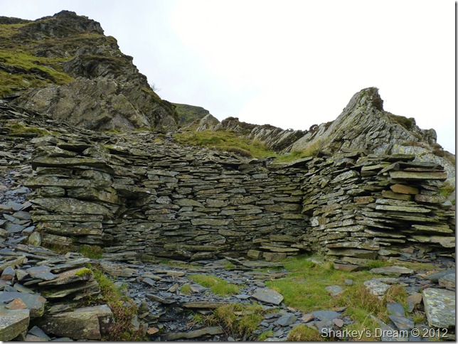
The ruined hut found just under half way up the ridge, now residing as a shelter.
I park my bum a while & take in the views while I get my breath back. |
 |
| |
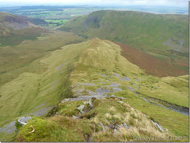
Looking down the ridge & not far from the summit, a pleasurable experience & highly recommended.
Souther Fell sits on the right & I am left amazed just how much length is in the fell, you just don’t see this from the road on the other side. |
 |
| |
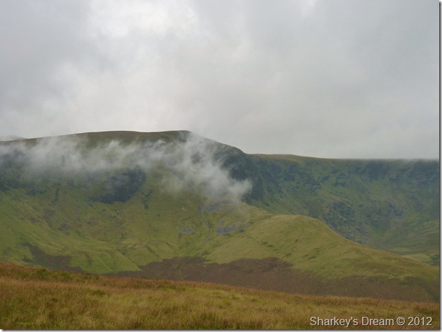
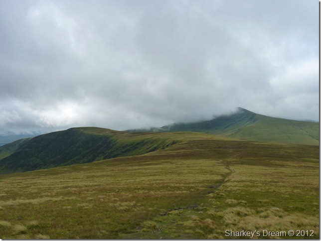
Blencathra, Sharp Edge, Atkinson Pike & Foul Crag from the highest point on Bannerdale Crags.
Leaving the highest point for the main summit cairn, indeed which I had to pass to get this shot, it’s not far away & I have to wonder why the good people at Ordnance Survey didn’t choose to mark this point as the main summit itself as it is clearly the highest point. There is a word for a felltop with two cairns marking its summit & that word is Curricks.
Don’t ask me what it means, I drew a complete blank too! |
 |
| |
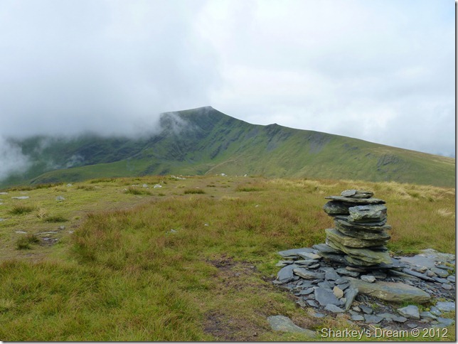
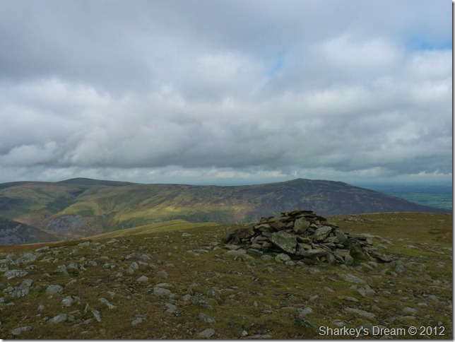
Bannerdale Crags main summit cairn with much of the eastern fells now under siege.
Time to head for Bowscale Fell & a walk I had been looking forward to for much of the morning. |
 |
| |
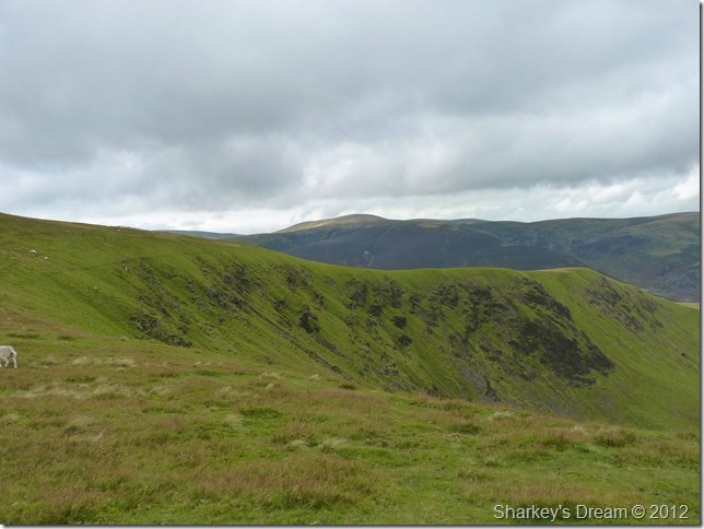
Rounding the rim of Bannerdale as I head for Bowscale Fell.
This part of the walk as mentioned really is pleasant, I don’t know what it is that strikes me about walking over secluded grassy paths linking fells together but I take great joy out of this, it kinda reminds me on a smaller scale of the section in between Great Yarlside & Harrop Pike in the far eastern fells, wait, I’ve just thought of a dozen more like this, best stop typing before I get carried away eh? |
 |
| |
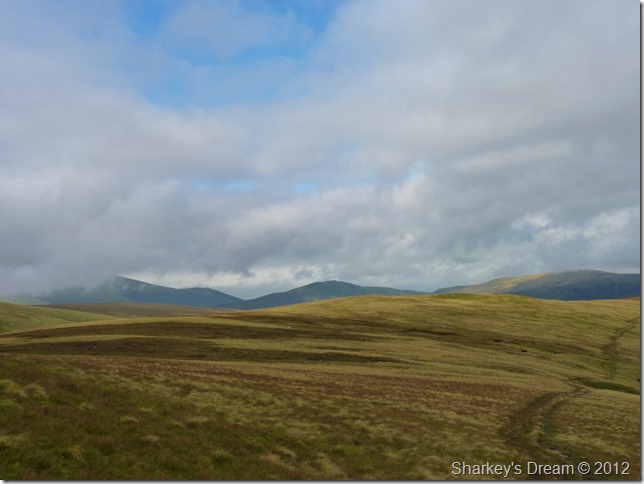
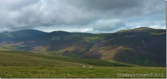
Skiddaw (L) has remained under low cloud for the duration of the walk, Bakestall however & surrounding fells are blessed in sunshine, centre we have Great Calva continuing right we have Knott. |
 |
| |
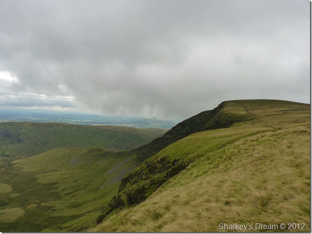
Looking back on Bannerdale Crags & my route up her east ridge, Souther Fell is there in the background. |
 |
| |
Bannerdale & The Tongue.
Bannerdale is steeped in lead mining history & half a dozen cave entrance’s can be spotted within the crags beneath me, sadly I failed to spot them & only the intrepid walker would reach them by means of the valley below as it is considered one of Lakelands boggiest spots. |
 |
| |
Looking back on Bannerdale Crags & a cloud topped Blencathra after negotiating some boggy spots myself.
Not too far from Bowscale Fell summit now. |
 |
| |
Bowscale Fell summit cairn with Carrock Fell in the distance, High Pike pointed summit can be seen far left. |
 |
| |
Tarn Crags.
As I leave Bowscale Fell behind I head in a slight easterly direction if only to take in the natural effect of the bowl of Bowscale Tarn, from here you get great views down on the tarn, the only difficulty being the path ahead that skirts the rim as I found it a little awkward underfoot & found the need to re-tie the boot laces afterwards. |
 |
| |
Bowscale Tarn & Tarn Crags.
In red shows the grassy rake used to ascend/descend to & from the tarn, to locate the rake find yourself adjacent with the tarns outflow, if the weather is poor, continue along the ridge & bear right, a more substantial & less steeper path can be found here to reach Bowscale Tarn. |
 |
| |
Great Calva, Knott & Coomb Height before I make my descent. |
 |
| |
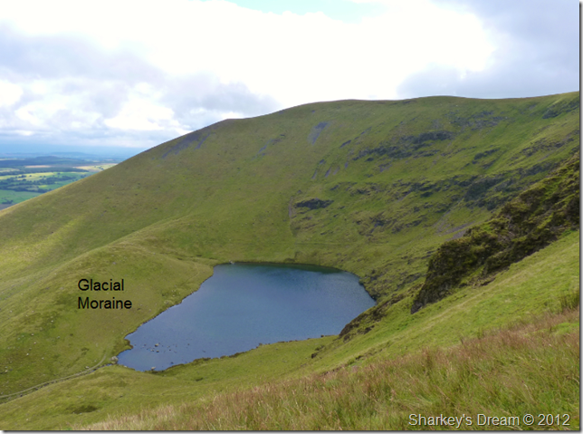
Views down to Bowscale Tarn’s glacial moraine.
The moraine is caused by the retreating ice sheet leaving debris behind & are common all over Lakeland, the moraine found here took between 13,000 – 15,000 years to form after the ice sheet retreated down the valley. |
 |
| |
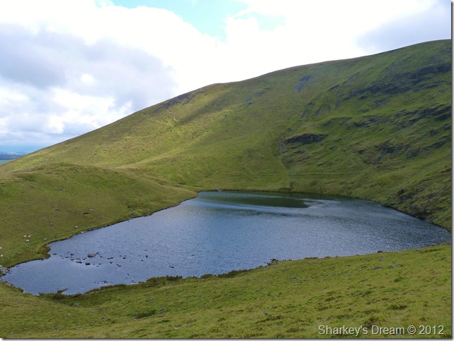
Bowscale Tarn.
All this geomorphology is making me hungry, I spot my dinner table at the outflow as I make the steep descent. |
 |
| |
In the glistening sun by the waters edge. |
 |
| |
Carrock Fell as I leave Bowscale Tarn.
Surprisingly the wind is high around the tarn, this makes my lunchtime end earlier than expected because with the wind came a slight chill. I am surprised at the lack of people here as the last time I was here during the summer months you were hard pressed to find somewhere to sit down, today it was just me, my tuna mayo & the wind. The path you see in the right of the picture is my exit route & is a really pleasant way to end the walk.
Wainwright wrote that the path to Bowscale Tarn during the sixties was not very popular & over grown in places, how the times have changed. |
 |
| |
Its just under a two mile walk pack to Mungrisdale, this is done in brilliant midday sunshine. |
 |
| |
| Longdale |
 |
| |
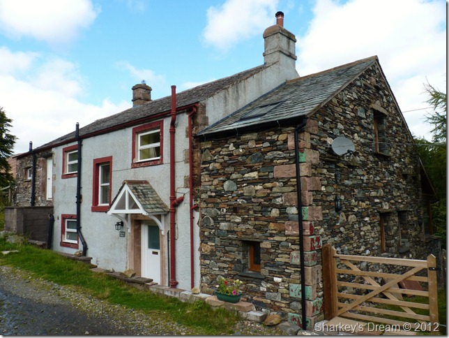
A rather tired looking Bowscale House. |
 |
| |
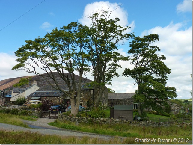
Home Farm, Bowscale.
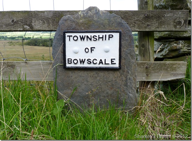
As I walk through the tiny hamlet of Bowscale I had my eye trained on an old boundary stone, I knew it existed, I just needed to find it, the boundary stone or plaque may seem pretty insignificant, yet I really had my heart set on finding this old boundry marker. |
 |
| |
The Township of Bowscale.
Found it! with what looks like a brand new lick of paint too. |
 |
| |
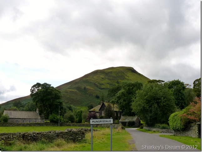
Mungrisdale sadly marks the end of my walk.
Wainwright illustrated this scene in his guidebook The Northern Fells with apologies to the GPO for not including the telegraph poles.
The walk in between Bowscale & Mungrisdale is by the means of the road you see in the picture, it is lane’d by farmyards & machinery & not to mention Bowscale Mos. Despite the odd traffic I use this road to reflect on the walk how, on the back of one of the most stressful months can one day in Lakeland bring a man back to normality in a matter of hours.
Until next time Lakeland. |
|
| |
| Back to top |
 |
|
