 |
Helvellyn & the Nethermost Pike East Ridge |
 |
 |
7th October 2012 |
 |
|
Today I find myself back in Lakeland, with a route that is going to blow the cobwebs off past & present events & maybe, just maybe, put me & my mind back on an even keel – if only for a little while. For those familiar with my blog I would like to add that mum is ever so slightly starting to show signs of progress, but lets not jump the gun I say to myself: is this merely a trip through Lakeland whilst in the eye of the storm?
I guess it is…
I came up with this route just over a week ago, it has everything I need & more: I chose this route to include Striding Edge or if needs see it – a diversion across Red Tarn to Swirral Edge weather dependable. But as you are about to read I had the weather with me which just added to a perfect traverse on one of England’s highest & most revered arêtes with a mystical visit to the elusive Hard Tarn thrown in.
I did at some point have to question ones integrity & ask myself why I should be challenging such traverses when really, ones mind is or could be a million miles away & the same answer kept coming back to me, i’ts this simple I thought, you’ll find exactly what you need when you need it.
Lakeland & her fells will simply not let you forget.
It all starts in the beautiful hamlet of Patterdale…. |
|
Wainwright Guidebook |
 |
| The Eastern Fells |
-Striding Edge:
Early writers regarded Striding Edge as a place of terror: contemporary writers, following a modern fashion, are inclined to dismiss it as of little account. In Fact, Striding Edge is the finest ridge there is Lakeland, for walkers – its traverse is always an exhilarating adventure in fair weather or foul, and it can be made easy or difficult according to choice. The danger of accident is present only when a high wind is blowing or when the rocks are iced: in a mist on a calm day, the edge is really fascinating day. |
 |
|
| |
|
Overview |
|
|
| Ascent: |
3,149 Feet, 960 Metres |
| Wainwrights: |
2, Helvellyn & Nethermost Pike |
| Weather: |
Bright & Sunny Throughout The Day Highs Of 11°C, Lows of 2°C |
| Parking: |
The White Lion Hotel, Patterdale |
| Area: |
Eastern |
| Miles: |
9 |
| Walking With: |
On my own |
| Ordnance Survey: |
OL5 |
| Time Taken: |
|
| Route: |
Patterdale – Hole-in-the-Wall – Striding Edge – Helvellyn – Nethermost Pike – Nethermost Pike East Ridge – Hard Tarn – Eagle Crag – Nethermost Beck – Grisedale Valley – Patterdale |
|
| |
|
Map and Photo Gallery |
|
|
 |
| |
| |
 |
| |
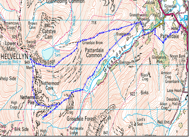
The White Lion, Patterdale 07:34 2°C
The promise of clear skies & low temperatures prevailed as I reached Patterdale which glistened under cloudless skies & a covering of early morning frost, this I thought, is going to be the perfect day for walking on the fells.
The slight churning of stomach eased as I passed the White Lion, there in waiting were two empty spaces roadside. I understand these days that parking on the White Lion car park is fine unless you cough up a few quid which I’m all fine & dandy with, but & here’s the question? with no meter, who the noras do you pay at 07:30 in the morning? Luckily I got to keep my pound coins anyway in the centre console but they were there for the taking should need be.
With the tailgate open I walk to the opposite side of the road to pull on the boots, why you may ask? I don’t know, it just seemed the right thing to do, call it getting a feel for the place eh.
There was most certainly a winter nip in the air & accordingly wimp like, I pull on my wind stopper gloves – if only to take the nip away from the hands, the wind stoppers lasted a mere twenty minutes as the morning heat broke through rather rapidly than expected.
With the tailgate closed I turn tail to head for the lower flanks of Arnison Crag, a path that is situated behind Patterdale Stores, a green car pulls up & takes the last available space & its not 08:00am yet.
Ears tingling over frosty ground, I press on. |
 |
| |
| |
 |
| |
Looking over Glenridding & the southern tip Ullswater.
Iced up puddles mark the path here & there but nothing too much to contend with, in other places water trickles down the stone path & at times can only be avoided by small diversions over frosty ground.
The guy who parked up behind me is on my tail, & I’m thinking he’s thinking I’m some kind of mentalist as I’ve already snapped around fifteen shots within less than five minutes.
It turns out we share a common interest, but more on that a little later. |
 |
| |
Birks under morning light.
My semi-frozen path takes me around the base of Birks, not before crossing Hag Beck, hidden within the trees in the foreground. |
 |
| |
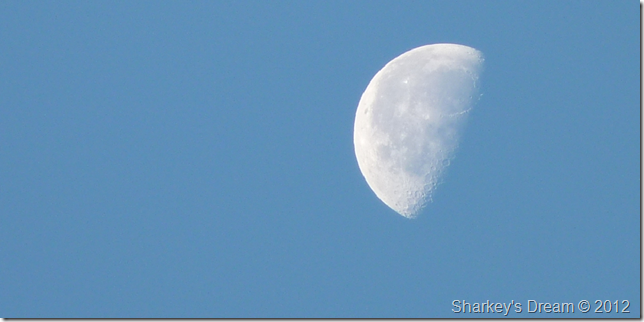
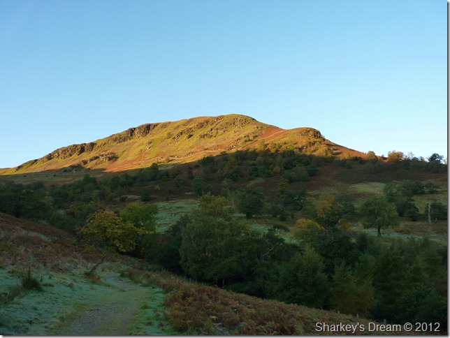
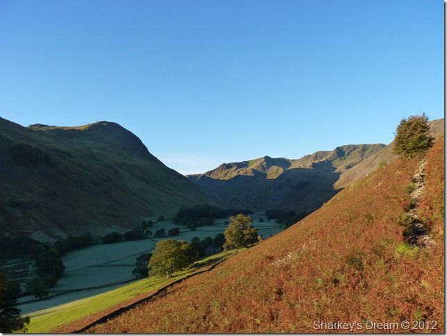
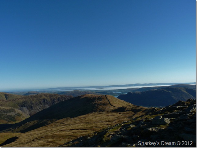
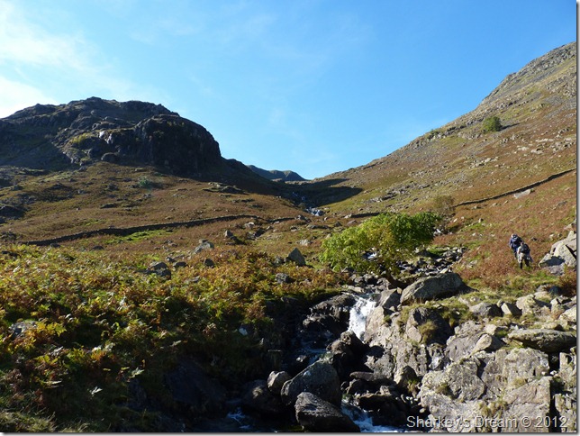
The beautiful Grisedale valley.
Its fair to say that Grisedale is up there with the best of my Lakeland valleys. Ahead lies the southern tip of the Helvellyn range incorporating (L-R) Dollywagon Pike & Nethermost Pike whilst my ascent will be gained by the fell side you see on the right leading me all the way to the Hole-in-the-Wall. |
 |
| |
It was so difficult to holster the camera, this time we have a clearer prospective of Saint Sunday Crag over on the left of the valley.
Looking back proving even more dramatic… |
 |
| |
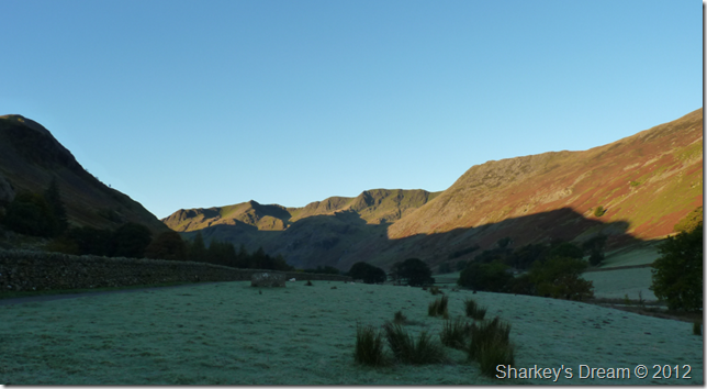
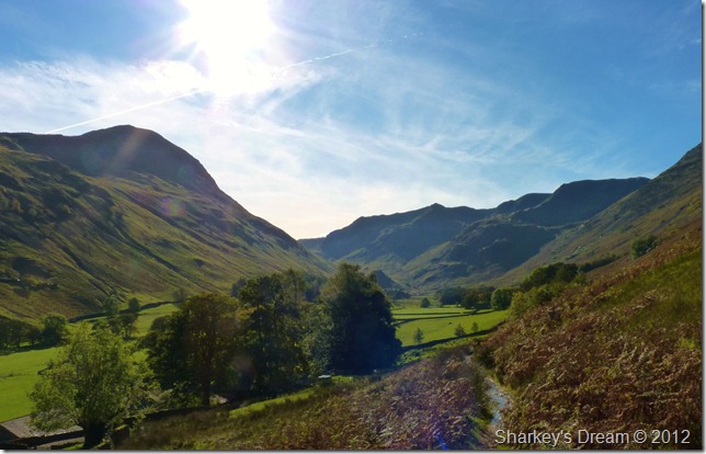
Just before the real ascent begins, I took this picture looking back on Place Fell, Boredale Hause & Angletarn Pikes. |
 |
| |
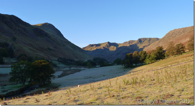
The Grisedale fells from a little higher from the path.
By now I had only been walking half an hour or so when I decided to layer down somewhat, off came the jacket, up went the sleeves & on went the Bloc Billy’s, despite the fact that it is touching zero down there, in the valley up here & out of the shade it is starting to feel like a mid summers morning.
Just before my crossing of Grisedale Beck was the point I was over-took by the walker who had parked behind me in Patterdale, whilst perched upon a boulder wiping my Bloc Billy’s & ready to shoulder pack did Martyn take over me with a solitary ‘Morning’
Little did I know but I was about to spend the next four hours ascending Helvellyn with Martyn. |
 |
| |
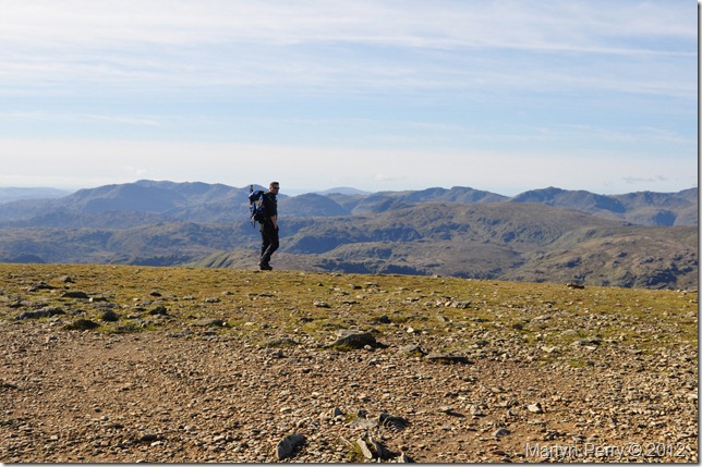
Martyn & I heading for Hole-in-the-Wall.
I soon caught Martyn back up along the path where it appeared Martyn was taking a small breather, as I passed we both commented on just how warm the ascent was, Martyn had already de-layered & more time was spent snap-shooting the valley until we set off with a bit of small talk in mind. |
 |
| |
The iconic landmark that is Hole-in-the-Wall.
Both Martyn & I had shared our designated routes & as guessed we were both heading for Striding Edge, Martyn hadn’t quite made his mind up whether to complete the Grisedale Horseshoe which would include a descent via Saint Sunday Crag, a magnificent feat on a day such as today & one I remember well from my own tour of Grisedale back in March of this year. |
 |
| |
Helevllyn (C) Swirral Edge (R) Bleaberry Crag (L) continuing on to Striding Edge.
After numerous visits to Helvellyn this is most certainly a first for me, brilliant beautiful blue skies above the eastern & indeed the whole of Lakeland, who could ask for more?
# Footnote
The one thing I took note of was the shade covering Striding Edge, with temperatures not rising much above 3°C Both Martyn & I had agreed to go ‘over’ Striding Edge as opposed to the path that gives you the option to take a less daring approach (this had always been my route) I just hope I had the bottle to traverse Striding Edge by the more gutsier route.
It turns out I did have the guts & the path turned out to be dry & free from any Ice. |
 |
| |
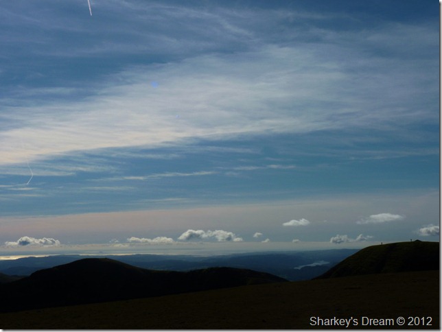
Looking back over Birkhouse Moor on a cloud inversion that is blanketing the whole of the Eden Valley & much of the Pennines.
The small ascent to reach Striding Edge over Bleaberry Crag was possibly the coldest I’d felt over the last hour or so, the difference between in, & out of the shade was quite noticeable. |
 |
| |
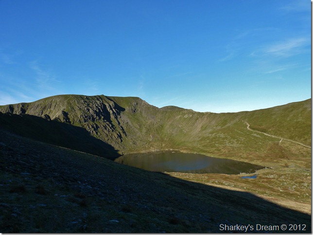
Helvellyn, Swirral Edge & Red Tarn from the shaded Bleaberry Crag. |
 |
| |
Striding Edge & the summit of Helvellyn. |
 |
| |
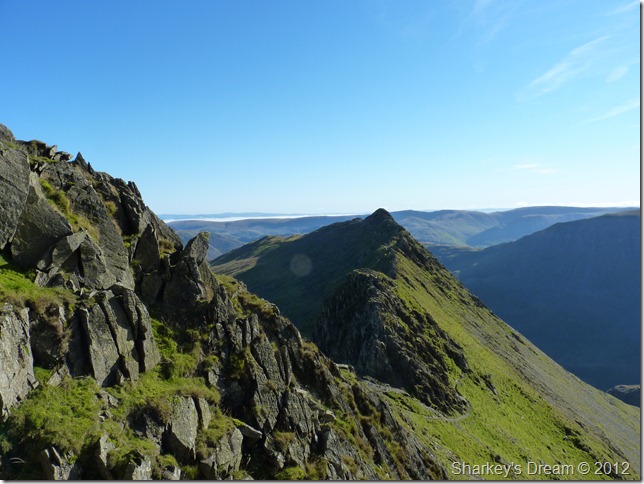
Striding Edge from Low Spying How, Red Tarn can be seen on the right whilst over to the left, my exit route… |
 |
| |
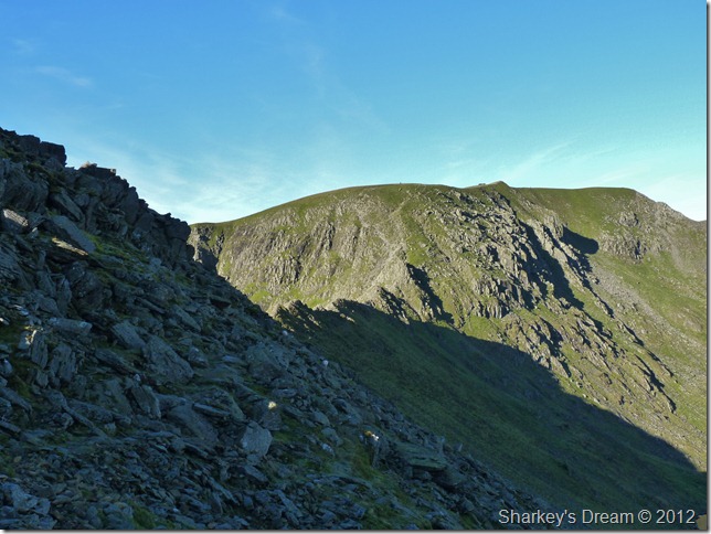
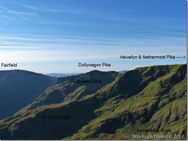
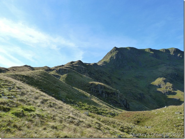
Nethermost Pike east ridge. |
 |
| |
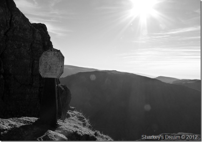
The Dixon Monument, often missed whilst traversing Striding Edge & this including myself, it read…
IN MEMORY OF ROBERT.DIXON OF ROOKINGS PATTERDALE WHO WAS KILLED ON THIS PLACE ON THE 27 DAY OF NOV 1858 WHEN FOLLOWING THE PATTERDALE FOXHOUNDS.
Please excuse the obscure black & white shot as the sun was high & strong proving neon impossible to photograph anything looking southwards, a fight that was to last the rest of the day, but hey, I’m not complaining. |
 |
| |
Martyn taking on Striding Edge. |
 |
| |
‘Over the top’ |
 |
| |
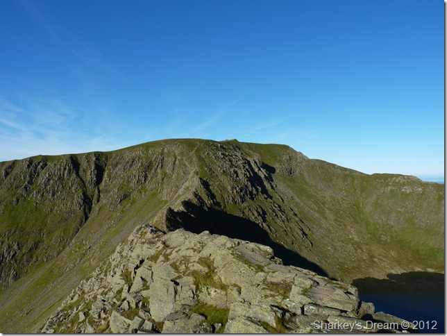
Striding Edge from High Spying How. |
 |
| |
Catstye Cam & Red Tarn (or should that be blue tarn) |
 |
| |
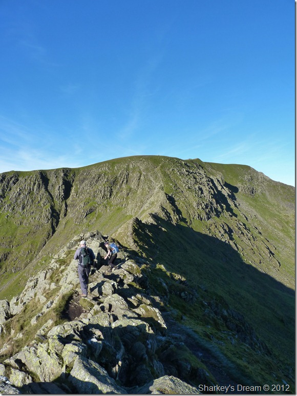
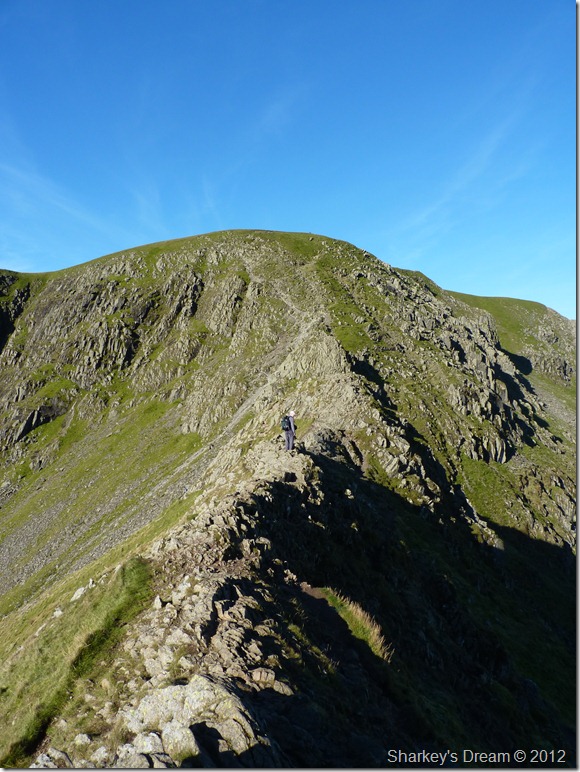
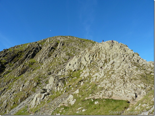
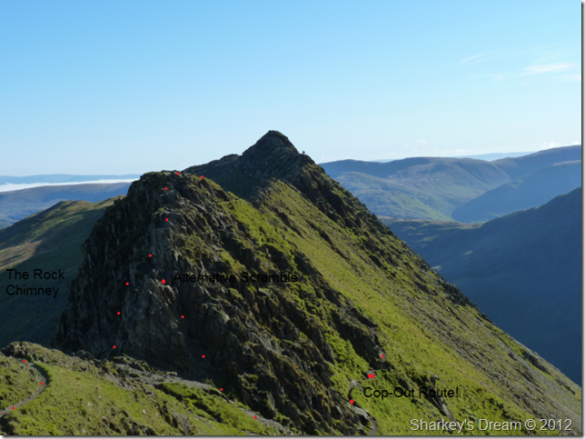
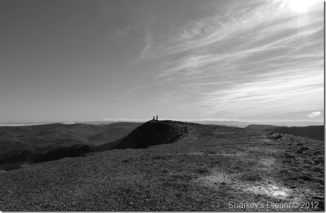
Nearing the end of Striding Edge & summit bound when I opt out of the last section which includes the ‘Rock Chimney’ & this rocky buttress seen right, the buttress is easily negotiated but the descent is otherwise, using one of two meanings, a steep scramble which by now is filling up with fellow climbers & a queue forming, or The Chimney, a steep descent matched by daring footings, the last being not a foot square with views if nothing else but daringly steep crags & Red Tarn.
Spawned by my first ever experience over Striding Edge back in 2008 – when unwittingly I used the the Rock Chimney as by means of descending the ridge, It very nearly petrified me as a young walker & from that day on I have always used the ‘scramble path’ to the left of the buttress.
# Footnote
With my experience on the fells – now I dare say the Rock Chimney would, & could, easily be negotiated but those memories hold fast just like I guess the same memories keep me from watching the first release of Nightmare on Elm Street when as a young boy I’d often find myself needing something from the fridge or yet another toilet break! |
 |
| |
Looking back along Striding Edge illustrating my route (Cop-Out!) The Rock Chimney & the alternative scramble, incidentally Martyn goes for the Rock Chimney noting to me the first words out of Martyn’s’ mouth were “I now know what you mean about that square foot of grass you have to hit”
I still get a wobble just thinking about it! we press on for the summit. |
 |
| |
Looking back on ground undertaken (cheesy grin & thumping heart not included) |
 |
| |
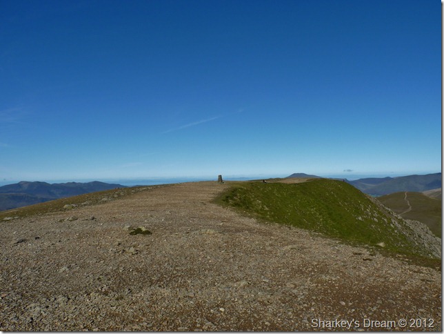
The ever impressive summit plateau of Helvellyn.
We reach the scramble the last yards together yet whilst making our way to the summit trig point Martyn gets chatting to more walkers, for now, under blue cloudless skies its just me & the summit. |
 |
| |
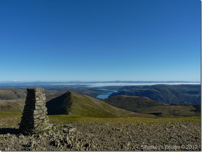
Catstye Cam, Ullswater & a retreating cloud inversion from Helvellyn’s summit trig point. |
 |
| |
Martyn chats to a fellow walker at the summit cairn.
Time to have a wee wander about the summit. |
 |
| |
Looking south west over the central ridge of High Seat with lots of summits to spot including the unmistakable Great Gable centre left. |
 |
| |
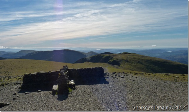
Nethermost Pike, Dollywagon Pike, Fairfield & Great Rigg from the summit cross-shelter.
It was here I take a small rest & maybe draw some attention to the niggling blister that’s starting to form on my left heel, so without haste & before the skin breaks I take out two plasters from my pack & apply them to the red heel.
This is mostly my own doing owing to the fact that I am wearing fully seasoned winter socks as apposed to a mid-weight sock, thus causing more sweat & friction In an already overheating boot.
Plasters applied & sandwich in hand, we press on for Nethermost Pike. |
 |
| |
Striding Edge forming that Cirques look. |
 |
| |
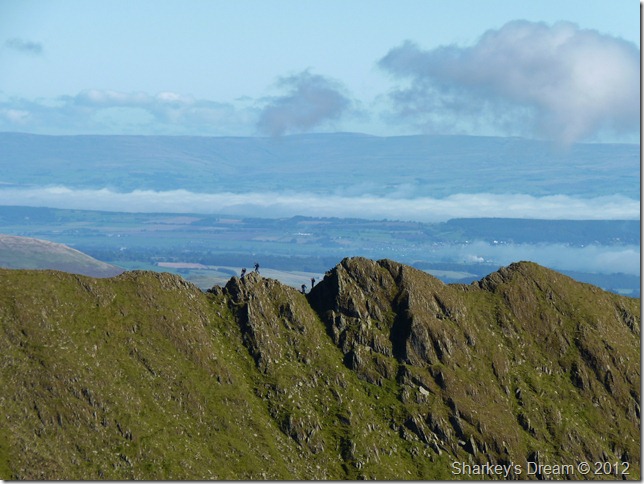
A close up of walkers traversing Striding Edge as we pass the top of Lad Crag. |
 |
| |
Morecambe Bay seen over the top of Dollywagon Pike after leaving Nethermost Pike summit. |
 |
| |
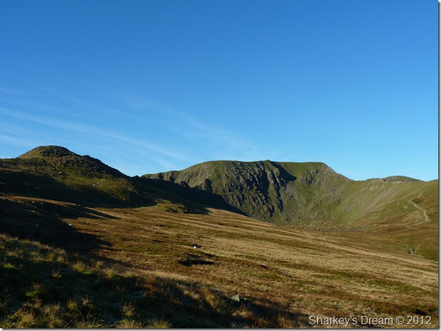
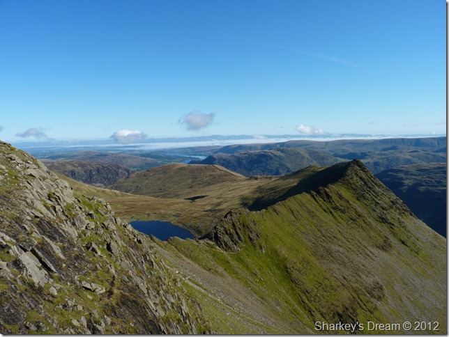
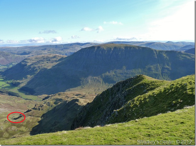
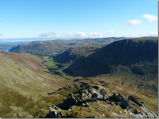
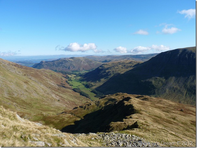
A daunting view of Nethermost Pike’s east ridge dominated by Grisedale & Saint Sunday Crag.
My objective encircled is a waterfall at the top of Nethermost Beck/Cove but that is a long way down yet.
# Footnote
Crossing Nethermost Beck at the top of the waterfall is imperative to a safe descent back down to the Grisedale valley. |
 |
| |
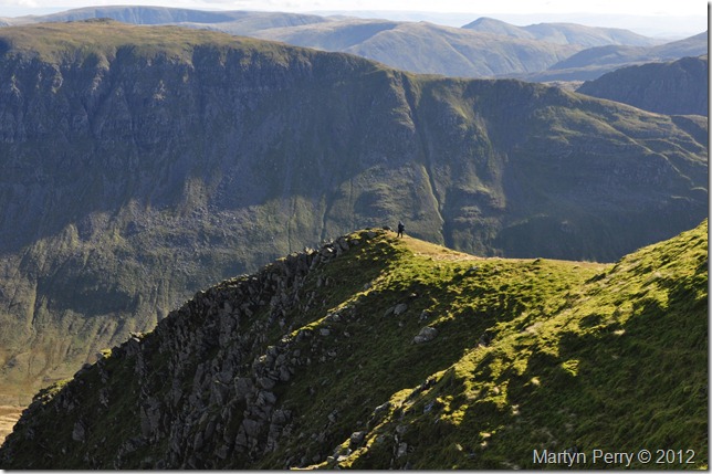
Martyn took this photo of me just before I headed down the east ridge. |
 |
| |
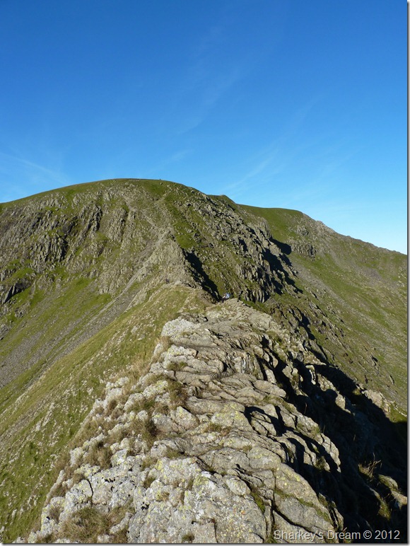
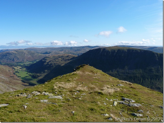
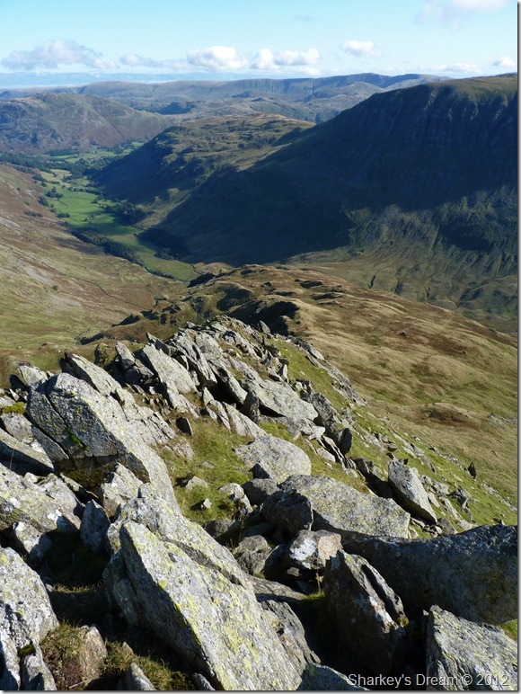
The top of Nethermost Pike east ridge.
It’s scenes such as this that displays the fact that ‘something good is about to happen’
It is also at the top of the east ridge I bid farewell to Martyn, we chat a while & swap email addresses, Martyn only has 77 Wainwrights to complete & after listening to his previous routes I have no doubt in my mind he will have completed them all by this time next year or possibly sooner.
With a hearty handshake & promises of more photographs of me descending the ridge, Martyn heads off for Dollywagon Pike & his descent route via The Tongue |
 |
| |
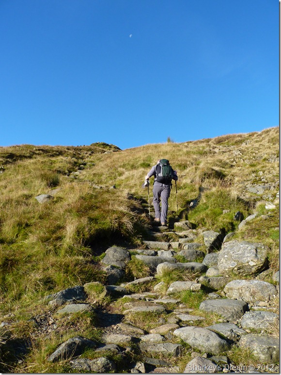
The east ridge looking like I’m about to drop ‘off something’ instead of walk down it & that’s because with the east ridge you do just that. The top of the east ridge is probably the most gruelling & requires absolute concentration in that; the path is barely existent & requires the walker to put ones body weight back into the ridge.
I am again once reminded that Striding Edge wasn’t the only ridge in my itinerary that requires skill & a touch of nerves with fierce drops to both sides of me. |
 |
| |
I’ll take a little exposure please Bob! |
 |
| |
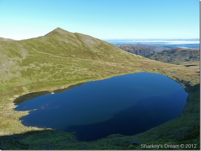
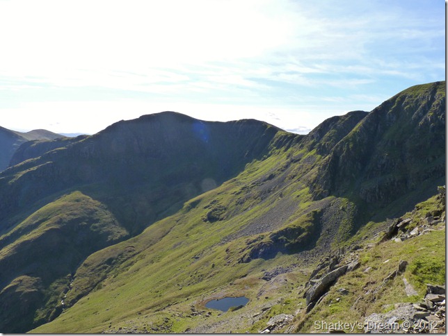
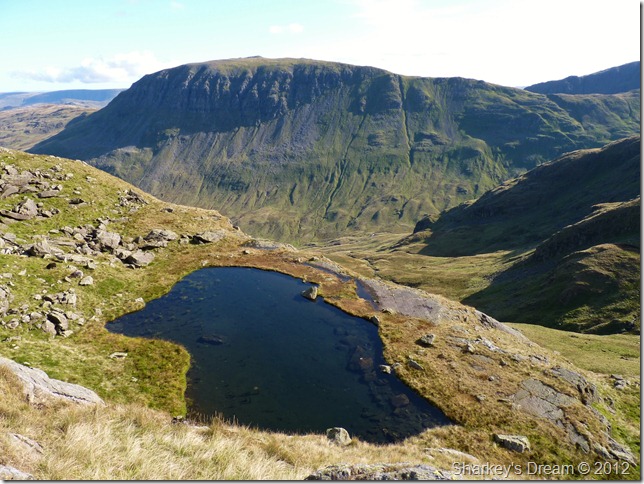
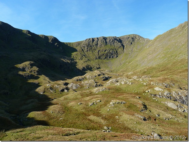
Dollywagon Pike & Ruthwaite Cove & Hard Tarn from my descent.
I’m not too sure If Hard Tarn is named so because it is ‘hard to get to’ or indeed ‘hard to see’ It seems only the intrepid explorer may venture on Hard Tarn from time to time, as it is featured as Lakelands least visited Tarn. |
 |
| |
Nearing the end of the east ridge.
During my descent I meet two Geordies on their way up the east ridge, they patiently wait for me to cover the last few metres whilst also taking a quick breather.
It’s just past midday so I pass on a thanks for waiting, they smile & say no-bother in a strong Newcastle ascent, you been here before one of them asked? first time for me I reply, see the waterfall? keep to the left (this I had already looked up on) Ok guys thanks for that, I’ll keep to the left.
Had I not already have planned my descent down the east ridge over a week ago – this kind of information is invaluable, even if you know your route as I did, it always pays to listen to friendly advice.
It’s time to head into Ruthwaite Cove & pay Hard Tarn a visit, I can hear the two Geordies now, ‘where’s he going’ |
 |
| |
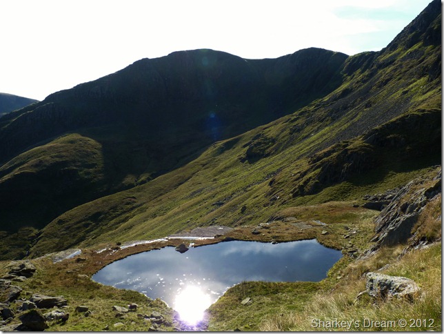
Dollywagon Pike in front of the elusive Hard Tarn.
Hard Tarn – hard to get to; I’ll go with that! To reach the Tarn requires a scramble over loose volcanic boulder & was tricky underfoot to state the obvious, take a look at the boulder field in the previous photo & its easy to see where I went wrong, if you do find yourself on the east ridge in need of a visit to Hard Tarn do as I didn’t, & only head into the Cove after you’ve passed the bottom of the boulders, other-wise prepare for ten minutes of ankle breakers.
I guess its not called Hard Tarn for nothing, the return to the ridge was done ‘under’ the boulder field & was mostly pleasant, but enough about that, its lunch time. |
 |
| |
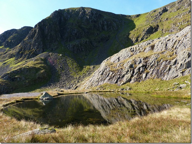
With a view…
Its pretty difficult to describe just how accomplished I feel being at Hard Tarn, I guess I can only compare it to other Lakeland feats such as Striding Edge or Lord’s Rake, to me it really is that special & at last, I am at its shelf like shoreline. |
 |
| |
Reflections on Hard Tarn.
It was time to head back up to my pack somewhere around sixty feet above my head where I left it, inside, the rest of my lunch which was washed down with gulps of Robinsons orange juice from my Camelbak.
I don’t want to leave but there’s still quite a lot of descent to be had. |
 |
| |
Looking back up on Nethermost Pike east ridge incorporating Nethermost Cove on the right. |
 |
| |
Almost on top of Nethermost Beck waterfall when I took this photo looking back at the ridge that forms the Nethermost Cove Cirques. |
 |
| |
Nethermost Cove & the summit of Helvellyn. |
 |
| |
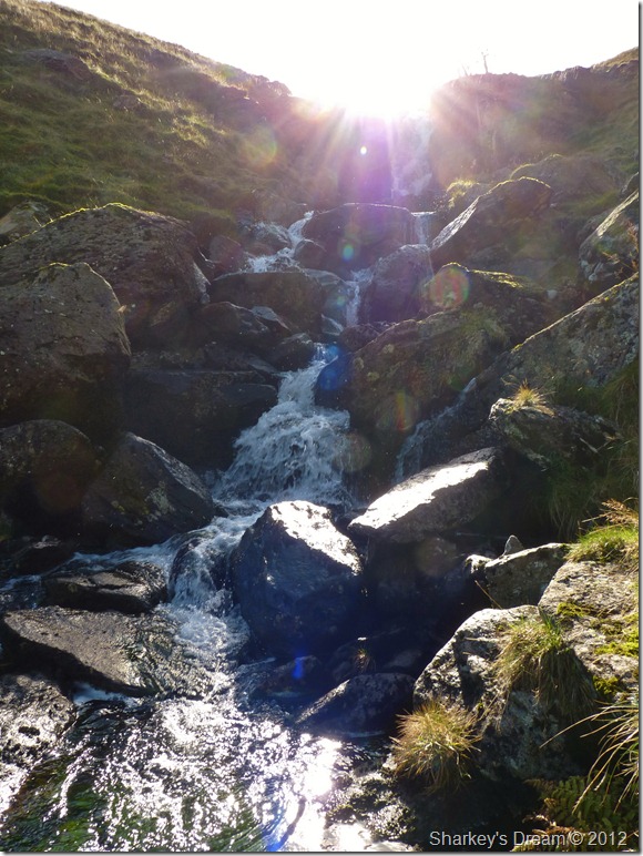
The much spoke about Waterfall was beaming with sunlight. |
 |
| |
Never venturing too far away from Nethermost Beck.
With the waterfall now behind me & Nethermost Beck a constant on my right, it was time to pick my way back down to the valley floor. It is what I would call off piste as a fell walker as there is no path to follow, so I left it to the lay of the land & my own imagination.
You will undoubtedly have very sore joints & feel the need to kick your toes back into your boots along this descent, matched with dense bracken in places that just doesn’t want you to pass through it almost entangling you into a head over heels moment, all the while the valley of Grisedale is just a couple of hundred metres below your escape route.
Careful footings over bracken with hidden rock & deep pot holes line Nethermost Beck so it is best to keep a watchful eye upon your route, best picking it at a sixty yard glance.
Grisedale never looked so good when you reach her valley floor. |
 |
| |
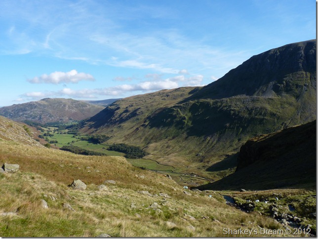
Eagle Crag & Nethermost Beck from the wooden footbridge that crosses Grisedale Beck.
Eagle Crag (L) forms the far eastern tip of the Nethermost east ridge, not heading for the waterfall would leave you at the top of Eagle Crag pondering an extremely steep & loose descent.
Its just over a mile & half back to the bottom of the Grisedale valley, this a path I hadn’t used & I was very surprised of the views it had of Grisedale Hause almost to the end, the path on the opposite side of the valley sadly does not offer this so on reflection I was quite pleased with the end result at this one & half mile trek under warm autumn sun. |
 |
| |
Grisdale under brilliant sun.
My walk is not quite over as Patterdale & my car is still a good half mile away. I pause a wee while looking back upon fells when years ago I dared not venture especially with the likes of the east ridge, now in my comfort zone I can add the east ridge of Nethermost Pike to my walking obituary & claim Hard Tarn in there too.
I pass a couple sat down enjoying the afternoon sun at a gate post, been to the top the guy ask? Hellvellyn? I reply, yeah how long did that take you? three hours to the summit via Striding Edge I say, ohh, well done he says.
Striding Edge nor Helvellyn was my objective for today as I bid a good day to the couple, it was the the tarn they named after how inaccessible it was, Hard Tarn.
Back to Wigan & back to reality, today, as always, did wonders for the soul. |
|
| |
| Back to top |
 |
|
