|
The Coniston Fells Part II |
 |
 |
19th October 2012 |
 |
|
It was while sitting at my desk last weekend did I receive a text message from Tim, Paul’ can you book next Friday off work & come do a walk with me? T
I haven’t walked with Tim since way back in May when we did the twenty four miler that was; The High Street Roman Road – due to family commitments & a heavy workload Tim decided to lay of the fells at least until he could kinda juggle his lifestyle into shape, there wasn’t a day when texts didn’t fly in-between one another, whether it be about the fells or more important, my mothers condition while she still remains in hospital.
I can’t thank Tim enough for some of those text whilst in my darkest of hours.
Tim threw a couple of plan A’s & B routes my way & asked me what I thought, one of which, as you can guess was this route; the other & an equally high task of Wainwrights was further north on the Uldale Fells (Back O’ Skiddaw)
It was to early for a weather report but given the conditions underfoot both routes worked around good/bad weather, providing given the rainfall/dank low cloud we are all experiencing – a map, compass & GPS should be duly packed.
During the week after I had penned both routes into something manageable, the looks of an optimistic day on the fells sank deeper & deeper, I text Tim the Wednesday evening, Tim, I think we should go for the Coniston fells, lets baton down the hatches & take it from there…
Tim replied, Agreed Paul.
This walk is the result of that late evening text, it was Friday 19th October when Lakeland was giving nothing away, take away what you must, dig deep & concentrate on not losing your path, it certainly was one of those soul searching this is why I do what I do kind of days. |
|
| Wainwright Guidebook |
 |
| The Southern Fells |
- The Old Man of Coniston:
The highest (by a few feet) and best known of the Coniston Fells is the Old Man, a benevolent giant revered by generations of walkers and of particular esteem in the eyes of the inhabitants of the village he shelters, for he has contributed much to their prosperity. The Old Man is no Matterhorn, nor is Coniston a Zermatt, but an affinity is there in the same close links between mountain and village, and the history of one is the history other other. Coniston without its Old Man is unthinkable. |
 |
|
|
| |
|
Overview |
|
|
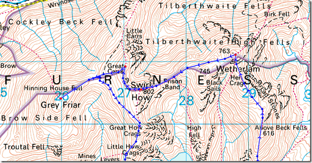
| Ascent: |
3,612 Feet, 1,101 Metres |
| Wainwrights: |
6, Wetherlam – Swirl How – Great Carrs – Grey Friar – Brim Fell – Coniston Old Man |
| Weather: |
Low Cloud Base & Some Drizzle, Not Lifting Until The Latter End Of The Walk, Highs Of 13°C Lows Of 8°C |
| Parking: |
Road Side Parking, Silver Bank Cottage, Coniston – SD30067 97839 |
| Area: |
Southern |
| Miles: |
8.1 |
| Walking With: |
Tim Oxburgh |
| Ordnance Survey: |
OL6 |
| Time Taken: |
6 Hours 25 Minutes |
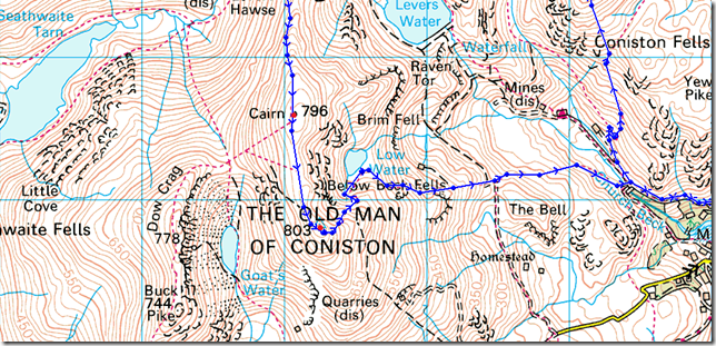
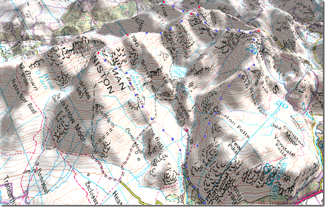
| Route: |
Silver Bank – Miners Bridge – Lad Stones – Red Gill Head Moss – Wetherlam – Prison Band – Swirl How – Great Carrs – Grey Friar – Fairfield Col – Swirl Band – Levers Hawse – Brim Fell – Coniston Old Man – Low Water – Boulder Valley – Miners Bridge – Silver Bank |
|
| |
|
Map and Photo Gallery |
|
|
 |
| |
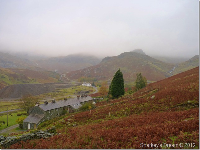
Silver Bank, Coniston 09:05am 8°C
Lakeland as you may or may not be aware is under a blanket of yellows, reds & oranges & is truly a wonderful sight even if where not to leave your car, your heart will explode with just how beautiful Autumn is in Lakeland right now, this providing the stunning backdrop as we drove through the south of the county as we made for Coniston.
We drove through many showers albeit light & drizzly along the lanes, nothing over 300ft got a mention, the autumn leaves provided the rest.
We kitted up besides Church Beck in low light, I wasn’t about to take chances on taking a soaking & doing much of the walk in wet gear, this morning as I was in full waterproof kit, topped off with my trusty gaiters & just as of last week, I couldn’t move until my clothing had loosened itself from my over excessive tuck-in-ness.
Tim had the fantastic idea (seasonal only) of wearing shorts under his waterproof trousers, that’s a belting idea I thought.
Tim walks away & takes in the dew of the morning air as I prepare to down the tailgate, with the waist strap fastened I walk away from my car, D’oh!! I’ve forgot to lock it, I unclip my pack, for the car keys are packed away inside my lid pocket, we all know how that feels I guess.
I press on & catch Tim up who by now has rounded a corner & is out of sight. |
 |
| |
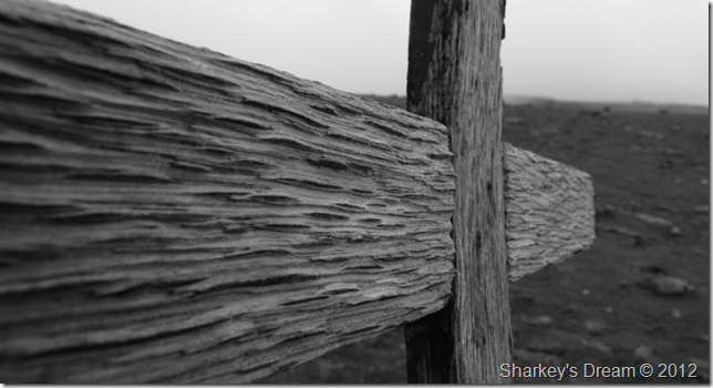
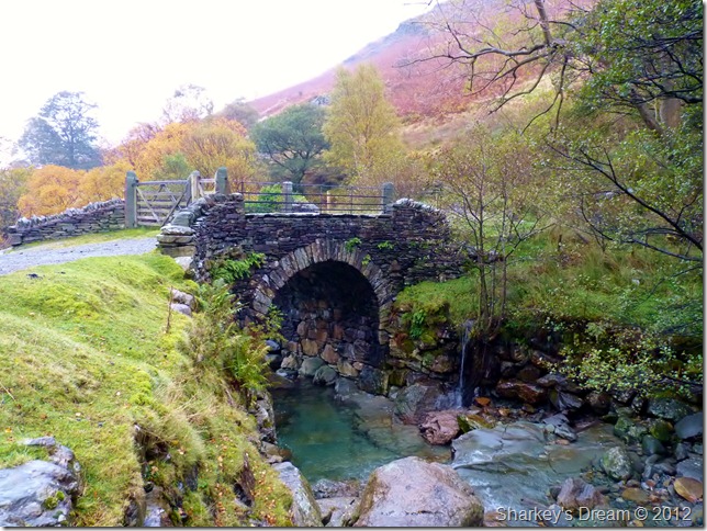
Passing Miners Bridge & Church Beck along the way, Miners Bridge will be crossed during our return, but that’s some time away yet.
There’s an air of drizzle before we hit the fellside, couple this with just how muggy it feels, well I guess you get my drift… |
 |
| |
Coppermines Valley & the old Coppermines Cottages (now holiday accommodation) from the start of the climb. |
 |
| |
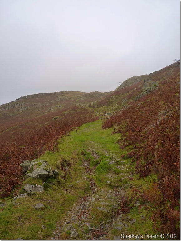
On route to the Stone Lads Ridge.
Two paths line the start of the Lad Stone fellside, this path is Lad Stone/Wetherlam bound & the one below us to our left is Red Dell Valley bound, both paths start at the same point yet after only a short while this path takes the high level route by means of ‘doubling back’ a wee while.
# Footnote
In wearing all of my waterproof gear it was not long after the ascent started did I realise just how muggy it was, with two layers around my legs & two around my body it wasn’t long before I started to overheat considerably, so much so causing nausea & a severe headache for much of this ascent, needless to say it was done in silence until I found my happy medium which was still quite a way off. |
 |
| |
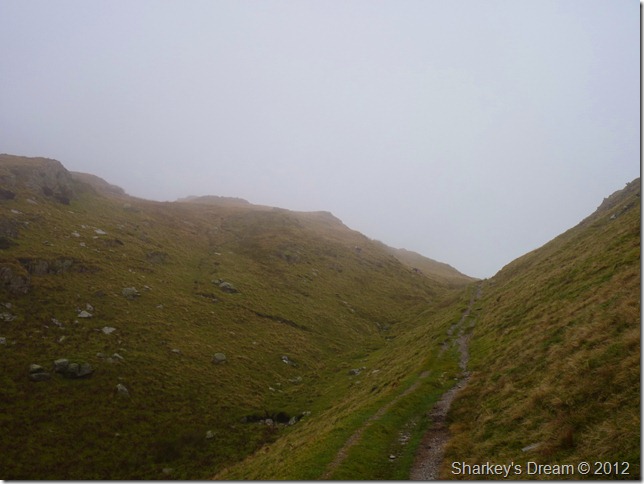
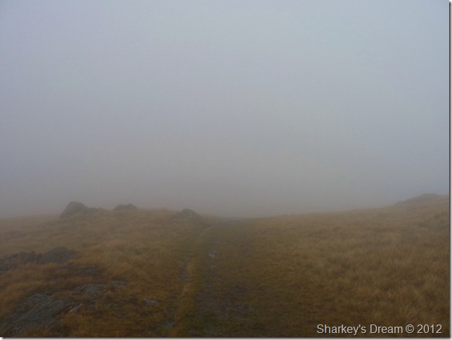
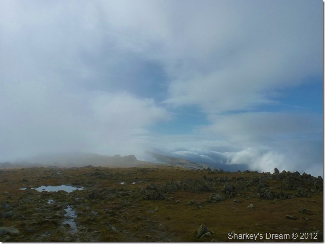
Ahead; Hole Rake, however, our route takes over to the left of the fellside & up the grassy path.
It was here we said goodbye to anything that resembled as a view. |
 |
| |
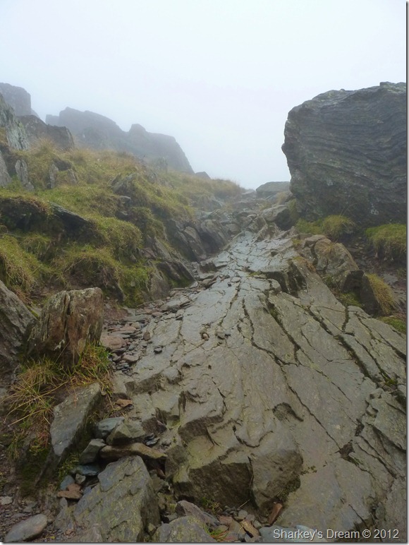
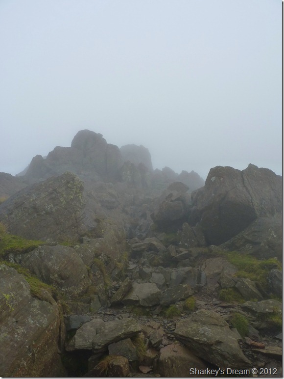
Crossing Lad Stones.
The path at times needed concentration as it disappeared into bog, only to remerge at the other side, our trouble was we didn’t get to see the other side until we were ‘upon’ it, follow your nose & if your legs are hurting then your more than likely, heading in the right direction.
To reach this grassy plateau, which indeed came as a welcome respite from the hauling up through the wet grassy fellside required some determination as the ridge took on a steep effect, in keeping with our position I knew that this plateau was in sight which gave me something to look forward & to aim for, this works on all levels when walking in conditions such as this, by the time we reached Lad Stones I could concentrate on relieving my headache knowing Wetherlam is ‘just around the corner’
With good sprits we press on for the summit. |
 |
| |
| |
 |
| |
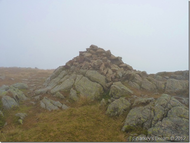
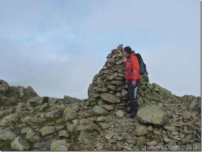
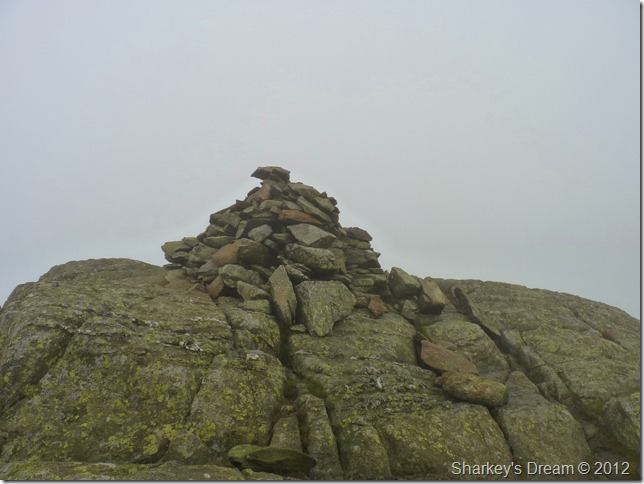
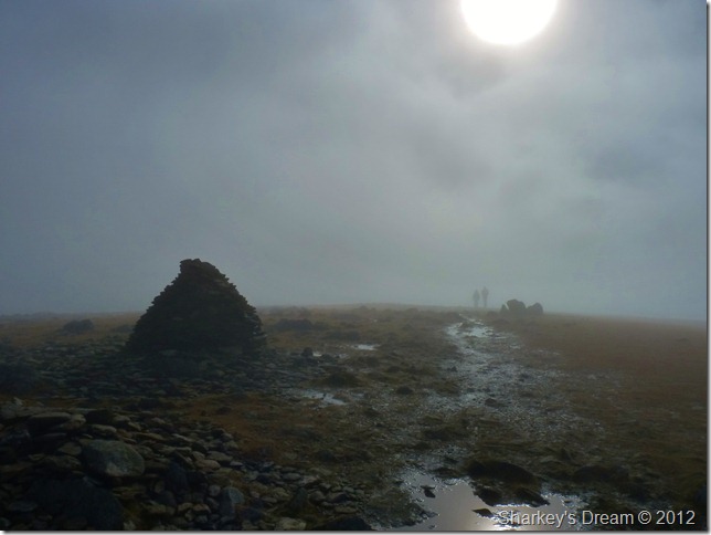
Wetherlam summit cairn.
We soon reached Wetherlam summit if not by accident, this the summit Paul Tim asked? erh… I think it is…first checking that the cairn is not just a summit marker, the GPS confirming that yes, we are at Wetherlam summit.
Now that’s what the mist/fog & low cloud can do to you, the summit caught me a little un-aware as I had to refer to my GPS after numerous visits to said summit, it just goes to show that you should never take your eye of the ball as I did slightly here.
With no fix on any sight-able object it was eyes down on the GPS again (and not to mention a little help from memory)
We press on for the Prison Band, still deep in the mist… |
 |
| |
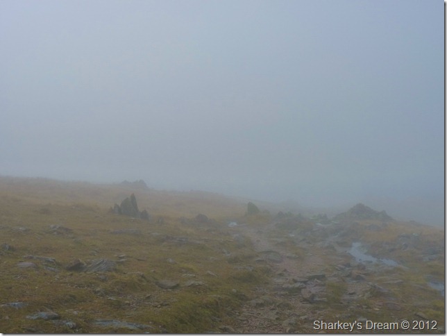
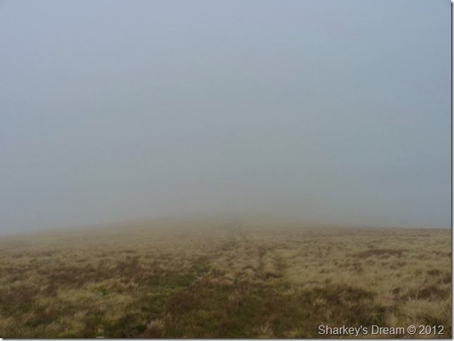
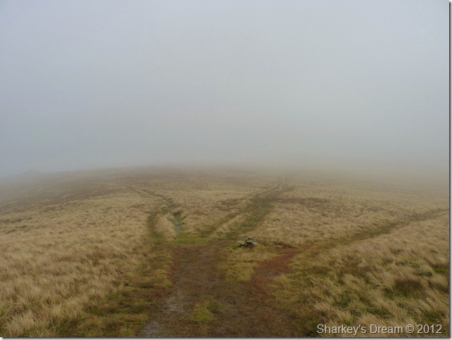
Are we there yet? I couldn’t tell you! |
 |
| |
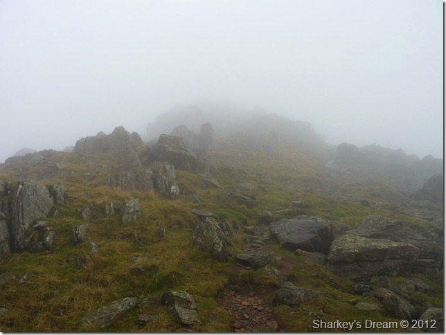
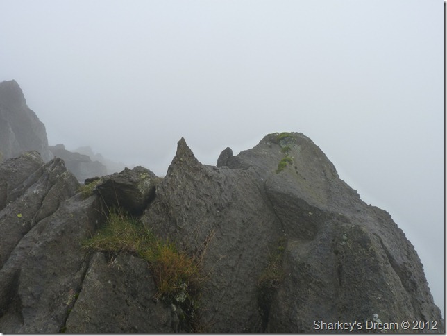
Prison Band.
After crossing Swirl Hawse we started our ascent on the craggy Prison Band, a section of rock commandeering Swirl How east face, this is a very much enjoyable exercise of the ascent on Swirl How’s summit, this was a time I thought to myself; the only way this ascent could be better was a drop in temperature, some snow & an ice axe.
Minus the snow, we press on with the slippery ascent. |
 |
| |
My wife often asks me, why is your wedding ring so scratched?
Dunno love. |
 |
| |
The last part of the ascent was quite eerie in the stillness of Swirl How’s summit. |
 |
| |
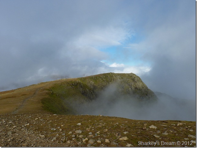
A chance view of Black Sails summit as I glance back over our route, seconds later the view had disappeared. |
 |
| |
Tim clambers through the mist just beneath Swirl How summit. |
 |
| |
A dynamic view south over a cloud topped Duddon Valley across the summit plateau. |
 |
| |
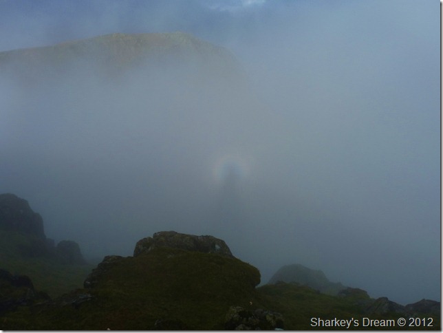
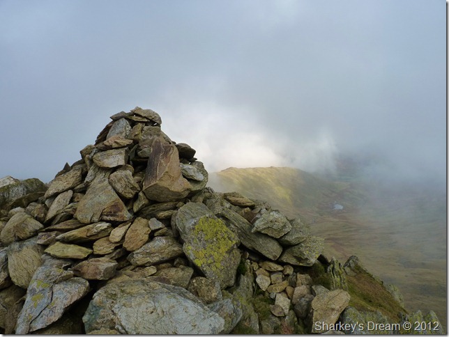
The ritual of touching a new summit cairn.
It was decided we both have a short rest stop as it was approaching mid-morning, no need to find shelter as it was positively calm up at the summit top, we drop down a few feet in hope of seeing our next fell of the morning in Great Carrs, what I saw next left me reaching for the camera in the rare phenomenon that is… |
 |
| |
The Brocken Spectre.
Ok, I know you find it hard to believe, but that is me, with a halo around my body, as at the same time Great Carrs also makes a brief appearance, both were gone within seconds.
Rare & beautiful & engaging are just a few words as I can describe that moment.
We press on for Great Carrs & hopefully some views, however brief they maybe. |
 |
| |
Grey Friar over Fairfield Col.
We have indeed Grey Friar on route today, but not just yet, next we have the honour of the small ridge like walk to Great Carrs summit. |
 |
| |
Great Carrs as we leave Swirl How.
540 Metres is all that separate both summits, could Swirl How & Great Carrs be two of the closest linked Wainwrights in the whole of Lakeland? I think its certainly a close contender |
 |
| |
Wetside Edge & Greenburn Reservoir from the summit of Great Carrs.
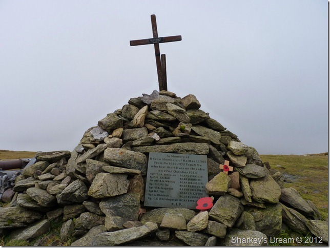
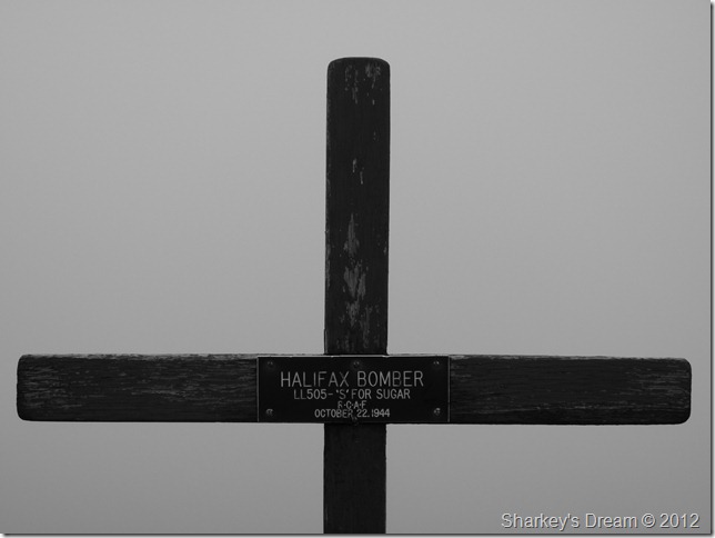
With just a few photos of the summit we turn heal & head south west & take in the War memorial for the WWII Halifax Bomber that sadly crashed on Great Carrs back in October 1944. |
 |
| |
The Halifax Bomber memorial which took place sadly almost exactly sixty eight years ago to the day. |
 |
| |
Call sign; S’ FOR SUGAR |
 |
| |
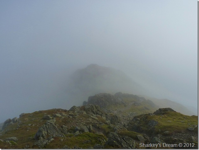
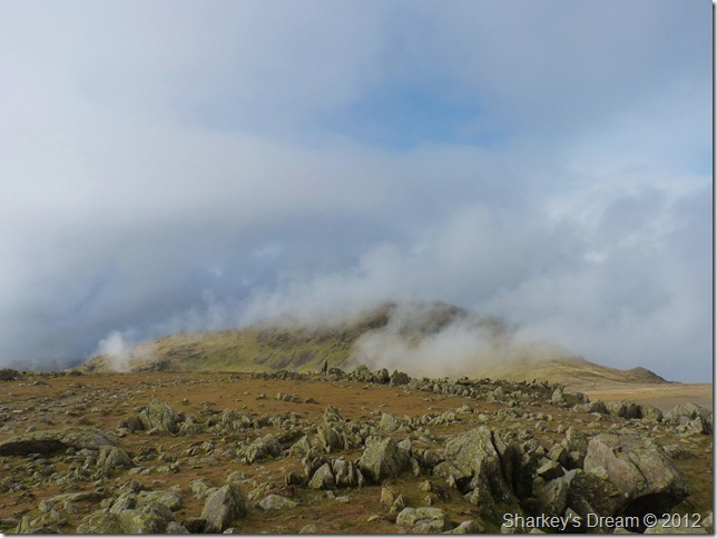
Fairfield Col.
After leaving Great Carrs we headed down to Fairfield Col which was well & truly nestling in the mist, ahead lies Grey Friar a noble mountain that is one & a half mile in width & two miles in length, sadly it seems, Lakeland is revealing nothing once more. |
 |
| |
Grey Friar summit cairn.
It was a silent pull up the grassy slopes of Grey Friar which I guess it showed how we both just wanted to make the summit, more so Tim.
Two cairns mark the summit, the south east cairn (or on your right as you approach from Great Carrs) being the actual summit.
It is only my second visit to Grey Friar & whilst here on my last visit I bared the summit to time as I needed to drop down to Seathwaite the long haul back to Walna Sca, again I am beaten by not time but the mist as the views from here command the Scafell’s, the Duddon Valley & Eskdale. A little saddened by this I go off in search for a more natural phenomenon. |
 |
| |
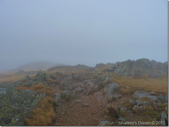
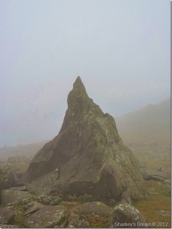
The Matterhorn Rock.
Found amongst the rocky summit plateau, the Matterhorn Rock is quite distinguished & not to difficult to find at all. Today I passed it on my right before I made the summit. |
 |
| |
Back at Fairfield Col.
It was here Tim asked, which way Paul? Right at the cairn buddy.
This path is merely a shot cut along the top of the Col that gently swings south to meet up with Swirl Band & Brim Fell bound, the path albeit boggy in sections comes recommended as an alternative to reach Swirl Band should you be in the direction of Brim Fell.
The weather worsens as visibility gets poorer, this a low point of the walk as again Seathwaite Tarn would be on our immediate right & as we near the end of the path at a point where we meet back up with Swirl Band the views are as dismal if not worse until we start to make the small ascent onto Brim Fell…
The sun makes a brief return… |
 |
| |
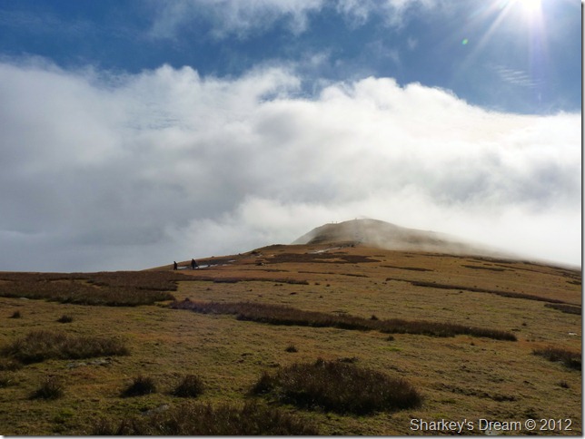
Brim Fell summit cairn.
Amazingly we seem to have respite in between the cloud as the sun struggles through the mist two walkers unaware that they are the first people we have seen all day. |
 |
| |
Coniston Old Man as we leave Brim Fell.
The null continues as we break for the Old Man, after walking in what can only be described as ‘grey’ for the past few hours this scene certainly got the heart racing & not to mention, the camera out! |
 |
| |
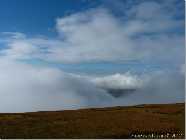
Dow Crag lay enveloped in thick brilliant white cloud just over to the left of the picture, meanwhile The Duddon Valleys lies under promising skies.
But will it last? |
 |
| |
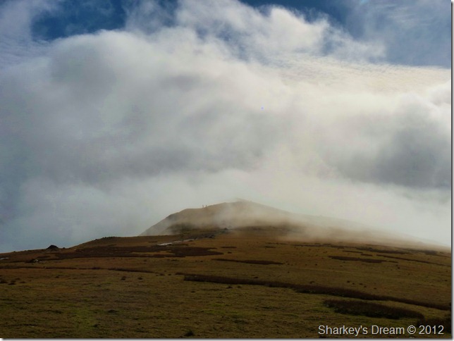
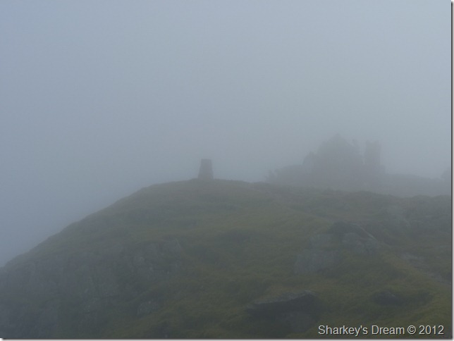
Coniston Old Man summit Trig Point through yet more cloud.
I guess not…
The last yards of the summit was met by more cloud, this time drifting up & over the cove of Low Water as it slowly makes it way across the summit. |
 |
| |
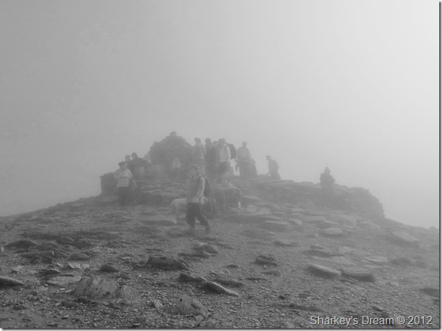
Ghostly figures span the shelter.
After a few photos we make our way around the crowded summit & decide on whether to stop or not, we go with a quick rest if only for the company after our previous summits spent looking into nothing. The summit is mostly made up of Duke of Edinburgh Award students & instructors, a percentage of them looking like they really didn’t belong there, nevertheless I listen to the instructor give them their much needed mountain skills as the students silently listened on.
More students make the summit as we prepare to leave, making an already crowded summit even more crowded.
I guess it was time to leave. |
 |
| |
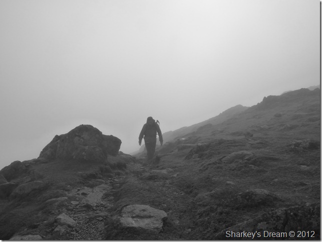
Descending via the tourist path.
It wasn’t long after leaving the summit did something strange happen, a camera, much like mine crashes down the fell side pinging & boinging as it hit rock after rock, eh-up! I recognise that bloody camera as it came to a sudden stop – about ten feet away from me…
Its bloody mine!
I race down to where the camera came to a stop, in the seconds it took me to reach the camera thoughts of a busted lenses or worse entered my mind, its done for, the camera has never been dropped so far & after numerous drops is this the final goodbye?
Tim asked, how is it?
Its fine mate, its bloody fine!!! big huge grin etched across my face, more familiar to Tim than ever I guess, as Tim is usually witness to such stupidity on my part.
It turns out I hadn’t fastened my camera securely back into its bag from the previous photo, it only took the slight jolt from the descent to exit its moorings jolt past the owner for, well, I’ve forgotten how many times this has happened. |
 |
| |
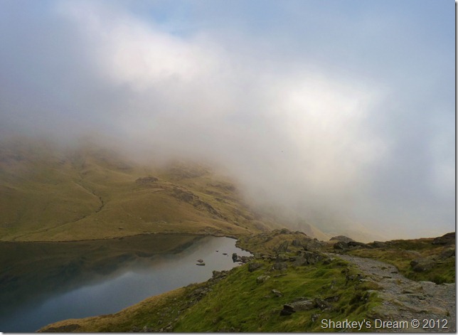
Passing Low Water from our Descent & hopefully all that remains of the low cloud. |
 |
| |
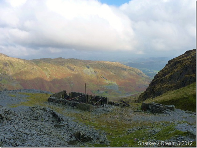
The old ruined stone huts mark the tourist route.
The latter end of the walk was turning out to be really pleasant with a warm afternoon sun now bearing down on us, I was still in full waterproof gear at this point & was beginning to ‘steam’
Tim & I had agreed that a visit to Tarn Hows would be in order as it is just a short drive away from Coniston, this was something that I had wanted to include in the walk from early week, you can see why towards the end of the walk… |
 |
| |
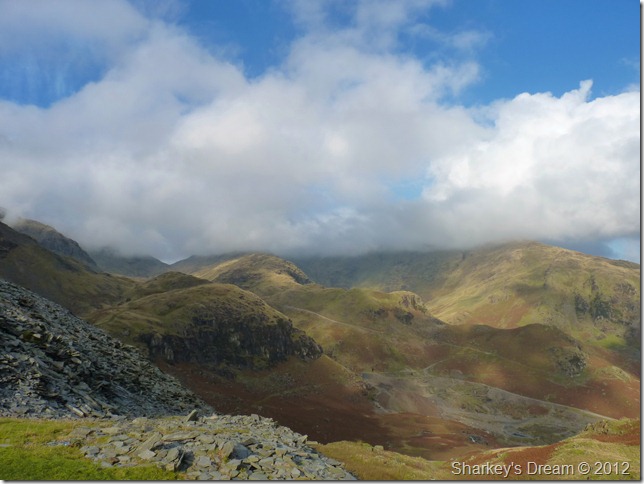
Boulder Valley with the Black Sails ridge (C) & our route over Lad Hows far (R) Wetherlam is under Cloud as Prison Band appears at the Col over on the left of the photo just beneath the cloud.
It was time to make our way across Coppermines Valley where we run adjacent with Church Beck for the final leg of the journey, it is here we would cross Miners Bridge & trek just over half a mile back to Silver Dale.
As we passed through the ruined huts Tim stops & takes some rather observant photographs of the old cable that used to carry the quarry dubs up & down the fellside, these photos I cannot wait to see.
Back at the car it was time to de-layer, did I get lazy in not layering-down while on the fellside, yes I guess I did, I also under estimated just how warm the valley floor would be, as Tim pointed out at the back of the car ‘Paul you are literally steaming’ well I figure a good workout never hurt anyone (except for the banging head that is)
I drink hot coffee from a flask I prepared this morning, which went down just nicely as I start the engine of the car and drive along the north tip of Coniston Water following a road sign marked Tarn Hows. |
 |
| |
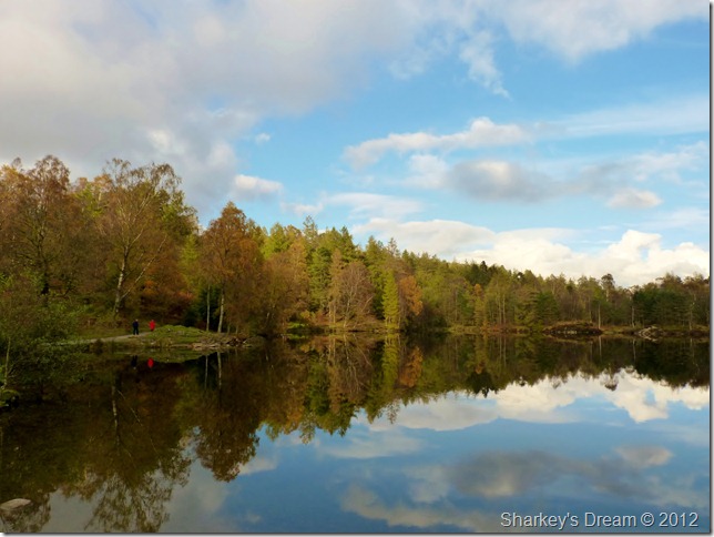
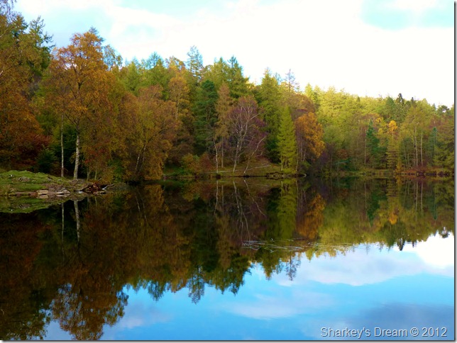
Autumn reflections on Tarn Hows. |
 |
| |
Tarn Hows.
Tarn Hows is a place that I had planned to visit over the next week or so before the leaves finally drop & lose all their beautiful colouring & detail, there are a few places myself can gather & look upon nature in wonderful colour in such a setting as Tarn Hows, this is a place I will always return when Autumn arrives for years to come. |
|
| |
| Back to top |
 |
|