|
Grisedale Pike, Whiteside & Force Crag Mine |
 |
 |
18th November 2012 |
 |
|
It’s not very often that I would find myself asking ‘why are you here today?’ Hectic work schedules, overtime & hospital visits are now starting to take its toll on me, it would seem the only time I have to myself right now would be the time I solemnly spend on the fells tying to shake the above.
Lucky right?
In some cases yes of course I’m lucky, the pull from Lakeland is never far away & non more so than at these trying times.
Your body one day is going to cease & call time out & I guess that is what is happening to me right now, fatigue is a major factor in my life right now, at times I cope with the stress of life as Lakeland comes as my saviour, at times like the past week I plan more & more when really I shouldn’t be leaving the house, one weekend away from the fells wont hurt I tell myself, this only appearing apparent the moment I place boot on fell.
Today is going to be a tough one in more ways than one…
I had no agenda of where I might find myself today, perhaps Skiddaw or Blencathra The Newlands Round also struck a cord & pulled at the boot strings.
I just wanted to be walking when I later learned, my body wanted to be back at home recuperating after six solid days & indeed months of stress.
Its not all doom & gloom, the fells as always, worked there magic on this tired body… |
|
| Wainwright Guidebook |
 |
| The North Western Fells |
- The North Western Fells:
The hills tend to crowd together in the confined space available, but not in confusion and disarray, for connecting links bridge the tops in a pattern of high crest and sharp arêtes that are a joy to explore. Indeed here is to be found the finest ridge-walking in the district,smooth going for the most part, non of it dangerous with ordinary care, all of it very pleasant and providing views of unsurpassed beauty. |
 |
|
|
| |
|
Overview |
|
|
| Ascent: |
736 Metres 2,414 Feet |
| Wainwrights: |
3, Grisedale Pike – Hopegill Head – Whiteside |
| Weather: |
Sunny To Start, Turning Overcast With a Cold Wind On Tops, Highs Of 8°C Lows Of 4°C |
| Parking: |
Car Park, Bottom of Whinlatter Pass (FOC) |
| Area: |
North Western |
| Miles: |
8.1 |
| Walking With: |
On my own |
| Ordnance Survey: |
OL4 |
| Time Taken: |
6 Hours 20 Minutes |
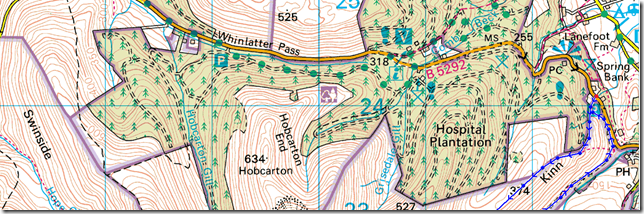
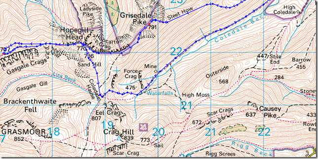
| Route: |
Whinlatter – Kinn – Sleet How – Grisedale Pike – Hobcarton Crag – Hopegill Head – Whiteside – Hopegill Head – Sand Hill – Coledale Hause – Force Crag Mine – Coledale Valley – Whinlatter |
|
| |
|
Map and Photo Gallery |
|
|
 |
| |
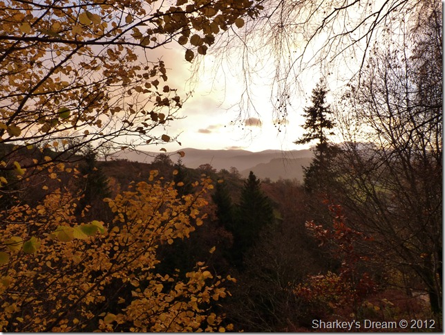
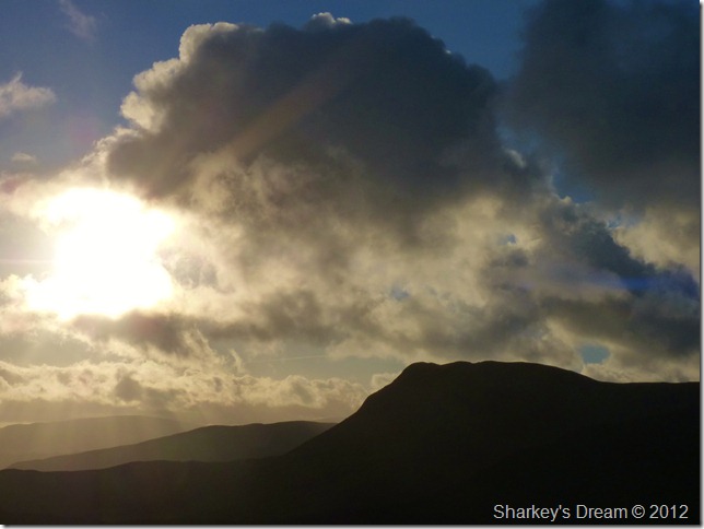
Afterglow over Whinlatter 08:06am 4°C
It’s wet & muddy as I kit up at the car park during what can only be described as a brief downpour. I’m walking around the car park in my North Face mid’s trying not to get them dirty as I will use them for the drive home later.
I don’t seem to have enough layers on, or the ones I do – do nothing to protect me against the morning chill, I delayer & then re-layer with my Rab soft shell fleece & instantly feel the benefit. I seem to be rushing around & I don’t know why…
Incidentally, if you seem to think you may have seen this photo before take a look here taken over twelve months ago. |
 |
| |
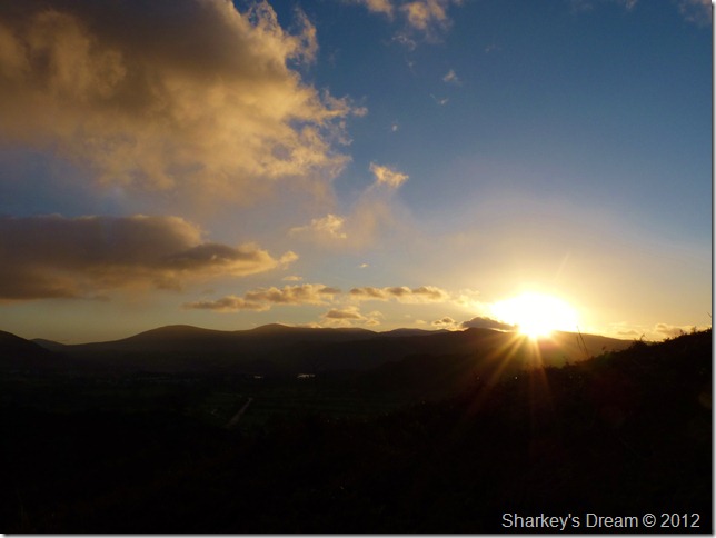
Sunrise over the eastern fells.
The damp underfoot continues as I slurch my way up the steep grassy slopes of the Kinn, the grassy bank is short as If the sheep had been on it which gave no grip whatsoever as I find myself walking through decaying bracken along the pathway in search of some grip.
This works well yet so early into the walk I’m feeling well behind my usual pace as I curse up the steep path.
On the other hand, the sun works wonders for the soul as its glow leaves beautiful silhouettes over the pointed peaks which picks me up a little. |
 |
| |
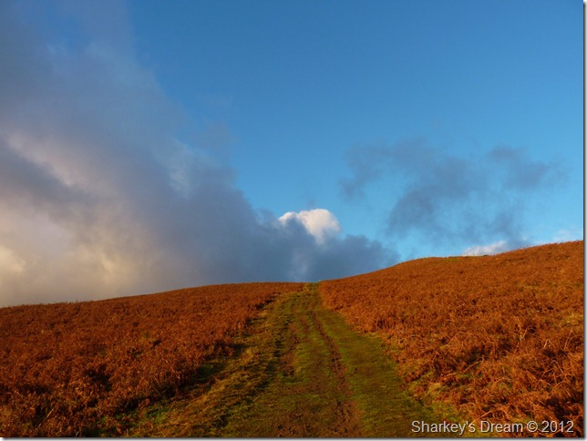
Overhead, blue skies. |
 |
| |
Causey Pike silhouette. |
 |
| |
Despite my complaining, it was so difficult to holster the camera with a sunrise as beautiful as this. |
 |
| |
Looking back over Kinn with a distant Skiddaw, Latrigg & Blencathra catching the morning sun. |
 |
| |
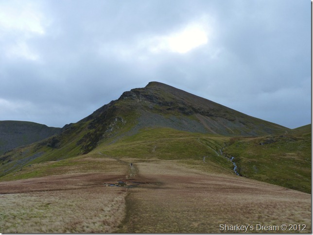
Grisedale Pike from Sleet How.
The steep ascent to the summit was almost upon me & I was quite sure if I was going to enjoy this next section or not, it was here I was trying to convince myself that you are in the place you hold dear & that right now where would you rather be?
My conscious mind repeated bed. Over & over – A battle I was losing convincingly.
I need to pull something out of the hat, & quick. |
 |
| |
Subconsciously Lakeland had her own trick up her sleeve… |
 |
| |
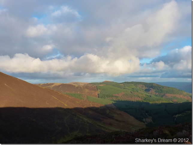
Looking north over Thornthwaite Plantation towards the Lord’s Seat Fells. |
 |
| |
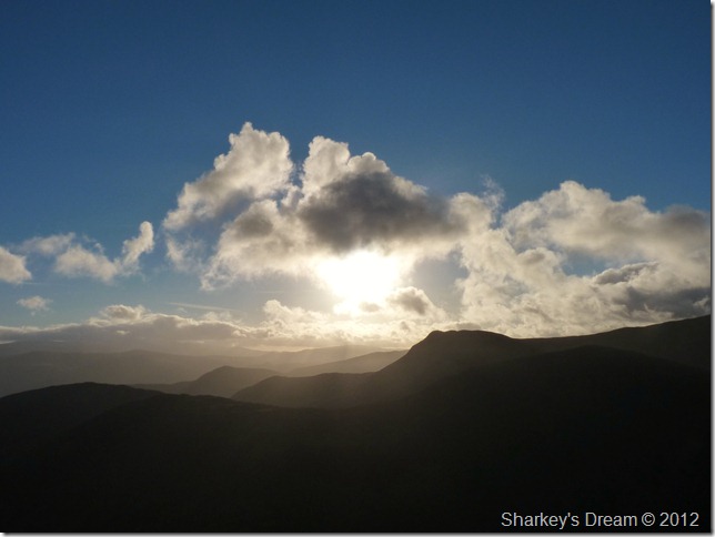
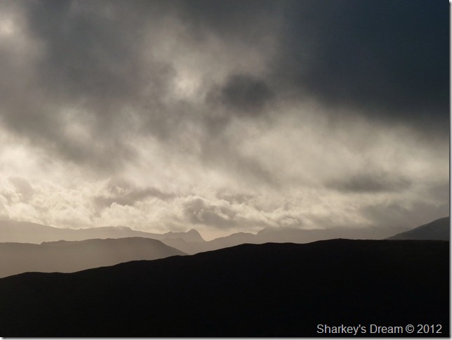
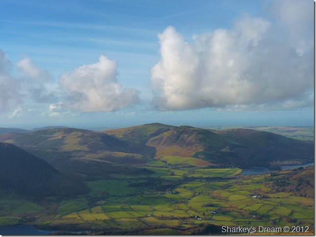
Grasmoor & Crag Hill (Eel Crag) will remain under cloud for much of the morning, centre bottom sits Force Crag & the Coledale Valley, a route I was to later use, its just right now, I didn’t know it. |
 |
| |
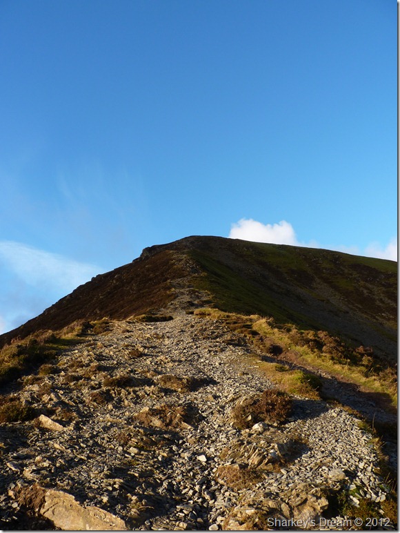
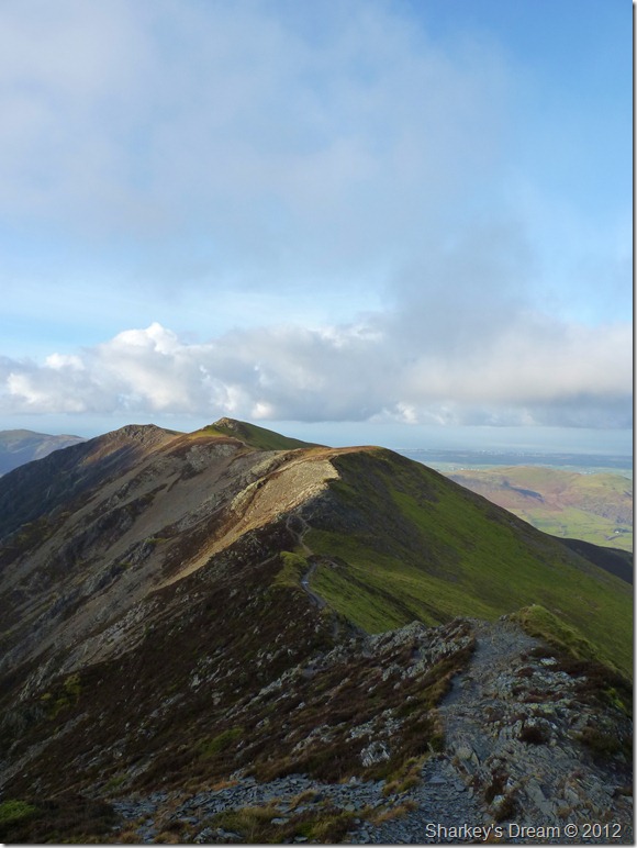
Sleet How & the final push towards Grisedale Pike summit.
Spirits start to pick up during the ascent as I pick my way over the loose rock, in the distant behind me I spot three walkers & a dog, they are too far away at this point to catch me up but the guy approaching from Grisedale Pike north ridge (R) isn’t, we seem to be on a collision course until I note his & my rest stops coincide simultaneously, we reach the summit at the same time. |
 |
| |
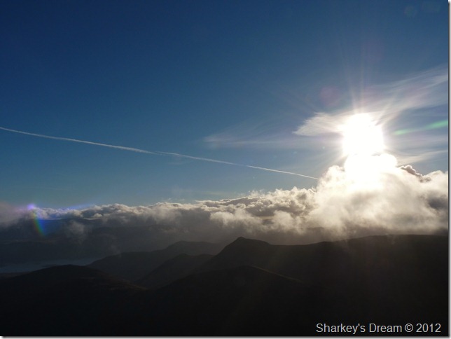
The distant Langdale fells appear in mono, as thick cloud momentarily obscure the sun. |
 |
| |
But not for long… |
 |
| |
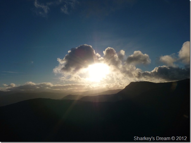
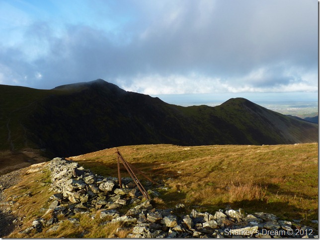
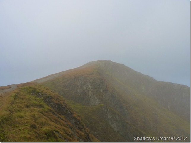
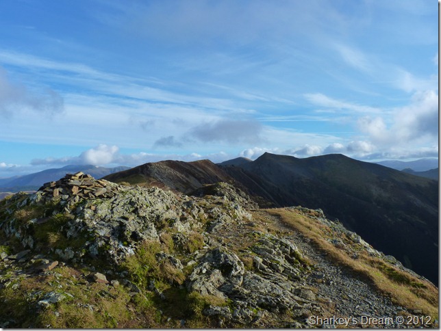
Hopegill Head (R) from Grisedale Pike summit.
I chat with my fellow walker who appears to be on a mission, for today he is in claim of three new Wainwright’s. Before I have time to speak & say, there’s a lot more than three on this round he explains his plans in his strong geordie ascent ‘my mate & I are doing the Wainwwright’s & he’s done more than me so today I’m going to climb three new ones, great I reply, Cat Bells – Causey Pike & I forget the other one he mentioned… Ah right I thought, I don’t have the heart to question his route skills or the fact that trying to park mid morning in or around Stair, Little Town or Skellgill will be neon impossible, I shudder to think what Portinscale & the surrounding networks looks like on this beautiful Sunday morning.
He later goes on to say that he is parked at Comb Bridge Whinlatter & that he should be making his way back to the car, what the guy did next startled even me by dropping of the back of Hobcarton Crag via an extremely loose scree slope, all the while checking his map.
I couldn’t help but think that if he was in such a rush to ‘get around Lakeland’ this morning then why didn’t he return the way he came instead of putting his life in danger & possibly ruining fresh legs on such a horrid descent?
I press on…
Footnote:
Hobcarton Crag is the in the foreground of the picture, my fellow walker dropped down into Hobcarton (valley) in between where I stood to take this photo & where the wall disappears in the foreground. |
 |
| |
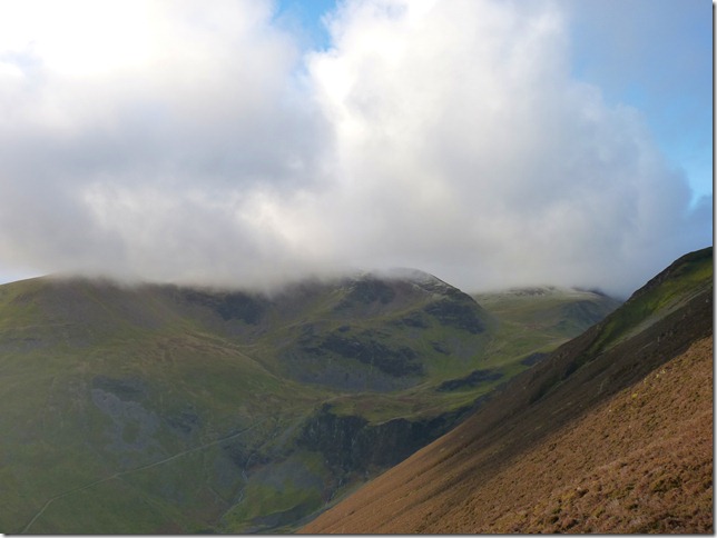
Hopegill Head & Ladyside Pike as I ponder my next move…
Hopegill or Coledale? |
 |
| |
I go for Hopegill Head amongst my second wind.
I practically ran up the approach path from the col below, this a section of path not twenty minutes previous laid on my mind, where that came from I do not know, but boy it felt bloody good.
Momentarily I seem to be at my usual Lakeland high, it lasted but not as long as I would have liked it to. |
 |
| |
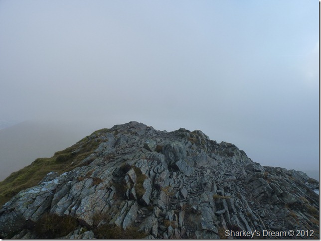
Hopegill Head summit.
With glamorous approaches from both the east & west ridge the summit of Hopegill Head is a little less easy on the eye especially when the cloud is down such as now which is a shame.
My second move was decided upon the cloud, I stood a while whilst at the summit looking in a westerly direction, I just needed the smallest of inspirations to carry on my walk & do something rather odd… |
 |
| |
Wait for it, wait for it… |
 |
| |
There comes the inspiration, now for the odd bit…
I was to traverse the ridge all the way over to Whiteside, then come back again…
Why? Because I wanted to! |
 |
| |
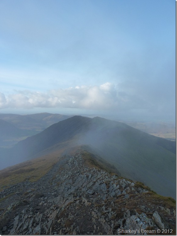
The Whiteside Ridge incorporating Gasgale Crags. It is said that this ridge is one of thee finest ridge walks in the whole of Lakeland.
I’m about to find out again, Twice. |
 |
| |
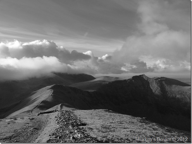
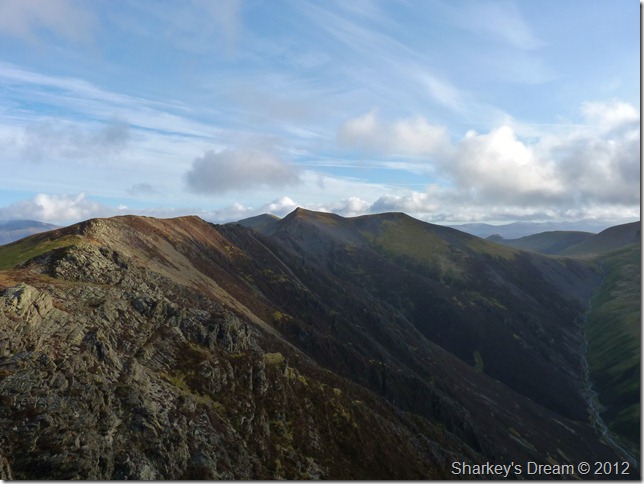
Hopegill Head & Sand Hill (R) from Whiteside summit cairn.
It was whilst along the ridge did I start to encounter more & more walkers walking as you would have guessed, in the opposite direction, If I was them I would of questioned oneself as to why a walker would be walking in the direction of Lanthwaite (Crummock Water) so early in the morning?
He’s either lost, or going the wrong way they’d of been thinking, or doing that odd thing you do & walking there & back along the ridge.
He certainly looked an odd character!
I tend to agree! |
 |
| |
Gasgale Crags with Liza Beck far below. |
 |
| |
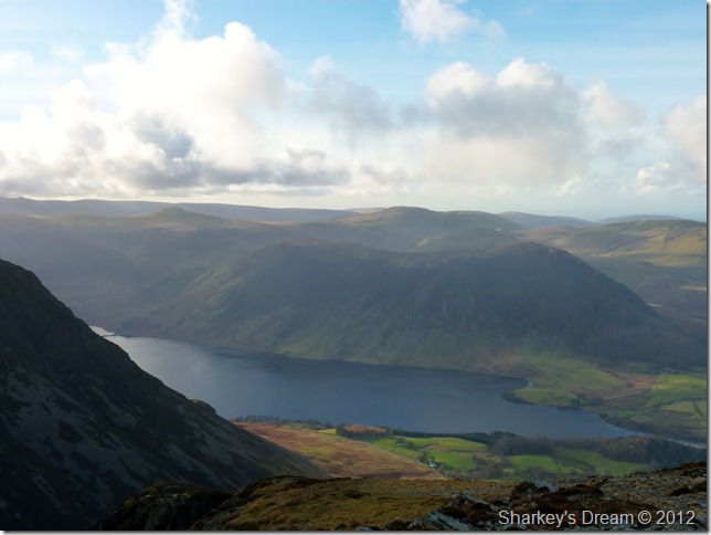
Hazy Mellbreak & Crummock Water, the fells seen behind are that of Starling Dodd & Great Borne over to the right of the picture. |
 |
| |
The Loweswater Fells & Loweswater over Lorton Vale. |
 |
| |
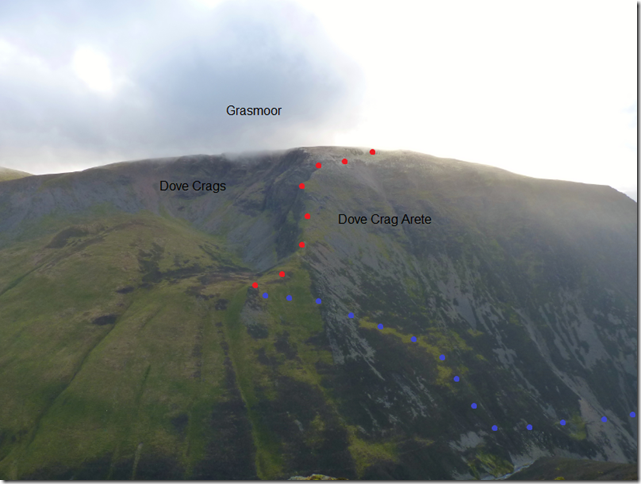
Grasmoor from Gasgale Crags.
This scene set great memories from my traverse through Gasgale Gill & upon to Dove Crag Arête during this summer. In blue shows my approach path from the direction of Lanthwaite Green, in red my path to the summit via Dove Crag Arête & on towards Grasmoor’s summit plateau. |
 |
| |
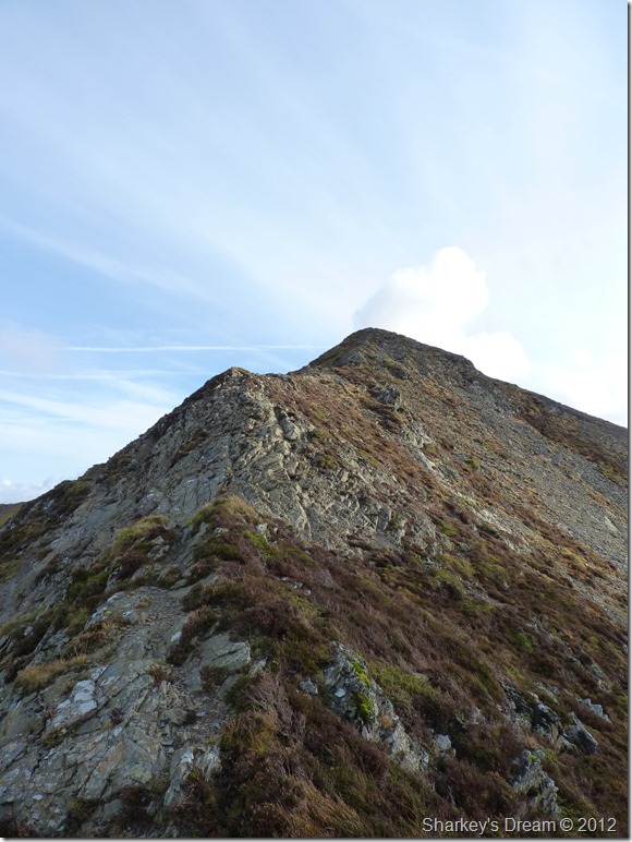
More traversing as I back track along the ridge until I reach another mini arête just before that last push onto Hopegill Head summit, aptly named the mini Striding Edge, here you don’t have to go up & over as there is a perfectly good path to the left of this fine ridge. |
 |
| |
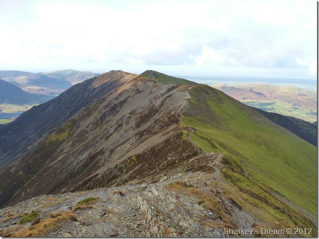
Crag Hill (Eel Crag) & Wandope (R) taken beneath the summit of Hopegill Head. |
 |
| |
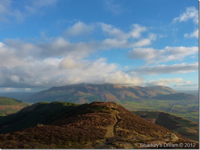
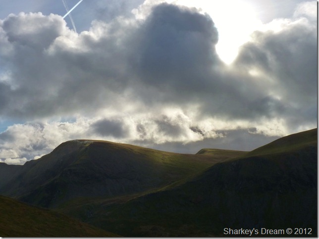
A biting wind traces across the undulating Coledale Hause.
It seems with the sun my second phase has been left behind somewhere along that Whiteside Ridge, as I drop down the winding stony path from Sand Hill I start to flag a little, the wind tears right though me as thoughts of a Crag Hill ascent & a possible completion of the whole Coledale Round lays in tatters.
It’s all down to these next few moments, I walk across Coledale Hause & make for the path O’yonder above Liza Beck (R)
I take my pack off here & untie my zip from my pack, I figure if anywhere it is while on the ascent of Crag Hill I’m going to need it, with this I grab a handful of chocolate buttons from a pocket at the side of my pack, I’m ready I say, just go for it Paul. |
 |
| |
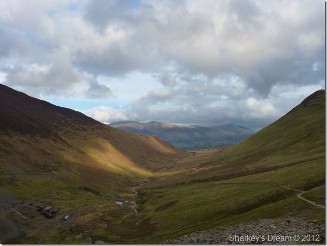
The valley of Coledale with Coledale Mine perched within her steep sides.
Something happened that I can’t quite explain whilst eating those chocolate buttons.
The wind fell right of my sails, I turned around & admitted defeat. Today, now I think I’ve had enough of pushing my already tired limbs, Crag Hill was just one fell too far…
I retreat down the valley with inspirations of Force Crag Mine, or anything for that matter that could pick me up. |
 |
| |
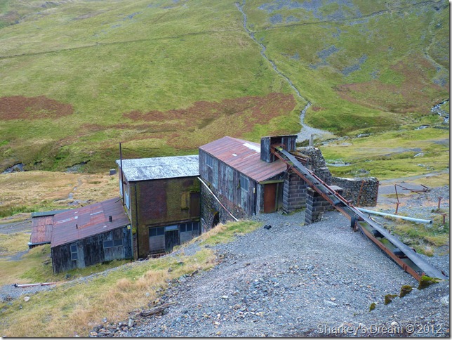
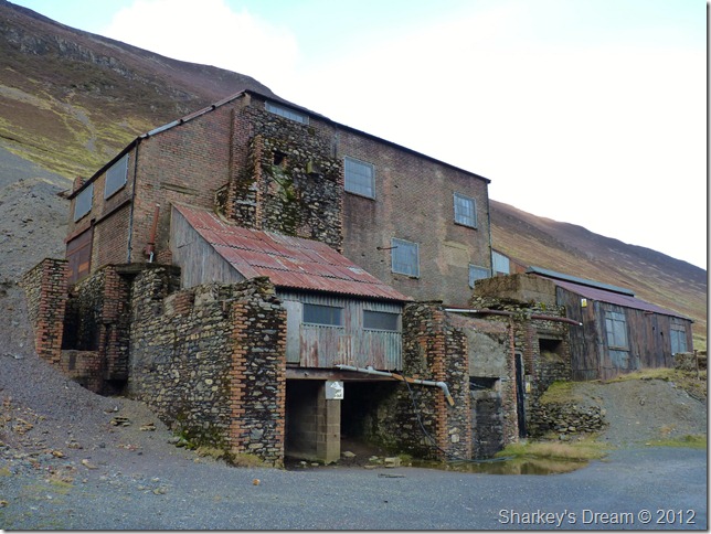
The de-shelved but not ruined, Force Crag Mine. |
 |
| |
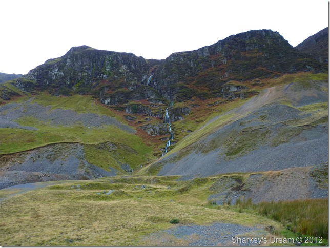
Force Crag & Pudding Beck waterfall.
It was whilst within the valley floor do I rest up & break for lunch underneath the vast & vertical crags of Force Crag, being here is something special, this place is steeped in history going back as far as the fourteenth century. |
 |
| |
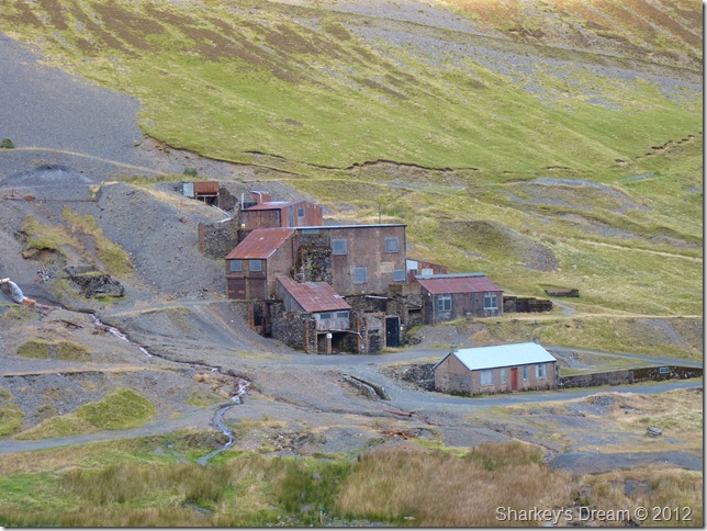
The main mill & out-buildings.
The mill buildings that you can see today were built in 1908-9 and redesigned in 1939-40. The mill contains the ore-refining machinery that was in use during the 1980s and until the mine fell abandoned in 1991.
Force Crag Mine was the last mine in the Lake district to cease operation. |
 |
| |
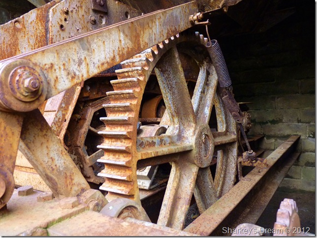
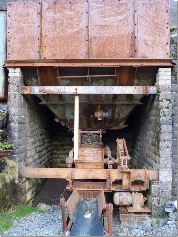
The bucket was filled from above via large steel tubs operated via gravity down the steep valley & then conveyed along the belt into the mill. |
 |
| |
This steel grid only allowing the right size ore to drop through onto the conveyer. |
 |
| |
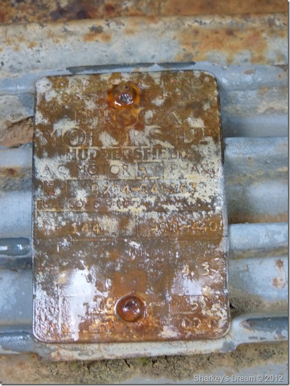
Brook Brothers Electric Motors, Huddersfield. |
 |
| |
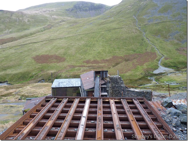
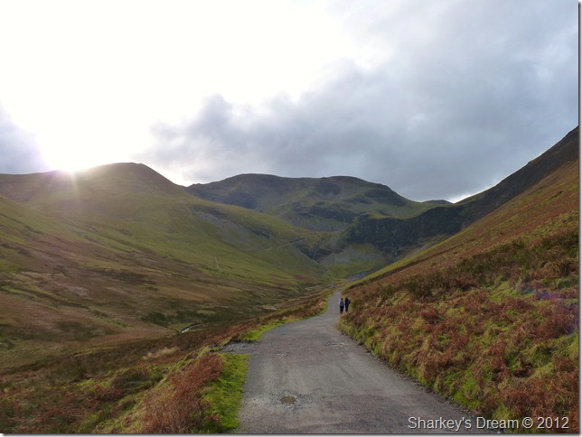
Looking back on Force Crag & Sail (L) from the mine track.
I figure every cloud has a silver lining & the exit via the beautiful Coledale Valley & Force Crag Mine was mine, go there, sit beneath the ever impressive Force Crag & revel in its mining history, then enjoy the two mile stroll from the mine back to the village of Braithwaite.
I didn’t particularly expect to take anything away from today, I figured I’d got it wrong & to an extent I had. What I needed was to rest, what I didn’t know that Coledale had already done this by the time I got back to the car.
There’s no better feeling than this. |
|
| |
| Back to top |
 |
|