|
Coniston Wonder’s |
 |
 |
8th February 2013 |
 |
|
I have always held a fondness like most humans for Dogs. Of course we see them as the lovable pets that they are, the paper mashers, the carpet poopers & slipper fetchers. Yeah right I hear you say, if your pet dog is anything like mine given a command you might get the belly roll, when indeed you’ve just asked your dog to sit.
Tickle me, tickle me, tickle me…
So its not just my dog then?
I can’t help but admire the professional dog, especially dogs for the blind or rescue dogs. I mean, their pretty amazing aren’t they? When was the last time you spotted a Mountain Rescue dog in his or her fluorescent rescue vest walking around with a crisp packet on the end of its nose?
Do you know I once witnessed many many moons ago whilst in Ennis, southern Ireland, a four month old Springer Spaniel retrieve a downed grouse from a frozen pond… There I was with my ear protection, as a double barrel shotgun rang out over the grouse butts, that dog never blinked an eyelid, not even when the shots were ringing out as this daft sod blinked before-during & after when the trigger was pulled.
Being a fell walker there are times I may stumble upon a farmer with half a dozen collies in toe, commanding sheep to the tune of w’ays & n’ips & a blast from a whistle thrown in. It’s quite poetic in a way isn’t it?
Charmer was a fox hound who at the turn of the century hunted; just like her predecessors as part of the Coniston Fox Hounds. Charmer fell to her death after spending a night crag-fast somewhere on the rocky buttresses of Dow Crag. Charmer’s owner had to endure his beloved hound howl throughout that night knowing he could do absolutely nothing until daylight.
I couldn’t imagine what Charmer & her owner went through that fateful night. Absolutely nothing some might say, Charmer was just another mutt doing her aristocratic duties when half the country were preparing for war in some foreign land.
But this is not so…
Charmer was retrieved the next morning & in the following weeks her owner saw tribute in the way of a grave stone, more commonly known as Charmers Grave.
Throughout the century the grave stone has remained quite elusive in many ways, & long may its undetected location remain that way, but for now, today, I am here to find Charmers Grave whilst in the midst of a beautiful winters day.
For this I have enlisted the help of fell walker, Ian Sharples. |
|
| Wainwright Guidebook |
 |
| The Southern Fells |
- Charmer the Foxhound
Another Promising Hound Dashed To Death
CONISTON FOXHOUNDS
The above hounds had a thrilling experience on Dow Crags at Coniston, seven of them being crag fast and not rescued for about 24 hours. Unfortunately one of the hounds, the promising young bitch Charmer, appeared to have stolen back on a fresh hunt, and got crag fast in the same place. But this was not discovered till later. On Sunday she was heard howling, and a rescue party tried to reach her, but before they could get there Charmer had fallen down the crag and was dashed to death.
Lakes Herald – 31st March 1911 |
| |
|
|
| |
|
Overview |
|
|
| Ascent: |
2,769 Feet, 844 Metres |
| Wainwrights: |
4, Coniston Old Man – Brim Fell – Coniston Old Man – Wetherlam |
| Weather: |
Bright & Sunny Throughout, Gust on Tops, Highs Of 5°C Lows Of 1°C Feels Like –4°C |
| Parking: |
Fell Gate, Walna Scar Road (F.O.C) |
| Area: |
Southern |
| Miles: |
9 |
| Walking With: |
Ian Sharples |
| Ordnance Survey: |
OL6 |
| Time Taken: |
7 hours |
| Route: |
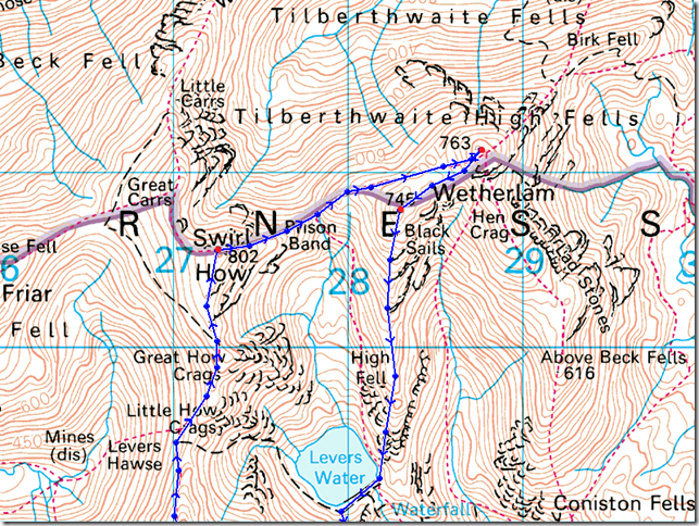
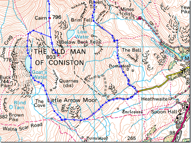
Walna Scar – Boo Tarn – Goats Water – Goats Hawes – Coniston Old Man – Brim Fell – Levers Hawse – Swirl Band – Swirl How – Prison Band – Swirl Hawse – Wetherlam – Black Sails South Ridge – Levers Water – Boulder Valley – Walna Scar |
|
| |
|
Map and Photo Gallery |
|
|
 |
| |
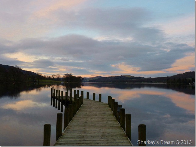
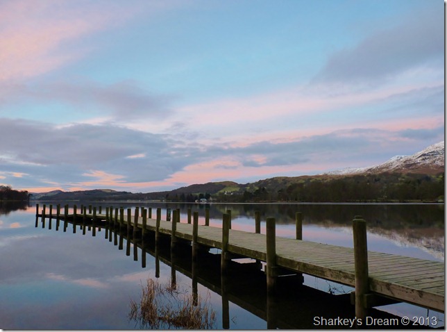
Sunrise reflections over Coniston Water taken from Monk Coniston jetty.
I arrange to meet Ian just off the M55 at 6:30am, here Ian leaves his car parked at Preston Grasshoppers rugby ground, a club Ian himself has played under.
As this was a first time meet Ian & I get acquainted on the drive up to Lakeland with the topic of conversation being the Lakeland fells.
In an email previous I asked Ian would he mind if I stop off at Monk Coniston at Coniston’s northern tip to take a few pictures from the jetty, little did I know back then would we capture this beautiful reflective sunrise, I think I can speak on Ian’s behalf that it was quite difficult to put the camera away at this point but, the fells were calling. |
 |
| |
| Coniston Old Man from Monk Coniston. |
 |
| |
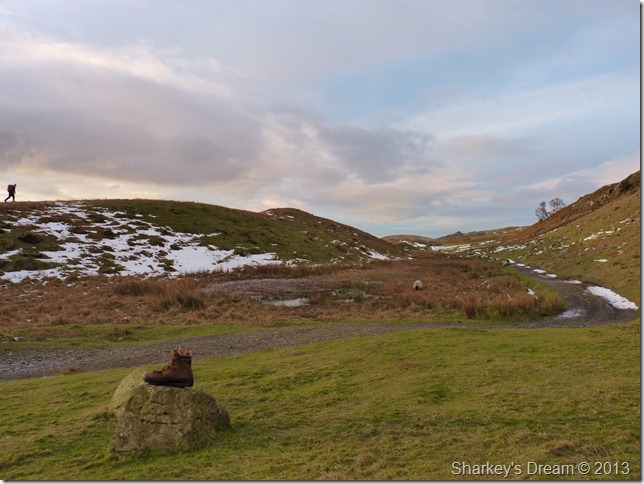
Boo (or should that be boot) Tarn as we take in Walna Scar Road.
Ian treks off the path a little to see if he can spot an ancient cairn/stone circle situated on the other side of the grassy mound, due to the nature of the ground with the sporadic snow covered layers he is unable to spot the cairn & soon retreats back to the path, oh well maybe next time.
Stickle Pike can be seen as the pointy peak centre right & with every time I find myself here it’s the same old saying relaying through my mind, I really must climb this small yet significant fell one day.
We press on in conversation. |
 |
| |
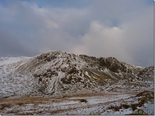
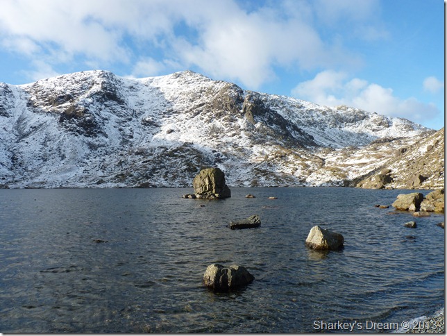
Looking across The Cove towards Brown Pike, Buck Crag & Dow Crag.
It is here we get a taste of the snowline, which if this location was anything to go by, was going to be a pleasure to walk over for the next few hours.
Thoughts now are on locating Charmers Grave. |
 |
| |
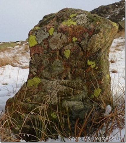
Charmers Grave.
After around ten minutes of searching Ian soon spots the Grave location, I telepathically do the same sniffer dog like; as I see Ian making a beeline for what he knew was the correct location.
Even after finding the elusive grave himself years ago, Ian noted to me that after finding the grave once, finding it again can be equally as tricky as the first time.
Charmers Grave now stands a mere foot out of the boggy ground on which it is rested upon, even in good light it was difficult to make out the spelling, running your finger over the stone confirms the letters & the date 1911. The rest of the stone seems to be sinking into the bog & I wonder if the whole stone will disappear for good over the next few years.
I pat the top of the stone like I would my own dog & with a hint of nostalgia & head for Goats Water. |
 |
| |
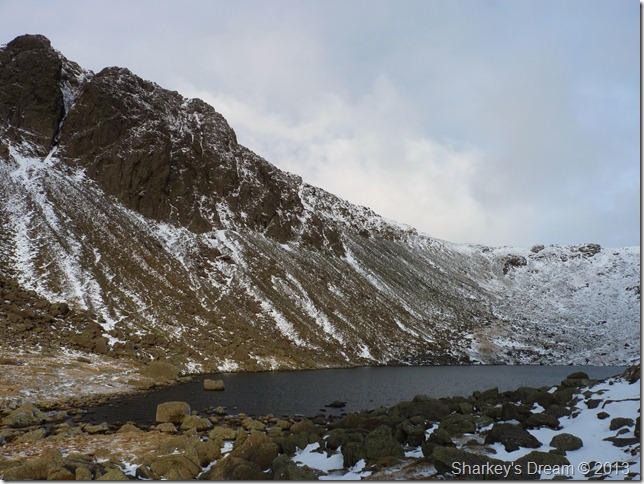
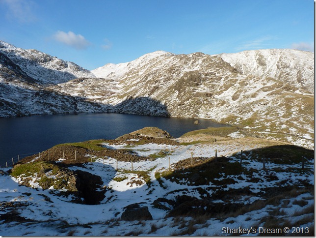
The formidable Dow Crag buttresses from Goats Water. |
 |
| |
Goats Hawse from Goats Water Tarn outflow. |
 |
| |
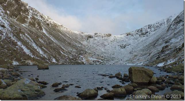
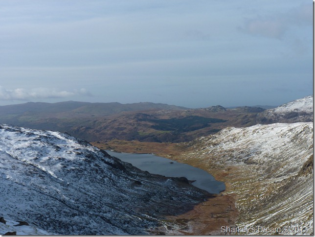
Goats Water from a little higher up the path forming that classic glacial cirques. |
 |
| |
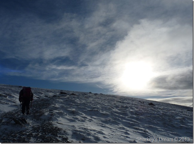
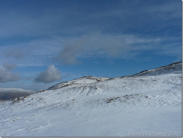
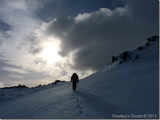
Summit bound.
After leaving Goats Hawse we made our way to the summit, not before adding some extra layers as the wind which lacked strength made up for it in bite.
The path from Goats Hawse was solid underfoot, more so on this last section towards the summit, here fresh snow covered verglas covered ground so at some points you really didn’t know you were walking over ice until you started to slide backwards. The reward for this was more than worth it |
 |
| |
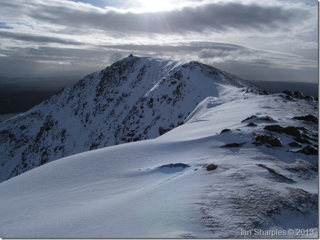
Approaching Coniston Old Man.
A short few words left our mouths at this stage, but none that didn’t rhyme with breathtaking. |
 |
| |
And here’s one from Ian. |
 |
| |
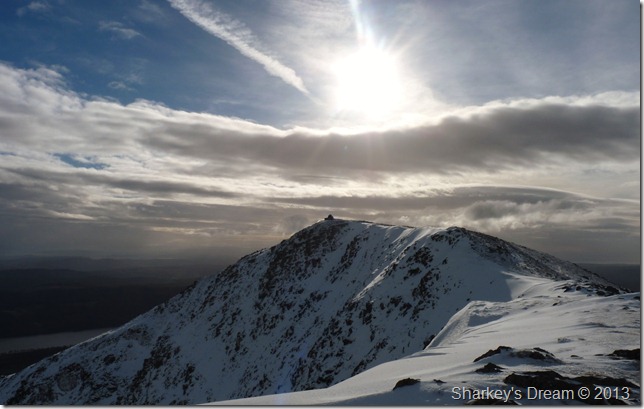
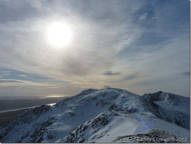
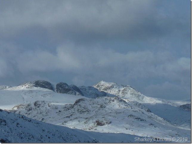
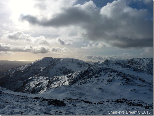
Brim Fell & a host of snow topped southern summits from Coniston Old Man trig point.
Ian makes for the stone shelter as I have a wander about taking photos, the glare from the sun was causing havoc with the camera lenses which was really sad, then again, I don’t think Ill ever forget a day like this in a hurry. I soon join Ian as he sips tea from his flask, not before this next photo. |
 |
| |
Brown Pike, Walna Scar & Blind Tarn from Coniston Old Man.
We chat awhile as Ian offers me a cup of tea, I refuse as I’m not the biggest tea drinker, yet the appeal of something warm in the belly prompts me to accept Ian’s offer.
Fuelled up we press on for possibly the shortest, yet best ridge walk in the whole of the district. |
 |
| |
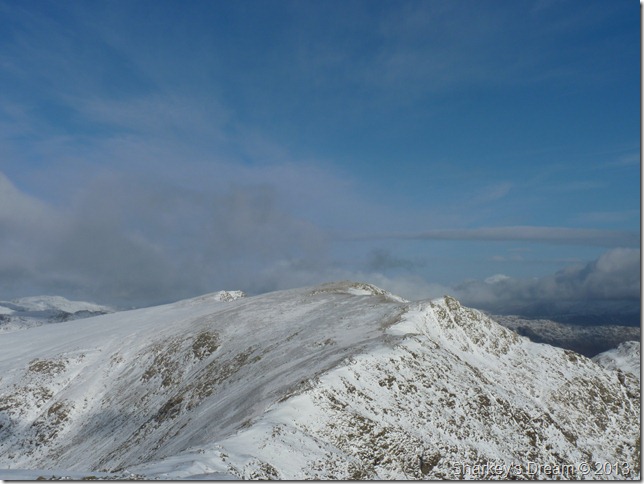
Coniston Old Man as we head for Brim Fell.
As we walked along the ridge to Brim Fell we spotted a solitary walker at the summit of the Old Man, with two dogs in toe we both said amusingly, I wonder if that is Sean McMahon from the popular Striding Edge website.
Nah….that’s one in a million territory. |
 |
| |
To the right of the summits stands a figure…its only Sean McMahon with Casper & Dougal.
You can see in Sean’s photos from yesterdays walk two figures walking the ridge, that’s me & Ian. |
 |
| |
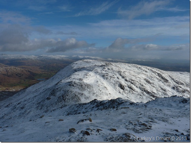
Coniston Old Man from the summit of Brim Fell.
See what I mean about the ridge between both summits being too short, especially on a day like today. |
 |
| |
Swirl Band, Swirl How & Great Carrs as we prepare to lose a little height & descend onto Levers Hawse. |
 |
| |
A pair of footprints breach virgin snow, here looing back on Brim Fell. |
 |
| |
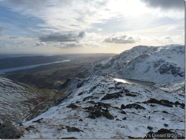
Seathwaite Tarn (reservoir) & a selection of the Dunnerdale fells in the background. |
 |
| |
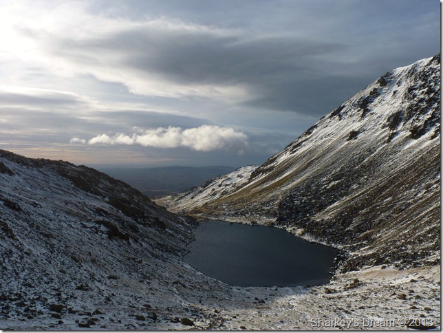
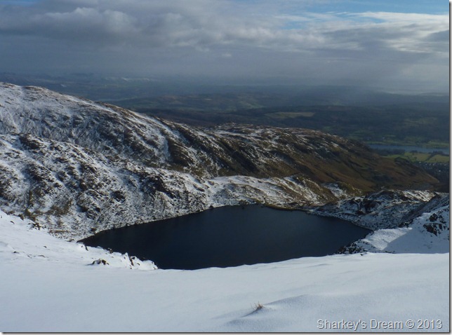
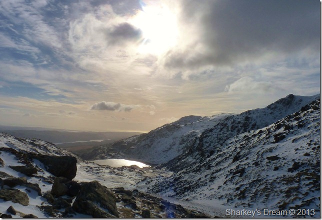
Levers Water taken from Levers Hawse, our descent route of Black Sails south ridge is in the foreground with the Lad Stones ridge directly behind. |
 |
| |
Looking back on Coniston Old Man (L) Dow Crag (R) & Brim Fell (C) we near Swirl How summit.
Sean McMahon’s descent route was via the ridge petering off the left of Brim Fell; Brim Fell Rake. |
 |
| |
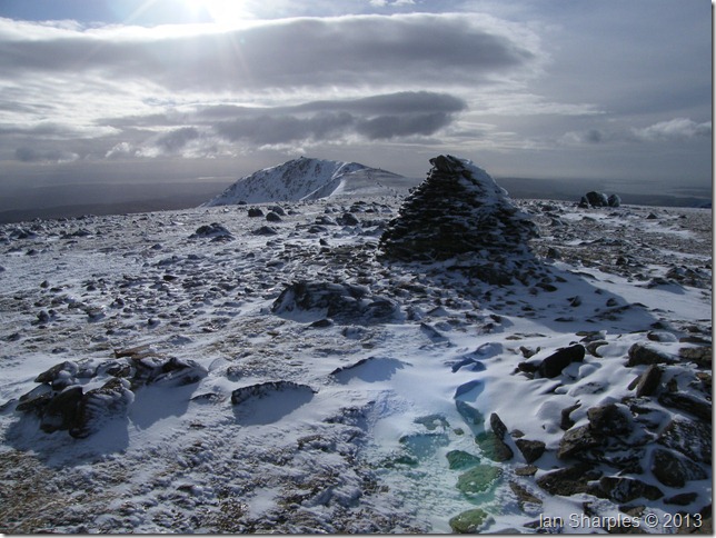
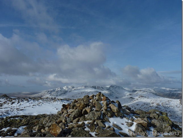
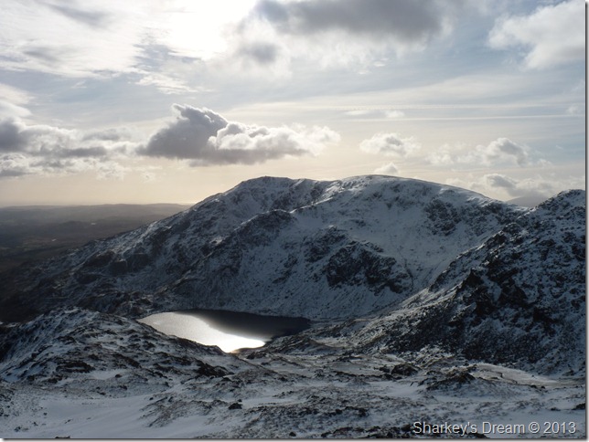
Coniston Old Man, Brim Fell & Dow Crag from Swirl How summit.
As we arrived at the summit Ian went to take his camera out, in doing this he held his hat underneath his arm, after only a couple of pictures Ian realised that his hat was now missing, it couldn’t of gone far Ian explained, I had it here just a second ago, as Ian searched around the summit I tracked back a hundred yards or so to see if it had been blown away, oddly, we both found nothing. |
 |
| |
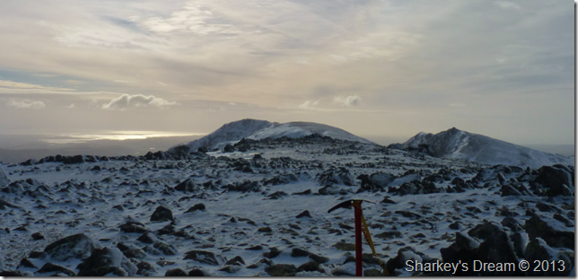
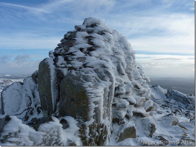
A rather chilled looking Swirl How summit cairn. |
 |
| |
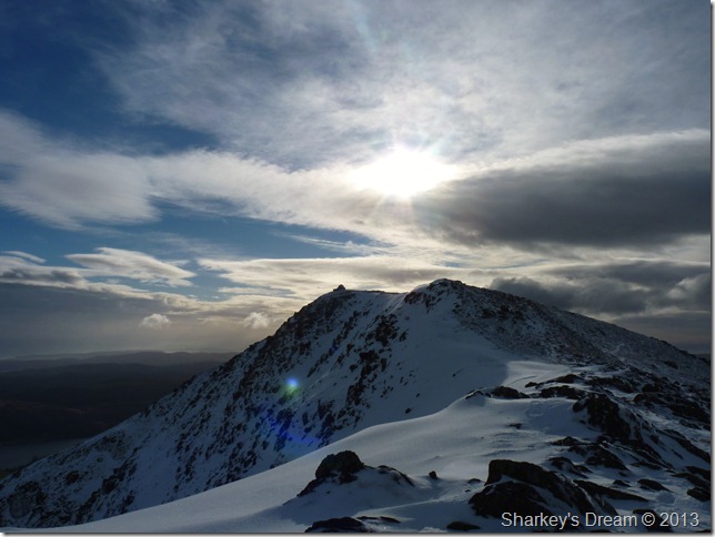
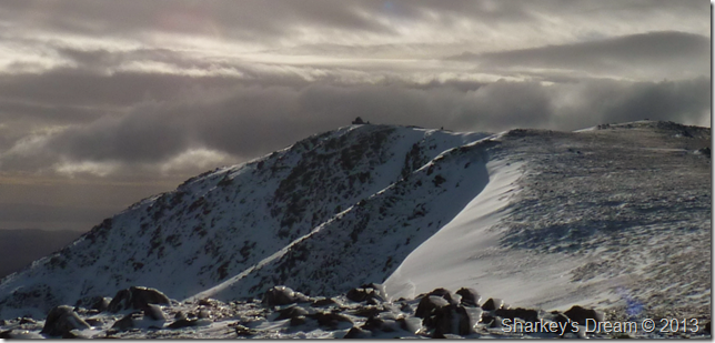
Prison Band, Swirl Hawse, Black Sails & Wetherlam from Swirl How summit.
A quiet apprehension ensued on both our parts next, we had spoken about it along Levers Hawse in that we didn’t know what to expect as we descended Prison Band, would we need our ice-axes & crampons was the question? |
 |
| |
Looking back up Prison Band from our descent, don’t worry about how steep it looks as it really isn’t this steep.
Well, I guess this answered our query, no we didn’t need crampons but the ice-axe came in handy. Here the snow was crunchy which just left us to kick heel holes when needed to make a safe descent which made this a pleasurable part of the whole walk. |
 |
| |
Midday sun catches Levers Water as we now start with a shy, yet tiring(ish)ascent on Wetherlam |
 |
| |
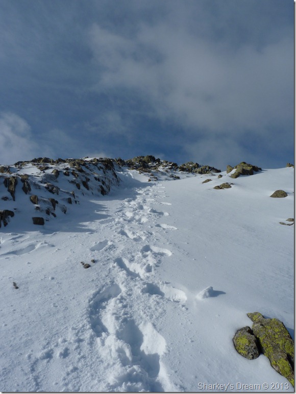
Wetherlam as we pass Black Sails over to our right.
The snow was a lot less pact which meant that every footstep gave through a foot of snow, the summit doesn’t look far & indeed, it is not, but punching fresh prints into a foot deep of snow sure made for some tiring work.
Heads down we press on. |
 |
| |
Crinkle Crags & Bow Fell from a well earned camera break. |
 |
| |
Looking back on ground covered from just beneath Wetherlam summit. |
 |
| |
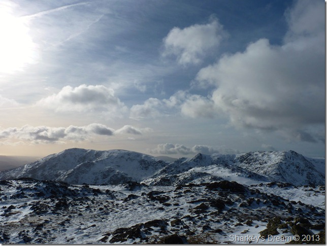
A host of southern fells including the Scafells from Wetherlam summit cairn.
It was time to take a short rest & maybe re-fuel.
We seek shelter out of the wind in the small stone shelter found nearby, this time we are not alone at the summit as two walkers prepare to leave the shelter (great timing) & press on in the direction we had just come from.
As we sat & ate lunch two women approach from the direction of Steel Edge, they approached the summit cautiously as one holds a map in hand, the two women walk over in the direction of Wetherlam Edge & didn’t look comfortable at what they are looking for, or at.
Eventually one of the women walks over & asked? What is the descent like over Wetherlam Edge/Birk Fell? we don’t know we explained, as we told her that we had come from the opposite direction, the women were dressed in winter clothing yet carried no poles, axe or crampons, do you think it is safe for us to descend that way they asked? Immediately Ian & I looked at one another at the same time, remembering that there is a rocky scrambly bit as you descend Wetherlam’s summit.
For all we know this section could be covered in ice & they were making it distinctively clear they did not want to do any type of scrambling no matter how small.
Hmmm, how do you recommend to someone not to go down that way without offending them or their climbing capabilities?
Well, in my eyes if you have to think about it for more than a few minutes you have already answered your question, don’t second guess it because its a long & tiring walk back if you have to turn around, I convince at least one of the women but the other is not as convinced, she looks at me as if I am querying her decision making, put it this way I smile, we are fully equipped for winter climbing today & given the decision I would have to think twice (not really true) to descend that way I guess – but given that these two ladies are of an elderly age(ish) & ill-equipped, I left the choice to them.
Thankfully they went back the same way they came.
After a short time spent at the summit & belly’s full again we spy our descent to the Black Sails ridge over more virgin snow. |
 |
| |
Now leaving Wetherlam for the Black Sails ridge (foreground) |
 |
| |
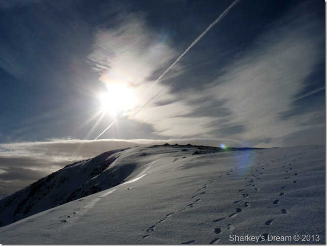
Blazing trails. |
 |
| |
Black Sails south ridge.
The ridge offers a fine platform of the surrounding summits & craggy outcrops, again a most pleasurable experience as we made our pathless descent towards Levers Water over on the right.
To the left of the ridge is the Red Dell valley, memories of my past two summits of Wetherlam started down there. |
 |
| |
Along with the time spent searching for Charmers Grave & the odd chat at each summit, Black Sails was just another key factor why this walk went into the seventh hour.
Talk about taking our time to endure this fine ridge is an understatement. |
 |
| |
Looking over Levers Water to Little How & Great How Crags.
We took more time out at the shore line of Levers Water, not because of tired of aching limbs, but because it would of been rude not to on this fine February afternoon. |
 |
| |
Looking over Simons Nick copper mine & the Black Sails ridge (R) |
 |
| |
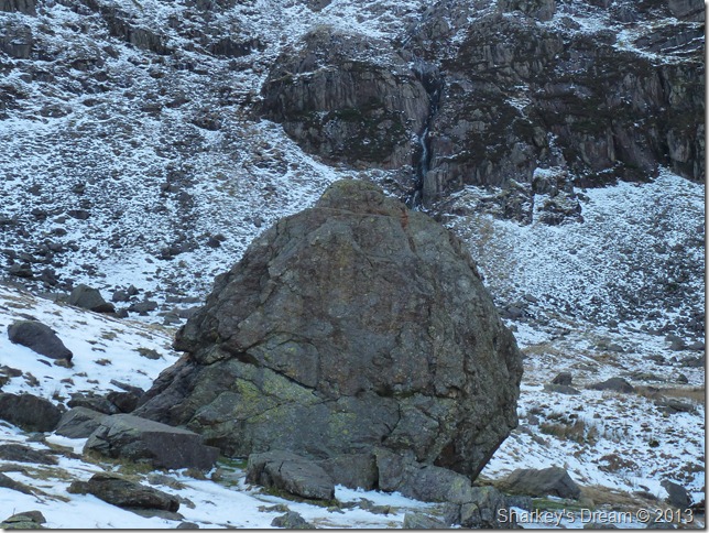
The Pudding Stone, Boulder Valley.
Deemed "not as big” as the Borrowdale Bowder Stone – The Pudding Stone is the largest boulder in Boulder Valley & would easily equal the size of a terrace house.
From Boulder Valley it is just a short brisk walk back to the car at Walna Scar, throughout the whole days walking I think more care was taken along this short section of iced-up path than any of the fells or edges we traversed today, luckily we both managed to stay on our feet avoiding any unnecessary embarrassment.
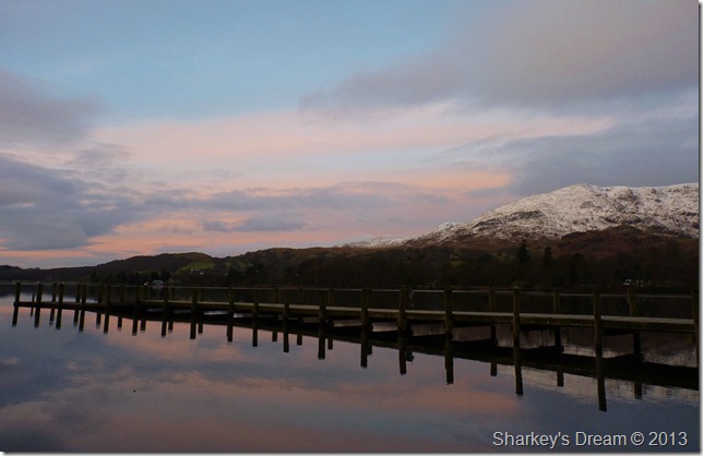
We arrive back at Walna Scar to a bristling car park (un-metered for now!) and begin to de-layer & pack gear up for the day, I finish off my coffee & sandwiches under a high sun & what promises to look like a beautiful evening sunset, in which case I or Ian wont be around to witness, so here’s one more from this mornings amazing sunrise over Coniston Water. |
 |
| |
Coniston sunrise from Monk Coniston.
Before I wrap this post up I would like to thank Ian for his superb company today & for helping me attain a wandering vocation in locating Charmers Grave, until next time. |
|
| |
| Back to top |
 |
|