|
Red Pike to Fleetwith Pike |
 |
 |
17th February 2013 |
 |
|
It can be a fantastic notion when you can hand pick your next walk, in-fact I was only talking on the subject to Ian last week whilst we traversed the Coniston Fells.
At times picking your next walk comes easily, at times it can be a conundrum of factors taking in your fitness & relying heavily on a weather forecast.
Well, my fitness is not back to its full potential whether it be physical or emotional, I’m bordering on the latter no matter how much I fight it…
Either way today I & anyone wandering the fells got lucky, that seldom day when all is going for the walker, the thought of what should happen should the weather turn buried deep inside, for now that is.
All I had to do was hand pick my fells & this week, I needed no help. |
|
Wainwright Guidebook |
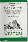 |
| The Western Fells |
-High Crag:
The fells aspect from Buttermere is exceedingly impressive, given an air of complete inaccessibility, but the opposite flank falling to Ennerdale’s new forest lacks distinctive features although everywhere rough. The summit commands a glorious view of mountainous country, a deserved reward for it is neither easily attained nor easily left, its defence of battlemented crags and hostile stones being breached only by the narrow ridge connected with High Stile, a mountain with difficulties of its own. Indeed, if it’s not for this ridge (which goes onto and beyond Red Pike) the summits of both will be almost unattainable by the ordinary pedestrian.
With the help of the ridge they should certainly be visited, the scenery being of the highest order and the situations exciting… |
 |
|
| |
|
Overview |
|
|
| Ascent: |
4,750 Feet, 1,448 Metres |
| Wainwrights: |
5, Red Pike (Buttermere) – High Stile – High Crag – Haystacks – Fleetwith Pike |
| Weather: |
Dry & Bright With Some Strong Gusts On Tops, Highs Of 8°C Lows Of 4°C Feels Like –6°C Over Exposed Ridges |
| Parking: |
Roadside Parking, St James Church, Buttermere (F.O.C) |
| Area: |
Western |
| Miles: |
9.2 |
| Walking With: |
On my own |
| Ordnance Survey: |
OL5 |
| Time Taken: |
7 hrs |
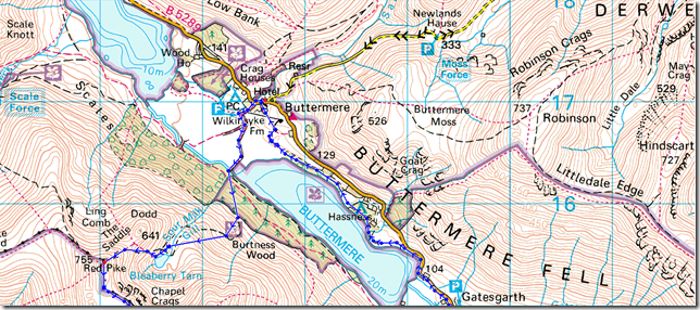
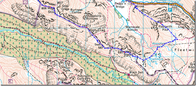
| Route: |
Buttermere – Old Burtness – Bleaberry Tarn – Red Pike – High Stile – High Crag – Gamlin End – Seat – Scarth Gap – Haystacks – Blackbeck Tarn – Warnscale Beck – Dubs Hut – Dubs Bottom – Fleetwith Pike – Fleetwith Edge – Buttermere Lake Path – Buttermere |
|
| |
|
Map and Photo Gallery |
|
|
 |
| |
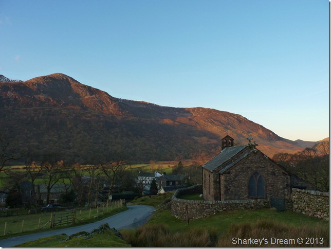
St James Church Buttermere 07:52am 6°C
Throughout the winter months I try to tie in my arrival in Lakeland with sunrise, today I was slightly later but not much due to a slight navigational error on my part as I drove through Keswick & I guess your thinking idiot, because they were the same testaments that left my mouth also.
In my haste I kinda put the foot down thinking I’m going to miss out on Buttermere’s only available roadside parking but I was wrong, Buttermere in fact had that ghost town feel to it as I got first dibs on parking spaces, it wasn’t to last but nice while it did.
Kitted up in no time at all, I have a wander over to St James Church. |
 |
| |
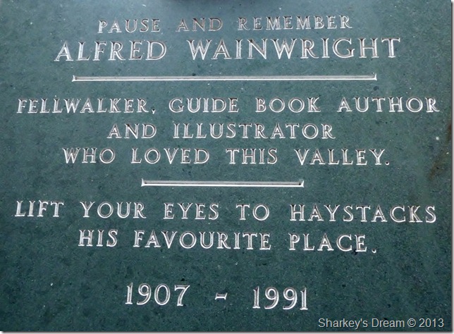
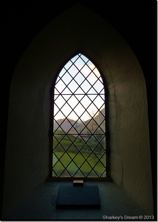
Because not every church in England has a memorial dedicated to Alfred Wainwright looking beyond his final resting place on Haystacks.
It Read’s… |
 |
| |
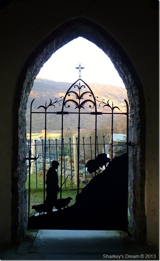
To the entrance of St James is the fantastic iron Good Shepherd gate along with his heard of sheep, I wonder how many visitors to St James have overlooked this lovely piece of iron work.
With pictures took it was time to head through the village & pick up my path at Old Burtness woods.
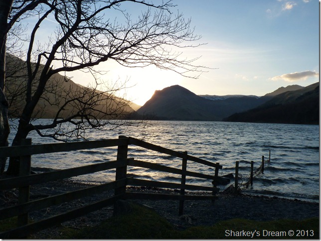
Not before a few pictures Lakeside. |
 |
| |
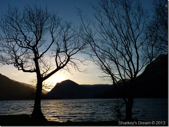
Fleetwith sunrise.
Fleetwith Pike stands across the water of Buttermere lake, it doesn’t look far & indeed it really isn’t, but in between here & there I’m going to squeeze in a little under 10 miles & over 4,700ft of ascent.
I best get on eh. |
 |
| |
Fleetwith Pike silhouette. |
 |
| |
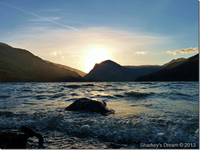
Fleetwith as the waves break.
Okay, now it really is time to go. |
 |
| |
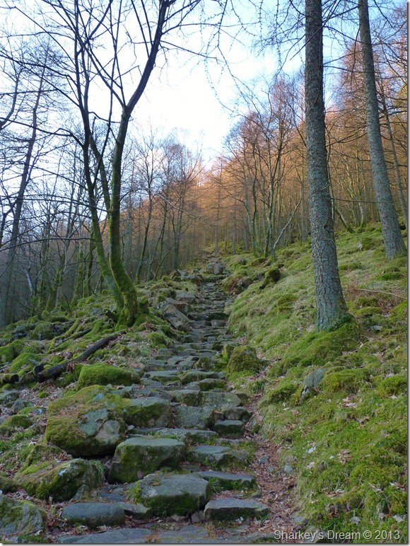
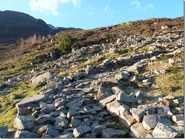
Steep ascent through Old Burtness Wood.
The stone path is reached after crossing the wooden footbridge over Buttermere’s outflow, or more commonly know as ‘Buttermere Dubs’ after crossing the footbridge the path is located just on your right, its a steep one straight from the start but of excellent pitch & quality. |
 |
| |
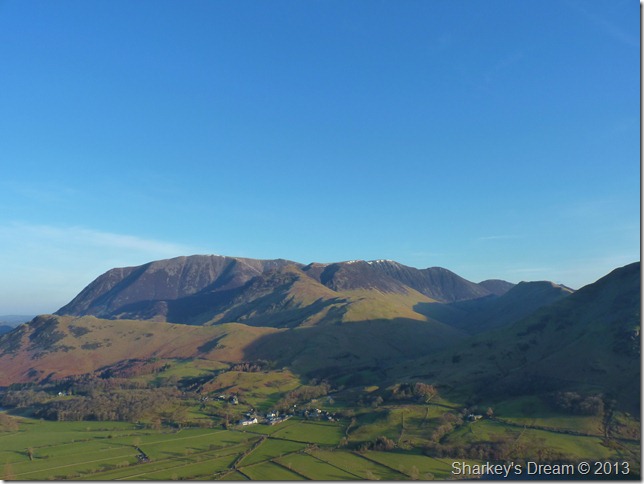
After the initial steep climb through the woods the views around really start to open up, here looking towards the bulk of Grasmore & her satellite fells. |
 |
| |
Bleaberry Tarn bound.
After leaving Old Burtness woods the path takes on a zig-zag effect, great if you like zigzagging! |
 |
| |
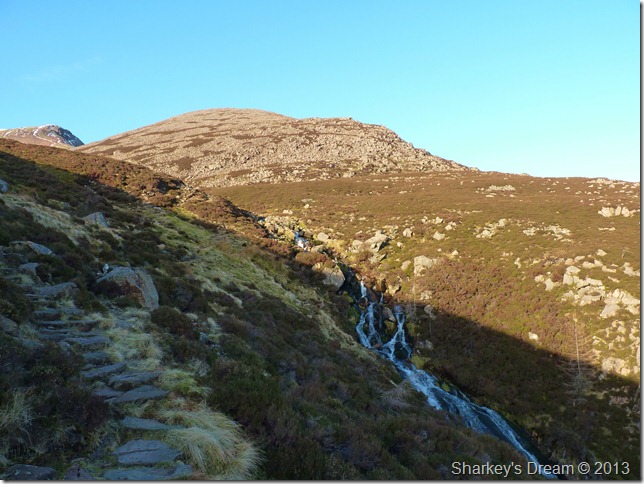
Red Pike (far left peal) from Sour Milk Gill.
On the last zag the path arrives at Sour Milk Gill & a gushing waterfall, Bleaberry Tarn is just an ease away. |
 |
| |
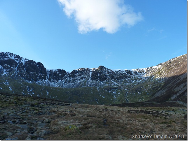
Chapel Crags as I take in the last strides for Bleaberry Tarn.
Normally a very wet & boggy affair, but not today, the semi-frozen ground was a pleasure to walk over. |
 |
| |
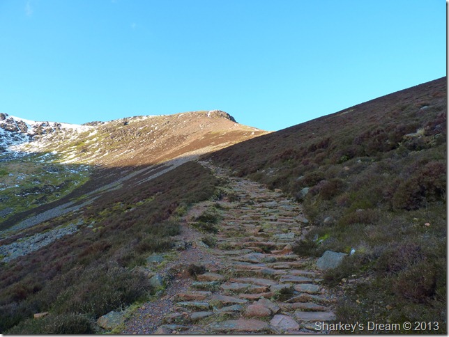
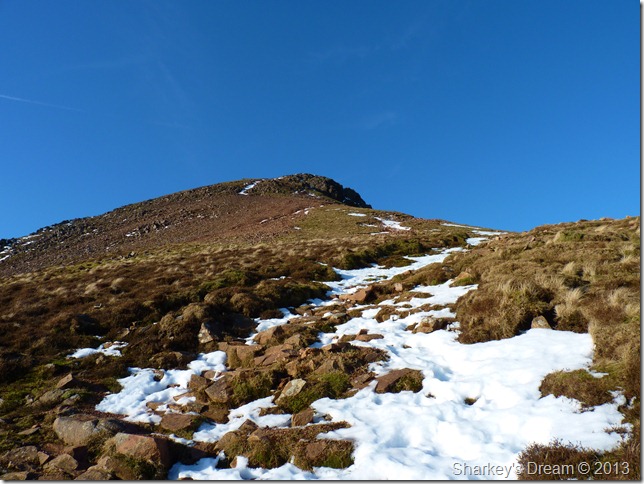
Red Pike ascent.
After a short time spent at Bleaberry Tarn do I decide to head for the summit, it really is a ‘look at your boots kinda ascent’ Evidence of this will appear later. |
 |
| |
Looking back on Bleaberry Tarn with Robinson & Hindscarth over in the left of the picture. |
 |
| |
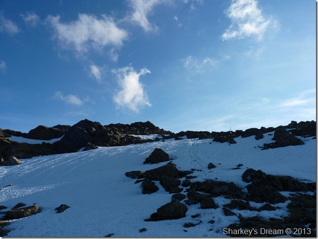
At approximately 650 metres I am met with a retreating snowline, avoidable in most places if you don’t mind taking on the grass as an alternative route of ascent, here the snow, as sporadic as it was-was almost un-walkable as it had gone from frozen, then back to thaw so many times it now resembles pack ice, if the snow was anymore than I had to cope here, the crampons would more than likely have made a brief appearance if not just to get up the last steep push.
The crampons stay in the pack as the summit beckons. |
 |
| |
The north & north western fells from Red Pike summit.
The air clarity was as good as I’d seen in a long time, with a strong sun & a fresh easterly wind it was time to nip up a little, on went the beanie & Windstopper gloves along with my ever faithful Bloc Billy’s, I’m going to need them I think to myself, as I turn face towards High Stile. |
 |
| |
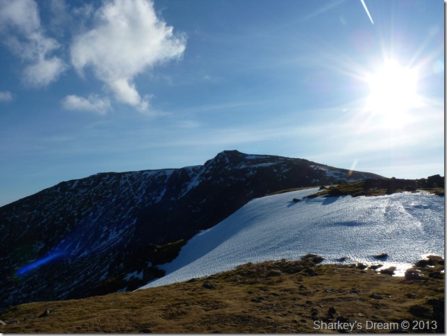
High Stile as I descend the ridge from Red Pike.
The sun glare is so strong taking photos becomes neon impossible of the ridge ahead. Note to self ‘must buy decent anti-glare filter for camera’ |
 |
| |
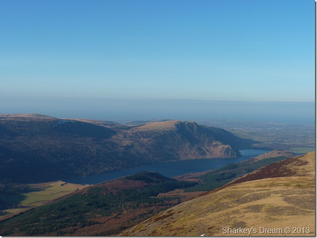
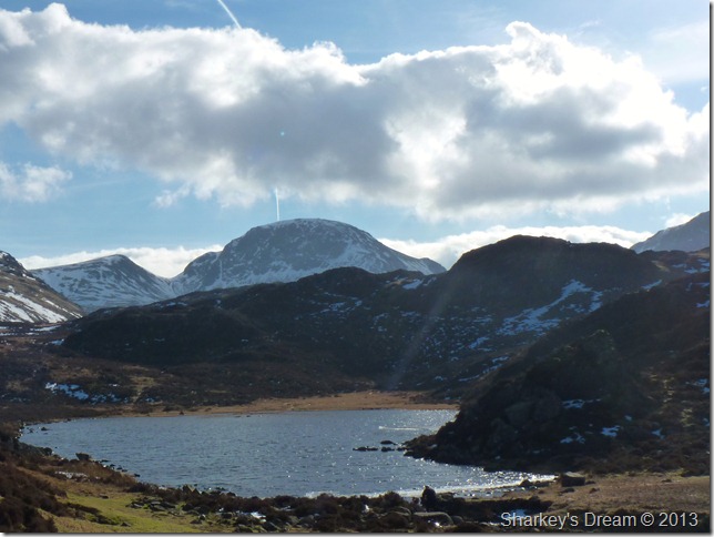
Ever more west towards Crag Fell & Enneredale Water. |
 |
| |
Continuing along the ridge as I cross numerous retreating snow cornice below the summit, is this the last we’ll see of the snow? I guess so in which case take a walk over the crunchy stuff, it may be your last experience until next years snow. |
 |
| |
Chapel Crags, Red Pike & Dodd from High Stile.
Red Pike can be seen as it escalates from Bleaberry Tarn with Dodd taking centre of the photo, here you can see the steep last pitch of Red Pike’s final ascent. |
 |
| |
Approaching High Stile summit after a little ascent from the ridge path. |
 |
| |
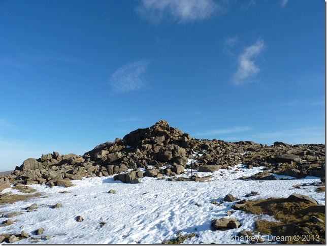
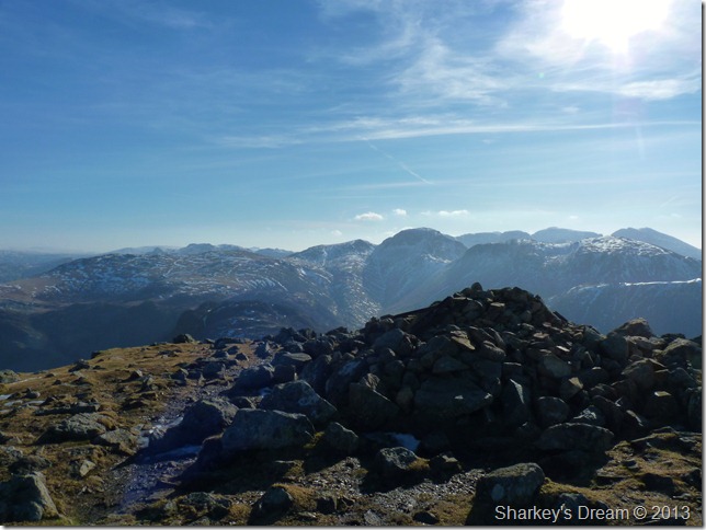
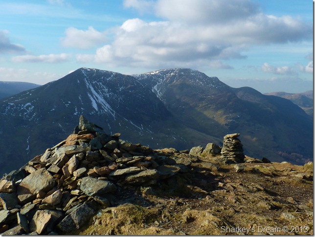
High Stile summit cairn. |
 |
| |
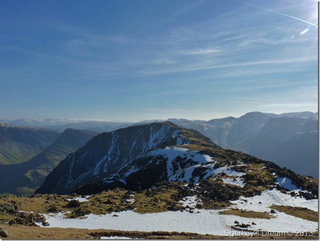
High Crag as I leave High Stile summit & prepare to re-join my ridge walk.
A wall of haze envelopes my surrounding views in an almost 360° panorama, over on my right for now at least, I have the impressive Pillar / Kirk Fell ridge but photographing it was, as I have said previously almost impossible to get a decent shot.
I continue along the ridge towards High Crag with hopes of the haze lifting which indeed it did, but for now at least, lets just concentrate on what I have before me & just how wonderful it looks. |
 |
| |
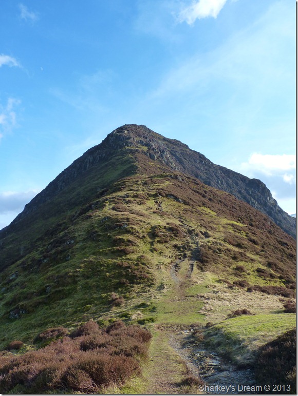
High Crag ahead.
I meet with my first walker of the morning as we share pleasantries on the weather & our routes, my fellow walker is heading towards Red Pike & Great Bourne, a route I did a couple of years earlier in my younger days of which I have fond memories, in-fact It was only my head strong & general stubbornness that didn’t see me heading for Great Borne as I gazed upon it from Red Pike not half an hour earlier.
We both bid farewell & get on our ways. |
 |
| |
Looking back along the ridge over Burtness Combe & High Stile. |
 |
| |
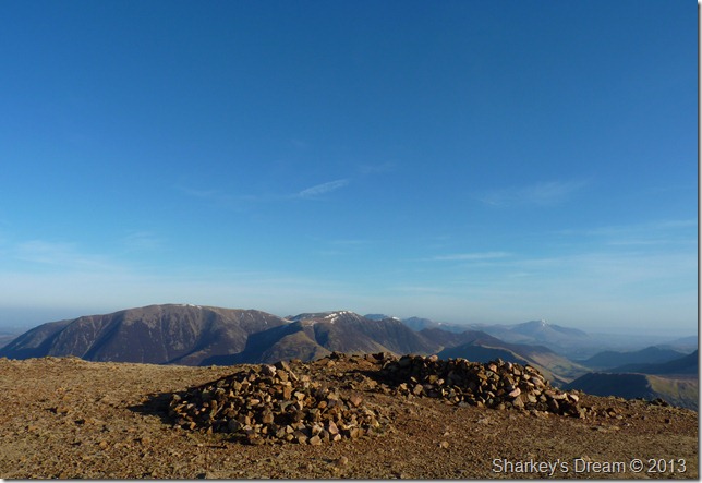
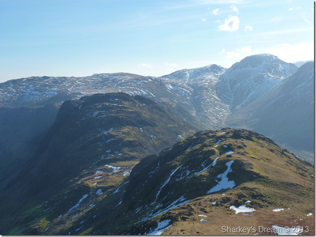
Through the haze, Green & Great Gable along with Kirk Fell & the distant Scafell’s from High Crag summit cairn. |
 |
| |
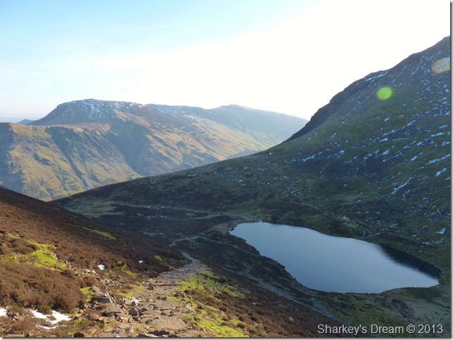
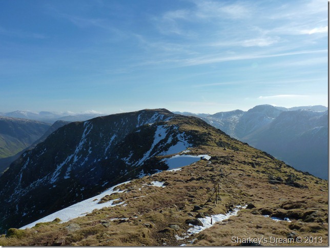
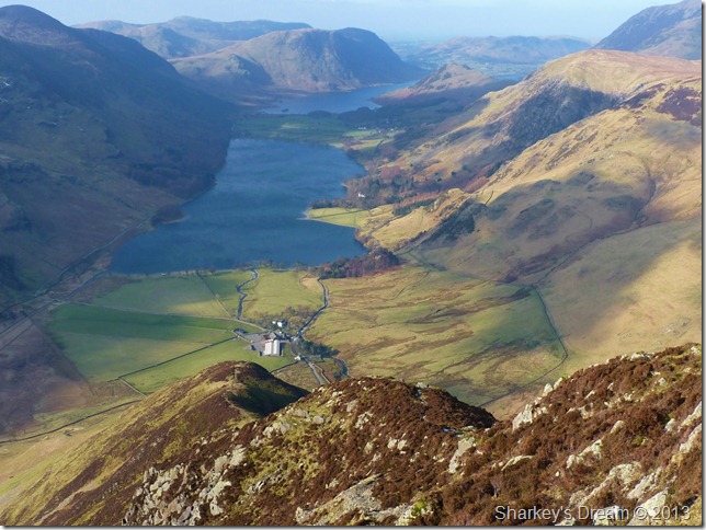
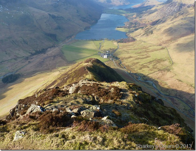
This is one of my favourite personal views in Lakeland, Haystacks over Seat (less the haze of course)
I make my retreat onto Seat via a loose scree path & finally the zig-zag stone path which was a major concern along my ridge walk, for I know this route is steep in descent & commonly packs up with snow drift, It turns out I was right to have a little concern at least – as I use the grass to give more traction underfoot.
Three down two to go… |
 |
| |
A close up of Fleetwith Edge from Gamlin End.
Fleetwith Pike is on my antennary as my last summit on todays walk, as I gaze over at the ever impressive Fleetwith Edge. |
 |
| |
Fleetwith Pike, Hindscarth & a glimpse of Dale Head from the top of Scarth Gap Pass. |
 |
| |
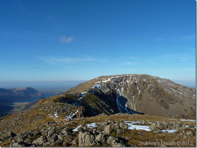
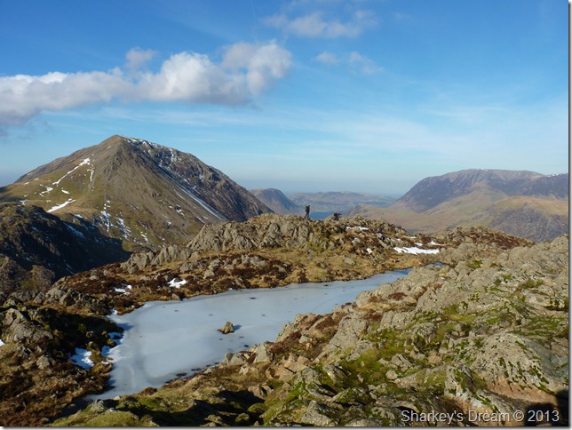
High Crag from just beneath Haystacks summit.
It was becoming apparent I was no longer alone, in fact I was glad of the company I had whilst on my craggy ascent on Haystacks.
I pass numerous crowds on the way up on this fine day, some with dogs some alone as I, all loving this breath taking landscape.
Anyone familiar to the ascent on Haytacks may remember ‘the craggy bits’ which of course are of real fun whilst on the ascent to the summit, it was on said bits did I obliterate my camera bag as it snagged on rock & as I pulled myself over the crags, I guess I was lucky not to lose the camera as now I will have to hold my camera ‘in hand’ for the duration of the walk.
Giant bridge camera in hand I head for the summit. |
 |
| |
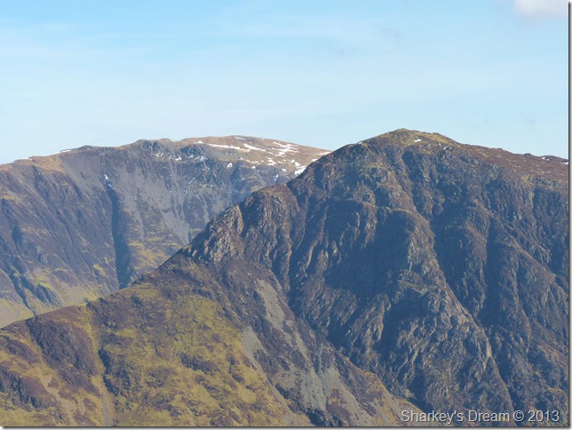
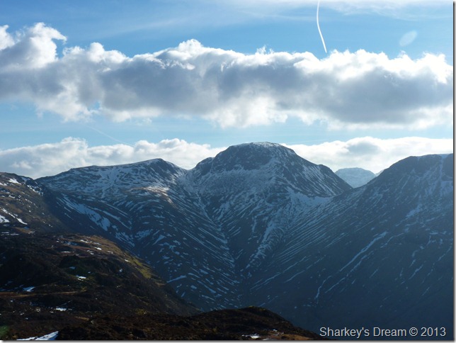
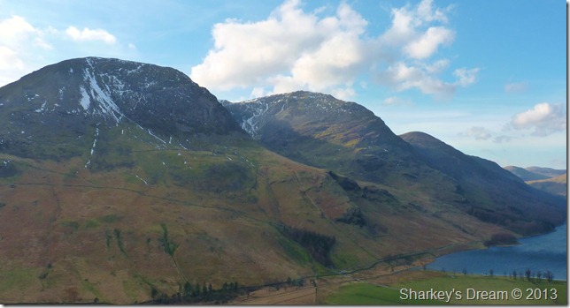
Green Gable & Great Gable from Haystacks summit.
As the haze lifted slightly I was able to get my shot of the Gables, the peak you see towards the right of Great Gable is that of Great End, petering further right is Looking Stead (Pillar)
Lunch Time. |
 |
| |
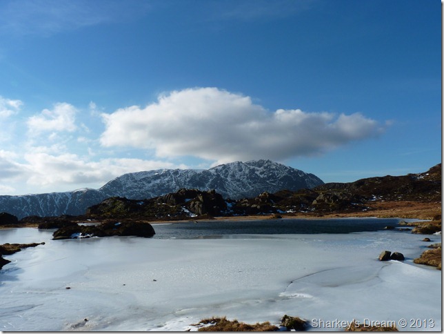
At a semi-frozen Innominate Tarn. |
 |
| |
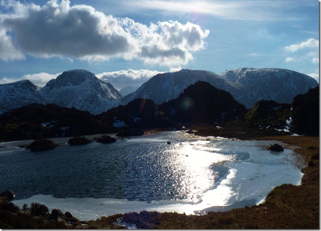
Pillar from Innominate Tarn.
Fed & watered I shoulder pack with thoughts of my Fleetwith Pike ascent. |
 |
| |
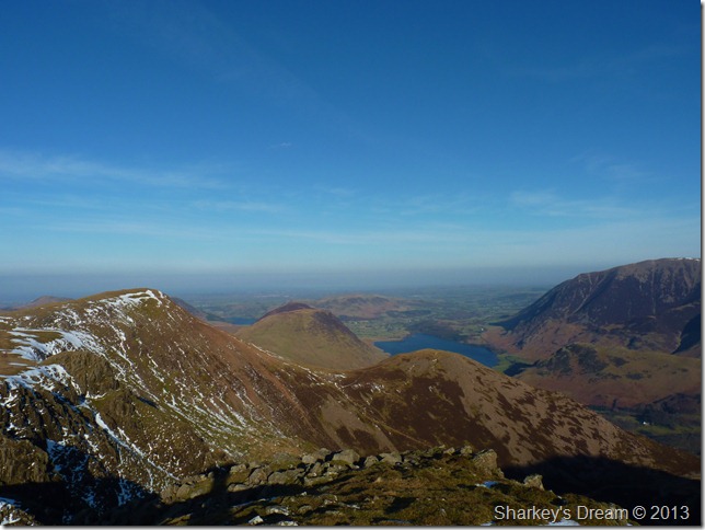
Green Gable & Great Gable with Windy Gap from Blackbeck Tarn. |
 |
| |
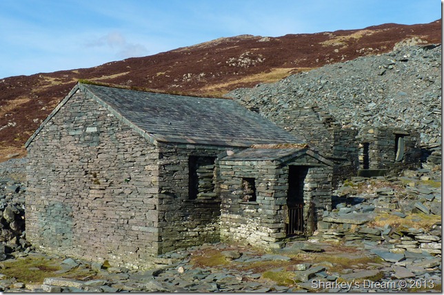
Dubs Hut in the afternoon sunshine.
With now tiring limbs I try & pick my best ascent route up towards Fleetwith Pike summit, I spot two walkers with a dog descending above Dubs Hut but this route looks steep, I figure if I walk a little further up the tram road I’ll take out a little of the steep ascent. |
 |
| |
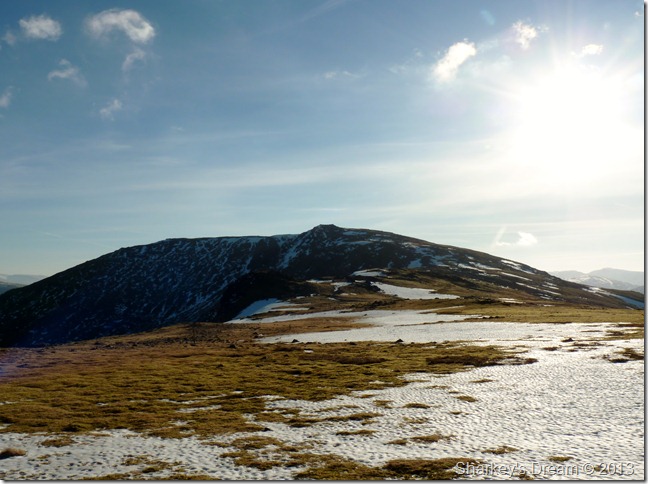
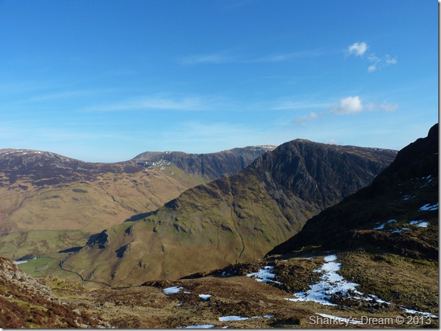
Looking back at my route starting with High Crag, High Stile & Finally Red Pike from Fleetwith Pike summit cairn. |
 |
| |
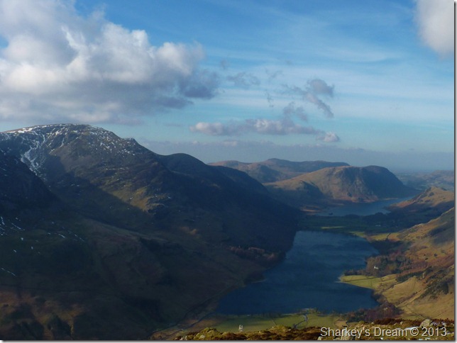
Buttermere & Crummock Water from Fleetwith Pike summit. |
 |
| |
Fleetwith Edge as I prepare for my descent.
Fleetwith Edge does have a sharpness to it but not like Striding or Sharp Edge, here routes can be descended by hand & careful thought, it is ironic that here on my last fell & descent of the day in my tired state do I require all my concentration.
The path is narrow & twiney especially along the upper reaches, but not dangerous nor misleading offering fantastic views throughout the Buttermere valley & Honistor Pass.
An ascent with fresh legs rather than descent with tired ones would be a fantastic way to reach the summit. |
 |
| |
Descent on Fleetwith Edge. |
 |
| |
Looking back up on Fleetwith Edge as I tap my toes back into my boots.
Fantastic! |
 |
| |
Looking back on ground covered with High Crag, High Stile & Red Pike as I near the end of my descent. |
 |
| |
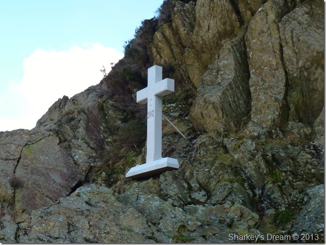
The Fanny Mercer memorial cross found on Fleetwith Pike’s lower crags.
Fanny Mercer age 18 servant of Rev P Bowden Smith accidently died here on her day off when her staff jammed against a crag, throwing her to her death on 8th September 1887 |
 |
| |
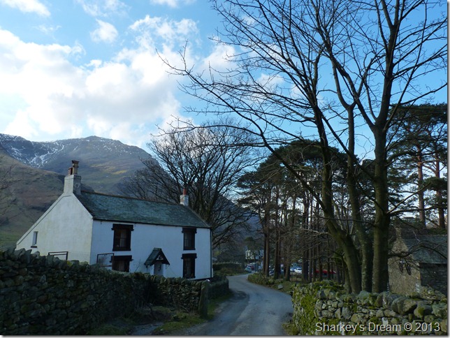
Gatesgarth Cottage.
My walk is almost over as I trod the lanes towards the Lake path that will lead me back to Buttermere village, here visitors buy ice-cream & take in the late afternoon sun wrapped up in their winter clothing.
Only the fact that my boots & trousers are evident of my adventures on the fells, oh…and my camera, still in hand. |
|
| |
| Back to top |
 |
|