|
Blencathra’s Ridges & Edges |
 |
 |
6th July 2013 |
 |
|
It’s the early hours of Saturday 5th July & I cant sleep. In just over a little three hours time my alarm is going to ring yet not through want of trying, my eyes just will not close. Aren’t you tired I hear you ask? I could sleep on a window sill (or at least my body could) but…my mind insists on keeping me awake at this hour.
It is unusual for my body to act this way, I cant speak for mind because that has one of its own, lets think about what could cause such events to happen, yes that’s a good idea because that’ll sure knock you to sleep Paul.
You don’t have to be a sleep therapist or a drunk to know why I’m awake at this ungodly hour of which I am about to share with you right now… its because up until around five hours earlier I knew where I should have been walking in a little over six hours time. For you see, I had set my sights on way west, somewhere around the Ennerdale Fells or, I may even break south & contour the Eskdale fells, that was the easy bit, reading a weather report forecasting that said two areas of Lakeland would be under cloud & mist until lunchtime kind’a messed my plans up… and my head, which these days doesn’t take much.
I scour my maps co-ordinating with the forecast, I can’t seem to get the south western fells out of my mind, that was until I remembered about Blencathra & the fact that although I have scaled her heights many many times, not so via The Doddick Fell Ridge.
Add to my already confused state that time was also factor in todays walk as I & my family had been invited to a BBQ at my brothers house, I was warned by said brother not to be late or I’ll miss the best of the food.
So you see my dilemma?
All I needed to do now was to drift asleep… its amazing what an idea can do to ones mind, all that was left was how I was going to gain her summit & make the most of her Ridges & Edges. |
|
| Wainwright Guidebook |
 |
| The Northern Fells |
- Sharp Edge:
Sharp Edge is the highlight of this walk, shining like a beacon on what is otherwise a dreary line of approach. The route has a long-established reputation and is deservedly popular.
Sharp Edge is a rising crest of naked rock, of sensational and spectacular appearance of breaking wave carved in stone. The sight of it as close quarters is sufficient to make a beholder about to tackle it forget all other worries, even a raging toothache. The crest itself is sharp enough for shaving (the former name was Razor Edge) and can be traversed only a cheval at some risk of damage to tender parts. But, as on Striding Edge, an easy track has been worn just below the rim of the north side; using this, rock-handling is kept to a minimum. There is one awkward place, calling for a shuffle off a sloping slab on to a knife-edge: countless posteriors have imparted a high polish to this spot. |
 |
|
|
| |
|
Overview |
|
|
| Ascent: |
3,307 Feet 1,008 Meters |
| Wainwrights: |
2, Blencathra – Mungrisdale Common |
| Weather: |
Hot & Sunny, Overcast At Times, Slight Gust On Tops, Highs Of 22°C Lows Of 14°C Feels Like 11°C |
| Parking: |
Road Side Parking, Threlkeld |
| Area: |
Northern |
| Miles: |
9.7 |
| Walking With: |
On my own |
| Ordnance Survey: |
OL5 |
| Time Taken: |
5 hours |
| Route: |
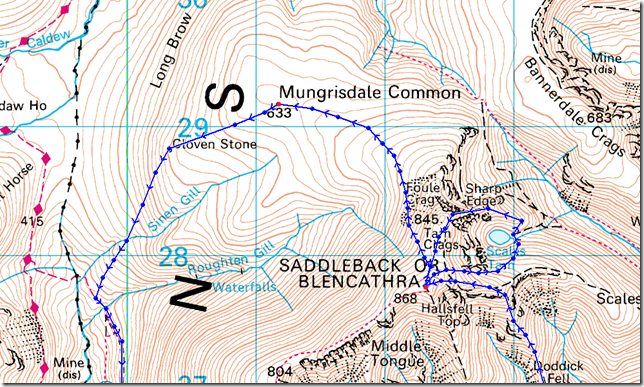
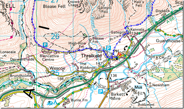
Threlkeld – Gategill Farm – Doddick Gill – Doddick Fell – Blencathra – Scales Tarn – Sharp Edge – Foul Crag – The Saddle – Blencathra – Mungrisdale Common – Cloven Stone – Path Below Blease Fell – Blencathra Centre – Threlkeld |
|
| |
|
Map and Photo Gallery |
|
|
  |
| |
| |
 |
| |
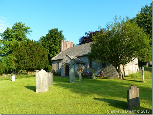
St Marys Church-Threlkeld 07:22am 14°C
The drive north consisted of how I was going to gain the most out of Blencathra & her fine buttresses, my main objective of the Doddick Fell Ridge had been firmly implanted but I needed more…Blencathra had ‘more’ by the bucket full, it goes by the name of Sharp Edge which I consider to be one of thee finest arêtes in the whole of the UK & I’m sure for any of you who has traversed it, will agree.
I park off road besides St Marys Church as the hot summer sun beamed down on the back of my neck as I laced up my boots, on the opposite side of the street a couple are talking at the door of their cottage whilst the bloke looks like he’s getting ready for a day out on his push-bike.
I open the iron gate to St Marys & walk about the church grounds… although the grass on the opposite side of the church is knee high in places, I found it strange that this side of the grass was cut to billiard table standard.
The church itself dates back to the mid sixteenth century but it is known that much older places of worship date back to this site as far back as the twelfth century. |
 |
| |
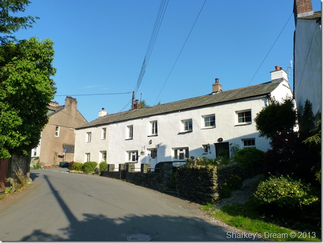
Taylors Cottages, Threlkeld.
As I leave the church yard back through the iron gate I turn left & head through the sleeping cottages of Threlkeld, here after passing Taylors Cottages – I take a right at the junction ahead sign posted Blencathra Centre, after only a few yards I am greeted by another sign posted Gategill, here I make another right & follow a faint path through a farmers field. |
 |
| |
The Hall’s Fell Ridge as I head for Gategill Farm.
The field despite the lack of rain is still very much wet underfoot as I squelch my way toward the farm building (Gategill Farm) you see in the bottom right of the picture.
The morning sun & the spectacular views make up for the bog like conditions underfoot. |
 |
| |
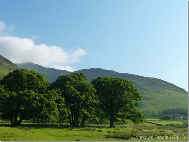
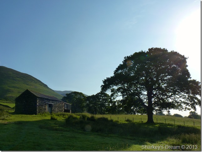
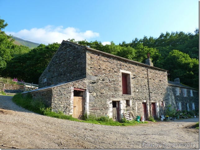
Passing this old stone barn & oak along the way. |
 |
| |
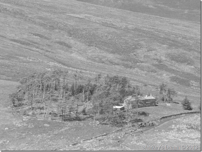
Gategill Farm.
I soon arrive at Gategill Farm after passing a polite oot Path sign (Foot Path F’ missing) directing my way through the farm yard, I couldn’t help but put on my best Scottish accent & continually repeat oot Path.
Idiot.
The footpath directs you through the yard where you will become complacent with the smell of a working farmyard complete with barking dogs, the clanging of gates & more barking dogs.
I over search my way through Gategill Farm before noticing another oot Path sign directing me far left of the building where I pass through a metal gate that flanks the lower reaches of Gategill together with a waterfall under the shade of trees. |
 |
| |
Hall’s Fell Top (Blenacthra’s true summit) seen from the bottom of Gate Gill.
Here I take on the lower flanks of Hall’s Fell before reaching Doddick Gill. |
 |
| |
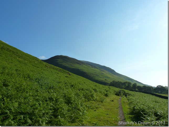
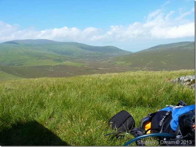
Heading for Doddick Gill.
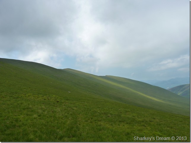
This was a pleasant walk that didn’t last as long as I would have liked it to, here Doddick Gill can be seen in the foreground of the photo with Doddick Fell rising above. The shaded buttress in the background is that of Scales Fell.
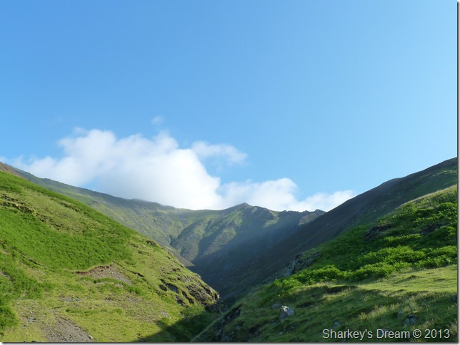
Clarity wasn’t a word for today, although I have a good mile of clear views yet anything further than that at this point was disappointing to say the least, hence no photos of Clough Head or the distant Mell fells which from here, shimmer through the heat of the morning air. |
 |
| |
The Doddick Ridge seen just before I encounter Doddick Gill.
My ridge walk starts on the grassy outcrop seen right. |
 |
| |
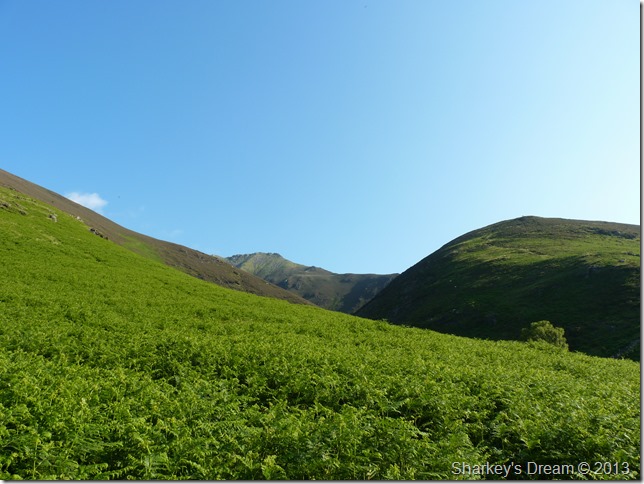
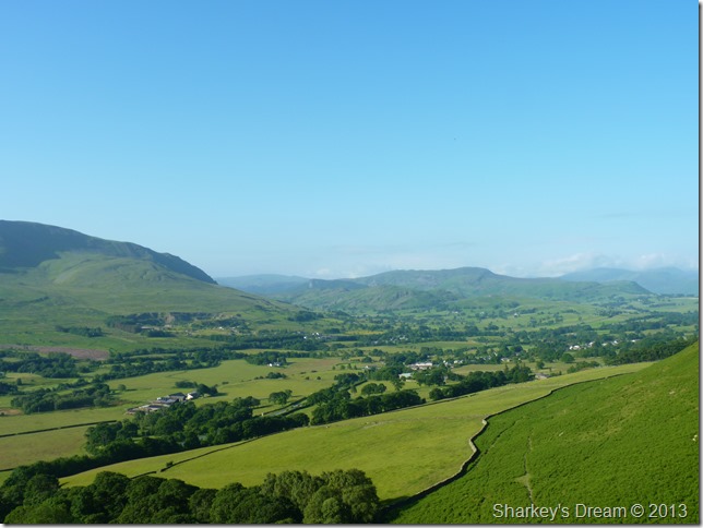
Distant views over Threlkeld towards the north west of Lakeland, the fell you see in the left of the photo is that of Clough Head which is now clearing a little through the haze. |
 |
| |
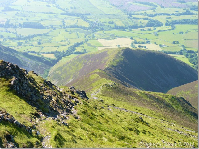
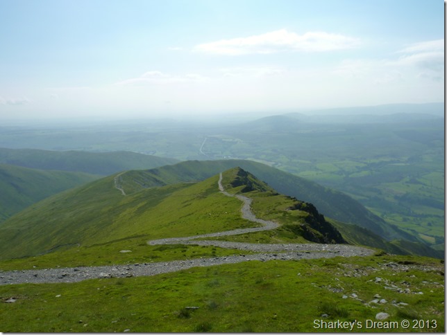
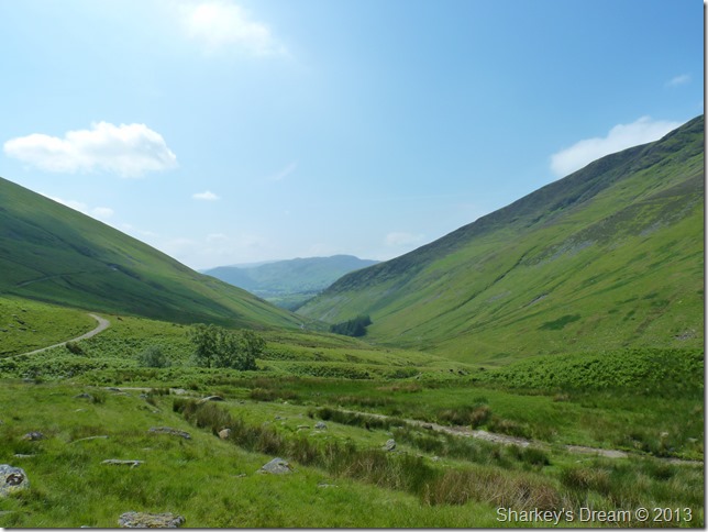
The Hall’s Fell Ridge (L) Doddick Gill (C) Hall’s Fell Top – Blencathra summit (C) Doddick Fell Ridge (R)
After reaching the top of a steep grassy climb are you presented with this grand view of Doddick Gill flanked by both the Hall’s & Doddick ridges.
Doddick Gill can be ascended but only by as A.W would put it… Tough Guys Only. I can see his point but I wouldn’t mind giving it a try some day. |
 |
| |
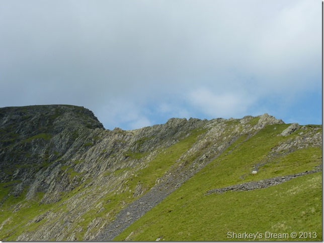
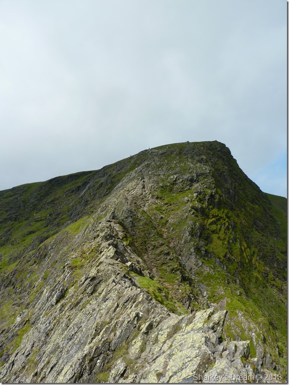
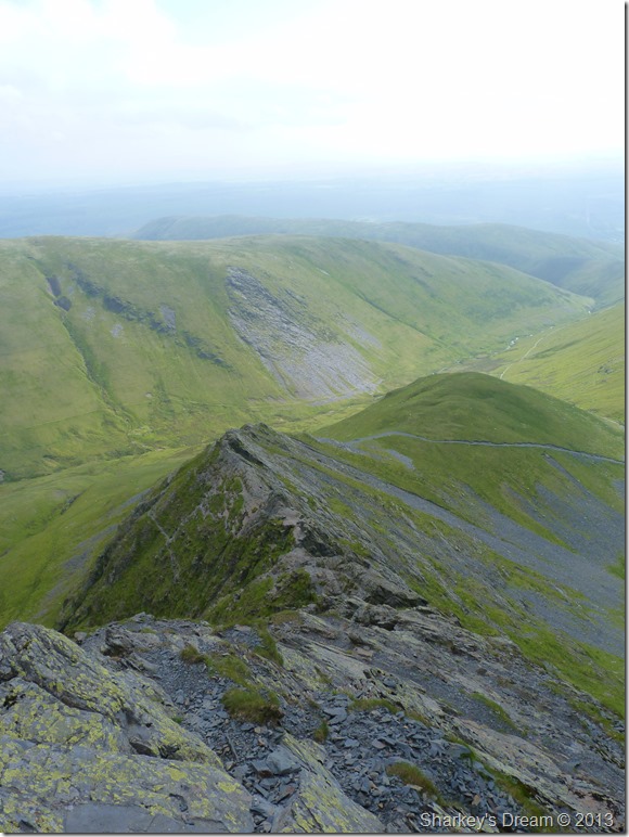
The Doddick Fell Ridge.
Comprises of a grassy ascent of which can be steep in places…I found myself looking over to the Hall’s Fell Ridge of which I have ascended/descended many times…I came to the conclusion that an ascent via the Hall’s Fell Ridge complemented by a descent via the Doddick Fell Ridge would come high on any walkers agenda. |
 |
| |
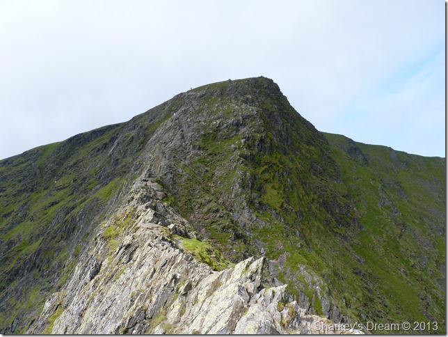
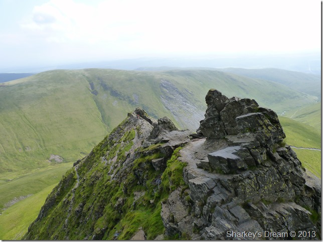
Here, looking back down the ridge from the second Rock Turret.
You are presented with a choice after arriving at the second Rock Turret as the path now divides into two, both paths will lead you onto Doddick Fell Top, the left path is more narrower & a little more daunting than the right which looks the more popular route…
I went with the left path that over looked Doddick Gill. |
 |
| |
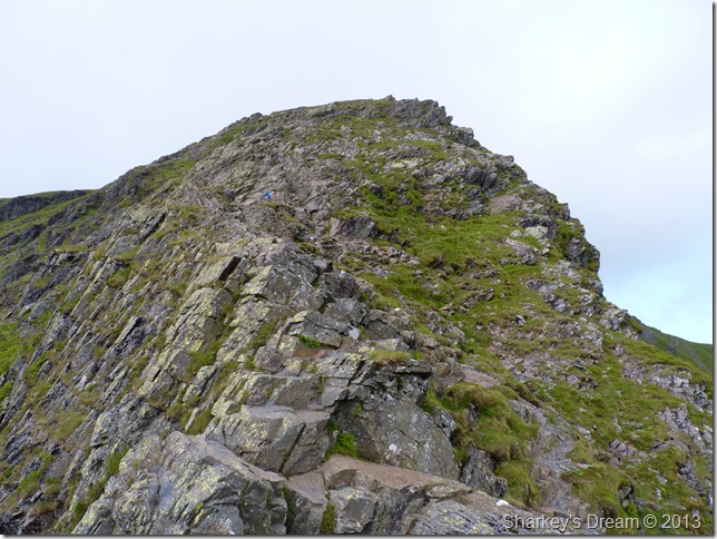
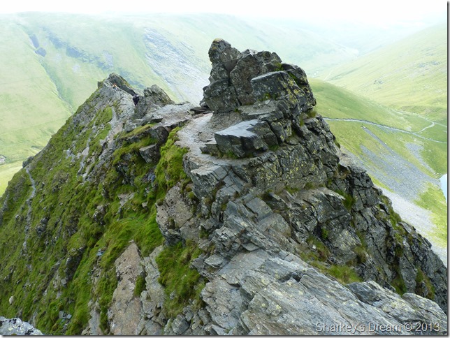
Here, looking back down the ridge via my ascent path with views into Doddick Gill. |
 |
| |
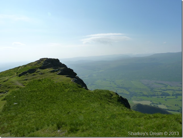
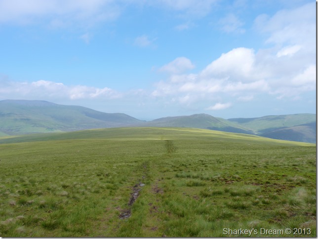
Doddick Fell Top.
From Doddick Fell Top you are presented with grand views over towards Sharp Edge. |
 |
| |
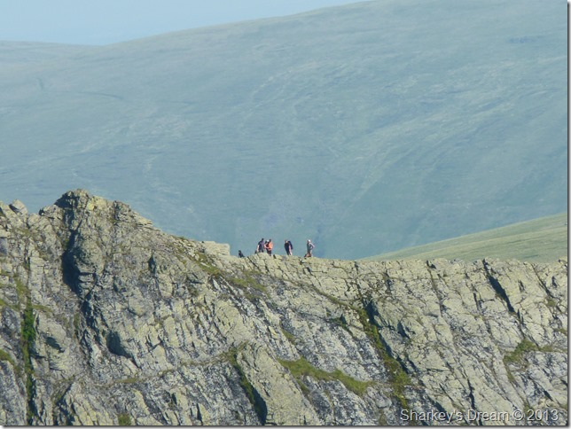
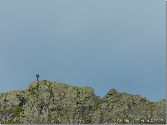
A close up of Sharp Edge from Doddick Fell Top.
Four walkers & a dog pause as they traverse Sharp Edge, by Scales Tarn below more & more walkers are approaching, I need to time my own traverse well, but first I need to make the summit myself. |
 |
| |
Sharp Edge less the zoom. |
 |
| |
Doddick Fell Top seen beneath the summit of Blencathra. In the background we have the Scales Fell ridge with hazy views of the Mell Fells over in the distant right. |
 |
| |
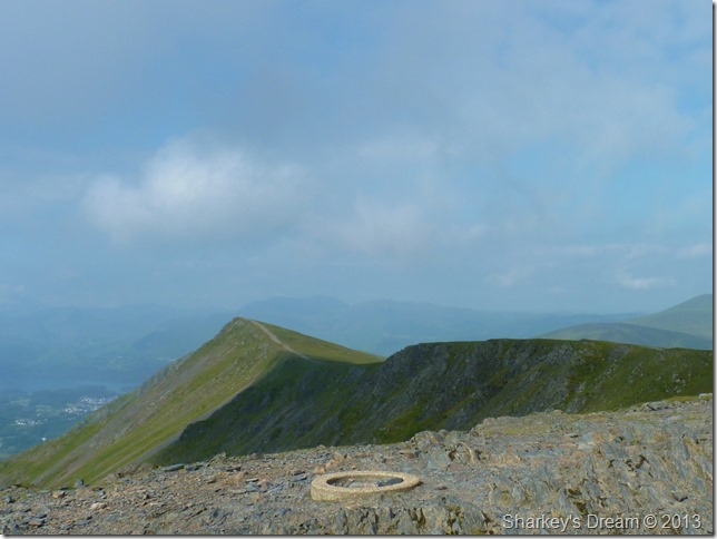
Gategill Fell Top seen from Blencathra’s circular summit trig column. |
 |
| |
The Saddle.
After summit one, it was now time to descend to Scales Tarn via a steep narrow path over on the right of the ridge. |
 |
| |
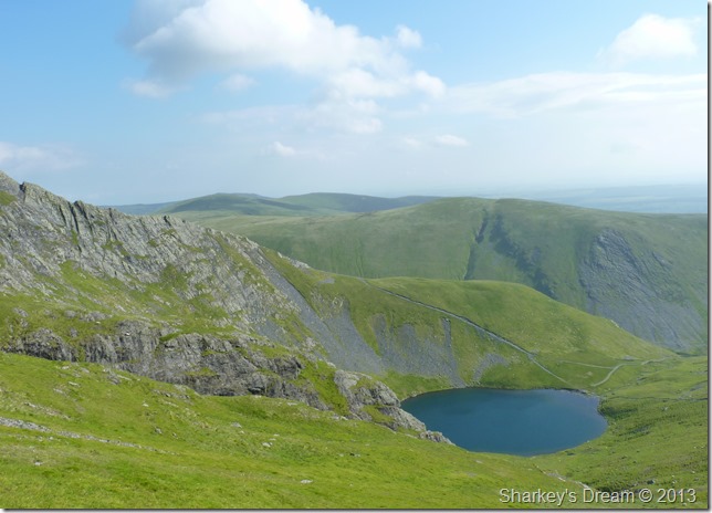
Sharp Edge rising steeply from Scales Tarn from my descent. |
 |
| |
Here I zoom in on a solo walker as he crosses Sharp Edge.
My main objective was to get down to the shore of Scales Tarn, here I can treat that niggling head ache caused by the humidity with pain killers & maybe rest up with fresh legs before taking on Sharp Edge.
I keep an eye on the ensuing walkers waiting to tackle Sharp Edge themselves as they too rest up at Scales Tarn. |
 |
| |
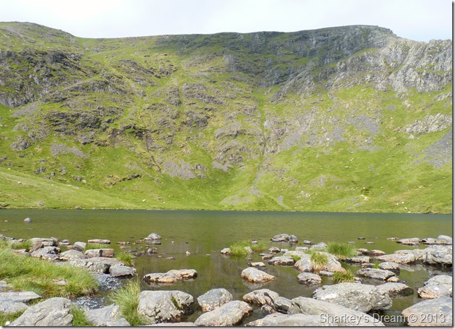
Down by Scales Tarn.
By the time I reach Scales Tarn the walkers resting up have made for their own ascents, I time my ascent by watching them ascend the steep path besides Scale Tarn, it’s only when they reach the base of Sharp Edge do I make my own move. |
 |
| |
Sharp Edge. |
 |
| |
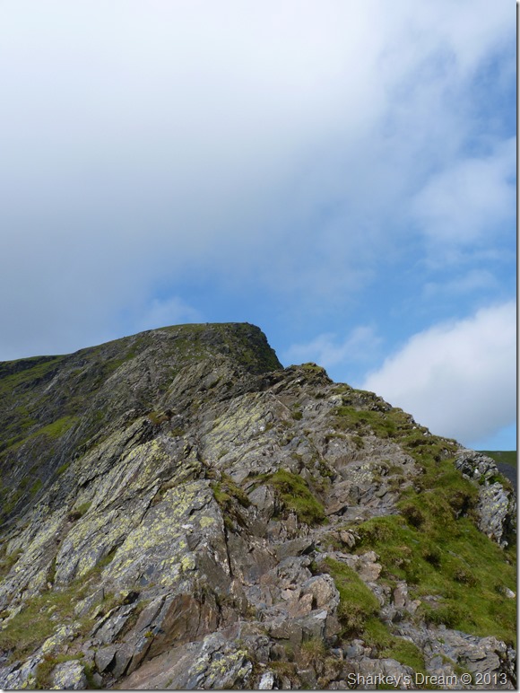
Sharp Edge from the foot of the climb.
I have traversed Sharp Edge many times now, it is only here do you get that butterfly feel in the pit of your stomach…this works wonders with the adrenalin that is about to follow. |
 |
| |
Living on the edge. |
 |
| |
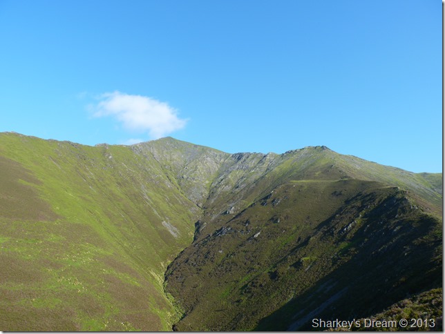
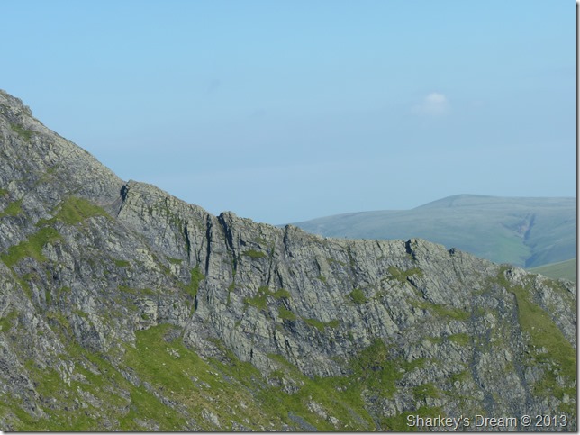
Foul Crag from Sharp Edge.
Spot the walker at the nearing the top of Foul Crag to give the photo some scale. |
 |
| |
Foul Crag from Sharp Edge.
If anything could make this traverse even better than it already is – it’s the ascent to the summit of Foul Crag via the scramble before you, it is steep & tricky so leaning into the rock while you climb is a great tip. |
 |
| |
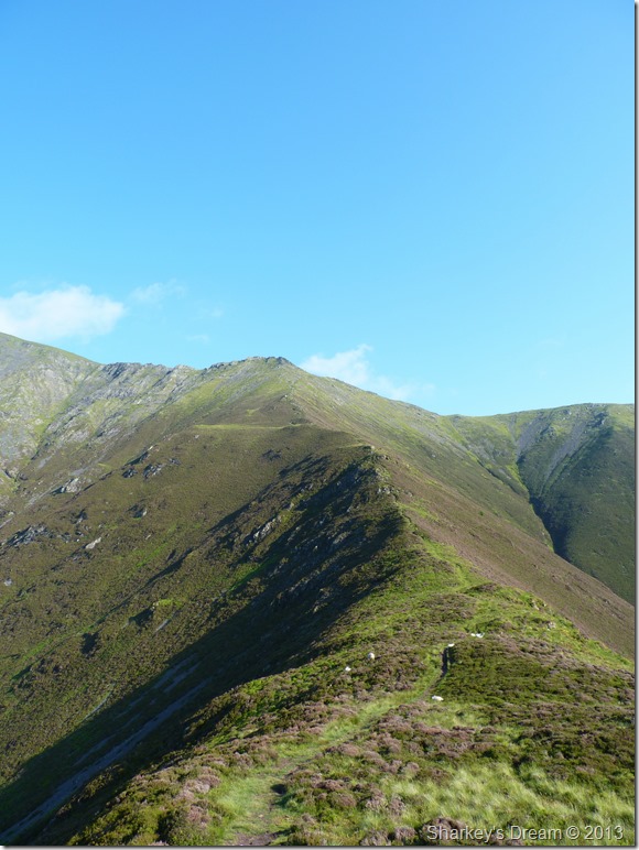
Looking back across Sharp Edge before the not so nice part of the traverse. |
 |
| |
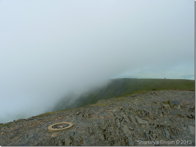
‘The Awkward Place’ |
 |
| |
‘The awkward place’
The awkward place is the most exposed part of the traverse & extreme care must be taken when crossing, I have yet to witness anyone cross here without four point contact including myself. On a lighter note I once dropped a water bottle at this exact spot down towards the tarn & I often wonder if it’s still there. |
 |
| |
Looking back down from the steep scramble up Foul Crag.
Despite the adrenalin pumped twenty minute episode behind me, it’s always with a sense of relief when I take on the scramble up Foul Crags that sense that ‘I made it again’
It was now time to take on the summit for the second time this morning, not before I took this next photo… |
 |
| |
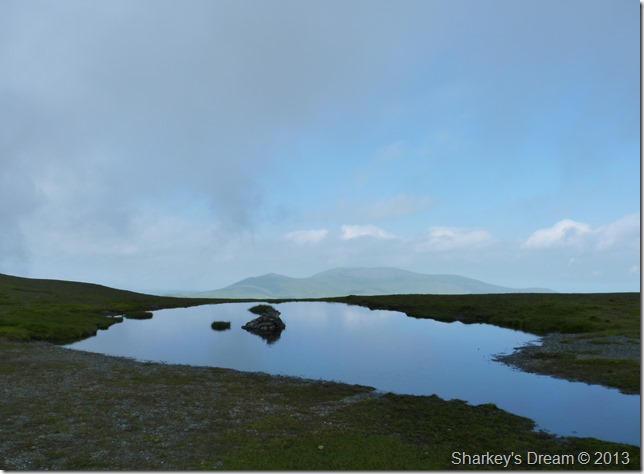
The un-named Tarn found on The Saddle, here looking through the haze towards the mass of the Skiddaw group. |
 |
| |
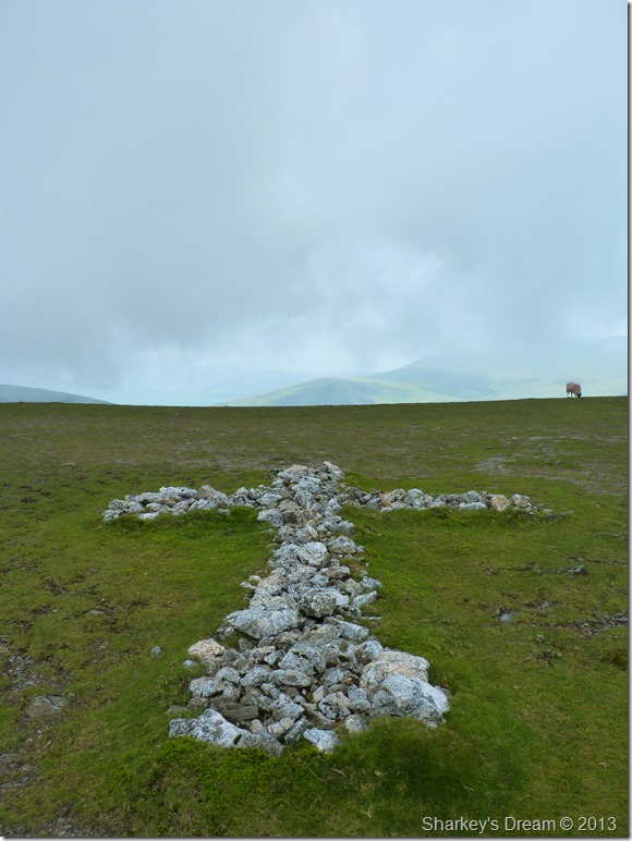
The white quartz cross found on The Saddle.
The quartz cross grew in size from 1945 onwards, more stone was added by a Harold Robinson of Threlkeld who did this in memory of a walker killed (most possibly on Sharp Edge many years earlier) more recent memorials can be found across The Saddle which are somewhat smaller in size but all bare the resemblance of a cross. |
 |
| |
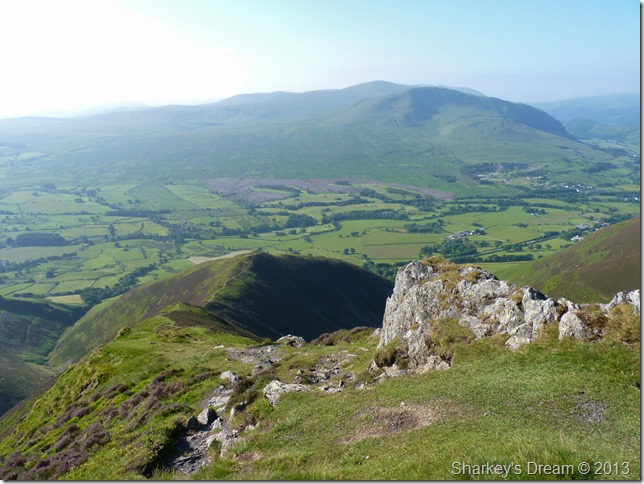
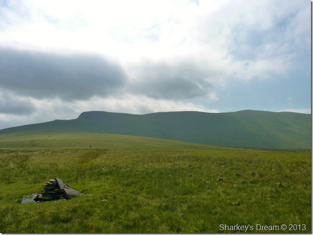
Hall’s Fell top is now obscured by fleeting cloud during my second summit.
The summit was a lot more crowded on my second return but in saying this, I did manage to spy the chance to take this photo…notably the wind had gained in strength & the temperature had dropped a little also… I figure it is time to leave Blencathra via the ‘back’ of the fell to meet up with the path for my next summit, Mungrisdale Common. |
 |
| |
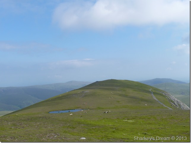
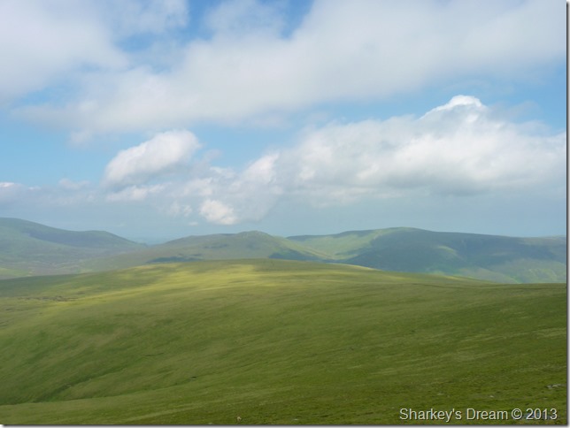
Mungrisdale Common.
Sunshine scatters across the fell side as I take in one of my favourite summits in Mungrisdale Common, I spot a lone walker half a mile ahead & think the same thing I always do when I’m here.
This is heaven & I am in my element once more.
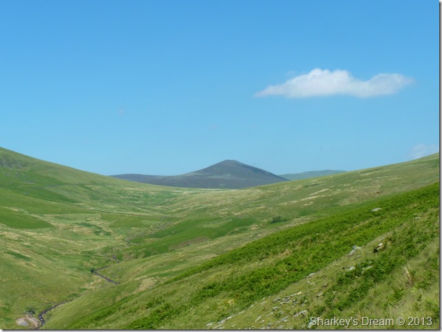
The distant hazy fells partially obscured through haze are Bakestall, Little Calva, Great Calva & Knott. |
 |
| |
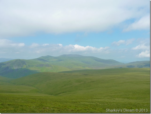
The Skiddaw fells are equally affected through the morning haze. |
 |
| |
My route after leaving the summit looking back up to Blencathra & Gate Fell Top (far right)
I think that’s the sun trying to break through… |
 |
| |
Mungrisdale Common beckons. |
 |
| |
Blencathra from Mungrisdale Common summit cairn. |
 |
| |
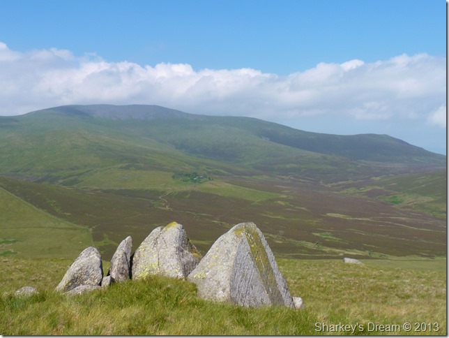
Skiddaw & Bakestall in from of the Cloven Stones.
Forgive me if I’m wrong but I wonder does Cloven derive from four leaf clover given that there are four stones set here?
All that thinking has worn me out…time for an early lunch. |
 |
| |
Skiddaw & Skiddaw Forest from my lunch spot.
I sit here in awe at the fact that just only three months ago Tim & I completed The Old Crown Round & rested at the same spot, except back then we had already summited Carrock Fell, Bowscale Fell, Bannerdale Crags & Blencathra by the time we reached here, all we had to climb next was Skiddaw, Great Calva, Knott & High Pike… |
 |
| |
A close up of Skiddaw House from Cloven Stones. |
 |
| |
Sinin Gill bound as I leave Cloven Stones behind.
I follow a faint footpath through the grass to reach Sinin Gill. Sinin Gill is more of an objective to reach the main path that will flank me below Blease Fell seen left…its a little while away yet so I enjoy the views together with a twisted ankle as my right foot gets eaten by what can only be described as a pot hole.
The route does offer great views over towards the north western fells even if the ground does try to kill you along the way. |
 |
| |
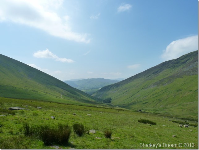
My path below Blease Fell is seen upper left, the path lower left is part of the Cumbrian way. On the other side of both paths runs Glenderaterra Beck & of course the fell on the right is Lonscale Fell.
Ahead are the central Lakeland fells with the peak most distinctive being Bleaberry Fell. |
 |
| |
Almost on the path as temperatures rise to a staggering 22°C |
 |
| |
Great Calva from Glenderaterra Beck. |
 |
| |
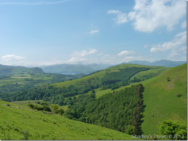
A long distant view towards Walla Crag & Derwent Water as the haze continues over the north western fells, in the foreground we have Latrigg & Brundholme Wood.
I have yet to walk less than a couple of miles before reaching Threlkeld as the midday sun dries the sweat upon my forehead (this the only reminder of a great day on the fells) I am passed by more walkers heading out & beyond, some mountain bikers too.
I know I am in for a treat tonight & I know my belly will be full of BBQ chicken & chargrilled burgers…yet I cant help but blame my brother for ending todays walk earlier than planned.
I guess I’m going to have to drink all his beer too. |
|
| |
| Back to top |
 |
|