|
Eagle Crag to Grange Fell via Greenup Edge |
 |
 |
31st August 2013 |
 |
|
‘It was as if someone had turned the dial from Summer to Autumn, all within the blink of an eye’
I guess that first paragraph pretty much sums up todays walk no matter how great the time we had partaking in it. It is true that in the UK (despite localised flooding sadly in some areas) that we haven’t had the wettest of summers compared to some years which have been a complete washout, I think it’s fair to say that the past two months have been pretty dry enabling the BBQ’s to come out which is something of a British rarity.
I can only hope that we haven’t seen the last of summer just yet but, going off todays sporadic downpours & fist clenching cold winds I fear we have all but skipped September straight through to October…like I say I hope I’m wrong…
We praise them when they’re right & mock them when they’re wrong, I am of course referring to the weather forecasters.
It all started opposite the Red Phone Box early morning in a sleepy Stonthwaite, where Tim & I are kitting up for a day on the fells in shorts & shades… the jackets as per norm, get tucked away in my pack just like they have for the past eight or so weeks. |
|
Wainwright Guidebook |
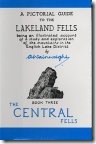 |
| The Central Fells |
-Ullscarth:
The top of Ullscarth is a cheerless place, even in sunshine; in a storm there is no vestige of a shelter. All is grass on this vast summit, and the only adornments are a cairn and a line of forlorn fence post running both ways to the horizon; the post are now useless for the purpose they originally served, but for the lost wonderer they have a real value in fixing his direction, and they lead unerringly to the highest point, which, without them, would be in some doubt. |
 |
|
| |
|
Overview |
|
|
| Ascent: |
2,464 Feet 751 Meters |
| Wainwrights: |
5, Eagle Crag – Sergeant’s Crag – Ullscarf – Great Crag – Grange Fell |
| Weather: |
Sunny Spells Together With Heavy Showers, Highs Of 13°C Lows Of 12°C |
| Parking: |
Parking Spaces, Stonethwaite (F.O.C) |
| Area: |
Cenral |
| Miles: |
10.4 |
| Walking With: |
Tim Oxburgh |
| Ordnance Survey: |
OL4 |
| Time Taken: |
6 Hours 20 Minutes |
| Route: |
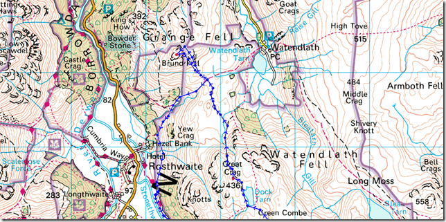
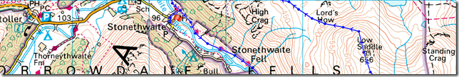
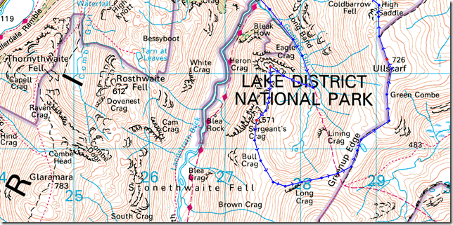
Stonethwaite – Greenup Gill – Eagle Crag – Sergeant’s Crag – Beneath Long Crag – Greenup Edge – Ullscarth – High Saddle (Coldbarrow Fell) – Low Saddle – (Coldbarrow Fell) – Lords How -Green Combe – Dock Tarn – Great Crag – Puddingstone Bank – Grange Fell – Puddingstone Bank – Cumbrian Way – Stonethwaite Bridge – Stonethwaite |
|
| |
|
Map and Photo Gallery |
|
|
 |
| |
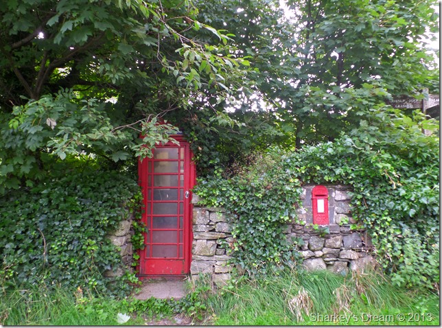
Stonethwaite 07:34 12°C
Whenever I think of the hamlet of Stonethwaite instead of the images of two up – two down white washed cottages I think of these two landmarks; the traditional Red Phone Box together with Post Box – set within a dry stone wall, but, that’s just me.
The air is cooler than that of late, but that does not stop us thinking that ‘it’s early’ and it’ll warm up later.
With this we shoulder packs & head for the fields of Stonethwaite & the footbridge that crosses Greenup Gill. |
 |
| |
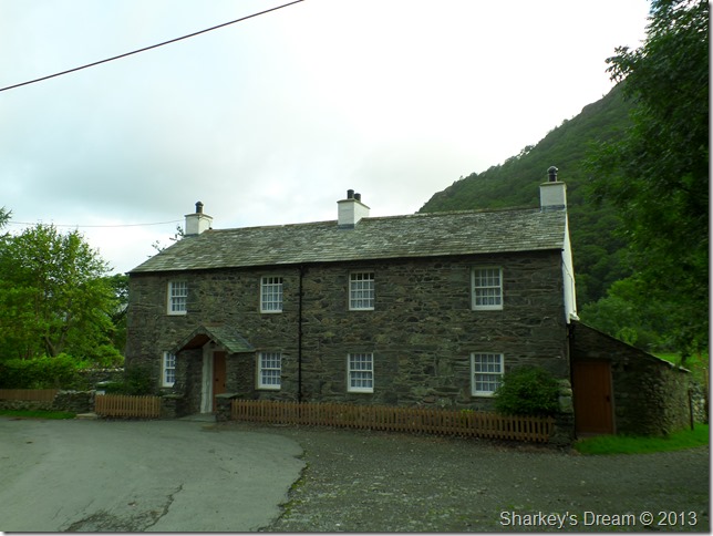
Traditional two up –two down cottages, Stonethwaite.
We head out via the track you see to the right of the cottages, I can firmly state that the rear of these cottages are more attractive than the front, which in itself is saying something, but I guess you’ll just have to take my word for it. |
 |
| |
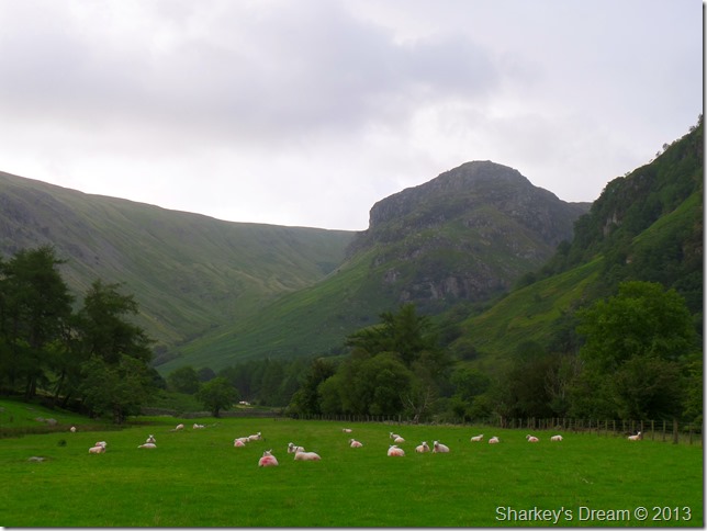
It’ll clear up soon…
From the track I took this photo of Eagle Crag together with some very white sheep sat in a very green field.
Our route would see Tim & I take in Greenup Gill which flanks Eagle Crag to the left of the photo |
 |
| |
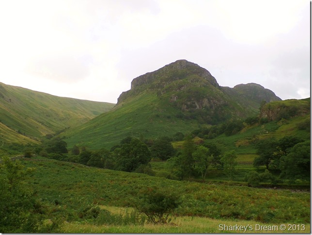
Eagle Crag & Sergeant’s Crag.
Our route as mentioned follows Greenup Gill (seen foreground) which ascends via a gentle stone path flanking Eagle Crag, whereupon you will reach an obvious col like feature, from here crossing Greenup Gill is made easy by the stepping stones where there after, you can gain Eagle Crag with minimum effort.
All of which will become a little more obvious in the next photo.
If that sounds too easy you can always go up the nose of the fell through the thigh high bracken via the faint stone wall you may be able to pick out in the photo. |
 |
| |
Eagle Crag after crossing Greenup Gill.
Er Tim’ yes Paul? did we just go through a rain shower? Yes… yes we did.
Whilst on the ascent we were hit by a rather wet & muggy rain shower, too wet not to reach for the jackets & to muggy to leave them on.
It’s okay because the weathermen said it’ll brighten up later…
Okay, I know I mentioned that gaining Eagle Crag from here was with minimal effort but I forgot to mention the steep up-heave from here to the summit. |
 |
| |
The route navigating the top of Greenup Gill.
Before we headed for the summit I glanced upon our route that would see us circulate the head of Greenup Gill beneath Long Crag, sure enough we found a faint path although I wouldn’t recommend it in bad weather. |
 |
| |
Eagle Crag summit with the High Spy / Maiden Moor ridge in the background.
Bad light was playing havoc with any photo taking, I had almost given up on any long distant shots & decided to point & shoot instead…more so, in the time spent at Eagle Crag summit. |
 |
| |
Sergeant’s Crag & The Langstrath valley from Eagle Crag.
After taking a few more photos we decided to head over to Sergeant’s Crag which is only a matter of a stones throw away, but, could we time our ascent with the next shower we spied just after leaving Eagle Crag summit? |
 |
| |
Only just…
Tim & I sit out one band of rain whilst waiting for the next one to arrive, here seen from Sergeant’s Crag summit.
We both remarked we couldn’t remember how long ago it was since we had to sit out a rain shower on a lofty summit which is not bad really, considering I visit the fells almost every week.
There’s something about waiting for the showers to pass as the wind howls above your head, its great to be in Lakeland this morning, even if they did get the forecast wrong. |
 |
| |
The Langstrath Valley as we leave Sergeant’s Crag summit.
We both pause as Tim picks out the distant summits, here from left to right we have Crinkle Crags, Bowfell – Esk Pike, Rossett Pike, Allen Crags, Ill Crag, Great End & finally Glaramara with a hint on sunshine seen far right. |
 |
| |
This time with the added bonus of blue skies…they weren’t to last but nice while they did. |
 |
| |
Looking back on Sergeant’s Crag & Eagle Crag.
After leaving Sergeant’s Crag we pick up a faint path that will navigate us around the head of Greenup Gill & underneath Long Crag. |
 |
| |
The Moraines are a unique feature to Greenup Gill.
The correct term for this type of Moraine is ‘Hummocky’ meaning ‘Disorganised, Disturbed or Chaotic’ formed when the melting glacier is covered by an extensive amount of ‘thick debris’ leaving the ground with a Hummocky appearance after the glacier has melted. |
 |
| |
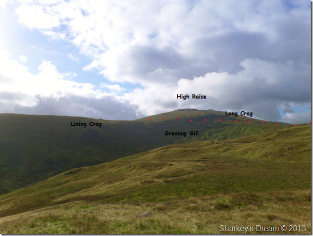
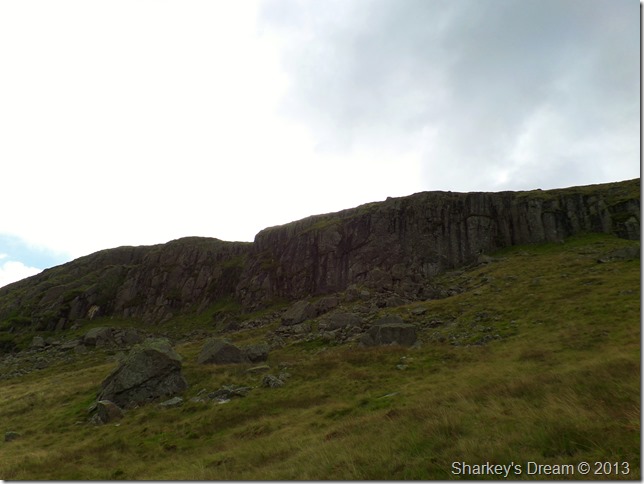
Passing beneath Long Crag.
The path here is faint but navigable, on first impressions, especially seen from afar it would seem that this would be a rough area underfoot but, the path we followed was of gentle pitch & very enjoyable giving spectacular views over Greenup Gill. |
 |
| |
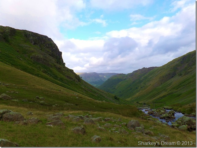
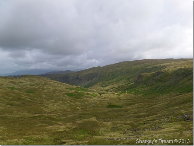
Greenup Edge.
After leaving Long Crag behind we took a short pathless excursion to Low White Stones where we picked up the path leading us across Greenup Edge, it’s a boggy crossing to say the least. |
 |
| |
Here looking back along Greenup Edge towards Low White Stones & High Raise.
Over there was another weather front approaching which carried more than the usual burst of showers, this front was to last. |
 |
| |
One last photo before the rain came.
I managed to take this photo before we were hit by more rain, here looking towards Helvellyn, Nethermost Pike, Dollywagon Pike, Grisedale Hause & St Sunday Crag, in the foreground in the right of the picture is Steel Fell & Steel Fell Tarn.
It was such a pity we were about to lose our views once more. |
 |
| |
Standing with my back to the rain.
It wasn’t long before we reached Ullscarth, if you look closely you can just pick out the fells mentioned in the previous photo through the cloud.
All though at this point we were both still wearing more or less gear fit for summer it seems as if my stubbornness set in, refusing to reach for the over-trousers as I billowed warm air into cupped hands.
We both remarked that ‘this was the coldest we’d felt on the fells since leaving winter behind well over five months ago. |
 |
| |
Blea Tarn & High Saddle (Coldbarrow Fell) as we leave Ullscarth behind.
After leaving Ullscarth we ventured away from the path to take in the descent to High Saddle, the rain had stopped with just the odd shower left in the air, the views, although cloudy started to come back too. |
 |
| |
Low Saddle from High Saddle (Coldbarrow Fell)
The sun soon came back out as we arrived at Low Saddle, this a top, I’m yet to set myself, although we could have navigated around Coldbarrow Fell I thought it right to summit both these Birkett summits. |
 |
| |
Blea Tarn & Low Saddle as I prepare to leave High Saddle (Coldbarrow Fell)
Tim left for Low Saddle well before I did making the crossing whilst I still stood & absorbed the summit..I witnessed Tim summit Low Saddle just before I left High Saddle itself.
The crossing between both summits although wet & boggy underfoot was a small highlight of the whole walk for me. |
 |
| |
Blea Tarn & Standing Crag (far right) as I make for Low Saddle.
It was still all too murky as the showers passed slowly away from the central to northern fells, over there anyone on Blencathra & Skiddaw are now experiencing the showers that we just had |
 |
| |
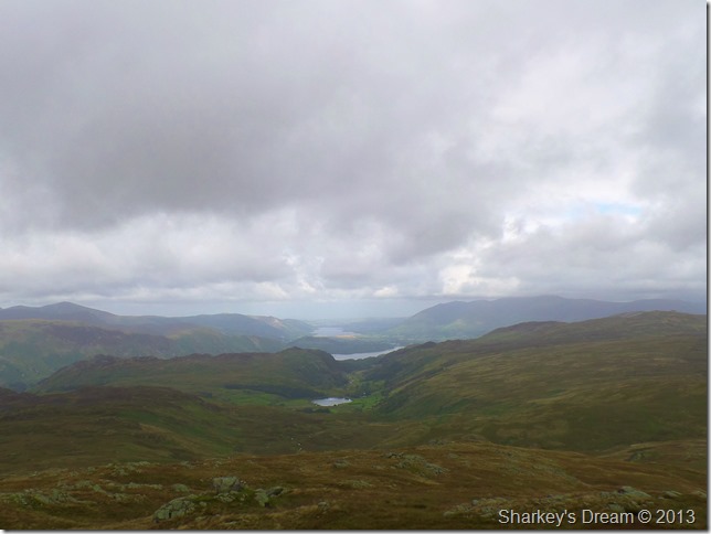
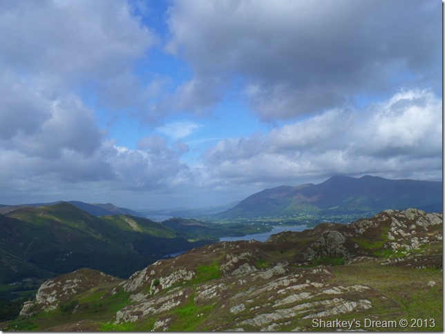
Here’s the view down to Watendlath, Derwent Water & Bassenthwaite Lake.
Our route would see us venture left of this position after leaving Low Saddle, over there on the right is the Central ridge with Armboth Fell, High Tove, High Seat & Bleaberry Fell through the murk & the bad light.
Before we head down we found a shelter from the fresh winds & sat down whilst we ate our lunches and Tim caught up with a few texts. |
 |
| |
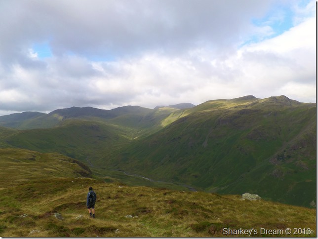
Crossing Lords How.
Considering it had only rained here for within the last twenty four hours Lords How was typical of what to expect within the central fells, very boggy & very wet, but, on a positive note the openness of the place gave our clothing time to dry off.
Here we head for the low point in between the Crags ahead, as you can see we are on a faint path once more which lead us to Green Combe & Dock Tarn bound. |
 |
| |
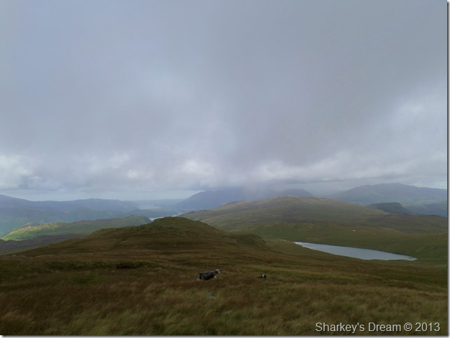
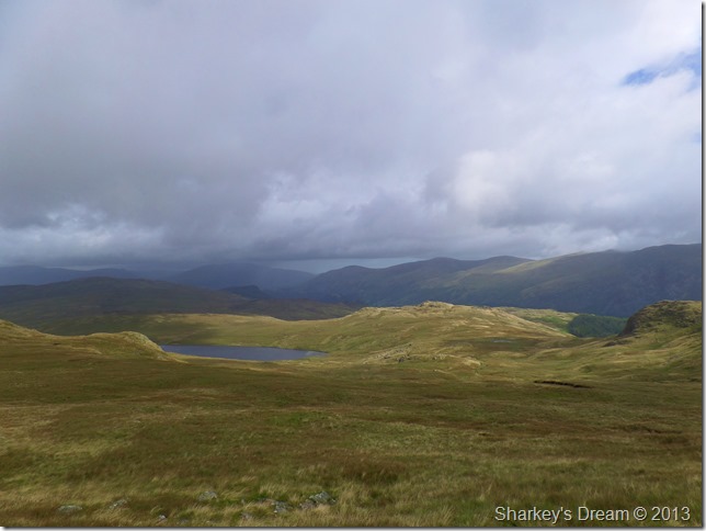
Great Crag & Dock Tarn from Green Combe.
We made our way through Green Combe at the same time trying to negotiate the bogs & mosses which was almost impossible, knowing this was another wet part of the route didn’t really affect morale much as we already knew what to expect. |
 |
| |
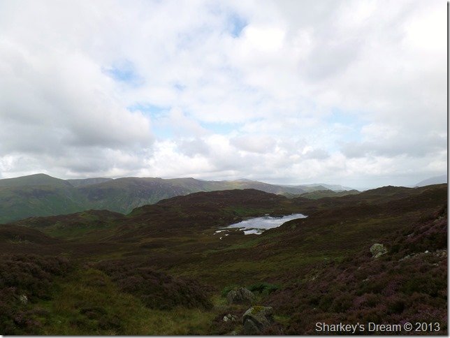
Bessyboot complemented by the floral heather as we round Dock Tarn. |
 |
| |
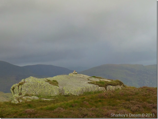
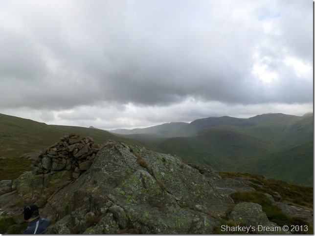
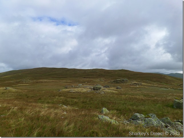
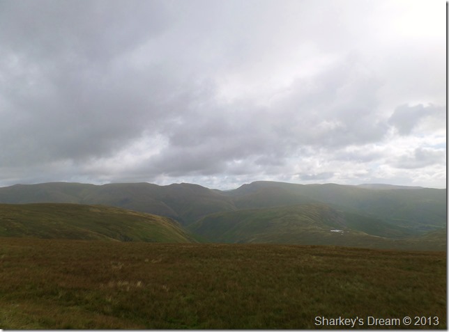
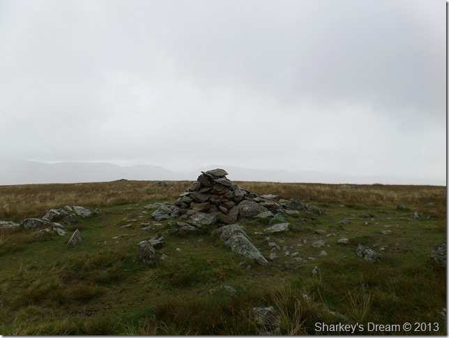
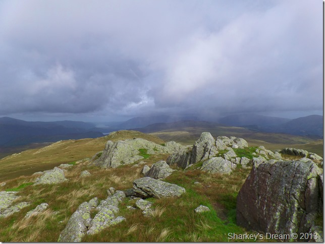
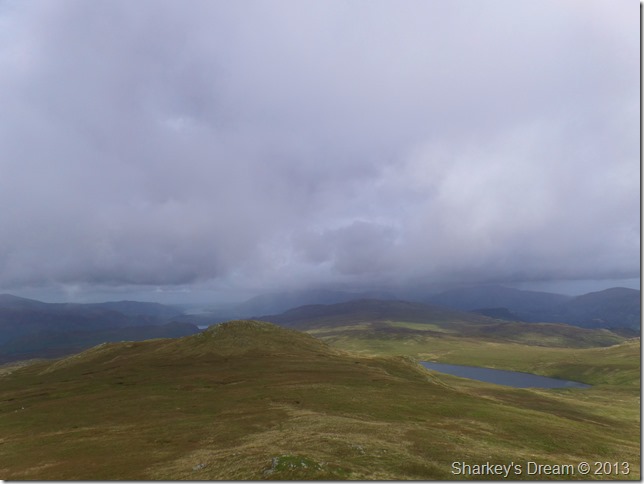
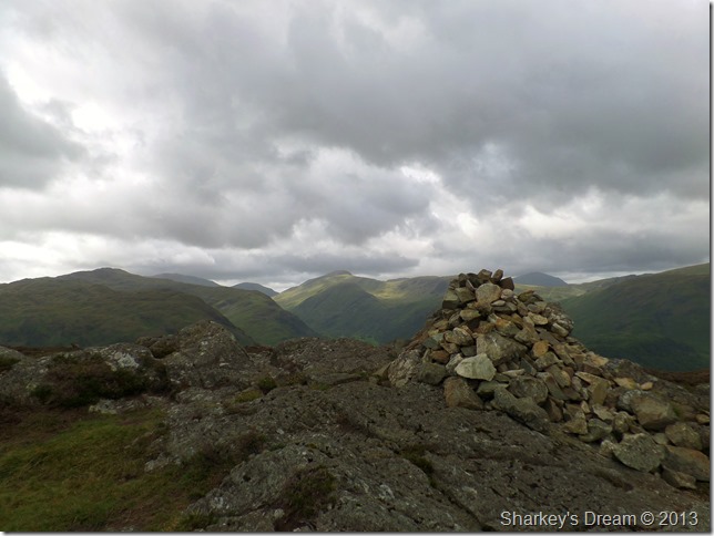
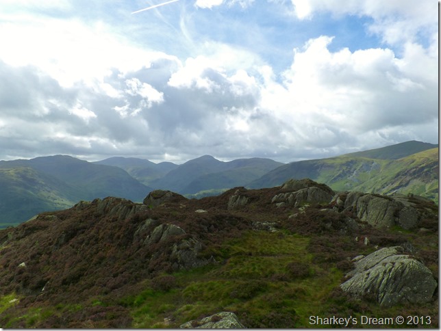
A host of south western fells seen from Great Crag summit cairn. |
 |
| |
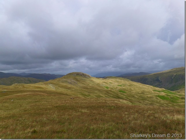
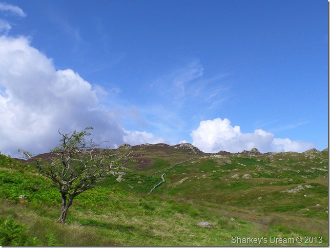
Grange Fell as we approach the top of Puddingstone Bank.
With promising blue skies we head for our final summit of the day, seen ahead as the highest point. |
 |
| |
A distant view towards Great End (centre) & the south western fells as we cross Puddingstone Bank to make the small ascent on Grange Fell. |
 |
| |
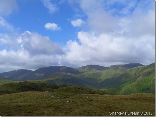
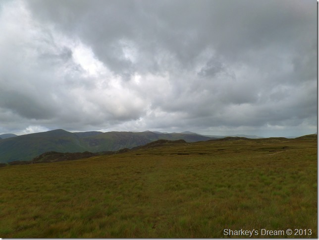
Still on a south west theme from the summit of Grange Fell. |
 |
| |
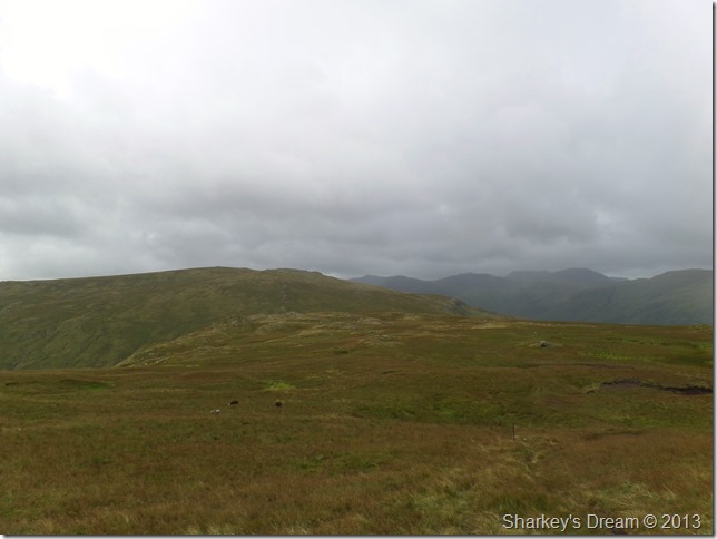
Much clearer weather looking north, here towards the mass of Skiddaw & the north western fells.
It was time to de-layer & maybe rest up a while, we had made great time so while at the summit both Tim & I sat listening to the wind howl through the long grasses.
The sound of which Tim stated was ‘Enough to bring a man out of a coma’
I couldn’t have put it better myself.
We could have sat there all day as time was on our hands, but, we had to make our way down the grassy descent & find our way back to Puddingstone Bank & make our way back to Stonethwaite. |
 |
| |
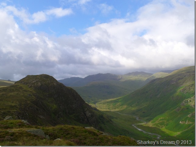
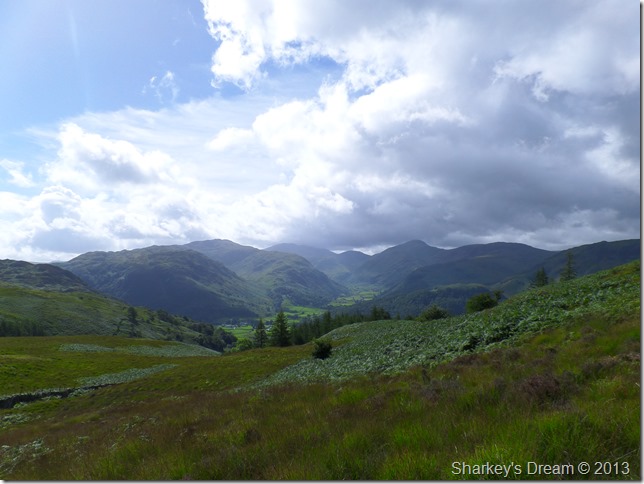
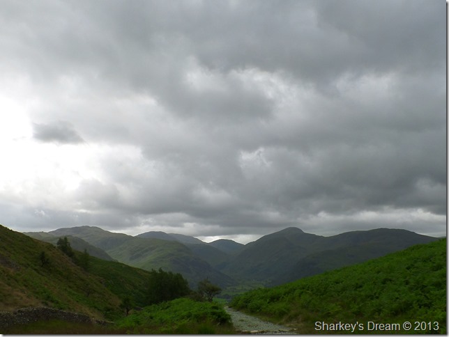
Great End & The Seatoller end of Borrowdale.
Within a matter of moments the sky had blackened once more & more rain looked on the cards before we made the two mile journey back to Stonethwaite.
We could get lucky though? |
 |
| |
Not likely!
It may not look it but it is bucketing down in this photo.
Soon after taking the last photo came the drips, then came the wind then followed by some very horizontal & heavy rain which lasted the whole journey back to Stonethwaite, making matters slightly worse (as if they could) but it was the thigh high wet bracken that soaked our already wet clothes through to the core.
However morale never dropped throughout the whole walk which was testament to two committed walkers with a tight bond for both the fells & friendship.
It’s strange what the weather can do to open your senses, todays weather did just that, today made me realise that it’s not all about the pictures & keeping yourself dry, its about the fells, because as we all know…they are never the same, the fells are seasonal & I believe that maybe I have witnessed the end of one season & the start of another. |
|
| |
| Back to top |
 |
|