|
Mellbreak, Red Pike & Great Borne |
 |
 |
29th September 2013 |
 |
|
With the good weather holding I pretty much had Lakeland in my hand, the only thing holding me back was the fact that today is a Sunday & tomorrow I have to work.
Long walks are normally reserved for Saturdays or during the holidays when the aches & pains appear where I can walk round my house barefoot & not frantically around the workshop or sat goggle eyed in front of a computer screen.
Seeing as I had no option but to work the Saturday I thought I’d put Sundays walk into the Saturdays walking category, a sure sign of getting old one wonders.
I hankered for somewhere North Western or Western, initially I had intended to take on Causey Pike & see where that lead me, that was until I pieced together this route two days ago.
A route that set the butterflies rumbling was sure to work, couple this with a concrete weather forecast & for me personally this is what can only be described as a perfect walk in Lakeland |
|
Wainwright Guidebook |
 |
| The Western Fells |
-Starling Dodd:
Starling Dodd, between Buttermere and Ennerdale, is one of those unobtrusive and unassuming fells that are rarely mentioned in literature or in conversation, that never really makes an impact on mind or memory, that most visitors to the district know vaguely, from its neat rounded summit surveys exciting landscapes but remains shyly aloof as though aware of its own limited contribution to the scenery. |
 |
|
| |
|
Overview |
|
|
| Ascent: |
2,526ft, 770 Meters |
| Wainwrights: |
4, Mellbreak – Red Pike (Buttermere) – Starling Dodd – Great Borne |
| Weather: |
Dry & Sunny Throughout, High Gust Up To 50mph On Tops, Highs Of 18°C Lows Of 11°C Feels Like 9°C |
| Parking: |
The Red Phone Box, Loweswater |
| Area: |
Western |
| Miles: |
11.7 |
| Walking With: |
On my own |
| Ordnance Survey: |
OL4 |
| Time Taken: |
6 Hours 50 Minutes |
| Route: |
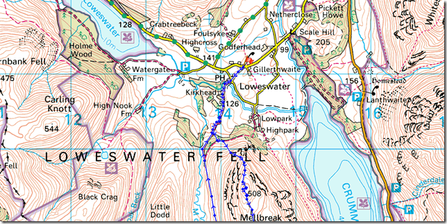
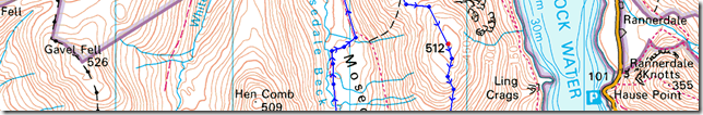
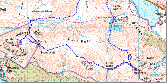
Loweswater – Kirkgate Farm – White Crag – Mellbreak – Scale Force – Lingcomb Edge – Red Pike (Buttermere) – Little Dodd – Stirling Dodd – Scaw Well – Great Borne – Herdus – Steel Brow – Floutern Tarn – Whiteoak Moss – Mosedale – Mosedale Beck – Kirkgate Farm – Loweswater |
|
| |
|
Map and Photo Gallery |
|
|
 |
| |
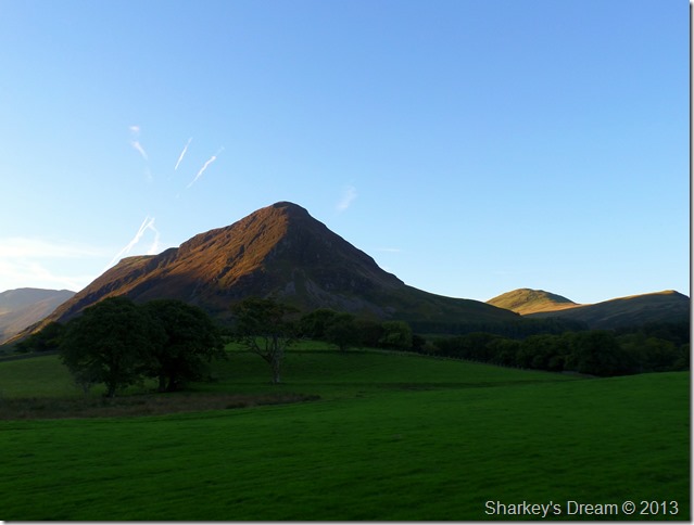
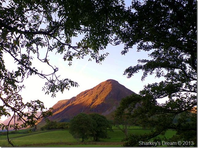
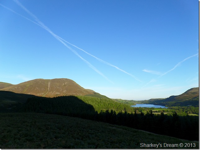
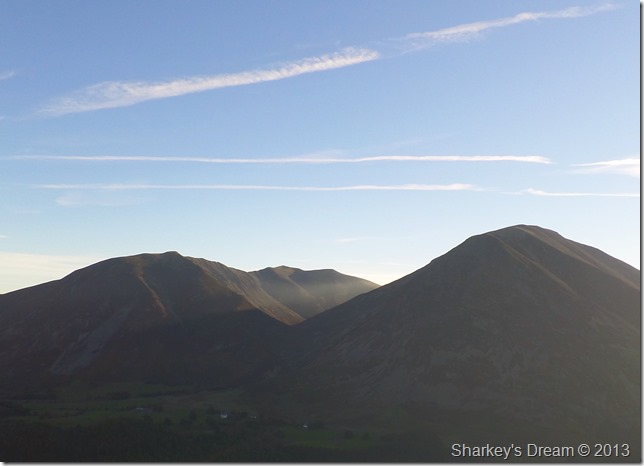
Mellbreak & Hen Comb lit by morning sun 07:46 11°C
I arrived in Loweswater a little flustered owing to the fact that road works had closed the main route in via Scales Hill & a detour was in place which meant driving quite a while back & detouring through Thackthwaite.
As I stopped at the top of Scales Hill where it looked as if I could go no further three cars in succession ignored the road closed sign & sped through, ok monkey see monkey do as I followed the cars too, yes the road was closed at what looked like drainage work by the side of the verge, here traffic could drive by the barriers & make their way into Loweswater, two minutes later I was at my destination.
The Red Phone Box, Loweswater.
Here there are enough free spaces for half a dozen well parked cars & seeing as I was the only car I set the stall.
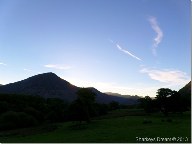
The clear forecast continued through & beyond the weekend, today I kitted up beneath a glaring morning sunrise as the sun crested the North West fells just over my shoulder, beyond that it was all blue, a great sign for what the day has in store one mutters. |
 |
| |
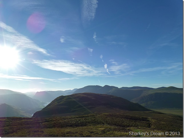
Positive signs as I glance over towards Grasmoor & Whiteless Pike. |
 |
| |
Through the trees where Mellbreak gets a dash of sun.
In the distance I hear whistle’s & dogs barking disturbing the Sunday morning peace, well maybe but this is the sound of Lakeland, which just adds to the mornings atmosphere. |
 |
| |
Casting shadows.
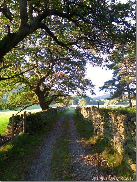
After passing through Kirkgate Farm I follow the lane until a wooden gate is reached, here a coppice of Pine Tree’s line the start of the ascent on Mellbreak. |
 |
| |
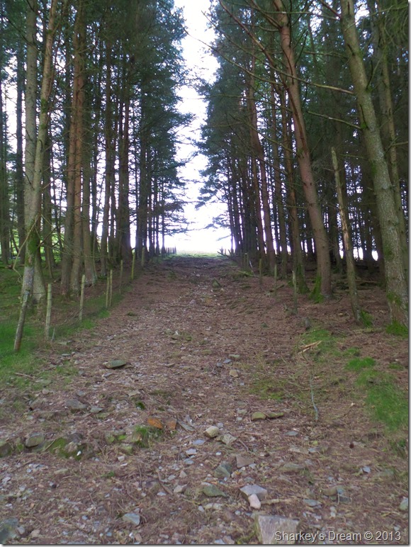
A taster of things to come.
I love this path that cuts beneath the high Pines, no matter what time of year, as you would expect needles cover the ground. As mentioned it’s a little steep & for me; is all part of the ascent on Mellbreak via its north face. |
 |
| |
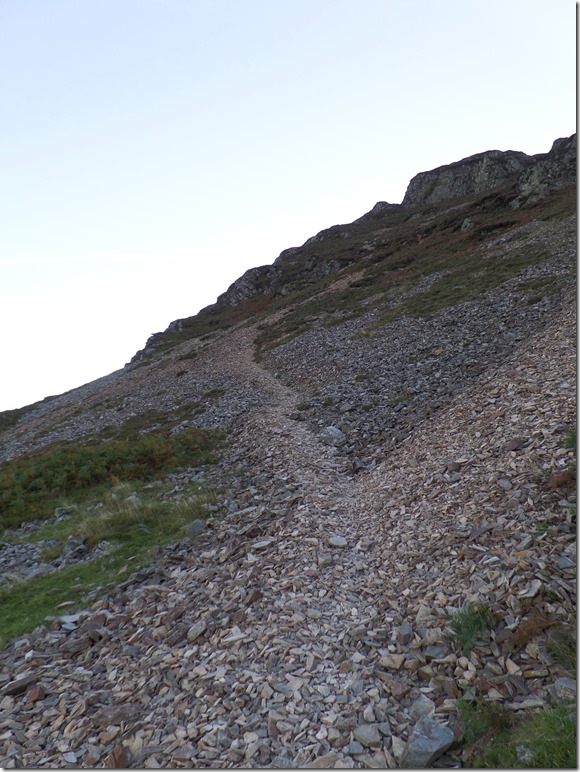
The scree path at the base of Mellbreak.
Once the base is reached the huge bulk of Mellbreak disappears leaving you with a steep scree path that zigs zags a route up, yes it’s steep but easily manageable & very satisfying.
I can still here those hounds barking… |
 |
| |
Carling Knott & Loweswater from the start of the ascent. |
 |
| |
Further round you’ll find Low Fell & Darling Fell basking in the sunlight. |
 |
| |
Here seen together in one picture.
The whistles became louder & so did the barking, way yonder on the flanks of Little Dodd & Hen Comb a pack of Hounds scattered the fell side as three of their owners looked on.
This was not a hunt in the slightest, if anything it looked like a training exercise more than anything.
Footnote Update 01.10.13
After discussions with fellow Fell Walker David Hall who was on Mellbreak a little later than I it turns out that in actual fact, the dogs where on a hunt as David witnessed the chase, lets hope the Fox gave the dogs the slip. |
 |
| |
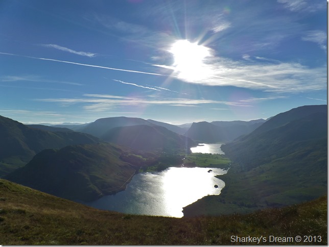
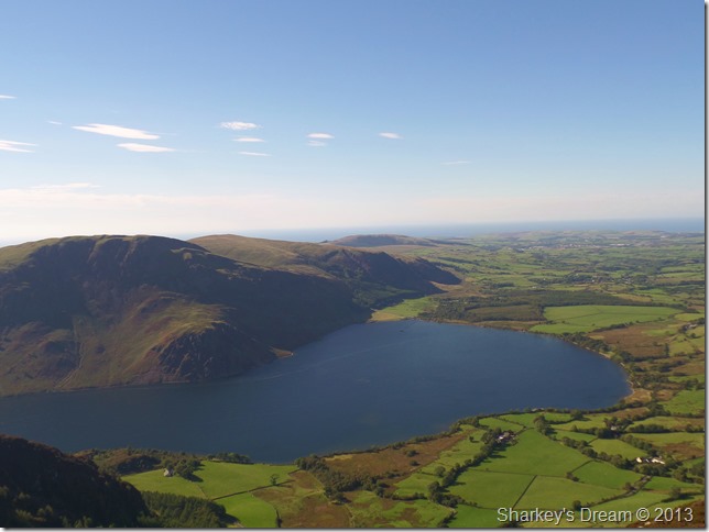
Crummock Water, Buttermere & Rannerdale Knotts from Mellbreak’s first promontory.
With no cloud to obscure the sunlight the sun shone directly down on the water glazing anything in its way which is fantastic for morale but not for the camera, not that I’m complaining mind.
Who knows how many of these days have we left! |
 |
| |
Whiteside, Hopegill Head & Grasmoor from Mellbreak.
Whilst on the ascent I couldn’t help but notice just how much strength the wind was gaining as it blew the hood on my jacket more times than I care to mention, that will be taken care of later, for now I couldn’t help but enjoy the views. |
 |
| |
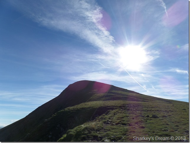
Mellbreak south summit from the north top together with a host of Western fells.
Only four metres split both summits; the south at 512 meters & the north top at 508 meters.
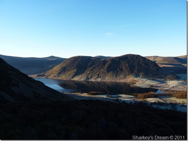
The backbone of Mellbreak is often described as ‘like the arch of a woman’s back’ see what you think with this earlier photo I took from Whiteside back in 2011. |
 |
| |
Mmm, but which woman? best not tell the wife eh. |
 |
| |
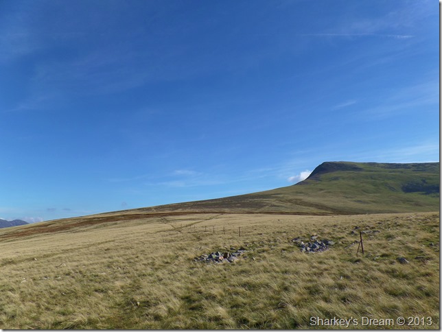
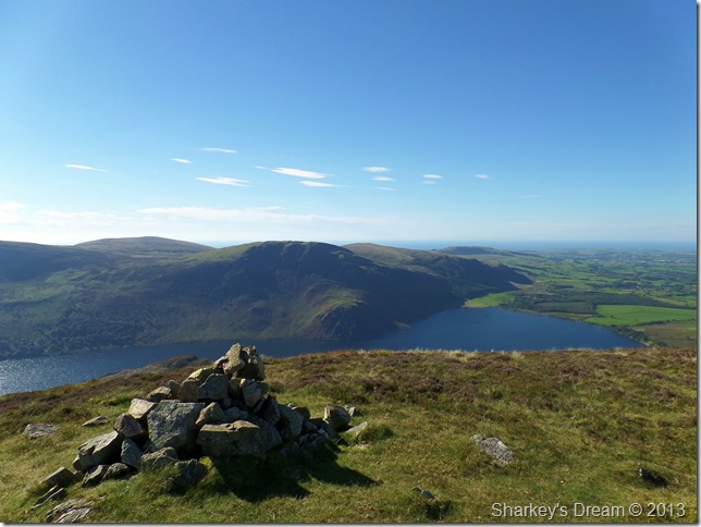
Starling Dodd & Great Borne from Mellbreak summit cairn.
Both Starling Dodd & Mellbreak are in todays itinerary but as you can see, they are a long way off yet, here I down pack & roll my hood into the collar of my Montane soft shell to stop the wind blowing it over my head & around the back of my neck.
The next part of my route would see me take in Scale Force, unquestionably Lakelands Highest waterfall, to reach Scale Force I have to descend via the south ridge which, is another path that I am yet to try as normally from Mellbreak, I always would descend into Mosedale.
But before my descent I take a few more photographs. |
 |
| |
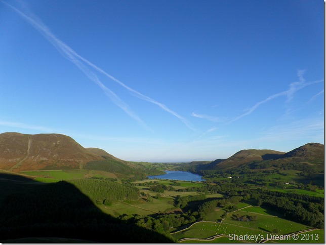
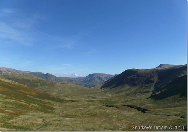
Looking further west here’s a photo I took of Great Borne & Floutern Cop at the head of Mosedale. |
 |
| |
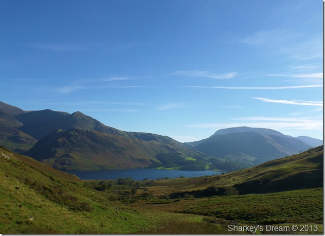
Crummock Water & Buttermere from my Mellbreak descent.
I pick up some good pace as I leave Mellbreak behind – sometimes with a slight jog over the steep grassy ground. |
 |
| |
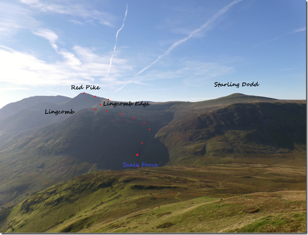
My route to Red Pike via Scale Force.
Between my position & Scale Force not seen in the photo is another depression leading to the base of Scale Force where I cross a footbridge over Scale Beck.
After taking a few photos I headed up a steep path with Scale Force/Beck to my right which was of great pitch & took the steepness out of the climb nicely.
Gaining Lingcomb Edge was done via a faint path through heather until a cairn is reached, this is the point the walk becomes more ridge like & comes extremely highly recommended.
Now you can see the route let’s see it in detail. |
 |
| |
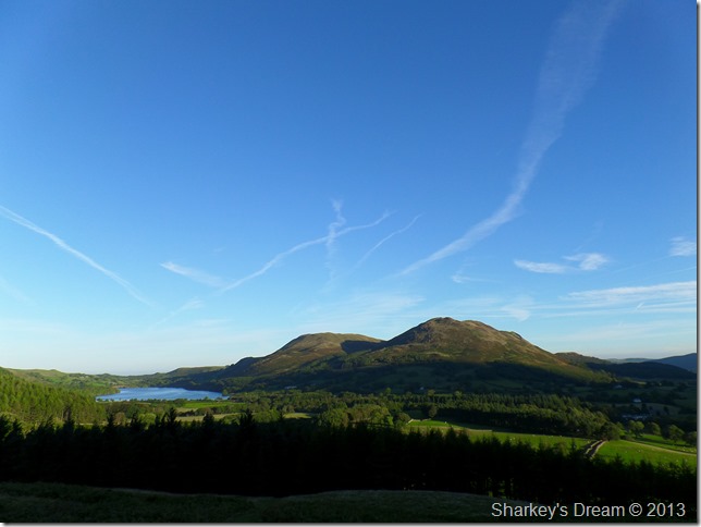
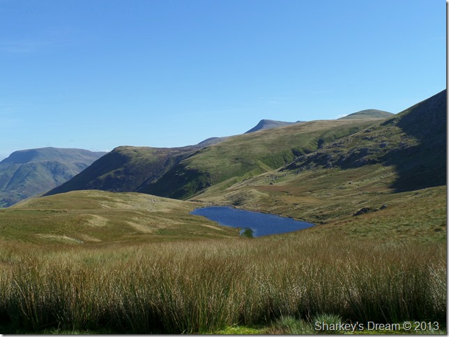
From Whiteoak Moss here’s, Great Borne, Floutern Cop & Hen Comb.
Whiteoak Moss is up there with one of my best Lakeland places due to its solitude & great memories I spent here as a novice walker brushing up with my navigational skills.
A place that I will always hold close.
Bloody miserable when the clouds down & not a place you want to find yourself without a map! |
 |
| |
Before I reached Scale Force I took this photo of Crummock Water, Rannerdale Knotts, Whiteless Pike & finally, Robinson far right. |
 |
| |
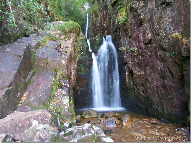
Scale Force.
Scale Force is reputed to be the highest waterfall in the district, falling 170 feet (51.8 meters) from its source high above from within a deep narrow gorge.
As mentioned earlier, my route will follow Scale Force alongside Scale Beck higher up the path, here more waterfalls can be found but non as dramatic as Scale Force itself. |
 |
| |
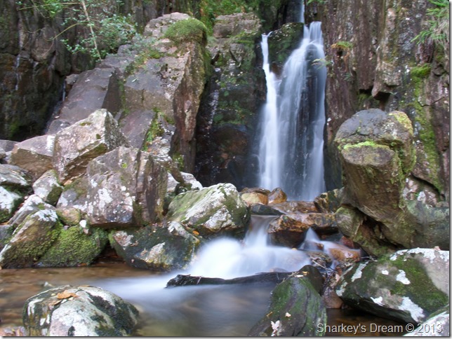
Scale Force.
I cross the beck for more photos submerging a full boot in at one point, D’oh!!
After more picture taking I finally relieve the camera & head out to the base of the path, from here on in & for the next hour or so, I shall be walking in some very welcome shade. |
 |
| |
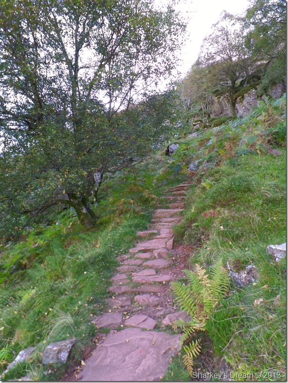
The path found besides Scale Force.
As mentioned the path is steep but of excellent quality all the while, the sound of a gushing waterfall is never out of earshot.
Further up the path as Scale Force is left behind the path follows the course of Scale Beck along a narrow track which at times; needs careful negotiations with the odd little scramble over boulders thrown in, at one point the path narrows & gives you that gorge like feel, not long afterwards the sight of Starling Dodd & Great Borne open up the views. |
 |
| |
Mellbreak, Whiteside, Grasmoor & Crummock Water from Scale Beck.
Here the gorge is at its narrowest offering superb views back down to Crummock Water & surrounding fells. |
 |
| |
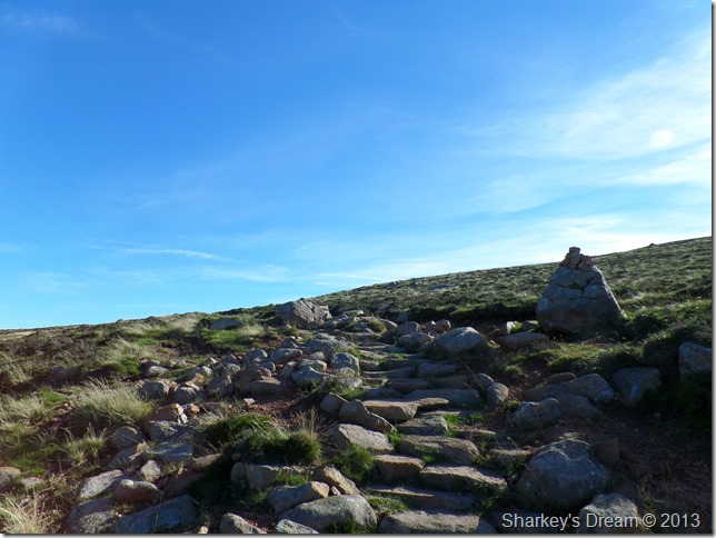
Joining Lingcove Edge supported by this stone cairn.
After leaving Scale Beck the path lends its way towards Lingcove Edge, here the path again is narrow in places through wild heather & over rocky stone.
I am about to get a taste of some real wind. |
 |
| |
Crummock Water & the North West fells from Lingcove Edge. |
 |
| |
Red Pike, Lingcove & Lingcove Edge.
The narrow path can be seen to the right of the picture which is as beautiful & dramatic as it looks as it was to walk, however, the wind was so strong along here that I struggled to hold my body in an upright position.
Along the edge I am wearing my trusty Bloc Billy sunglasses but they do not protect against the wind as my eyes start to stream, the wind also gave my sinuses a good blow though taking my breath at the same time, I had no choice whether I wanted the contents of my nose spread across my face, the true experience of what portrayed along here just does not show in what can otherwise be described as a perfect crossing. |
 |
| |
Gloriously powerful in so many ways. Does anyone have a hankie! |
 |
| |
Red Pike.
I took a slight breather & composed myself before I took on the steep ascent on Red Pike, it seemed the wind was confined to the ridge almost as the ascent was nowhere near as gusty as I thought it would be. |
 |
| |
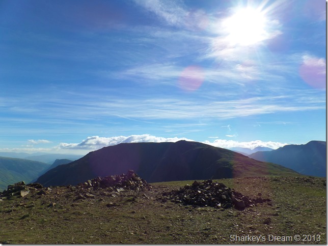
High Stile from Red Pike summit cairn & shelter.
Spending time at the summit was minimal due to the high nature of the gust, I think in all I took two photos one of which did not turn out.
It was nearing 11:30 & the belly was rumbling so after the few photos I re-traced my steps & took refuge on a patch of grass next to the path, here you could drop tissue paper oddly enough & it be around for you to catch it, a perfect lunch spot.
One last photo before I leave. |
 |
| |
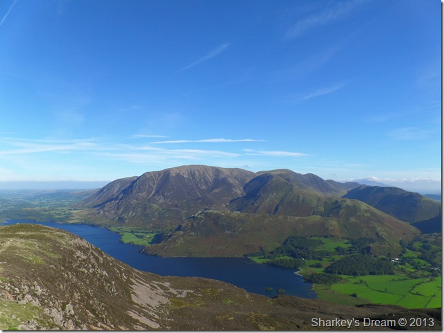
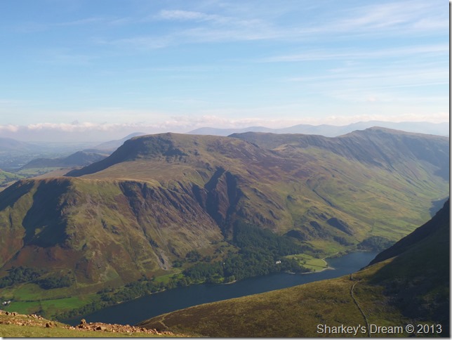
Buttermere, Robinson, Hindscarth & Dale Head from Red Pike.
Time for that early lunch. |
 |
| |
The view from my dining table.
It was quite surreal sitting here as a gale force wind blew above my head, every now & again a breeze would blow down the fell side scattering my lunch box lid & freezing the cold sweat on my back.
This section of the High Stile Ridge is one of the main reasons I planned this route the way I did as it’s been quite some time since I walked this here, three years to be exact…
I can only ask myself why did I wait so long to walk it again.
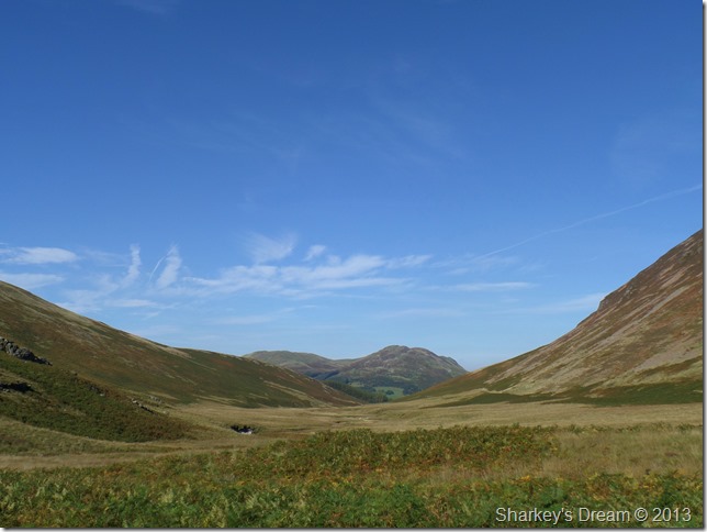
Indecently, Ennerdale & Crag fell can be seen yondering off to the left of the photo, meanwhile Little Dodd, Starling Dodd & Great Borne can be seen ahead.
‘Yondering’ That’s a word I just made up, so don’t bother to look it up!
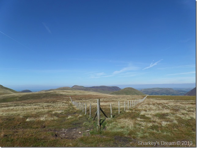
After a very pleasant lunch, I packed up & made my way down via the steep stone/scree path & picked up the course of an old fence which is followed almost all the way to Great Borne. |
 |
| |
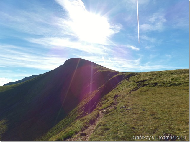
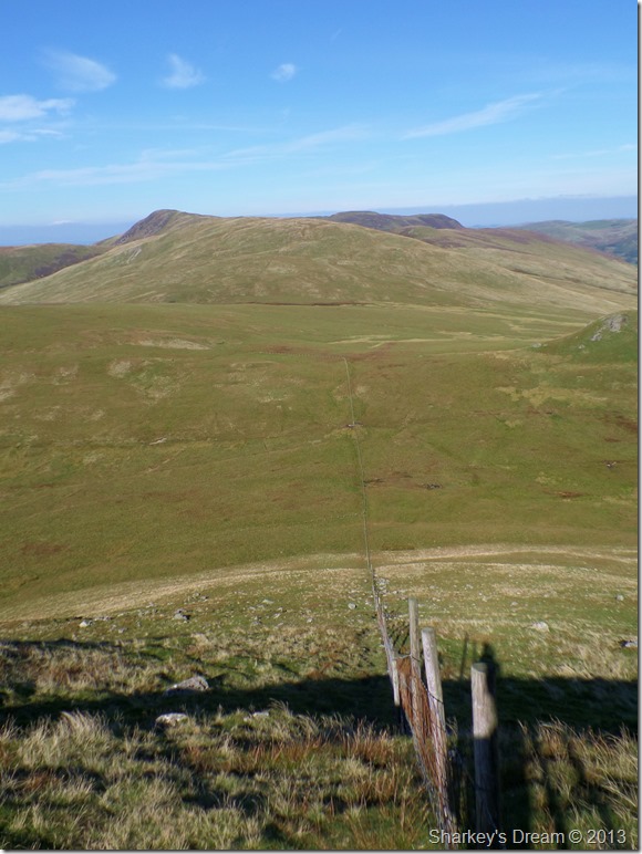
Looking back on Red Pike before I take on the slight ascent on Little Dodd.
Oh, and there’s the old fence post I mentioned. |
 |
| |
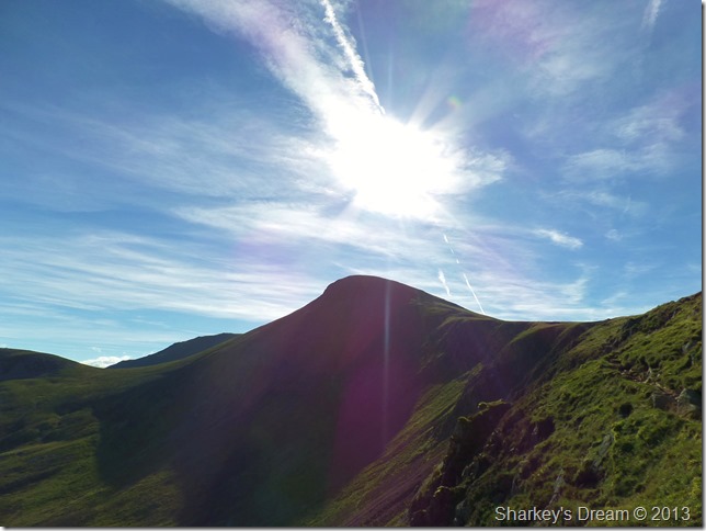
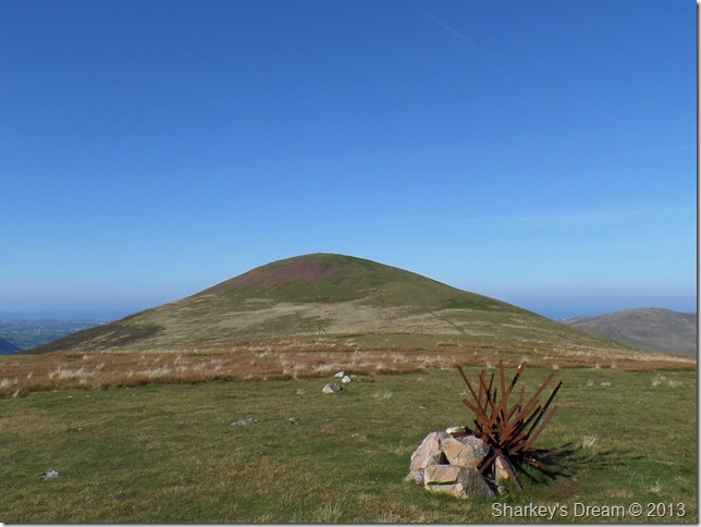
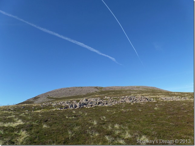
Starling Dodd from Little Dodd.
If Starling Dodd is unassuming as A.W put it ,what does that make its sister fell Little Dodd.
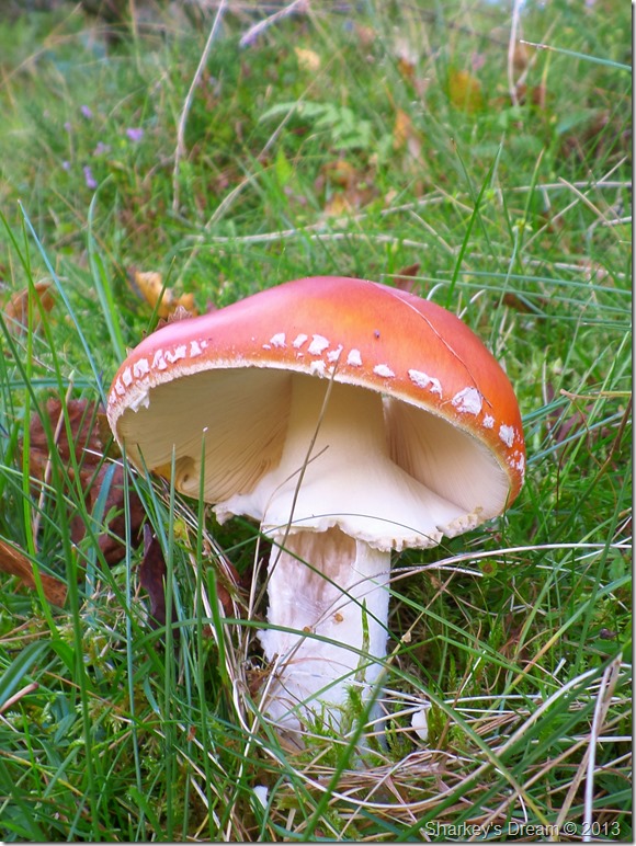
I took hardly any gain to reach its summit away from the main path linking both fells, and, there’s a bit of an art exhibition going on… |
 |
| |
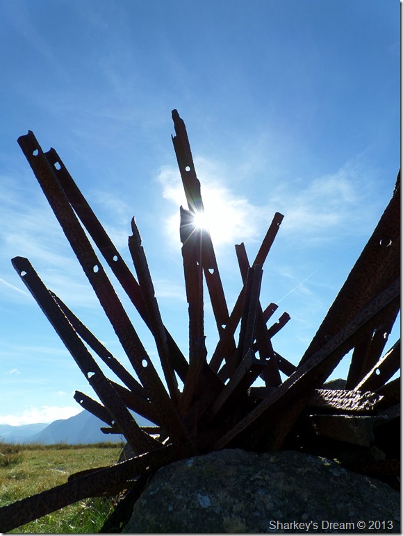
That’s got to be worth 27.9 million at Sotheby’s…
Oh well maybe not, but still worth the effort I thought. |
 |
| |
Scoat Fell, Black Crag, Wind Gap & Pillar seen from Starling Dodd summit cairn.
In the distance are the unmistakable Green & Great Gables with Windy Gap almost certainly living up to its name today. |
 |
| |
Ennerdale & The Bowness Plantations.
Here I took this photo from the ridge in-between Starling Dodd & Great Borne looking down over Bowness Knott & Crag Fell. |
 |
| |
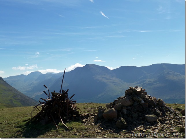
Marking boundaries.
I follow the left fence for a short while before a short cut detours left slightly before meeting back up with the fence just below Great Borne’s summit. |
 |
| |
Great Borne.
The summit is almost in reach as I pass an almost dried up Scaw Well which in actual fact, resembles a muddy pool rather than a well.
As the afternoon sun beats down I ease my pace to take on my last ascent of the day which if any, was the easiest to tackle with exception of Little Dodd of course. |
 |
| |
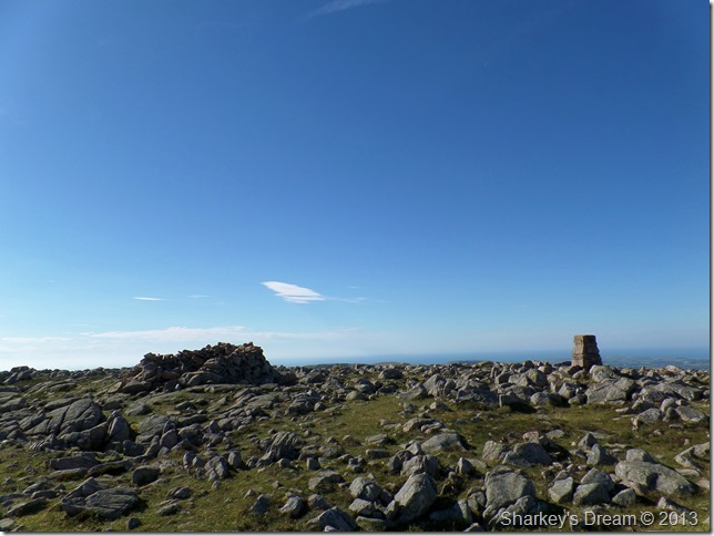
Great Borne Trig Point & summit shelter.
Whilst at the summit I make my way other to the Trig Point & give it a gentle tap, while doing so I here a woman’s voice coming from behind the shelter, it is in fact a couple from Newcastle taking a bit of time out, they both smile & say hello as I wander over for a small chat, we pass on our route details & so on, the couple have come up from Ennerdale, when I explained where I started the bloke looked a little surprised, blimey what time did you start this morning, here have a Jaffa Cake!
Out of pure courtesy I would never accept an offer from strangers, but those Jaffa Cakes looked to good to miss…take two the bloke says, you don’t have to ask me twice I laugh.
From the summit I take a look down at my watch & as it goes I have made good time, enough so that I had time to take the excursion to Herdus, a rocky outcrop on the western spur of Great Borne.
In times gone by Great Borne was actually named Herdus by the West Cumbrian’s, Great Borne was the summit area & Herdus the name of the fell itself, it only felt fitting that if time was on my side I pay the extended summit a visit. |
 |
| |
Herdus from Great Borne.
The crossing from Great Borne to Herdus isn’t as easy as first thought, it pays to look for the narrow path that circulates the boggy area seen centre. |
 |
| |
Ennerdale Water, Crag Fell & Lank Rigg seen from Herdus.
Now where’s that narrow path again?
After a short time spent at the spectacular platform of Herdus I turned heel & headed off in search of Steel Brow & The Floutern Pass, taking care to stick to that narrow path. |
 |
| |
Not before one last photo of Ennerdale Water & Crag Fell, this time seen with Grike. |
 |
| |
The Floutern Pass seen from the top of Steel Brow.
And yes, its as steep as it looks, by the time I reached the bottom I looked (And felt) like I’d been put through the spin dryer, on reaching Floutern Pass laces were re-tied & trousers pulled to the appropriate height. |
 |
| |
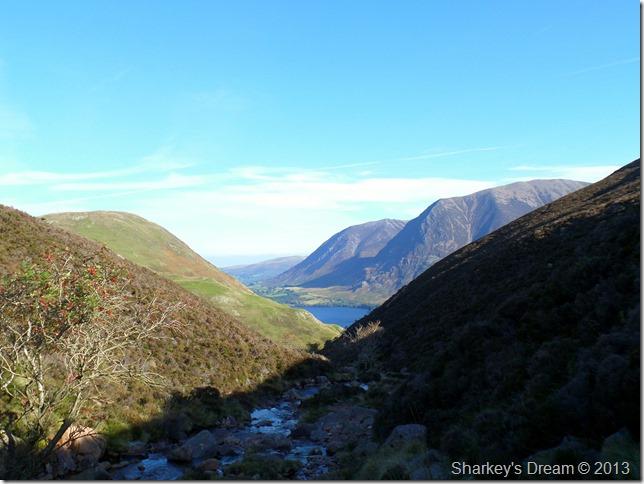
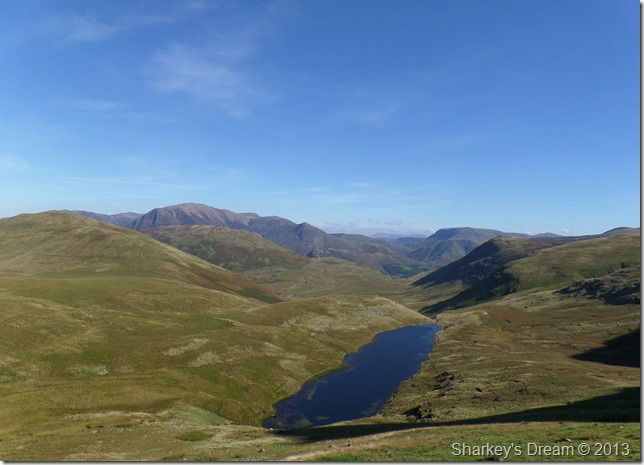
Floutern Tarn, Mosedale Head with a north western perspective seen from Steel Brow.
During the descent I took a slight de-tour if not only to zig-zag my way down at the same time taking the steepness out of the descent, it worked well as I was able to get this proper view of Floutern Tarn. |
 |
| |
This time with Red Pike & Starling Dodd in view, note how from here Starling Dodd looks much higher than Red Pike. |
 |
| |
Mosedale & Whiteoak Moss with Red Pike appearing upper right.
It’s commonly thought that Mosedale & Whiteoak Moss is an unpleasant way to gain Great Borne, but, If like me & you like the seclusion Mosedale provides then what is a little bog underfoot when you can take so much out of just being there. |
 |
| |
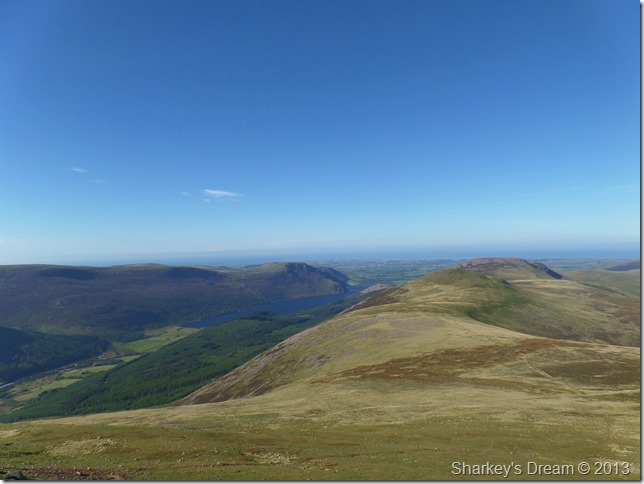
Low Fell & Darling Fell as seen from Mosedale.
Flanked by both Hen Comb (L) and Mellbreak (R) I am almost towards the end of my walk. Mosedale has been kind & kept my feet dry, all what was left was to take in just under two miles in seclusion under a basking afternoon sun. |
 |
| |
Low Fell & Darling Fell seen over Pine Plantations.
My time through Mosedale gave me time to reflect on just how well todays walk worked out with time spent on old fells & new routes, this walk together with the weather wont be forgotten in a hurry.
It’s not very often we & indeed the fells are blessed with successive days of not just dry, but warm weather so late into September, when such a thing does occur, grab it with both horns & take all you can.
I believe that is what happened today…
As I make my way back to Loweswater I pass The Kirkstile Inn, people sit outside & chat while I walk by…I have a few pound coins in my pocket but I daren’t set foot into a place where people are eating as I am indeed in need of, a bloody good shower.
No truer sign of a belting day on the fells. |
|
| |
| Back to top |
 |
|