|
Wetherlam, Steel Edge & the Cathedral Cave |
 |
 |
1st November 2013 |
 |
|
I had only been away from Lakeland the one week but it felt much longer in these boots. Today I wanted to take away as much as I could from a walk & I don’t think I got it far wrong with this route, even adding some unexpected extras towards the end of the walk.
Today I find myself in Tilberthwaite, a once thriving slate mining community that I haven’t visited since May 2010. I expected nothing to have changed & it hadn’t with exceptions of the Yewdale fells being awash with Autumn colour, which made the drive through its tree wooded lanes that bit more pleasurable.
But first I wanted to visit a few sights before reaching Tilberthwaite around Yewdale & Coniston, I’d already made time for these planned trips & as I’d got there so early I had them all to myself, it all started before sunrise at the car park at Tarn Hows. |
|
Wainwright Guidebook |
 |
| The Southern Fells |
-Wetherlam, the most industrialised of Lakeland mountains:
This fine hill, however, is too vast and sturdy to be disfigured and weakened by mans feeble scratching’s of its surface, and remains today, as of old, a compelling presence to which walkers in Brathay will off turn their eager steps. |
 |
|
| |
|
Overview |
|
|
| Ascent: |
3,018 Feet, 920 Meters |
| Wainwrights: |
4, Wetherlam – Swirl How – Great Carrs – Grey Friar |
| Weather: |
Sunny Start Turning Overcast, High Winds Across Tops, Highs Of 12°C Lows Of 10°C Feels Like 7°C |
| Parking: |
Car Park, Tilberthwaite |
| Area: |
southern |
| Miles: |
10.2 |
| Walking With: |
On my own |
| Ordnance Survey: |
OL6 |
| Time Taken: |
6 hours |
| Route: |
Tilberthwaite – Above Tilberthwaite Gill – Dry Cove Bottom – Steel Edge – Lad Stones – Wetherlam – Prison Band – Swirl How – Top Of Broad Slack – Great Carrs – Fairfield – Grey Friar – Fairfield – Wet Side Edge – Greenburn Beck – Slater Bridge (Little Langdale) – Cathedral Quarry – Moss Rigg Wood – Pierce How Beck – Tilberthwaite |
|
| |
|
Map and Photo Gallery |
|
|
 |
| |
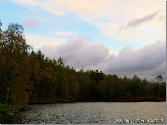
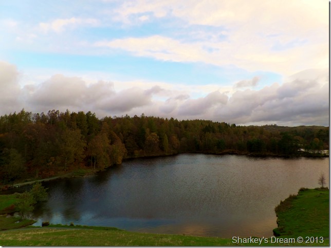
Tarn Hows.
I arrived at Tarn Hows in good stead just before sunrise, being early I waited about in the deserted car park waiting for that bit of extra light which wasn’t really materialising. With the engine turned off for those few minutes the wind swept through the trees & I didn’t want to the leave the comfort of the car.
I was only expected to be away for a few shots but that didn’t stop me taking my jacket along |
 |
| |
Tarn Hows.
The sky shone with a tiny pink afterglow & the wind carried the clouds obscuring much of the sunrise at the same time taking any warmth away too.
It sure was cold as I finished my photos breathing warm air into cupped hands as I made my way back to the car. |
 |
| |
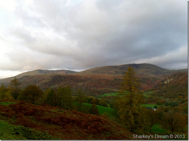
Here casting my eye over Holme Fell towards Coniston Old Man & Wetherlam from the top of Lane End.
After leaving Tarn Hows I drove over Lane End which effectively is a narrow steep road that will lead me back on to the A593.
The road was very narrow & in a state of disrepair in places, the previous nights heavy rainfall was still gushing over the tarmac so care was taken as I drove through the coppices of trees keeping everything crossed that another car wasn’t heading my way.
Still, a fantastic place to stop the car non the less. |
 |
| |
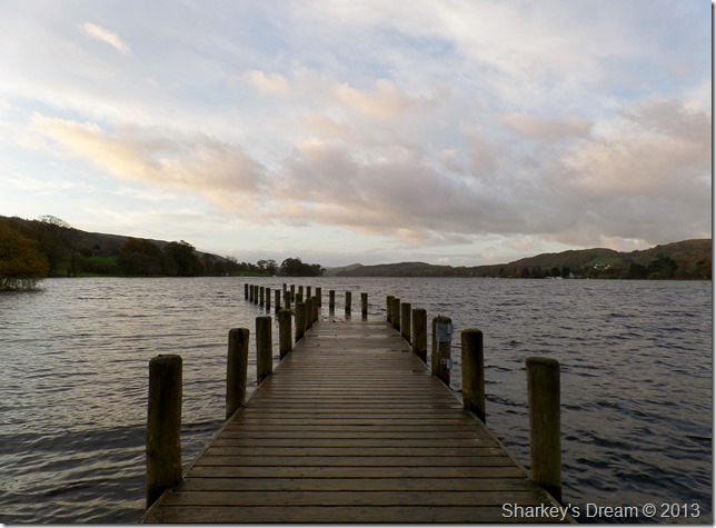
Monk Coniston Jetty, Coniston Water.
I hadn’t planned to stop at Monk Coniston at all but seeing as my time at Tarn Hows was brief I thought why not. |
 |
| |
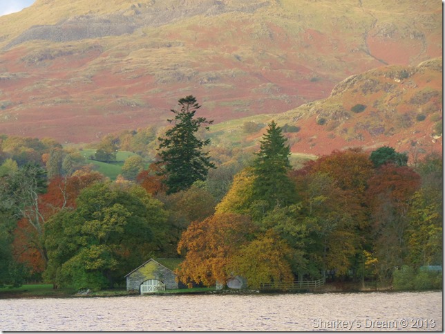
From Monk Coniston I was treated to this great view of the Boat Houses with a spread of Autumn colour.
Time was pressing on a little so I jogged back to the car & made the short drive to Tilberthwaite. |
 |
| |
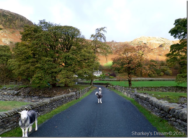
Where I got the usual morning welcome.
Tilberthwaite, 07:48 10°C
After parking my car I kitted up besides the sound of Yewdale Beck as it broke the morning silence, adding to this sporadically was that fresh wind I had already experienced back at Tarn Hows.
Despite the sunshine I opt for hat & gloves which gave some much needed warmth after leaving the comfort of the car…numerous times! they don’t last long as I warm up quite quickly after taking the steep stone path over Horse Crag, I then pass through the first of many quarries that I will encounter today. |
 |
| |
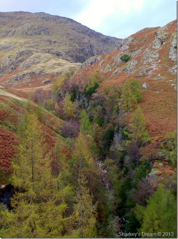
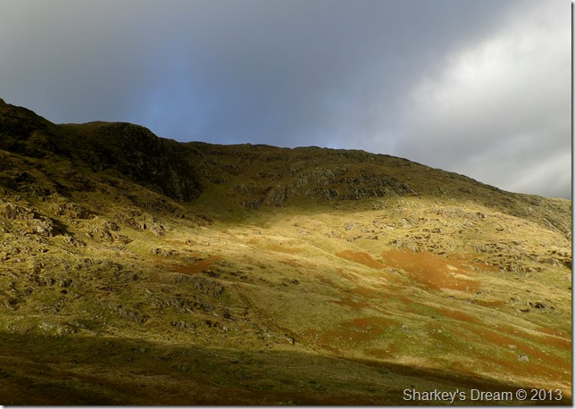
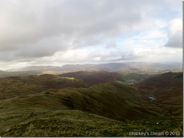
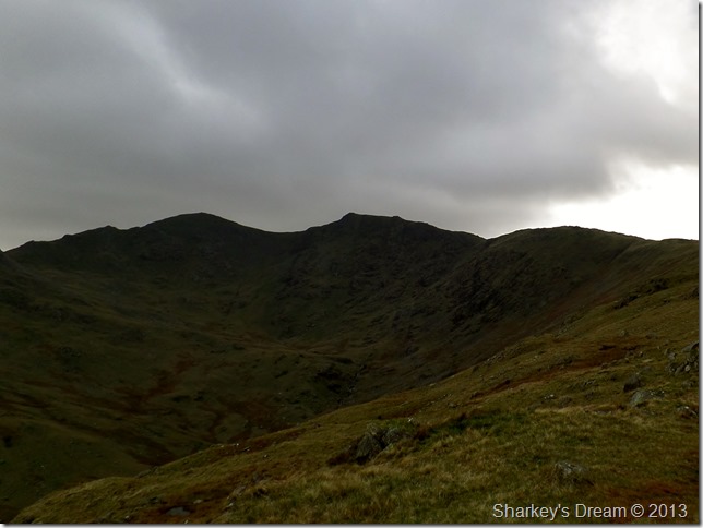
Wetherlam & Steel Edge after passing through the quarries.
After leaving the quarries behind I got my first view of Steel Edge & Wetherlam, down there in the foreground within the trees is where Yewdale Beck becomes Tilberthwaite Gill. |
 |
| |
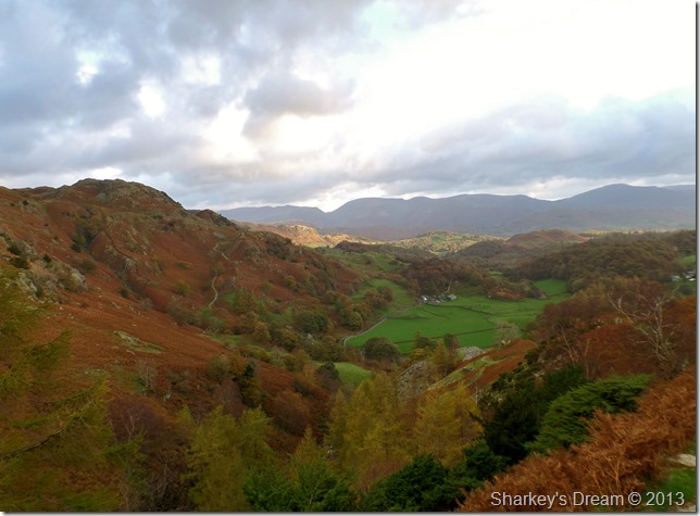
Tilberthwaite in Autumn glory with a distant view of Grisedale Hause & the Eastern Fells. |
 |
| |
Tilberthwaite Gill & Steel Edge from a little higher up the path. |
 |
| |
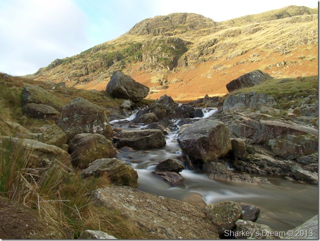
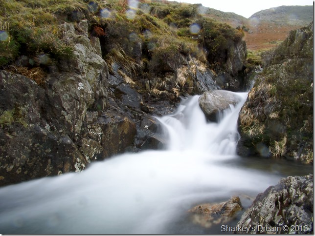
Crossing Crook Beck.
The crossing went without incident taking care as the water ran fast over the slippery wet rock |
 |
| |
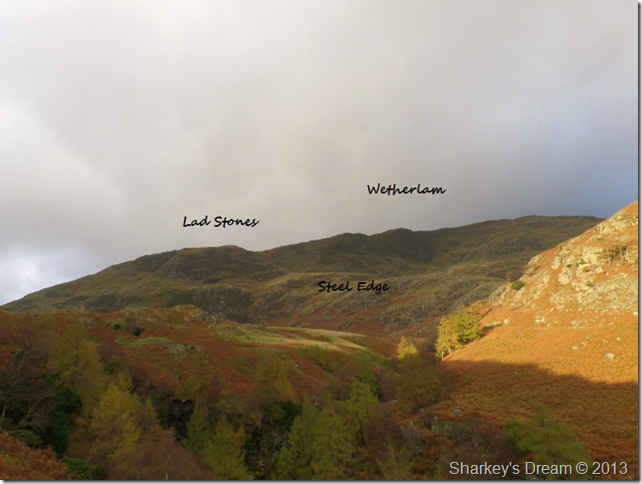
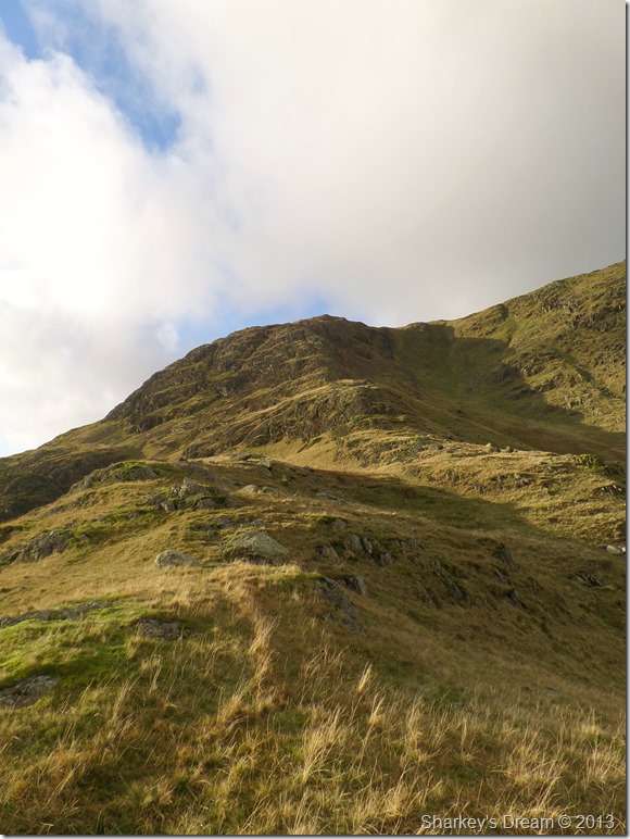
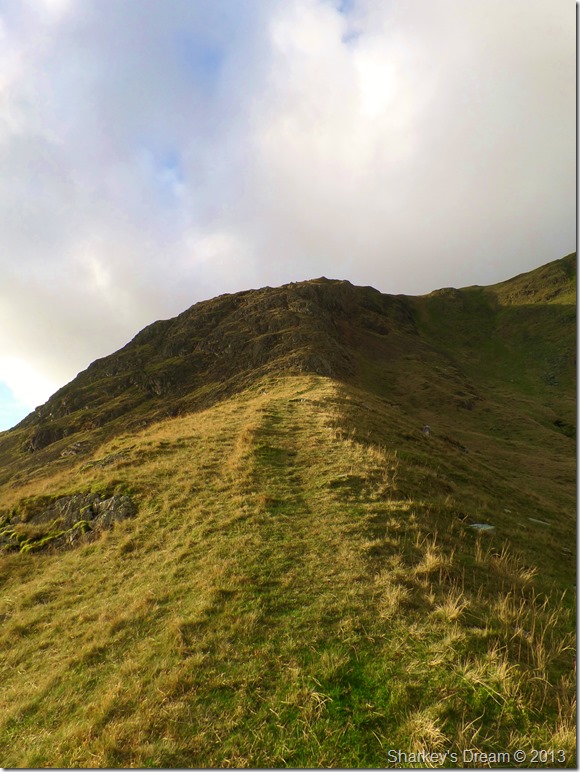
Steel Edge.
There is an initial steep climb to gain the ridge which puts you in good stead as to what to expect for the next thirty minutes or so, but all undoubtedly well worth it. |
 |
| |
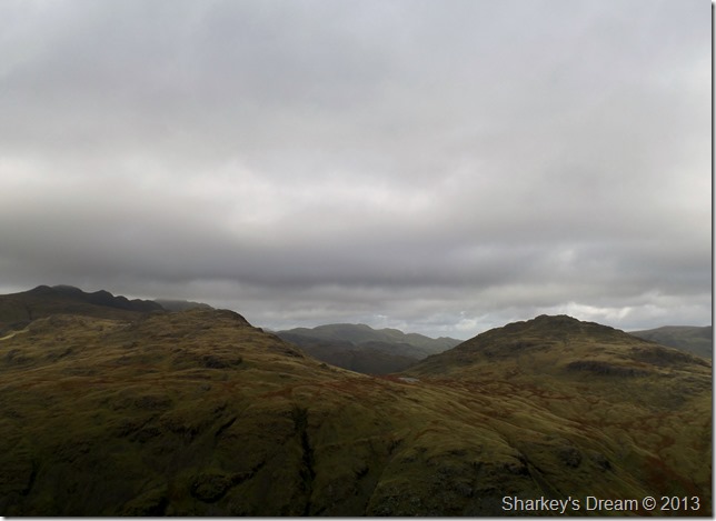
Here I paused to capture my breath over looking Dry Cove Bottom & Blake Rigg. |
 |
| |
Wetherlam Edge was never far from sight over to my right. |
 |
| |
Steel Edge.
A well worn grassy path lines the route towards the craggy section of the ascent. |
 |
| |
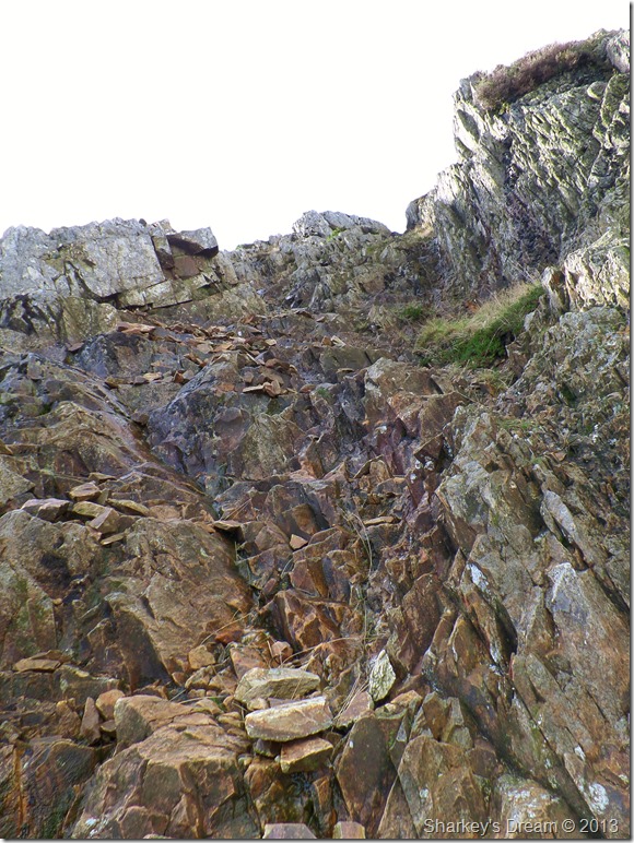
The hands on approach to Steel Edge.
I approach this section of the ascent with a little caution as here the rock is still wet from the previous nights rain, so I make sure of good holds before taking each step which worked well making the ascent very enjoyable |
 |
| |
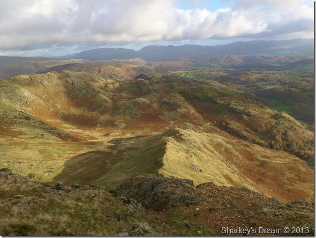
Steel Edge from above.
Steel Edge offers some great scrambling for beginners & in my account is the best way to gain Wetherlam after my experience today. Steel Edge’s only fault being, that it is over far too quickly.
A great winter route after the snow has fallen perhaps. |
 |
| |
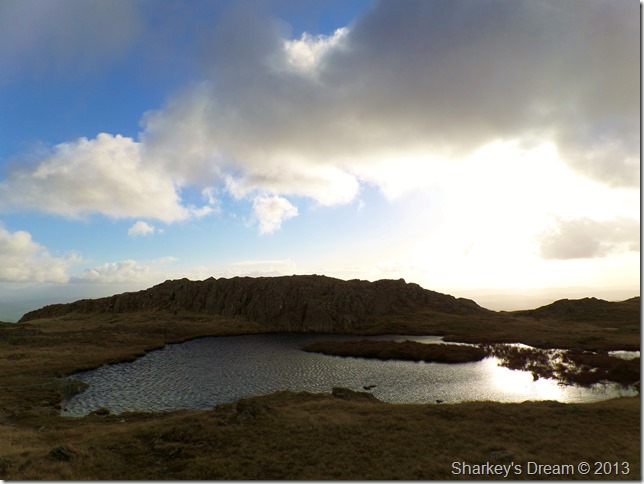
One of three Tarns found on the South East ridge of Wetherlam.
After reaching the top of Steel Edge I soon picked up the Lad Stones Ridge by following a faint grassy path which lead me to the more prominent summit path, here I had a brief respite from the wind which didn’t last long but was nice whilst it did.
Where did I put the hat & gloves. |
 |
| |
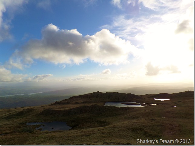
From a little higher up all three tarns are now visible.
The summit is just a short walk away & I couldn’t help reflect in that although I have climbed Wetherlam numerous times now, this was only the second time that I had complete visibility which almost gave Wetherlam that new mountain feel to it. |
 |
| |
Coniston Old Man from Wetherlam summit.
By the time I reached the summit I had lost quite a bit of light which was as predicted in the forecast, the wind had also gained in strength making the last part of the ascent almost a fight to stay vertical which was more tiring than the actual ascent itself.
After leaving the summit I make for Swirl Hawse & Prison Band, in doing this I have lost enough descent which gave me further more respite from the strong winds. |
 |
| |
Black Sails, Swirl How & Great Carrs taken shortly after leaving Wetherlam summit. |
 |
| |
Prison Band & Swirl How from Swirl Hawse.
Prison Band is a tough little cookie but extremely forgiving with its neat little scrambles & perfectly pitched paths which is why I consider Prison Band one of the best Lakeland ascents |
 |
| |
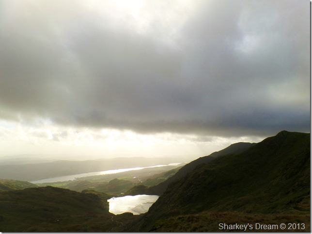
Here offering fantastic views over the length of Coniston Water & Levers Water as they capture the sun between breaks in the clouds. |
 |
| |
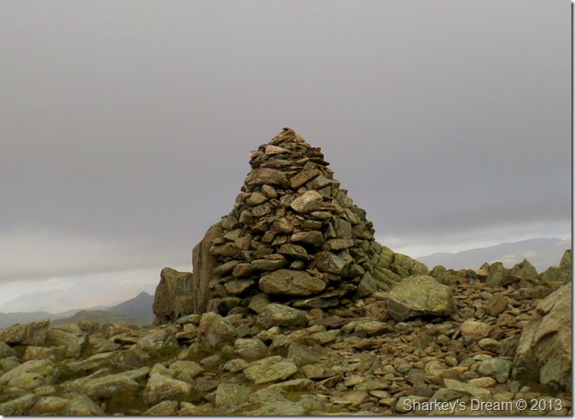
Swirl How summit.
Whilst at the summit of Swirl How I was again back in the mercy of the strong unforgiving winds that seemed to gain in strength the more time I stood still, hence just the one summit shot & I was out of there. |
 |
| |
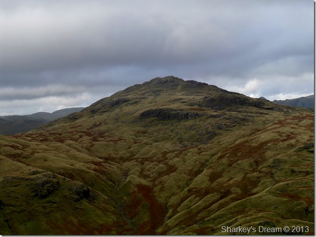
Great Carrs from the Top Of Broad Slack.
The crossing between both summits was altogether deafening as I struggled to keep upright noting my distance from the main path was to be kept a good distance away should I lose control of where I opted to place my feet! |
 |
| |
Great Carrs summit.
Again just the one summit photo which almost never materialised as I approached the final few steps a gust caught me…
I swear I was air borne for a second or so but maybe not…still scary stuff. |
 |
| |
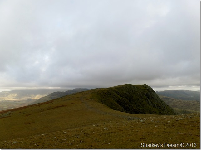
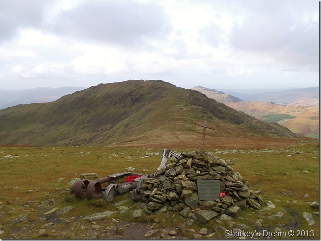
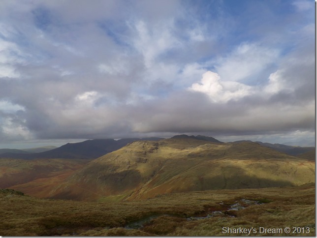
Grey Friar from the WW2 Halifax Bomber Memorial site.
After leaving Great Carrs summit I fought my way down to the remains of the Halifax Bomber Memorial which crashed here after hitting the steep crags on Broad Slack in bad weather back in October 1944 killing all eight crew members.
I take a couple of photos at the same time pondering do I continue to Grey Friar & battle with the wind once more over Fairfield, or do I cut my walk short & head for Wet Side Edge behind me? |
 |
| |
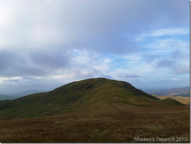
Grey Friar from Fairfield.
Grey Friar it is.
I take on an almost sideways stance as I cross Fairfield my only pleasure was knowing that on the way back it would be the right side of my face taking a beating from the wind! |
 |
| |
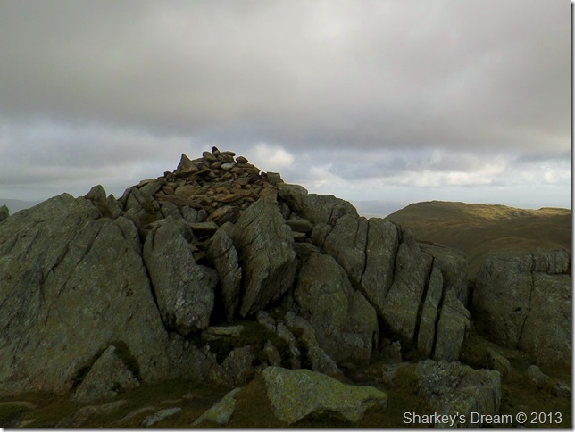
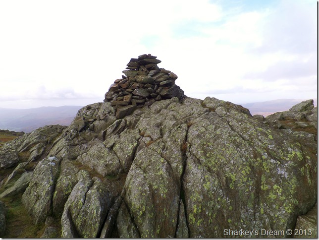
Grey Friar summit cairn.
With the exposure of Fairfield now behind me I soon became sheltered during the ascent of Grey Friar which caused me to react with a sudden charge towards the summit which wasn’t nearly as windy as I thought it would be. |
 |
| |
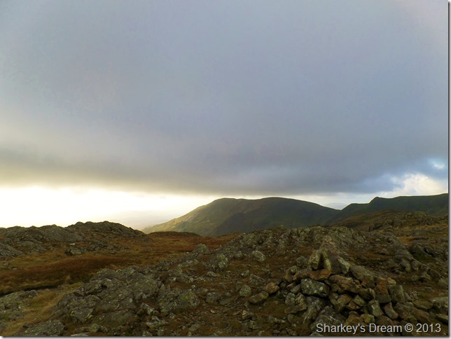
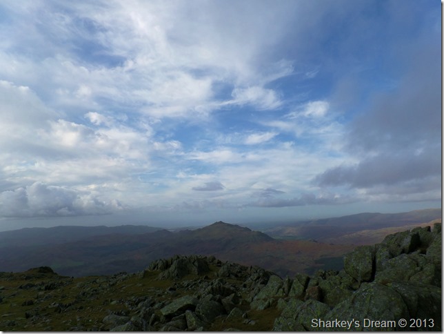
Harter Fell (Eskdale) from the summit of Grey Friar.
The wind had eased enough for me to enjoy the summit as I ponder about watching the cloud whirl across the sky as chinks of blue start to appear.
Camera in hand I have a little exploring to do. |
 |
| |
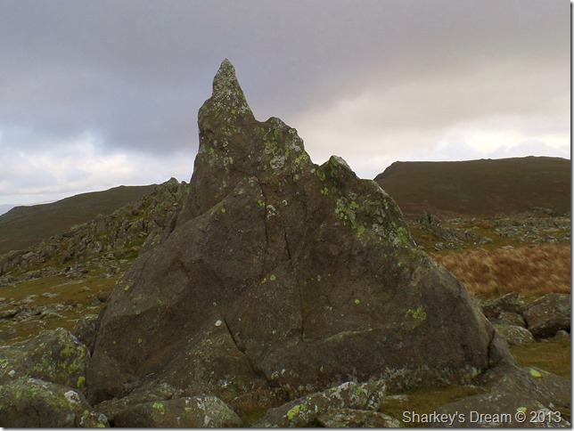
The Matterhorn Rock, Grey Friar. |
 |
| |
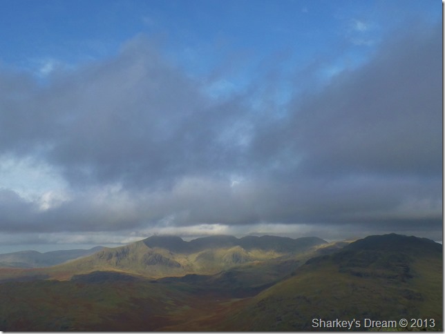
The Scafells Esk Fells from Grey Friar.
Here I took this long distant shot over Mosedale towards the Scafells whose summits where drifting in & out of the cloud.
After a few photos & a quick bite to eat I was now on the homeward part of the walk (or halfway) so to speak. My plan now is to descend into Little Langdale briefly via Wet Side Edge & back into Tilberthwaite via the disused Quarries & Moss Rigg Wood.
But all that is quite a while off yet so it’s time to soak in Wet Side Edge & its fantastic views. |
 |
| |
Flanking Great & Little Carrs towards Wet Side Edge after crossing Fairfield once more…strangely enough the wind had died down the second time around. |
 |
| |
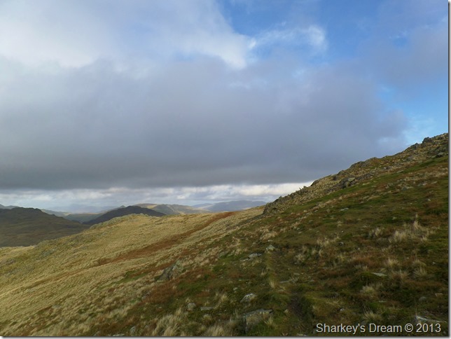
Little Stand domineers the view as I approach Wet Side Edge.
The fells in black in the far distance are Slight Side, The Scafells & Crinkle Crags. |
 |
| |
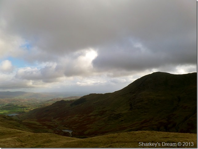
Greenburn & Little Langdale taken before my descent on Wet Side Edge.
Little Langdale Tarn features in the far distance & looks quite a considerable way off yet which indeed it was, but, I had good intentions of visiting Slater Bridge which made the trek worth the while. |
 |
| |
Cold Pike & Pike O’ Blisco together with Red Tarn nestled neatly in between. |
 |
| |
Wetherlam & Wetherlam Edge flanked my right, incidentally that’s Greenburn Reservoir down there in the valley below. |
 |
| |
A close up of Pike O’ Blisco together with Black Crag. |
 |
| |
Looking back on Great Carrs (R) & Swirl How taken shortly before I left the ridge to drop down into Greenburn. |
 |
| |
Crossing Greenburn Beck.
After descending Wet Side Edge I made for the narrow footbridge that crosses Greenburn Beck shortly afterwards, I then picked up the track that flanks Low Fell (Tilberthwaite) |
 |
| |
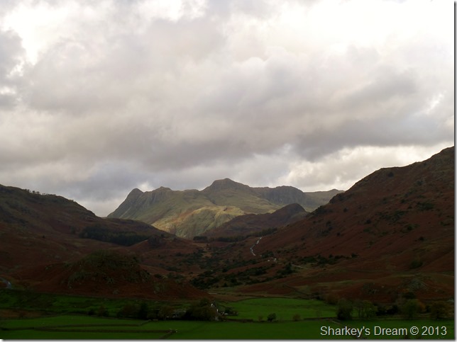
The Langdales seen over Little Langdale.
It looks like the Central part of the district was enjoying a little more sunshine than I was, but that being the nature of todays weather, I didn’t let it bother me too much. |
 |
| |
Little Langdale Tarn shown with Lingmoor Fell. |
 |
| |
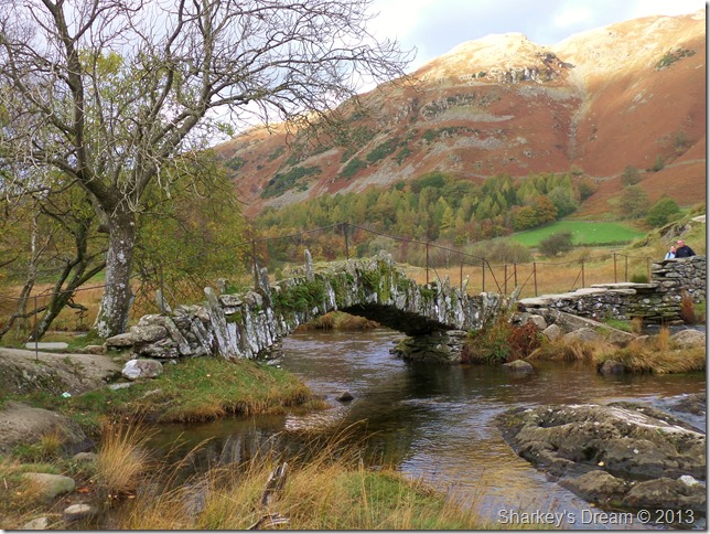
Slater Bridge & The River Brathey, Little Langdale.
Slater’s Bridge is believed to have been built by quarry workers from the nearby quarries of the Langdale Valley well over a hundred years ago hence the name of the bridge.
The bridge is unusual in it’s appearance as it is built from pieces of uneven slate, in what appears to be in a haphazard fashion, although it has stood the test of time remarkably well.
Time spent sadly at Slater Bridge was brief as minutes after taking this photo a large group of cyclist ascended upon the area dumping their bikes on both sides of the River to stop for lunch.
This was my queue to exit. |
 |
| |
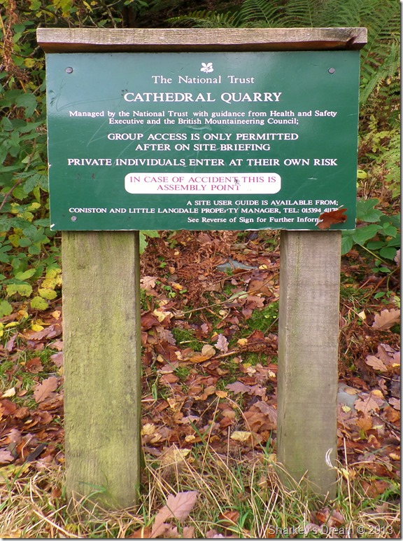
Todays walk wouldn’t of been complete without a visit to Cathedral Quarry. |
 |
| |
The entrance to the Quarry is found just above the hillside.
There’s something quite special inside that I’d always wanted to see… |
 |
| |
The Cathedral Chamber…I am extremely impressed. |
 |
| |
The main attraction in the Quarry is the cavern which is named The Cathedral which boasts an impressive 40ft high pillar of rock which is lit by this huge window once blasted out of the rock by the Quarrymen. |
 |
| |
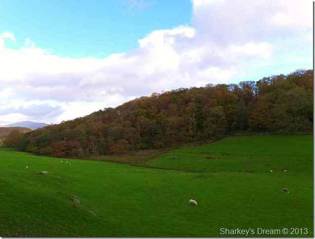
Bakestone Barrow Wood taken from Low Tilberthwaite.
After leaving the Quarry somewhat impressed I take on the last mile & half back to Tilberthwaite, in doing this I take a wrong turn almost & nearly end up at Hodge Close Quarry which wouldn’t have been such a bad mistake I suppose.
I retrace my footsteps & find my path once more where I flank masses of blasted Quarry rock sometimes two/three stories high… vast amounts of rock.
The sun is strong & strikes through the woodland branches with blinding results leaving me in a hot sweat not really wanting that hot coffee I have waiting for me in the boot of the car…this afternoon I shall be dining on Diet Coke to quench the thirst.
I am left battered by the wind, caught by windburn & thirsty, but most importantly I am left fulfilled |
|
| |
| Back to top |
 |
|