|
Beda Fell to Place Fell from Martindale |
 |
 |
1st December 2013 |
 |
|
Todays walk was pretty much off the cuff which is not normally like me as I think a little forward planning always helps.
Up until 24 hours previous I had no idea where I would be walking with exceptions that it would be somewhere in the Far Eastern side of the district following the recent weather forecast. I guess I got pretty lucky that I at least had some views albeit, through low, & sometimes distant cloud.
It looked as though my luck had ran out as I crested the ridge just below Beda Fell summit, where all around me distant summits where obscured by mist, drizzle & low cloud.
Today I could at least take away that I got to view the marvel of the Beda Fell ridge, when considering that this is the third time I have walked almost this exact route, today was the first time I had the views that my previous outings so much lacked. |
|
Wainwright Guidebook |
 |
| The Far Eastern Fells |
-Angletarn Pikes:
The distinctive double summit of Angle Tarn Pikes is a familiar feature high above the Patterdale valley; the two sharp peaks arrest attention from a distance and are no less imposing as a close acquaintance, being attainable only by rock-scrambling, easy or difficult according to choice of route.
The crowning glory of the Pikes, however, is the tarn from which they are named, cradled in a hollow just below the summit. It’s indented shore and islets are features unusual in mountain tarns, and it has for long, and deservedly been a special attraction for visitors to Patterdale. The charms of Angle Tarn, at all seasons of the year, are manifold: in scenic values it ranks amounts the best of Lakeland tarns. |
 |
|
| |
|
Overview |
|
|
| Ascent: |
2,714 Feet 827 Meters |
| Wainwrights: |
3, Beda Fell – Angletarn Pikes – Place Fell |
| Weather: |
Overcast, Some Drizzle, Lows Of 8°C Highs Of 9°C |
| Parking: |
Parking Spaces, Martindale New Church |
| Area: |
Far Eastern |
| Miles: |
9 |
| Walking With: |
On my own |
| Ordnance Survey: |
OL5 |
| Time Taken: |
5 Hours 30 Minutes |
| Route: |
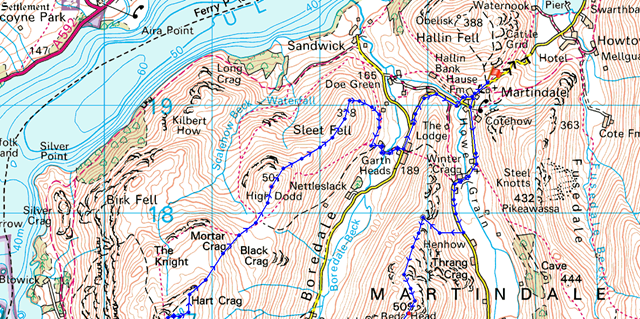
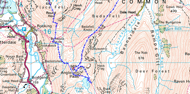
The Hause – Martindale – Nickles – Beda Fell – Bedafell Knott – Heckbeck Head – Angletarn Pikes – Angle Tarn – Boredale Hause – Steel Edge – Place Fell – Hart Crag – Low Moss – High Dodd – Sleet Fell – Garth Head Farm – The Hause |
|
| |
|
Map and Photo Gallery |
|
|
 |
| |
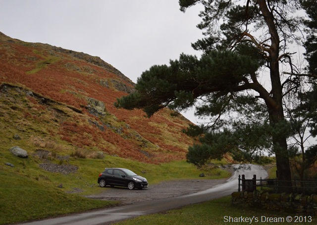
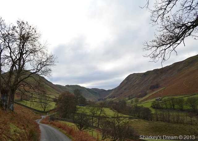
The Hause, Martindale 07:50 8°C
I arrived in Martindale under the cover of darkness which in fact gave me the option to take the small drive over to Sandwick & weigh up my parking options, it wasn’t the lack of space but more of a logistical way of thinking as Sandwick offered the perfect spot to return to the car once the walk was over, however parking in Sandwick meant I couldn’t visit some of Martindale’s historical buildings so I drove back just when the sun (I use the term lightly) started to come up.
It was nice not having to rush my kit on, noting that I pulled at both socks after I had laced my boots making sure for now, they held high.
It was wasn’t as cold as predicted either so the hat & gloves remained in the pack & that’s where they stayed for the whole duration of the walk. |
 |
| |
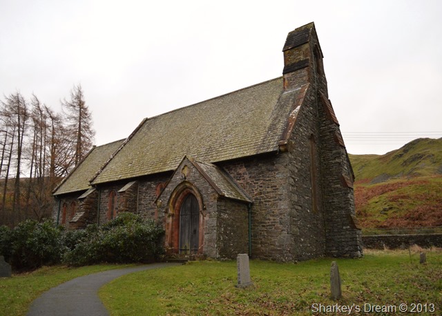
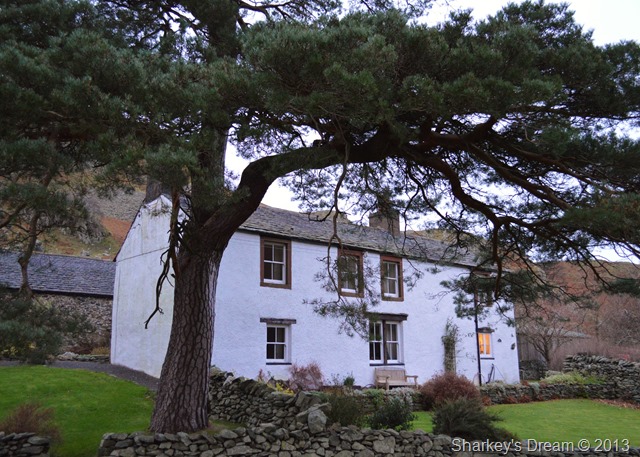
Martindale New Church is found if you turn your head 90° around from the car park. Martindale New Church replaces, yes you’ve guessed it, Martindale Old church which is found a little further down the lane. |
 |
| |
Beda Fell & Winter Crag.
The road winds its way in the valley of Martindale, here I can pick my route via Nickles which can be seen at the Col in between both Winter Crag & Beda Fell, more options are available to gain Winter Crag by taking numerous path picked out a little further into the valley. |
 |
| |
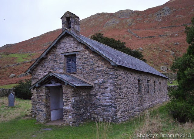
Martindale Old Church. |
 |
| |
Shortly after leaving Martindale Old Church Winter Crag Cottage is passed, gaining Winter Crag can be done via a path situated behind the cottage or if like me you are ascending via Nickles another path can be found between a break in the stone wall to your right after around 150 metres. |
 |
| |
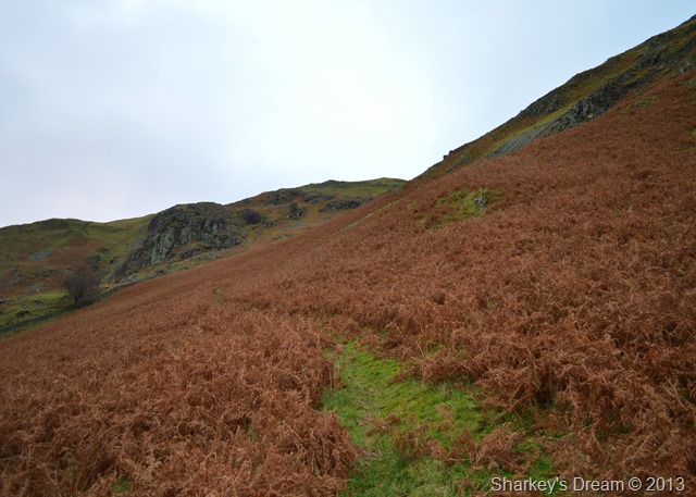
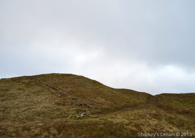
Ascent by Nickles.
The path is a little steeper than it looks in the photo but not much, here the grassy path takes on a course for Raven Crag (seen ahead) before abruptly turning right where the Col can be gained. |
 |
| |
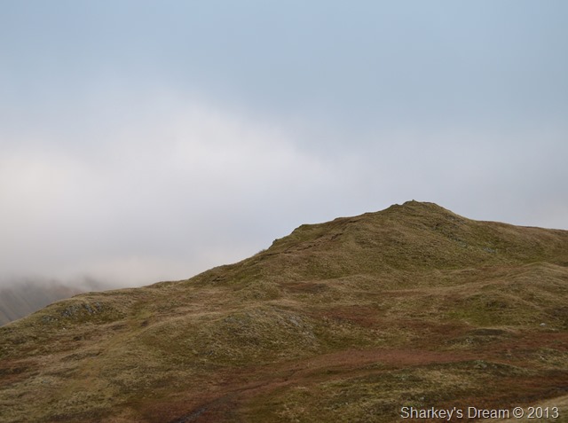
Beda Fell summit lies ahead.
After arriving at the Col a more gentle ascent is needed to reach the summit, it’s a steady course & nothing much to worry.
My only worry was history repeating itself as my last two summits of Beda Fell & indeed the ridge walk that would unfold had been done in low cloud very similar to what I am experiencing right now, could it be third time lucky? |
 |
| |
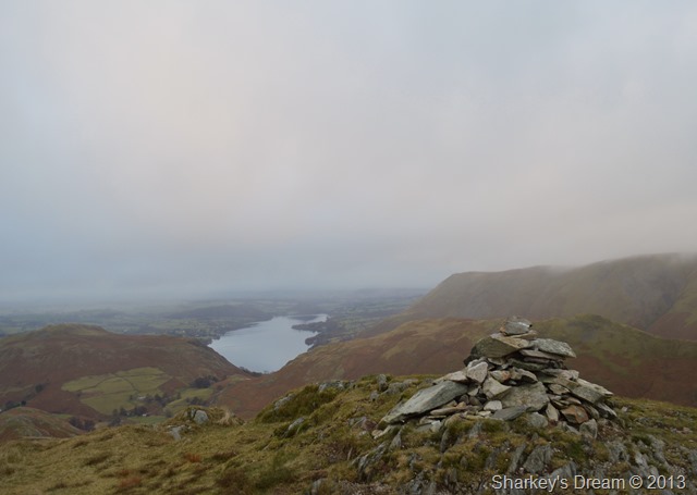
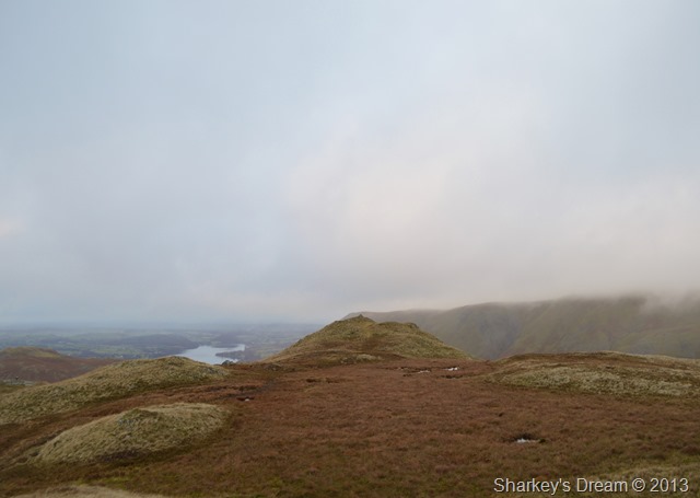
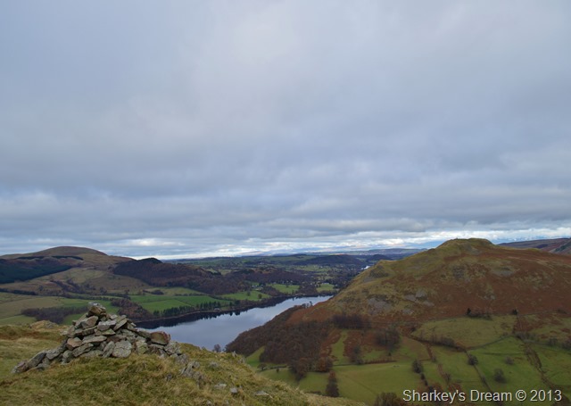
Through the mist Ullswater, Hallin Fell, Steel Knotts & Bonscale Pike appear from the Beda Fell summit cairn. |
 |
| |
Looking back on Beda Fell summit after some bog trotting. |
 |
| |
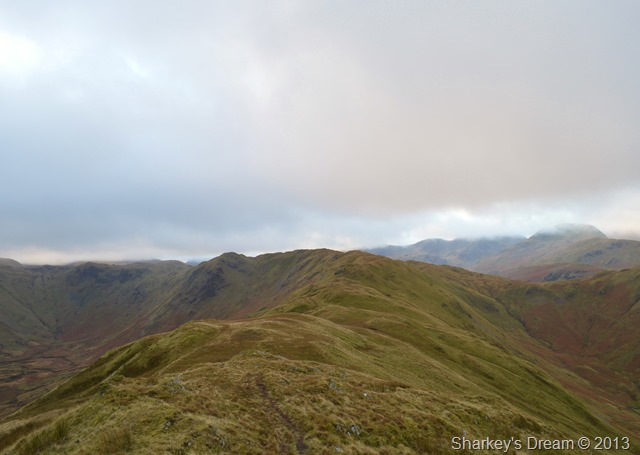
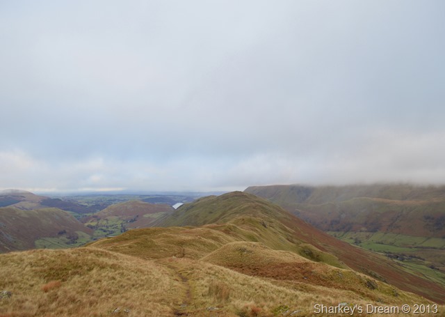
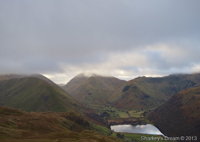
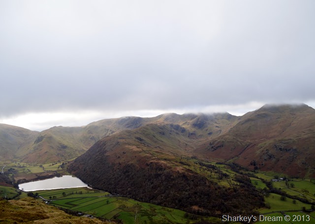
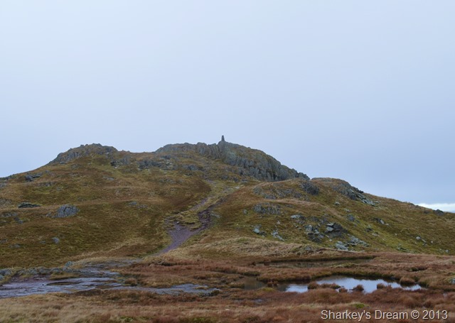
That’s more like it.
As the minutes passed the cloud lifted revealing the ridge walk before me, over to the left of the photo we have the valley of Bannerdale & to the right is Boredale Hause & of course the valley of Boredale, ahead is my ridge walk all the way to Angletarn Pikes, my route depicted in the next few photos. |
 |
| |
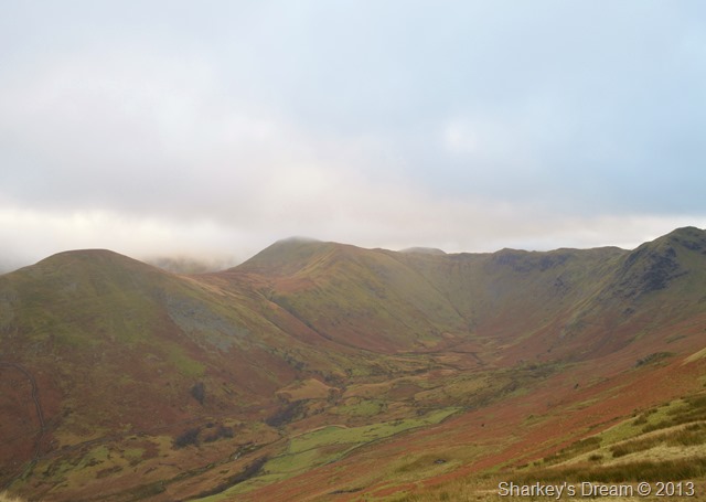
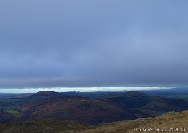
But first here’s a rather murky photo of Bannerdale, The Nab & Rest Dodd, the prominent crags seen further right are that of Heck Crag / Heck Cove.
Here I spot herds of Deer directly below me, a rumble of rock only giving away their position, my camera stays in the bag as they are much too far away to photograph. |
 |
| |
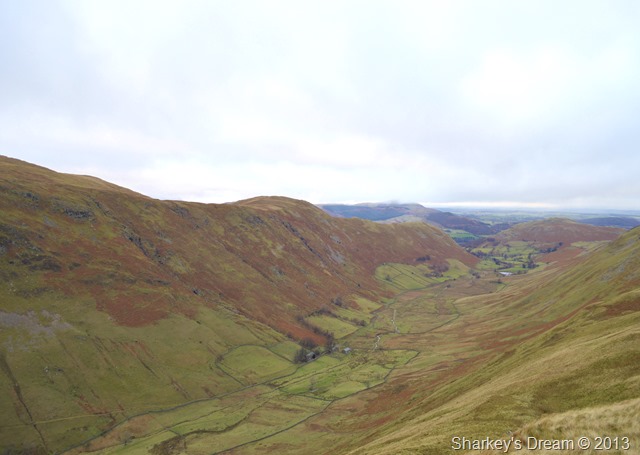
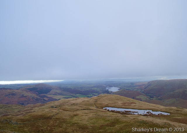
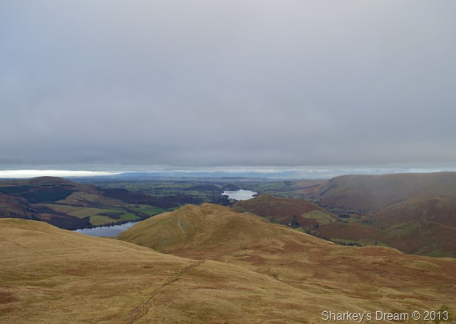
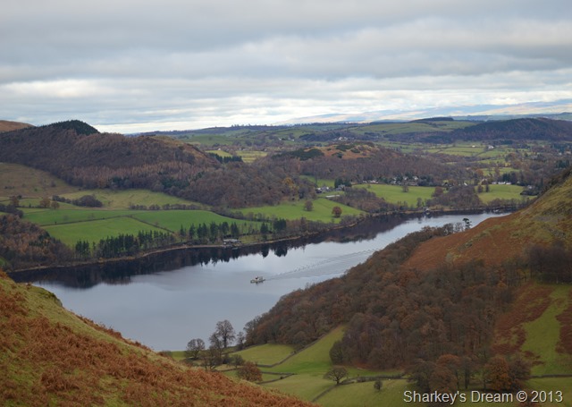
The Boredale Valley with a distant Hallin Fell.
I may not of had the weather, nor the light but I was sure counting myself lucky because right there on the other side of the valley is my next ridge walk, but first I had to reach Angletarn Pikes |
 |
| |
Left for Angletarn Pikes & right for Boredale Hause.
It pays to keep to the path in bad weather (speaking from previous experience) as mentioned, this is my third walk along this ridge but only the first time as I recall, I’ve noticed this cairn! |
 |
| |
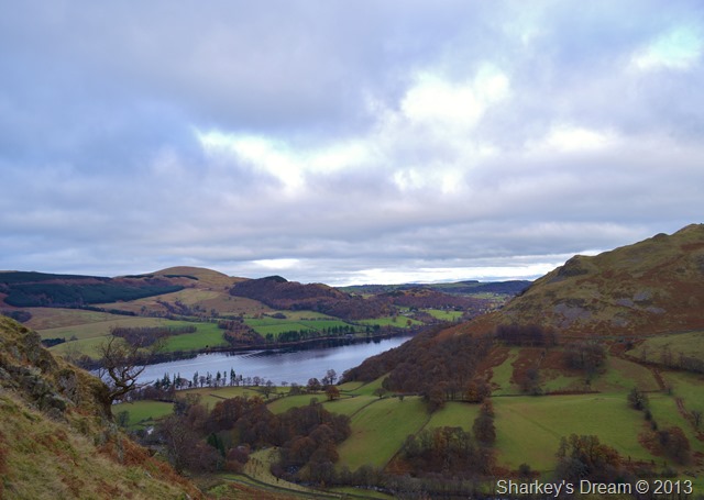
Here, looking back on Beda Fell & that distinctive ridge curve from Bedafell Knotts. |
 |
| |
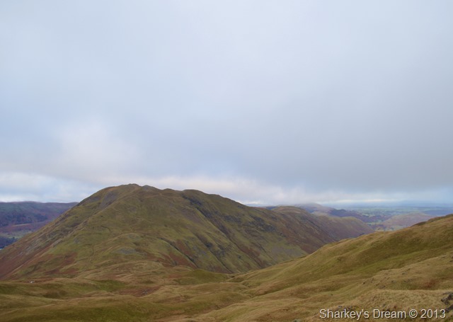
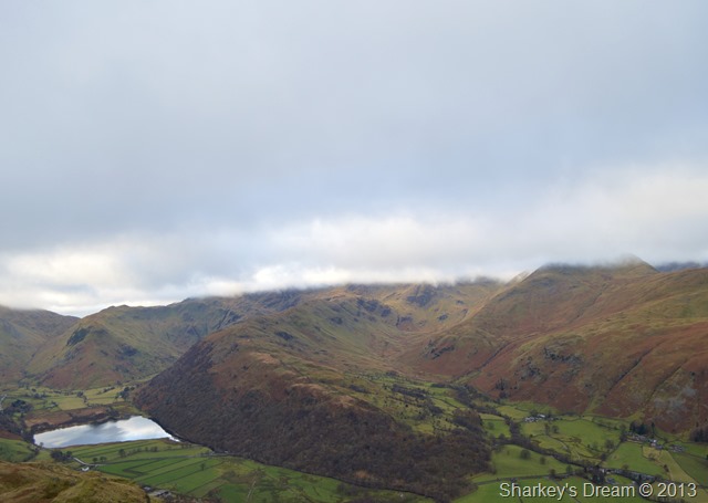
Place Fell & Boredale Hause seen after leaving Heckbeck Head. |
 |
| |
Soon after traversing above Boredale Hause both Angletarn Pikes come into view, the north top (summit) seen more striking over to the right. |
 |
| |
Hartsop Dodd, Middle Dodd, High Hartsop Dodd, Dovedale & Brothers Water viewed from Angletarn Pikes summit.
I am always a little saddened when I return to Angletarn Pikes as it is a place that I hold dear to my heart, I finished my last Wainwright here back in 2011 Back then I buried a champagne cork within the stone cairn, I can accept that the cork is long gone but what saddens me most is that the cairn has now vanished too with little else to distinguish the summit than a few scarcely scattered buried rocks. |
 |
| |
From the summit views extend towards Hartsop Above How & the valley of Deepdale. St Sunday Crag, Hart Crag & Dove Crag scatter the skyline beneath the low cloud. |
 |
| |
Here I zoomed in on Brothers Water, High Hartsop Dodd & Dovedale from Angletarn Pikes summit.
It was now time to leave & pay Angle Tarn a visit.
I do this after paying the south top a summit, then instead of making a beeline for Angle Tarn instead I head east by following a faint path almost as if I was making for the top of Heck Crag before turning sharply right where I pick up another faint path that will lead me down to the Tarn, my route was quite a diversion but beat the steep & wet grassy direct route down to the Tarn.
I hope all that made sense! |
 |
| |
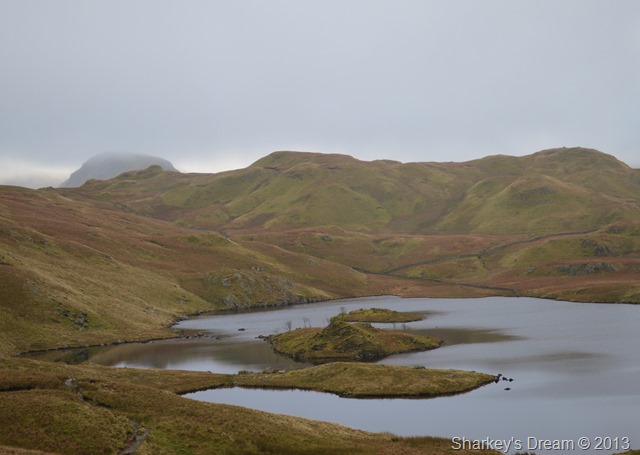
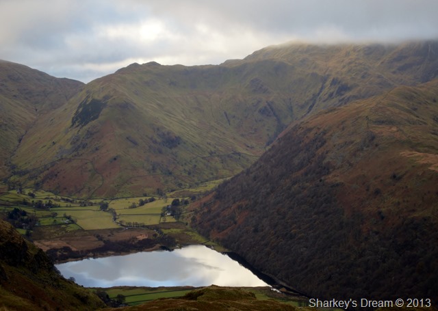
Angle Tarn & Brock Crags from my slightly odd descent.
My route might have been a little out of the way but was made up by the grand sight of Angle Tarn from an angle I’ve never viewed before.
Here I soak in this special place as it started to drizzle, with this came a bank of low cloud that came & went, I contemplate an ascent on Brock Crags from my position but decide to give it a miss as the moment I lost sight of it.
The next photos were taken before the drizzle & low cloud drifted in. |
 |
| |
After leaving Angle Tarn I took this photo of Hartsop Above How Deepdale & Brothers Water, I know you’ve just seen one just like it but this was taken when the sun made the briefest of appearances.
Enough of the picture taking for now, there’s a Holland’s meat pie in my pack that I’m going to eat for a late breakfast. |
 |
| |
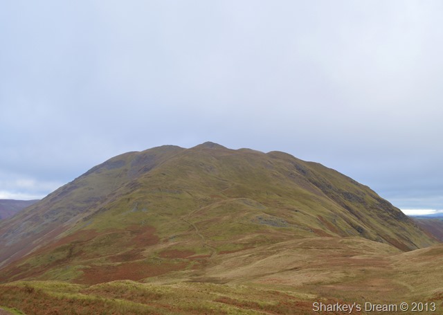
Place Fell domineering Boredale Hause.
From here I could see tiny dots making there way up the steep flanks of Place Fell, four of which I overtook & on my own ascent, I was somewhat impressed with my achievement even though I felt on the brink of collapse. |
 |
| |
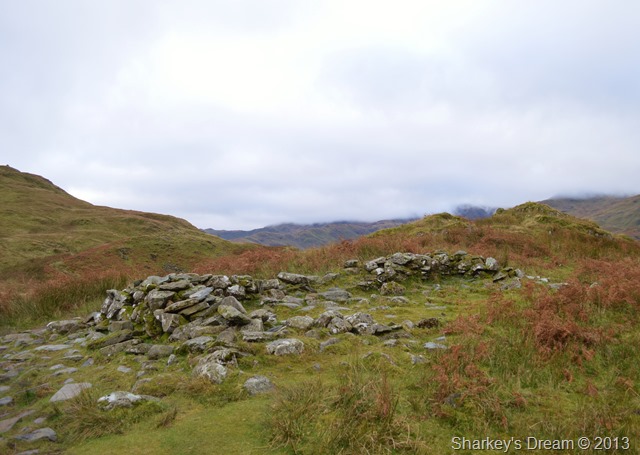
The Chapel in the Hause which is thought to predate the twelfth century.
Passing the old stone ruins of what once was Boredale Chapel from which the villagers of both Boredale & Patterdale would congregate. |
 |
| |
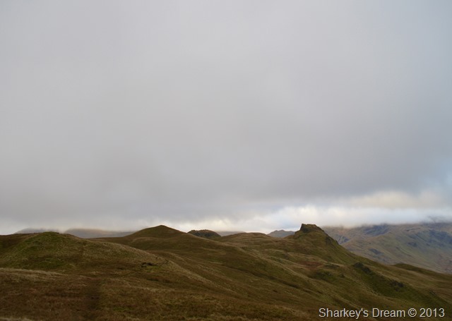
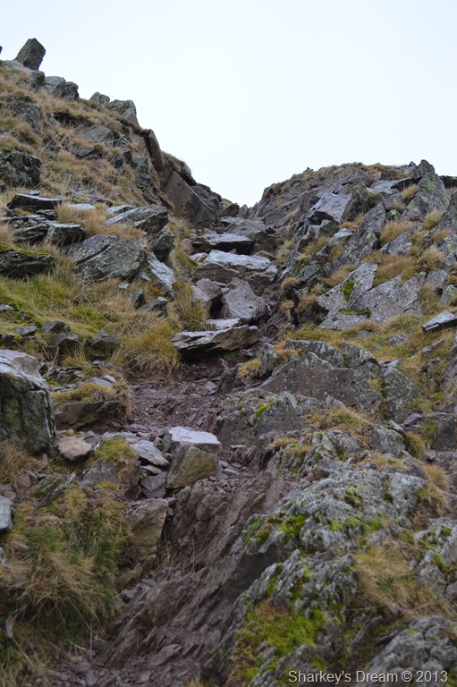
Here’s the craggy scrambly bit found at the top of Steel Edge. |
 |
| |
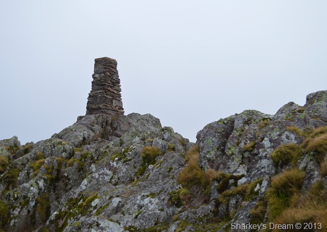
Place Fell summit is just ahead. |
 |
| |
Place Fell summit Trig Point.
I only managed the one photo as the previous walkers I had just overtook were approaching. |
 |
| |
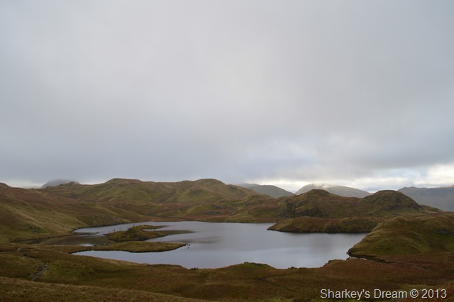
Place Fell Tarn & Hart Crag mark the start of my ridge walk all the way to sleet fell, here the light seemed to be getting lower & lower, the blanketing cloud above obscuring any light from the sun which glowed faintly through the grey cloud. |
 |
| |
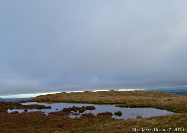
Place Fell Tarn. |
 |
| |
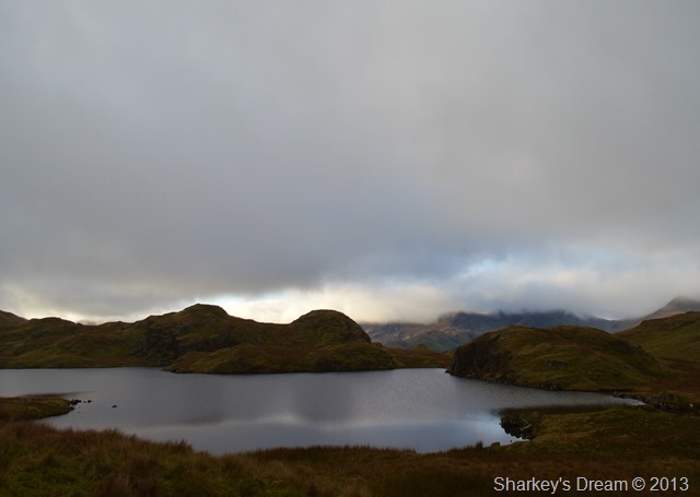
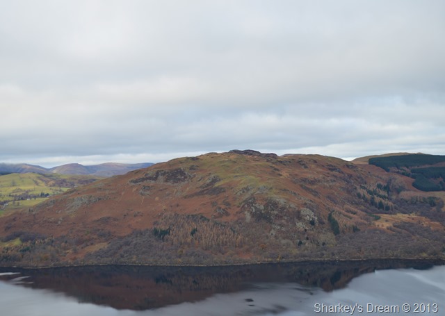
Gowbarrow Fell & the Mell Fells appear in almost shadow form beneath the low cloud. |
 |
| |
Low Moss & High Dodd can be seen from my descent by Hart Crag. |
 |
| |
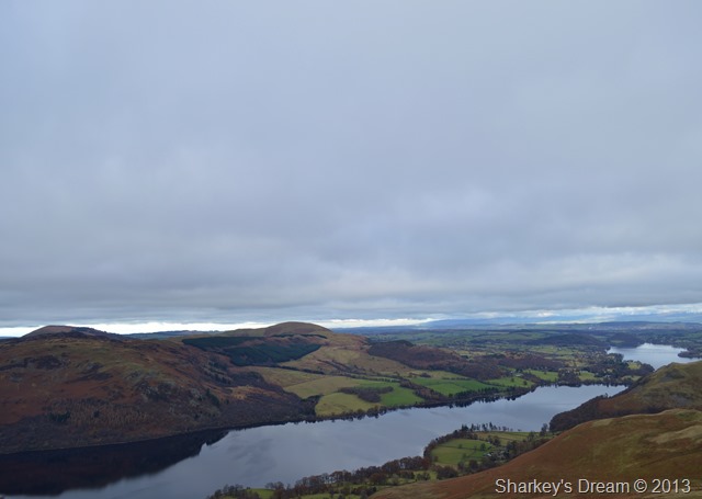
From which Ullswater starts to domineer the scenery. |
 |
| |
Gowbarrow Fell seen across a calm Ullswater. |
 |
| |
Little Mell Fell, Ullswater & Hallin Fell seen from Sleet Fell summit cairn. |
 |
| |
Ullswater Steamer seen over the hamlet of Sandwick. |
 |
| |
A corner of Sandwick from my Sleet Fell descent.
Sleet fell was sharp & rugged in descent, here as I trample through dying bracken I trip yet somehow manage to maintain a vertical slide via my right leg, after dusting myself down I am yet again bogged down on a tight slope as my right boot is swallowed whole sending me falling forwards, my right boot still bogged deep I somehow manage to pull my right boot out & land with my left, to my right I startle a full grown male Deer with antlers almost four feet in width a little over sixty yards away.
He looks back on me after a short bolt, stops, stares & bolts once more.
I offer him my humble apologies. |
 |
| |
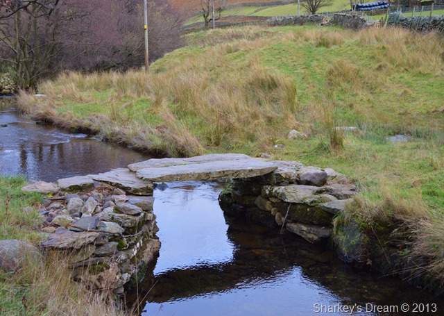
Here crossing Boredale Beck via this old stone bridge. |
 |
| |
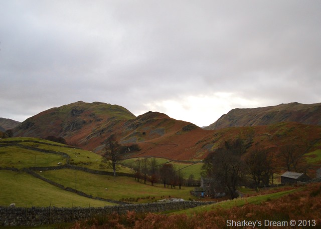
The Boredale Valley.
The sun started to creep out bringing light & indeed some warmth to the latter end of todays walk, I have yet to make the steep trek back up to The Hause but I know those concrete yards are going to pull at some tiring muscles.
Bringing the walk to an end as I reached the car was the those ten minutes I spent sat perched above the car park on a large stone boulder eating lunch & drinking coffee as my body steamed in what was turning out to be, quite a nice afternoon.
Its on days like these that I have to remind myself that I am above all a fell walker, memories are good & cameras capture those blue sky events well, but on a dark dull drizzly day in Lakeland as I had today a camera doesn’t quite capture Lakeland the way the way memories do. |
|
| |
| Back to top |
 |
|