Fairfield to Nab Scar via Little Tongue Gill

16th February 2014

With the wet weather continuing throughout the whole of the UK a small break between the gales & the downpours was more than overdue & was exactly what I got today. Despite the poor folk down south experiencing unimaginable & relentless misery the forecasters are still saying that even if it stopped raining today it would take until May for the rivers to return to their normal state.

I simply cannot imagine what it must be like for the thousands still without power with their homes under feet of water. It now seems completely irrelevant to complain about the weather & not being able to get out when others in the country are relying on the Army to pick through what is left of their homes.

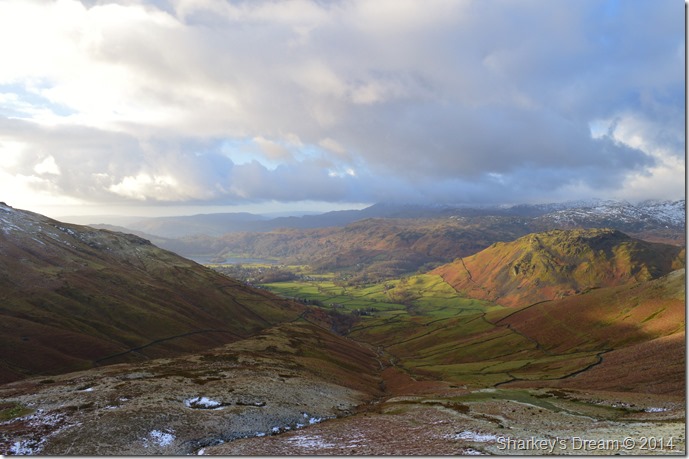
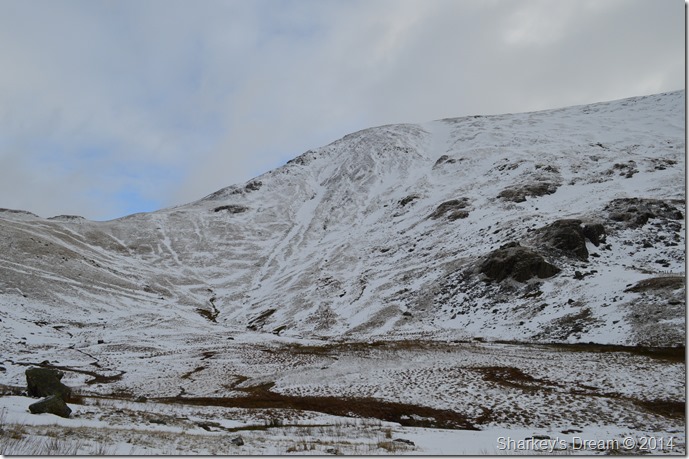
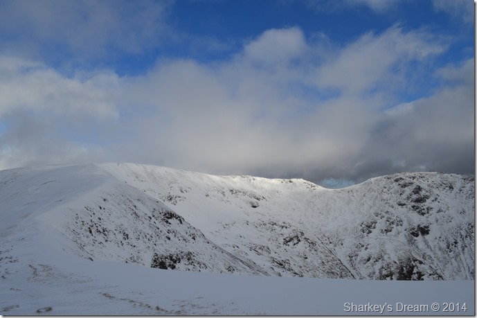
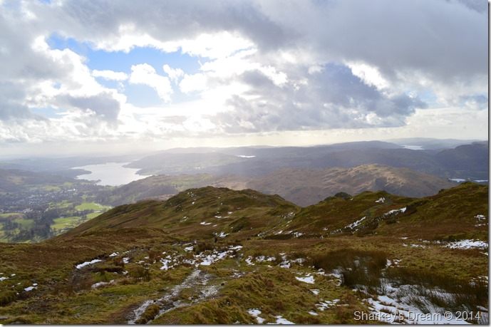
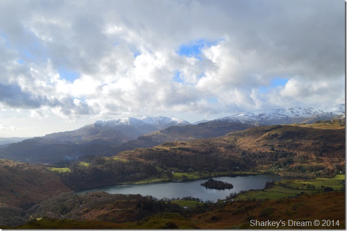
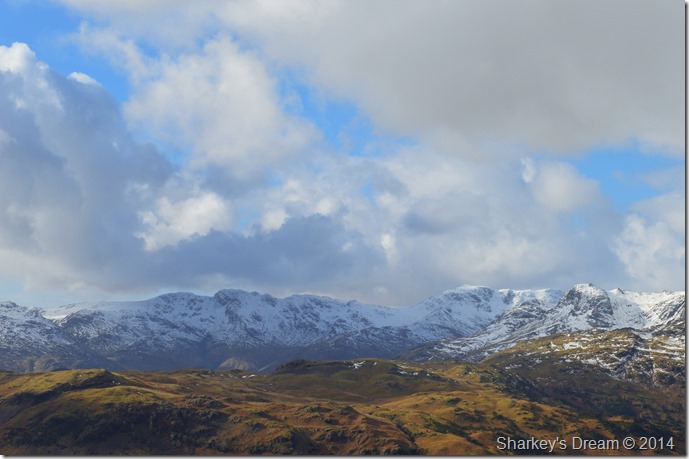
I guess Lakeland got away lightly which is unusual in itself, but for that, I & the uninfected should count ourselves lucky.

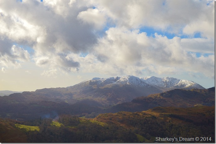
This walk was planned just a day or so ago as I wanted to take advantage of the clear day forecasted, I intentionally had a walk planned south in & around the Coniston fells where I would take on the ridge from Dow Crag to Caw but, the weather for now put that particularly walk on hold, but I still have full intensions of carrying out the route in the not to distant future.

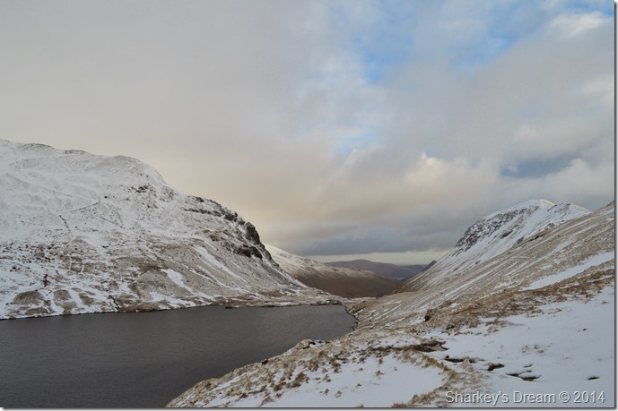
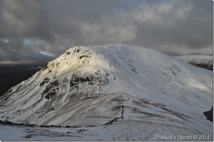
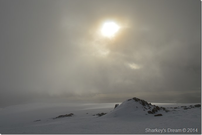
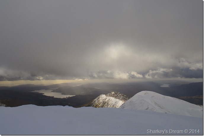
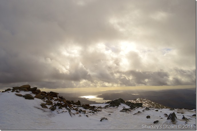
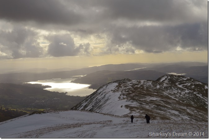
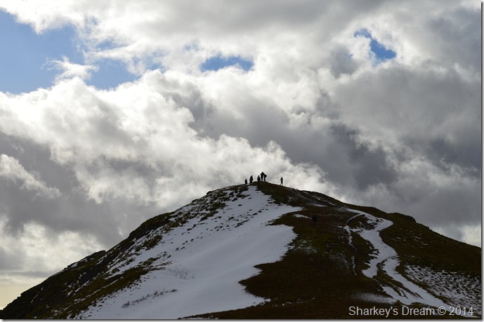
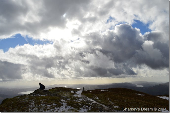
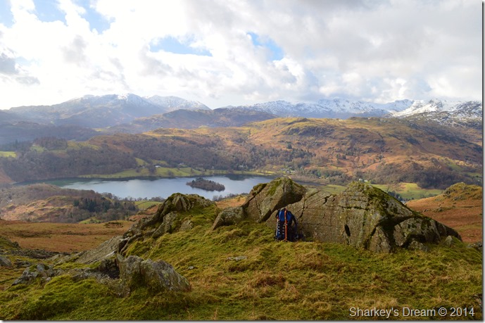
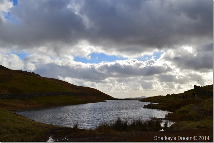
The forecast stayed true over stating that the eastern side of the district would experience the best brighter spells which I guess can count on why I saw so many people on todays walk, it was just nice to see other walkers enjoying the sunshine however brief it was on what can only be described as a spring like day in Lakeland.

Before I get on with the walk I would just like to add that I am now back in full time employment after securing a job with Peugeot based in Salford just outside Manchester city centre, for this walk all I can add is that I no longer will be carrying the burden in insecurities as I have on my previous walks.

For that todays walk feels that bit extra special.


Wainwright Guidebook One

The Eastern Fells

-Fairfield

The whole mass constitutes a single geographical unit and the main summit is Fairfield, a grand mountain with grand satellites in support. No group of fells in the district exhibits a more striking contrast in appearance when surveyed from opposite sides than this lofty Fairfield group.


Overview
Ascent: 2,683 Feet, 818 Meters
Wainwrights: 4, Fairfield – Great Rigg – Heron Pike – Nab Scar
Weather: Overcast To Start Turning Warm & Sunny. Highs Of 8°C Lows Of 3°C Feels Like -1°C Fresh Winds
Parking: Roadside Parking A591 Outside Grasmere
Area: Eastern
Miles: 7.8
Walking With: On My Own
Ordnance Survey: OL5
Time Taken: 5 Hours 15 Minutes
Route: A591 – Mill Bridge – Little Tongue Gill – Hause Riggs – Hause Moss – Grisedale Hause – Fairfield – Great Rigg – Heron Pike – Nab Scar – Alcock Tarn – Forest Side Plantation – Michaels Nook – A591 – Mill Bridge
 

Map and Photo Gallery


Steel Fell & the Travellers Rest taken from the A591 just outside Grasmere 07:44 3°C

I don’t know where I have been the last few weeks as the last time I walked in Lakeland sunrise was around 08:00am. This morning I planned my arrival for sunrise at the earlier time much to  my surprise of 07:30am which just goes to show that Spring is just about starting to creep in.

I took the foot of the gas on the drive north as I was running early so I lay in the wake of many a truck driver.

It was around 07:30 that I hit Windermere under heavy showers as you can see by the photo, with this I decided to wait them out so I decided to make an unscheduled stop at the petrol station/ Spar at Troutbeck Bridge where I treated myself to a coffee & a soft drink for the return journey.

I wasn’t first to arrive at the parking spaces outside Grasmere as I spied a walker kitting up behind his car a little further up the layby, time was taken to kit up myself eagerly awaiting a little more sunlight.


Seat Sandal seen as I pass the Travellers Rest.
No matter the time of day the Travellers Rest always looks inviting, I resist temptation & carry on a little further to the cottages seen ahead on the right, it is hear I pick up the path towards Tongue Gill.

Great Tongue seen ahead from the path.

Its now decision time on which route do I take?

Option One: Take on Great Tongue (seen with the grassy path ahead)

Option Two: Take Tongue Gill (to the right of Great Tongue)

Option Three: Take Little Tongue Gill (to the left of Great Tongue)

Decision’s decisions….

Confused? me too, this being the reason why I stood around a while trying to work out which route to take…

Talk about making a mountain out of a molehill!


Going with the Little Tongue Route.
Its fair to say I hummed & eyed which route to follow but in the end I went with the Little Tongue route, here in the photo shows where both Tongue Gill (Far Left) meets Little Tongue Gill (Right)

Heading for Hause Crags ahead.
The path here resembles a river bed & has done since leaving the A591 evidence of an over whelming amount of water pouring down the fellside is hard to ignore more so underfoot.

Looking back down Great Tongue & Little Tongue Gill.
As the sun rose more & more light started to creep into the valley, the fact that at this point there wasn’t any wind to speak of making the ascent incredible humid for the time of year. I can only guess it was the same for anyone making an ascent on Helm Crag this morning.

Navigating around the top of Hause Crags as Fairfield comes into view.
Its a steady climb before Hause Crags are reached, once here the path levels out to give a little respite on tired limbs before the next ascent on Grisedale Hause.

Sunrise over Great Rigg taken from Hause Moss.
 

Grisedale Hause from Hause Moss.
This being the first time I have gained Grisedale Hause via either any of the Great Tongue routes made Hause Moss a highlight of the whole walk. Hause Moss was also the point where the slushy snow underfoot turned to much deeper soft snow.

Fairfield over Hause Moss.
 

Dollywagon Pike together with St Sunday Crag from Grisedale Tarn.
After topping out on Grisedale Hause instead of heading for the summit I took this de-tour to take a few photos of Grisedale Tarn & St Sunday Crag. It was pretty early but I was still surprised I was the only person around (for now) so I took the opportunity to have a wee rest after wiping the snow of the grassy hummocks while I took in the stillness of my surroundings.

Ascent on Fairfield.

After a small rest I climbed back up towards the Hause over the grassy hummocks, my route was ‘as the crow flies’ & most certainly random; in doing this I still managed to pick up a boot track along the way, what are the odds on that I muttered.

While at Grisedale Hause the snow was well over a foot in depth & still quite soft so at the lower levels on the ascent I tried to stick to the left of the path making sure grip came from the grass which topped out above the snow, this wasn’t to last but useful.


Below 600 Meters the snow was soft & powdery.
 

Seat Sandal & Grisedale Hause from my ascent.
Seat Sandal enjoys a brief spot of sunshine as I pause for a camera break, it was during the ascent did I notice a slight change in the weather as the cloud sporadically drifted through dark greys & blues adding a real dramatic touch to the ascent.

Grisedale Tarn.
Not long after taking this photo a walker emerged from the Great Tongue route as I had, he/she stopped at the top of Grisedale Hause to layer up, I didn’t take to much notice on where the walker went next as now I had to deal with my next decision.

It was time to get the Crampons & Ice Axe out.

It was no use I just couldn’t put it off any longer as cutting steps in what was soft snow turned out harder & harder, not to mention unsafe to carry on without the Crampons.

The experts say always adapt your Crampons before you need them & I can see their point, however I guess the stubbornness in me came out as I knew I only had around 140 meters before I reached the summit, when you kick like hell into a sheet of ice & nothing happens its most certainly Crampon time.

Rather than struggle with camera bags & kit ect I stripped all of my gear down including the camera & laid it down carefully, I don’t see any point struggling when fitting Crampons as they have to be fitted correctly first time all the time, this means by making sure your boot is secured underneath the pivot heal of the Crampon. I guess if you’ve got equipment dangling down & blocking your view your going to make what needs to be a calm situation into a bull fight.

Trust me I know.

The best steps are those first after correctly fitting your Crampons when you ask yourself why didn’t I fit them sooner & you answer, because there’s no good time to fit Crampons.

Stubborn git!


Great Rigg appears over my shoulder as two pairs of Ravens circle watching my advance.
 

Fairfield summit cairn.

My ascent was tiring as I made my way across the summit shoulder, oddly enough the snow although deep wasn’t able to sustain my weight as each step required effort to lift my boots out of the foot deep snow.

Closer to the summit cairn the snow became much more compact & the Crampons came in handy as I paused to take a few photos. In gaining the summit the cloud had engulfed & then lifted during the brief time I spent here only adding to the light dramatics over my head.


Bearing down on Great Rigg shortly after leaving Fairfield summit.

I was met with more low cloud after leaving Fairfield hence no photos of what would of been the ridge ahead to Great Rigg.

Here I pass a fellow walker seen as a little black dot in the photo heading towards me, I get a strange look as I’m still wearing my Crampons (fair point) he gets one too as he’s wearing a pair of lycra shorts.


Great Rigg looks positively inviting.
 

Even when the sun isn’t shining.
 

Fairfield, Rydal Head & Hart Crag (The Higher selection of fells on the Fairfield Horseshoe)

Ferrr-lipppin Eck…

Or words to that effect were muttered as I paused to look back at Fairfield’s summit which was now completely free from cloud, I had missed out on a cloud free summit by minutes so it seems, not to worry as I have every confidence that I will be luckier on my next summit.


Sun lit Windermere from Great Rigg summit.
The dramatics overhead continue as I reached Great Rigg summit, here I am met by groups of walkers now appearing along the ridge.

Heading for Heron Pike.
Windermere dominates the view as I leave Great Rigg for Heron Pike passing Rydal Fell along my ridge route.

Ascent on Heron Pike.

The group at the summit is lead by a instructor who has around half a dozen teenagers with him, one in particular who’s name was Nick took it upon himself to completely ignore his instructor when asked not to walk too close to the edge through the snow, Nick wanting to appear as if he didn’t give a toss what his instructor asked of him continued to ignore all his instructors efforts.

I could only mutter to myself that if you ignore your instructors advice further ahead where there are dangerous snow cornice you may well be leaving the fell strapped to a winch of a RAF Sea King.

I press on.


Heron Pike summit.

I’m not to sure if this young lad was in the same group but he’s got the right idea…or maybe he’s just had enough of Nick too.

Either way, by the way the young lad looks it looks like we have budding fell walker in the making, well done that boy.


Descending towards Nab Scar.

The ridge was getting more & more busier which meant I had to wait until the large groups had passed before I could take any photos.

The descent was a little tricky due to the over whelming amount of water lying on top of already sodden ground, the snow was thin & slushy & best avoided.


Here, looking back up towards Heron Pike as more groups take on the ascent shortly before I reach Nab Scar.
It was time to retrace my steps back to a carefully placed cairn up ahead where I can pick up a narrow path that will lead me down towards Alcock Tarn.

It a pretty obvious route but the cairn still helps seen here on the left.
The views picked up from the path are simply amazing on a day like today.

With views over Grasmere towards the snow capped Coniston Fells.
 

With views over Grasmere towards the snow capped Coniston Fells.
 

This time with a little zoom on the Langdales & Central Fells.
 

Here looking south towards the Coniston Fells.
 

Here Crinkle Crags, Bowfell & Esk Pike together with the Langdale Pikes seen over the contrast of Silver How.
 

All that picture taking has made me hungry, I decide on a early lunch before I reach Alcock Tarn.
My plan was to eat lunch when I arrived at Alcock Tarn which is only around a five minute walk from here, however, judging by the families around Alcock Tarn I figure I’m going to struggle finding somewhere to sit, so instead, I chose this little idyllic piece of heaven to eat lunch.

Alcock Tarn.
Most of the families & walkers I witnessed while having my lunch have moved on so it seems, leaving a more quainter feel about the place, just beautiful.

Alcock Tarn.


Stone Arthur seen shortly after leaving Alcock Tarn.
 

Helm Crag & Steel Fell as I descend towards Greenhall Gill.

This walk seemed to have that turning point feel to it, as if mother nature gave us a glimpse of just what’s around the corner.

My walk is almost at an end as I take in the steep descent towards the gushing sound of Greenhall Gill, the sun is out & I’m delayering which each step, dare I say a little sweaty from the mid afternoon sun that lights up the fell side as if this was in actual fact, summer.

After crossing Greenhall Gill I make my way through the delightful cottages of Michaels Nook, I dream of winning the lottery & idle my body back towards where my car is parked except now I am having trouble seeing it, as the layby I left virtually empty over five hours ago is congested beyond belief…I’m looking for a black car through the carnage.

Daffodils line the narrow lanes & in a few days they will spread their colour but not just yet., mother nature hasn’t lost her grip on winter just yet.


Back to top