|
Four Stone Hill to High Raise from Burnbanks |
 |
 |
8th May 2014 |
 |
|
It hasn’t been the best of weeks for fell walking as more un-settled weather sweeps the region, this coinciding with my week off work has somewhat hampered my already prepared plans, instead I should have to plan around the weather.
No change there then!
Last night I laid plans to re-visit the Lord’s Seat fells, in fact, I was very much looking forward to staying below the low cloud & traversing some fells that I hadn’t trodden since April 2011. The forecast all changed before bedtime leaving me to conjure up a plan B walk which when I think about it wasn’t too difficult. The best of the weather the forecasters said would be in the far east of the district so that’s when Burnbanks sprang to mind. Burnbanks is a quite hamlet tucked away in the far north west corner of Haweswater, a place I was eager to visit & a place where todays walk will start from.
The next thing I had to do was link a route together which wasn’t too difficult, I wanted to keep my walk brief in choosing just the two principle fells but the legs wouldn’t allow it, such the route that I followed today that naturally traverses the walker over four of the six summits along my route with the added bonuses that Haweswater & its history was never far away. |
|
Wainwright Guidebook Two |
 |
| The Far Eastern Fells |
-Ridge routes
The route follows the wall south: it may be crossed near Redcrag Tarn for the best views, but on a gusty day it offers shelter if kept immediately to the right. When the wall ends at a short fence, above a steep ravine, the path climbs across the open fell. The cairn is among stones 100 yards away to the left of the path at its highest point. |
 |
|
| |
|
Overview |
|
|
| Ascent: |
2,800 Feet, 854 Meters |
| Wainwrights: |
2, Wether Hill – High Raise (Martindale) |
| Weather: |
Overcast, Some Rain/Drizzle Highs Of 11°C Lows Of 10°C |
| Parking: |
Parking spaces, Burnbanks, Haweswater |
| Area: |
Far Eastern |
| Miles: |
11 |
| Walking With: |
On My Own |
| Ordnance Survey: |
OL5 |
| Time Taken: |
6 Hours 20 Minutes |
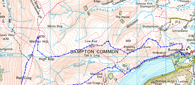
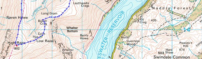
| Route: |
Burnbanks – Four Stones Hill – Low Kop – High Kop – Wether Hill – Red Crag – Red Crag Tarn – Raven Howe – High Raise (Martindale) – Low Raise – Long Grain – Measand End – Measand Beck – The Forces (Waterfall) – Haweswater – Burnbanks |
|
| |
|
Map and Photo Gallery |
|
|
  |
| |
| |
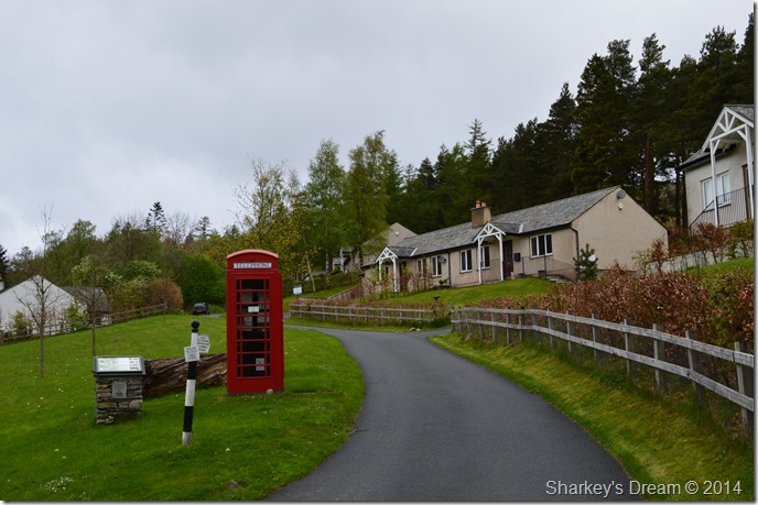 |
| Burnbanks, 08:06 10°C |
The alarm went of at 06:00am, the same time I use to get up for work, which seems strange when I think about the fact that I can arrive here in Burnbanks in the same time it takes me to drive through the traffic to get to work in Manchester every morning.
The morning drive was the usual mid week busy which saw me nestled behind the lorry’s for most of my journey, this didn’t really bother me knowing I was in no rush to arrive nor to finish my walk, which kinda left a care free feel about the whole day.
The air was mild on arrival in Burnbanks, I parked straight away once I entered the tiny hamlet at a dirt layby just after passing over a speed hump, which, I thought a tad odd – I then realised that the one narrow lane through the village leads to a host of Water Board facilities all tied in with the Haweswater Dam just a couple of hundred yards out of the village, I’m guessing it’s not the villagers, but the engineers they’re trying to slow down.
With the car locked I follow the road past one of the cleanest red phone box’s I think I’ve ever seen, I tried not to look too interested but I just couldn’t help it being a clean freak myself!
Past the phone box & the neat little bungalows arrives you at a wide wooden gate, the type that is split in two for cars & pedestrians, I don’t know why but I use the wider gate before turning right onto the fell side. |
 |
| Looking back on a tree topped Burnbanks. |
| After passing through another smaller wooden gate the path now presents itself with two choices, the Lake path or in my case, the path to gain Four Stones Hill by, there’s a couple of steep bits but height is gained relatively quickly as are the views. |
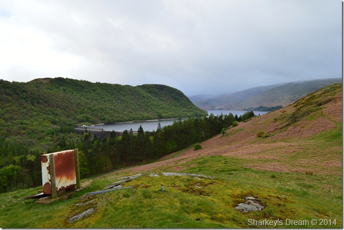 |
| Haweswater Reservoir & Dam comes into view from the old Burnbanks TV Transmitter. |
| After a short ascent the views really start to open up over the north east corner of Haweswater, from here I can see the Dam in all its entirety which prompts further investigation, but first, I’m going to have to gain more height. |
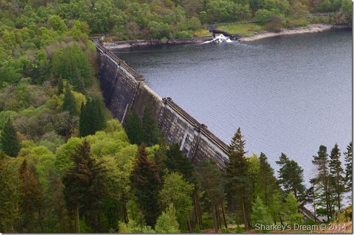 |
| Haweswater Dam. |
The sound of the Weir on the other side of the dam was pretty overwhelming given the recent rain fall but not in a disturbing kind of way, this is a great place to imagine what Haweswater & indeed Mardale Green was really like before Manchester Corporation completed what was then, the first hollow constructed Dam Buttress in the world between 1929 & 1940.
It really was a sad state of affairs what happened here during those years when the whole valley was flooded to make way for the Reservoir, but in saying this I don’t think Manchester Co-operation did a bad job of what they left behind either, even down to hiding the dam wall with what would have been back then, newly planted Conifers & Fir trees. |
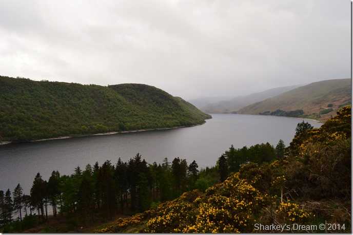 |
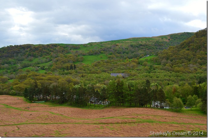
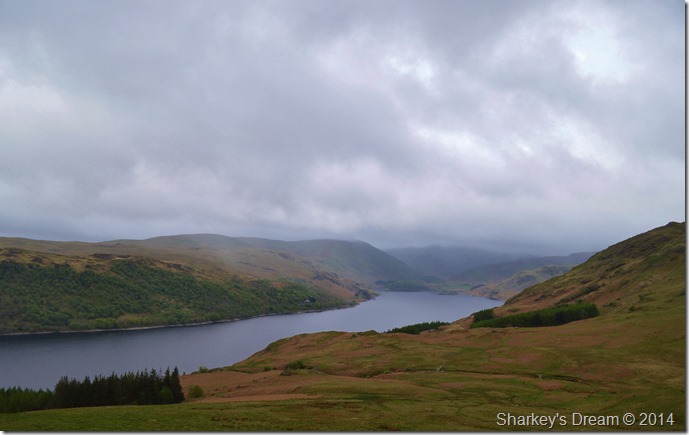
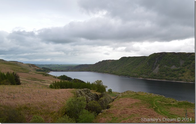
| Haweswater seen with the densely wooded Wallow Crag. |
| After leaving the remains of the Transmitter behind I skirt along the edge of the fell side if not only to take advantage of the beautiful views up the length of Haweswater where the bright colour of the Gorse Bushes provided some much welcome colour about the place. |
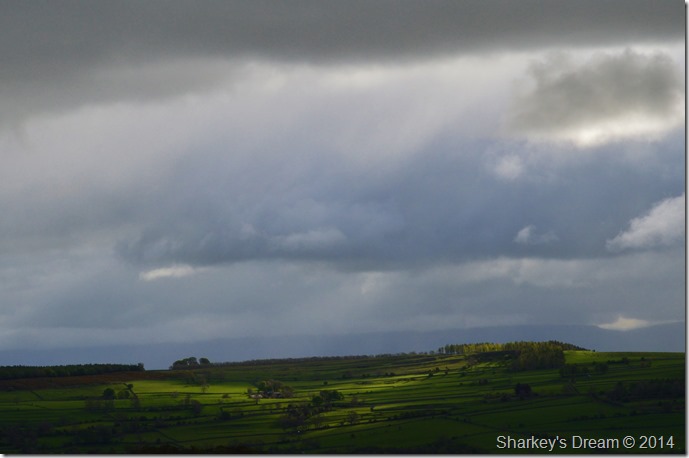 |
| Sun light over Rosgill. |
| Which was was brief to say the least, but eye catching while it lasted… |
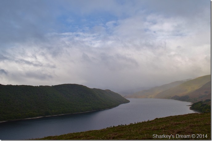 |
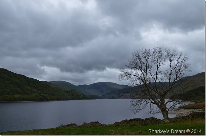
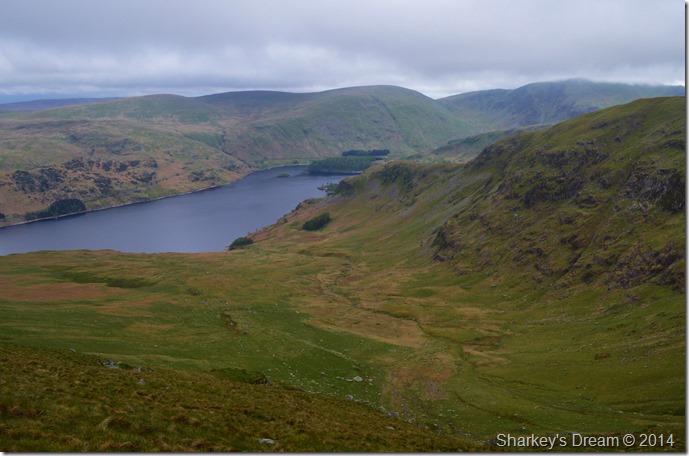
| Distant & somewhat murky views towards Low Raise east ridge. |
It was quite difficult not to stick to the ridge above Haweswater such were the grand views no matter how murky they turned out to be. A few spots of rain are about the air which can only lead me to think that that murk down the south end of the lake has a few light rain showers passing through it.
It’s now time to leave the ridge behind in search of Four Stone Hill. |
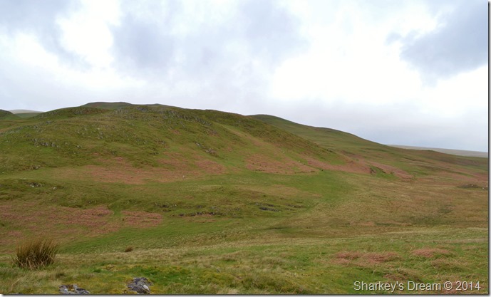 |
| Little Birkhouse Hill. |
I ascend north a little where I came upon the undulating ridge plateau, here Little Birkhouse Hill is flanked by using a narrow grassy path – although I did have the option to go over rather than walk around it…
I guess it’s been a busy week! |
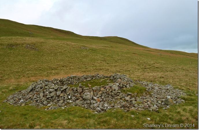 |
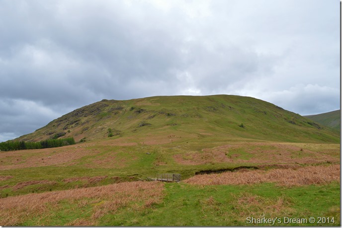
| The ancient stone cairn found below Four Stone Hill. |
It wasn’t long at all before the ancient stone cairn was reached, to my left is the summit of Four Stone Hill itself where a little more ascent is needed.
The significance of these ancient cairns goes without saying which date all the way back to the Bronze Age, although it is thought that this Round Cairn has been built up much more recently. |
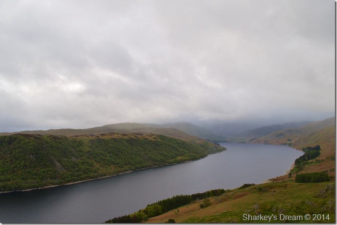 |
| Views over the Haweswater Reservoir from the summit of Four Stones Hill. |
| Four Stones Hill lies besides the ancient stone cairn & not much ascent was needed to get these fantastic views over Haweswater towards Mardale Head which sadly looks right now as if more showers are about to pass. |
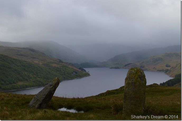 |
| The ancient Standing Stones found just below Four Stone Hill summit. |
There are in actual fact Four Stones yet sadly these are the only two that remain standing, the other two stones can be found above the reservoir lying flat although I am unsure of their exact location.
Ahead another rain shower passes blackening the sky in the process, it seems yet again someone has left the tap to drip rather than to turn it off! but still, it’s quite warm despite the passing rain showers. |
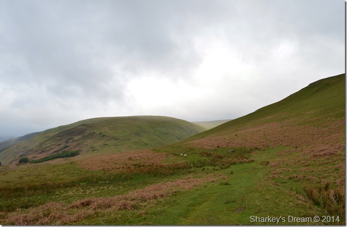 |
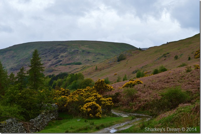
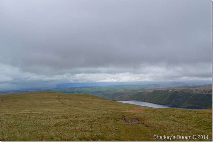
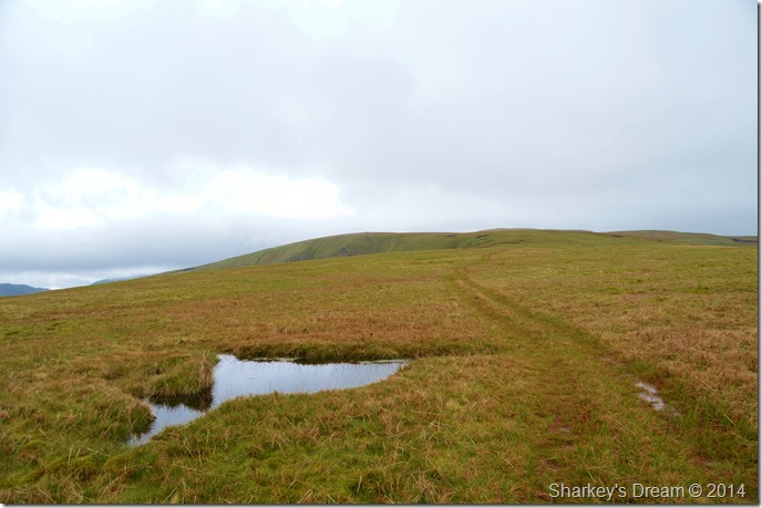
| Measand End & the Low Kop Ridge. |
With the constant showers that I now found myself walking towards I had a sudden change of heart to stay low & try to avoid getting wet, however the same heart got the best of me when I thought ‘what’s a little rain going to do’
The track naturally follows the course towards Measand End & upwards towards Low Raise, if I had stuck to my original route I would have followed Measand Beck directly on to High Kop thus flanking out entirely on Low Kop.
Today my heart told me (with a little help from my legs) to head up the ridge (seen foreground) where I would gain Low Kop via a more gentle grassy approach. |
 |
| The views, too difficult to ignore from my Low Kop ascent. |
| |
 |
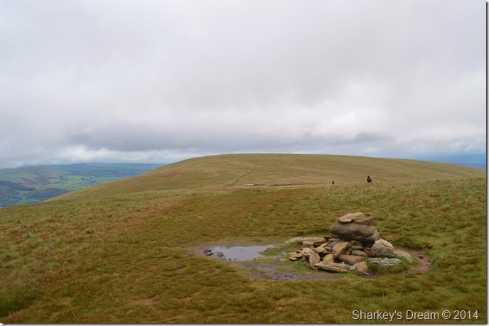
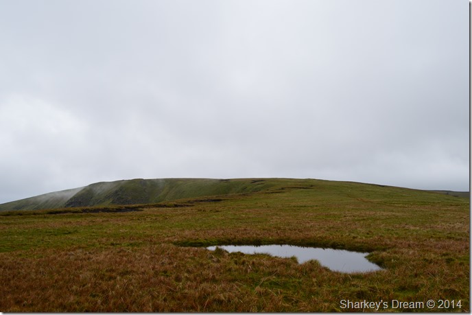
| Low Kop from High Kop. |
| Once I had gained Low Kop I was presented with a fabulous undulating ridge walk passing High Kop en-route to Wether Hill, this type of walking was characteristic of a vast majority of the ground covered on todays walk which was just fantastic no matter the weather. |
 |
| Loadpot Hill from Wether Hill summit cairn. |
Once High Kop was gained it was just a case of making my way towards Wether Hill, this was done by following two tandem tracks which then met up with the main course of the High Street Roman Road. Shortly before I arrived at the summit these two walkers decided to leave which when considering I hadn’t seen a soul all morning, a bit of conversation here might have been nice right about now.
Oh well… |
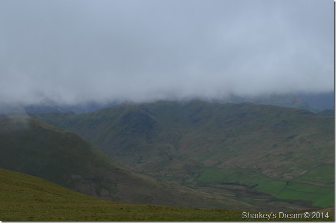 |
| More murky views this time into Bannerdale featuring The Nab, Heckbeck Head & part of the Beda Fell ridge. |
It was here I took my GPS out to see if I could again alter my route as my intended route of Red Crag – High Raise was by now shrouded in low hill fog, however venturing north east towards Loadpot Hill would see me avoid the fog & cloud but would also dramatically alter my route back to Burnbanks, thus missing out on a return via the Haweswater lake path.
Decisions decisions… |
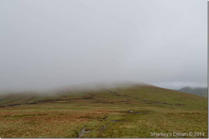 |
| Venturing off in search of Red Crag through some very thick hill fog. |
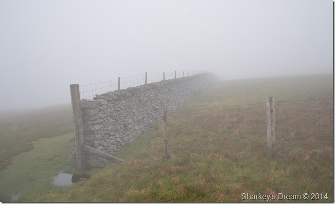
| I chose to stick by my original route & take my chances with the cloud & hill fog which by now didn’t look to be going no-where fast as it blanketed a vast majority of the far eastern fells obscuring any summits along the way. |
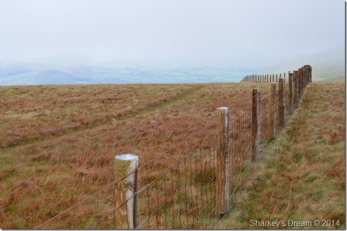 |
| The wrong side of the fence. |
| After leaving Wether Hill I took the plunge into the cloud, not before realising that I was on the wrong side of the fence to get a proper view of the summit when I do reach it, on any other occasion I would have corrected this lower down but today I didn’t see much point in summit spotting, more so when the cloud is down. |
 |
| Red Crag summit cairn. |
| The summit cairn can be easily missed when the cloud is down, however those of you with a keen eye on the lay of the land will realise that the summit top evens itself out once the little ascent is behind you, then it’s a good time to leave the path to have a wee explore until you come across the summit cairn which I find easily recognisable as it sits besides a substantial hole in the ground. |
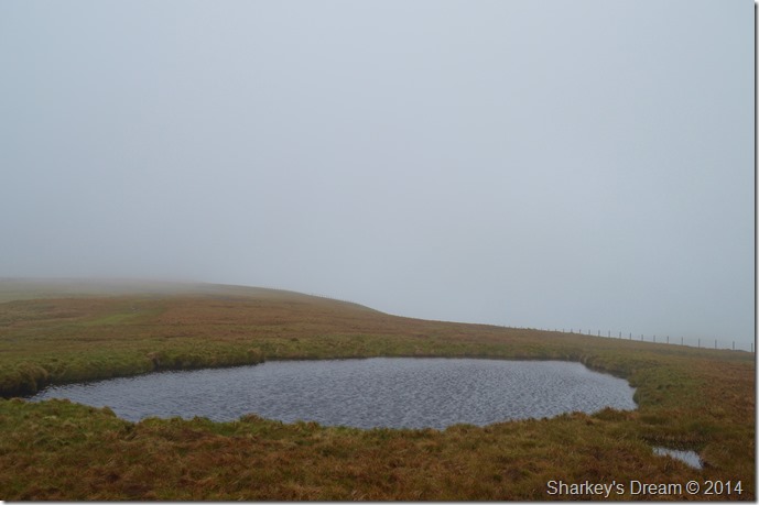 |
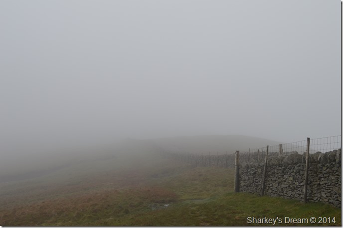
| Red Crag Tarn. |
| Passing features such as Red Crag Tarn does have its advantages of also being a great navigational fixing point should the visibility be as low as I have it today. |
 |
| Re-joining with the Roman Road at Raven Howe. |
By far I had just experienced the worst of the rain showers shortly after leaving Red Crag summit behind, met also by a cool cross wind that soaked just the right side of my attire, here I use the stone wall as a rain/wind break when despite the thick cloud it does not rain again until I’m almost back at the car.
But, that’s a little while off yet. |
 |
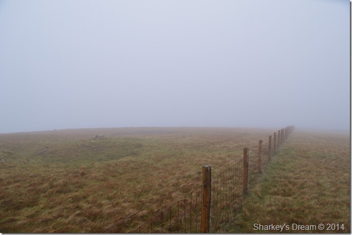
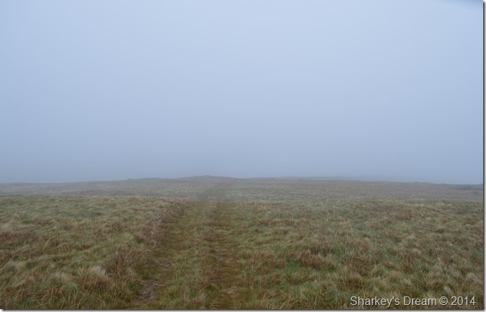
| Fog walking at its best…or worst, I’ll let you decide! |
| |
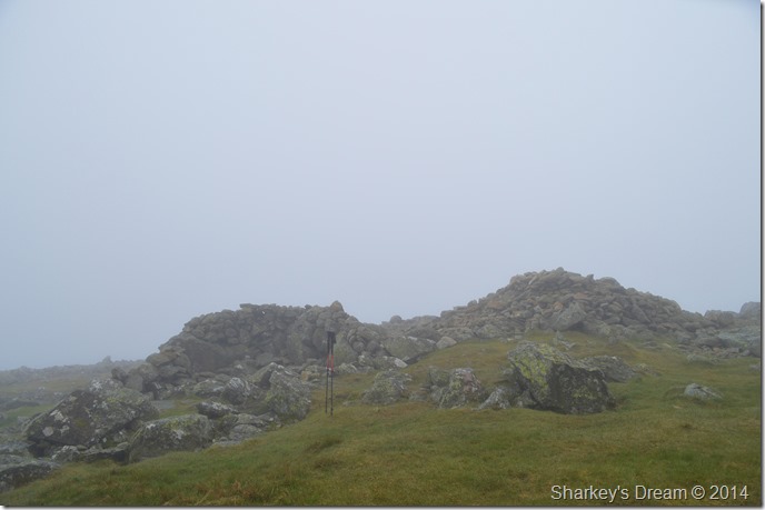 |
| High Raise (Martindale) summit cairn & shelter. |
| While at High Raise I chose to have a quick rest where I could listen to the wind from my peaceful surroundings of the stone shelter, I enjoyed this so much I decided to make a personal video recording by placing my camera on top of the shelter & setting it to record as the mist magically appeared then quickly disappeared. |
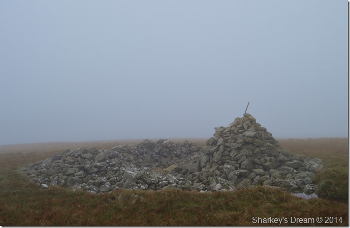 |
| More ancient findings at Low Raise summit (Tumulus) cairn. |
| I found the stay at High Raise summit shelter too tempting to leave but needs must I guess & Low Raise wouldn’t find itself, this, only my second visit to Low Raise is becoming accustomed with low cloud as my last visit here in January 2013. Then I found it difficult to locate the path linking both the summit tops together, this time however, it was nice to have learned from last years mistake as I followed the faint path between both tops with ease. |
 |
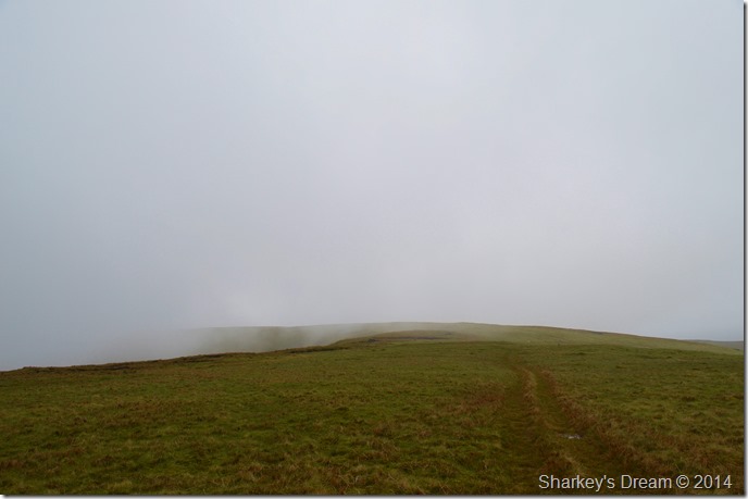
| Hill walking delights as I make my way down to Bason Crag. |
| Despite not having any views I found this slight descent towards the top of Bason Crags a real highlight of the walk, from here it can only get better, which it did. |
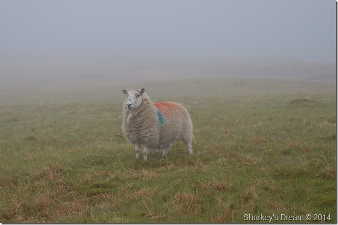 |
| Hey there fella. |
| |
 |
| Passing the top of Bason Crag. |
It was only by chance did I decide to look back when I realised that the cloud was lifting before me, the small flock of sheep are the same ones I passed just moments earlier only this time I can see them from forty yards.
Its happening… |
 |
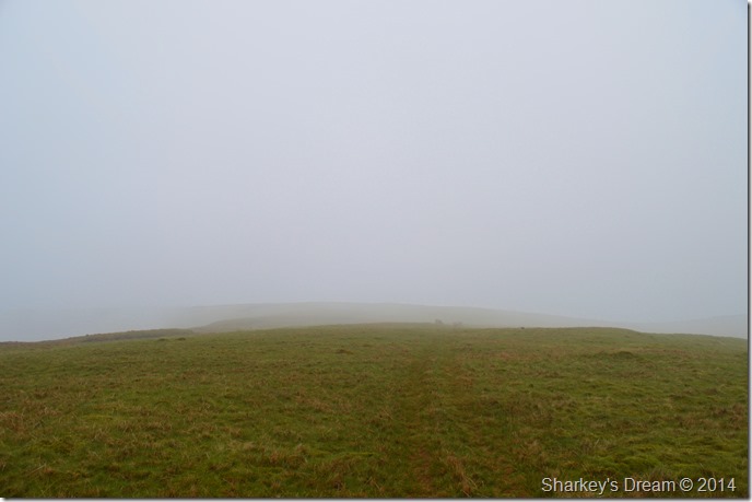
| Moments later the cloud was quickly beginning to disappear. |
| This was just another fantastic moment to remember the walk by, here I could literally stand & witness the cloud as it lifted from the hillside, so I decided to go on a wee excursion towards the top of Bason Crag to hopefully catch some views into Mardale. |
 |
| Tremendous views towards Branstree, Artle Crag, Harter Fell, Haweswater, Whelter Bottom & Whelter Crags forming the Low Raise Ridge to Castle Crag. |
| To be fair, I didn’t expect the views to be half as good as this which was why I de-shouldered my pack & sat down on a slab of rock to enjoy them for ten minutes or so. |
 |
| Twenty minutes later, here looking back to a cloud free Low Raise. |
| |
 |
| Long Grain. |
It’s pretty difficult to extend into words just how the descent to Measand End was captivating the whole walk but it is, I don’t mind walking in cloud, regular followers to my blog may know that sometimes I prefer it, yet the bonus views along Long Grain as the cloud lifted knowing it was just me & the hillside, that afternoon will stay with me for a long time to come.
What a beautiful little ridge walk Long Grain is. |
 |
| Here looking back up to Low Raise over Long Grain. |
| |
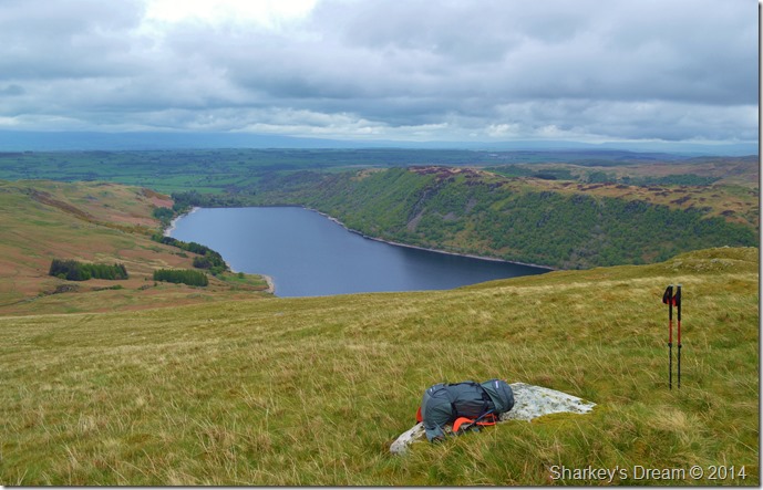 |
| A late lunch before my Measand End descent. |
I simply couldn’t walk past this carefully placed boulder without wanting to plonk myself down on it. Try & book yourself into a restaurant with a view like that without re-mortgaging the house!
Today I shall be dining on Turkey salad washed down with Robinsons Orange juice. |
 |
| Measand End after crossing Measand Beck. |
Earlier during the morning I took a look at an ascent on Measand End whilst contemplating changing the route if you remember, from where I was stood it looked much more steeper than I just found the descent, which is just another reason why more walks will be planned from here for the future.
Incidentally I made a small navigational error here as from my descent I saw more than one route to gain the Lake path, what I didn’t see was the wire Deer Fences that were now blocking said paths, so…it was back I go. |
 |
| Above Measand Beck/Forces Waterfalls. |
| After crossing the wooden footbridge I soon found myself flanking Measand Beck & The Forces Waterfall, which is one of those waterfalls you can most certainly hear, but have trouble seeing. |
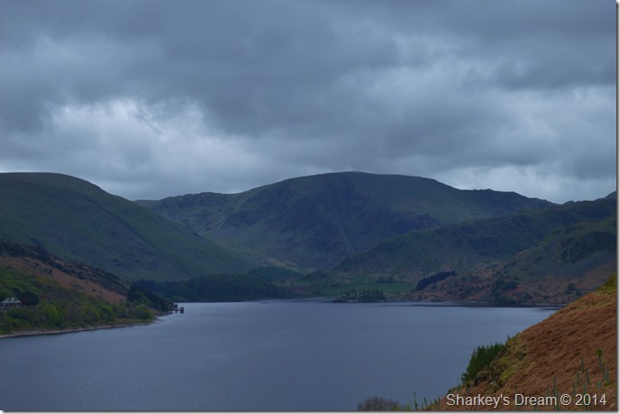 |
| Very Moody skies over Harter Fell (Mardale) towards the southern end of Haweswater. |
| Behind me it looked as though night had come early as the sky blackened once more, it wasn’t the case in the direction of Burnbanks where thankfully it looked relatively calm & dry, but for now I’m going to have to keep my eye out before I get another drenching. |
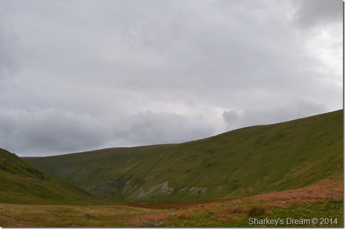 |
| Passing Fordingdale Bottom as Low Kop flanks the ridge above. |
| |
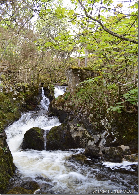 |
| The Forces waterfall. |
| Thankfully I had spied a clearing from where I took this photo although sadly, not of the main falls themselves. |
 |
| Measand End from the Lake Path back to Burnside. |
| The inevitable had happened & it had now started to rain less than half a mile before I walked back into Burnbanks, I do nothing to adjust this as the afternoon air is mild, I decide to shield the camera by lowering my jacket zip & tucking it inside which would work a treat before I get back to the car, the rain simply cannot hamper just how well today turned out to be. |
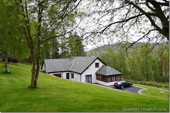 |
| 54 Burnbanks, yours for £625,000 |
There’s all this talk of Blencathra for sale, If I had that kind of money going spare, I’d put it here.
What another great day out on the fells. |
|
| |
| Back to top |
 |
|