|
Ill Crag via The Cockly Pike Ridge |
 |
 |
21st June 2014 |
 |
|
At the beginning of each year I try to set myself a few ‘out of the ordinary walks’ two of which I have already completed in; Scafell Pike from Grasmere and Scafell Pike via Piers Gill which when I think about it there’s a bit of a trend forming with Scafell Pike whose routes are roughly based upon the good weather the summer season brings, there’s a couple of winter walks I have planned to do also but that’s miles away yet. Walk three from my ‘out of the ordinary walks’ would be a direct ascent on Ill Crag from Great Moss which up until a few weeks ago were just words on a sheet of paper as I hadn’t really planned on how I was going to get myself up there, if at all it was even possible for the average walker already knowing somewhere in the back of my head, that the most direct ascents were Grade 3/4 Scrambles.
It all sort of came together one afternoon two weeks ago as Tim and myself had already set a day aside for a walk. I mentioned my plans to Tim who came back with a reply asking could Esk Pike be included in the days itinerary? Well, seeing as Esk Pike was en-route I couldn’t see any reason why not, if anything including, Esk Pike completed the days proceedings. While I was at work Tim did some homework on Ill Crag on its possible ascents, most of which as already mentioned were highly graded Scrambles, all except one, a direct ascent via Cockly Pike. Cockly Pike is a non-obvious summit that forms the base of Ill Crag and can only really be seen once Little Narrowcove is passed or, if on an ascent on Esk Hause via Great Moss, even then the summit can easily be mistaken for a just another noble of scattered rock, after all it’s Ill Crag that steals the show here, nevertheless, this non-obvious summit was our starting to point to gain Ill Crag via “The longest continuous scrambling gradient in England”
It all started at McDonald’s, back in Wigan. |
|
Wainwright Guidebook Four |
 |
| The Southern Fells |
-Ill Crag
A chaotic and desolate scene set at a precipitous gradient, a frozen avalanche of crags and stones much of it unexplored and uncharted, wild in the extreme, and offering a safe refuge for escaped convicts or an ideal depository for murdered corpses. Someday when the regular paths become over crowded, it may be feasible to track out an exciting and alternative route of ascent for scramblers here, but the author prefers to leave the job to someone with more energy and a lesser love of life.
“The longest continuous scrambling gradient in England” |
 |
|
| |
|
Overview |
|
|
| Ascent: |
3,093 Feet – 943 Meters |
| Wainwrights: |
Esk Pike |
| Weather: |
Clear Warm & Sunny,light Winds, Highs Of 22°C Lows Of 12°C |
| Parking: |
Jubilee Bridge – Hardknott Pass |
| Area: |
Southern |
| Miles: |
11.5 |
| Walking With: |
Tim Oxburgh |
| Ordnance Survey: |
OL6 |
| Time Taken |
7 Hours |
| Route: |
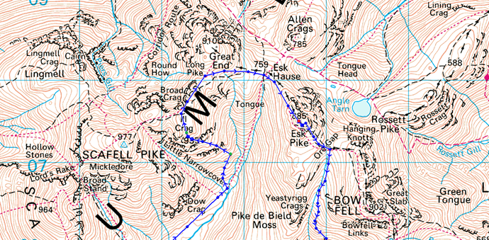
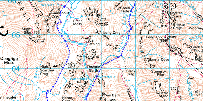
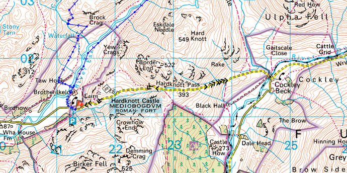
Jubilee Bridge – Brotherilkeld – Taw House – Scale Bridge – Damas Dubs – Great Moss – River Esk – Sampson’s Stones – Cockly Pike – Cockly Pike Ridge – Ill Crag – Calf Cove – Esk Hause – Esk Pike – Ore Gap – Yeastyrigg Gill – Lingcove Beck – Lingcove Bridge – Brotherilkeld – Jubilee Bridge |
|
| |
|
Map and Photo Gallery |
|
|
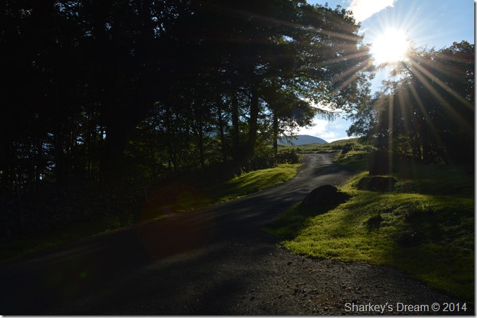 |
| Jubilee Bridge just outside Brotherilkeld 7:44am 12°C |
Tim had stopped off at MacDonald’s before he picked me up this morning and duly handed me a Sausage and Egg McMuffin for the journey up to Lakeland which was marred by the fact that we couldn’t access the M6 from Junction 26 because of roadworks, instead I guided Tim through a slight detour until we reached Junction 27 a little further north. Our delay hadn’t really put that much time on the day and was soon forgot about once we hit the Motorway. Our journey was uneventful thereafter and no sooner than we knew it we were taking on the narrow lanes of Skelwith Bridge then the more difficult to negotiate, Wrynose and Hard Knott Passes. On arrival at Jubilee Bridge we found the car park half full, it had just gone half seven and within another hours time parking here was going to be difficult. We set about kitting up taking long swigs of diluted juice from the extra bottles we had with us, not before leaving them in the boot and packing more into the side pockets of our packs. |
 |
| Taw House Farm. |
After kitting up and locking the car we took a left from the car park, then crossed a cattle grid before making a right at the Red Phone Box destination Taw House.
Before Taw house is reached we flank Brotherikeld Farm from where we crossed the River Esk via a long narrow wooden footbridge which then dropped us out right into a farmers field full of sleeping sheep…sleeping until we got there that is.
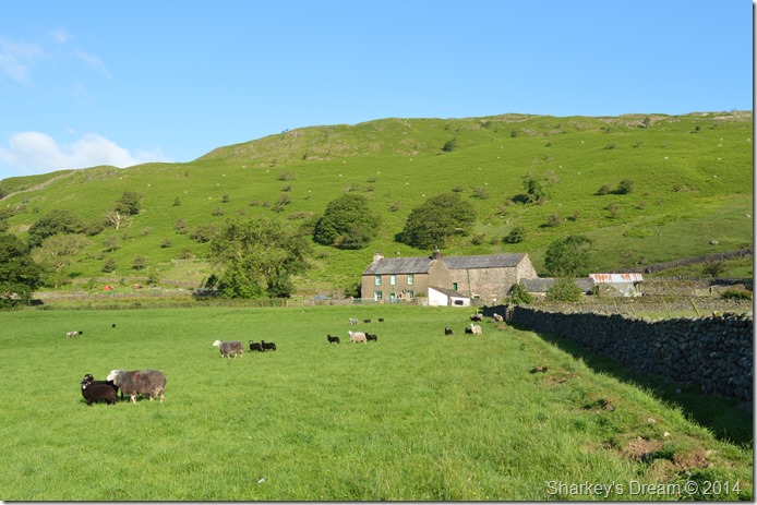
Taw House is known as High Fell farm with common grazing’s that extend all the way up to the Scafell range, the farm dates back to 1806 but was actually built on the site of a much older site dating back to 1723. |
 |
| Brock and Heron Crags. |
Not content with disturbing the sleeping sheep we also did a pretty good job of waking the sheep dogs whilst passing through Taw House Farm some of which barked from behind closed barn doors shattering the peace as we passed through this quiet haven, after closing the farm gate behind us we left the dogs barking who still could be heard from a good distance up the path.
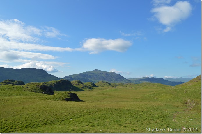
Our route to gain Great Moss starts here at Brock Crags seen ahead in the photo, after passing through the gate ahead we soon pick up grassy track through knee high bracken, the gradient here is mild but that doesn’t stop the sweating mind.
I asked Tim could he pass me my baseball cap which was zipped away in the buddy pocket of my pack lid, the cap does a great job of keeping the sun of my face but is quite a menace when trying to look through the view finder of the camera, the only solution was to spin it around leaving the peak hanging over my neck, the last time I wore a baseball cap like that I think I was still suffering with acne.
After topping out on Brock Crags we pick up a narrow grassy path that expands a wide plateau, here the path is still moist underfoot, in other places the track appears dry and cracked but in all a pleasure to follow knowing what awaited us as a section of the path blinds itself around a section of grassy outcrops up ahead. |
 |
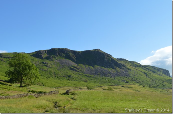
| Slight Side. |
I somehow manage to nip ahead of Tim and found myself at a blind bend in the path first, here the sight of Slight Side was just sensational and was a real impressive surprise to Tim by the time he had caught up with me. |
 |
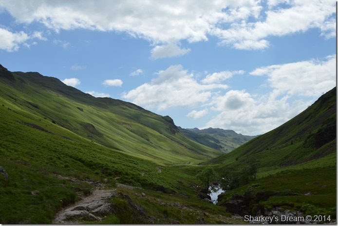
Looking back on Dumas Dubs with a distant Harter Fell (Eskdale) as we flank High Scarth Crag. |
| Our path can be seen in the right hand side of the photo, it really is quite an obvious path but not one I would like to find myself upon should the cloud and mist come down, today however we don’t have any issues with cloud and the views weren’t too bad either. |
 |
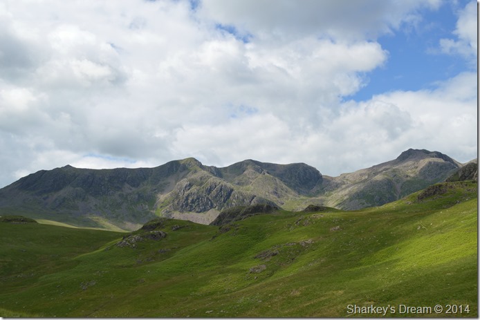
| A distant Esk Hause seen with Scafell Pike, Esk Pikem Scar Lathing and Bowfell over to the right. |
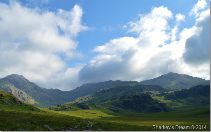
| We continue along the path as the cloud begins to lift from both Esk Pike and Bowfell revealing Bowfell’s distinctive cone like summit, for now however eyes are fixed straight ahead where I try and pick out what I can of the Cockly Pike ridge, it’s no use from this distance, we need to get a more close up, all the while taking in the enormity of our position surrounded by Lakelands highest fells. |
 |
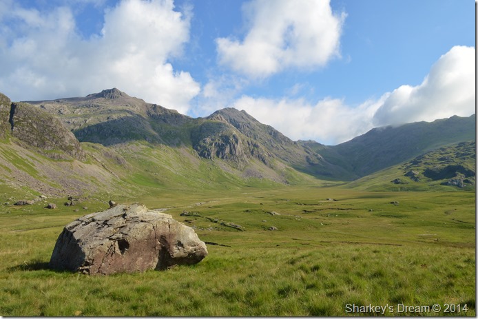
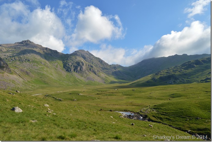
| Scafell Pike, Pen and the distant peak of Ill Crag summit seen as we enter Great Moss. |
Nothing can quite prepare you for the sight of Scafell Pike as it dominates Great Moss and the Esk. Here one can only look on feeling like a very small part of something spectacular that has been here for the past 450 million years.
I found it very difficult to put my camera down such were the clear and atmospheric views we had here today. |
 |
| Scafell Pike, Esk Hause, Esk Pike from Great Moss. |
| |
 |
| That iconic view of Scafell Pike seen with the Sampson’s Stones from the ‘bend in the River Esk’ |
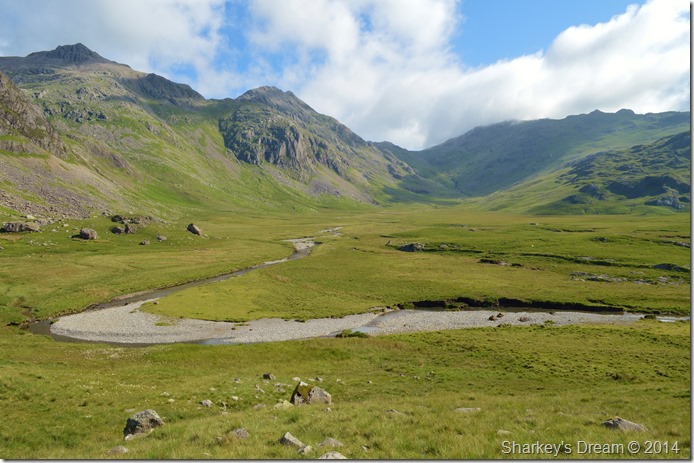
I knew at some point I would have to put the camera down if not only to gain some ground after seamlessly taking photo after photo of the views before me.
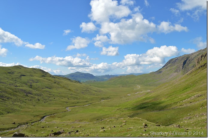
It is still a good distance before we reach the Esk Hause path at the head of the valley, at this point we can only just make out the summit of Ill Crag as Esk Buttress and Pen dominate our ascent ridge beyond. |
 |
| Cam Spout Crag seen with the Sampson’s Stones and a distant Scafell Pike. |
| |
 |
| Pen, Esk Buttress, Esk Pike as seen as we pass by the Sampson’s Stones. |
| |
 |
| Great Moss in the shadow of Esk Pike. |
| |
 |
| Scafell Pike, Rough Crag and Pen from Great Moss. |
| It is at this point that I was reminded of my own ascent on Pen last year from where after I would take on Scafell Pike via the interconnecting ridge of Rough Crag, the fact that back then and today the conditions were almost identical. |
 |
| A close up Esk Buttress and Pen. |
| Should you feel like an ascent on Pen from Great Moss there is now a large stone cairn marking a faint path that flanks Esk Buttress to the left by following the ravine largely all the way to the summit, but, be prepared for a steep climb! |
 |
| Flanking Esk Buttress/Pen. |
| Known to climbers as Esk Buttress, this 400-foot near vertical crag rises from the fellside low down in the mountains east flank, over looking the River Esk. A.W |
 |
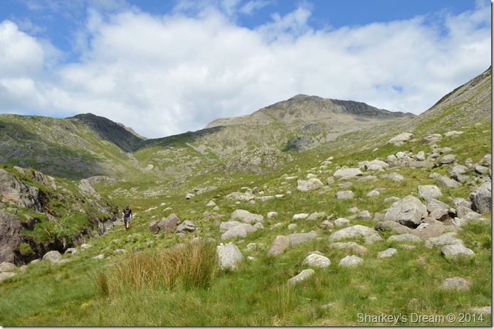
| Little Narrowcove. |
| It’s only after passing Little Narrowcove do the views onto the Cockly Pike ridge start to open up. |
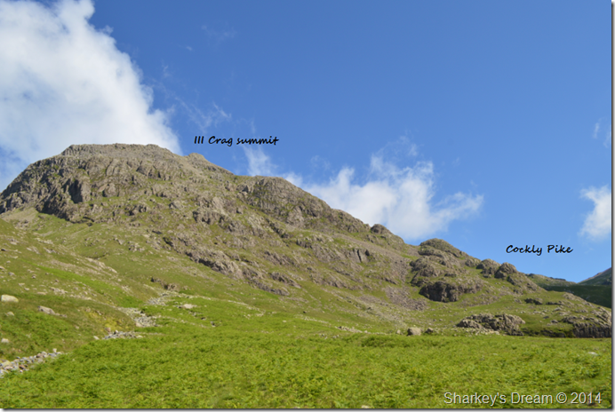 |
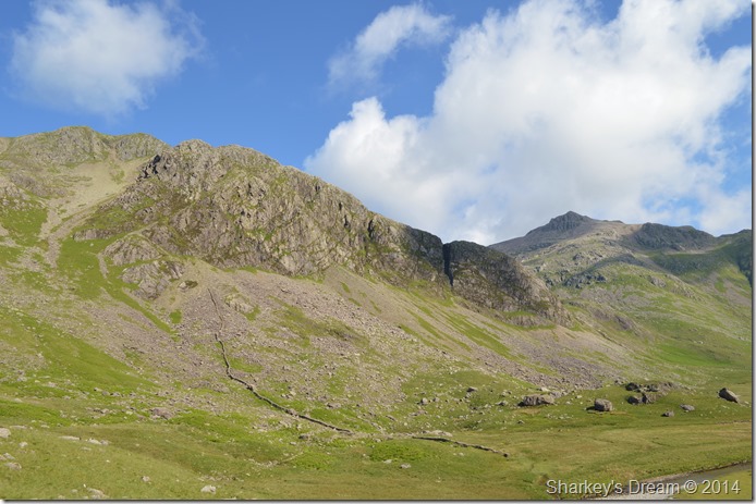
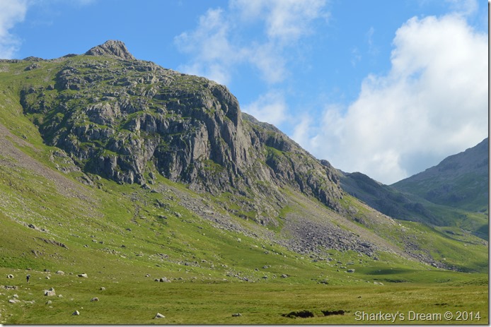
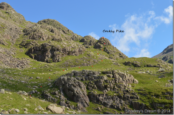
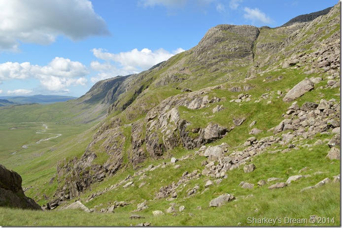
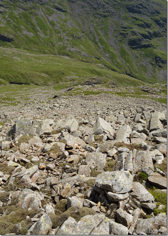
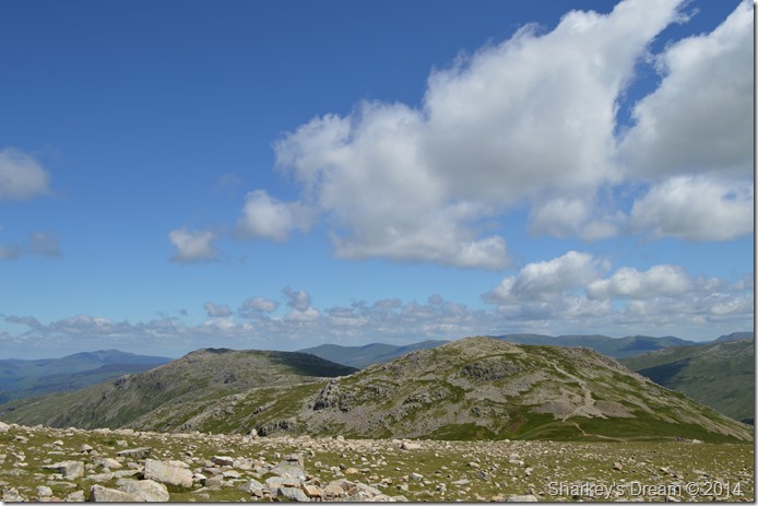
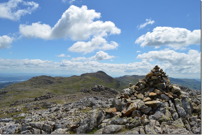
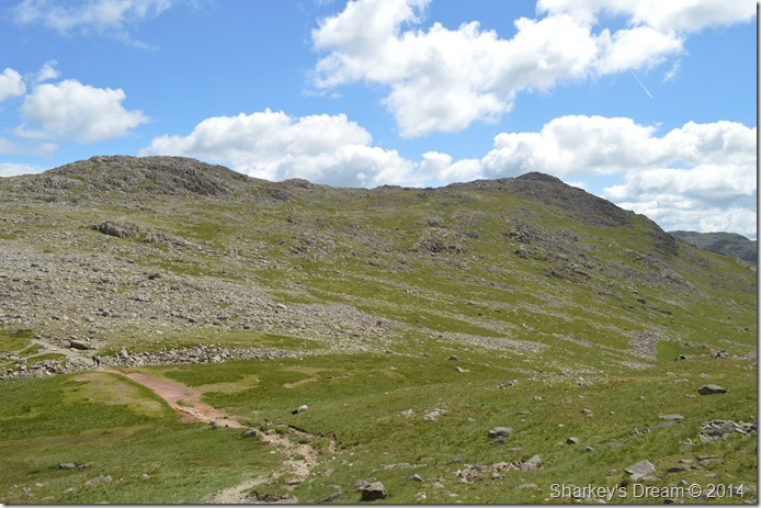
| Ill Crag and Cockly Pike. |
| After passing beneath the vast crags and shattered boulder field of Esk Buttress do we finally have our first sight of Ill Crag and Cockly Pike, at this point however our ridge route isn’t so apparent as it only starts from the base of Cockly Pike itself, so without further a do, we down packs for a quick rest from where we can plot our route to gain Cockly Pike. |
 |
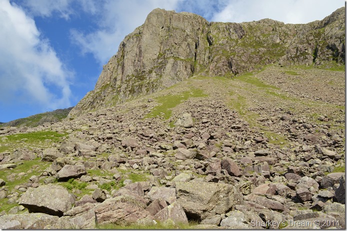
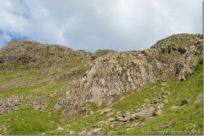
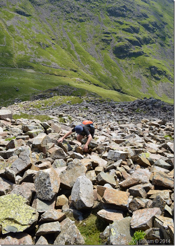
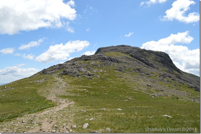
| Cockly Pike ascent. |
We struck up a fairly obvious pathless route to gain Cockly Pike which wasn’t without its steepness. I go with the idea to use my trusty walking poles during the ascent on Ill Crag but I couldn’t have got my choice more wrong if I’d tried, but more on that later.
We press on towards our subsidiary summit. |
 |
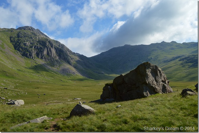
| Harter Fell dominates our view south. |
| Harter Fell dominates the view south seen over the vast expanse of Great Moss. |
 |
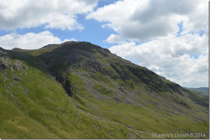
| Pen with a cross section of the Scafell Range from Cockly Pike summit. |
Cockly Pike was gained quite quickly after negotiating the first of many scrambles to reach its cairn less summit. Here the choice to use my poles wasn’t going down to well as they hampered my ascent towards the last push not helped by a hands on approach to finally top out on the summit itself, just minutes after taking them from the pack I fasten them back in again.
A true taster of what’s to come. |
 |
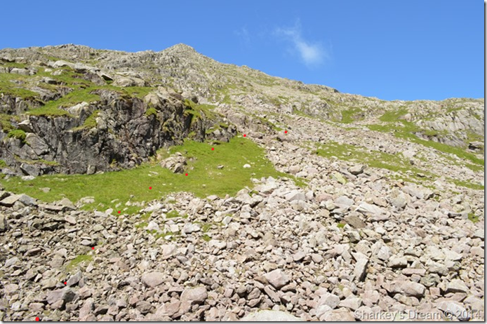
| Plotting our next move. |
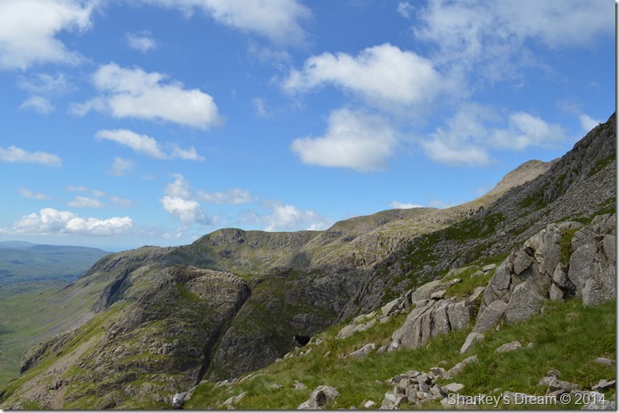
From the summit of Cockly Pike we had another fairly obvious choice on which way to gain the main ridge, the summit can be seen in the top left of the photo which can be mis-leading when thinking that the ridge goes straight up from Cockly Pike, it seems that there are a matter of twist and turns together with the odd descent and ascents thrown in too.
But the views make all the hard work worth it. |
 |
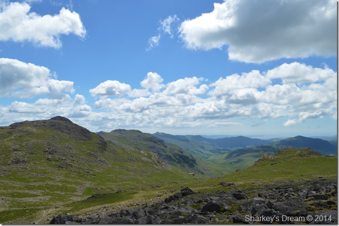
| From Pen to Slight Side. |
| This photo was taken from where the last red dot can be seen in the previous photo, we followed a steep grassy rake which soon tuned into fixed boulder scree, getting around or over the boulders just added to the excitement of the ascent as the rock was porous giving excellent grip throughout the ascent. |
 |
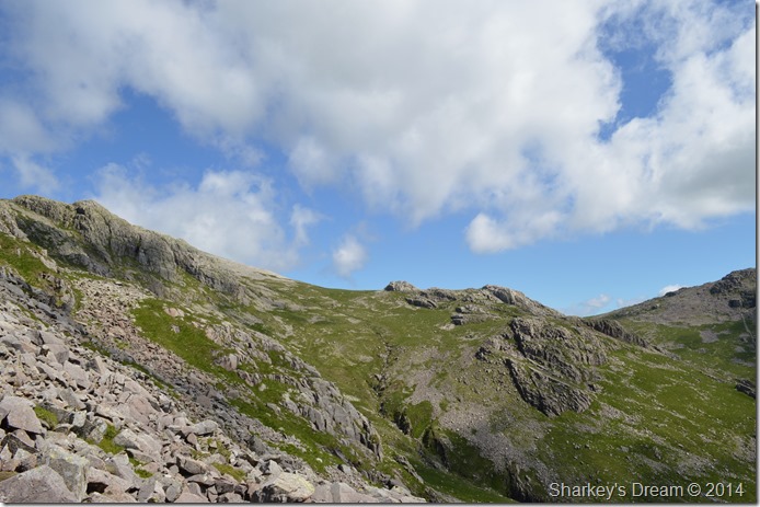
| The Cockly Pike ridge. |
After arriving at the top of the grassy rake we were presented with the ridge ahead. When I look back one of the best memories that I took away was the plotting and planning on which route to take.
Here we find our way over more fixed boulder until we agreed to reach the next point at which we would stop again and re-evaluate the route. |
 |
| Meanwhile Esk Hause looked so close we could almost touch it. |
| |
 |
| Rock hopping boulder fun! |
| After reaching our next designated stop we again took hold of the route by giving it a few moments of thought before proceeding again, seeing as we were having so much fun sticking to the boulder field we again stuck to what we thought best, in this case by veering left over the top of the boulders once more. |
 |
| Tim gives the ascent of the ridge some scale. |
This photo clearly depicts our scramble via the boulder field as it bends left down the ridge (right looking up as in previous photo)
We were really starting to gain some height now. |
 |
| Pen, Scafell and Slight Side seen from a momentarily rest stop. |
| |
 |
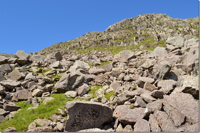
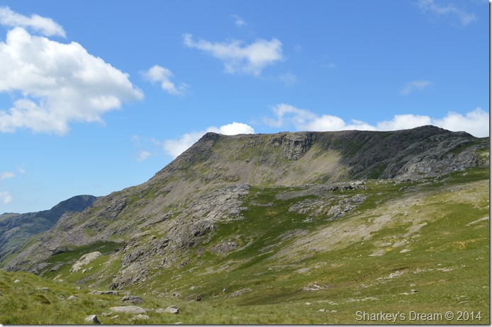
| Do you want the good news or the bad news! |
Whilst on our ridge ascent at times the conical summit of Ill Crag was sometimes lost behind walls of crags and scree, after more hands on scrambling and with the summit out of sight we topped out on a grassy purchase only to realise that the summit was in fact, much farther away than we had anticipated.
I was the first to give Tim the good news. |
 |
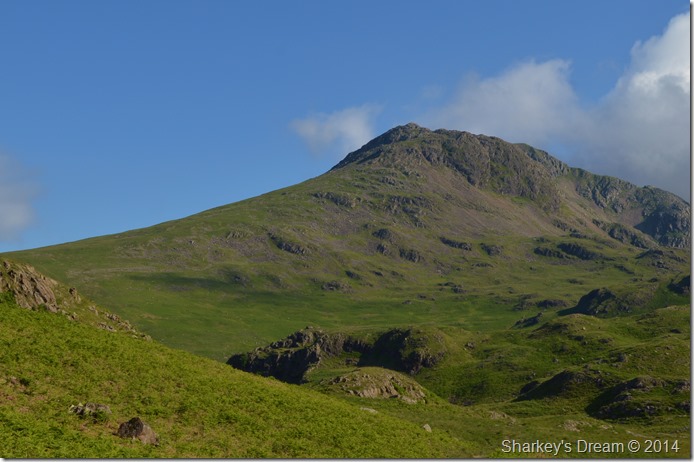
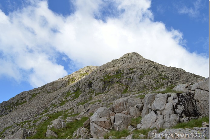
| Almost upon the summit of Ill Crag. |
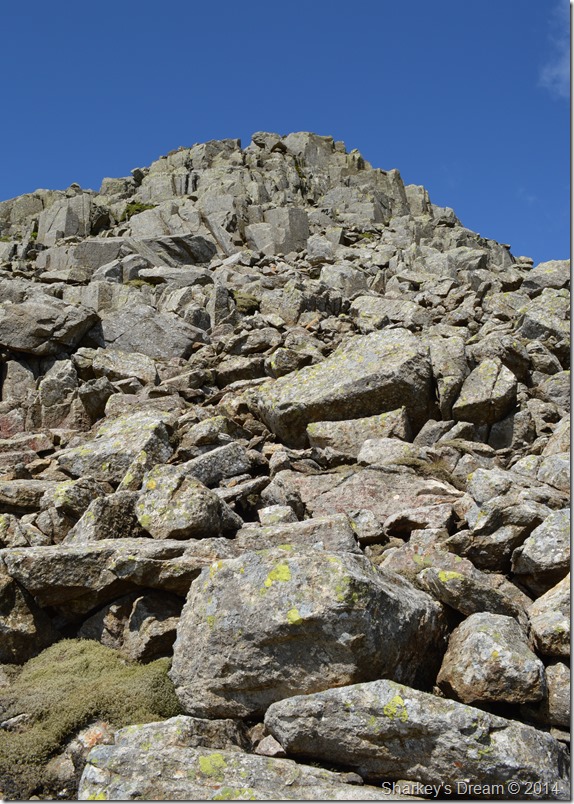
The conical summit of Ill Crag is bound together by much larger boulders than we had seen during the ascent of the ridge, if our legs weren’t already tired by the thrashing they had received now was the time to muster that last bit of strength before reaching the summit.
The sight of which can only spur you on. |
 |
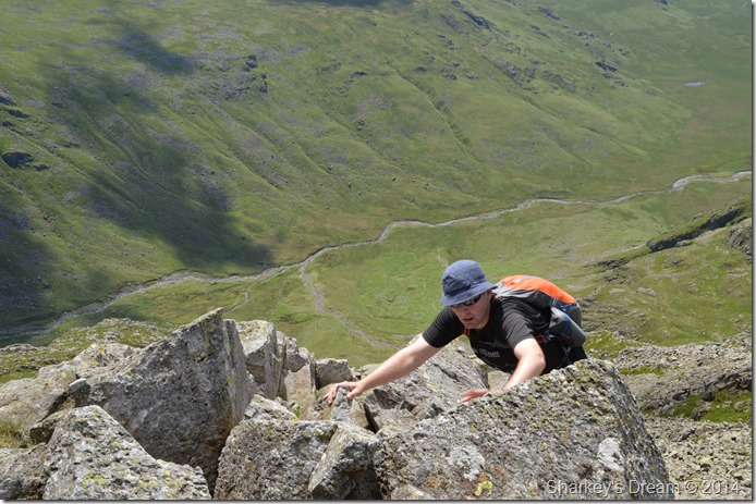
| One last photo looking down the ridge. |
| Here is the last photo of the Cockly Pike ridge before it disappeared beneath a tower of rock that forms the summit, from here we were less than thirty feet away from the summit cairn but thirty feet of exhilarating concentration as Tim demonstrates! |
 |
| Almost at the summit. |
Our ascent on Ill Crag via the Cockly Pike ridge took us the best part of ninety minutes, it was ninety minutes of adrenalin fuelled heart thumping action and I for one will never complain that a ridge ascent was over too soon.
Not after completing the longest continuous scrambling gradient in England. |
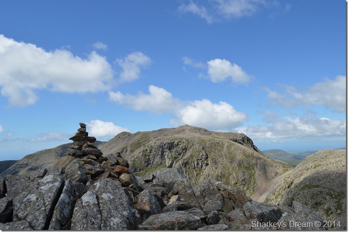 |
| Scafell Pike and Broad Crag Col from our celebratory lunch spot on Ill Crag summit. |
By the time we reached the summit cairn the adrenalin had started to subside a little so we decided it was a great time to eat lunch, without a breath of wind and as the sun beat down we sat there upon the summit people watching as they made their way to Scafell Pike.
We were joined by two gents who just came from out of nowhere ‘you’ve got to watch the rock round here fellas, one wrong move qyour over’
Tim and I replied aye, aye…all behind two cheeky grins. |
 |
| Scafell Pike, Broad Crag Col and Broad Crag. |
| This particular view of Scafell is up there amongst my favourite views of Scafell Pike, more so when the weather is as clear as we had today. |
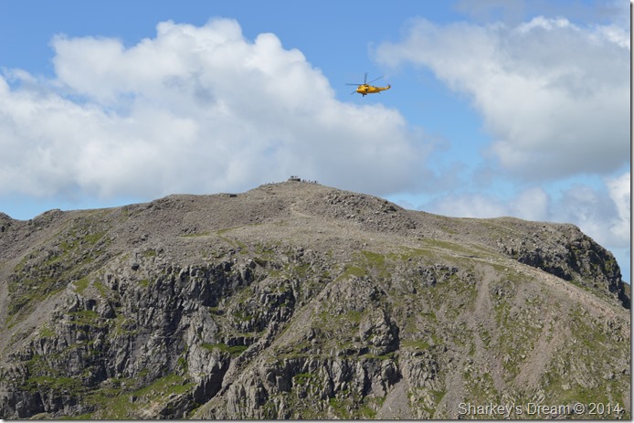 |
| RAF Sea King reckies the summit of Scafell Pike. |
| Shortly before packing up we were passed by this RAF Sea King that flew around the summit of the Pike before hovering directly above the cairn for quite a few minutes, neither myself or Tim could understand what was happening nor the dozens of walkers who had also stopped to watch what was happening unfold. |
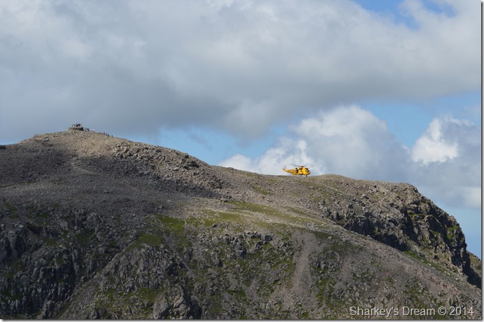 |
| Sometime later the Sea King touched down. |
After failing to find the cause of what was going on I can only assume that a rescue was underway, I only hoped it was nothing too serious.
We soon shouldered packs and made our way off Ill Crag’s rock strewn summit before meeting with the busy path feeding more and more walkers onto the Pike, the sun was blazing down and most walkers we passed were walking shirtless thankfully carrying with them large amounts of hydration in some cases which was good to see.
We soon made our way down to the top of Calf Cove passing more and more groups of walkers along the way, by the looks of things Scafell Pike will be one busy summit today, we both agreed that given the fact that today is the Summer Solstice, walkers would still be here at 9pm this evening making the best out of the years longest day. |
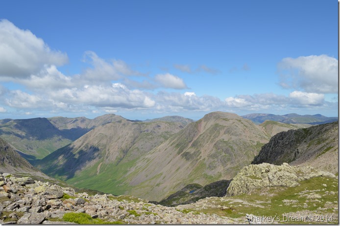 |
| With clear views all the way over towards the Gables, Kirk Fell, Pillar Scoat Fell and Red Pike. |
You may be able to make out a small stretch of water in the foreground which bases itself beneath the summit of Great End, this is Lambfoot Dub, which by all accounts is also on this years ‘to do list’
We press on with our descent down Calf Cove. |
 |
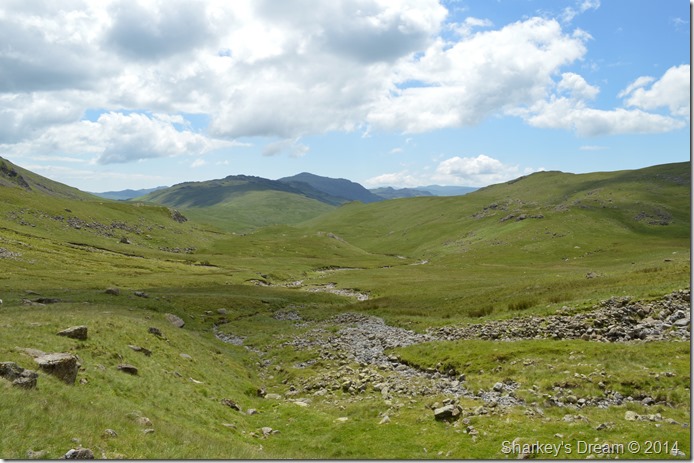
| Calf Cove seen as we make our descent down to a very busy Esk Hause. |
| |
 |
| Allen Crag and the interconnecting Glaramara Ridge as seen from Esk Hause. |
| |
 |
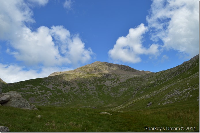
| Esk Pike ascent. |
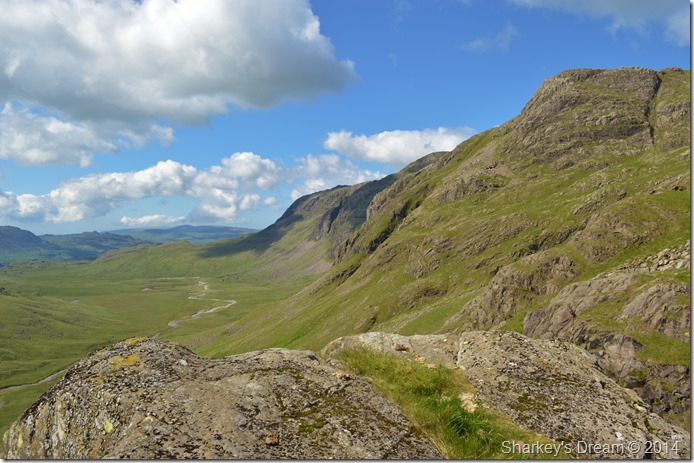
| It was just past midday by the time we crossed Esk Hause and found ourselves at the foot of Esk Pike, the heat of the afternoon sun adding to what is usually a mild ascent which was done at a steady pace, all the while Ill Crag and the Cockly Pike ridge was never far from view. |
 |
| Ill Crag from Esk Hause. |
Twenty fours hours later I am almost lost for words when I think just how incredibly fantastic that ridge climb was.
We press on towards the summit of Esk Pike, not before one last picture of… |
 |
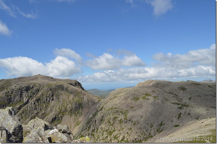
| Ill Crag, Pen, Rough Crag, Scafell Pike, Scafell East Buttress, Cam Spout Crag and Slight Side. |
| |
 |
| Bowfell and Ore Gap from Esk Pike summit cairn. |
It wasn’t long before we found ourselves at the Esk Pike’s summit cairn, here we were greeted to large groups of walkers equally enjoying a day on the sunburnt fells.
Earlier Tim and I had spoke about our next move, or more to the point should we include Bowfell or descend Ore Gap via Yeastyrigg Gill from where we could pick up Lingcove Beck, the decision to leave out Bowfell was a hard one from both our parts as the final call took quite a long time to make.
We came up with the notion in lets enjoy the long walk back through Upper Eskdale & Brotherilkeld rather than ‘run’ through it as we both agreed we wouldn’t want to be returning home late evening.
It seemed odd to have to make such decisions and they really do pull at the heart strings no more so than mine and Tim’s, but when you take in the two hour each way journey and the early rise of 5:00am (earlier for Tim) you’ve got to know when to make the right call.
I think we should kick stones Tim.
(my own way of saying lets take our time back) |
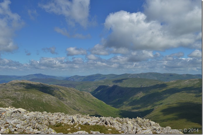 |
| The Langstrath Valley. |
Before leaving Esk Pike summit I took the time to take a few more photos before our Ore Gap descent, here looking into the Langstrath Valley as both Allan Crags and Glaramara dominate its left flanks, over to the right we have High Raise (Langstrath) with the distant summits of Sergeant’s Crag and Eagle Crag as the valley flows north into Borrowdale. Beyond the central fells we have the eastern fells in the very back ground with the Helvellyn ridge penetrating from south to north until Blencathra can be seen in the far left of the photo.
It’s not very often such a host of Lakeland fells can be seen, today we had a treat. |
 |
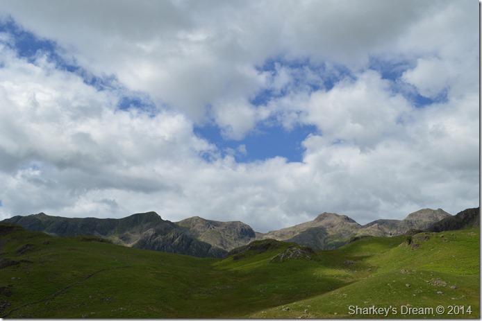
| The Langdale Pikes seen with the Mickleden Valley from Esk Hause summit. |
| |
 |
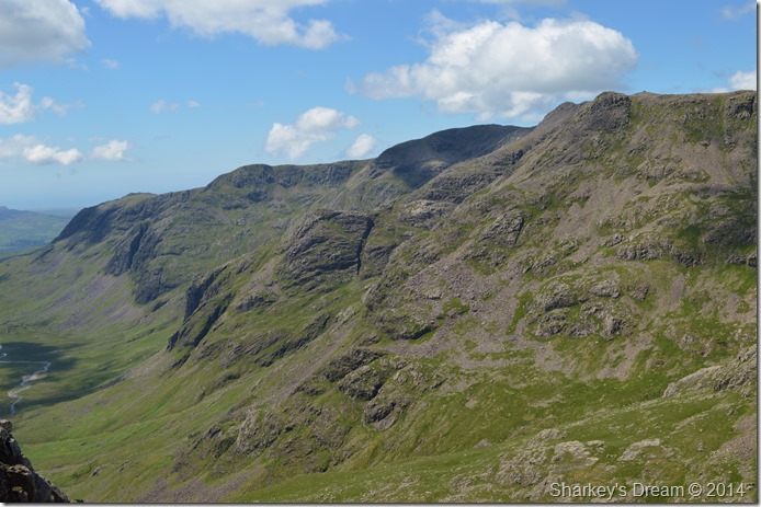
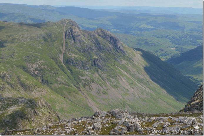
| Bowfell and Crinkle Crags seen over Ore Gap. |
After a short descent onto Ore Gap Bowfell pulled once more at the heart strings, after estimating ascent and descent times we again agreed that indeed, today, Bowfell was a fell to far.
Many more walkers are passed all heading up to Esk Pike as we make our way down in the midday heat, it seemed such a shame to leave the fells early but in saying this, we still had two hours of magnificent Upper Eskdale to soak in yet. |
 |
| Bowfell from Ore Gap. |
It was time to make our exit by taking a right at Ore Gap via Yeastyrigg Gill, here I am cursed as I go over on my right ankle not once but twice consecutively, I have no excuse for my clumsiness but the small stones that are rattling and causing such pain in both my boots.
Tim I’m gonna have to take the boots off and empty the stones out.
Tim picks a boulder to sit on as I start to un-lace both my boots, my laces leave small dust plumes as I begin to untie them, once done I duly empty the contents of Cockly Pike onto the ground. My socks are twisted and show signs of wear so thin that the once cushioning that once stretched from tip to toe now resembles a quality sheet of tracing paper.
I pick the remains of cotton from my bare white steaming feet (sorry) and begin to give the once trusty Brasher Season Two socks a shake of luck before applying them back over my feet.
We press on. |
 |
| Crinkle Crags and Rest Gill seen from our Yeastyrigg Gill descent. |
We pick our descent via a narrow path which seemed to have a sudden steep drop to it, either that or my now painful feet were starting to play tricks on me. The pain in my feet however was easily taken away by my view ahead. There are ways to leave the fells, Lingcove Beck through Upper Eskdale has got to be one of the best Lakeland has to offer.
|
 |
| Hard Knott and a distant Harter Fell (Eskdale) from the source of Lingcove Beck. |
| Our route would see us head firstly along the banks of Lingcove Beck via a faint grassy singular track which at times does widen up but in any case is quite easy to follow. Ahead sits Hard Knott which marks a right turn as we would continue to follow Lingcove Beck back through to Brotherilkeld, but that, is a long way away yet. |
 |
| Here, looking back on Bowfell from the shade of Lingcove Beck. |
| |
 |
| This time Yeastyrigg Crags and Yeastyrigg Gill (L) can be seen with Bowfell. |
| |
 |
| Slight Side, Scafell and Scafell Pike seen as we flank Hard Knott to our left. |
| We soon came to a section of Lingcove Beck where the Valley of Mosedale is passed to our left, here we spot two walkers heading out over Thostle Garth (foreground) looking like they had a wild camp in mind, we could only look on with envy. |
 |
| Not using as much zoom reveals Ill Crag in the far right of the photo. |
| Besides the splendid views that unfolded before us I had other reasons why I choose to plan our exit via the scenic Lingcove Beck and the isolation that it had to offer. |
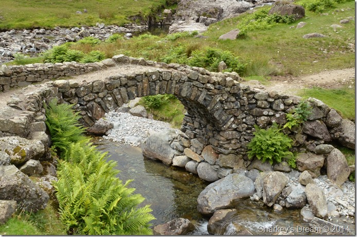 |
| Lingcove Bridge. |
It was shortly before 2pm by the time we reached Lingcove Bridge, after passing numerous skinny dippers who swam and paddled in the crystal clear waters of Lingcove Beck under the warmth of a mid afternoon sun.
Tim held back a while and studied the clear waters as I made my way over to Lingcove Bridge which is a place I regrettably have to say, I’d yet to visit. Lingcove Bridge marks the spot where the River Esk flows into Lingcove Gill as seen in the top of the photo.
Tim arrives to find me still taking photos of this iconic Lakeland landmark, I will try not to leave it so long until my next visit. |
 |
| Yew Crags ahead as we take in the last few miles before reaching Brotherikeld. |
We take in the last miles under the duress of a brilliant afternoon sun as we pass more paddlers who spend their afternoon up to their waist cooling off in the River Esk, Tim and I can only look on as the dust rises from the heels of our boots as we finish off the remainders of our Hydration Packs and water bottles.
Time here could have stood still, because memories from such walks will always remain firmly fixed, the Cockly Pike ridge may not be to everyone’s liking but it sure comes close to the next best thing. |
|
| |
| Back to top |
 |
|