|
Parlick, Fair Snape Fell & The Bleasedale Circle |
 |
 |
13th August 2014 |
 |
|
Today’s forecast was unusual for mid July ranging with drizzle & mostly low cloud that wouldn’t lift until midday, instead of waiting for the cloud to lift I thought about a short walk that actually turned into a longer one on the Bowland Fells which are less than an hours drive from Wigan where out of the window came mid morning – it had started to clear up rather nicely.
Although I had set my sights on a short walk over to Ullscarth from Wythburn & the fact that yes, I had a feeling of almost betrayal to my beloved Lakeland fells I thought I could kill two birds with one stone & still come away feeling like I’d had a long walk which was exactly what I got.
It all started at Fell Foot Farm, just gone 11.00 am. |
|
|
| |
| |
|
| |
|
| |
|
Overview |
|
|
| Ascent: |
1,560 Feet – 488 Meters |
| Wainwrights: |
N/A |
| Weather: |
3, Parlick – Fair Snape Fell – Wolf Fell |
| Parking: |
Road Side Parking, Fell Foot Farm |
| Area: |
Chipping, Forest of Bowland |
| Miles: |
8.7 |
| Walking With: |
On My Own |
| Ordnance Survey: |
OL41 |
| Time Taken: |
3 Hours 50 Minutes |
| Route: |
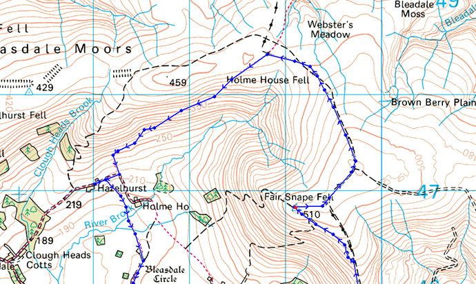
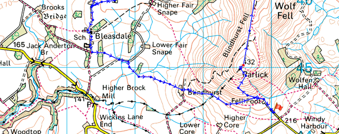
Fell Foot – Parlick – Nicks Chair – Fair Snape Fell (Paddy’s Pole) – Holme House Fell – Friendsdale Head – Whinny Bank – Hazlehurst Farm – Admarsh Barn Farm – Vicarage Farm – Bleasdale Circle – St Eadmer’s Church – Bleasdale – Blindhurst Farm – Fell Foot |
|
| |
|
Map and Photo Gallery |
|
|
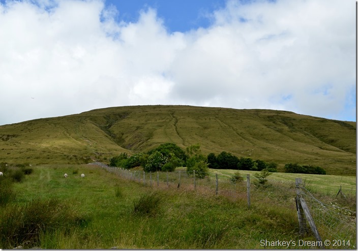 |
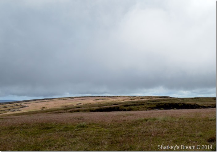
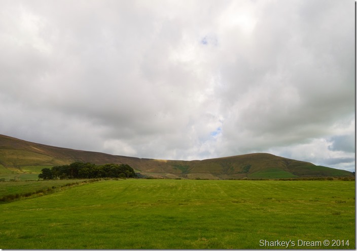
| Parlick taken shortly after passing through Fell Foot Farm 11:06am 16°C |
I left Wigan around 09:45am not before stocking up on a Meal Deal at my local Coop seeing that as today, I’ve come pretty un-prepared, but at least I’d had my coffee.
A long narrow lane leads you all the way to Fell Foot Farm after leaving my car a short distance behind at the aptly located parking spaces that I thought I may have trouble parking in, to my surprise there was more spaces left, even after I had left my car.
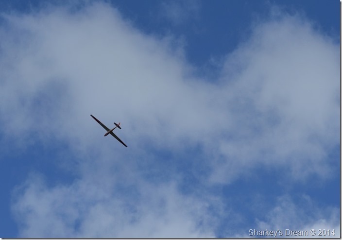
In a field near by Gliders take off from where an orange wind sock blows with the wind, I don’t just mean those Gliders where you take off from the top of a hill beneath a canopy, I mean full size things with Wings & Cockpits, they were pretty huge & very silent.
Despite the sun it’s pretty snappy so I put my Montane Soft Shell on over my T Shirt before locking the car & making my way towards Fell Foot Farm.
Already, I am regretting the decision to wear the jacket. |
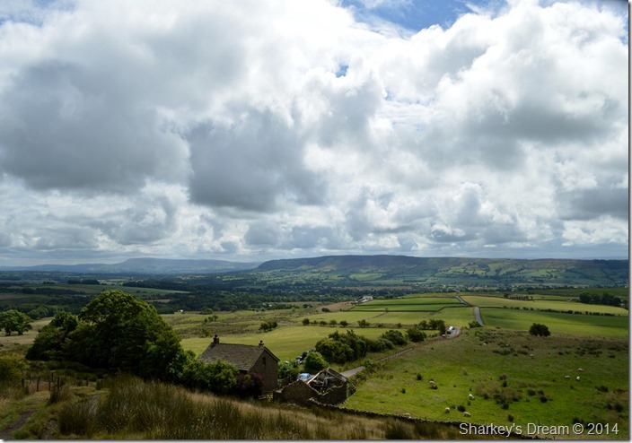 |
| Extensive views over Fell Foot & Chipping towards Longridge Fell & a distant Pendle Hill. |
| I hadn’t been walking long at all, in fact you can clearly see the car parking spaces dotted along the lane when I started to feel the heat even through a chilly wind, the best decision here was to take my jacket off & pack it away but I was far too stubborn or lazy to do that, instead I stayed uncomfortable for the next fifteen minutes or so whilst I took in the steep path that flanks the fell side before getting steadily steeper once a direct line to the summit is reached, by means of a wire fence. |
 |
| |
| |
 |
| Parlick summit & shelter. |
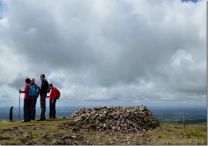
After a short but steep pull I soon arrived at the summit where I was joined by a group of walkers admiring the views, I passed on my good morning & received a jolly good morning in return.
Here the views opened up extensively all over Lancashire towards East Yorkshire & the Fylde Coast but that cloud, although not as grey & murky as of the last couple of hours did lie low as it sped across the sky carried by a strong wind that also gusted across the summits.
I only realised afterwards that the guy in black is wearing a hat, I couldn’t blame him, it was here I thought that maybe keeping the jacket on wouldn’t be a bad decision after all.
Speaking of cold conditions the last time I was here it was -8°C with 4ft of snow drifts, I had never seen the ridge towards Fair Snape Fell look so inviting as it did right about now. |
 |
| Fair Snape Fell shortly after leaving Parlick summit. |
I was in my element as I strode to take in the short ridge in-between Parlick & Fair Snape Fell all the while watching as the grasses changed colour each time the sun was obscured by cloud, it is mid July but a tiny piece of me thinks that this could be mistaken for Autumn as the wind pinched at my cheeks & ears.
I swore for one moment, I billowed warm air into cupped fist. |
 |
| Fair Snape Fell. |
The group that I greeted me back on Parlick were at times catching up with me so much so over the wind I could hear the topic of conversation although I couldn’t tell you what about.
Here the ridge takes a slight dip unseen from both Parlick & Fair Snape Fell, it’s at this point do I pass through the wooden gate to take on the more obvious path seen on the left of the wall, an action I had mistook to do when back here last February causing me to plough through deep snow that had drifted against the stone wall, once bitten twice shy…even though it’s touching on 16°C ! |
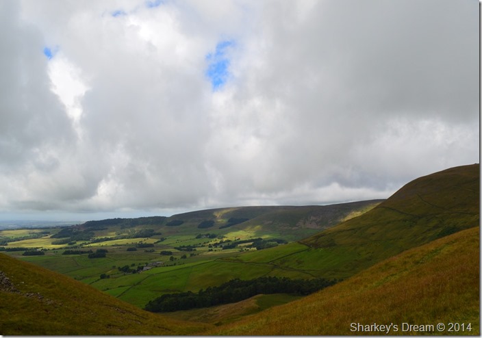 |
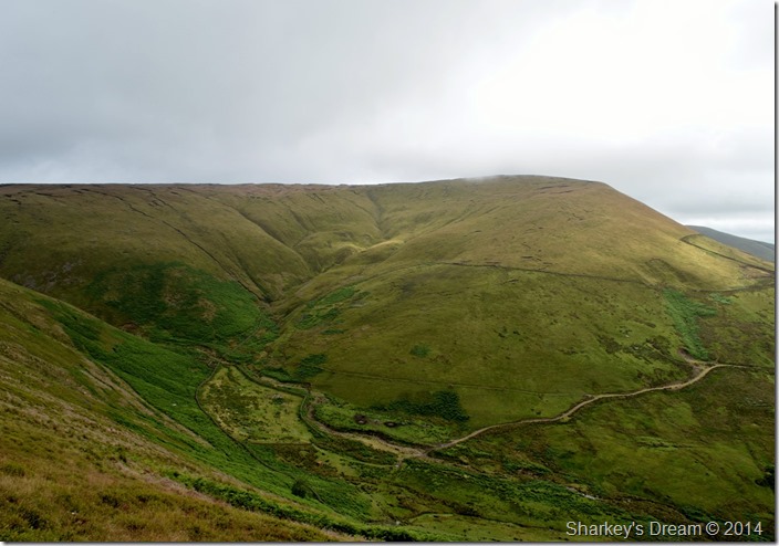
| Fair Snape Fell seen with the Bleasdale valley. |
My route will see me pass through the picturesque valley of Bleasdale after descending Whinny Bank which can be seen dropping down into the far centre part of the valley/photo.
Negotiating the numerous farms & lanes was a tougher challenge than first thought which I’ll get to later in the walk. |
 |
| Here, looking back on Parlick shortly before arriving at Fair Snape Fell. |
| The group who had been trailing me had long gone by the time I reached the summit path beneath Fair Snape Fell, here the weather also took a slight turn for the worse as it started to cloud over towards the north, looking south however, the sun still shone brightly adding a generous amount of colour to the grasses across the ridge. |
 |
| Parlick taken from Fair Snape Fell / Paddy’s Pole. |
I soon arrived at a deserted Fair Snape Fell after watching two walkers leave the summit & head out east towards Saddle Fell, then out of view as I negotiated the peat hags common to this area of the Bowland Fells.
The cloud seemed to be getting darker & the wind stronger & once more I was reminded that even at just a little height above the Valleys the temperature can drop enough to make me think I was glad to have kept the jacket.
After taking a few photos from the shelter I took the short walk over towards the summit Trig Point where the blue skies where slowly fading to grey. |
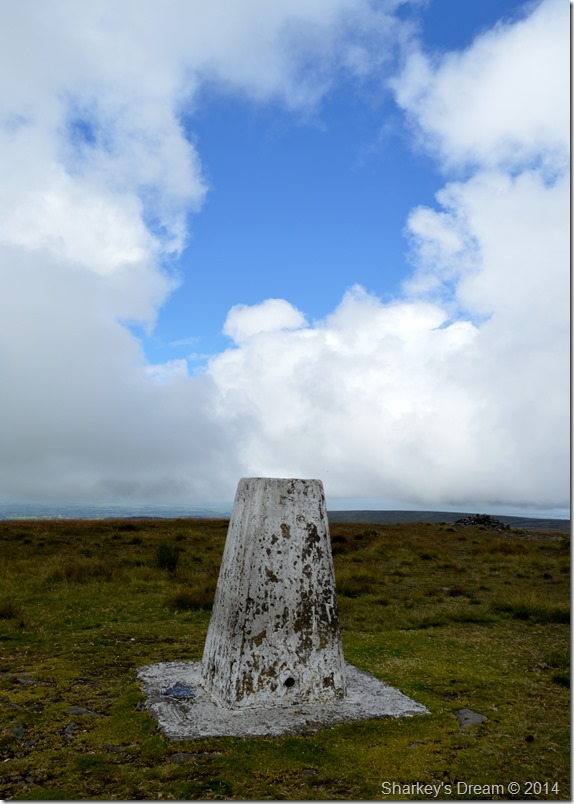 |
| Fair Snape Fell summit Trig Point. |
| |
 |
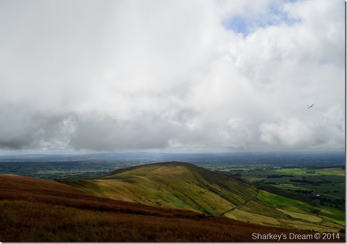
| Wolf Fell is out there somewhere. |
After taking just the one photo of the Trig Point I too headed East via a faint stony grass path that also lead me to a halt once I reached the peat hags. What looked like a farmer dressed in a wax oil jacket held his collie, over the wind I heard an aye,aye, I replied morning tipping my head at the same time pretending I knew exactly where the peat hags were taking me, when in actual fact I was mapping my route towards Wolf Fell by eye alone.
I clambered over a section of peat of around 5ft in height before spotting a direct path towards Wolf Fell over towards my left which I took; altogether feeling that I’d ‘been lost’ for just a little while. |
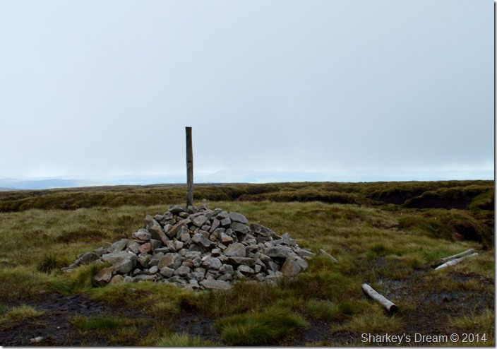 |
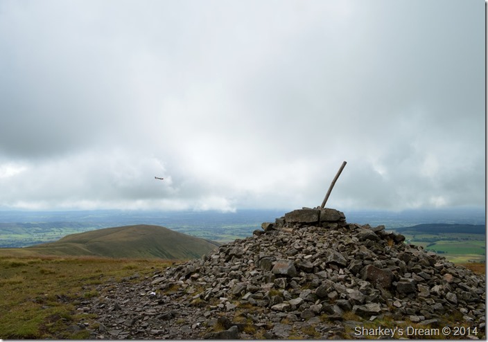
| Wolf Fell summit Cairn. |
nce above the hags I was able to spot a fence just a few hundred yards away running north to south, this surely was the path that would traverse me over Holmes House Fell towards the head of Friendsdale Head valley…
A mouthful I know.
The summit stake quickly appeared through an array of more peat hags as a procession of carefully positioned stepping stones ran over the damp peat beneath my boots, the last time I was here volunteers from the National Trust were profiling the peat hags to more manageable sizes by chopping away at them with Mini Diggers & overall hard labour to try & keep the peat at bay.
It was interesting although a little unsightly to see how they had managed it. |
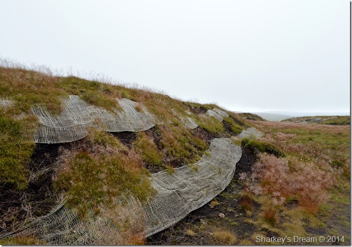 |
| Peat Hag profiling using wire mesh bands. |
| |
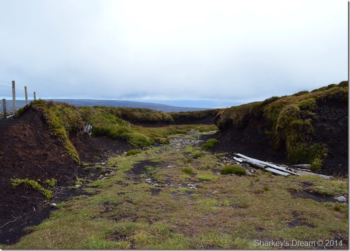 |
| En-route to my Holmes House Fell. |
After crossing more stepping stones my path took me through the highest of the peat hags that were more than shoulder height, here I had lost all of my surrounding views more so as the cloud began to steadily grow thicker only hindered by the odd burst of sunlight trying to streak through.
I’ll be glad once the peat hags are behind me. |
 |
| My ridge route across Holmes House Fell. |
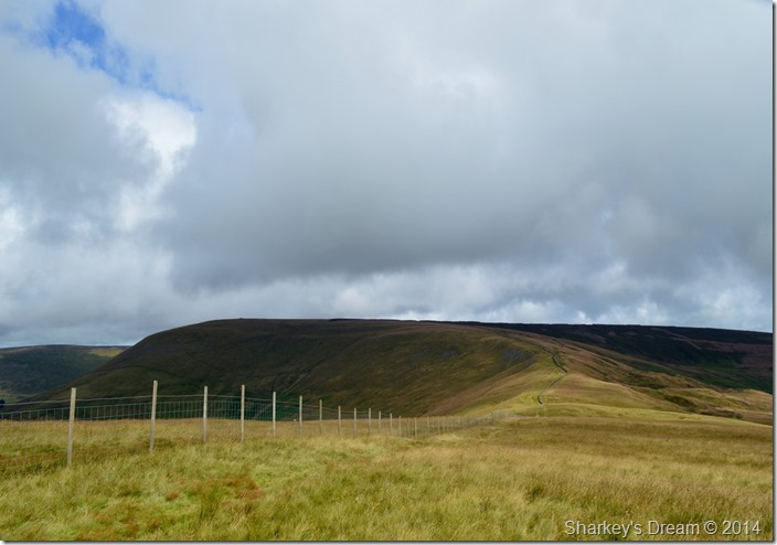
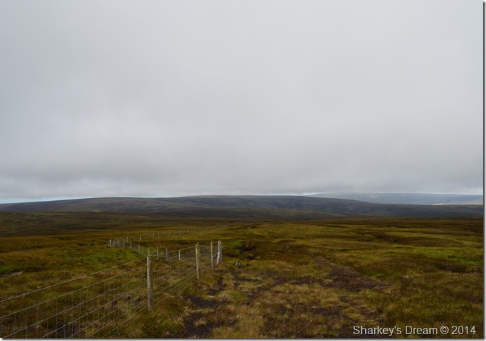
Garstang & Preston are no more than three miles away as the crow flies but that didn’t stop the isolation I felt while crossing the boggy moorland known as Holmes House Fell which is pretty featureless to state the obvious.
Here I follow the wire fence as way yonder in the distance I spot a small wooden sty situated besides a metal gate which helped with navigation as the cloud rolled in & out.
Other times, the sun would shine again transforming the moorland into an array of colour. |
 |
| Whinny Bank from Holmes House Fell during a spell of sunshine. |
| My route would see me flank Whinny Bank to my left as I descend into the valley of Bleasdale, but that’s in a little while yet. |
 |
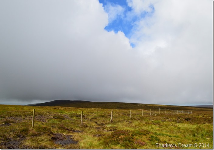
| Here, looking back on Fair Snape Fell as the cloud rolls in once more. |
My ridge crossing wasn’t exactly what I had expected as my path ran its course through wet bog which I guess can only be expected of the area. Here it’s handy to learn to walk over a carpeted swimming pool as oddly as my boots sank into the bog, they always came out bone dry.
A sure sign that the bog here is missing its main ingredient! |
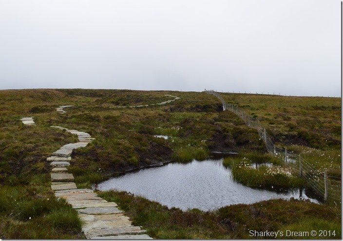 |
| Friendsdale Head. |
Through the cloud & mist I spotted what looked like white dots which turned out to be this delightful path that some very thoughtful & kind person had laid to stop us walkers sinking through the quagmire.
By now I had lost visibility & had been walking in the cloud for the last twenty minutes or so until I reached the stepping stones which descended me west towards a distant Hazlehurst Farm, but before all that I had quite a few miles to cover. |
 |
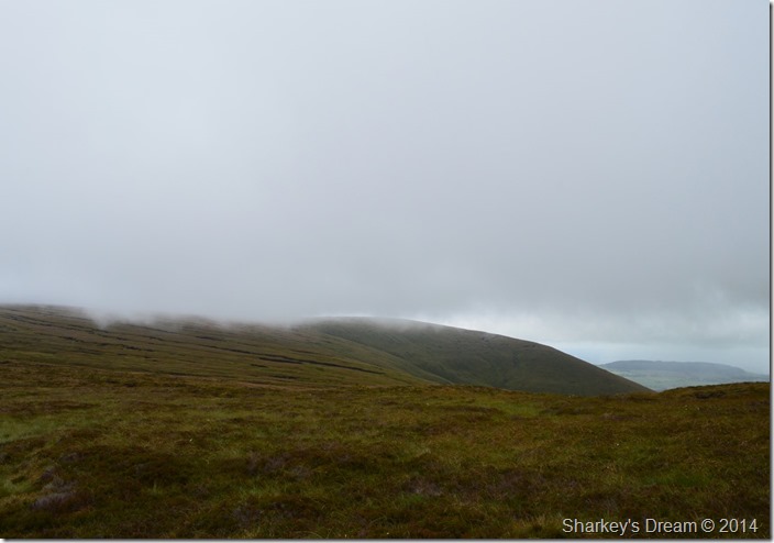
| Fair Snape Fell as the sun reappeared. |
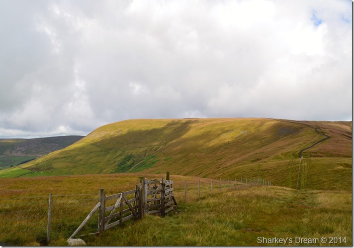
| I thought about taking a direct line to the summit of Whinny Bank but was a little put off by a pathless ascent over yet more boggy ground, instead I took my time whilst I descended the fell as it seemed with each step the sun grew brighter & indeed much warmer. |
 |
| Fair Snape Fell seen with a distant Parlick. |
My descent took me much longer than I had first initially thought but this didn’t concern me as my views over the valley of Bleasdale, Fair Snape Fell & Parlick were well worth the long wait before reaching the valley floor.
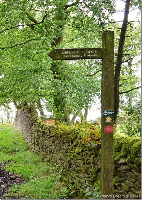
I hadn’t had to use my map until now as I needed to learn my way through the various lonnings & farm paths that would see me through Bleasdale & one particular place that I wanted to visit was that of the Bleasdale Stone Circle, my research had told me that the ancient Stone Circle was found within a small copse of trees not long after passing through Hazlehurst Farm.
Picture the scene… |
 |
| Hazlehurst Farm. |
No this isn’t the copse of trees that I am looking for, this is Hazlehurst Farm where I stood map in hand…sometimes sideways trying to pick out the location of the Bleasedale Circle amongst half a dozen wooded areas that could have easily been identified as the location of the ancient monument.
What started off as a simple walk was now turning into a map reading course & a good eye for the lay of the land, my map told me that a path ran from the wooded area from where I took this photograph where I would join a lonning towards the next farm situated a miles walk from here.
My problem was I just could not find that footpath.
I strode to the edge of the woods which over looked cropped fields only separated by a wire fence but a faint brook gave my position some clarity so I went for it, my map told me to stick left of the brook which didn’t stop me having to scale a wire fence were to reach it I had to walk through waist high tangled wild grass, here I was to be stung by stinging nettles all up my right leg.
I sure hope that Stone Circle is worth it.
After scaling the wire fence I found myself in a empty field, ahead of me in the distance another metal gate was spotted which I made for, thankfully, as I neared the gate I soon spotted that ‘give away’ orange rope around the gate which if common to walking in the country side meant ‘no right of way through here’ thankfully though, a wooden step lay just off the path where I could scale my next fence before making my way through Admarsh Barn Farm where I succumbed to a little conversation with the farmer as he loaded his quad with a single bale of hay.
Hi’ is this Admarsh Farm? aye he says, end of conversation.
This little tippet of conversation was enough to tell me that the Stone Circle lay just ahead & around the next corner which was flanked heavily by a wooded area. |
 |
| Not far now. |
I walked for up to three quarters of a mile before arriving at the next farm on the map which was named Vicarage Farm, it was there I spotted the sign post as a sigh of relief left my shoulders!
The sign pointed towards a large wooded gate where a large open field opened out, in it, was the small copse of trees that I had been looking for. |
 |
| Parlick seen above Bleasdale seen with the site of The Bleasdale Circle. |
I have to say that it has been numerous years since I had to resort to a map as I found myself a little sketchy of my unwary surroundings, seeing that sign post put an end to all that.
It was well past midday & since leaving Wigan I had only eaten my Kellogg’s Crunchy Nut for breakfast – so it was here I decided that once I had explored the Stone Circle, I would sit down & feast on some well earned lunch. |
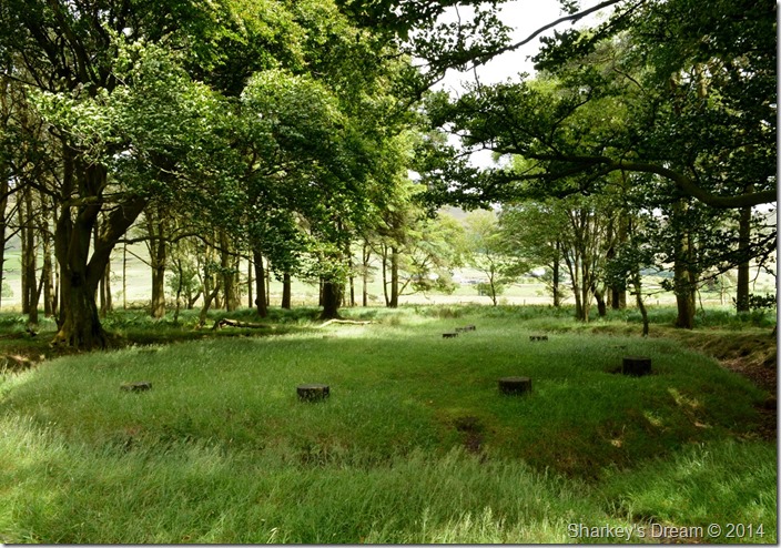 |
| The Bleasdale Stone Circle. |
The Bleasdale Stone Circle was only discovered as late as 1898 but what fascinates me most is that this site which dates back between 1700 BC is that a burial chamber was excavated containing charred remains of human bone which were thought to have been cremated by means of Funeral Pyre.
Inside the grave a small ‘accessory cup’ was also unearthed believed to contain food & drink for the afterlife of the deceased.
The now Stone Circle measures 45 metres in diameter with a mound containing the grave in the centre, the circular objects seen today are replacement ‘stone pillars’ left here after the original timber post had understandably rotten away over the the last centuries.
It is thought that the woodland was planted only after the discovery to protect the ancient site from the elements.
Sitting here in awe of the history of our region just didn’t seem right, it took a while to sink in but surely it did as the shadows of the trees danced across the ancient site there I sat, eating my BLT.
Purely magical & well worth the stinging nettles.
Sooner or later I knew I would have to leave which is what I did after around twenty minutes, after one last look back I passed through a wooden gate that would leave me across the field & back to Vicarage Farm where I would pick up the lane bound for St Eadmer’s Church which was just under a mile away. |
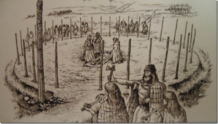 |
| An artist impression of The Bleasdale Circle C/O the Ribchester Museum. |
| |
 |
| St Eadmer’s Church, Bleasdale. |
| |
 |
| Kerplunk anyone? |
| |
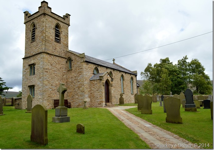 |
| St Eadmer’s Church, Bleasdale. |
After taking in the lane from Vicarage Farm I soon arrived at St Eadmer’s Church which is a fine monument & well kept village Church situated in the heart of the valley of Bleasdale. Before reaching the Church grounds I pass two elderly park rangers tucking into their lunches whilst sat on a bench, ‘afternoon I say’
I don’t get a return although not through ignorance, through a full mouth of sandwich.
I press on. |
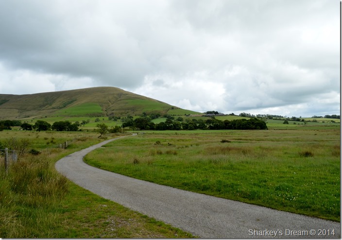 |
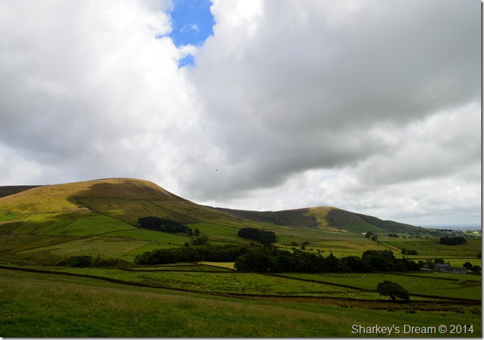
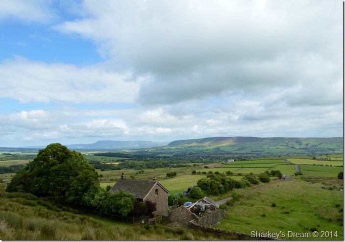
| Parlick with Blindhurst Farm down below. |
After leaving St Eadmer’s behind it was back to the map & how I would find my way towards Blindhurst Farm which you may be able to spot just as small out buildings below Parlick, it would seem a pretty simple A to B.
Which couldn’t have been further from the truth.
I first had to leave the tarmac road where you see the trees were I would take a right turn along the edge of a narrow stream, at first my path was faint but became more overcome by long grass the further I walked besides the bank.
After crossing the brook I could see Blindhurst Farm across a large field which I crossed before I gained height steeply towards the farm buildings themselves. |
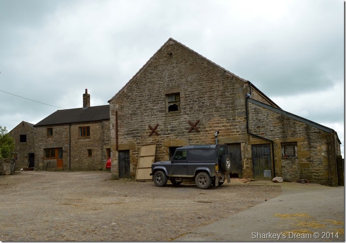 |
| Blindhurst Farm. |
| |
 |
| Blindhurst Cottages found close to the farm. |
| After passing through the farmyard to the sound of a group of four barking sheep dogs which I only realised sooner rather than later I might add that they where all on the end of steel chains, the dogs barked territorial & didn’t stop until I left the farmyard completely, I think this caused my next navigational error slightly however, when you see how faint the paths were I had to follow & the lack of use they had you may feel a touch of sympathy for me! |
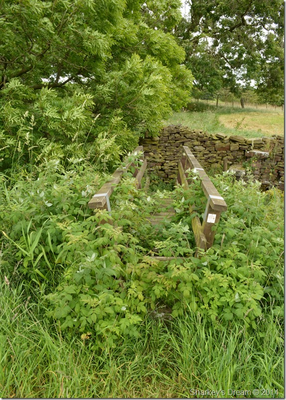 |
| Stumbling across this wooden footbridge. |
I scoured the top of the field for a crossing, only learning that there was water flowing through sound only as the long grasses completely covered their courses.
Here I place both hands like a gymnast would as I propelled myself forwards over the nettles & alike before crossing the wall where I was in reach of Fell Foot.
In reach yes, but more field negotiating had to be had.
I appeared to have found myself in a field of cowpats followed by large groups of their owners, I see no way through.
I keep with a stone wall which ran beneath a patch of trees, ahead I spot an open gate but I can’t make a direct route, I have to go around by sticking to the wall carefully negotiating the swill all the while heading for the gate. |
 |
| Back at Fell Foot. |
After passing through the gate I found myself close to Fell Foot even though I could not see it, ahead all that lay was a short flank of Parlick before a sudden turn revealed Fell Foot & a sea of glorious countryside with views as far as the eye could see.
I wipe the sweat from my brow & with the tiniest of pretence, I pretend the last half hour never happened because nothing could have spoiled my short walk that turned into a rather larger grand day out. |
|
| |
| Back to top |
 |
|