|
Scafell & Slight Side from Eskdale Green |
 |
 |
7th August 2014 |
 |
|
As the good weather continues throughout my weeks holiday I caught up with David on Wednesday via email regarding our planned walk for the Saturday 9th August where we would set the unusual route of Scafell from Miterdale, together with a ‘plan B’ walk should the weather turn nasty.
The forecast didn’t really look too good for a hike up Scafell from a midweek forecast, this was when David suggested he could book the following day off bringing the walk forward to Thursday given a much dryer & brighter forecast, my reply to David was simple.
Book the day off David, lets go for it. |
|
Wainwright Guidebook Four |
 |
| The Southern Fells |
-Scaw Fell
When men first named the mountains, the whole of the high mass south of Sty Head was known as Scaw Fell; later, as the work of the dales folk took them more and more into the height’s and closer identification became necessary, they applied the name to the mountain that seemed to them the greatest, the other summits in the range, to them individually inferior, being referred collectively as the Pikes of Scaw Fell. Many folks today even with the added knowledge that the main Pike is not only higher but actually the highest land in the country, share the old opinion that Scaw Fell (now Scafell) is the superior mountain of the group. |
 |
|
| |
|
Overview |
|
|
| Ascent: |
4,100 Feet – 1,249 Meters |
| Wainwrights: |
2, Scafell – Slight Side |
| Weather: |
Warm & Sunny, Cool Breeze On Tops, Highs Of 22°C Lows Of 11°C |
| Parking: |
Parking Spaces, Giggle Alley, Eskdale Green |
| Area: |
Southern |
| Miles: |
15 |
| Walking With: |
David Hall |
| Ordnance Survey: |
OL6 |
| Time Taken: |
8 Hours 55 Minutes |
| Route: |
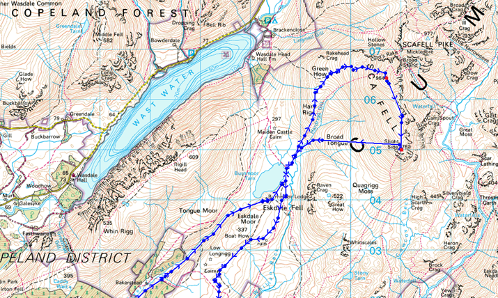
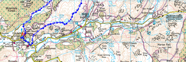
Eskdale Green – Giggle Alley – Porterthwaite – Miterdale – Low Place – Miterdale Head – Burnmoor Tarn – Burnmoor Lodge – Bulatt Bridge – Hard Rigg – Green How – Scafell –Long Green – Slight Side – Broad Tongue – Hardrigg Gill – Bulatt Bridge – Eskdale Moor – Brat’s Moss – Blea Tarn – Fell End – Hollin How – Eskdale Green |
|
| |
|
Map and Photo Gallery |
|
|
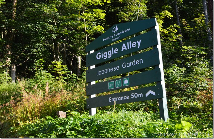 |
| Giggle Alley, Eskdale Green 08:03am 11°C |
We arranged to meet at the parking spaces in Giggle Alley just outside Eskdale Green for 08:00am, we both arrived about ten minutes early so this time was spent catching up as we kitted up behind the cars.
Although Eskdale is a rather remote spot to get to it hadn’t taken me as long as I thought which was a little over the two hour mark via the Birker Fell Road, the journey was as expected & rather quiet, that was until I had to wake most of Eskdale up by sounding my horn at the sleeping sheep who blocked the road at times.
The forecast was as predicted which meant that it was going to be another nine hours before I took the Bloc Billy’s off which I might add, left me looking like a Panda by the time I got home.
We were soon kitted up & with the cars locked we left the car park for Giggle Alley. |
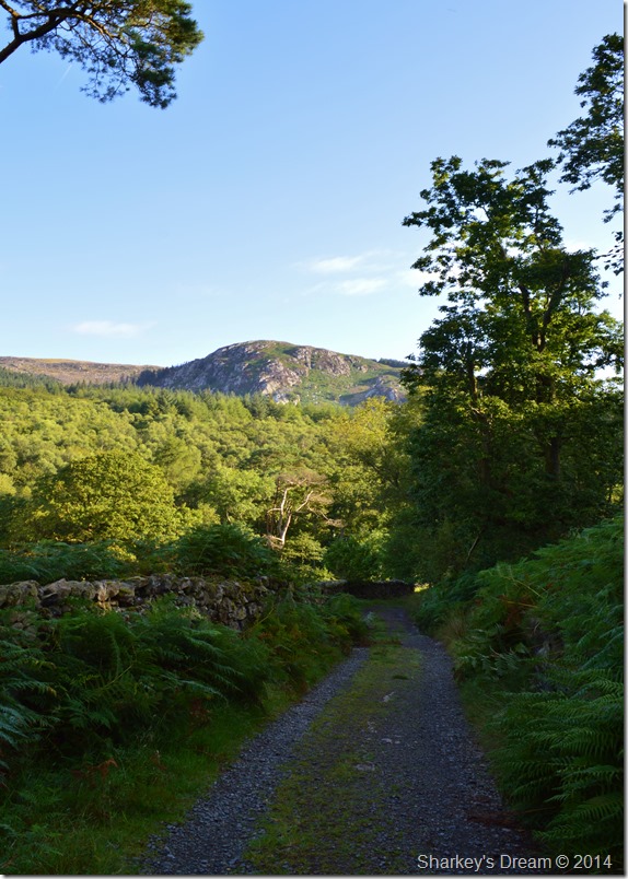 |
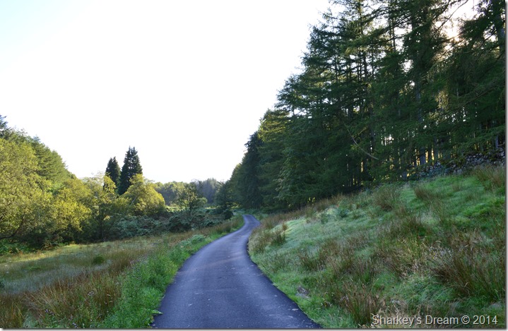
| Great Bank from Giggle Alley. |
Eskdale’s famous Japanese Gardens are found within the woodland which intriguingly is known as Giggle Alley having only recently been restored to their former glory by locals & the Forestry Enterprise.
Giggle Alley although as amusing as the name sounds is a beautiful tree lined passageway which some would describe as a ‘short cut’ through to our next destination of Porterthwaite.
The topic of conversation however wasn’t the beautiful scenery, our route or the clear skies above, it was Dawn of Planet of the Apes as I’d only watched it with my son the day before. |
 |
| Porterthwaite. |
It wasn’t until after we had left the tree lined lane of Giggle Alley did we notice just how much dew was lying on the ground this morning, a sure sign of a significant temperature drop overnight can only mean one thing…
Autumn is just on its way, but lets suppress that thought for a while, it’s about to get very warm indeed |
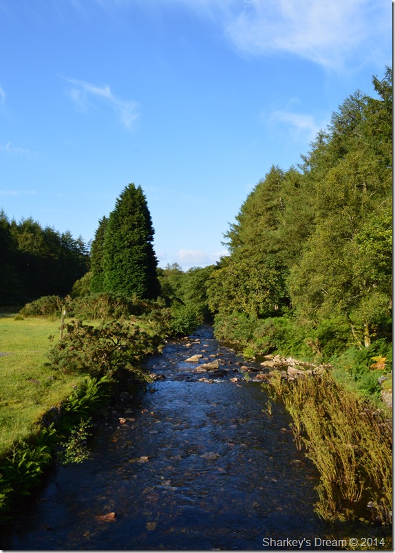 |
| Crossing the River Mite at Porterthwaite. |
| We soon arrived at the wide wooden footbridge which we crossed before heading into Miterdale under a warm morning sun |
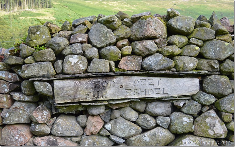 |
| ‘Head right for Eskdale’ |
As we approached Low Place Farm we awoke the farm dogs who in turn ran, jumped & did just about anything to let us intruders know we were passing through their farm.
Our path would lead us straight through the farm yard before two gates are reached, after closing the second gate behind us we couldn’t help but laugh at the sign the farmer had left on his wall, Hod Reet Fur Eskdel rolled straight off David’s tongue, as a Lancashire lad I wasn’t too far behind in abbreviating either.
We press on. |
 |
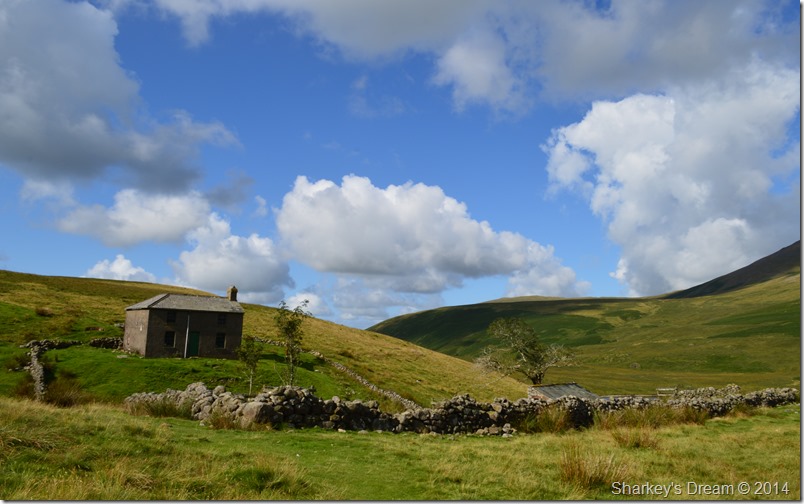
| We pass by Bakerstead Outdoor Pursuit Centre. |
We kept with our track that was both stony & overrun with water still flowing down from the fellside, after negotiating many hop, skip & jumps we arrived at the Bakerstead Outdoor Pursuit Centre which is locally owned by Wyndham School in Egremont.
Today however, the once was working farm building is boarded up & looked as though it hadn’t seen the light of day for quite some time as the building looked virtually sound. |
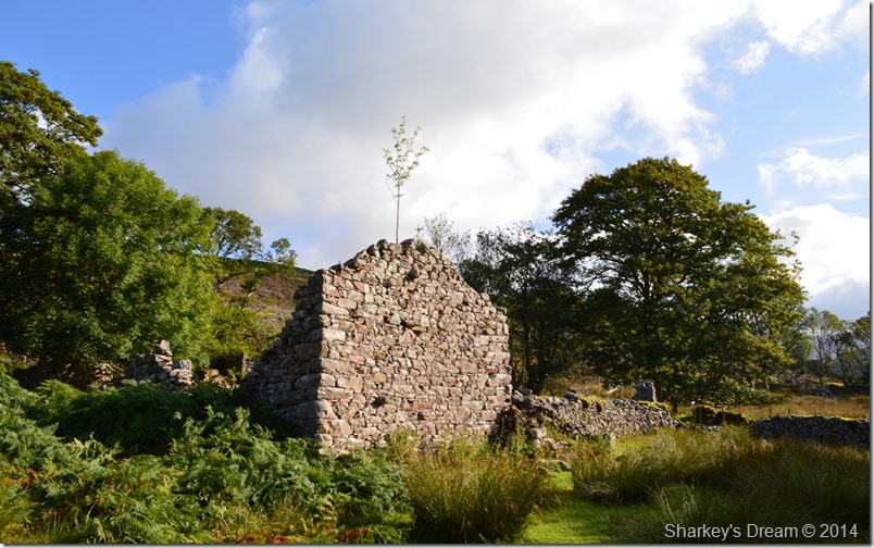 |
| The same however, couldn’t be said about this old ruin. |
It seems inevitable we both spoke, that that poky stick growing from the top of the ruin will one day bring the whole wall crashing down.
Found half way along the secluded valley of Miterdale are the old ruins of what once was Miterdale Farm seen here as we look at what we think maybe the barn & even a stone walled lane. It was here we stood a while pointing out all the man made objects including the old farm buildings that occupied the Miterdale valley many hundreds of years ago, back then with no power & no running water we could only imagine how difficult times must have been for the families who farmed this land. |
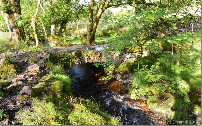 |
| This Old Packhorse Bridge found close to the old ruins. |
| After leaving the ruins of Miterdale Farm behind we crossed the River Mite by means of this very old looking Packhorse Bridge that had a layer of new concrete that ran over the top no doubt laid recently to support much heavier machinery than the intended horse & cart. |
 |
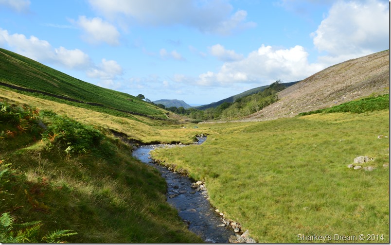
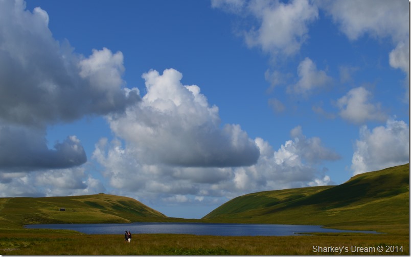
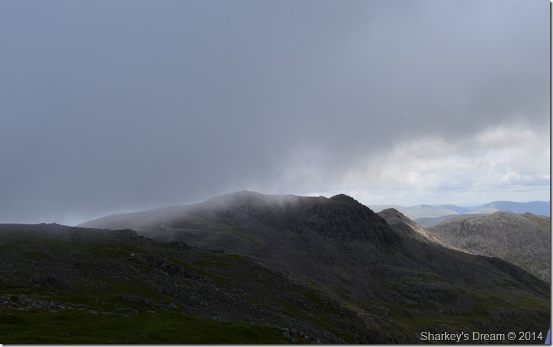
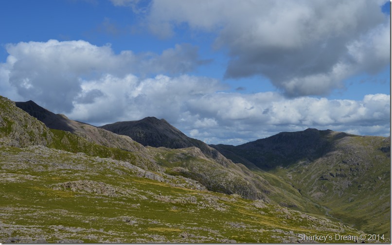
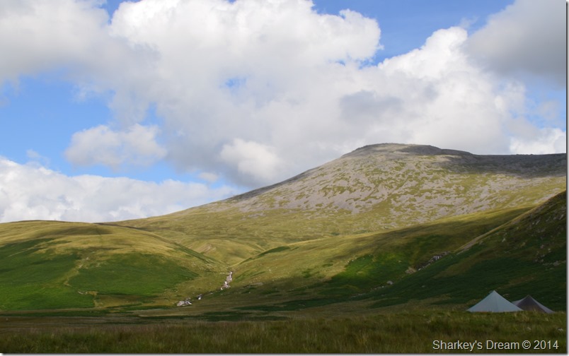
| Scafell over Miterdale. |
Scafell is well positioned from within the Miterdale Valley so much so it domineers the head of it. Here we look on as cloud envelopes, then leaves the summit leaving us guessing that we may not have any views by the time we get up there.
But todays walk is all about the secluded valley of Miterdale, David spoke to me about Miterdale quite some time ago now as he explained how the valley mind bogglingly narrows; so much to an extent you could almost reach out & touch the valleys sides.
Ahead we spot a tent on the other side of the Mite, we then both spot the campers heading away maybe to look for some fire wood, whatever they were doing they looked like they had chosen a great night & a great spot to sleep under the stars. |
 |
Scafell ahead from Miterdale & the River Mite. |
| |
 |
| A long distance view all the way back to Muncaster Fell, beyond, the Cumbrian Coast. |
| |
 |
| The head of Miterdale with Scafell still under cloud. |
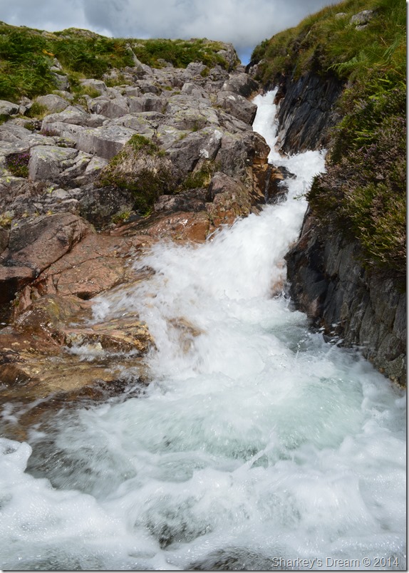
We crossed the River Mite in order to negotiate the narrow path & the high bracken that flanked the Mite on both sides, here the river is very narrow but deep in places so careful footings was key.
There’s a bit of a push to climb out onto the valley head, the more popular route is to stay right which is just what we did. |
 |
| Yer cant swing a cat in ere! |
| David was right, just look how narrow the valley becomes which is all down to the glacial activity that formed this land many thousands of years ago. |
 |
| Miterdale from Miterdale Head. |
| Such the curvature of the valley Muncaster Fell is now out of site as we pause to take photos. It is thought that Burnmoor Tarn post glacial times once ran through the valley of Miterdale thus leaving the valley with that distinctive stream bed shape, drainage from Scafell & Slight Side was then somehow diverted south to how we know it today. |
 |
| There’s a guy hiding behind a wall there David…oh yeahhh… |
| As we left the valley head behind we pass Burnmoor Lodge where I spotted a guy sheepishly hiding behind the lodge, I don’t think there was anything sinister at all, just the fact that he thought that we thought we hadn’t seen him. |
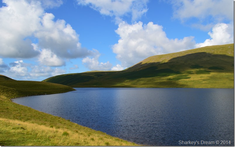 |
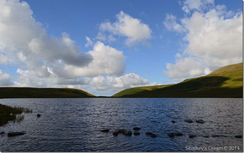
| Burnmoor Tarn. |
| |
 |
| Miterdale Head from Burnmoor Tarn. |
Now I’m no geography teacher, but it does look like glacial/water once flowed into Miterdale from Burnmoor Tarn, I could however, be totally wrong!
We head for the small crossing at the outflow of Burnmoor Tarn via Bulatt Bridge |
 |
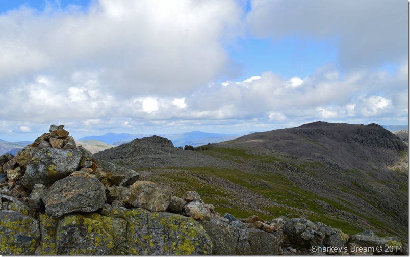
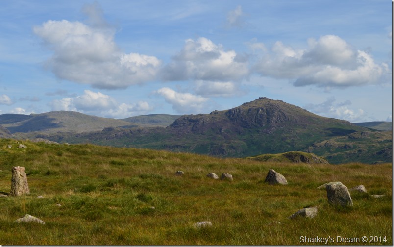
| Scafell as we flank by the Maiden Castle cairns. |
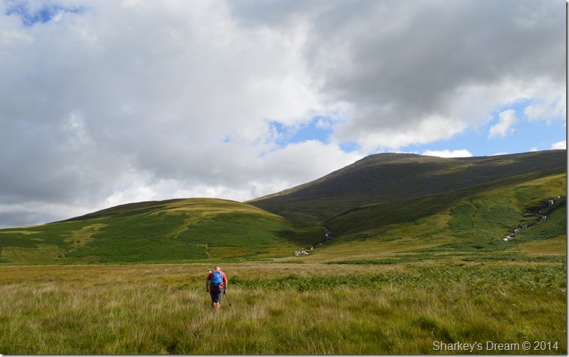
| Despite the district seeing a lack of rainfall over the last few months our crossing towards Hard Rigg was a wet & squelchy one. The summit of Scafell is now cloud free as we make our way left where we will pick up the Hard Rigg ridge, it’ll be the first time I’ve climbed Scafell via Hard Rigg & I don’t quite know what to expect. |
 |
| Burnmoor Tarn & Miterdale lit up with a bright morning sun. |
The couple you see behind us didn’t speak much English, we both guessed at Lithuanian but we wasn’t quite sure, they were heading one way then spotted David & myself & decided to tail us until they caught up with us while we took a short break, in broken English they spoke of just how beautiful the place was & of course, we agreed.
Is that Scafell? the young man asked, yes Scafell we replied, oh okay.
From there we seemed to have picked up two hitch hikers who tailed us for much of our ascent stopping for rest when we did & picking back up afterwards, It certainly didn’t feel intrusive just the fact that it felt we were guiding them up from afar.
We couldn’t help but note to one another however that, was it Scafell Pike they were looking for & not Scafell? we will never know, nevertheless, it looked like they enjoyed it whatever mountain they thought they were on.
It wouldn’t be the last time today we would get asked the same question, but, more on that later. |
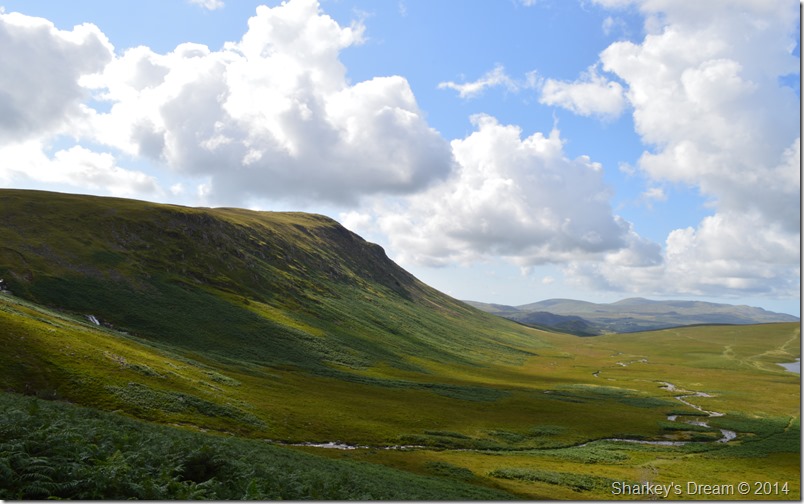 |
| Here, looking back on Great How from the start of our Hard Rigg ascent. |
| |
 |
| A close up of the Mosedale Valley Fells. |
| It doesn’t seem two minutes ago since I last walked that ridge, from left to right we have Red Pike (Wasdale) Scoat Fell, Pillar & Kirk Fell. |
 |
| And without the zoom Haycock makes an added appearance over on the far left of the photo. |
We had long since left the grassy ridge behind as the grass gave way for boulder & loose scree, here the path takes on a much more definitive steep approach as we take on the ascent with more concentration & a little less talk owing to the fact that conversation will only make the ascent much harder.
I trail David only stopping only for a few words or maybe a photo, both of which were good excuses to regain ones breath back. The path takes on a zig-zag effect towards the last push where it was clear that our view ahead was indeed the true summit & not a false one.
Behind us our newly adopted hitch hikers pause much the same time we do, they have a good pace but even with their youth on their side, they will not catch us up.
For the first time in months we speak about a different chill in the air, one were if you look carefully you can see the breath escaping your mouth which can only lead to the earlier subject that we are within the last few weeks of summer which doesn’t go un-noted.
My legs feel the last push the most as I trans fix on the back of David’s boots, I pass through the burn not yards from the summit itself which does not get a mention. The summit is almost upon us when in creeps dark clouds from the east threating our views, but it is brief.
This is the moment we decide to kill some time by watching the cloud unfold as it crosses the summit of England’s highest as we tuck into our lunches, we chose not to summit, instead we pick two flat rocks to perch on when moments after, the young couple arrive.
They too sit down only yards away and for now, also miss out on a summit in favour of lunch. |
 |
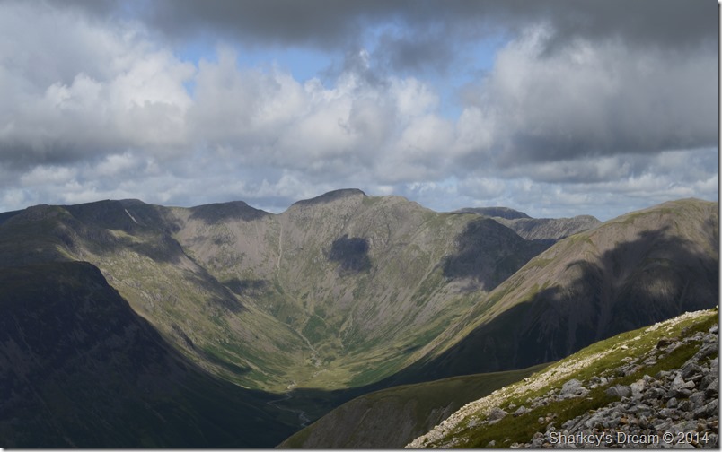
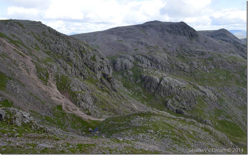
| Peering over towards Scafell Pike seen here with Ill Crag & Esk Pike. |
| |
 |
| We didn’t have to wait long before the cloud cleared & the sun came out. |
| |
 |
| Scafell Pike from Scafell. |
It’s not very often summit time would exceed well past twenty minutes but today from our lunch spot as a slight breeze blew we gazed upon the masses who were on the summit of Scafell Pike along with the advancing crowds knowing that on her sister summit including ourselves for now, there was just four people.
Incredible isn’t it, however, four soon turned to six. |
 |
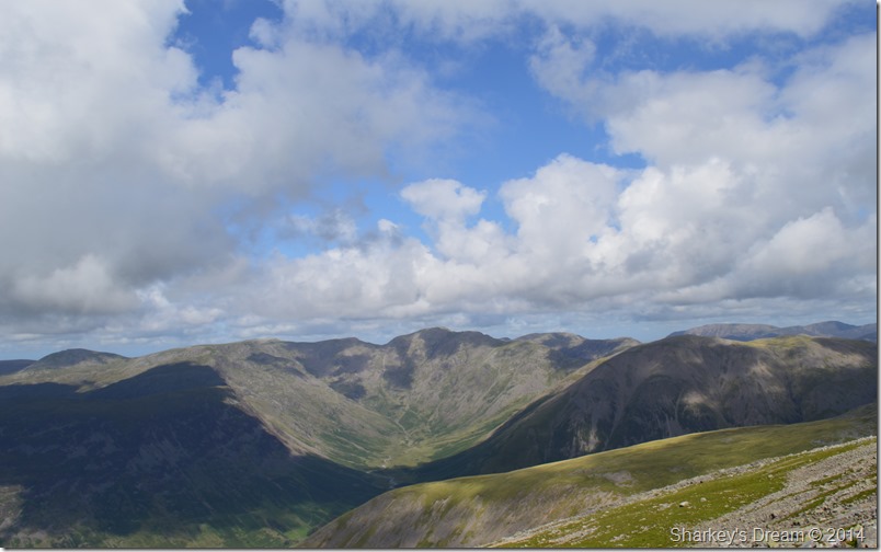
| Extended views over the western, & north western fells. |
| |
 |
| Scafell Pike from Scafell summit cairn. |
After what seemed like the longest extended lunch ever we shouldered packs & made the short climb to the summit where we caught up with two walkers who had ascended via the Fox’s Tarn route, we soon struck up conversation mainly on how busy The Pike looked ‘they’re just like little ants one of them spoke out’
We soon got on to the topic of routes & where we had walked from, after explaining that they had come up from the Great Moss it was easier for us to point out Miterdale as it could clearly be seen from our summit spot. ‘You look like two regular walkers one of them quips’ David replies as he points out with his finger the next three locations, I live over there, I work over there & I play over here.
Well put, we all share a laugh.
We then go on to the subject of Lord’s Rake because in this guys guidebook it says it had been closed off & had any of us tried it? David glances over towards me & says, he was in it just a few weeks ago, from there I tell the guys that Lord’s Rake is in regular use but was closed off due to fear of the chock stone coming down, I don’t exactly remember the dates when they ‘re-opened’ it so to speak, but it still gets many a visitor.
With that we bid our fellow walkers a good day on the fells before heading along the summit top for a good look over towards… |
 |
| Foxs Tarn. |
That’s Foxs Tarn looking rather dry in the lower half of the photo, from there the ascent path can clearly be seen as it ascends via the east buttress.
It’s a route I have still never used myself due to the over whelming response I usually get (including the two guys we had just spoken to) that the route is un-interesting & that the Tarn itself is nothing more than a puddle with a rock in it. This maybe so but it still deserves an ascent in my eyes, I just have to get myself round to doing it!
David suggested I do some investigating over at Broadcrag Tarn which sadly cannot be seen in this photo but its location can clearly be seen centre right in the photo.
Broadcrag Tarn is etched into memory for another day. |
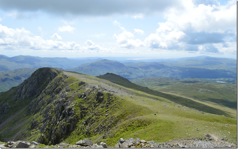 |
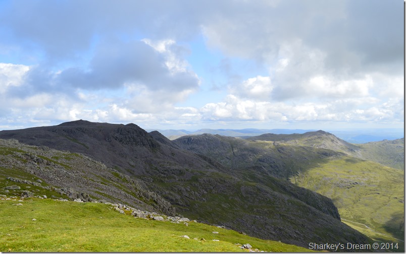
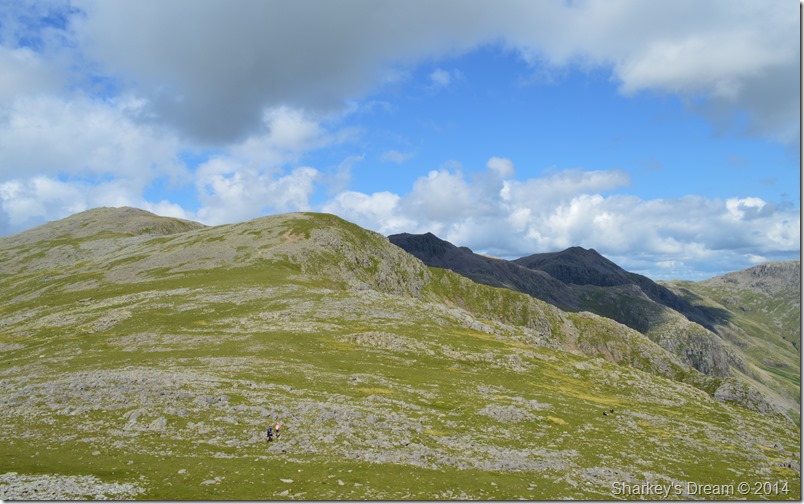
| Slight Side beyond Long Green. |
| After our visit high above Fox’s Tarn we soon found ourselves back on the main path & heading towards Slight Side, at times we kept with the path so as not to lose height, other times we lost a small proportion if not only to avoid the boulder fields that line this popular route. |
 |
| Here, looking back on Scafell from Long Green. |
If your lost out on the fells bumping into someone with local knowledge can make a big difference in guiding you back to safety, this wasn’t the case when two woman approached us asking ‘is that Scafell? yes it is we replied, Scafell Pike? no Scafell Pike is behind sorry you can’t see it from here.
From that moment on we could clearly see the two women’s faces drain & at the same time ‘turn angry’ we just want to get off! we’re sick of walking in bog which way is best back to the Woolpack!
David & myself tried to get a word in edgeways by stating their exact location, you have many options but your quickest way back is the way you came, David hadn’t finished his sentence before one of the woman disagreed & thought an ascent on Scafell would be quicker because she simply didn’t want to get her feet wet again.
The conversation lasted less than a minute as they failed to listen to our advise & continued up towards Scafell, pack-less & map-less.
What we had just witnessed was utter ignorance & discontent for the fells and their own personal safety, both David & myself could only look on in disbelief.
We press on. |
 |
| Scafell Pike, Pen, Ill Crag, Esk Hause & Esk Pike seen shortly before we make Slight Side summit. |
| |
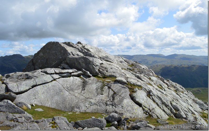 |
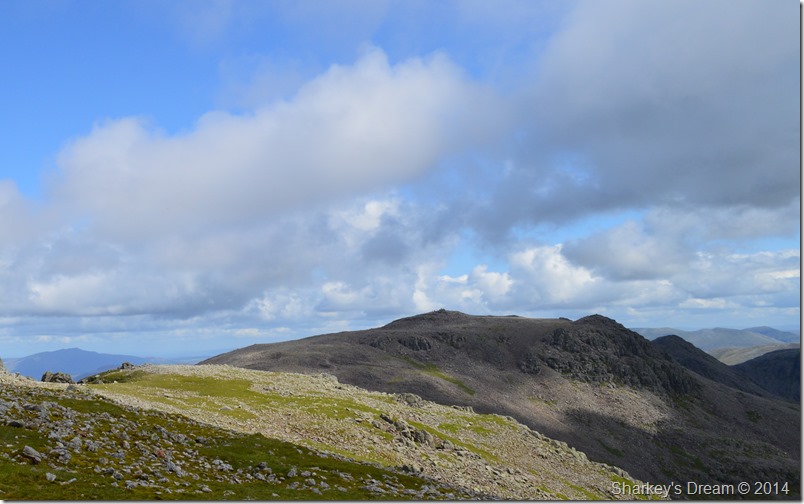
| Slight Side summit. |
We soon crested the summit of Slight Side before it suddenly dawned on us that we were only around the half way mark and that we had still a lot of ground to cover before reaching Eskdale Green. If we had been in a rush or we had a set time to be back by we’d of been in quite a bit of trouble at this point.
Oh well, no point in rushing. |
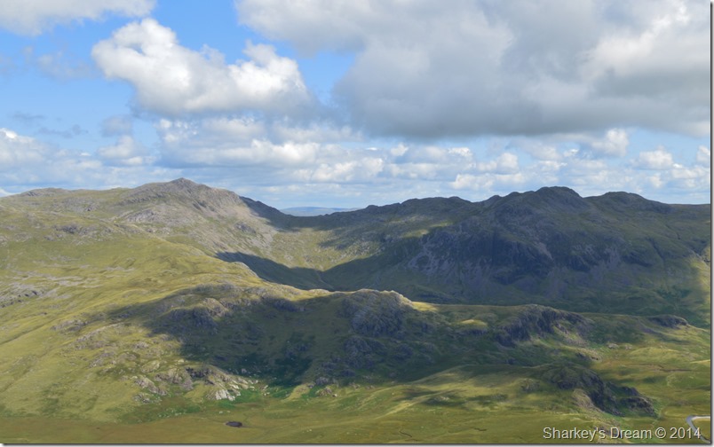 |
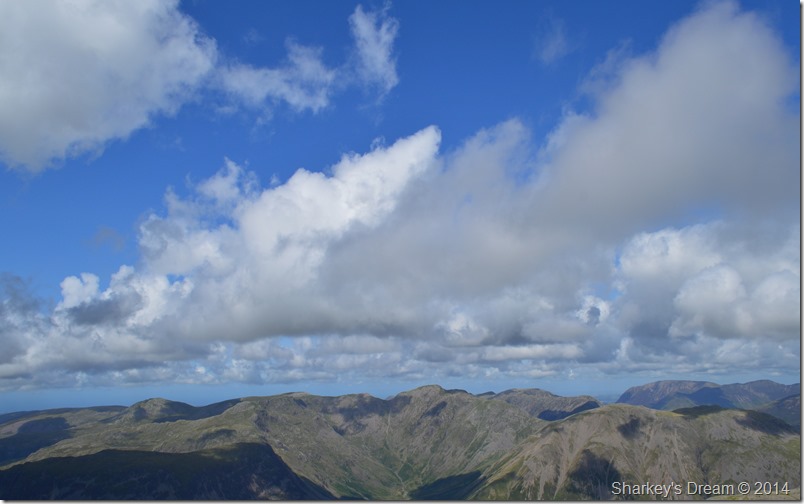
| Bowfell & Crinkle Crags seen over Great Moss & High Gait Crags from the summit of Slight Side. |
| |
 |
| Here, Scafell, Scafell Pike, Ill Crag & Pen can be seen as the high cloud cast shadow over the Scafell range. |
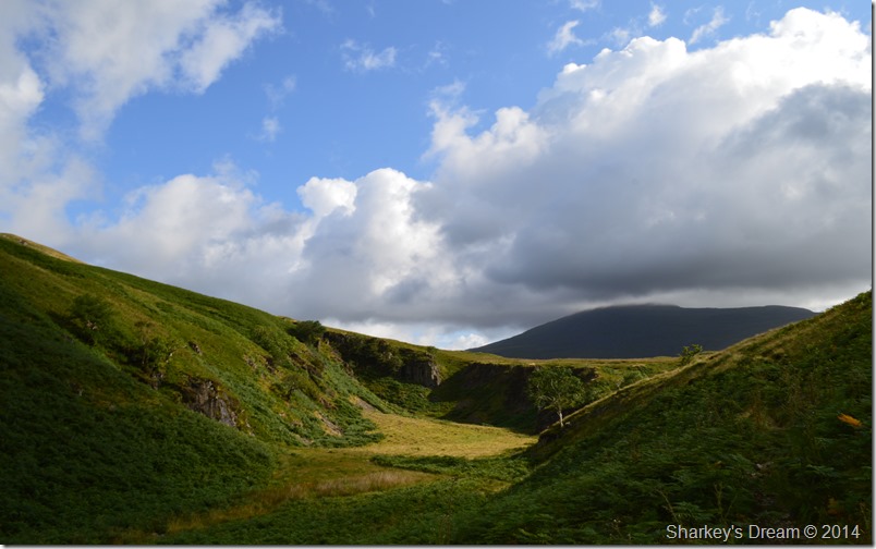
Time spent at Slight Side was sadly brief but it was the point where we could plot our route back through to Eskdale via a visit to the ancient cairns found at Brat’s Moss, from there our route would continue through to Blea Tarn which is a place I really wanted to include into this walk.
From the summit of Slight Side we doubled back before taking a pathless descent in the direction of Broad Tongue, not before coming across the the Memorial Plaque to the two lost Airmen who’s Hurricane Aircrafts both crashed just below the summit of Slight Side in low cloud back in August 1941 |
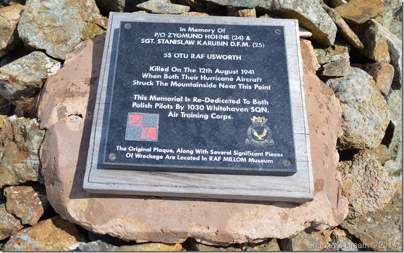 |
| The Memorial Plaque found at the crash site. |
| Dedicated to Pilot Officer Zygmund Hohne & Sergeant Stanislaw Karubin. |
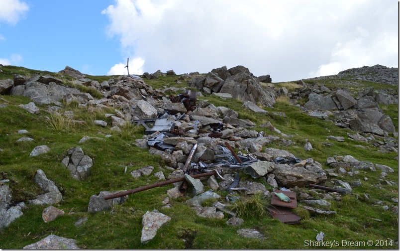 |
| Extensive aircraft debris can still be found at the crash site. |
Below the Plaque one of the Aircrafts Merlin Engines can clearly be seen in minute detail down to the Crank, Pistons & Piston Rings, a lot of which bore the markings of heavy impact.
It is believed the two aircraft had taken off from Usworth near Sunderland on a two ship formation flying exercise over the north of England with Sgt Karubin as the flight leader. At some point during the flight the two entered cloud, while still flying in cloud the two aircraft flew into Slight Side killing both airmen. |
 |
| Is that Scafell? Here looking back up at Slight Side from our descent. |
After leaving the crash site we took on a pathless descent negotiating awkward grassy tussocks while making directly for Broad Tongue. In the distance we spot a fellow who I thought gave us a slight wave, is he coming towards us David? We carried with our intended route before realising that the guy had altered his course & was now heading for us.
He soon reached us, a guy dressed in T Shirt boots & jeans, in his hand an Ordnance Survey Map of the area, is that Scafell he asked?
Not again…
No that’s Slight Side we answer, I’ve come from Eskdale Station & I wanted a photo of Scafell before I have to head back, have I got time to go on he asked?
When is your train due? he replies with a little over three hours time.
In that case you’d probably be safe to start heading back, it’s a good distance from here so if you set off now that would leave you with some ample time hopefully we reply.
The guys thanks us while at the same time he asked where are we parked? we reply with Eskdale Green before bidding him a good day, I’ll just head up a little further the guy says, if only to take a couple of photos.
David & I set off again not really believing how many people have asked us ‘is that Scafell’ of course we are always happy to help, even those who don’t wish to listen, yet the odds on todays advice, well, you couldn’t make it up could you!
Every now & again we would glance back before a depression in fell side meant that we couldn’t see the guy, the last time we checked he was taking photos thereafter, he started to follow our course towards Hardrigg Gill.
We didn’t see him again for a while. |
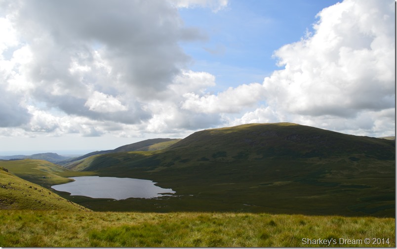 |
| Miterdale, Burnmoor Tarn,Illgill Head & Whin Rigg seen from Broad Tongue. |
| |
 |
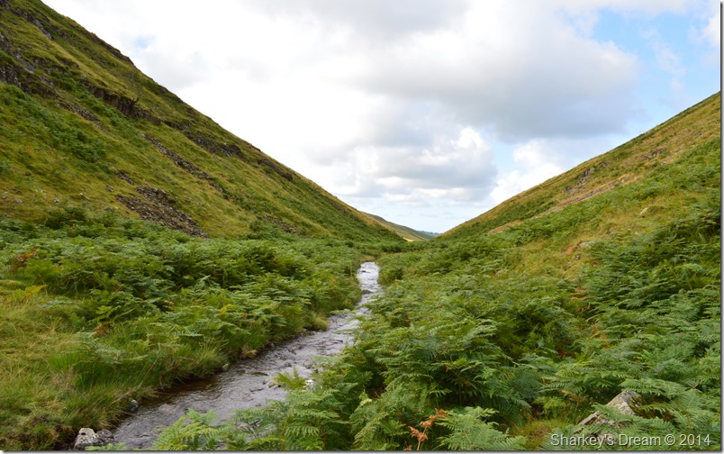
| Hardrigg Gill. |
It was nice to be out of the grassy tussocks by the time we came to the top of the waterfalls where we looked for a crossing, from higher up the falls we thought we’d spied safe spots to cross Hardrigg Gill by only once upon them, although narrow in places the water depth was much too deep to cross.
Again more sites were spotted to cross by only again realising that the water was too deep or the rock too slippery, we eventually made it all the way down to valley level & followed the water course through thick bracken before coming to a point where Hardrigg Gill took a sharp left, it was do or die as we spotted half a dozen rocks that could be used as stepping stones & with the help of our walking poles, we crossed Hardrigg with little to no effort at all keeping bone dry in doing so.
Patience is a virtue, or so it goes.
|
 |
| Scafell & Broad Tongue seen with Hardrigg Gill as we ascend above Burnmoor Tarn towards Eskdale Moor. |
| |
 |
| Hater Fell (Eskdale) seen with Green Crag. |
t had seemed some time had passed since we had left Slight Side summit, in that time the air clarity had increased & so too had the afternoon heat which was just how my afternoon on the Ennerdale Fells had panned out just two days earlier.
As we passed the old ruined Peat Hut we then continued towards the Neolithic Stone Circles found at Brat’s Moss. |
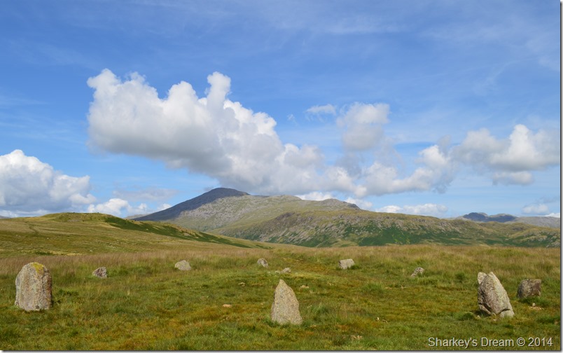 |
| Scafell & Slight Side seen from one of the Stone Circles. |
| Although Neolithic flint has been found at near by Roman Fort of Ravenglass it was the Bronze Age settlers who provided occupational evidence on the higher Eskdale Fells, the close by Burnmoor Tarn derives from ‘Barron Moor’ meaning ‘the moor of stone heaps’ |
 |
| Harter Fell (Eskdale) seen behind one of five Stone Circles found at Brat’s Moss. |
After a short time spent at the Stone Circles we continued over White Moss towards Blea Tarn Hill via a narrow boggy grassy path. I could only look back over the seclusion of Eskdale Moor plotting more walks in this wild area of Eskdale.
We soon reached Blea Tarn Hill topped off by a huge stone summit cairn, perhaps one of the largest found in the district. From there it was just a short walk down hill where Blea Tarn still remained hidden until we reached a large outcrop of crags which were partially covered in high bracken. |
 |
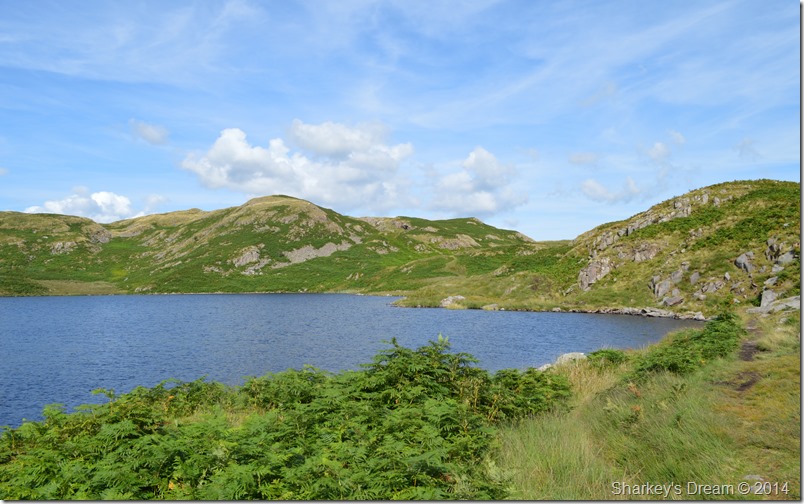
| Blea Tarn (Eskdale) |
| We soon rounded the crags & started our descent to Blea Tarn which is perhaps one of the less yet most beautiful idyllic of all the Lakeland Tarns, it was pretty imperative we included Blea Tarn in todays walk, I guess it wasn’t difficult to see why. |
 |
| Blea Tarn Hill from Blea Tarn. |
| |
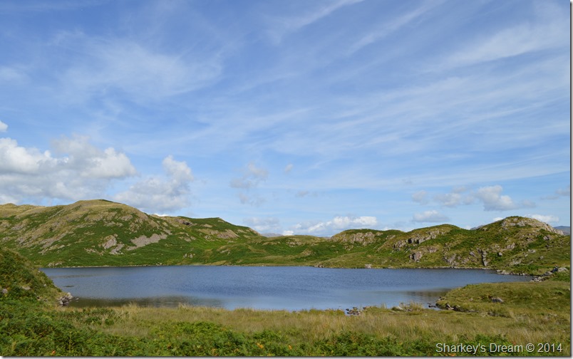 |
| Seclusion; Is best served up at Blea Tarn. |
| |
 |
| Harter Fell (Eskdale) seen with Green Crags above Eskdale Green. |
After leaving Blea Tarn behind we the gave both Blind & Siney Tarn a wide flank by heading south west via a prominent grassy path with a slight descent to it. This told us we were indeed heading back down to Eskdale Green via a path that David had to question; he hadn’t used before.
Fisherground Campsite lay to our left flanks which looked full to capacity with tents & campervans.
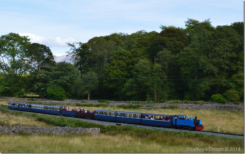
During the latter stages of our descent we heard the distinctive blast from the whistle of La’al Ratty, after our route passed over a stone bridge with the narrow gauge track below we soon realised that we had missed the miniature train by a matter of seconds.
But we weren’t quite out of luck when we heard the whistle once more after passing over a second bridge with the track below. |
 |
| La’al Ratty meaning ‘little railway’ |
Once again we had missed La’al Ratty as we passed over the stone bridge but had a fleeting glance over our shoulders before she stopped at Green Station.
It was nice to see passengers still waiting to board the train at Green Station as well as the packed carriages too.
This much-loved railway or (La’al Ratty) was first opened in 1875 to carry iron ore from the mine at Boot to Ravenglass where Iron Ore was transferred to the Furness Line After closure in 1913, it was re-opened as a narrow gauge railway in 1916 and found a new market carrying granite. The quarries closed in the 1950s and the line once again fell into disuse, but in 1960 a group of railway enthusiasts stepped in to save it & preserve the railway as we see it today. |
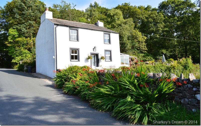 |
| Hollow Mire cottage, Eskdale Green. |
We were less than a three quarters of a mile from Giggle Alley but that short mile meant the end of a grand day on the fells, Eskdale did this fittingly under brilliant afternoon sun as we took in the narrow lanes of Eskdale Green where tired feet awaited the comfort of the cars.
The car park was almost full by the time we arrived back, here I down pack & tumbled around in my pack to retrieve the car keys knowing full well I had a litre of Robinsons Juice to gulp down which I did almost without pause.
David begins to take off his boots as I scurry around for the remains of lunch from my pack, a soggy tuna sandwich was what I found but it still went down well, in more or less three bites.
I take a look at my watch, it’s almost five to five as I swallow the remains of my sandwich I go over to shake David’s hand in celebration of a fantastic walk, there & then our next walk was founded but is it going to top the like’s of todays.
We’ll have to wait and see. |
|
| |
| Back to top |
 |
|