|
Angletarn Pikes to Gray Crag from Hartsop |
 |
 |
31st January 2015 |
 |
|
It’s the time of season when keeping an eye on the forecast is priority not to mention local road reports too as Cumbria has experienced heavy snowfall at all levels over the last four days. Both Saturdays & Sundays forecast looked bright yet still chillingly cold. Midweek I told myself that I would climb Helvellyn via Swirral Edge starting from Glenridding, when once the summit was reached, well, I didn’t really get that far.
As the days drew closer to the weekend the forecasters predictions were still true, however strong winds across the summits meant I would have to put my Swirral Edge plans on hold, I held out right until the last hour to see if they would die down, all to no avail.
Working around my plan B wasn’t difficult but getting to it might just be due to snow, as the Kirkstone Pass is closed from Ambleside to Hartsop which meant a little detour further north which would see me ‘drop in’ to Lakeland rather than drive through it.
My plan B was this exact walk, which is a very similar route that I took back in October 2012 only then, I included Place Fell. The forecasters were correct, the snowline is at a mere 850 feet ABSL (250 meters) and as I was soon to find out it got progressively, or maybe… aggressively deeper.
This is Angletarn Pikes to Gray Crag from Hartsop. |
|
| Wainwright Guidebook Two |
 |
| The Far Eastern Fells |
- Angletarn Pikes:
The crowning glory of the Pikes, however, is the tarn from which they are named, cradled in a hollow just below the summit. It’s indented shore and islets are features unusual in mountain tarns, and it has for long, and deservedly been a special attraction for visitors to Patterdale. The charms of Angle Tarn, at all seasons of the year, are manifold: in scenic values it ranks amounts the best of Lakeland tarns. |
 |
|
|
| |
|
Overview |
|
|
| Ascent: |
2,800 Feet – 853 Meters |
| Wainwrights: |
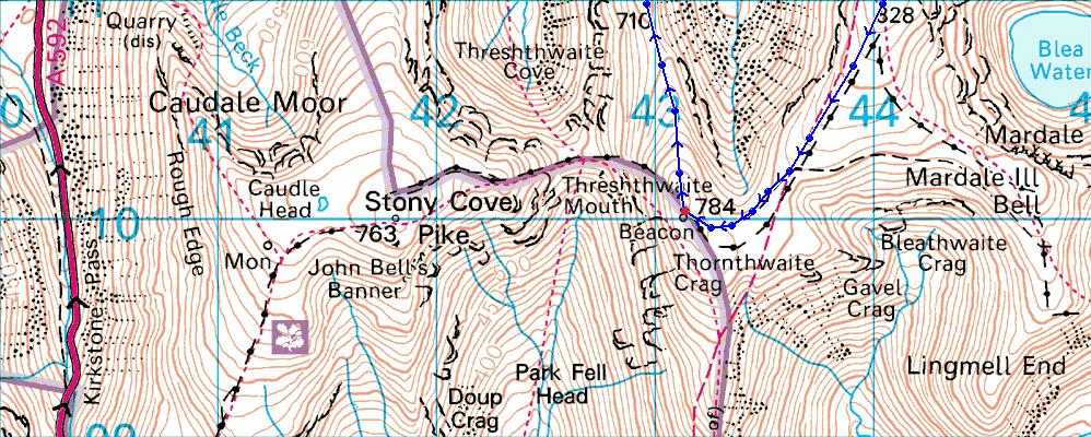
5, Angletarn Pikes – The Knott – High Street – Thornthwaite Crag – Gray Crag |
| Weather: |
Dry & Overcast, Turning Sunny For The Latter Of The Afternoon, Strong Winds Across The Summits. Highs Of 3°C Lows Of 2°C Feels Like -13.1 |
| Parking: |
Car Park, Hartsop Village |
| Area: |
Far Eastern |
| Miles: |
10.4 |
| Walking With: |
On My Own |
| Ordnance Survey: |
OL5 |
| Time Taken: |
6 Hours 30 Minutes |
| Route: |
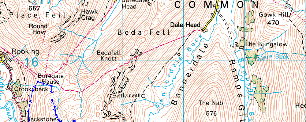
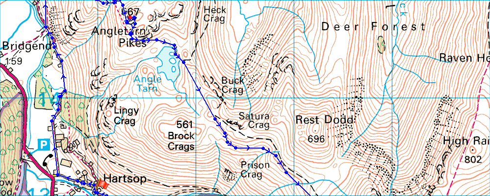
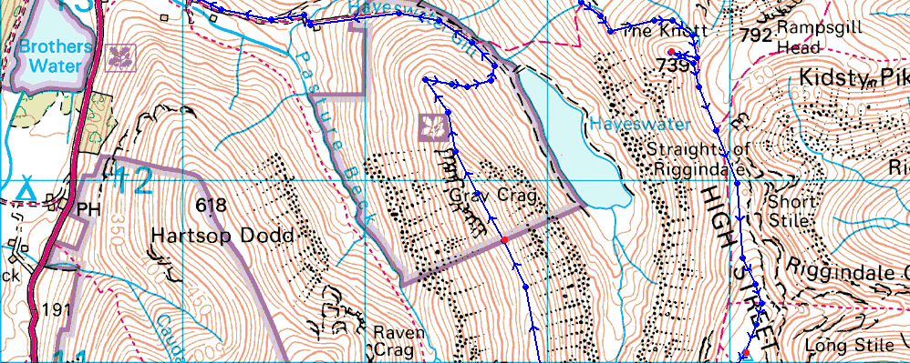
Hartsop – Dubhow – Boredale Hause – Angletarn Pikes – Angle Tarn – Satura Crag – The Knott – Straights of Riggingdale – High Street – Thornthwaite Crag – Gray Crag – Hartsop |
|
| |
|
Map and Photo Gallery |
|
|
 |
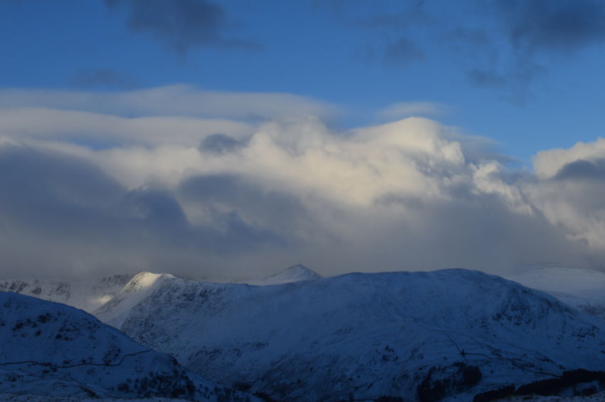
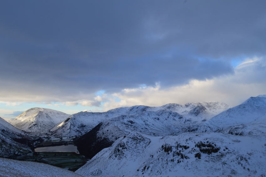
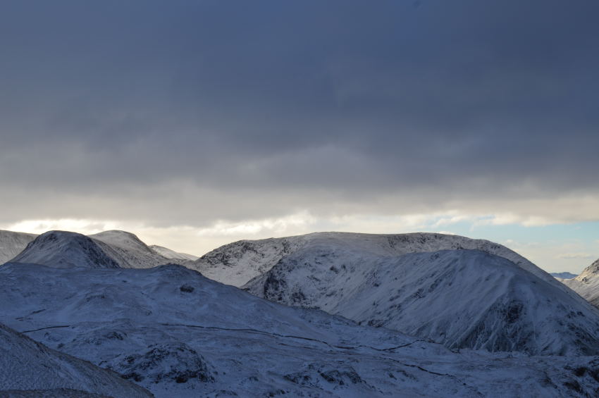
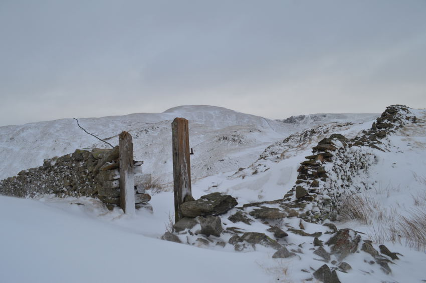
| Hartsop Dodd from a wintery Hartsop 08:10am 3°C |
It wasn’t the fact that I had been away for a couple of weeks why Lakeland felt a little strange, dare I say deserted as I drove along the shoreline of Ullswater not passing one car along the way, I put this down to the Kirkstone Pass being closed at Hartsop. Outside the car windows pre-dawn views were bleak but snow topped summits were seen through a null of variations of grey cloud, a world away from what the forecasters had predicted.
After passing through the quite villages of Glenridding & Patterdale I soon arrived at Hartsop not before slowly negotiating the deep water filled craters at the car park. Parking was easy as I was the only one there so I neatly reversed my car before proceeding to kit up.
My hat & new gloves had been pre-warmed on the passenger seat which only left me to tie up & throw my jacket on, checking I had everything I closed the boot & locked the car before heading through the hamlet of Hartsop once more, this time by foot.
The start of today’s route would see me head for Boredale Hause, I had two options one of which was to climb steeply above Hartsop beneath Lingy Crag & follow a concrete path which narrows into a woodland path before reaching Bridge End. This path I had used & in particular the Woodland path isn’t fit for a winter excursion, which is why I took the more substantial lane instead found at the entrance of the village. |
 |
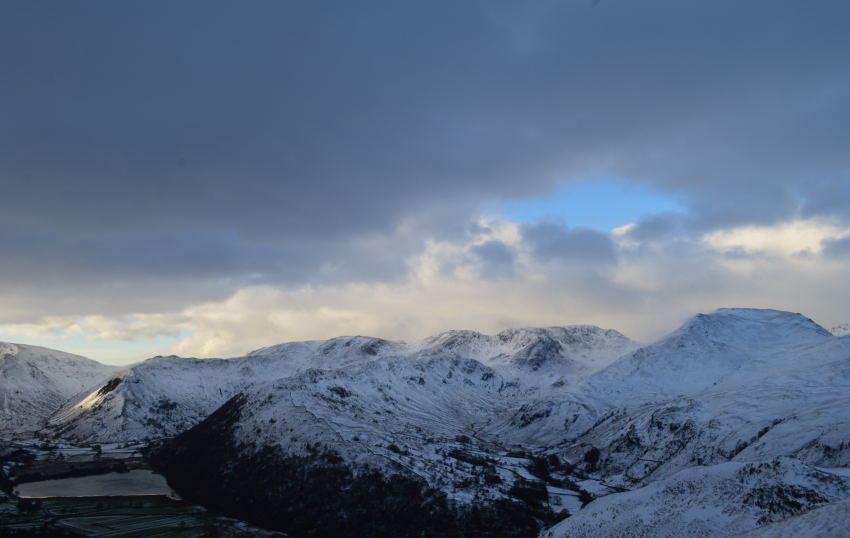
| Looking back towards Hartsop Dodd & Middle Dodd from the lane. |
| It had gone 08:00 yet the light was still low & moody, I half expected to be walking under sun by this point but a quick check of the forecast hours earlier told me that any brightness would only arrive later during the afternoon, oh well not to worry. |
 |
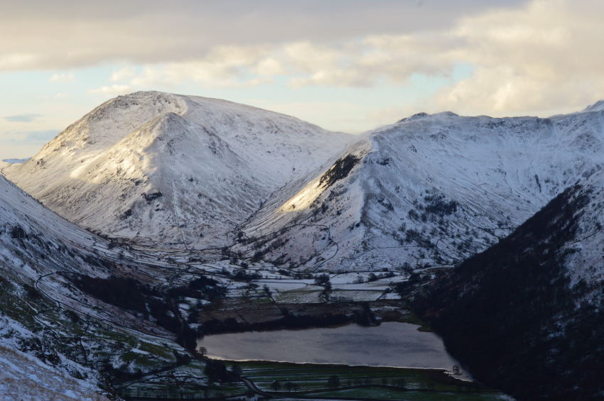
| Here, Hartop Dodd, Caudale Moor, Middle Dodd, Red Screes, High Hartsop Dodd & Hartsop Above How can be seen once I had gained my path above Bridge End. |
| Within no time at all I soon found myself at the start of the footpath bound for Boredale Hause, already views were starting to open out, however, the low light continued. |
 |
| A closer look at Brothers Water, Hartop Dodd, Caudale Moor, Middle Dodd, Red Screes, High Hartsop Dodd. |
Once on the ascent for Boredale Hause I found that the path was gentle & not challenging at all which is just what this walker needed after a week out, views were plentiful looking back on the Kirkstone Pass as I followed red tail lights as they slowly made their way up, which was odd, as I thought the Pass had been closed to traffic, maybe not.
The gentleness of the path soon made way for a much steeper approach the closer to Boredale Hause I got, the last push required some determination from my walking poles as the path lends its way steeply right before a null & another last steep push which then saw me link up with the Rooking path briefly before arriving at the stone cairn. |
 |
| Things are most certainly starting to brighten up further west into the park. |
| I’d worked a bit of a sweat up gaining Boredale Hause as my hands inside my gloves started to feel clammy as did my head beneath my hat, it wasn’t to last long as the predicted cold wind chill started to take effect almost immediately, best to keep moving. |
 |
| A hint of sunlight seen along Striding Edge, Catstye Cam, not so lucky. |
| |
 |
| Place Fell over Boredale Hause. |
| I guess it was soon after leaving Boredale Hause did I notice just how deep the snowdrifts were as at times they swallowed up the lower half’s of my walking poles (45cm) I was only at 1,250 Feet (380 meters) which just goes to show how much snow had fallen over the last few days & the previous night as I found myself blazing my own trail through fresh powdery snow. |
 |
| ‘That view’ could only mean you are Angle Tarn bound. |
Although the path was deep with snow gaining height here was done by keeping to the edges of the path where the grass poked through the snow, which meant a good percent of the time made for good purchase.
Views soon opened up over Brothers Water & beyond. |
 |
| Shafts of light on Red Screes, Middle Dodd & High Hartsop Dodd were real highlights so early into the walk. |
| |
 |
| The wider view. |
| Once I had passed Stony Rigg to my left my view soon opened up again over Dovedale & the Deepdale valleys where the cloud had now lifted revealing the snowcapped summits of Dove Crag, Hart Crag & Fairfield. |
 |
| Once further along the path views opened up into Deepdale revealing St Sunday Crag. |
| |
 |
| Attentions were still drawn to the brilliant light over on Red Screes & High Hartsop Dodd. |
The delights of my light show would soon come to an end as I came to the top of Dubhow Beck, here a sharp dog leg in the path indicated me to head east where I would leave the path for Angletarn Pikes summit.
The fresh snow was avoidable as I used the edges of the path, however, after leaving the main path for the summit I soon found myself striding through deep unavoidable snow. My only way ahead was to leave the path & keep with the fell side where the snow hadn’t accumulated above much of the grass tops. |
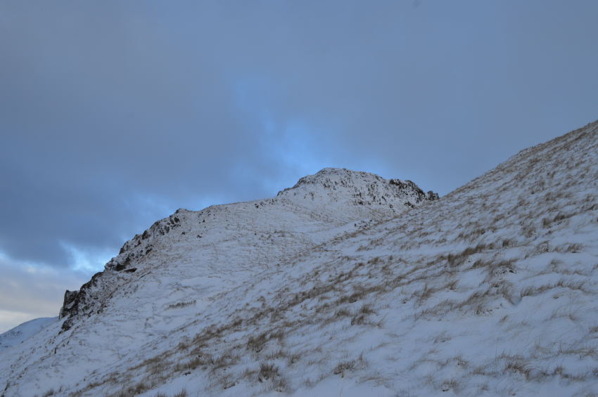 |
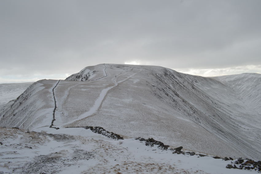
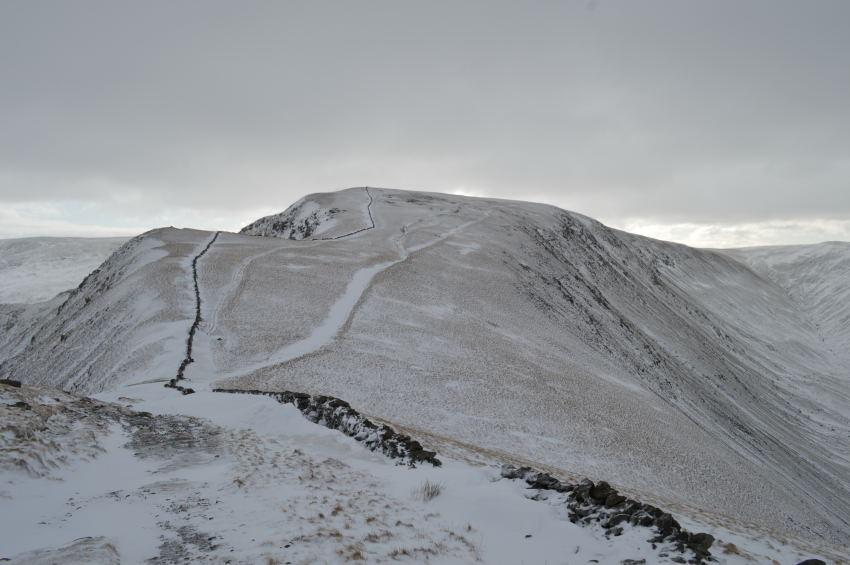
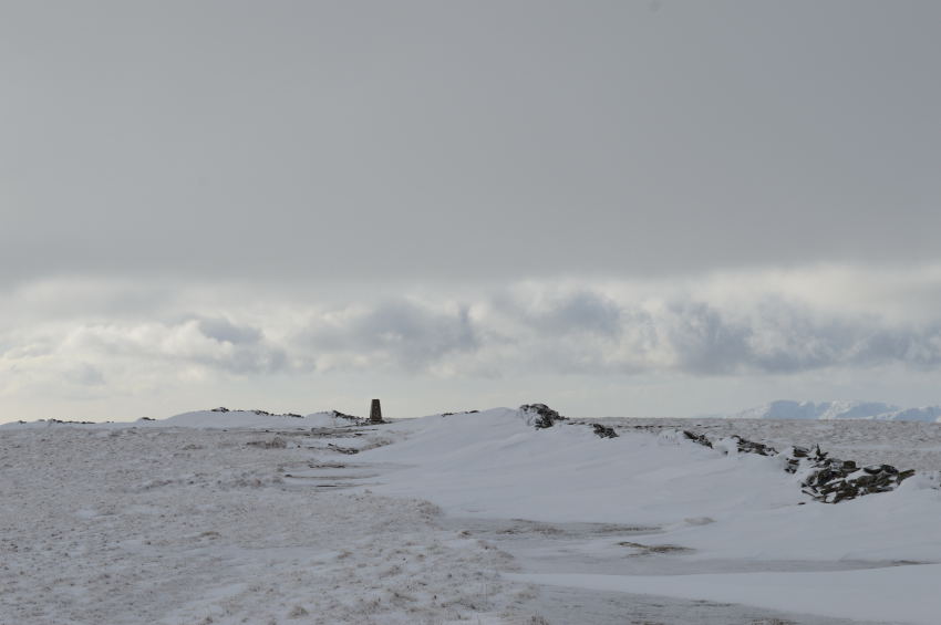
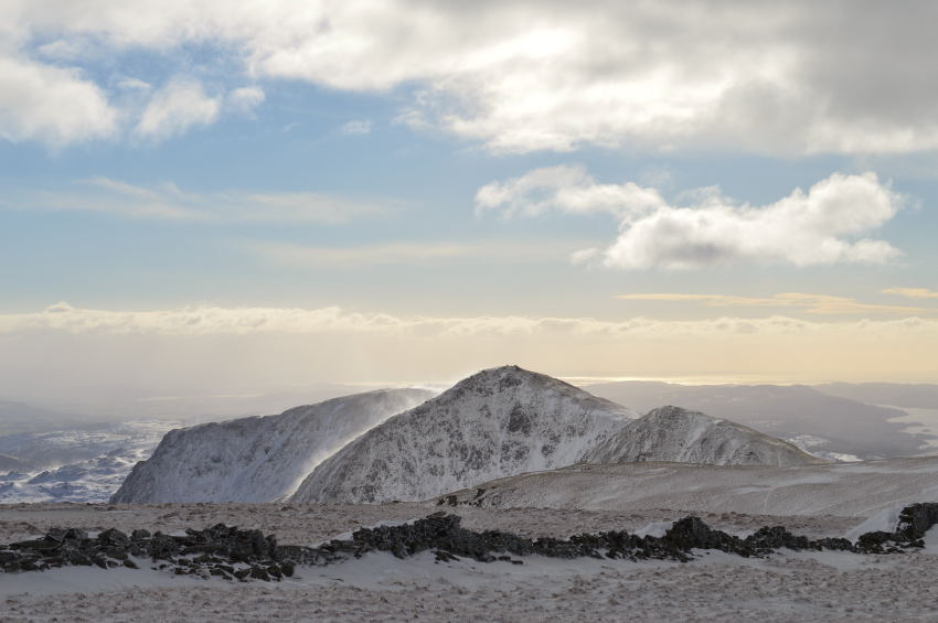
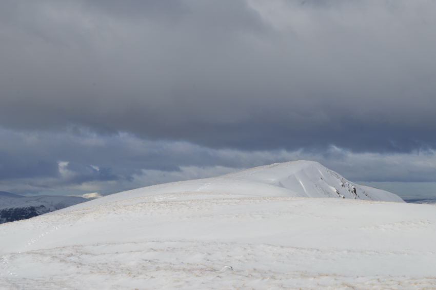
| Angletarn Pikes summit is just ahead. |
A common trate was soon found in that the higher I found myself the less snow I had to deal with, this I experienced throughout the whole of the walk, sounds odd I know, but stay with me on that one.
Again, to gain the summit I used the paths ‘edges’ which weren’t as deep filled as the path itself, with the snow being fresh & powdery it didn’t maintain any purchase whatsoever which meant the short descent was going to be fun, if not a little tricky. |
 |
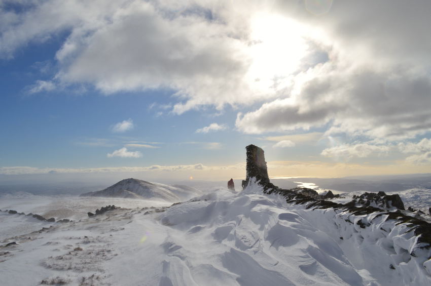
| Cold, and yet strangely heart warming were my views from Angletarn Pikes summit. |
Summit time was briefer than I would have liked due to the severity of the wind chill which bit like needles at exposed skin, it’s only at times like these do you notice the floppy bits at the bottom of your ears!
I choose not to summit the Angletarn Pikes parent peak, instead I would rejoin the main Angle Tarn path by retracing my steps then cutting across to meet back up with the main path. |
 |
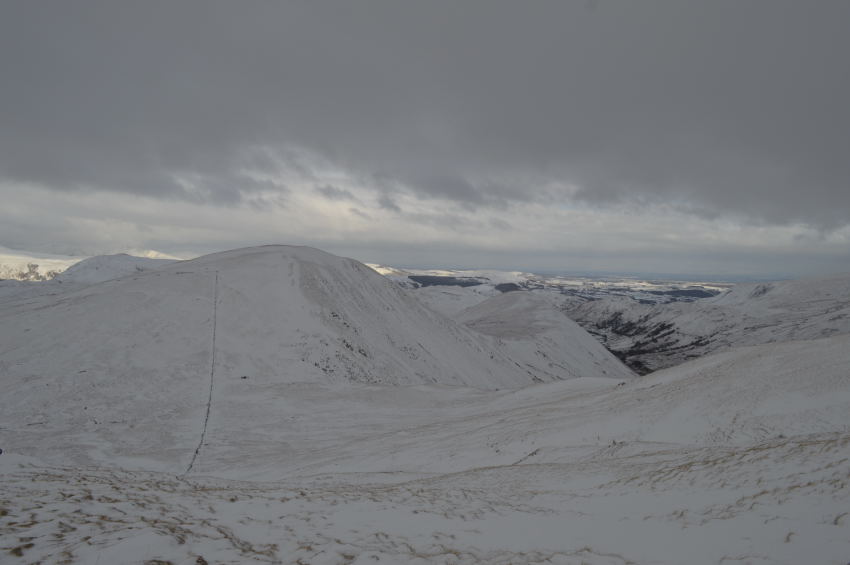
| From the path a large proportion of my route appears above Angle Tarn, through to Rest Dodd, The Knott & High Street. |
| However, my attentions were soon drawn on how to negotiate the path around Angle Tarn. |
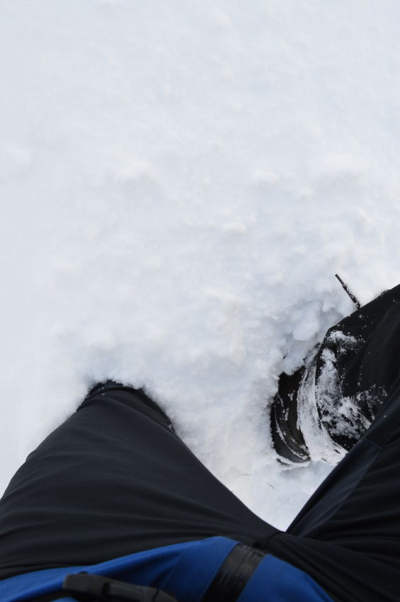 |
| When faced with thigh high drifts. |
I hadn’t been on the main Tarn path long at all, moments even when with each step I succumbed to the deep drifts that had choked the whole path that navigates Angle Tarn. Here I found myself climbing higher which subsequently sapped at energy levels, at times I was naively drawn back to the Tarn path where I thought the snow level had become less dense, all to no avail.
Time spent navigating the whole area from Angle Tarn up until reaching Satura Crag was testing to say the least, the though of a summit of Brock Crags soon left my plans as thoughts were taken up on how to get from a simple A to B without exhausting myself out.
To add to things I found that I had left my gaiters back in the car which meant with every step my trouser legs would roll up thus filling my inside leg with snow, I was now walking with dozens of tiny snowballs inside my trousers that had started to collect around the tongue of my boots!
I still managed to take the odd photo. |
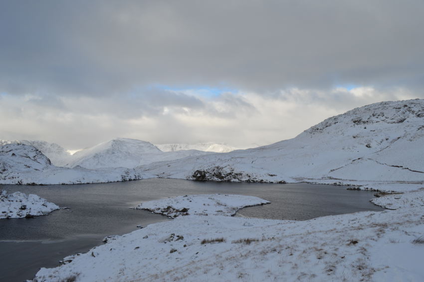 |
| Angle Tarn. |
This side of Angle Tarn wasn’t as deep yet still testing, I was still using the ledge above the path which wasn’t without its drifts.
The sad thing for me personally was I spent so much time looking at where I was about to put my feet I hardly looked up at the Tarn which has always held a special place in my heart.
With no pun intended, I just had to plough on. |
 |
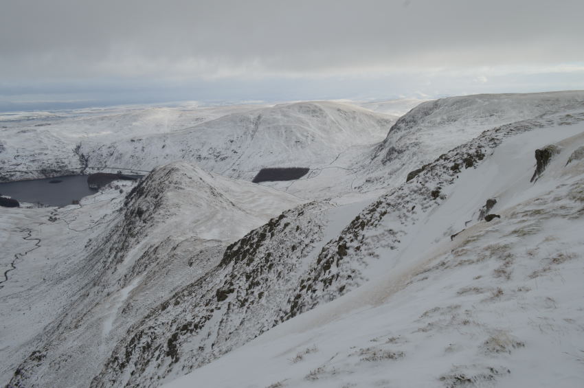
| Rest Dodd from Satura Crag. |
With Brock Crags falling casuality to my plans so too did Rest Dodd as sadly the drifts impeded any forward motion to less than a crawl at times, not that I didn’t give the path a go before diverting back towards the path/fence that runs above Prison Gill.
Despite still dredging through two foot drifts the sight of four walkers heading up The Knott at a steady pace meant they weren’t having to cope with anything like the drifts that I had experienced.
The thought of which spurred me on. |
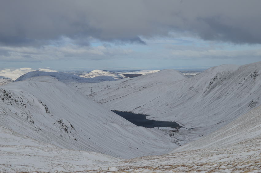
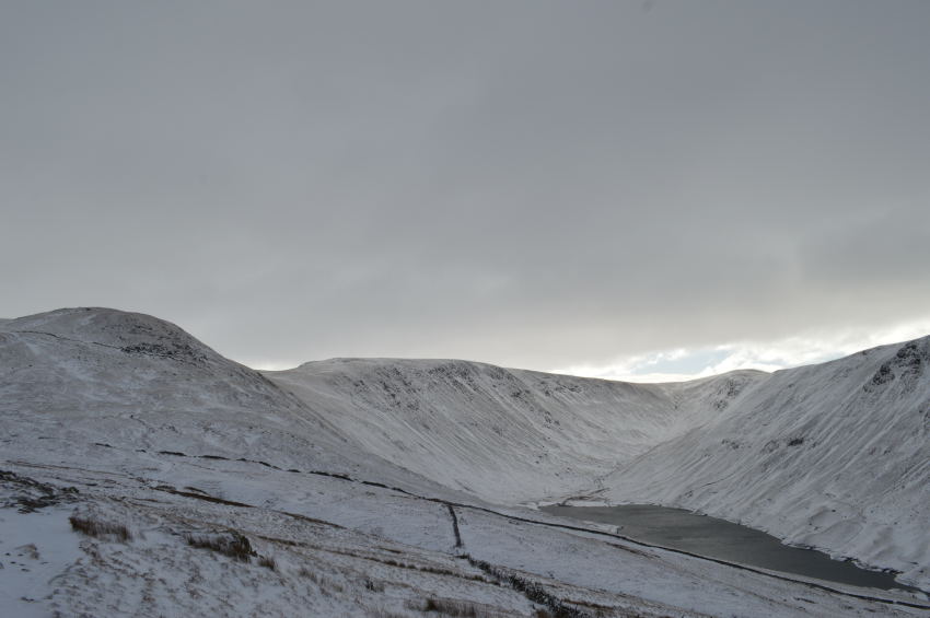 |
| Hayeswater, The Knott & High Street. |
| I soon left the tricky drifts behind as my heart rate began to return to normal, my thighs ached a little through lifting them in & out of the deep snow but other than that I was good to go, long gone were the thoughts of cutting the walk short as an ascent on The Knott now lay ahead. |
 |
| St Sunday Crag & Fairfield seen above Hartsop Above How. |
| |
 |
| Anyone on the eastern fells will be enjoying all that winter sun. |
| |
 |
| Not like my monotone, with views towards Rest Dodd & The Nab. |
My ascent on The Knott although steep was like a clear breath of fresh air, the guys that I had seen from Satura Crag had long gone & so to had their footprints as they succumbed to the spindrift helped along by a fiercely strong & cold wind.
Step by step I took in my ascent first by the stones that form a steep like staircase still visible over the snow, ice & frost. I soon spot the prints left behind by Crampons which on a personal level I thought was a little hasty as the snow was still fresh & powdery and any ice patches where easily avoidable.
The spindrift was a different subject, even as it hit you from behind it still managed to cause such a frenzy I lost count of how much of the snow I swallowed, it was time to take out my snow goggles.
I purchased my snow goggles out of season some time ago which meant I only spent the best part of twenty quid for them, I don’t see spending fortunes on something that only gets used three or four times a year warranted, and they did the job of keeping my hat firmly pressed against my ears too. |
 |
| Rampsgill Head & High Raise (Martindale) seen shortly before arriving at The Knott summit. |
| |
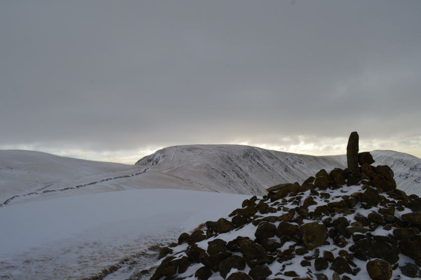 |
| High Street over The Straights of Riggindale as seen from The Knott summit. |
Instead of using the short path to reach The Knott which I found was also deep under drift I followed a contour of the summit shoulder which I found by leaving the main path early.
I kept to the grassy tussocks who’s needles could just be seen above the snow, these meant I wouldn’t punch through any accumulated drift although at times this was unavoidable.
I soon found myself at the summit cairn which was blowing a hooley with biting conditions, I wasn’t too sure of the real feel temperature but it felt much colder than anything I had experienced for a long time, I decided to get out of wind not just for comfort but down time too, besides the severe chill I needed to collect myself, doing this out of the wind worked wonders, even if I had to sit in the snow.
Over the wind I thought I heard voices which caused me to leave my purchase for a look around, I spot a large group of walkers knelt down looking over a map just off the main path, with no shield from the wind I could only mutter why were they doing that there when, at the base of The Knott a stone wall would have made for a comforting wind break.
High Street averts my gaze as I plonk myself back down, the guys who I had been following were by now just passing Short Stile which prompted me to get up & get a move on, besides, I was only getting colder sat there… |
 |
| High Street over The Straights of Riggindale. |
This is by far one of my favourite views of High Street just in case you hadn’t heard me mention it before.
The guys I had been following had broken the summit shoulder & were by now out of sight. As I had descended The Knott the walkers seen huddled around a map were collecting themselves together, it was here I expected to get views on them every time I glanced back, in fact, it was the last I saw of them. |
 |
| High Street. |
| I choose to take the path to the left of the summit wall which offered protection from the now strong winds & the severe chill they brought, but first I crossed the wall seen in the foreground of the picture before crossing it again further ahead. |
 |
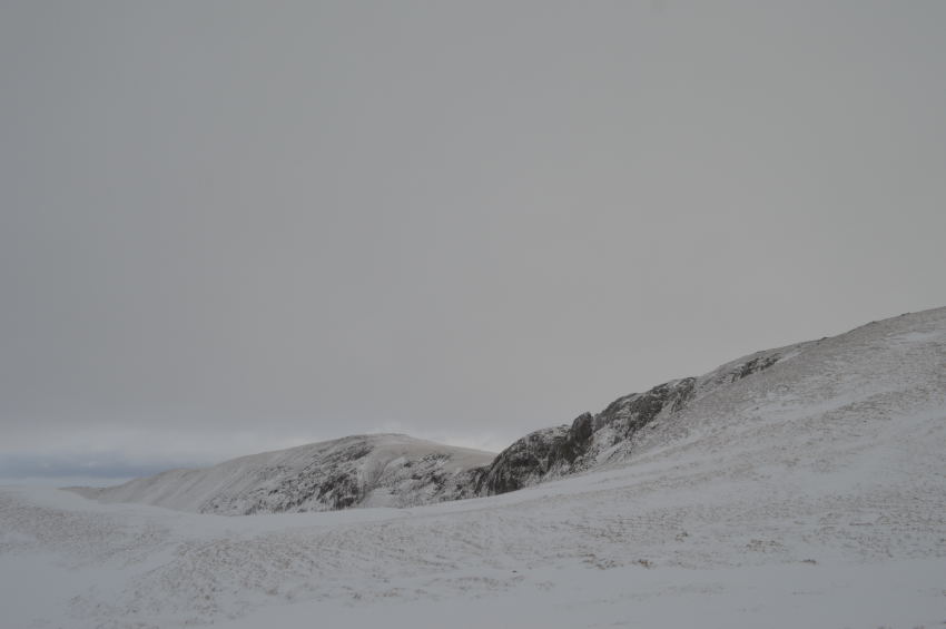
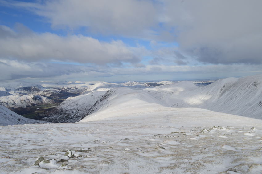
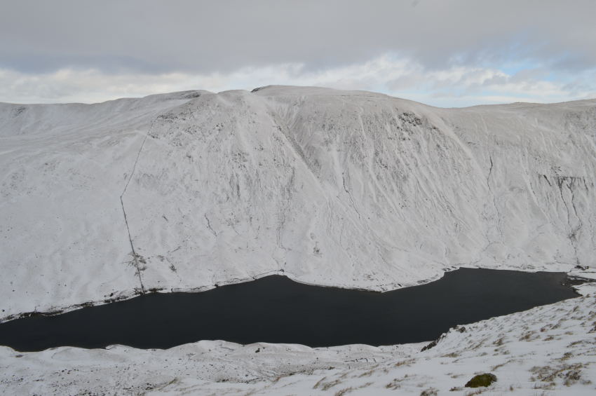
| Rough Crag & Long Stile seen under winter conditions, beyond, Harter Fell (Mardale) |
| It was a look at your boots kinda ascent right up until reaching the summit shoulder where I stopped to take a look down on Rough Crag & Gaspel Gate Tarn which was completely hidden through snow & frost. |
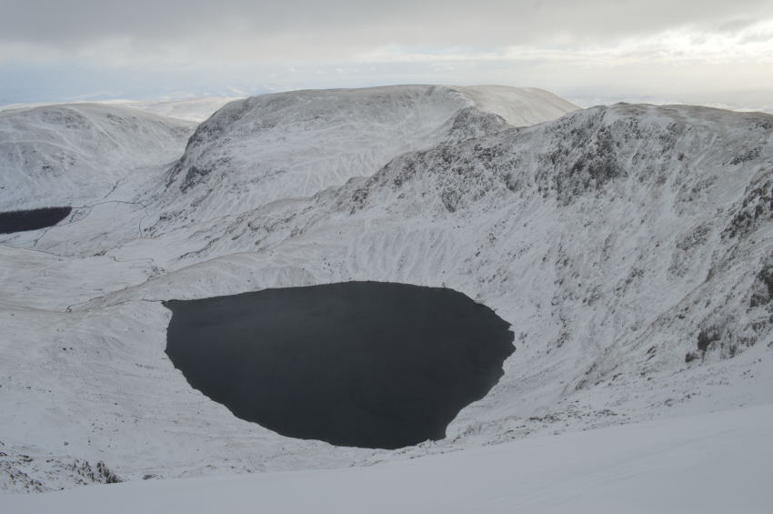 |
| Peering down over the edge to get views of Blea Water. |
| Around the summit area, in particular around the top of High Stile were a considerable snow cornice had formed along the east faces slopes, which meant careful footing took precedent. |
 |
| Here, views over the Rough Crag Ridge, Mardale & Haweswater. |
I asked myself the question would I have climbed High Street today from Mardale, although the ridge looked tempting but the fact that I couldn’t see one car at Mardale Head suggested the road might have been a little too icy to deal with.
With this I turn tail & head for High Street summit trig point. Here, the summit area has a healthy covering of snow which typically accumulates into drifts along the stone wall, the path between High Stile although as short as it may be was completely frozen & had to be avoided for much of the way. |
 |
| Arriving at High Street summit. |
| It was here that I expected to bump into more walkers yet I found it to be deserted, the walkers I had seen previously must have left & were well out of sight, which meant that of course I had High Street all to myself. |
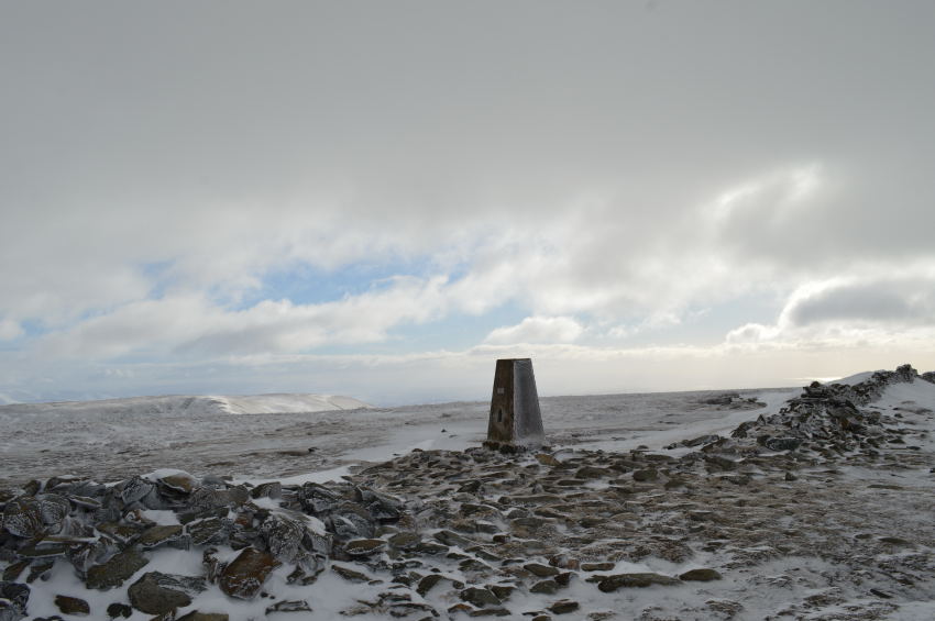 |
| High Street summit trig point. |
Despite having High Street to myself summit time was brief as I tapped at the summit trig with one hand as if to say hello again. The light had really started to brighten up during my time spent at the summit as Harter Fell in the background seems to have a covering of blue sky over it.
As quickly as I had said my hello’s I said my goodbye’s, before I knew it I was heading towards my next summit of Thorthwaite Crag, where, I broke into song…
I had to, it was the only thing that took my mind of the severe wind chill! |
 |
| Harter Fell (Mardale) seen with Mardale Ill Bell. |
| |
 |
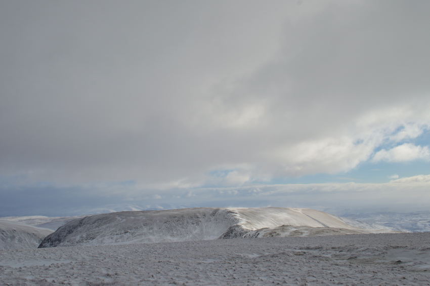
| Thornthwaite Crag beacon appears with the Coniston Fells in the far distance. |
I felt I had coped well with the severe wind chill, that was until I passed the top of Hayeswater Gill (R) where the wind chill blew so cold this was undoubtedly the coldest part of the whole walk, a part of which I yearned for the shelter Thornthwaite Crag would provide.
Even the singing stopped. |
 |
| The Ill Bell Ridge. |
| But not the photography, not when presented with views such as this, I could have stood & watched the spin drift whip up on Ill Bell all afternoon. |
 |
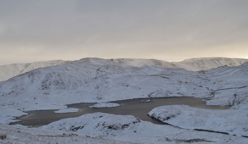
| Gray Crag, Hayeswater, The Knott & Rest Dodd from the top of Hayeswater Gill. |
| |
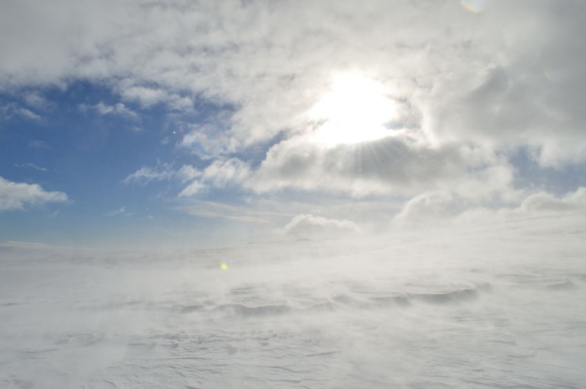 |
| Beautiful, memorising spindrift. |
Before reaching Thornthwaite Crag the sun came out which illuminated the whiteness of the snow, it was numbingly cold to watch the spindrift but captivating too.
I only had a matter of forty or so feet to gain before reaching Thornthwaite Crag summit, but, heavy snowdrifts had built up in the direction that I was taking which left me no other choice other than to walk over them, all the while being watched by three walkers who arrived shortly before me from the direction of Froswick. I didn’t look up as once again my legs sunk up to knee high in the drifts, all the while being pounded by spindrift. |
 |
| The Ill Bell ridge with a distant Windermere. |
I got a cheery hello by the time I arrived, the three walkers who had just arrived were sitting out the wind behind the cairn, one of whom was holding up a wind meter which read 27.4 mph with a whopping -13.1° Wind chill, I smirked whilst wiping my nose & they too saw the funny side which I can only put down to being Brits.
Within the rocky crops I found myself somewhere to sit down to take a small rest, the chance of eating under such conditions were slim so I just ate away at a breakfast bar that I had with me which would do the job until I was back at the car. Again, downtime was kept to a minimum due to the severity of the wind chill. |
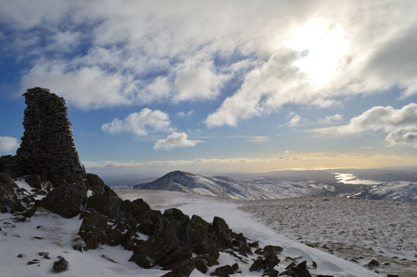
 |
| Time to leave Thornthwaite Crag, not before one last look back. |
| |
 |
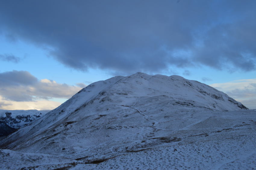
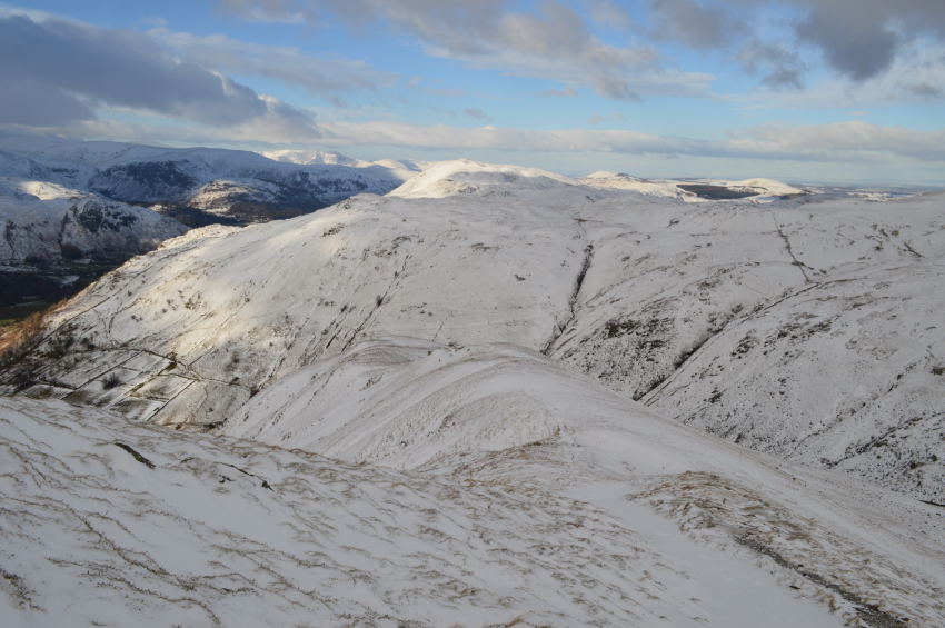
| Descent on Gray Crag. |
After leaving Thornthwaite Crag I soon passed a walker nestled down just off the summit shoulder, he was quite difficult to spot through the spindrift yet we both managed to raise our arms to one another.
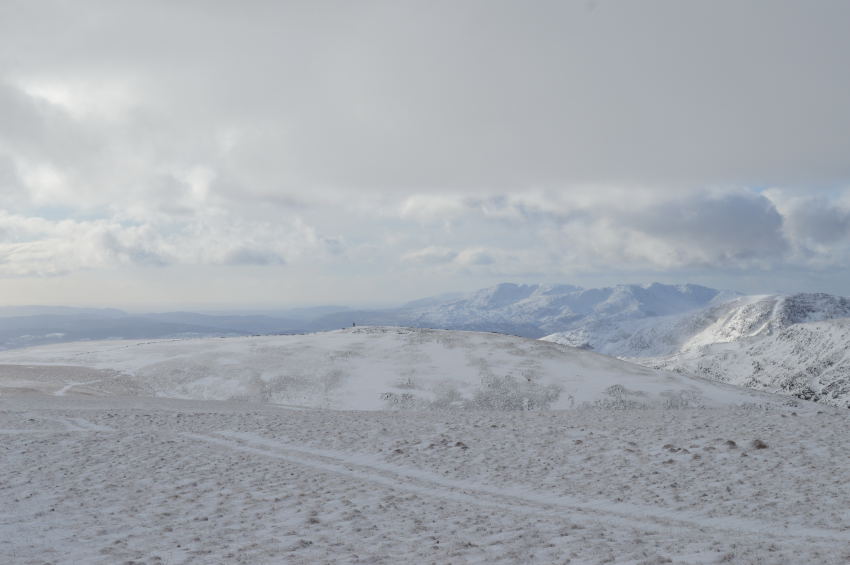
Ahead of me two walkers are leaving view, I witnessed them from High Street arrive at Thornthwaite Crag who were by now a good distance away along the Gray Crag ridge. The sun had come out to take in my last summit of the day, and once more, I had the fantastic ridge of Gray Crag to do it all under.
Good times. |
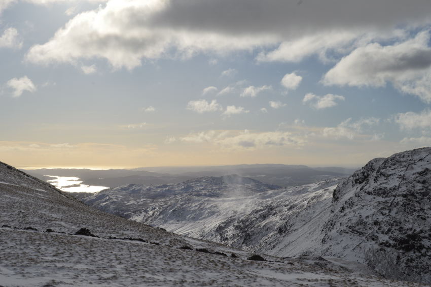 |
| Windermere appears as a golden glow seen over Threshthwaite Mouth. |
| |
 |
| Here, looking back up to Thornthwaite Crag. |
| |
 |
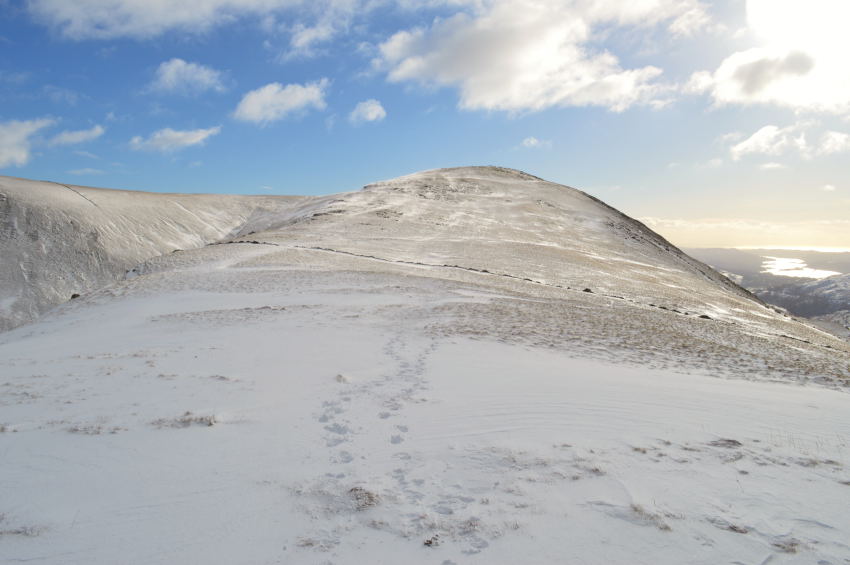
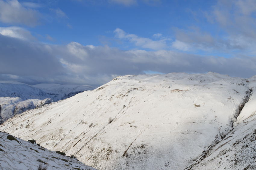
| Cray Crag summit appears closer. |
| The ridge crossing of Gray Crag was fantastic as the sun & spindrift whipped up beneath my feet, the sun was by now doing its best to leave its warmth across the back of my neck. This came with such a welcome as by now I had been walking headlong into the cold wind, it’s amazing however, what a little sun can do for morale. |
 |
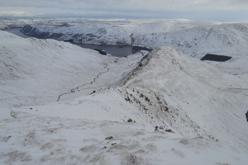
| High Street seen towering above Hayeswater. |
I had all intentions of a summit photo, that was before I bumped into two chaps who stopped me to ask for advice, do you think we’ll make High Street they asked? I looked at my watch, it was 13.50pm to which I replied, you might yes but it’s unlikely you’ll be down before dark, One of the fellows thanked me for my advice, his mate then went onto ask? what about down there, pointing at Pasture Bottom, well I explained, it’s a steep descent from Threshthwaite Mouth into Pasture Bottom, one of which even with Crampons could be tricky, it’s entirely up to you but why not just make for Thornthwaite Crag & return the same way? enjoy rather than rush I went onto say.
I again was thanked for my advice, they were nice fellows who had clearly set off too late, a common problem during the winter months.
Bugger, I forget to get a summit photo. |
 |
| Descending Gray Crag. |
The two walkers who I had been following along the ridge had just disappeared from view, the descent from Gray Crag is steep even during the summer months so care was taken under the conditions hence why I had caught up to the two walkers who in turn, must have took their time here.
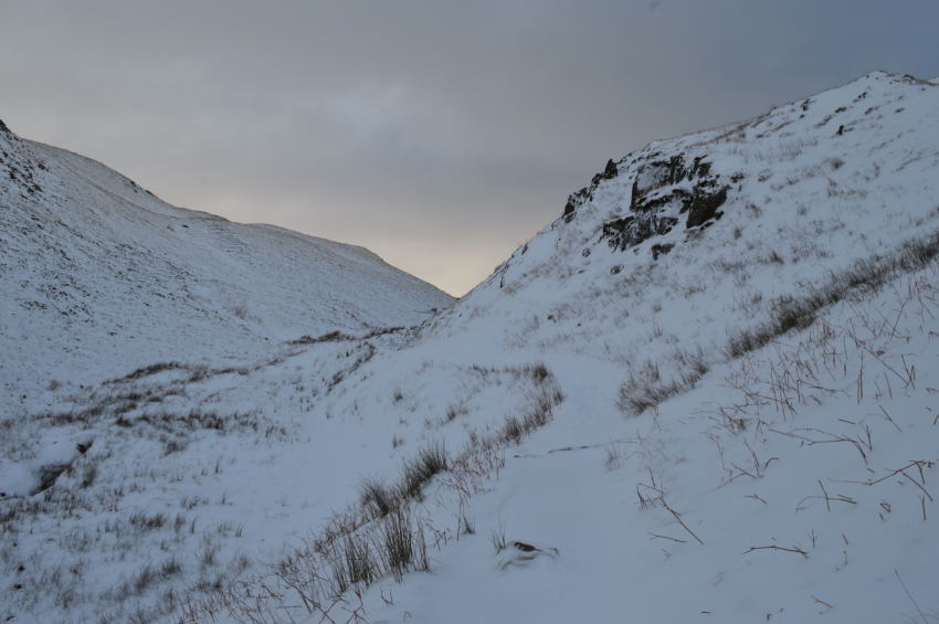
I had two options on how to descend the final ridge of Gray Crag, option one was to follow the nose off the fell which is steep & difficult to follow, option two as always for me is to follow the ridge towards the end before taking a sharp right where a path can be picked up that descends gradually towards where the new footbridge has been erected over Hayeswater Gill. |
 |
| Brock Crags under glorious winter sunlight. |
Under a strong winter sun my walk is almost coming to an end, all around me I spot dots coming off the fells that turn into large walking groups by the time we all congeal at Hayeswater Gill. Like me some walkers look tired & have a look of sunburn etched across their faces, but we all know that this is windburn. The moisture from my lips has been wicked away by the chill as I yearn for the warm coffee that is waiting for me in my boot.
And with that the comfort of a fresh warm pair of socks that I’m going to treat my feet to for the return journey home. Another fine day in Winter Lakeland. |
|
| |
| Back to top |
 |
|