|
The Harry Griffin 2,000 footers Walk 1 -The Langdale Pikes |
 |
 |
21st February 2015 |
 |
|
Choosing which walk to take on first was going to be difficult as many of the routes require a full day on the fells with a healthy appetite for a solid days walking. After spending many an evening thinking about it The Langdale Pikes was the route that kept on coming back to me in that it ticked all the boxes for winter conditions & not to mention our February light window.
Although I have climbed the Langdale Pikes many times never have I followed a route the same as Harry Griffin planned which appealed to me for so many reasons, in fact all 27 routes that Harry planned are almost new to me which gave me a whole new feel to the project.
In todays walk I have kept to the route for much of the way, however as you will read due to lack of daylight I sadly could not go off exploring untrodden paths or crags that Harry Griffin did when as he illustrated back in June 1977
For the rest of the walk I followed in Harrys footsteps as fell walker almost seventeen years his junior, this walk was a starter, a teaser of what was to come, I couldn't have chosen a better day to kick my new project off by. |
|
| Freeman of the Hills |
 |
| |
'The Langdale Pikes'
-The best known skyline in Lakeland is the battlemented profile of the Langdale Pikes |
| Harry Griffin |
|
|
| |
|
Overview |
|
|
| Ascent: |
3,540 Feet - 1,079 Meters |
| Summits over 2,000 ft |
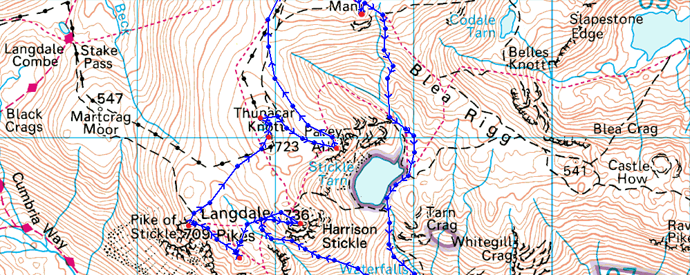
9,Harrison Stickle - Loft Crag - Pike O'Stickle - Thunacar Knott South Top - Thunacar Knott North Top - Pavey Ark - High Raise (Langstrath) - Ullscarf - Segeant Man |
| Weather: |
Sunny to start turning overcast through to midday, lighter spells of sunshine, Gust across the summits Highs of 6°C Lows of 3°C Feels Like -2°C |
| Parking: |
Stickle Barn, Great Langdale |
| Area: |
Central |
| Miles: |
11 |
| Walking With: |
On My Own |
| Ordnance Survey: |
OL6 |
| Time Taken: |
7 Hours 20 Minutes |
| Route: |
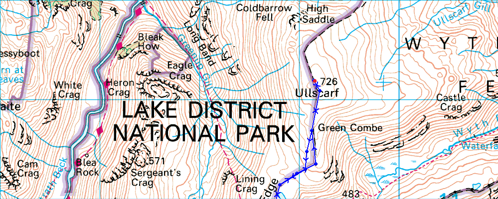
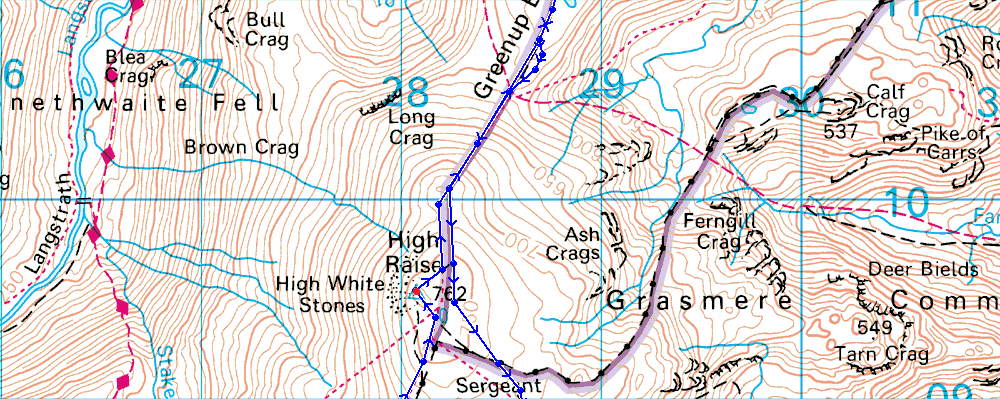
Stickle Barn - Pike How - Harrison Stickle - Loft Crag - Pike O'Stickle - Thunacar Knott - Pavey Ark - High Raise - Low White Stones - Greenup Edge - Ullscarf - Greenup Edge - Low White Stones - High Raise - Sergeant Man - Stickle Tarn - Stickle Ghyll - Stickle Barn |
|
| |
|
Map and Photo Gallery |
|
|
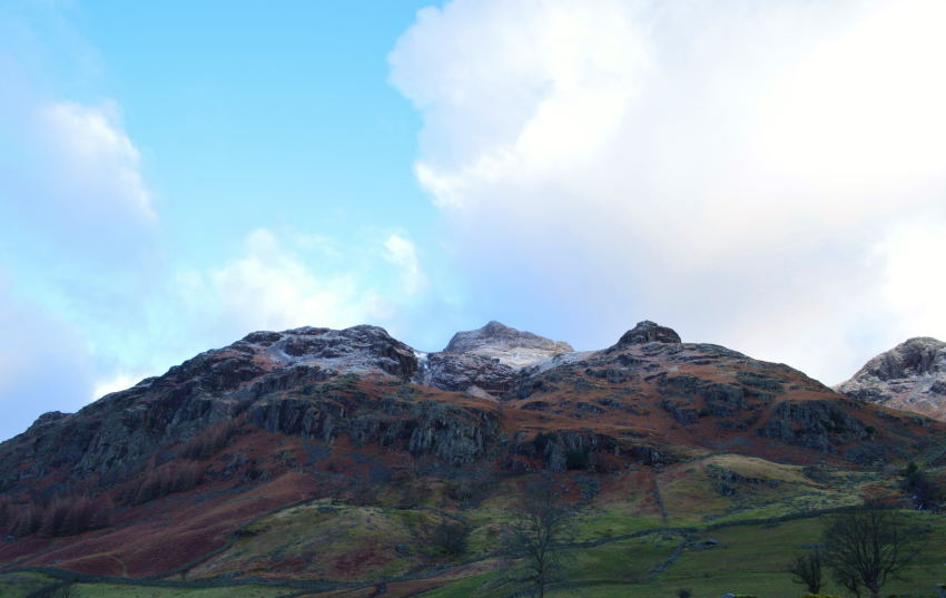 |
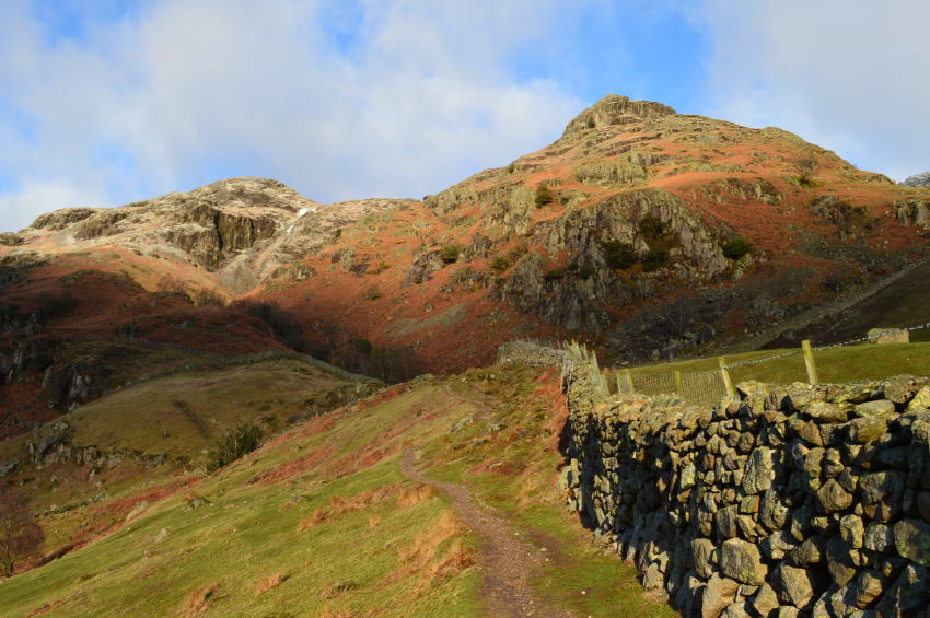
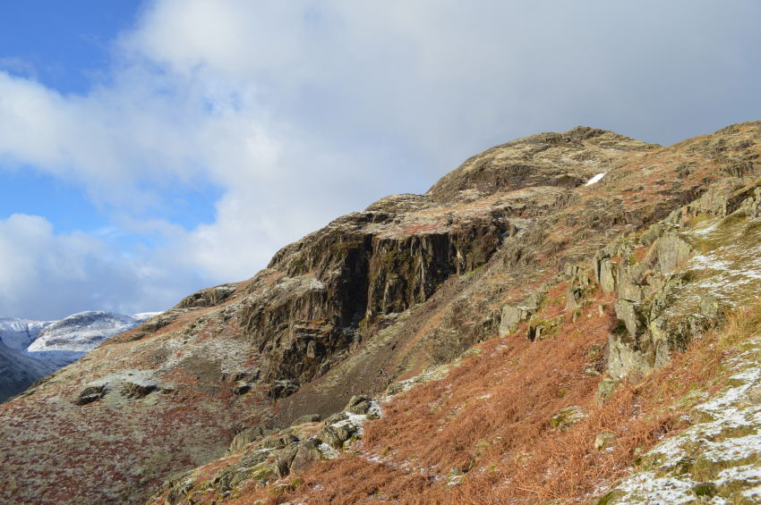
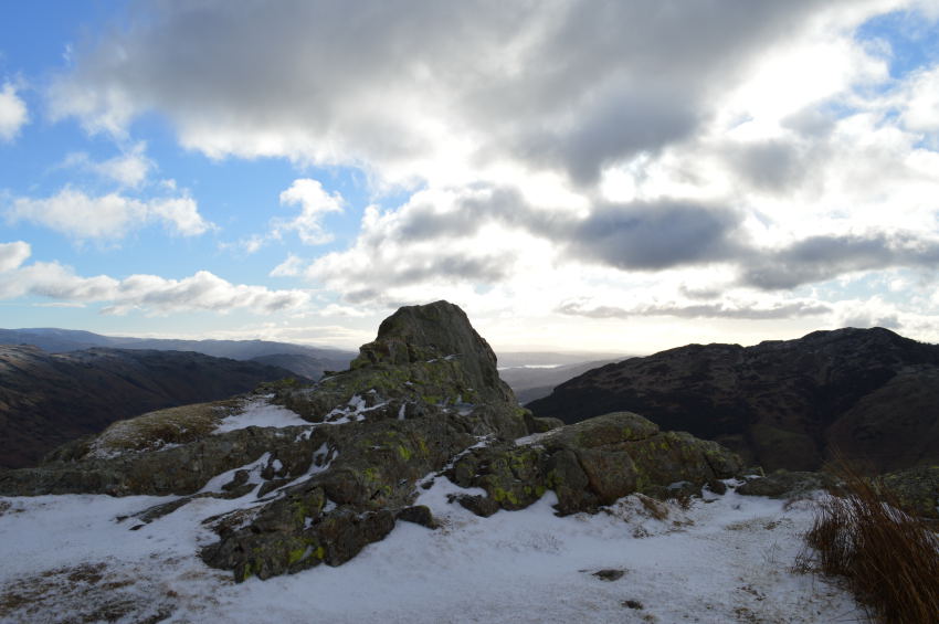
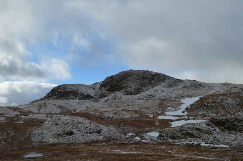
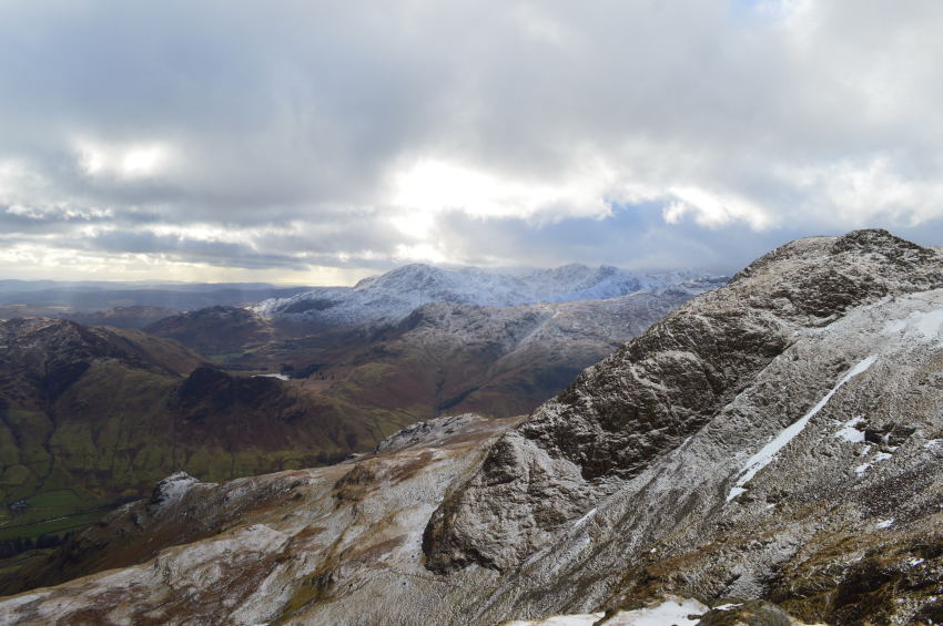
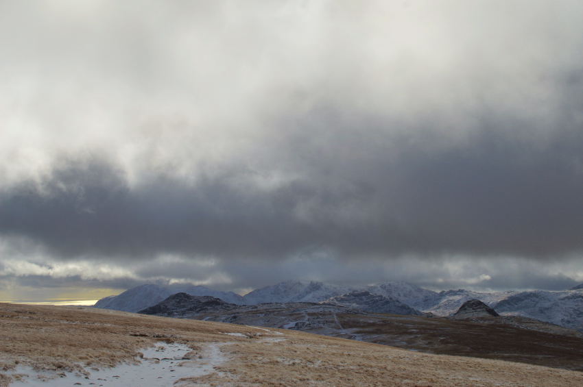
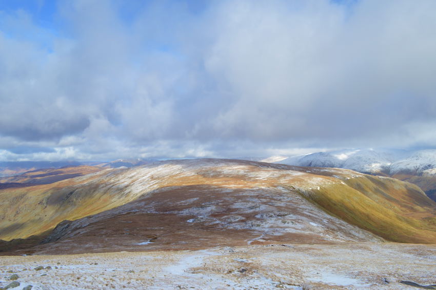
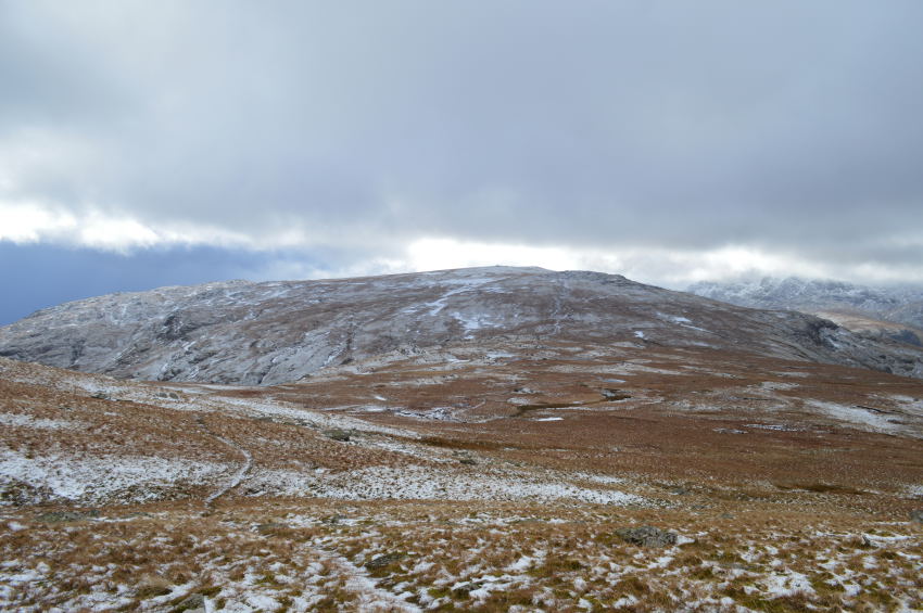
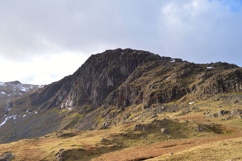
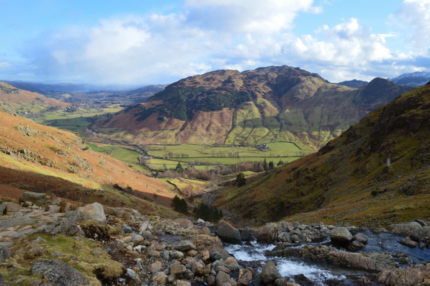
| Thorn Crag, Harrison Stickle & Pike How from Stickle Barn 08:08am 3°C |
The early morning sunrise didn't go unnoticed through my rear view mirror as I drove north, a sure sign that Spring is just around the corner, couple that with the S.A.D syndrome that I always deny I suffer from is more than welcome in more ways than one. By the time I reached Windermere the sun was rising which shone low beneath the cloud creating a pink effect across sky, it's fair to say that this is a landmark morning in that it's probably been close to six months the last time the sun was up before I had laced my boots up.
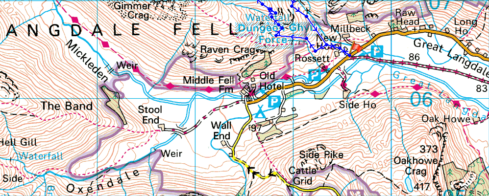
Great Langdale was reached shortly afterwards where I arrived at a deserted Stickle Barn car park choosing my parking space close to the entrance as I wanted to double back onto the road if not only to plot todays route onto Pike How, not by Stickle Ghyll but by Dungeon Ghyll.
With no clear route sighted I returned back to the car making star fists with my hands as the morning air had a most definite nip to it as I made sure to throw my jacket on before lacing my boots up. I had to second guess my gear as my last two walks had been mild causing the usual discomfort when kitted out in full winter gear, so, this morning I had a mix of my fleece layered Rab waterproof trousers with one long sleeve Mid Layer & a thin T-shirt to go under, then to top things off I threw on my fleece neck gaiter which left that warm blanket on a cold day effect on me.
With the car locked I set off in eager anticipation to get my first 2,000 footer underway, not before picking up the main path behind Stickle Barn where I came to an immediate stop. |
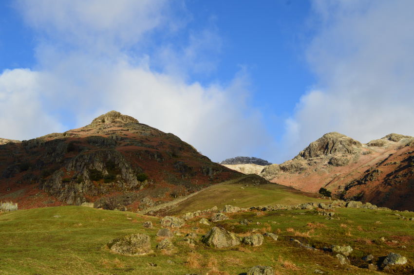 |
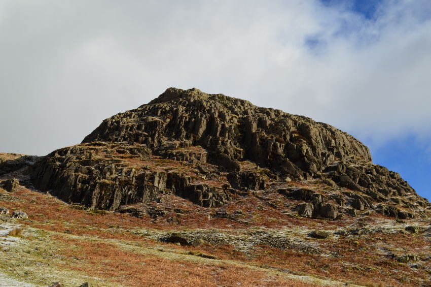
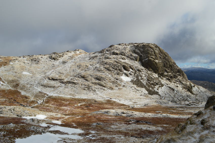
| Pike How, Pavey Ark & Tarn Crag seen shortly after leaving Stickle Barn. |
| Options opened up as soon as I hit open fellside, it was tempting to stay on the broad path which follows Stickle Ghyll on both sides, however my route today as already mentioned would see me navigate Dungeon Ghyll & Dungeon Ghyll Force before a steep climb to gain Pike How, which meant as soon as I had left Stickle Barn behind me, it was time for a left turn. |
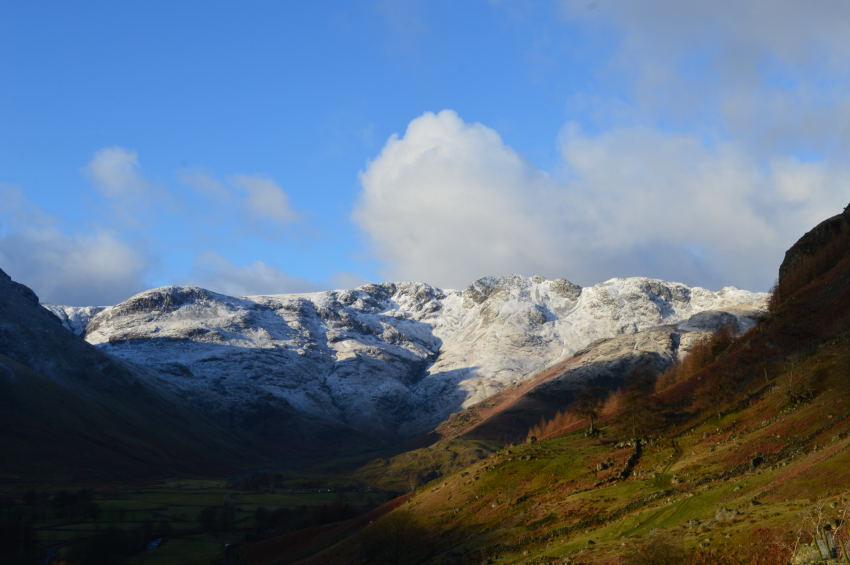 |
| Here, Crinkle Crags & The Band can be seen in first light casting shadow over Oxendale below. |
| |
 |
| Thorn Crag seen with Pike How. |
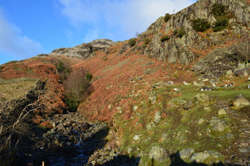
| After a gentle rise along The Cumbrian Way I arrived at a wooden gate where I took a right turn, here the prominence of Pike How stands out & fills my vista. Dungeon Ghyll falls away to the left forming a deep ravine from where I will pick a narrow path up that follows the ravine beyond Dungeon Ghyll Force, but, all that is a little while away yet. |
 |
| Dungeon Ghyll lower ravine. |
By following the wall seen in the previous photo I soon arrived at Dungeon Ghyll lower ravine, again I had options in how to gain Pike How by; one of which lead away by continuing to follow the stone wall. My route soon became apparent as a faint path formed through the bracken duly noting how close the path stuck to Dungeon Ghyll by.
I disturbed a small heard of sleeping sheep as I broke away for my path the ground underfoot was wet & soggy as my ears were filled with the sound of cascading water, a sound that any walker even though here I could not see it, would never tire off. |
 |
| Here, rewarding views as I glance back over Great Langdale. |
| |
 |
| Thorn Crag shortly after passing Dungeon Ghyll Force. |
My narrow path followed the course of Dungeon Ghyll as it fell away at times vertically into deep chasms into the ravine, views here were further hampered by trees that blocked any site of Dungeon Ghyll Force until at times I would arrive at a spur of short waterfalls or a fast flowing narrow band of water that disappeared through treeline or fell sharply, although I saw little of the Force itself the sound of the cascading water was a fantastic comfort which took the mind off the steep climb.
Here the lay of the land was telling me I needed to head straight up as I took sharp right turn - pin pointing large boulders to steer my route by, fortunately I picked up a faint path that lead me through fallen bracken, thoughts turned to how lucky I felt at this moment as in just a couple of months this whole area & indeed the narrow path would have been completey hidden by thick bracken.
My route was steep as ever so slowly the summit of Pike How rounded behind a wall of crags, from here I could see a much wider path rising steadily beneath the crag that fell below the summit itself, this is where I needed to be.
Once more I set my eyes on fixed objects whether they be boulders of gorse bushes, the line of which they lay were as good as any map & before I knew it I was standing on the main approach path beneath Pike How summit. |
 |
| Thorn Crag now dominates the view. |
| |
 |
| Pike How. |
| I was still well below the snowline as I contemplated an attempt on whether I summit Pike How, after all it wasn't on today's agenda but I knew that even so, I'd probably regret not doing so. In Harrys Griffins route he too optioned out of summiting Pike How, instead opting to scramble all the way up Dungeon Ghyll itself, this is where walker defers from climber I guess. |
 |
| Harrison Stickle seen over Dungeon Ghyll middle ravine. |
| |
 |
| Harrison Stickle seen with Thorn Crag over Dungeon Ghyll middle ravine. |
If I had to choose from the many highlights from todays walk the view over Dungeon Ghyll towards Thorn Crag & Harrison Stickle had to be amongst the best that I took away, the whole scenery changed with the light leaving a magical effect on the way the Pikes looked.
I probably stood on this exact spot far too long as I started to notice the sweat had started to freeze across my back. It was here I called time before returning back to the main approach path.
I was soon back on the path which broke away from Dungeon Ghyll & followed a steady climb around the back of Pike How, having only used this route once (unrecorded) around 2007 It had completely slipped my mind in just how easy a summit of Pike How would be as it was only a short double back from the approach path to gain its summit. |
 |
| Pike How summit. |
| |
 |
| Thorn Crag & Harrison Stickle seen across the saddle ridge. |
| Although the path here looks steep it was actually easy & enjoyable walking all the way towards Harrison Stickle summit shoulder. |
 |
| With commanding views back over Blea Tarn, Pike O'Blisco & The Coniston Fells beyond. |
| |
 |
| Thorn Crag seen above the upper ravine. |
| |
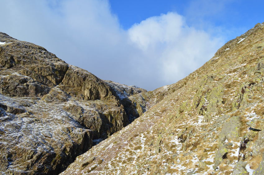 |
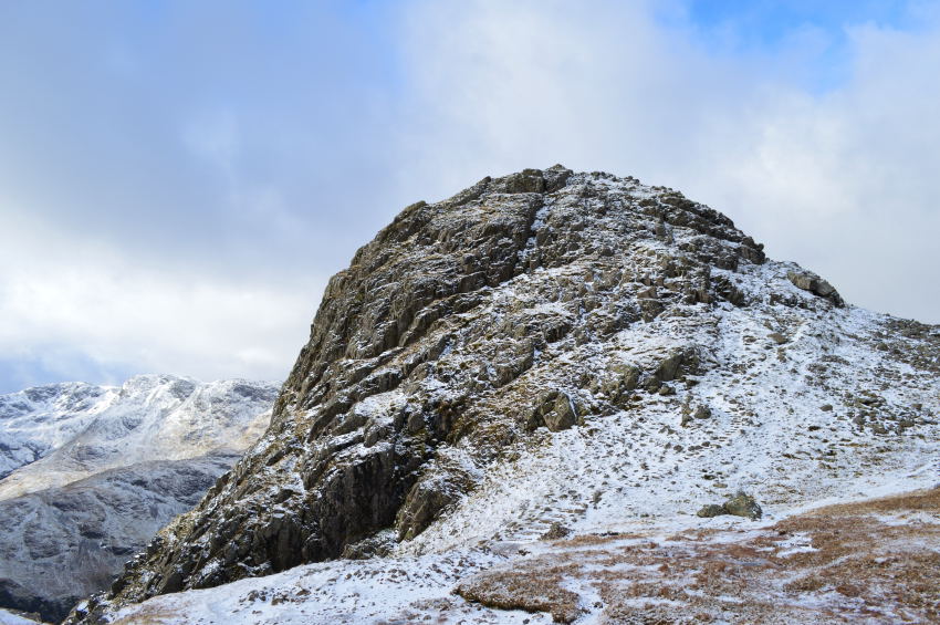
| Approaching Harrison Stickle south - west buttress. |
By the time I had reached Dungeon Ghyll upper ravine I stopped to way mark out my route ahead. Dungeon Ghyll upper ravine lies ahead but to reach it a traverse must be made across the south west buttress. There is a ledge like path to follow which takes you up & over small rock scrambles, care must be taken towards the end as the ground falls away steeply over Dungeon Ghyll.
I could see faint paths tracing direct routes up the south - west buttress which looked awfully tempting especially as the side of the mountain was blessed in warm sunshine, however, I stuck to my traverse path which lead me onto a more prominent path a little further on.
After being mightily impressed with the views into Dungeon Ghyll it was now time to make a purchase on my first summit of the day, again I saw narrow break-away-paths although I knew if I followed my path a while longer I would soon reach the main summit approach path. |
 |
| Sporadic light show over Harrison Combe with views of Crinkle Crags & Bowfell, in the foreground, Loft Crag & Pike O'Stickle |
I gained healthy ground on the summit as I encountered a lack of light which meant I could concentrate on the climb instead of the views, in the distance Bowfell summit is topped by dark cloud pushed along by 40mph plus winds, it was no place to hang around.
The approach path was completely frozen over, more so with the height that I was quickly gaining, my only answer was to use the grass which made for good purchase as it was covered in crunchy snow which helped with grip. |
 |
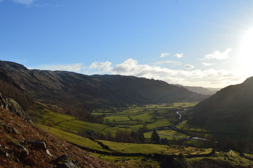
| Great Langdale from Harrison Stickle summit. |
| I was soon at the the summit where I was treated to fine views over Great Langdale but nothing could take the thought away from the wind that bit at the side of my face, only a couple of summit shots were sadly taken here. |
 |
| Views over Pavey Ark & Stickle Tarm from Harrison Stickle summit. |
| Although it was still early I expected to see groups gathering around Stickle Tarn yet from my lofty height I couldn't see a soul in every direction. After the briefest of summit times I turned boot & headed back the way I had came following my own boot prints all the way back to Harrison Combe. |
 |
Loft Crag (R) seen with Thorn Crag (L) over Harrison Combe. |
Anyone who can read a map will tell you that the Langdales are amongst the easiest fells to group summit once the main height had been gained, made more easier today by the frozen ground underfoot.
I picked my way over Harrison Comb following the wide path that crosses the early stages of Dungeon Ghyll where here it flows as a gentle stream. My path navigates around a column of crags before doubling back, it was before I round said crags do I spot a cheeky faint path which lead me directly onto Loft Crag's lower shoulder from where a short walk is required before reaching the summit. |
 |
| Harrison Stickle catches a hint of sunshine seen shortly before I summit Loft Crag. |
| From here you get a great view of the south-west buttress, the path can now be seen running along the upper ravine over on the right hand side. |
 |
| Pike O'Stickle from Loft Crag summit cairn. |
| |
 |
| Here, Bowfell & Rossett Pike can be seen over Mickleden, with views of Pike O'Stickle which is where Im heading next. |
| |
 |
| Stickle Breast. |
By now it felt good to be collecting summits one by one as I knew I hadn't even reached the halfway mark as yet, Pike O'Stickle was next which meant a traverse over the deep gully to the west which was once home to the Neolithic Stone Axe Factory where Stone Axes were hand carved & have been found only as recently, in the River Thames. The start of the approach path can be seen in the lower centre of the photo where it steadily climbs towards a steep pitch of crags that require four point contact, other routes are available but all require care. Walking Poles can only be a hinderance here so I leave the both of mine at the bottom of the crags before plotting my route up the crag, after only a couple of good hand & footholes I break over the top of the crags from which the summit is just a short scramble over boulder away. |
 |
| Harrison Stickle & Loft Crag seen from Pike O'Stickle summit. |
Despite the clear weather & indeed the clarity the wind was biting once again, sadly yet again summit time was brief.
I now had the task of lowering myself back down the scrambly bit found just beneath the summit, there was no saving graces as I let my bum do most of the work which worked well! With the scramly bit over I looped my walking poles back over my wrist & set off for my fourth summit of the morning, Thunacar Knott. |
 |
| Not before taking one last photo of Harrison Stickle over Harrison Combe. |
| Did you ever enjoy those 'Where's Wally' books as a kid? Theres a fellow in a red jacket in this photo, see if you can spot him. |
 |
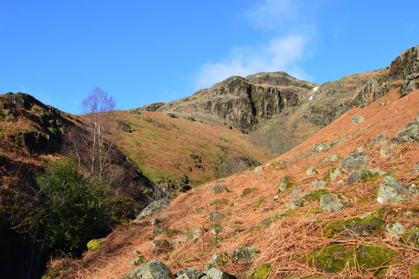
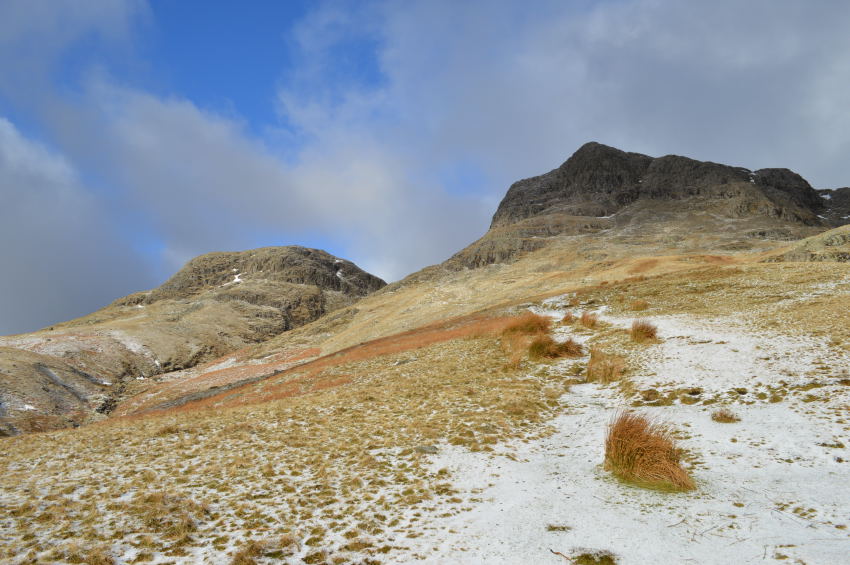
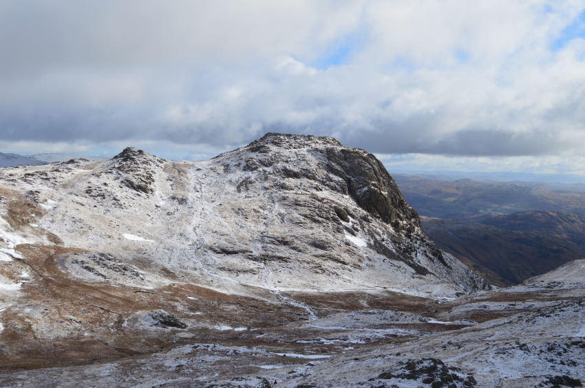
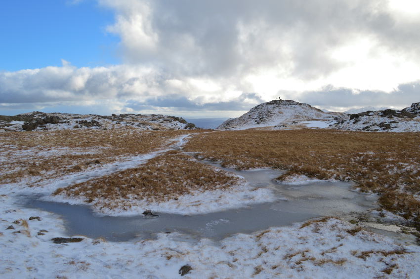
| Thunacar Knott waits ahead, as does High Raise in the distance. |
| It felt good again to be out of the biting wind, here I was able to work up a sweat as I detailed my way towards Thunacar Knott over what I would consider to be frozen ground but was soon proven wrong as my path retained its bog like status. |
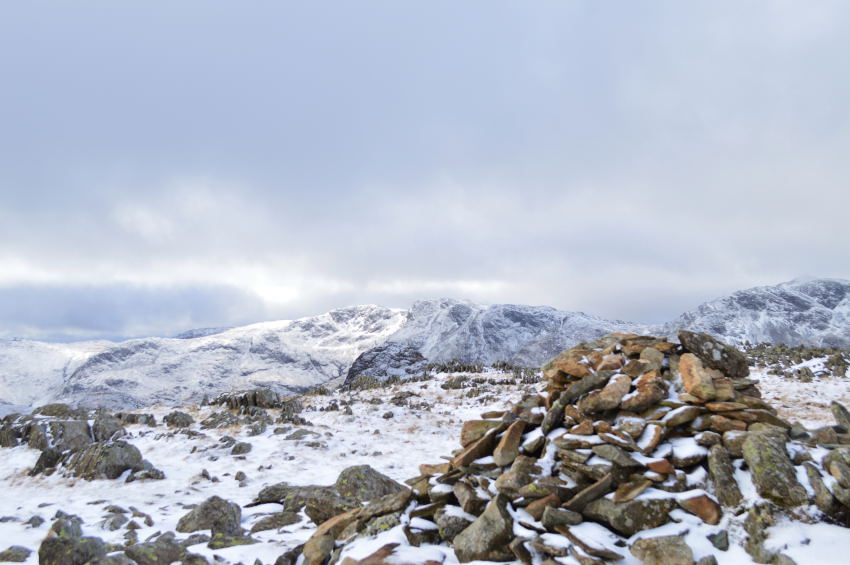 |
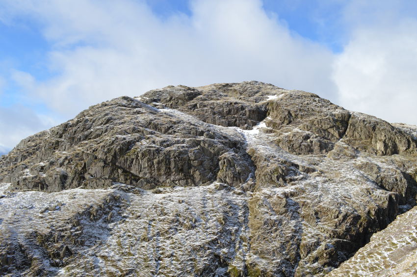
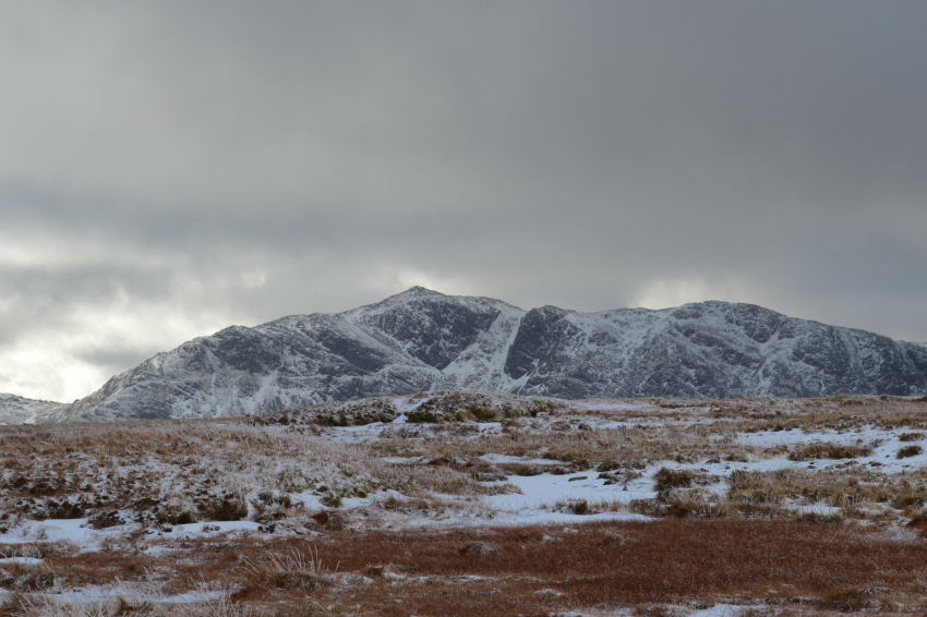
| Thunacar Knott (south summit) cairn with Bowfell & Crinkle Crags in the distance. |
| Despite the un-frozen ground between Pike O'Stickle & Thunacar Knott it didn't really take much time to reach the summit south cairn, ahead the north cairn can also be found which classifies Thunacar Knott as having two 2,000 ft summits. |
 |
| High Raise from Thunacar Knott (north summit) cairn. |
Footnote:
Harry Griffin respectively followed the distinguished summits first set by Francis Falkingham who stated that Thunacar Knott indeed does have two summits above 2,000 ft, however Francis Faulkingham also stated that Pavey Ark had none. In a time of modern day literature Harry Griffin then went on to blame Francis Falkingham's magnifying glass for the error!
As the crow flies it's a quarter of a mile from Thunacar Knott to Pavey Ark summit, but anyone who knows this area will know that a wide berth must be given as the ground is rich in moss which normaly means a lengthy detour to a higher purchase south east from where more stable ground could be found. |
 |
| Pavey Ark from Thunacar Knott. |
I spent time casting my eye & figuring out my route, the detour didn't appeal at all as I still had three remaining summits after Pavey Ark was reached, it was here I decided that I instead of the detour would just go for a crows eye route which despite the odd squelchy bits, I made it across to Pavey Ark with relatively dry feet
....and a runny nose. |
 |
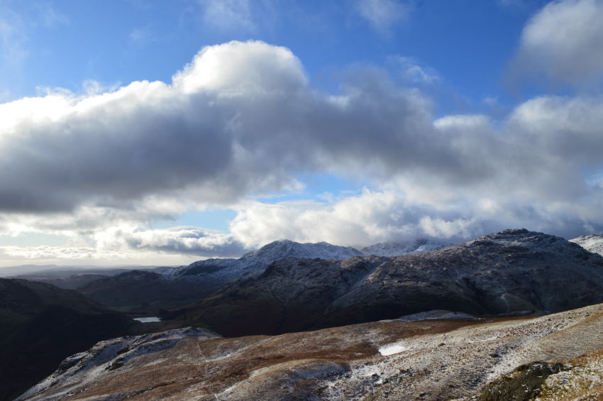
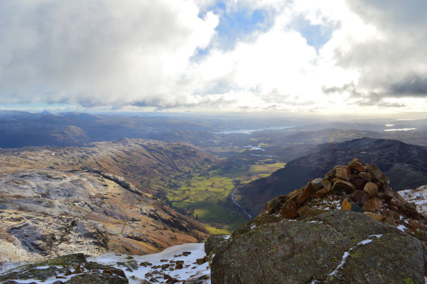
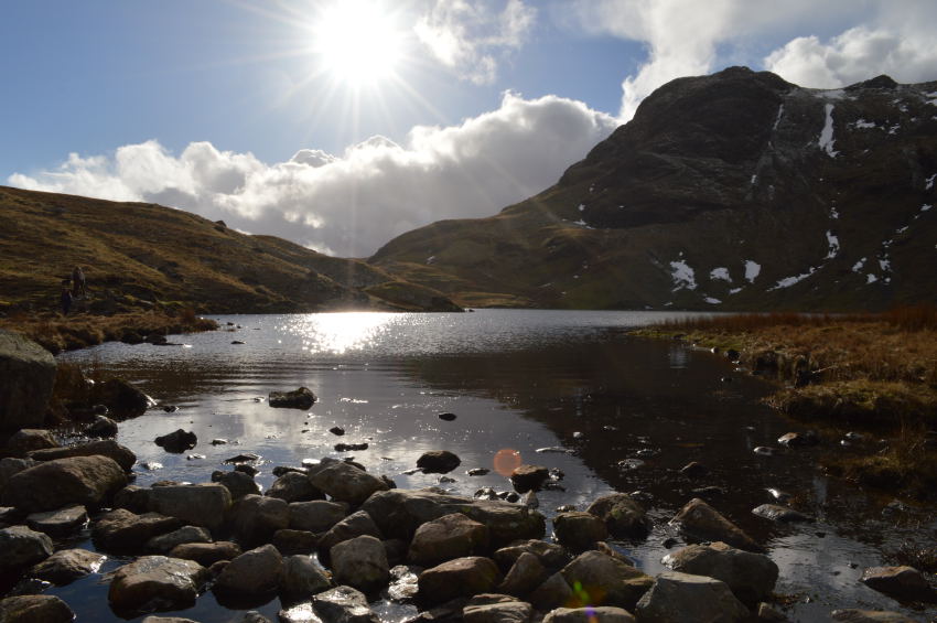
| Great Langdale,Windermere, Stickle Tarn & Lingmoor Fell from Pavey Ark summit. |
With hurried boots I made Pavey Ark summit in what felt like no time at all, from the top of the north rake two couples emerged one of which held a map to which I could only assume they were looking for the whereabouts of the summit which sits high above a broken stone wall which runs parallel across the summit plateau.
I didn't need to say much, just a slight wave followed by a smile as I strode across the wall in line for the summit, after a quick look back both couples were now heading my way which took me back to thoughts of how my first summit of Pavey Ark felt some years ago when If I recall, was gained by Jack's Rake.
Good times. |
 |
| Harrison Stickle & Pike How from Pavey Ark summit. |
| This would be my last view of Great Langdale for another four hours as I turned shoulder all the while wondering will I get lucky once more as I contemplate how I would get to High Raise from Pavey Ark, options opened & left me with two choices one of which would be a simple return to Thunacar Knott, this made easier by following my own boot prints, or I could risk a soaking by taking a short cut above the head of Bright Beck. |
 |
| High Raise seen shortly after leaving Pavey Ark. |
I figure I'd had a good feel for the ground since leaving Pike O'Stickle to take my chances with a direct route towards High Raise, it was tempting to do this as I took a direct line keeping to higher ground between the far left snow patches off centre in the photo.
My route worked well shortly before reaching the main pass linking both High Raise with Thunacar Knout, this was until the long grasses surely started to sink me under covering my laces in freezing cold water, lucky for me my boots held the water out & before I knew it I was on main path heading towards High Raise. |
 |
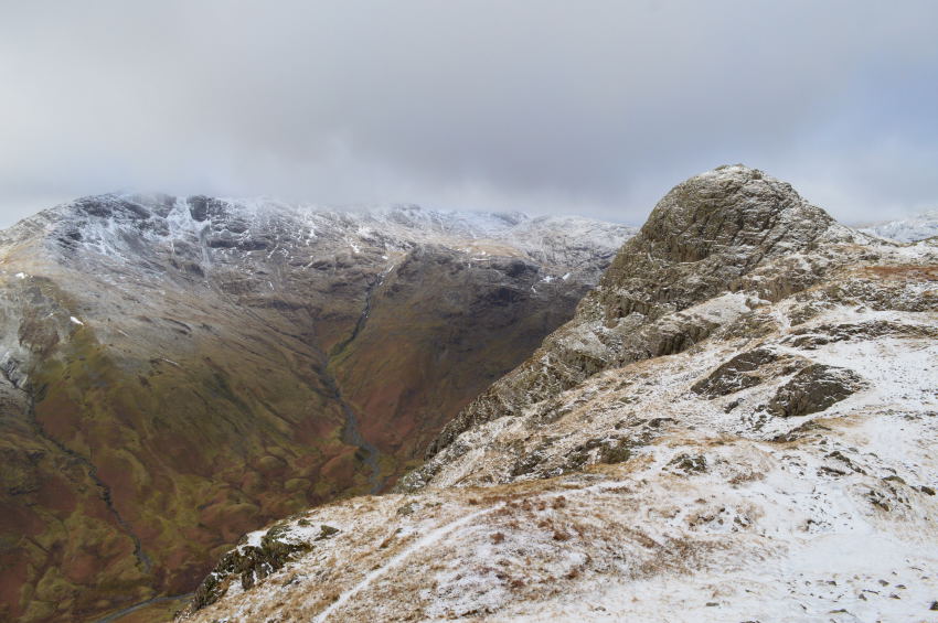
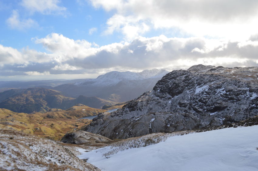
| Crinkle Crags & Bowfell seen shortly before arriving at High Raise summit. |
| |
 |
Looking back under over trodden ground with Pavey Ark off to the left & Thunacar Knot over on the right, the Langdales Pikes beyond. |
| |
 |
| Looking back on the Langdales Pikes with the Coniston Fell beyond. |
As I took on High Raise summit shoulder dark menacing clouds blanket the skies pushed along by fiercely cold winds that now started to feel relentless as my running nose started to resemble a tap which didn't need a wipe - as the wind took care of that side of things. |
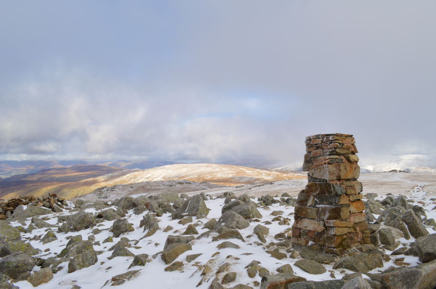 |
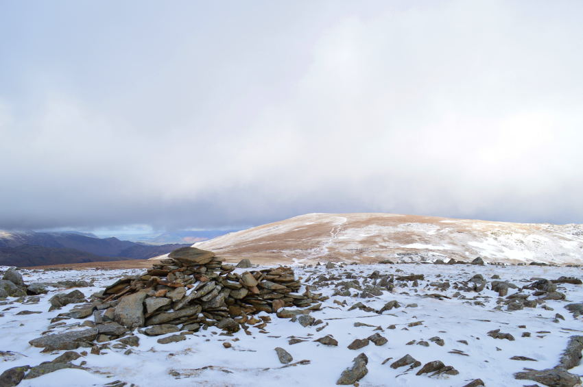
| High Raise (Langstrath) summit trig point. |
I soon found myself at High Raise where I had boosted morale by promising myself lunch whilst buried within the stone shelter which would have protected me from the biting winds, this was all to no avail as I closed in on the shelter only to find deep snow had accumulated inside, meaning that if I wanted any form of respite from the wind Id had to dig myself a seat which I did by using a hand sized rock.
Minutes later I was dug in close to the entrance and, out of the wind. It's amazing what just a few moments can do where one can collect himself, dust himself down before feeling completely fresh again all the while listening to the wind howl over my head while gazing down at my boots. |
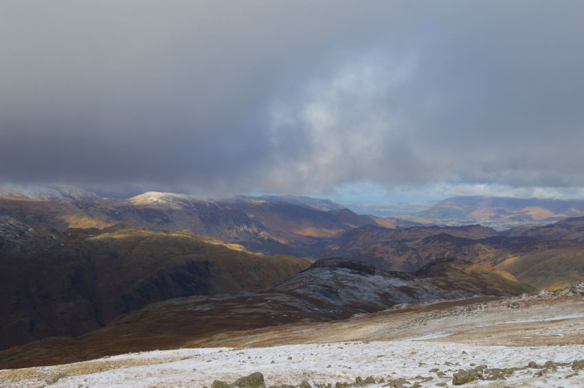 |
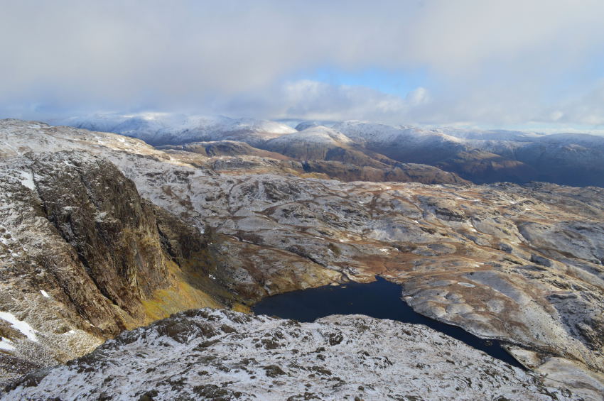
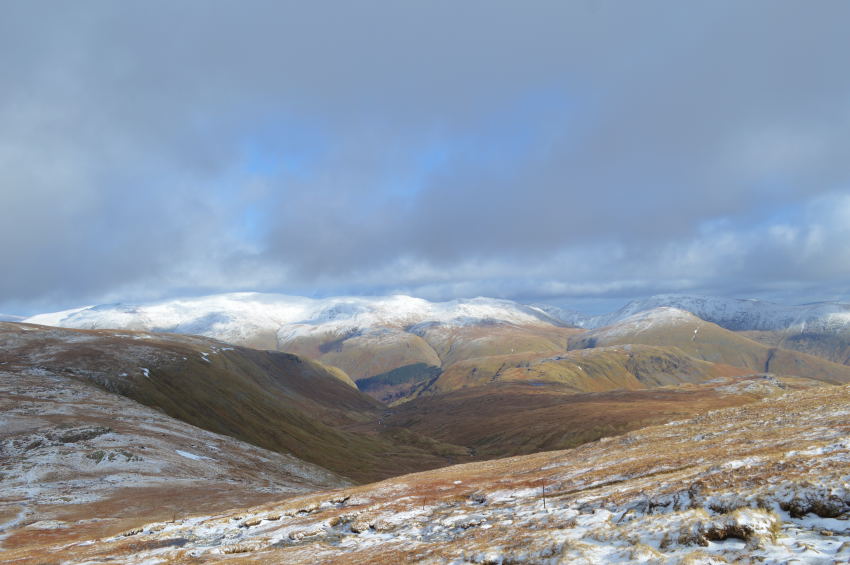
| Commanding views over the Borrowdale Fells as far as Basenthwaite seen in the distance. |
| |
 |
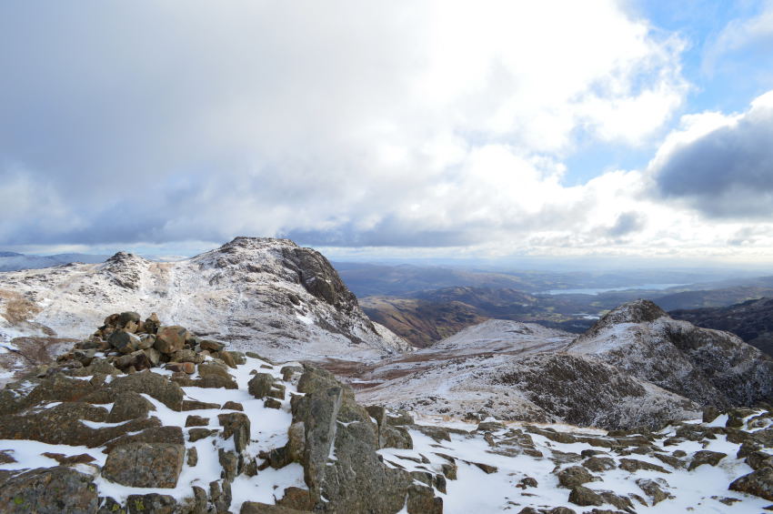
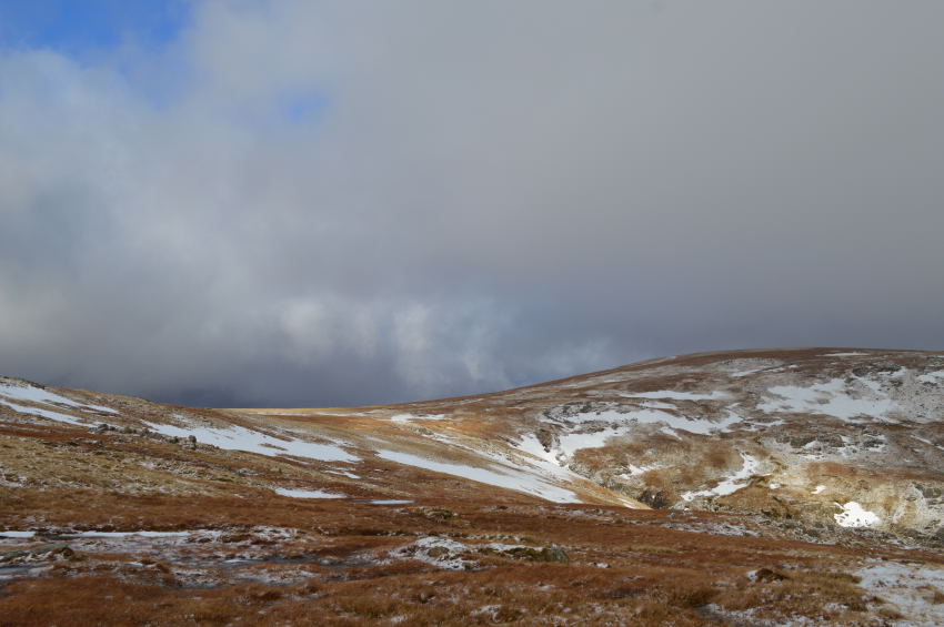
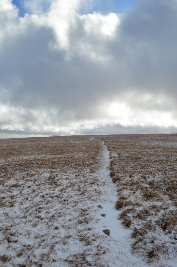
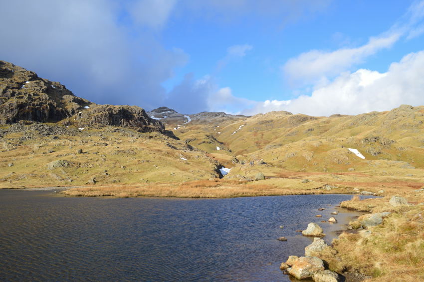
| Ullscarf seen from Low White Stones. |
Although I had collected five summits behind me it was here that I needed to put a fresh look both mentally & physically on the walk as i learned from earlier research that I now faced a four mile outward then inward walk back to this exact spot, which also included the descent from Low White Stones, the ascent on Ullscarf, descent once more from Ullscarth & finally the ascent back to Low White Stones.
Best not to think about it, just go for it. |
 |
| Greenup Edge from Low White Stones. |
I pondered on what I would expect to find the ground like as I descened Low White Stones, on any other occasion this area is commonly known to be wet even through a dry period, although I had been lucky with my boggy marches up until now I wondered was my luck about to run out.
For the third time today I was in luck as I kept to a narrow path which ran centre left of the ridge, my crossing at times wasn't without the odd bog hop which saw me sink up to my heels yet despite this, I figured I had escaped much of the bog due to the thawing out.
Ascent on Ullscarf despite its gentle rise from Greenup Edge was a little testing as my right calf started to cramp up, this was probably due to my lack of hydration & the fact that my bite valve had semi-frozen on my Camelbak.
Despite the freezing temperatures & howling winds not drinking enough hydration was a school boy error which now resulted in both my calf's cramping up...
But, I'll get to that in a little while. |
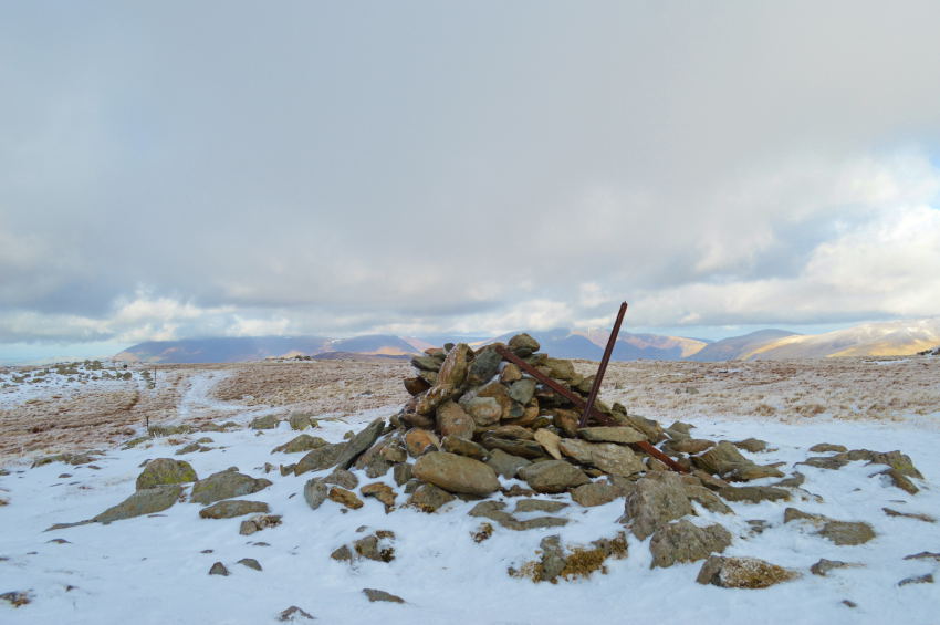 |
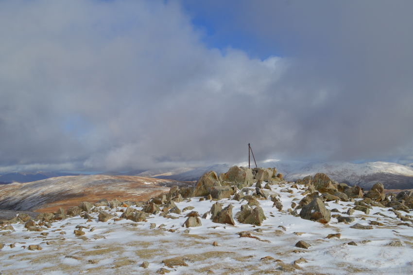
| Ullscarf summit cairn. |
I had a second wind not helped by my now twitching calf that flexed with severe pain every now & again 'walk it off just walk it off' I would utter to myself.
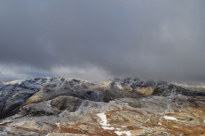
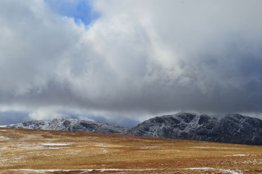
Ullscarf's stone summit cairn appeared over the undulating summit plateau & was a welcome sight for sore eyes as I drew closer. To the west Glaramara, Fleetwith Pike & the Gables poked through thickening cloud which had a purple haze to it, on any other occasion I would have been reaching for the hood but thankfully the cloud carried itself high south before unleashing snow showers over & beyond the Coniston Fells. It was quite a surreal moment which only lasted minutes at a point where I couldn't be any further away from my car if I tried. |
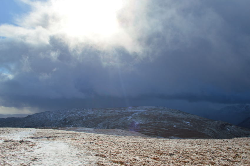 |
| Watching the snow showers pass. |
| I planned to spend more time than I actualy did whilst I was at Ullscarf summit but Low White Stones, & indeed High Raise beckoned. |
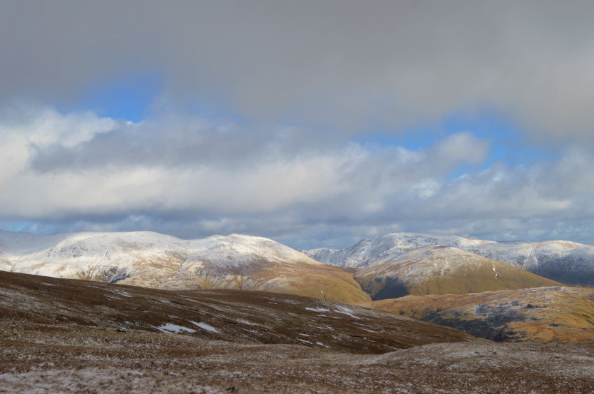 |
| Anyone on the eastern fells will be enjoying thier tropical like conditions. |
| Here Nethermost Pike, Dollywagon Pike, Seat Sandal, Fairfield & Great Rigg bask in wall to wall sunshine, I however am still thanking my lucky stars I managed to avoid those snow showers just now. |
 |
| The return trip over Greenup Edge with welcome views over High Raise. |
| I choose not to follow my footprints back over Greenup Edge instead opting to break away right as I descended Ullscarf summit. Ahead below Low White Stones I spot movement heading my way. |
 |
| Views into Wythburn & Steel Fell with the Helvellyn ridge still enjoying a lenghty hint of sunshine. |
After crossing Greenup Edge eyes were averted into the Wythburn Valley seen below, the group of walkers I had spotted earlier were by now descended into the Valley as I now took on the ascent back up to Low White Stones.
It's often those times you worry about something so much it starts to eat at you and this was what was happening to me the more I thought about this last ascent, my winter legs clearly weren't used to such excursions normally reserved for summer which lead me to a more severe bout of cramp in my right calf.
From Low White Stones a large group of walkers were now making their own descent as one by one they glanced over for a wave or even a mutter hello, what they got was myself trying to disguise the pure agony my right calf was now in as I waited for the cramp to pass, It was right there I could have quite literally swore out aloud.
After what seemed like the longest minute the cramp eased which lead me to place my right foot forward...oh crap here it comes again.
I wont swear here but I did under my breath quite a lot actually mostly words which began with the letter 'F' much like a broken record would, it hurt like hell as the calf muscle shortened & spasmed, my calf now felt like a brick, the pain was excruciating.
Not an experience I would want to repeat, but the cramp hadn't finished with me just yet.
I press on. |
 |
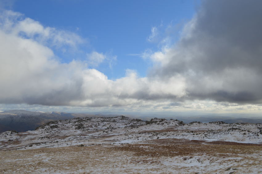
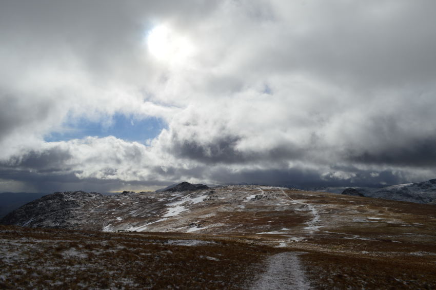
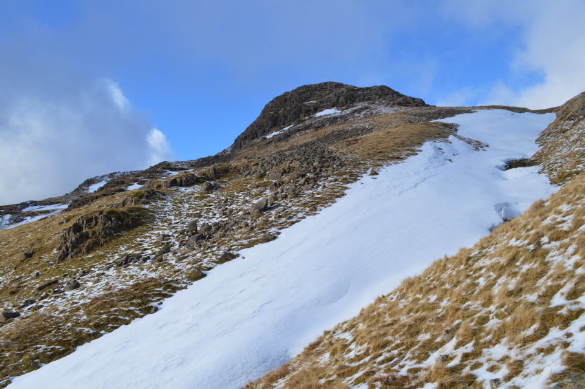
| Flanking High Raise for Sergeant Man. |
| For now it seemed I had managed to walk the cramp off although my right calf was feeling rather tender as I tried not to think about it too much, despite the niggling pain walking across High Raise eastern plateau towards Sergeant Man was another great highlight I took from the day. |
 |
| Low light over Bowfell set alight by the contrasting wild grasses over High Raise. |
| |
 |
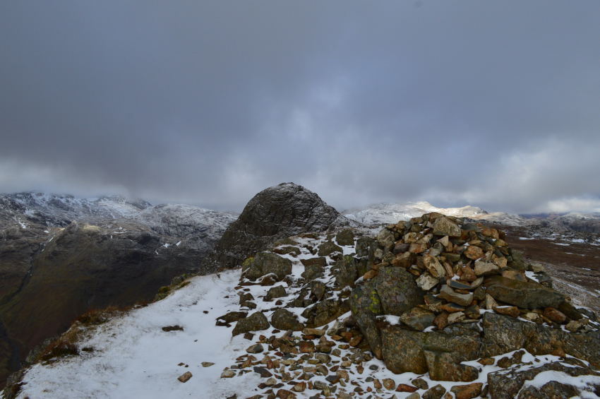
| Sergeant Man is just ahead. |
It didn't take long at all to find myself at the foot of Sergeant Man, where at times during my way over it as if people were forming an orderly que to make their own summits.
The couple you see on the summit made their way down but before I would arrive another couple also made their summit, the guy muttered & then joked about forgetting his hat which when you have a bald head made for an incredibly cold head, we laughed but rather him than me, this cold wind was no laughing matter but at least he saw the funny side. |
 |
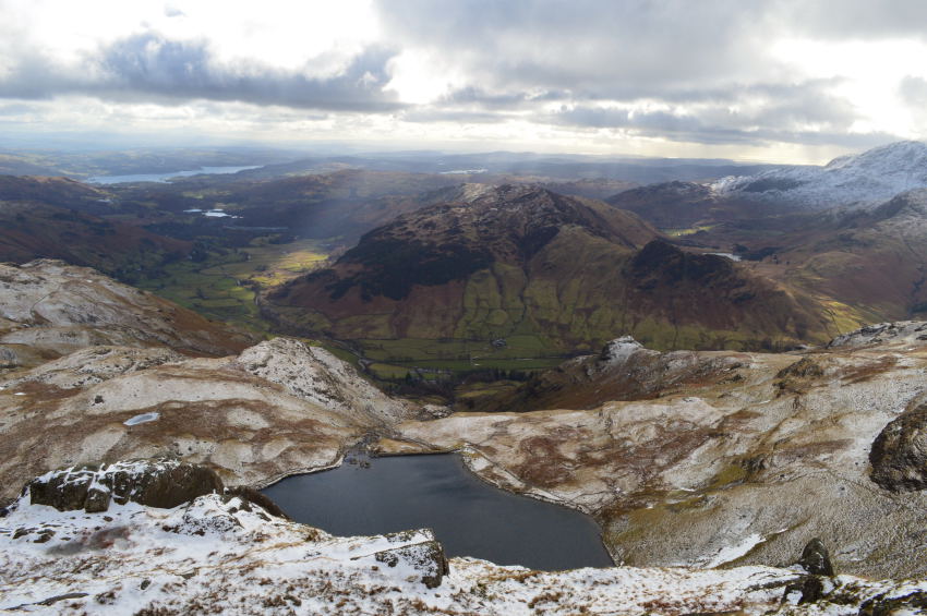
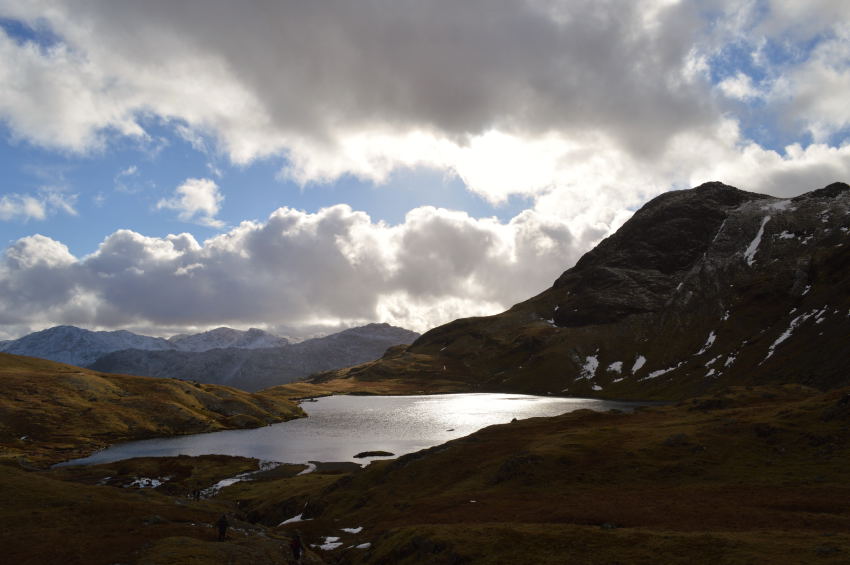
| Pavey Ark seen with a glimpse of Stickle Tarn taken from Sergeant Man summit. |
Sergeant Man was to be my last summit of the day, it had never been far from sight but I didn't ponder on the moment would be standing at its cairn for most of the walk as I knew even though it was close, Sergeant Man was always going to be watching over me for much of my walk & now that I was here the feeling of contempt came over me. Down below lies Stickle Tarn but before me & it is a lovely descent from where I could look back on the many highlights from the walks.
But as mentioned ealier, the cramp hadn't quite finished with me just yet. |
 |
| Here, looking back up towards Sergeant Man along side a large snow bank. |
I thought I had walked the cramp off despite my right calf feeling tender it was something I was willing to put up with until I had finished the walk, after all, nothing could spoil a day like today, more so on such a grand stand as my first completed walk from my Harry Griffin 2,000 footers Project, that was until I was stopped in my tracks with cramp once again only this time three consecutive spasms in my left calf which went on for close to five minutes.
Stickle Tarn flickered in the sunlight below as crowds of walkers seemlessly walked passed me as I held back my pain, my left foot hovered above the ground as I darnt lay it flat, given the choice would of been nice as my left calf muscle seemed to contract to what felt like, half its length.
I don't want to go on to much about the cramp because although the pain was clearly memorable It simply couldn't take away how great a time I was having, and to top it all off, I now had the beautiful Stickle Tarn to complement my walk by. |
 |
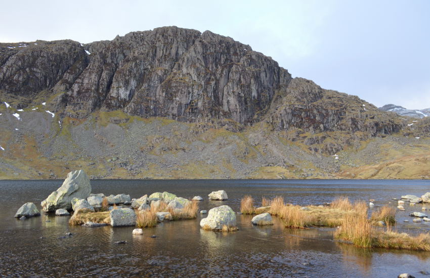
| Harrison Stickle & Stickle Tarn. |
| Stickle Tarn still proves to be one of most visited Tarns in the whole of Lakeland & today was no different, I couldn't blame one person for not wanting to be here on what was turning out to be a beautiful mid-afternoon. |
 |
| Pavey Ark. |
I figured I had earned myself a rest stop as my last one was back at High Raise in a snow packed stone shelter, here I have the comfort of dry grass as I lower myself on a grassy purchase over looking the tarn path with fantastic views over both Jack's Rake & Easy Gully.
I could have sat there all afternoon. |
 |
| Crossing the stepping stones over Stickle Tarn outflow. |
| |
 |
| Here, looking back at Sergeant Man as I round Stickle Tarn. |
| |
 |
| Pavey Ark once again. |
I couldn't resist this last view of Pavey Ark as I passed three old gents sat against the path all pointing out the various rakes & gully's that they had climbed in their youth, for just one moment as they drank hot tea from their tartan flask I could only ponder that that will be me one day. |
 |
| Descending Stickle Ghyll with views of Lingmell Fell & Great Landgdale. |
It was quite a surreal moment as I took in the descent via Stickel Ghyll as I had now de-layered to just my mid layer as the sweat had dried and formed a layered crust across my forehead, my lips felt chapped as did the end of my nose when from no-where a snow shower descended quite literaly from the direction of Stickle Tarn. Ahead my view of Lingmoor Fell still is blessed in sunshine made for a 'stop to think' just how beautiful Lakeland can look when one half of you is taking shelter from a snow shower, and the other half see's you dazzled by the sunlight.
During this project I know that I won't be as lucky as I have been with today's weather, I know I won't at times get the views and I'm sure the immortal words of 'what am I doing' will cross my lips more than once, but being inspired to do something, setting that goal & therefore achieving that goal will make each and every walk as individual as the next. |
|
| |
| Back to top |
 |
|