|
The Harry Griffin 2,000 footers Walk 23 -Around Coledale Hause |
 |
 |
15th August 2015 |
 |
|
I guess you could say that I have saved what I consider to be the finest Lakeland Horseshoe until last with todays walk in the Coledale Horseshoe, or as Harry named it in his book as 'Around Coledale Hause' The Coledale Horseshoe is certainly ranked high which is why I've probably walked it more than any other Horseshoe in Lakeland.
Todays walk isn't without its twist's which will see me collect added summits which usually aren't linked with the oringinal Horseshoe, as today three 'out and backs' are needed in order to collect Ladyside Pike, Whiteside and Whiteless Pike.
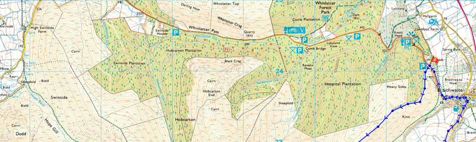
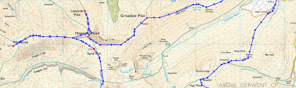
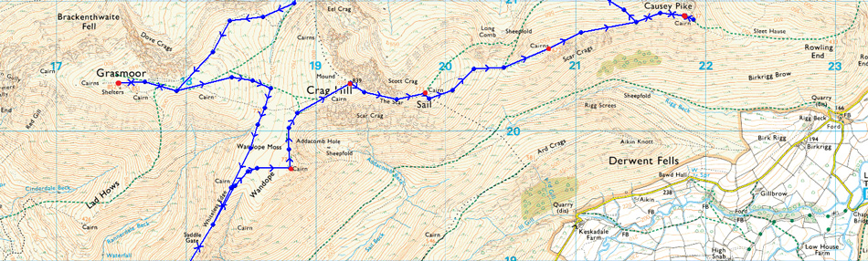
This walk demanded good weather which was what I thought I was walking into which all changed very early into the walk, but more on that later, For anyone not familiar with the route my walk starts from the car park situated at the bottom of the Whinlatter Pass from where Kin is gained before summating Grisedale Pike, thereafter I take the ridge over Hobcarton End before collecting my next three summits of Hopegill Head and Ladyside Pike, not before a slippery descent and re-ascent back onto the Whiteless Pike ridge before collecting its respective summit. Here I double back without summating Hopegill Head, instead traversing across its broad flank to where Sand Hill is summated, from Sand Hill I drop down onto the delightful Coledale Hause before rising steeply up Grasmoor's north east ridge followed by a traverse over the edge of Dove Crags thereafter, taking on the grassy summit plateau before an early lunch at Grasmoor's summit.
After leaving Grasmoor I then trek south west over Thirdgill Head Man before descending my final 'out and back' in Whiteless Pike, here strength is summoned to re-ascend back onto Wandope and Eel Crag before taking on one of the best Lakeland ridges from Eel Crag all the way to Causey Pike.
It did turn out delightfully sunny in the end, but, contrary to the forecast, that isn't how todays walk started. |
|
| Freeman of the Hills |
 |
| 'Around Coledale Hause' |
| The shadows were lengthening as I came down to Braithwaite but the wind had dropped and the smoke rose straight from the cottage chimneys. There is an inn ate Braithwaite where they sell real ale drawn from the wood and this was were I concluded my perambulations in suitable style, it had hardly been a round - more a series of traverses along diverging ridges - but I had been all round the compass and trodden all the north western fells - some of the best walking country in Lakeland. |
| Harry Griffin |
|
|
| |
|
Overview |
|
|
| Ascent: |
5,493 Feet - 1,675 |
| Summits Over 2,000Ft: |
13, Grisedale Pike - Grisedale Pike (NY 139 221) - Hopegill Head - Ladyside Pike - Whiteside - Sand Hill - Grasmoor - Whiteless Pike - Wandope - Eel Crag (Crag Hill) - Sail - Scar Crags - Causey Pike |
| Weather: |
Sunny to start turning overcast with periods of rain in low cloud. Brisk across the summits, turning brighter after noon. Highs of 16°C Lows of 10°C |
| Parking: |
Car Park, Whinlatter Pass, Braithwaite |
| Area: |
North Western |
| Miles: |
15 |
| Walking With: |
On My Own |
| Ordnance Survey: |
OL4 |
| Time Taken: |
7 Hours 45 Minutes |
| Route: |
Whinlatter Pass – Kin – Sleet How – Grisedale Pike – Hobcarton Crag – Hopegill Head - Ladyside Pike - Whitleside - Traverse below Hopegill Head – Sand Hill – Grasmoor North East Ridge - Grasmoor - Thirdgill Head Man - Whiteless Edge - Whiteless Pike - Whiteless Edge - Wandope – Eel Crag (Crag Hill) – Sail – Scar Crags – Causey Pike – High Moss – Barrow Door – High Coledale – Braithwaite – Whinlatter Pass |
|
| |
|
Map and Photo Gallery |
|
|
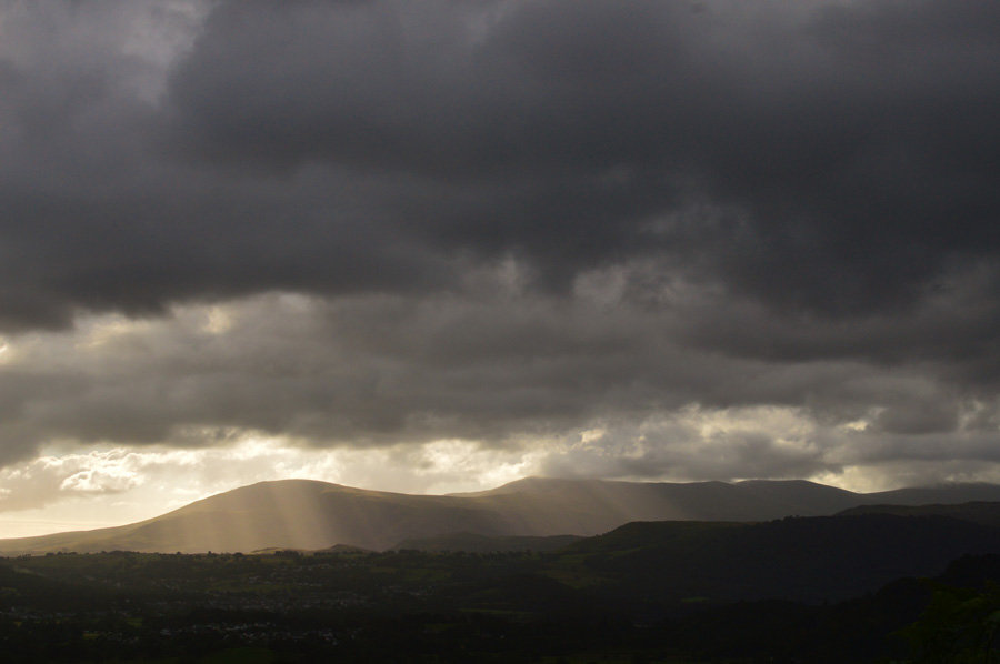 |
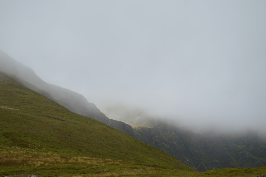
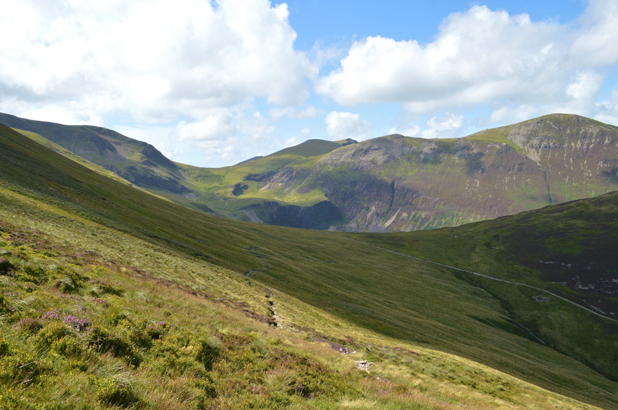
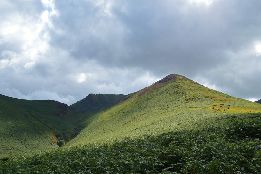
| Dark views east over the Dodd ridge 7.45am 10°C |
Having driven to Lakeland wearing sunglasses under deep blue skies I was a little surprised to see that the further west I drove the darker the skies became which by the time I had reached Braithwaite cloud had gathered and was now starting to drop on my respective round, bringing with it, a drastic change in light.
This does not phase me during the time it takes me to kit up, noting that today, and unlike last week where I shivered my way through the walk I will be wearing not one, but two base layers, and as always my jacket which gets roughly rolled up and squeezed into my pack. With the car locked I head steeply from the car park on to Kin, a grassy ridge that will lead me eventually on to Grisedale Pike, just before I leave the car an elderly lady jogs onto the car park before heading out through the barrier towards the Coledale Valley, I was somewhat impressed by not just her age, but having already jogged up the steep road leading out of Braithwaite, I only hope, I fair as well, as today, I'm going to need every bit of energy I can muster. |
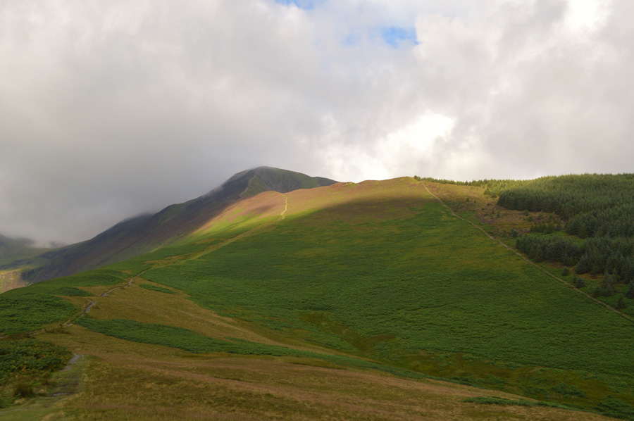 |
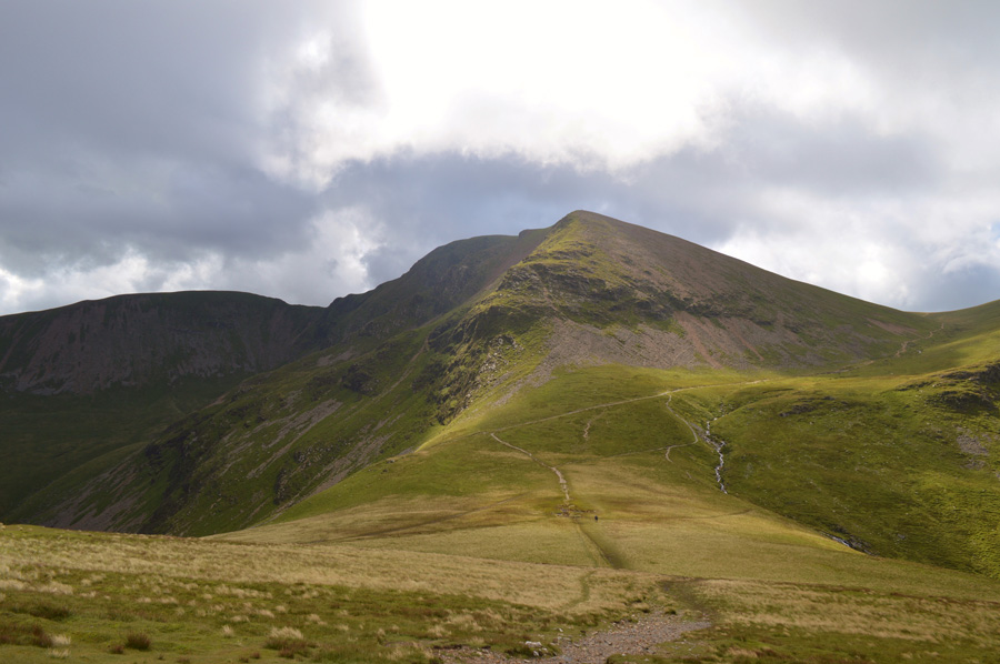
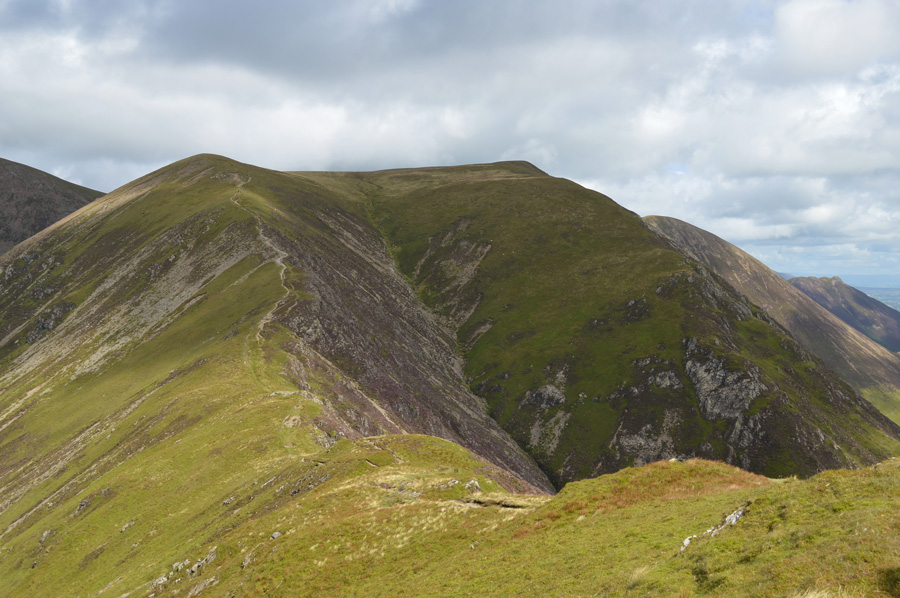
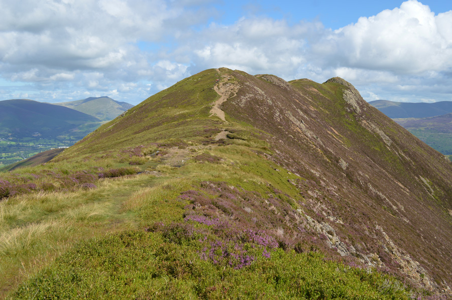
| Grisedale Pike over Kin. |
With the light changing quite dramatically with every minute here I get my first real views of Grisedale Pike which was at this point, wonderfully lit up in changing light, ahead a fell runner and his dog have taken over me not before morning pleasantries are passed, as I was taking photos looking back over Keswick at the time I was asked was I going up or down.
He trots on stopping sometime later to take off his jacket, further up the ridge I spot another walker on Sleet How, blimey I thought it was me who was the early bird, obviously not.
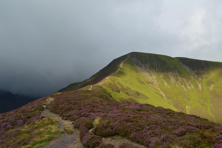
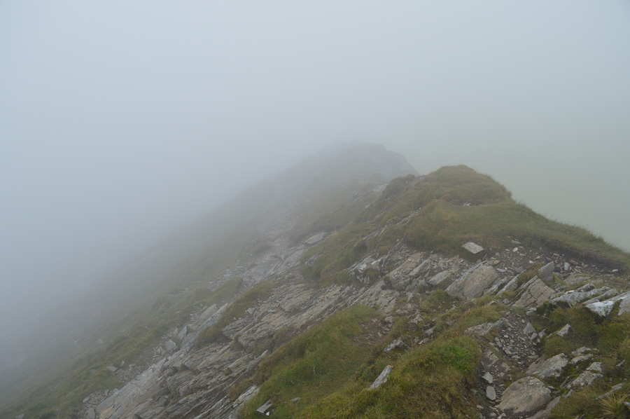
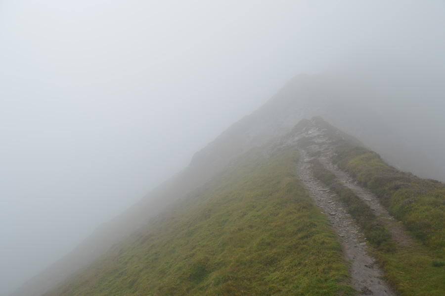
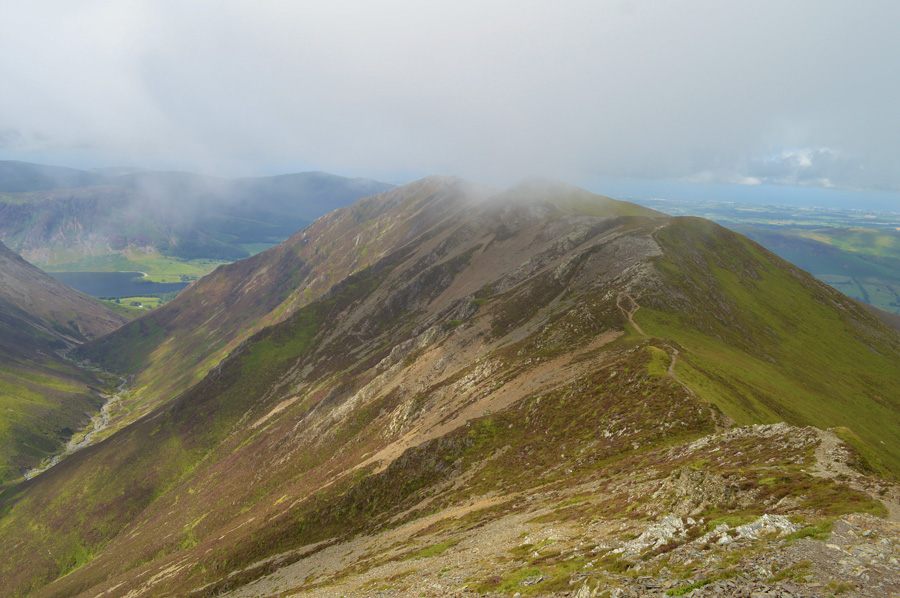
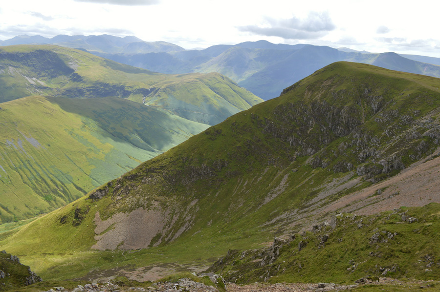
Gaining Kin wasn't without is steepness and today's only difference being from when I was here last is that the path has narrowed due to the bracken taking over widely across the fell side, having that steep ascent behind me I can now concentrate on the task ahead noting all the while, the cloud which is creeping in over Coleldale Hause seen in the left of the photo.
It just looks too dense to be hill fog... |
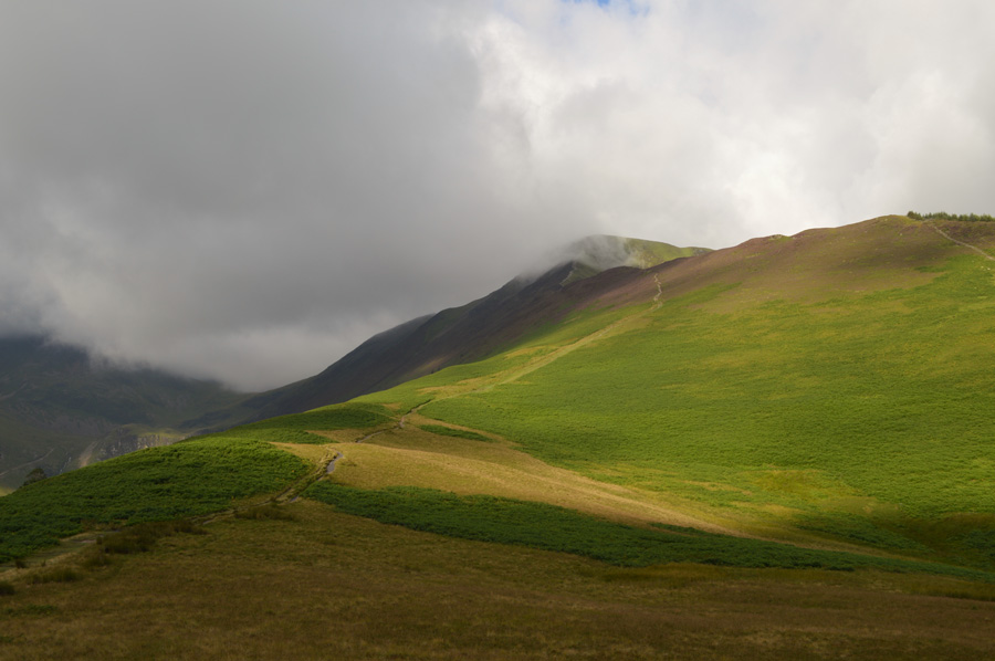 |
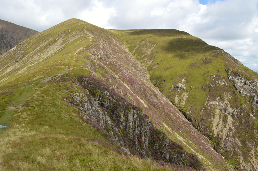
| Grisedale Pike and Sleet How over Kin. |
| Something tells me that I'm looking at a tiny fraction of just how large this cloud cover really is, nevertheless, the sporadic sunburst which illuminate the bracken somehow make up for it. |
 |
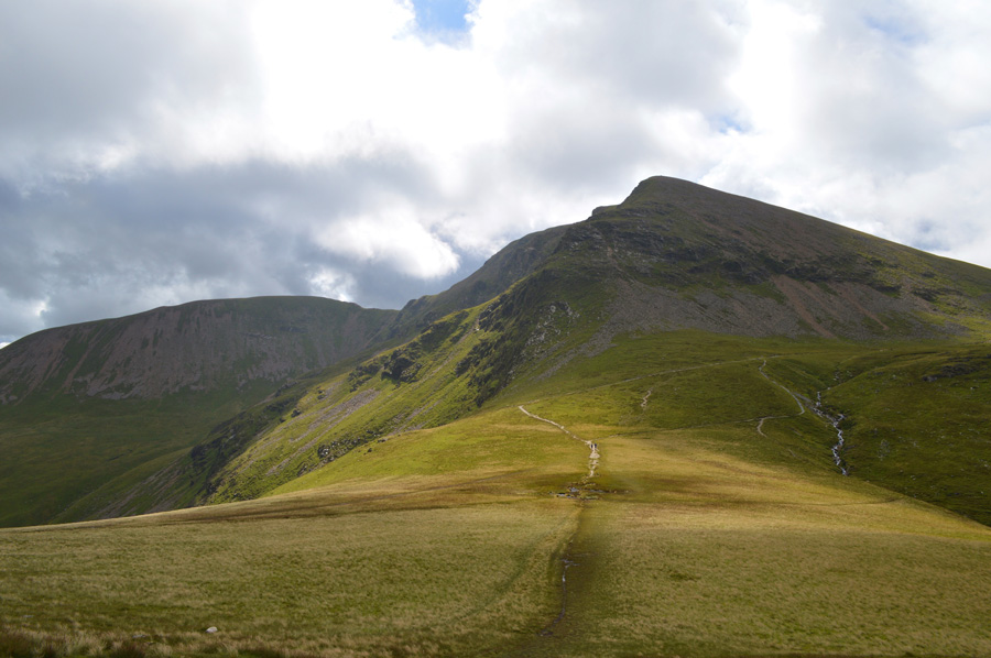
| Grisedale Pike from Sleet How. |
It's August which is when the Heather starts to appear here made more present by the great light the ridge is under, but sadly all of that is about to change.
Ahead the two walkers are still on their ascents and haven't reached the summit yet, although by the time they do, the summit will be engulfed with cloud cover, best make the most of it while it lasts. |
 |
| Force Crag illuminated by a last show of sunlight before the cloud closes in. |
| |
 |
| Grisedale Pike summit. |
Having taken on the steep ascent of Sleet How I witnessed the walker in front of me peak out at the summit right about the same time the cloud dropped down, his ghost like shadow disappeared into the cloud leaving me wondering what to expect once I too arrived at the summit which had a large covering of cloud, there goes my views.
Whilst on the ascent - even when the sun was out I noticed a chill blowing down the ridge, there was no point in adding layers when I was climbing as that would have made things a little uncomfortable, but here, whilst at the summit all that changes as I quickly de-shoulder my pack from where I try to add my jacket, my sleeves at the same time getting caught by the summit cross wind. Ahead I will collect two more summits along the ridge in Grisedale Pike's subsidiary summit otherwise known as Hobcarton End, thereafter Hopegill Head, and who knows, the cloud may have lifted by then. |
 |
| I tramp on easily to my next summit of Hobcarton End found just a short walk after leaving Grisedale Pike summit. |
| |
 |
| A glint of sun catches my eye over Hobcarton Col. |
| |
 |
| Grisedale Pike subsidiary summit otherwise known as Hobcarton End. |
| Grisedale Pike second summit was soon reached although my hopes of the cloud lifting had become fainter and fainter, much like my views... |
 |
| Ladyside Pike seen from the Hobcarton Col. |
| Having descended the subsidiary summit blanketed largely by cloud here whilst crossing the grassy col I am gifted a glimpsing view of Ladyside Pike; my fourth two thousand footer of the morning, but first, a short yet steep-ish ascent on Hopegill Head after leaving the Col. |
 |
| Mirky views Hopegill Head summit. |
Despite my lack of visibility the short ascent was matched by atmospheric views of Hopegill Head steep cliffs that drop down sharply into the Hobcarton Valley, each time I find myself here I always say that one day I'll find a route between the cliffs and make a direct ascent on Hopegill Head from the valley below, after all, it is do-able if you like 'off the path' type ascents which I tend to go for every now and again.
I press on. |
 |
| Descending Hopegill Head for Ladyside Pike. |
| There wasn't much to keep me at the summit of Hopegill Head except more cloud which saw me keep my camera in its case. From the summit my next challenge was to descend the rock slab found on the north side of the summit, this ascent was a test of ones agility and patience to say the least, I really wouldn't recommend this descent / ascent unless you are experienced with the ground, especially after a night of rain as the rock slab, offers no grip whatsoever as each step should be tested first making todays descent - a slow and time consuming one. |
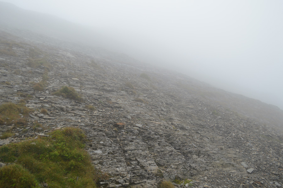 |
| Looking back on the rock slab. |
It's fair to say that I wouldn't call any man or woman who would turn their back on this descent this morning and I am also pleased no one was here to witness my own descent which was done, largely on my backside. The rock appears to be porous meaning grip is at hand but it's the exact opposite meaning even with a Vibram sole, all your boot will do is slide rather than grip, this means finding alternative ways around which are found wider-a-field where walkers have grooved out paths in the slate, even so, these paths still require negotiations around the slippery rock as extra care when wet should always be taken here.
Todays descent had to be one of the most unpleasant I have yet to experience, lets hope next time I have better conditions. |
 |
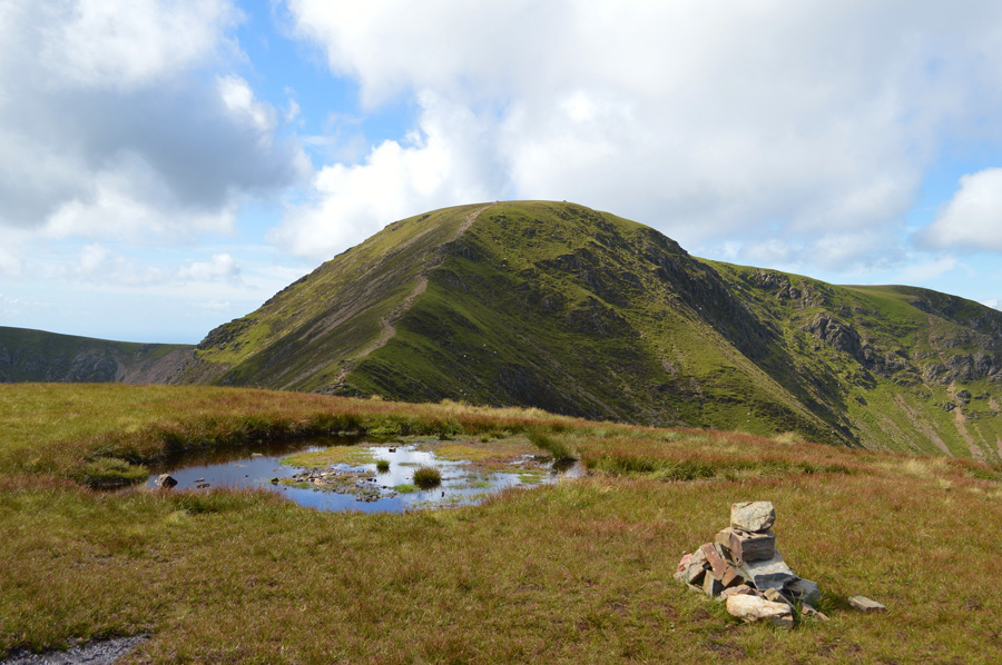
| Ahead, Ladyside Pike. |
|
|
 |
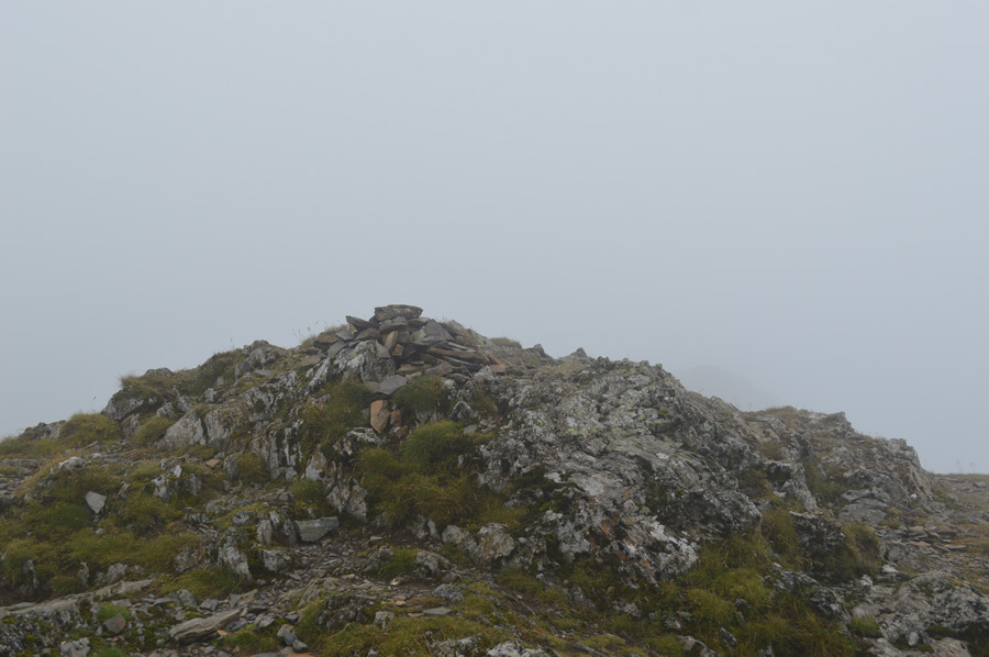
| Ladyside Pike summit cairn. |
|
 |
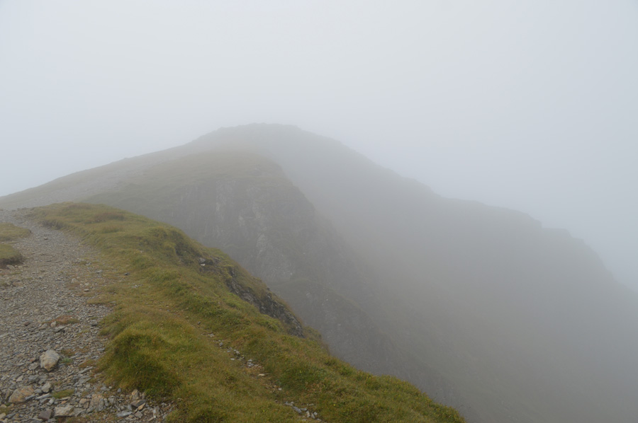
| Back on the Whiteside Ridge. |
Large droplets of rain had started to highlight over my jacket and shorts by the time I was ready to leave Ladyside Pike which then transpired into a heavy rain shower which saw my gear take a soaking, things were looking pretty grim at this point, I still had to re-ascend the Whiteside Ridge the same way as Harry had by not summating Hopegill head, instead, traversing west below the summit to a Col found at the bottom of a mini Arete. This caused me to take out my map due to conditions where although the traverse would only be a few hundred meters in terms of distance, meant I couldn't see the lay of the fell side which was as good as walking blindly.
Spirits were low but I insisted on keeping to the original route so, from the the base of the rock slab I steered west over loose slate and shale coming to an abrupt stop where through the cloud, the Arete would tower above me. I continue with my pathless trail side-stepping slate and grassy hummocks all the while continuing to check my progress on my GPS, after what seemed a pathless life time I emerged just short of the Col below the Arete from where a distinct path could be made out, adding to this was the now distant voices I could here along the ridge which at the time, were of some comfort.
After finding myself on the path I gave myself a mental dust down, it was still raining and the wind chill had made the skin on my legs turn red. By now my shorts were starting to stick to my legs due to how damp they were when out of the cloud a fellow walker appears, we are of the same age as I notice him checking his map, you ok there I ask? yeahh, just this bloody weather eh, yep, I agree 'it should clear up later' aye reckon so, have a good day mate.
And that was that, he went off in the direction of Hopegill Head while I headed for my fifth two thousander of the morning in Whiteside.
Good O'l British spirit eh. |
 |
| Heading for Whiteside. |
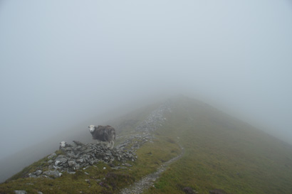
More and more walkers had been passed whilst heading out to Whiteside, their voices echoing along the ridge at a point when you expect them to appear through the cloud, only for the voices to continue before finally they do appear through the mist and a 'morning' is finally shared.
I press on towards the summit. |
 |
| Whiteside summit cairn. |
It had thankfully stopped raining by the time I had reached Whiteside summit, over the last ten minutes or so I had seen more walkers along the ridge, topic of conversation was of course the weather which hopefully soon, should start to clear up. After taking the one photo of the summit cairn I drop down a little where I down pack once more if only to take out a snack, it's easy walking back along the ridge and my hands will be free as I hold both my walking poles in one hand, and a chocolate oat bar in the other. |
 |
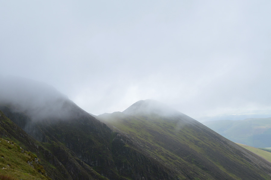
| Looking back to Whiteside as the cloud starts to lift above Gasgale Crags. |
| A good proportion of the morning had been spent walking in rain and low cloud when now, it looks to be clearing up, it never ceases to amaze me how quickly the cloud lifts. |
 |
| Views along the ridge towards Whiteside with Gasgale Crags below. |
One blink, and its gone...
My next summit would be Sand Hill, that's the grassy plateau you pass over between Hopegill Head and Coledale Hause, sometimes, without knowing it. When Harry collected Sand Hill he did it by traversing beneath Hopegill Head on the Gasgale valley side, I too would follow in Harry's footsteps which on paper, looked more more arduous than it actually was. |
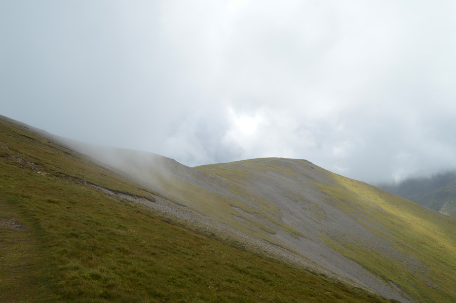 |
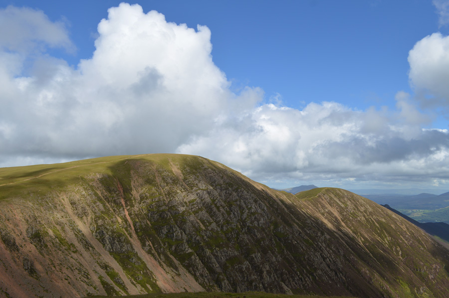
| Sand Hill seen ahead as I out flank Hopegill Head for the second time. |
| By the time I reached the exit point from the ridge the cloud had started to lift just nicely, ahead is Sand Hill and the short traverse below Hopegill Head in order to reach it was done with relative ease keeping above the slate all the while maintaining a line for the depression between both summits. |
 |
| Views open up over Whiteside, Grasmoor and Gasgale Gill towards Crummock Water, Mellbreak and the western fells. |
| |
 |
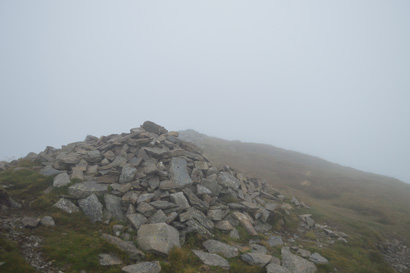
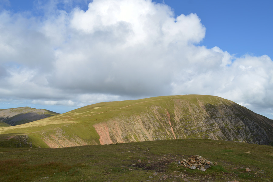
| Sand Hill summit cairn, |
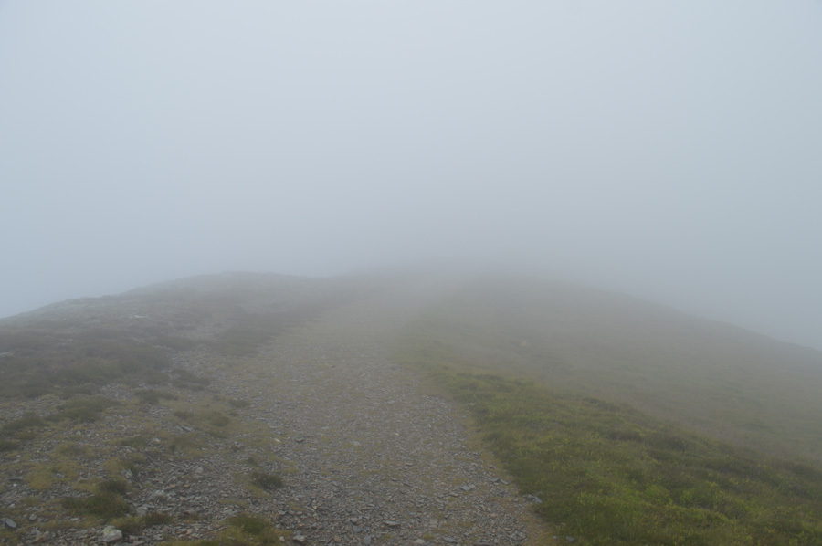
Sand Hill was soon gained having witnessed more walkers on Hopegill Head and indeed, Grisedale Pike. Summit time on Sand Hill was kept brief due to the nature of the low light, it would appear as if someone had taken the bulb out! It was nothing to worry about other than passing cloud partially blocking the sun.
Time to descend onto Coledale Hause. |
 |
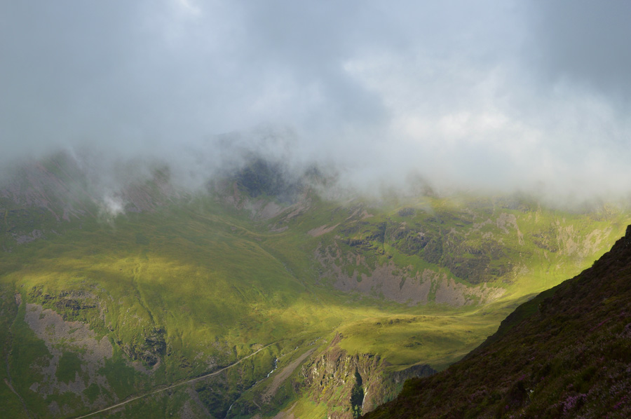
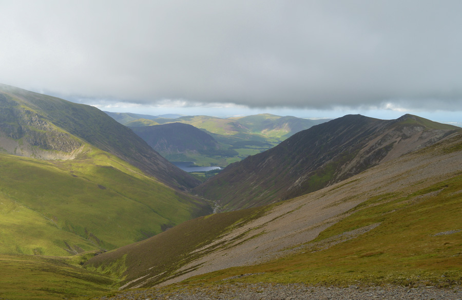
| Eel Crag and Sail over Coledale Hause. |
| The sun came out moments later illuminating Coledale Hause and Eel Crag, ahead the roar of Gasgale Gill Waterfalls accompanies my crossing of what I consider to be my favourite Hause on the Lakeland Fells. |
 |
| Eel Crag over Coledale Hause. |
| To the right of the Hause Grasmoor summit is still under cloud but shows promise, moments after taking this photo the cloud lifts revealing blue skies but unfortunately I wasn't in a postion to photograph the summit having already crossed Coledale Hause. |
 |
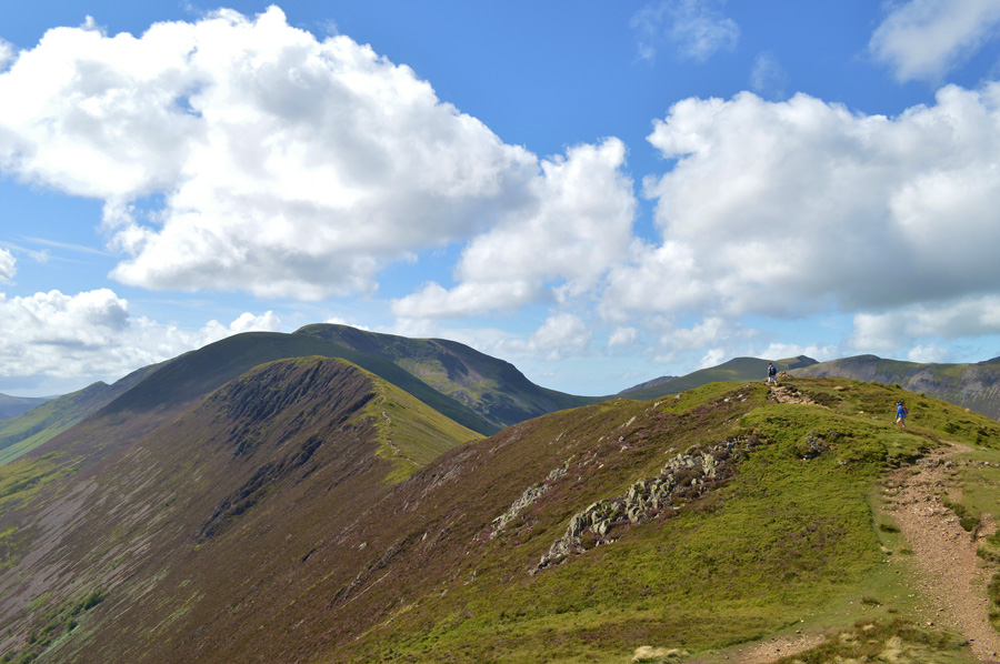
| Here, views back along Grasmoor's north east ridge over Coledale Hause and Grisedale Pike. |
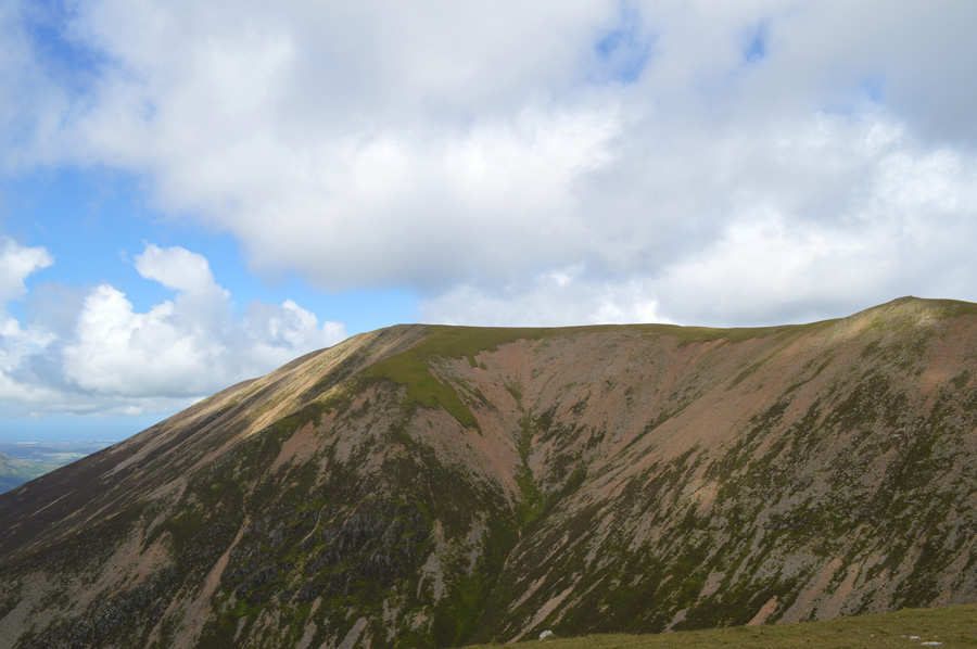
I gained the ridge prematurely straight after crossing over Gasgale Gill with a direct line in sight, lower down the path is narrow, steep and after rain, sponge like. Yet after a little height the path gives way for a narrow stoney track which rises steeply before continuing along the length of Grasmoor's broad shoulder where views open out over the impressive Dove Crags before the summit is finally reached.
A.W wrote that this ascent is the easiest way to gain Grasmoor which for me today works well knowing what I still had ahead of me. |
 |
| The north west ridge ascends directly around Dove Crags leaving impressive views of the Dove Crag ridge. |
| |
 |
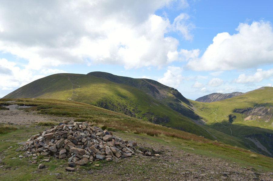
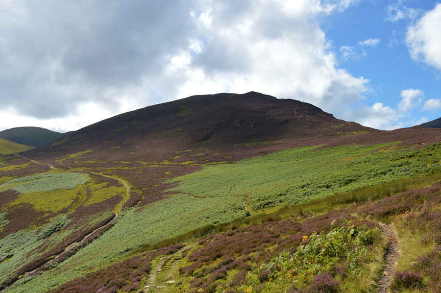
| Grasmoor summit and shelter. |
By the time I had reached Grasmoor summit I found the shelter looking rather crowded at a time when my stomach was telling me to put food in to it, all four sides of the shelter were occupied which meant if I was to stop for lunch I may have to find somewhere else to eat. After a quick scurry with hazy views over Buttermere and beyond the High Stile ridge I came across a small single man shelter with my name all over it where I de shouldered and ate Sainsburys garage forecourt finest BLT sandwiches followed by a Snickers bar, after a quick ten minute lunch I was back on my feet again throwing my pack onto a cold sweaty back. Despite the blue skies I was still wearing my jacket such the chill across the summits, I wouldn't describe the temperature here as freezing, but it wasn't far from it.
I was at a point when I knew that my next summit was by far a tough one, not technically, put physically in that I would now have to descend Whiteless Edge before summating Whiteless Pike, then to reascend back to Thirdgill Head man before continuing to summit both Wandope and thereafter, Eel Crag. |
 |
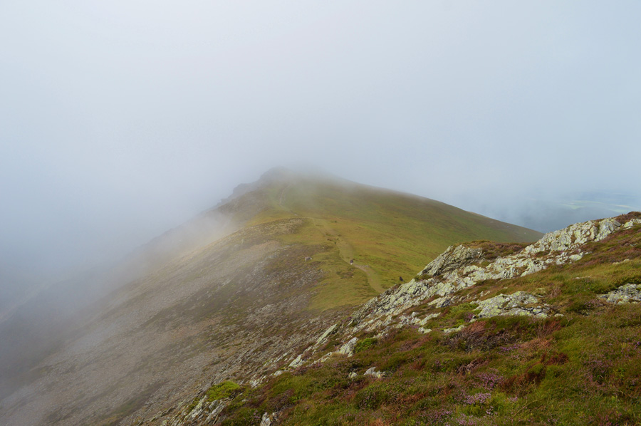
| Views towards Whiteless Pike from Grasmoor summit. |
From the summit of Grasmoor Whiteless Edge looked far less daunting than I had remembered which left me feeling a little more encouraged about the 'out and back' than I first thought.
I press on. |
 |
| Views over my shoulder over the mass of Grasmoor as I take on Whiteless Edge. |
| |
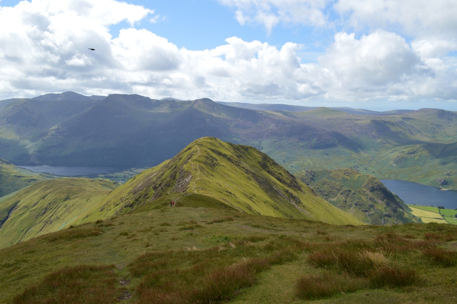 |
| Whiteless Pike from Whiteless Edge. |
| Walkers are passed looking flustered as they make their own ascents, this leaves me now feeling a little less encouraged! |
 |
| Views back along Whiteless Edge from Whiteless Pike. |
| Feeling flustered myself summit time was brief as I didn't want to stop for too long, despite tired legs I get straight back into the re-ascent while my adrenalin was still flowing. |
 |
| No time to hang around. |
| Having not timed my descent and re-ascent at the time it was only when I got home to look at the pictures did I realize that my Whiteless Pike 'out and back' took thirty three minutes from Thirdgill Head Man and back, a time of which I expected to have taken at least one hour, mind you by the time I reached the top of Whiteless Edge to anyone else it may have looked like I had a smile on my face, which was just a disguise for the pain my legs were feeling, nonetheless the ground underfoot eased in gradient as I now made my way towards my ninth two thousander of the day in Wandope, now, at a much slower pace. |
 |
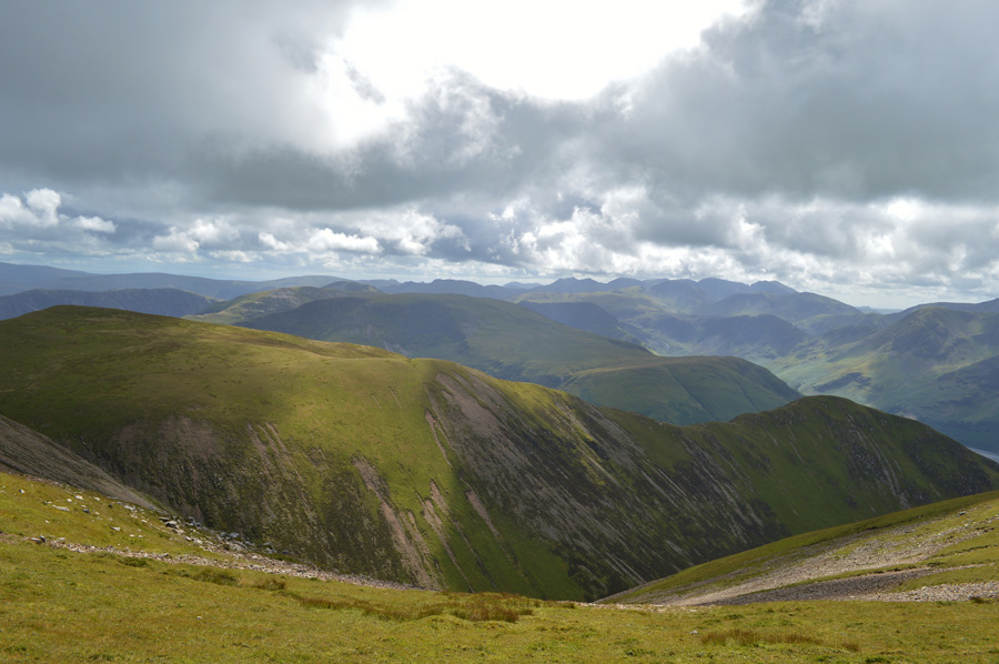
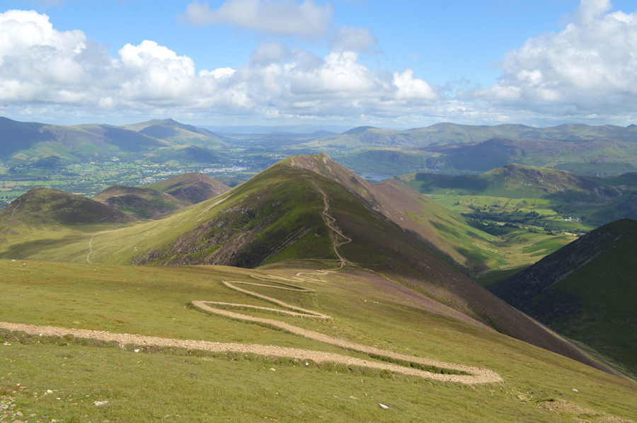
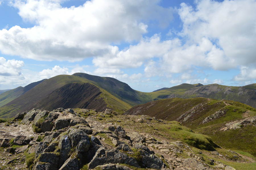
| Eel Crag (Crag Hill) from Wandope summit. |
| Having eased myself onto Wandope summit taking note that it was still cold enough to see ones breath in the air I down pack for a few moments where I sit on the grass knees high - hands streched across the tops, despite the long ridge walk ahead I could now rest easy that all three 'out and backs' had been completed and that now, I could enjoy without hesitation, the wonderful Causey Pike ridge. |
 |
| Eel Crag (Crag Hill) and Sail from Wandope. |
| Causey Pike summit can be seen in shade at the far end of the ridge to add scale. |
 |
| Views over Addacomb Hole seen with Wandope east ridge. |
| Having sat out for a few moments on Wandope summit I re-shouldered and took the path that skirts narrowly around the edge of Addacomb Hole where I was reminded of last years descent down the ridge, a steep and great alternative route to Sail Beck. Above me and to my left I can hear walkers on the main approach path which I will re-join a little further up before summating Eel Crag. |
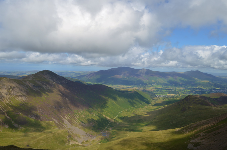 |
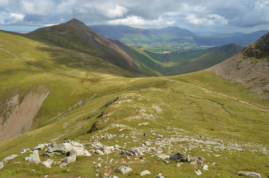
| Commanding views over the Coledale Valley towards Grisedale Pike and a distant Skiddaw and Blencathra. |
| The summit of Eel Crag was duly reached having gained the main approach path where I was joined by large groups of walkers all enjoying a day on the fells. Summit time sadly was kept minimum and no photo was taken of the trig point which after some years of lying on its side, has now been re-erected even though it still bears the damage from what was thought to be a lightening strike a few years ago. As more walkers surround the trig point more are about to leave, realizing this I need to get ahead of them or I will be caught behind them which I know sounds a tad grumpy of me, but seeing as I'm making good time, I don't really want to loose any of my pace. |
 |
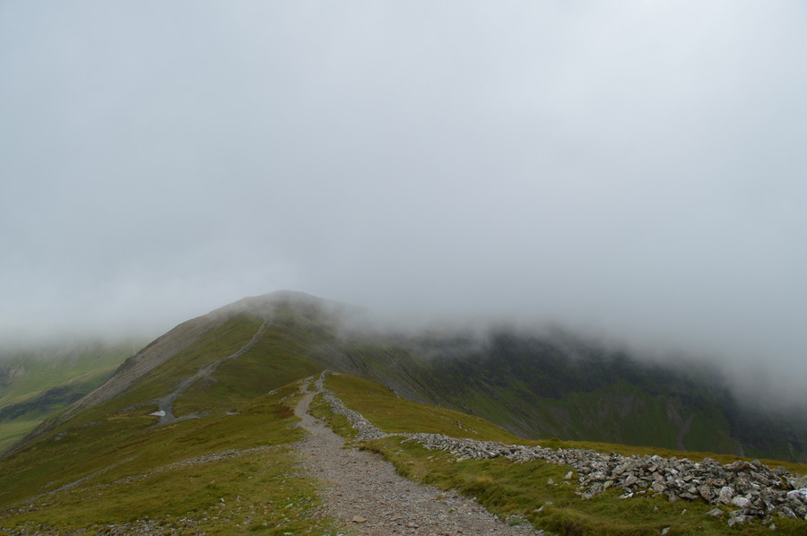
| Descending Eel Crag with Sail, Scar Crags and Causey Pike ahead. |
| This is classic Lakeland ridge walking at its best. The descent from Eel Crag is fairly steep and can be loose in places, however that was not the case today I make good time in descent crossing The Scar below before ascending steadily in order to gain Sail summit, behind me the groups of walkers who had left the summit the same time as me their voices becoming more and more distant the further I descend down the ridge. |
 |
| Looking back on Eel Crag from The Scar. |
| My fellow walkers are still in descent having dogs and young children with them, although despite the gap, one particular walker continues to talk so loudly I can hear him three over a country mile, yes yes we know you can name, and therefore point out all the fells, could you just do it a bit quieter please. |
 |
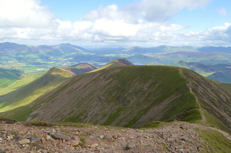
| Eel Crag from Sail summit. |
| Midday has been and gone and I had descended low enough now to feel the benefits from the sun, it was here while at Sail summit do I take my jacket of and roll it under the hood of my pack before rolling my sleeves up Scar Crags bound. |
 |
| The less said about this path the better. |
| My legs were back to fitness - feeling strong I flank the path whilst taking on a jog, not stopping until I reach the lower Col before taking on my final two summits of the day in Scar Crags and Causey Pike. |
 |
| Sail and Eel Crag from Scar Crag summit. |
| Such the diversity of Lakelands weather I could only look on towards Whiteside summit (seen just above Coledale Hause) where I was at a bit of a low point in the walk due to the soaking I was under, now look how glorious it has turned out. |
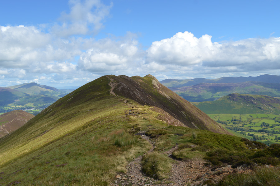 |
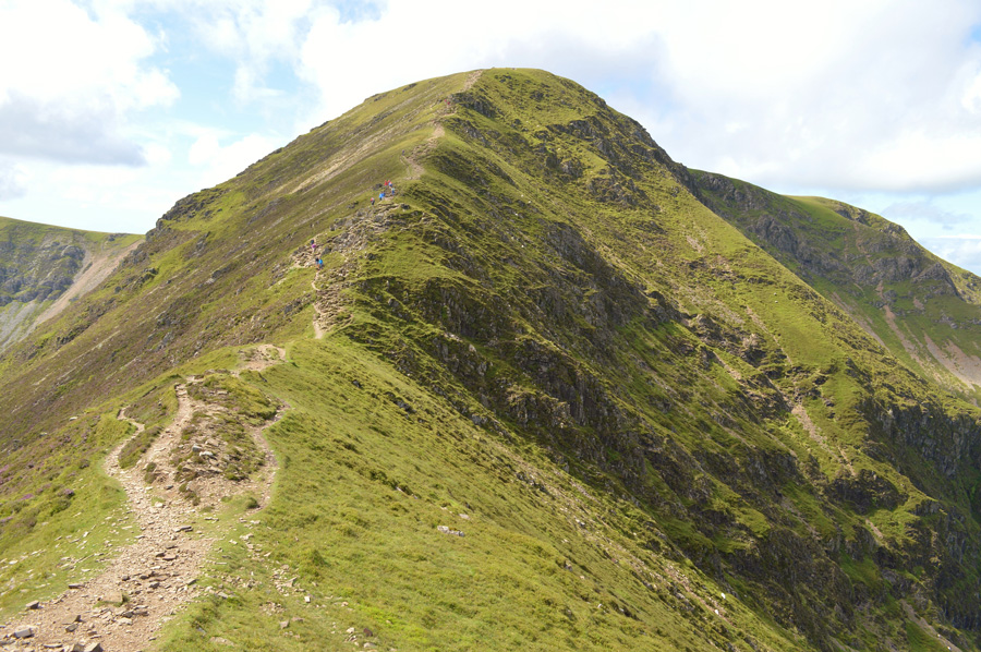
| Causey Pike is just ahead. |
| Savouring time. |
 |
| |
| |
 |
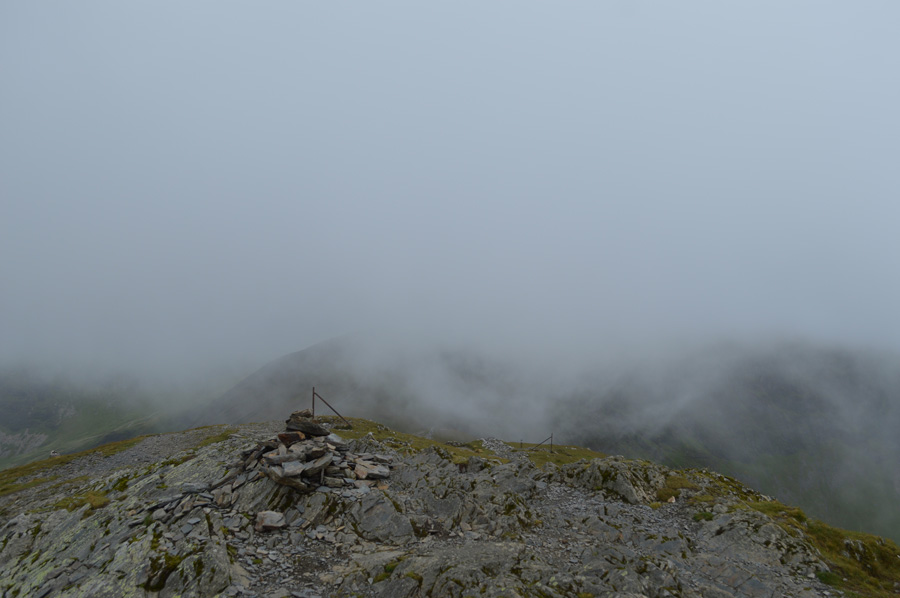
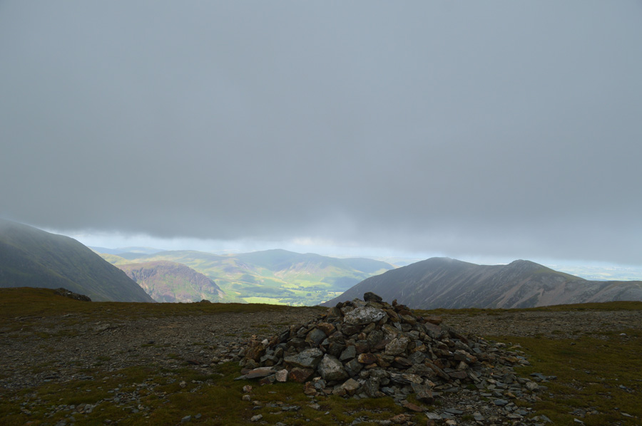
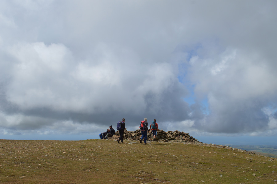
| Summit counting from Causey Pike summit. |
My final and thirteenth summit was upon and I had planned some down time from where I could look back on trodden ground and count a good proportion of summits collected stretching all the way back to Whiteless Pike at the end of the ridge and Whiteside seen in shade in the distant right of the photo. Lone summit time was brief as I sat there taking in the views over Newlands and Derwent Water when I was joined by a family with young children who asked me would I mind I take a photo of them at the summit, I of course obliged before taking my seat again. I had to make a phone call back home seeing that now I had a signal on the phone, it was nothing important but I rang my wife anyway 'you sound out of breath' she said, tough one today I replied! but its gorgeous now I'm just going to sit here and take it all in (best let my breathing return to normal too) After around ten minutes I stood up before slinging my pack over my shoulder, I left the young family on the summit and bid them a good day before trotting off back the way I had came leaving the ridge for High Moss and Barrow Door bound. |
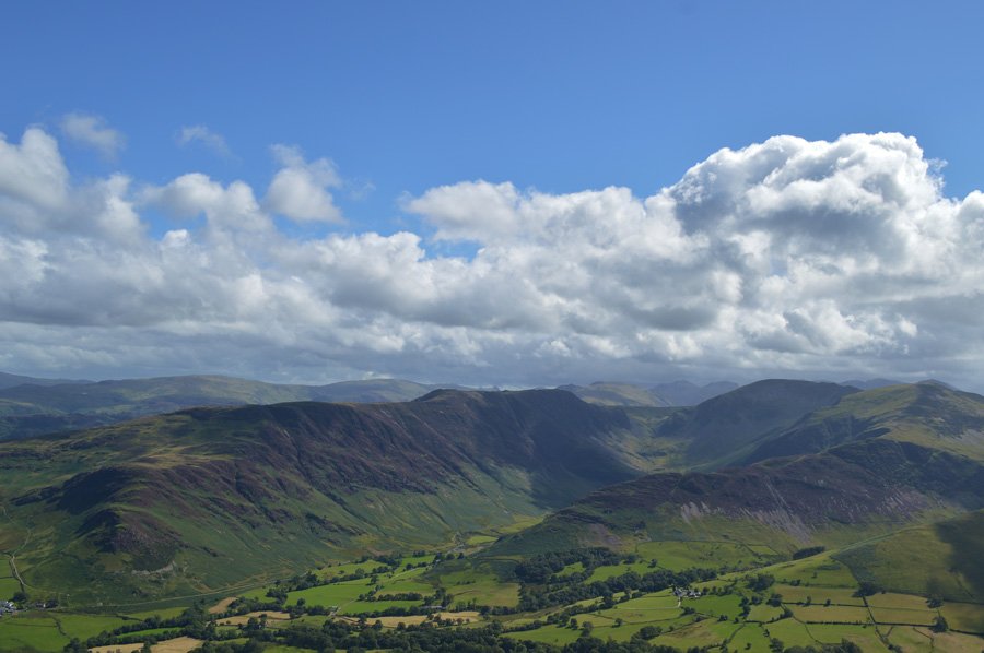 |
| Maiden Moor, Nitting Haws, High Spy, Dale Head and Hindscarth or, other wise known as the Newlands Horseshoe. |
| I had previously spoken to Rod Hepplewhite the night before about what we were up to at the weekend when Rod told me he had planned a route from Holllows Farm onto Nitting Haws and High Spy before continuing to Cat Bells, I guess our timings were out but Id hoped he had enjoyed his day the way I had. |
 |
| One last photo of the Causey Pike ridge looking back on Scar Crags, Sail, Eel Crag and Whiteless Pike. |
| |
 |
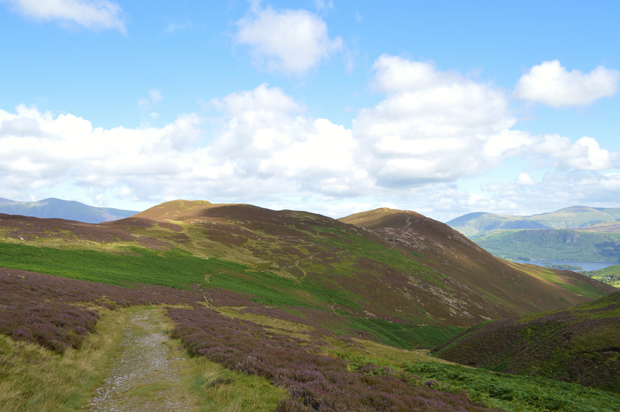
| Descending High Moss with views of Coledale Hause, Hopegill Head, Grisedale Pike and Force Crag. |
| |
 |
| Stile End, Barrow Door and Barrow seen from Stonycroft Gill. |
| I follow Stonycroft Gill before leaving the path off to the left for a narrower path that rises gently through bracken which will soon lead me towards Barrow Door seen between both Stile End and Barrow, here I pass another family who are resting taking in the views over Stonycroft Gill and the Newlands valley. |
 |
| Here, looking back towards Outerside and Sail. |
| |
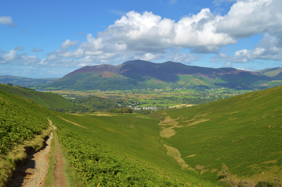 |
| Skiddaw from Barrow Door. |
| Skiddaw enlightened my view all the way back to Braithwaite as I take in the gentle descent under the cushion of a narrow track, hot sun, and soft grass, I couldn't of asked for better way to walk myself of the fells. |
 |
| Looking back on Stile End and Barrow Door. |
Under a hot August afternoon sun my walk was almost coming to an end as I head back into Braithwaite, young families and indeed fell runners are passed along the track as the roof tops of Braithwaite start to come in to view. I know from memory shortly I will be passing the Coledale Inn and no matter how tempting it is to go through the highs and lows of the day whilst sipping on local brew I resist while casting an eye on holiday makers doing the same thing. Soon Braithwaite is reached as I find myself passing through the narrow lanes and back gardens where washing drys under afternoon sun.
Coledale Beck is reached which sparkles through a thick canopy of trees, with the bottom of Whinlatter Pass just beyond I stop a while at a narrow wooden footbridge as traffic passes seamlessley by. After a few moments I cross the beck before my last ascent of the day which feels steeper than it actually is, with my walking poles held in one hand, I make my way back to the car park which is full as to be expected.
From the carpark I can see the entrance on to fell side from where I started my walk a little under eight hours earlier, sunlight passes through the tree branches as I unlock my car and throw my gear in to the boot before making my way around to the front where I collapsed in to the drivers seat uttering the words, that was some walk. |
|
| |
| Back to top |
 |
|