|
Four remote far eastern fells from Swindale |
 |
 |
26th September 2015 |
 |
|
It's fair to say that I am still very much in 'Harry Griffin' mode which I guess shows how focused I have been this year, to help me ease my way back into normal everyday walking close to the end of the campaign I told myself that I would find a nice remote seclusive area of Lakeland where I would find myself back at one with hill again.
David had previously suggested a Tarn walk where he needed to visit two in the far east of the district namely Branstree Tarn and the frequently less visited Tarn of Howes which is perched over the valley of Mosedale...I guess there was no need to do any planning as it had already been done for the pair of us with the exception that David had planned, but not cemented his walk starting from Mardale Head, after clubbing our heads together we agreed to start the walk from the secluded valley of Swindale instead thus compensating for both our needs on what started out to be a rather dreary morning at Swindale, the theme would continue with low light throughout the morning, any brightness only appearing towards the latter stages of the walk which brought the walk to a fitting end. I only wish I hadn't forgotten something rather important. |
|
| Wainwright Guide Book Two |
 |
| The Far Eastern Fells |
-Grey Crag
There is nothing remarkable about Gray Crag, but here Lakeland may be said to start and moorland country to end - and the transition is sudden: the quite beauty gives place to romantic beauty, placid scenery to exciting. One looks east, and the heart is smoothed; west, and it is stirred. |
 |
|
|
| |
|
Overview |
|
|
| Ascent: |
3, 094 Feet - 941 Meters |
| Wainwrights: |
4, Selside Pike - Branstree - Grey Crag - Tarn Crag (Longsleddle) |
| Weather: |
Mild and Overcast, Turning Brighter Highs of 15°C Lows of 9°C |
| Parking: |
Parking Spaces, Swindale Lane, Swindale |
| Area: |
Far Eastern |
| Miles: |
13.7 |
| Walking With: |
David Hall |
| Ordnance Survey: |
OL5 |
| Time Taken: |
8 Hours |
| Route: |
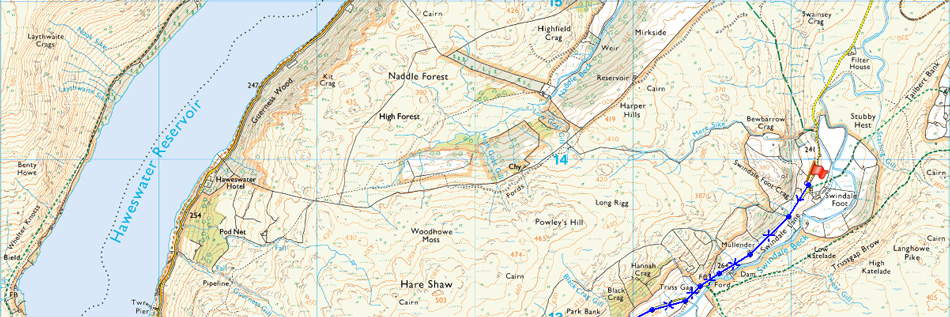
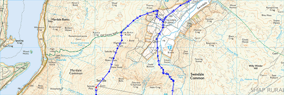
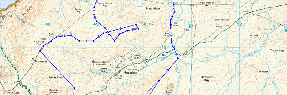
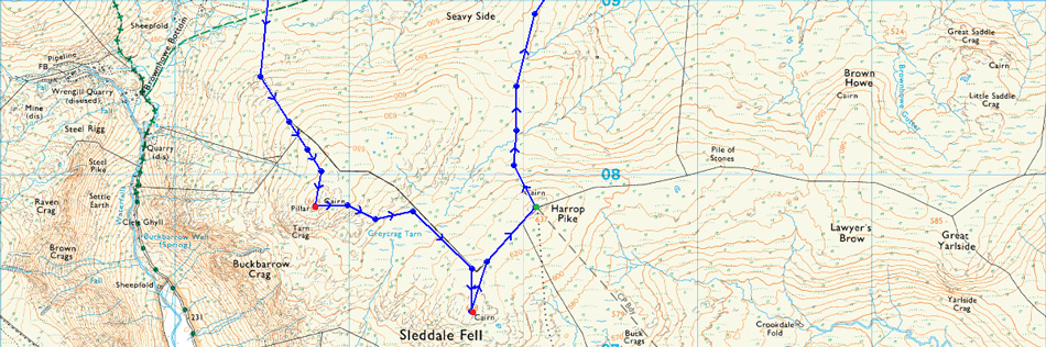
Swindale Lane - Old Corpse Road - Selside End - Selside Pike - Captain Whelter Bog - Howes - Branstree Tarn - Artle Crag - Branstree - Selside Brow - Brownhowe Bottom - Tarn Crag (Longsleddale) - Greycrag Tarn - Grey Crag - Harrop Pike - Brunt Tongue - Mosedale Beck - Swindale Head - Swindale Lane |
|
| |
|
Map and Photo Gallery |
|
|
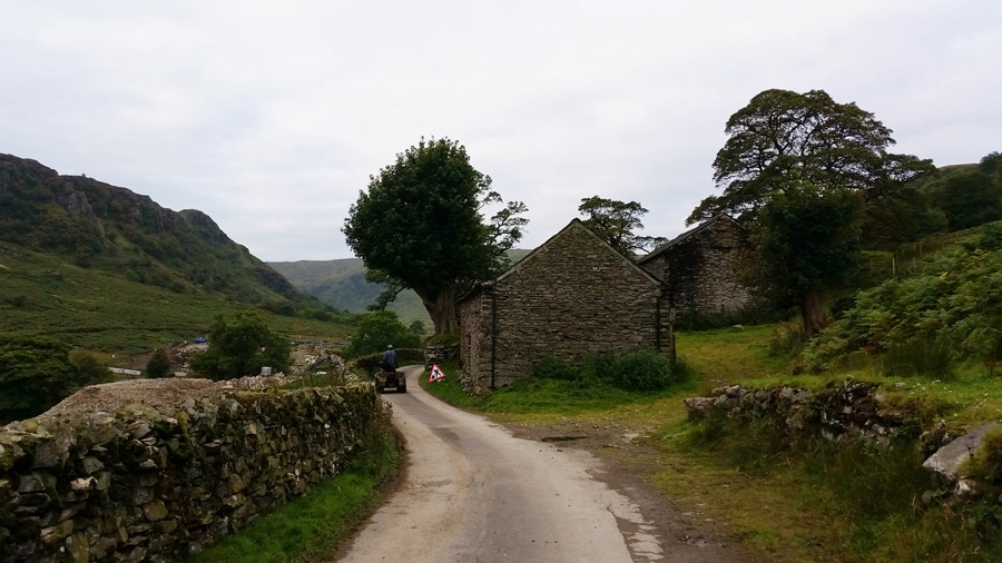 |
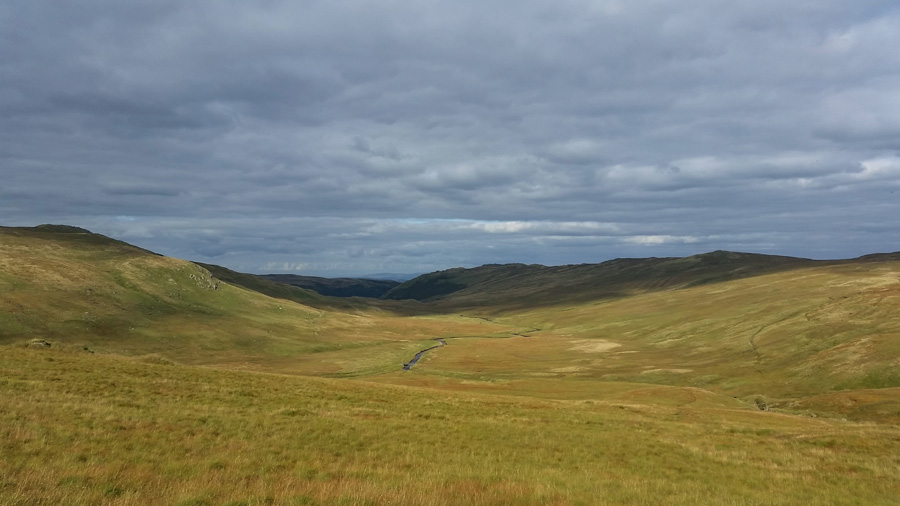
| Swindale Lane 08:15am °9C |
David and I had arranged to meet quite far back up Swindale Lane close to the old Filter House where we arrived at 08:00am to an already bustling car park which we found a little strange due to the seclusive location, even so we managed to park the cars besides each other and kitted up under a rather muggy morning air. The forecast had predicted a dry day with sunny spells although our only emphasis was on the dry yet as I write this just twenty four hours later it's as we say in Wigan "cracking the flags out there"
With the cars locked we take in just over a mile and a half of easy walking before reaching the Old Corpse Road, what we didn't expect to see however was the flashing of orange lights and heavy plant machinery further into the valley where we were met by a large construction site fenced off by security cabins and what can only be described as an abominal sight here in one of Lakelands untouched valleys, we stopped to read the signs left by the Construction company which read they were diverting the course of Swindale Beck to help the fish swim down river, or words to that effect, seems a bit much all this disruption we piped up, agreed, and quite sad too, it was here that Manchester Cooperation had decided not to flood the valley at the turn of the century, instead opting to flood the adjoining valley of Mardale, since then, the valley of Swindale had escaped relatively unscathed, until now that is.
David takes a couple of photos but I choose not too after offering my camera up to take a photograph of Swindale Head I soon realised to my own thoughtlessness that I had forgotten to put back the battery into the camera after charging it, which was why, despite after switching my camera on, I couldn't hear that reassuring focus 'click' dam and blast you stupid bugger.
Neither of us had a spare battery but it wasn't the end of the world and I certainly wasn't going to let it spoil the walk (a full report without photos would have been just as adequate) as I lifted out my Samsung Galaxy 5 which comes with a rather nifty camera anyway, of course picture quality will now be an issue and for that I whole heartedly apologise. I packed my camera back into my pack and drew a line under the subject. Shortly afterwards we had been passed by the farmer, his wife and two sheep dogs on a quad bike, we share our 'good mornings' before they return, this time the young farmer politely asked us would we mind we hold back behind his quad so he can herd his sheep who were on the fell side to our right, yes of course we replied, this gave us time to take in the valley having left the construction behind, soon after we caught the farmer up again close to a huge hay shed where he thanked us for our politeness.
Looking back, it was rather an interesting start to the morning. |
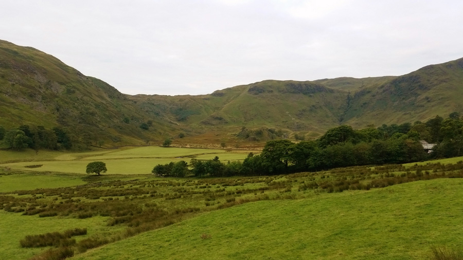 |
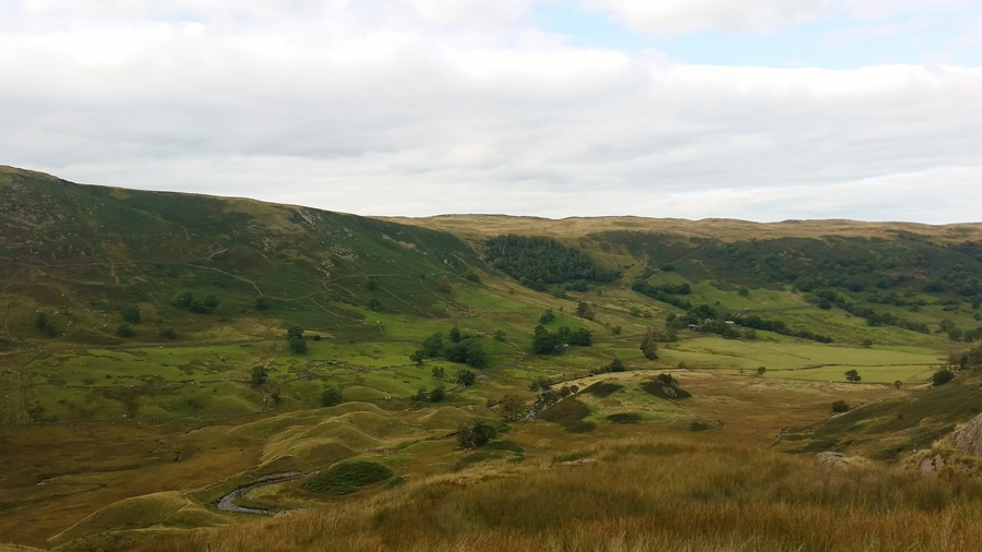
| Swindale Head seen with Hobgrumble Gill over Dodd Bottom. |
After leaving the farmer we progress along Swindale Lane taking in the valley before us, it was only now did it feel that Swindale was how it should be with the reconstruction of Swindale Beck far behind us, later we would joke about the fish who wouldn't recognise the new layout of the river thus confusing them 'lads who's holding the map' where bloody miles off here best turn around!
We head to the farm building seen within the trees from where, we would pick up the Old Corpse Road. |
 |
| Looking back on Swindale Head as we start to gain height. |
| We follow a swollen footpath enclosed by two stone walls on either side, here the path rises steadily, then steeply before steering by the right stone wall, soon after the terrace path is sighted above - in order to gain the path we switch a sharp left as views start to open up along the Corpse Road. |
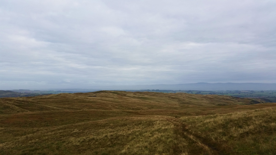 |
| Here, looking back to Hare Shaw from our Selside Pike ascent. |
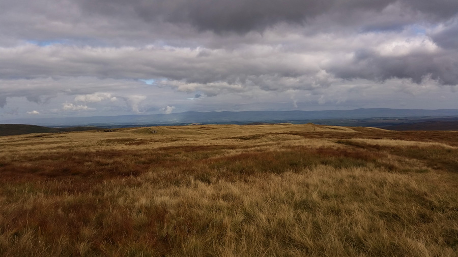
It's fair to say that my photography was rather restricted with my mobile phone, not helping was the low light which my newly adapted camera struggled to define. In this photo we had just left the Old Corpse Road in order to gain Selside Pike and are looking back on Hare Shaw seen as the Highest point centre left, the Corpse Road runs right through the centre of the photo from left to right or visa versa depending on your line of direction. This really is great walking territory and was the main reason for being here today.
Ahead of us a group of four walkers are also making their own advances on Selside Pike, at times they stop to chat and it's looking inevitable we are soon going to catch them up. |
 |
| Swindale Valley seen as we divert off path a little to take in the classic view. |
| |
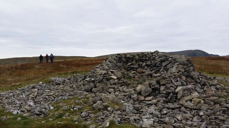 |
| Selside Pike summit shelter. |
| We caught up the four lads at the summit shelter where we pass on our 'good mornings' they are holding maps and look to be first time summiters 'good times' I quietly think. Our time at the summit was brief too and plans were unfolding in which was the best way to reach Howes, from the summit we have a good take on the land as conversation is taken up between leaving the summit and gaining a little height as we traverse our way around Captain Whelter Bog, we both agree to keep a steady height around the valley head in order to 'drop on' Howes rather than climb onto it. |
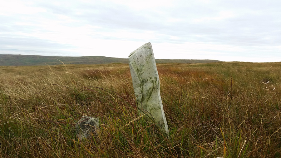 |
| A Boundary Marker is passed as we round the valley head. |
| We may have taken the wrong line while, at the same time mis-judging the terrain on our map with what we were actually dealt with in order to reach the collection of Tarns found at Howes summit, here the ground crests and rises over tricky grassy hummocks making some time consuming work indeed, nevertheless we soon found the small Tarns on Howes, as David went onto explain, they were exactly what I expected. |
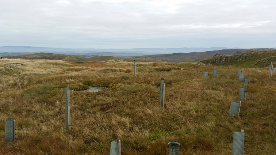 |
| Howes Tarn(s) |
The Tarns found at Howes are just small pools of water which can easily be mistaken as puddles 'I've come across a few Tarns like this' David went on to explain, however, all was not lost as we had been watching a herd of Deer lead by a full grown Stag since leaving Selside Pike summit, we thought we had seen the last of them, even at a distance of around half a mile they bolted and had disappeared from view. After checking an outlier Tarn situated on the far end of the ridge David came across them again at a distance of only thirty meters or so, they of course bolted instantly but before so, David did manage a few photos which we both agreed afterwards, made our out and back in locating the collection of small pools more than worth it.
We steer a line towards Branstree Tarn found at the Col between Selside Pike and Artle Crag. |
 |
| Looking back at Howes. |
| We take an 'as the crow flies' approach meaning whatever ground we found before us, we would tackle it as it came along, we talked about finding the easier line from Howes but that would have eaten into too much time, instead, we slog it. |
 |
| Rewarding views over the valley of Swindale. |
| In keeping with our pathless approach to Branstree Tarn we flank Selside Pike subsidiary summit making sure we maintain a constant level of height which was hard work indeed given our terrain. Soon walkers would appear to our far right flank indicating that we were close to both path and Tarn, this was a welcome sight on tiring legs so early into our walk, soon we could redeem them during the slight ascent on Branstree, but first... |
 |
| Branstree Tarn. |
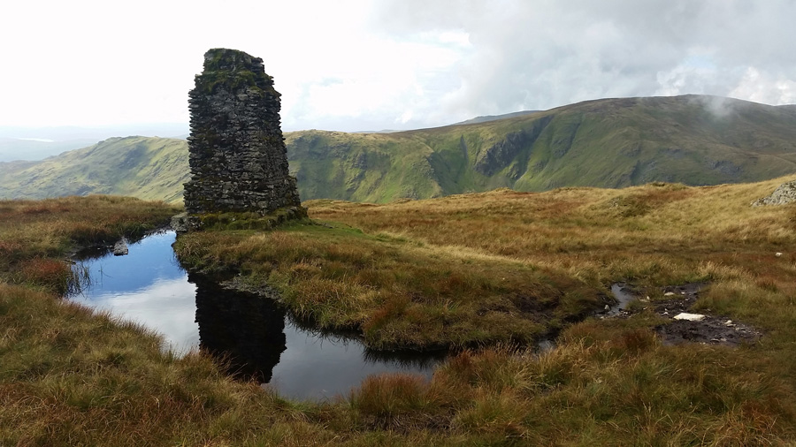
| We trot our way down to Branstree Tarn leaving the grassy rises behind, at the Tarn we find the ground is swollen but this is easily negotiated, we take a few snaps before heading out to the Survey Pillar left behind by Manchester Cooperation during the construction of the Haweswater pipe line. |
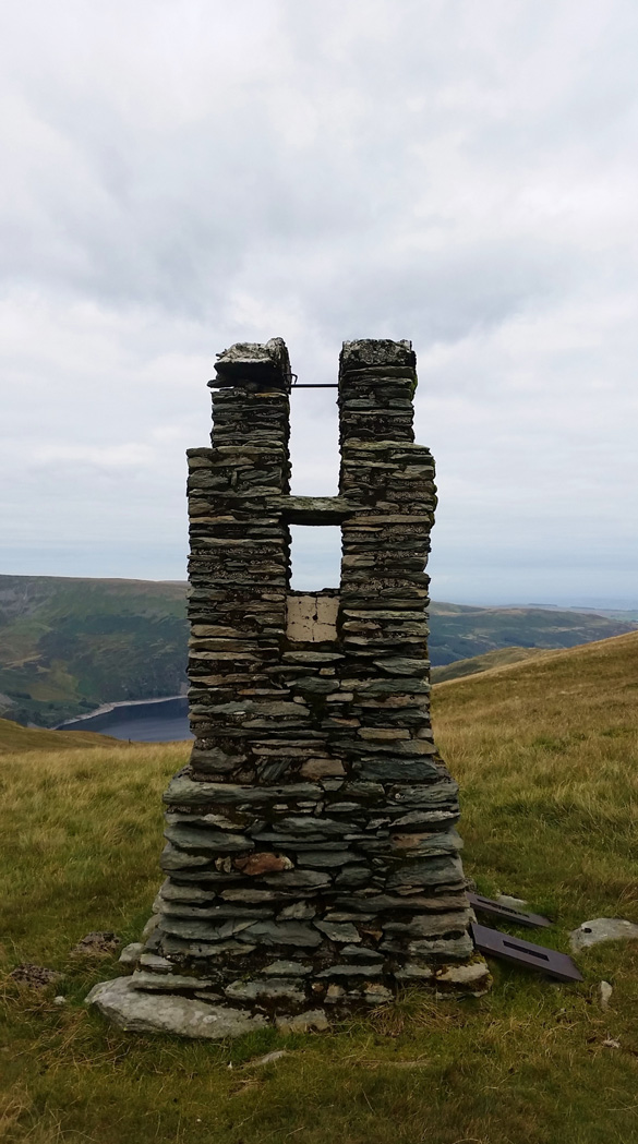 |
| Haweswater Survey Pillar. |
| Found between Artle Crag and Selside Pike. |
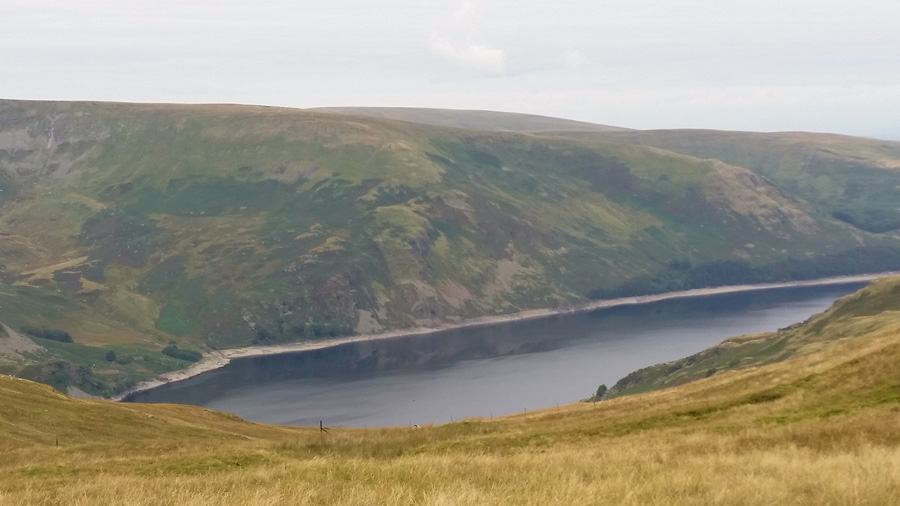 |
| Views over Haweswater Reservoir towards Castle Crag, Low Raise, High Raise and Measand End. |
| |
 |
| Selside Pike from Artle Crag. |
It was a welcome but short pull in order to gain Artle Crag where we passed a young woman with a young child, oddly carrying a wooden stake in her hand, we agreed she didn't look like a vampire so why the wooden stake? Perhaps she needs it to complete her fence at home, either way that looked a heavy piece of wood for such a little figure.
Our legs, now redeemed and thankful for our path we underfoot trot on towards Branstree summit. |
 |
| Branstree summit circular Trig Point. |
We soon arrived at Branstree summit and had the place to ourselves, with a liitle sadness it was whilst at Branstree summit did I look up on High Street, unable to capture the Rough Crag ridge under moody light with my mobile camera did I feel the want to kick myself once more, well, mistakes happen which is why they put rubbers on pencils I guess.
Still, yer daft bugger. |
 |
| Distant views towards Tarn Crag (Longsleddale) from Branstree summit. |
| It was late morning by now and the topic of conversation was lunch and where to have it, between Branstree and Tarn Crag there is quite a lot of descent followed by steep ascent in order to gain Tarn Crag summit, there was no point filling our bellies here before all that so it was agreed we would eat lunch after the hard work was behind us, my stomach wasn't best pleased with this but, was the best plan of action. |
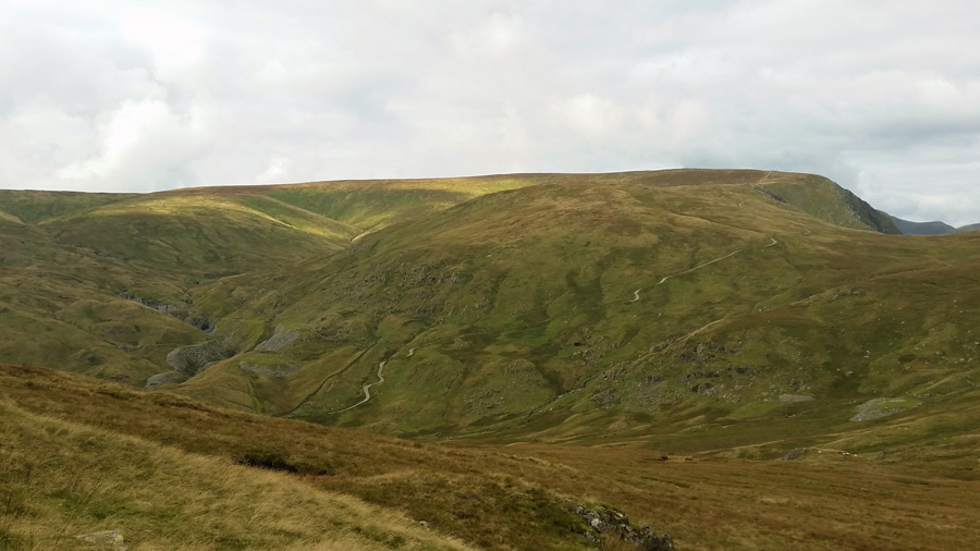 |
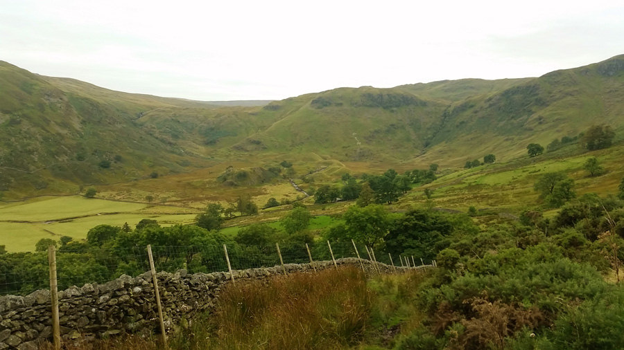
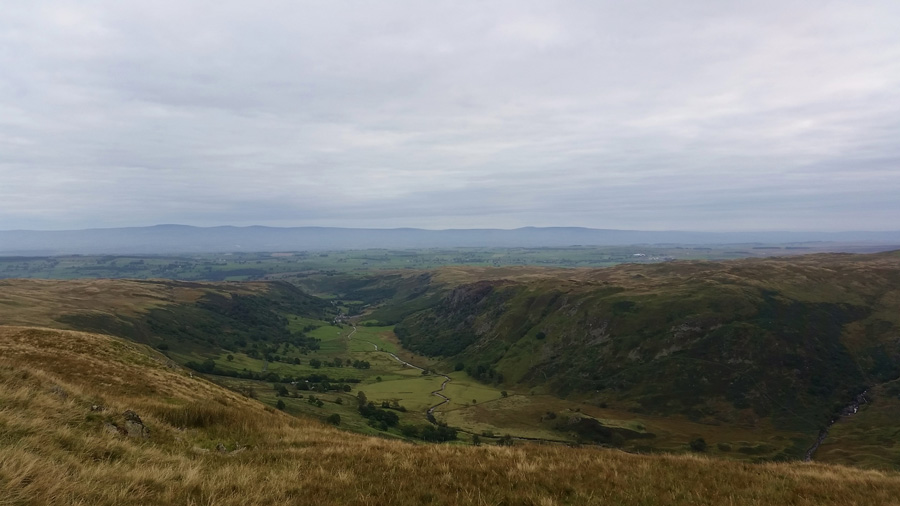
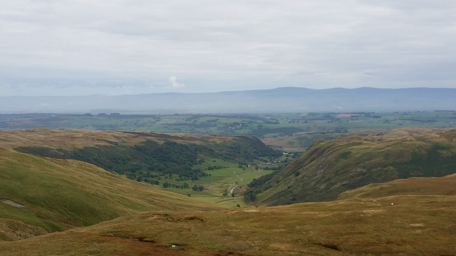
| Looking over Brownhowe Bottom towards Harter Fell (Mardale) |
| With the descent via Selside Brow behind us we could now concentrate on lunch, err I mean ascending Tarn Crag, but before all that we had to negotiate the notorious bog in the Col between both summits, our boots were already wet by now and getting them wet was no further hardship as we wadded through bog before picking up the steep climb. Behind us a fell runner is also taking on the bog but we won't know if he is following us up Tarn Crag or heading through Mosedale until he reaches the base of the path, as it turns out the young lad follows us up and soon catches us up while David and I stop to chat about website stuff 'muggy int it' aye not half, the lad with youth on his side soon disappears off in the distance and we pick up on our conversation by which time, the sun had started to come out. |
 |
| Kentmere Pike, Goat Scar and Shipman Knotts from the Survey Pillar on Tarn Crag. |
| Soon after we reached the summit of Tarn Crag (Longsleddale) not before witnessing the young lad running off in the direction of Greycrag Tarn, by now my stomach was growling and my pack was just held on with the one shoulder, however, before lunch we walk over to the true summit of Tarn Crag to take a few photos. |
 |
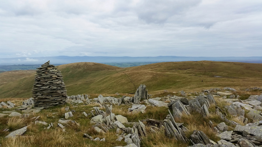
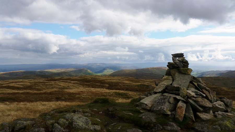
| Tarn Crag (Longsleddale) summit cairn. |
| |
 |
| Grey Crag from Tarn Crag (Longsleddale) |
| |
 |
| Views eastewards towards the Pennies from Tarn Crag summit. |
The sun had started to come out with prominence and had started to illuminate the wild grasses along the summit plateau, this is the time of year I love fell walking best as changes to scenery become all more vivid and apparent which was just another reason for being here today.
Okay, I'm sure it's food time now. |
 |
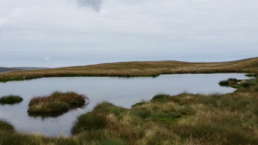
| Harrop Pike and Grey Grag over Graycrag Tarn (Dry) from our lunch spot. |
We pick a spot to lunch over looking Graycrag Tarn where the air is warm and the wind is slight as from time to time we spot walkers walking between the adjoining summits of Harrop Pike and Gray Crag, we didn't expect it to be as busy as it was but I guess they were only here for the same reason as ourselves.
With bellies fed we shoulder pack and take a direct line down to Greycrag Tarn, not really knowing what ground conditions we will find when we reach the edge of the dry Tarn, we were surprised to be able to walk across the area relatively unscathed taking a direct line towards the fence, it was only there did we experience the bog like conditions notorious to the area. It was also here we pass a Scottish couple who were reminded not to come here again once they had got there summits 'this is like the area above Watendlath she pipes' (we guess at the High Tove ridge) and we wont be going back there again either!
The less said about that sentence the better I suppose.
We trot on towards Gray Crag summit passing two gents along the way, no complaints, just a smile. |
 |
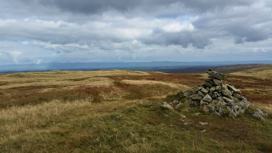
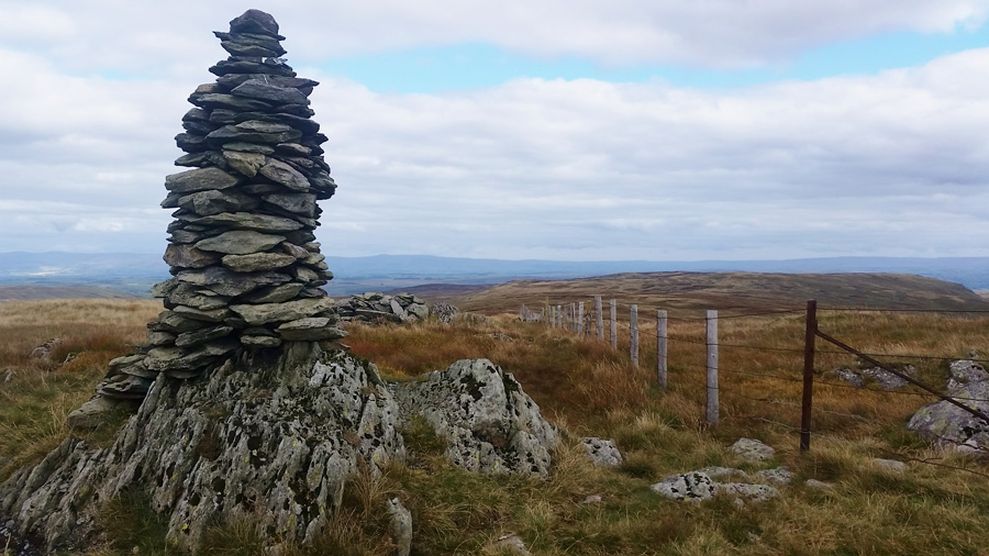
| Grey Crag summit cairn. |
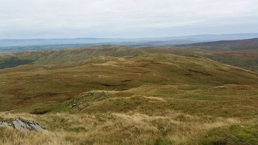
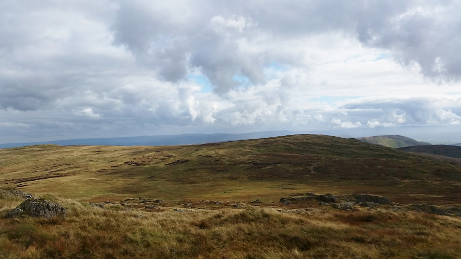
| After more bog negations Grey Crag summit was soon reached under a scattered afternoon sun, we dug our walking poles in if only to take in our views of the adjoining valleys of Crookdale, Bannisdale and Longsleddale. This is an area of Lakeland that both myself and David immensely enjoy walking in due to its terrain and seclusion, it's the kind of place you are almost guaranteed to have to yourself on long summer walks, more so in the bleakness of winter, a truly challenging and inspirational part of Lakeland. |
 |
| Great Yarlside from Harrop Pike summit cairn. |
We take on sodden ground between Grey Crag and Harrop Pike with views of another favourite summit of mine in Great Yarlside, seen here in the right of the photo, I remark to David in my own personal opinion that between Grey Crag and Great Yarlside is perhaps, one of Lakelands best miles.
We chat about how we would reach the Mosedale Valley and Swindale from our vantage point here on Harrop Pike before agreeing on a descent via Brunt Tongue which sits just north east of Harrop Pike. David spots a group of rocks situated on the southern flank of Brunt Tongue which is where we steer for, but first we needed to descend Harrop Pike which is done relativity pathless through long wild grasses and equally long reed beds.
With the descent taken care of we can now join the Brunt Tongue ridge, here we spot the same group of Deer again, with the male Stag, still too far away for a photo they head up the flank of Selside Pike from where, they had no doubt came. Once on the Brunt Tongue ridge we head north east towards lower Mosedale flanking Mosedale Cottage to our left, here again, the ground is hard work with deep saturated grassy marshes found along the whole section of the ridge, thighs are stretched as conversation dips - ahead the end is near and we are thankful that the traverse across the ridge is almost coming to an end.
The sun comes predominantly clearing any broken cloud leaving the fells and valleys adorned in afternoon sun. |
 |
| Mosedale, Mosedale Beck, Nabs Moor, High Wether Howe and Scam Mathew as we descend Brunt Tongue. |
| |
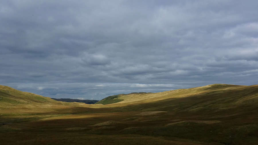 |
| Afternoon light over Mosedale. |
With the Brunt Tongue ridge now behind us we take on the delights of Mosedale in the ever changing afternoon light, below us and off to the far left is the bridge we are heading for in order to cross Mosedale Beck, we take on the familiar track which leads us to the Mosedale Beck, yet seeing as this is a 'Y' junction in the river we now find ourselves on the wrong side of the bridge, oh dear.
Without hesitation we both cross Mosedale Beck without incident, only letting the bottoms of the walking trousers get further drenched. Ahead is the head of Swindale seen in the centre of the photo where more swollen ground needs to negotiated, we flank left below Nabs Moor and Nabs Crag picking up a single extremely slippery path where I take a slip landing on my left hand side, only pride is damaged here I as I get up and wipe the mud from my trousers. David reminds me of the time he and Richard Ratcliffe spotted a naked man (yes a naked man) around the Force Falls area of Swindale Head, what even no boots I ask...no boots completely naked.
The funny thing David explained was, I had dropped a piece of my kit and had to go back for it, the fellow starkers; had picked it up and said 'have you dropped this' I mean...where do you look he laughed!
Dear god it takes all sorts. |
 |
| Descending into Swindale Head. |
| |
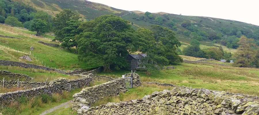 |
| Swindale Lane. |
After more laughs about the naked man we soon found ourselves on the valley floor having passed Dubbs Bottom and Hobgrumble Gill to our left before taking in the traditional stone walls that make up Swindale Lane, it's well over a two mile walk back to where we had left our cars this morning and all this is now done under a warm afternoon sun.
Todays walk in Swindale is just what was needed to bring me back to walking normality, I chose to walk here because of what this part of Lakeland offers the walker, in seclusion and think time, there is no finer place in Lakeland that can bring a man back down to his his/her walking needs other than Swindale, and that is were this fine walk ends. |
|
| |
| Back to top |
 |
|