|
Riggindale, Short Stile and a High Street Skyline |
 |
 |
3rd October 2015 |
 |
|
I guess I could say that this walk has been close to two years in the making, I have often spoke of gaining High Street via Short Stile but the idea always got pushed back for one reason or another. I would often view the valley of Riggindale from the heights of Artle Crag on the other side of Haweswater and gaze upon the natural features forming at the head of the valley, each time the curve that sweeps steeply from Kidsty Pike summit to Short Stile forming a mini Cirque had always caught my eye and caused curiosity. It was only while on last weeks walk from Selside Pike did I come to think that I really need to get into Riggindale and do some much anticipated exploration of the valley, enough talking, more walking so to speak.
The ascent of Short Stile had already been planned from previous trips to High Street and Kidsty Pike, the ascent looks viciously steep so instead of hitting the mini ridge head on, I had planned to attack the ascent from the Kidsty Pike side of the ridge if only to exercise on the side of precaution, but I'll get to that later in the walk.
If god was giving out days to walk on today he dealt the far east of the district his best hand, adding to this not only was I exploring of the valley of Riggindale, but I was also summitting one of my favorite summits in the process, I simply can't see how today could have got any better than it turned out. |
|
| Wainwright Guide Book Two |
 |
| The Far Eastern Fells |
‘A striking range in grandeur and wilderness’ The range forms across the eastern spirit of Lakeland, providing a splendid full days march at a consistently high altitude, but is, distant to the areas most favoured by the fell walker and is comparatively unfrequented, appealing mainly to the lovers of mountain solitude. |
 |
|
|
| |
|
Overview |
|
|
| Ascent: |
2,913 Feet - 889 Meters |
| Wainwrights: |
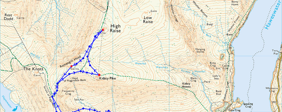
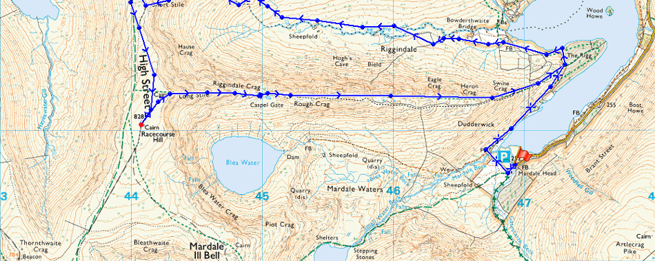
4, Kidsty Pike - High Raise (Martindale) - Rampsgill Head - High Street |
| Weather: |
Sunny with Light Winds. Highs of 11°C Lows of 5°C |
| Parking: |
Car Park, Mardale Head, Haweswater |
| Area: |
Far Eastern |
| Miles: |
9.5 |
| Walking With: |
On My Own |
| Ordnance Survey: |
OL5 |
| Time Taken: |
5 Hours 30 Minutes |
| Route: |
Mardale Head - The Rigg - Riggindale - Riggindale Beck - Short Stile - Straights of Riggindale - Kidsty Pike - High Raise (Martindale) - Rampsgill Head - Straights of Riggindale - High Street - Caspel Gate - Rough Crag - Mardale Head |
|
| |
|
Map and Photo Gallery |
|
|
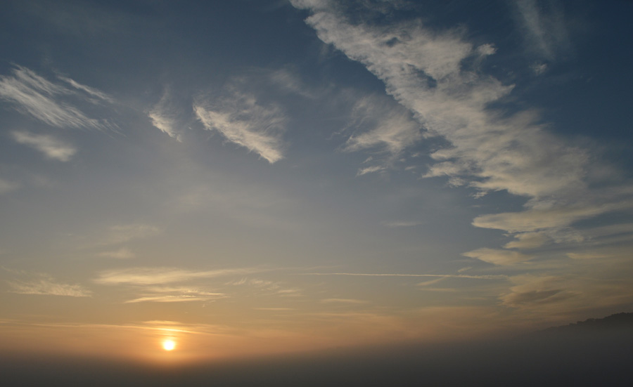 |
| Sunrise from Burnbanks while on route to Mardale Head. |
| |
 |
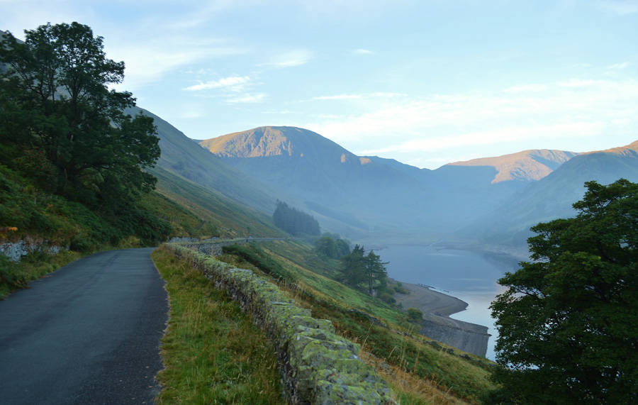
| Morning light over Harter Fell (Mardale) Mardale III Bell, The Rigg and High Street. |
| |
 |
| Mardale Head, Harter Fell (Mardale) the top of Nan Bield Pass and Mardale III Bell taken close to Rowantreethwaite Beck. |
| |
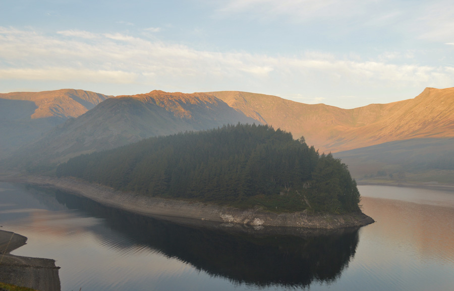 |
| Mardale Ill Bell, The Rigg, High Street, Kidsty Pike, and the valley of Riggindale topped in a morning afterglow. |
| |
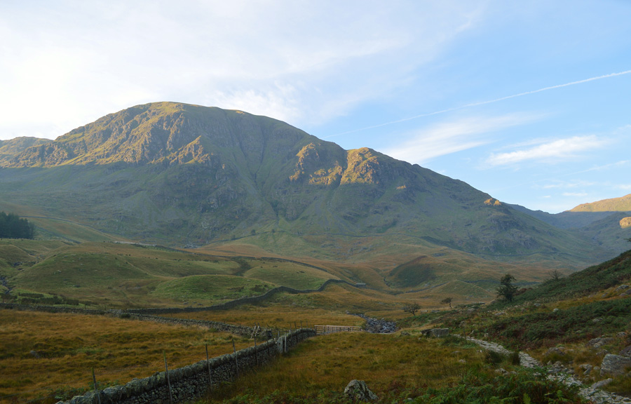 |
| Here looking back on Harter Fell (Mardale) 08:30am 5°C |
By the I arrived at Mardale Head it had gone 08:00 due to my camera stops along Mardale Road. I parked easily even though there was at least half a dozen cars there already some of which, as I was soon to be informed had been there all night. I kit up shaded by the surrounding fells of Branstree and Harter Fell causing the temperature to feel much cooler than it actually was. I hadn't noticed at first but behind me I can hear the sound of a diesel engine running...any minute now the owner is going to turn it off and Mardale can return to how it should be, peaceful. Instead the owner blips the accelerator letting the engine revs go from high to low every minute and, it's getting really annoying.
I'm soon ready for the off but I confronted first by the owner of the Transit who still, rather annoyingly hasn't turned his rattling engine off, he walks over - tea stained cup in hand and says 'off out' where too? I'm heading into Riggindale, he then points at Harter Fell and says, is that it?
I like to think I'm a polite and tolerant person, but this guy is actually questioning me asking me was I sure? he then proceeds to tell me where the owners of the cars are from before telling me, he had seen the male Golden Eagle from his van window over Haweswater just the day before, granted there is a male Golden Eagle native (or presented in Riggindale) but the chances of seeing it from your van window are pretty slim I suspect.
I bid him a good morning and I'm soon on my way again.
The noise from the van engine gets fainter and fainter as I leave the car park before crossing the wooden footbridge over Mardale Beck, what happened just minutes earlier has already been forgotten as I am lost in trance at the tranquility and beauty of my surroundings. |
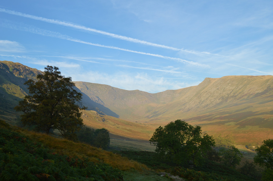 |
| Riggindale. |
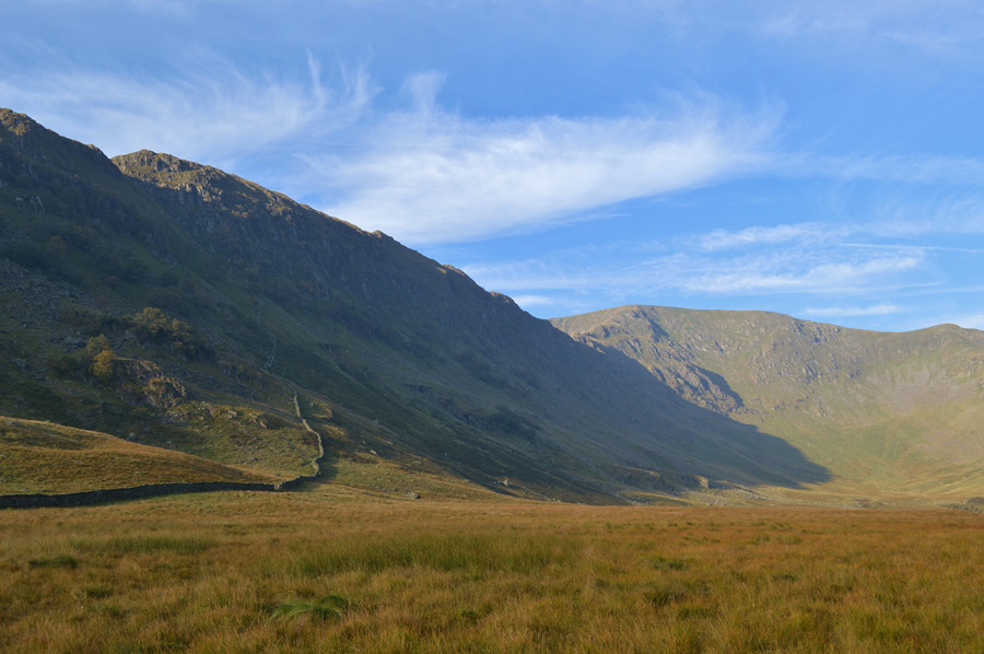
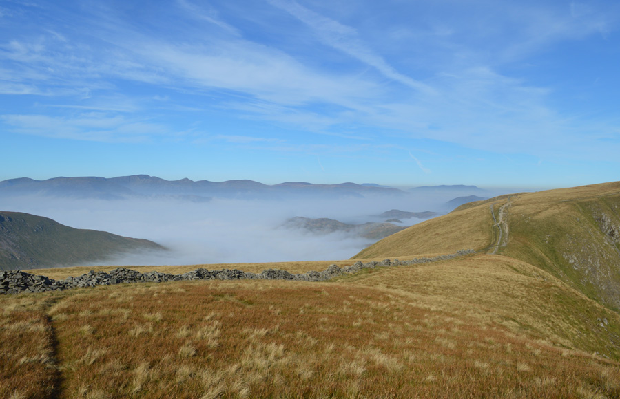
| Still in shade I climb steadily towards The Rigg while the temptation to change my route and head onto the High Street ridge is toying around in my head, that was until I was met with this view of a sun drenched Riggindale, my route onto Short Stile, a little over a mile and half ahead is clearly visible which keeps temptation at bay. |
 |
| Swine Crag and Heron Crag. |
| |
 |
| Views over Haweswater close to where Riggindale Farm once stood. |
| This is more like it, ahead I have clear and distant views of the Riggindale Valley while to my right the stillness of Haweswater sets the mood of the morning, things could not be any more perfect. |
 |
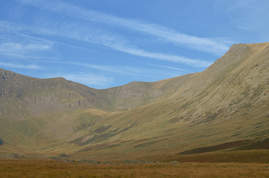
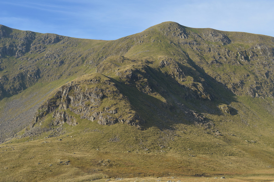
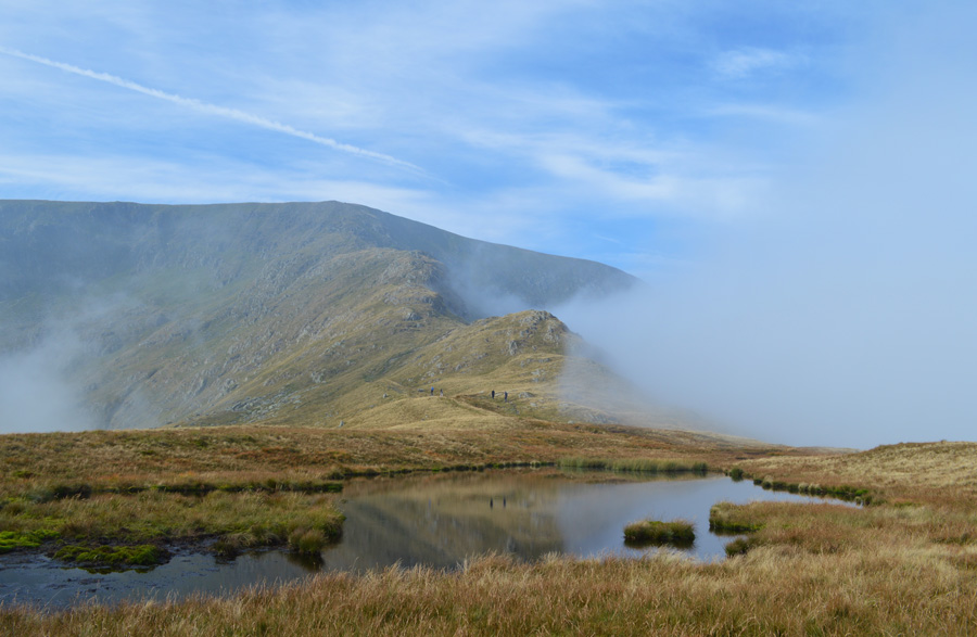
| Kidsty Pike, Short Stile and Riggindale. |
I follow a wide grassy path maintained by grazing sheep, the path heads towards the first of two RSBP Viewing Stations seen here in the right of valley, the second Station is found close to the trees in the centre of the photo.
As previously mentioned there is a male Golden Eagle who is thought to be around 16-17 years of age which is considered to be of prime age, he is currently looking for a female which may have caught your attention on local news stories throughout the year, his predecessor was thought to have been around 32 years of age making him a prominent feature to Riggindale during the 70's and 80's before the current Eagle was re-introduced in 2001
With this, and maybe some high hopes of seeing the Eagle myself I head into the valley all the while a strong sun is now starting to appear over the summit of Branstree behind me casing the valley temperature to rise almost instantly. |
 |
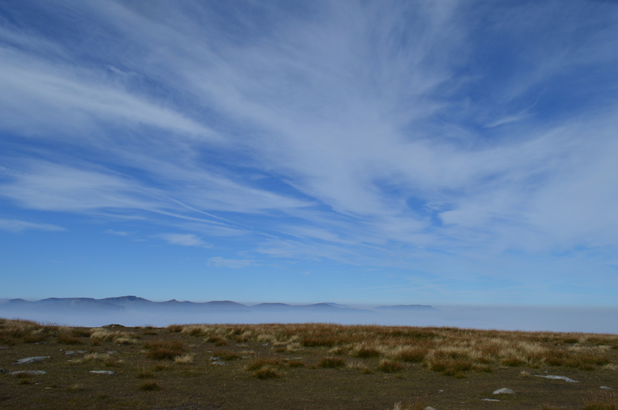
| Here, I stop to take in the views back over Haweswater and Selside Pike. |
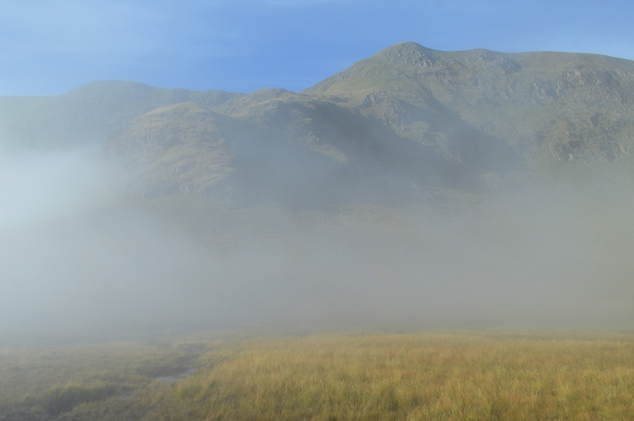
Unbeknown to me at the time I took this photo a cloud inversion is aproaching over Haweswater, it had only taken me less than five to ten minutes since leaving the banks of Haweswater and back then, there was no sign of the inversion. My idea was that the inversion would confine itself to the low tempretures found over Haweswater, perhaps come inland a few hundred feet and remain there.
At first I pay the approaching clould little attention but put it on a 'low level risk' in the back of my mind, afterall, today before setting off for Lakealand I took Holly out for a walk back in Wigan and could hardly see ten feet in front of my face, that was around 5.30 this morning and I had driven through fog banks all the way up too, so seeing the cloud as was nothing unusual. |
 |
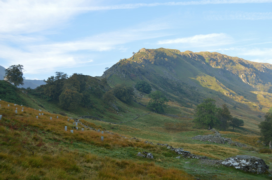
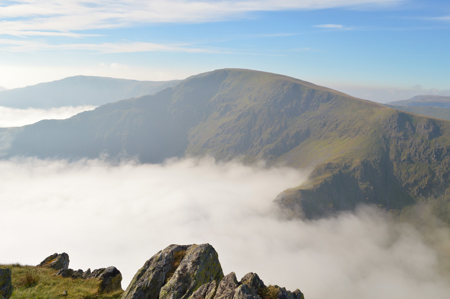
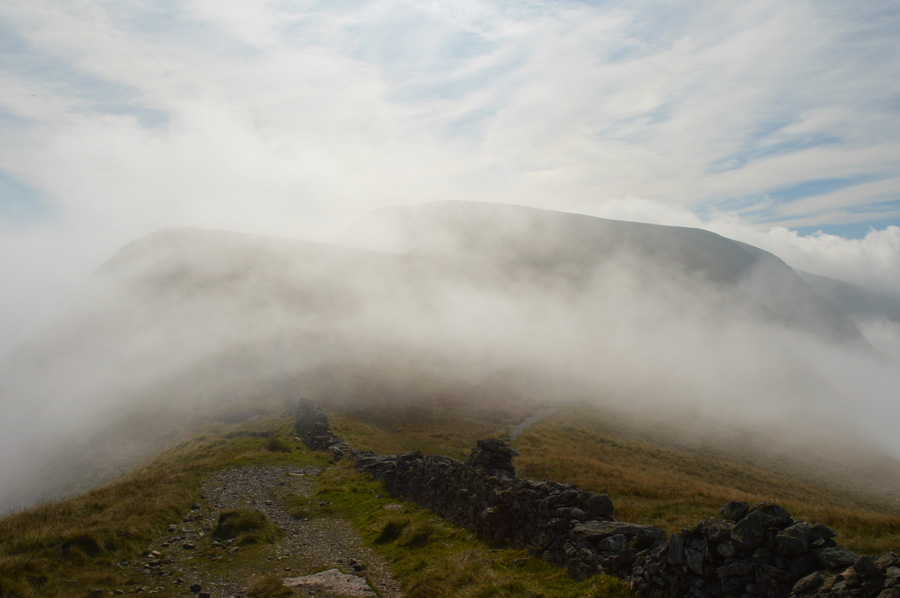
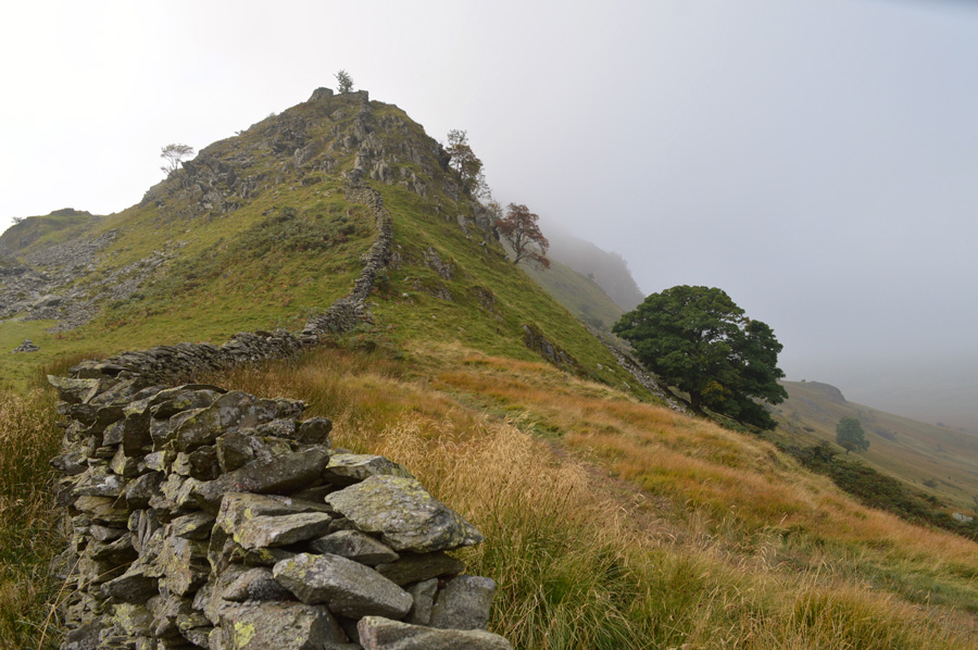
| A close up of Short Stile, Two Penny Crag and Kidsty Pike. |
Having left the Stations behind I make my way to the right-hand side of the valley, first crossing Riggindale Beck before rising steeply on the other side of the bank from which, I seem to have spotted a faint path. Here I get my clearest views of the natural curve that forms from Kidsty Pike summit to Short Stile's summit, found in between, a mini Cirque known as Sale Pot where, you would expect to find a Tarn, instead the source of Riggindale Beck begins life here.
My next dilemma was which course do I take in order to reach the foot of Short Stile, as far as I can see I have two options, one is to follow the course of Riggindale Beck which will naturally lead me to Short Stile or two, leave Riggindale Beck and steadily pick my way in a horizontal type of ascent, I go with the latter.
With this I leave the remnants of the faint path behind before picking my way through shrub and bracken, all the while maintaining a steady ascent passing over subsidiary stream outlets that are tiring as these were often found in deep channels below Kidsty Pike summit. |
 |
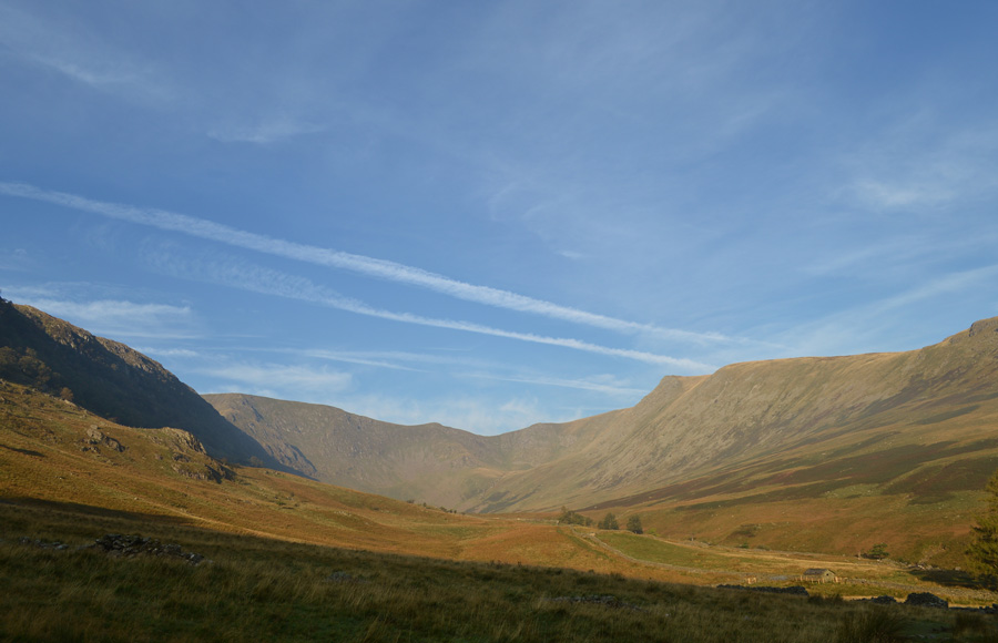
| Lengthening views along the Rough Crag Ridge, Long Stile and High Street. |
| |
 |
| The Cloud Inversion has finally caught up with me. |
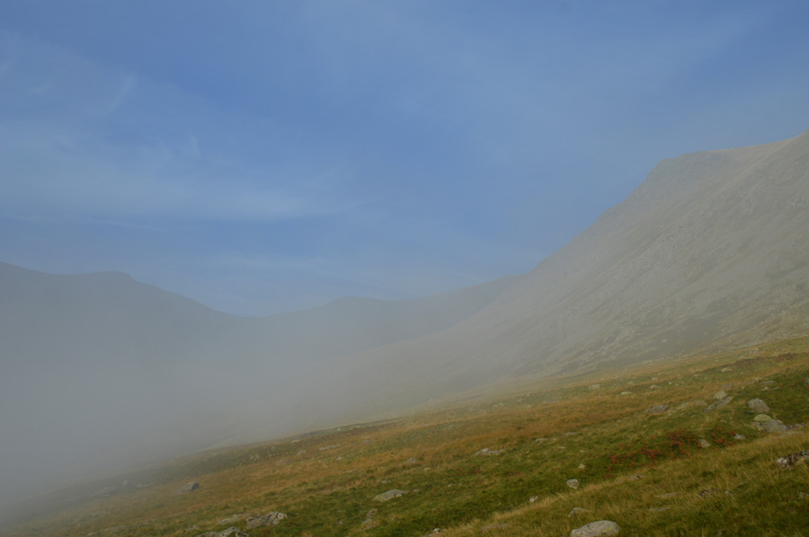
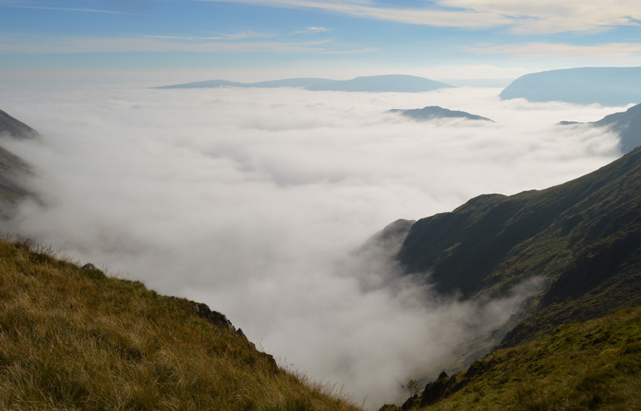
With incredible speed the cloud inversion soon caught up with me as it came in around the back clinging to the lower flanks of Rough Crag, in awe I watch the cloud first approach, then overtake me as it soon became apparent, there was not a chance in heaven I was going to keep ahead of it, the most frustrating thing right now however, was the fact that with the loss of visibility I was soon to lose the sight of Short Stile, and more importantly, the route I was about to take, I had no choice other than to navigate by map and GPS, after all, the last thing that I needed was to find I was ascending Kidsty Pike instead of the Cirque.
For the next half hour or so, and with Riggindale Beck, at a distance to my left I take a mental bearing and head steadily and steeply towards the foot of Short Stile, there is no sound, no sign of any sky just an over whelming calmness which has descended along with the inversion. Through the cloud I can see the sun but it fails to burn through the cloud, as far as I knew, this was begining to feel like a bank of fog that now, has almost put any views of my Short Stile ascent on the back burner, I had gone from high to low within the space of ten minutes and there was nothing I could do about it.
The sun tried its best to break through, at times I could feel its warmth and with it, came increased visibility but mother nature was merely playing tricks on me only for the light to fade along with any views.
Had I known that I was beneath a cloud inversion and the thought of a credable chance to climb out of it, my thoughts would have been much more uplifting, but again, mother nature was making me wait until it suddenly happened... |
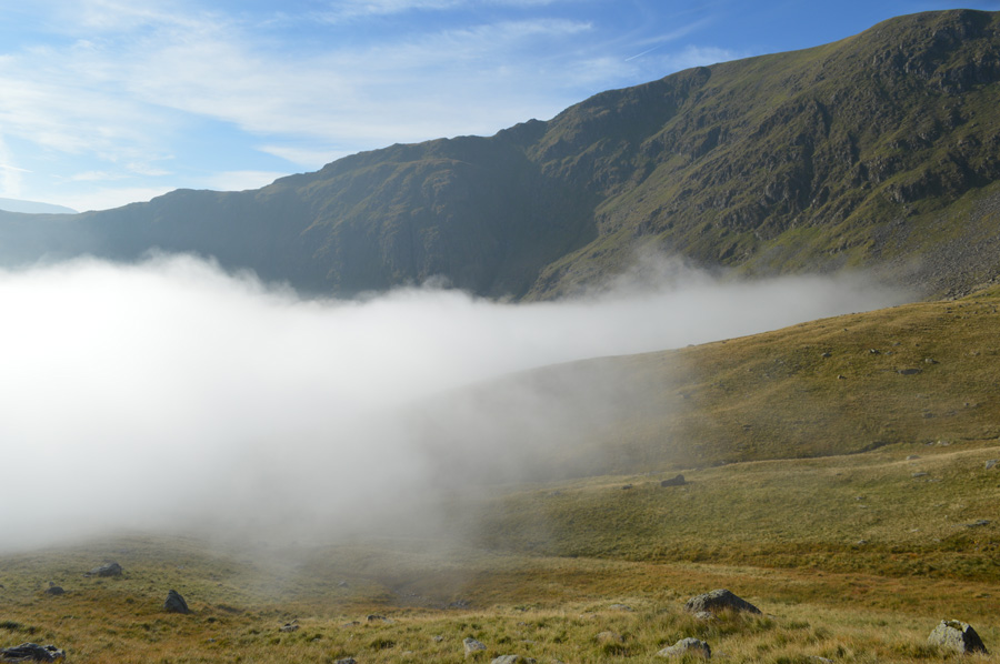 |
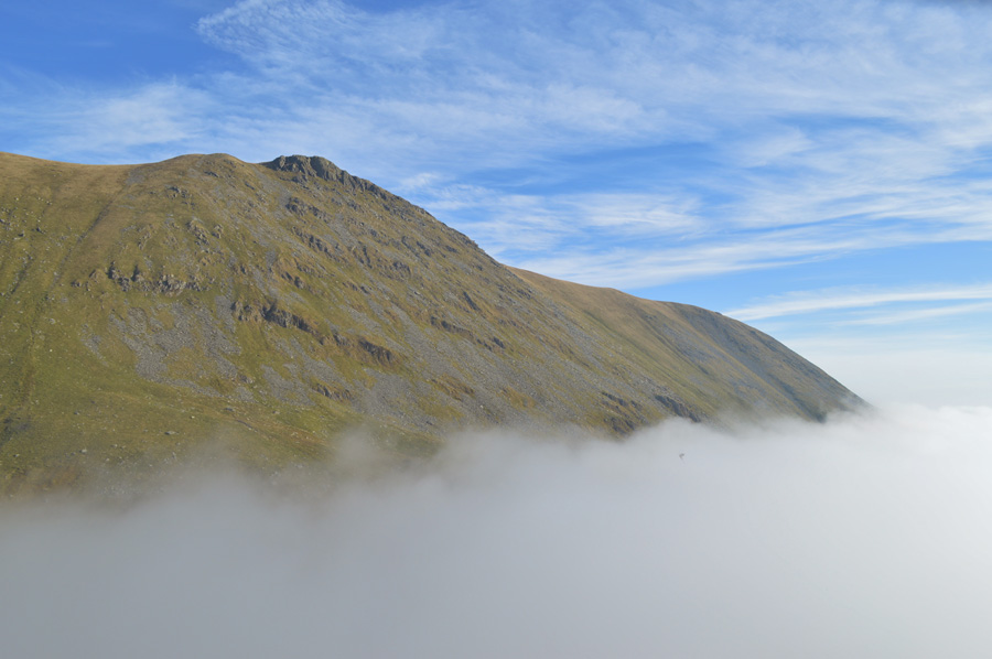
| I climb my way out of the Inversion. |
My heart was almost pulsating out of my chest the moment I realised that I wasn't walking beneath a bank of fog, but a cloud inversion that once more, I had climbed out of, My eyes could barely take in everything that was unfolding, so much so I span on the spot making sure that it was real and it wasn't just a gap in the cloud, above me, blue skies. Behind me the whole valley of Riggindale was under a cloak of cotton wool as far as the eye could see, with this I hear the unmistakable sound of a heard of Deer rutting although their exact location seemed to be beneath Two Penny Crag, later I would confirm this.
Just in case I should get caught again by the inversion I quickly take a line and in fact, find I have to descend a little to reach the foot of Short Stile first crossing a youthful Riggindale Beck, the rutting continued but I now find I am in a race against time, despite wanting to view the Deer, my intention is to make my way to the base of Short Stile first. |
 |
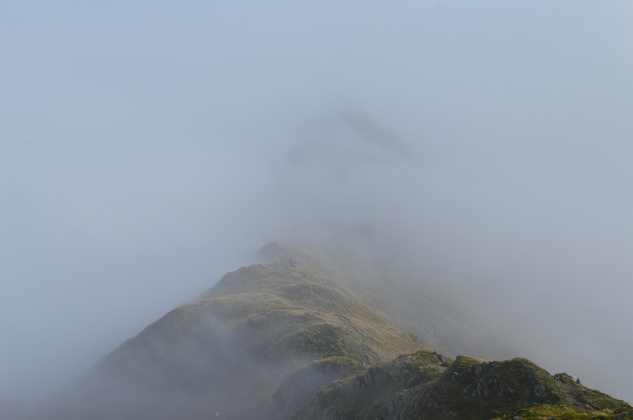
| Short Stile over Sale Pot. |
In my eagerness to reach the foot of Short Stile, and still racing against time to reach the base of the crag, any thoughts of exploration of the cirque sadly diminishes. Here comes the inversion again, this time... |
 |
| Gathering strenght. |
| Despite this, at least I now know what I am dealing with and the chance that once again, I will be soon above the inversion which should make for some jaw dropping scenery. |
 |
| The mighty Kidsty Pike from my ascent on Short Stile. |
Having already planned my ascent on Short Stile previously I quickly changed the route on which I would take, instead, opting for the more direct approach over grass and crag, the ascent is steep bringing my walking poles to almost shoulder level, a faint path can be found in places especially from the base of the crag, this lends its way away from the face and indirectly, around the back which was my own intended plan of ascent, I found the direct ascent steep, but immensely enjoyable.
Especially when faced with views like this... |
 |
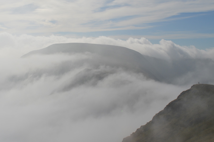
| Riggindale Cloud Inversion. |
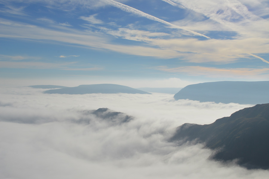
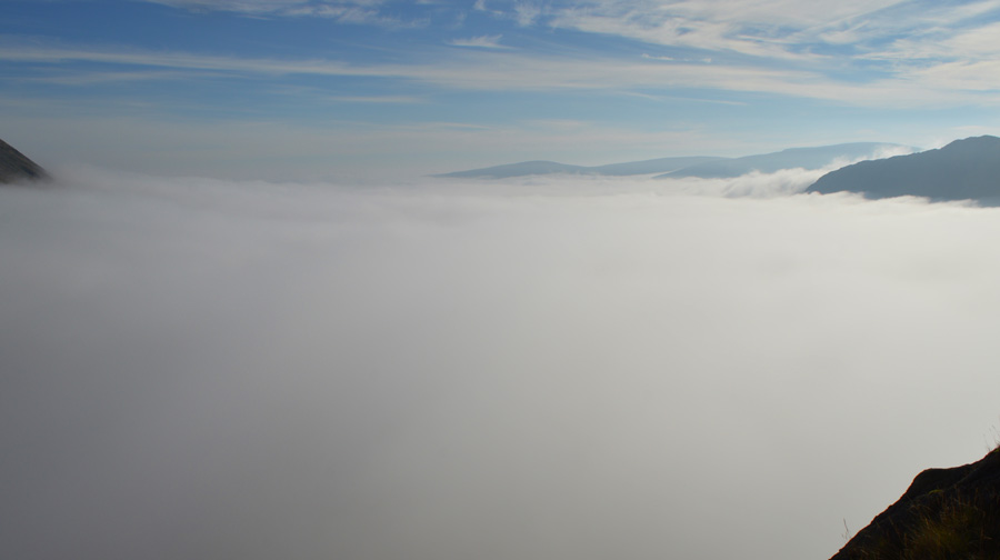
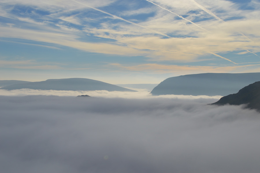
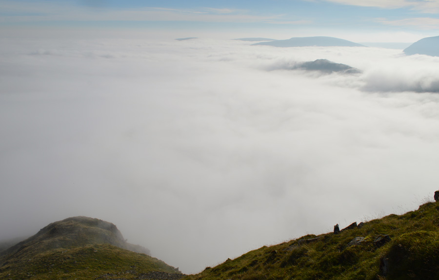
| The strength of the cloud inversion was plain to see, it was enormous and seamlessly, had triggered from almost nothing, when I look back at the timings of my photos, I passed the first RSBP Station at the foot of the valley at 08.58am, it is now 10.07am - It has only taken a little over one hour to go from excellent visibility to complete inversion, that's simply staggering. |
 |
| Kidsty Pike. |
| |
 |
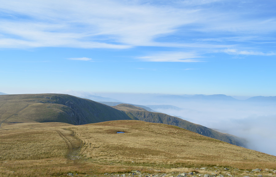
| Views over the valley of Riggindale towards Selside Pike, Branstree and Harter Fell (Mardale) |
| |
 |
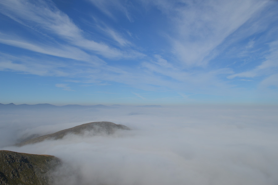
| Any clues what the little summit peaking out above the cloud is? |
| |
 |
| Rough Crag. |
| Dear god I think I've died and gone to heaven, and I'm thinking that's exactly what the three walkers are thinking who are standing at the summit of Rough Crag right now. |
 |
| Awe inspiring views that left me feeling mesmorised. |
| |
 |
| Rough Crag and Long Stile. |
| |
 |
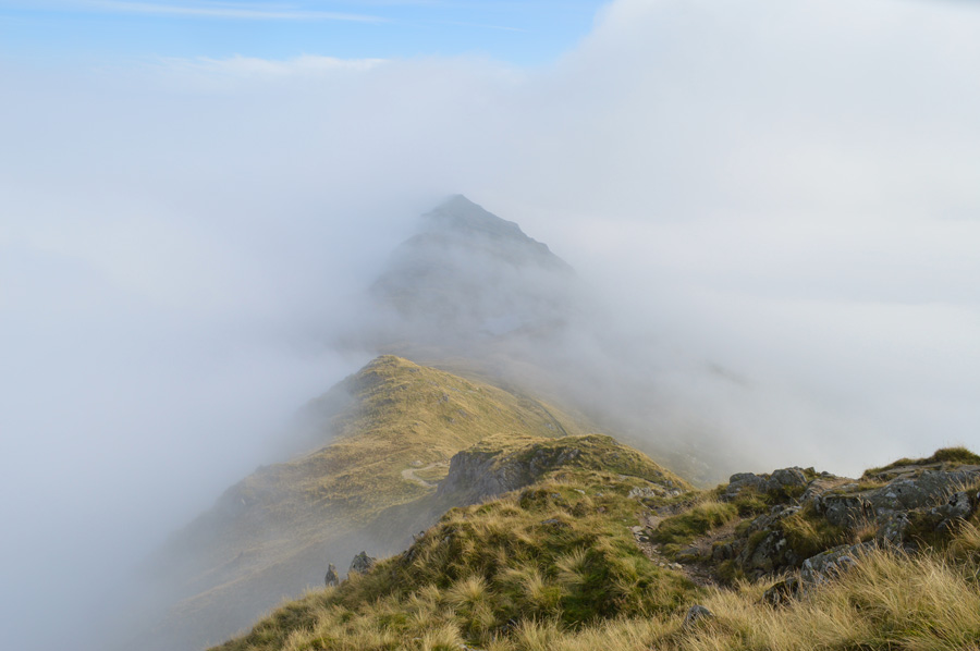
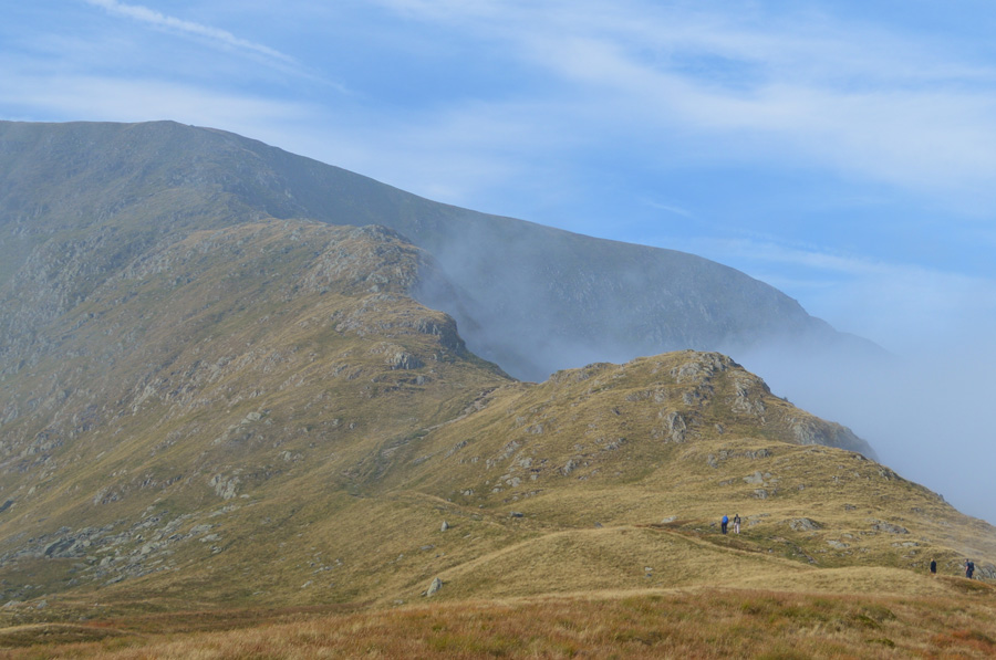
| Looking down on Short Stile. |
Lets get briefly back to the walk. By now a large crowd had gathered on the straights of Riggindale over looking the valley, I liked to think they were thinking; by eck that's an odd little route yon-mon's taking but in fact, they too were in awe at was unfolding below them, soon, it was like a little army was stood there, dogs mountain bikers, I could see them all stopped in their tracks, and to top it all...the rutting continues.
I put my ascent into three sections divided by short ridges, I thought from the base of Short Stile I had the steepest ascent behind me, but by far, I had that yet to come in the last section before reaching the summit cairn, at least I had a good excuse to stop and get my breath back. |
 |
| Rough Crag and Long Stile emerge from cover as the cloud starts to break up. |
| |
 |
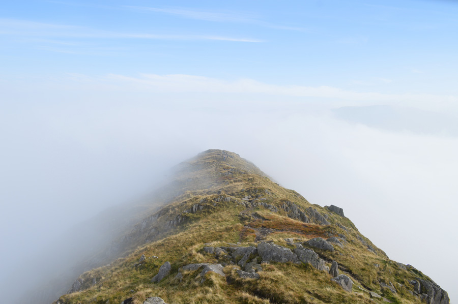
| The Straights of Riggindale from Short Stile summit. |
| The crowds who had gathered along the top of the Straights of Riggindale had gone their own ways by the time I reached Short Stile summit cairn, many of whom including the mountain bikers were all close to summiting Kidsty Pike, however, it would seem the cloud inversion wasn't just confined to just Riggindale and Mardale... |
 |
| Helvellyn skyline over Gray Crag. |
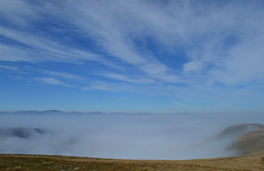
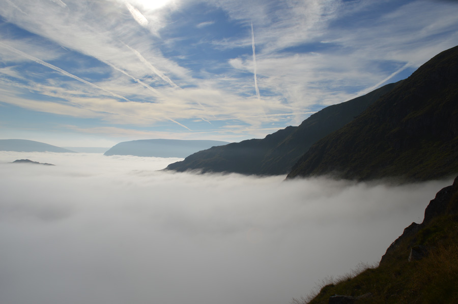
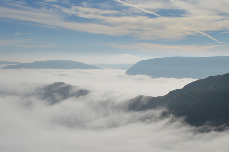
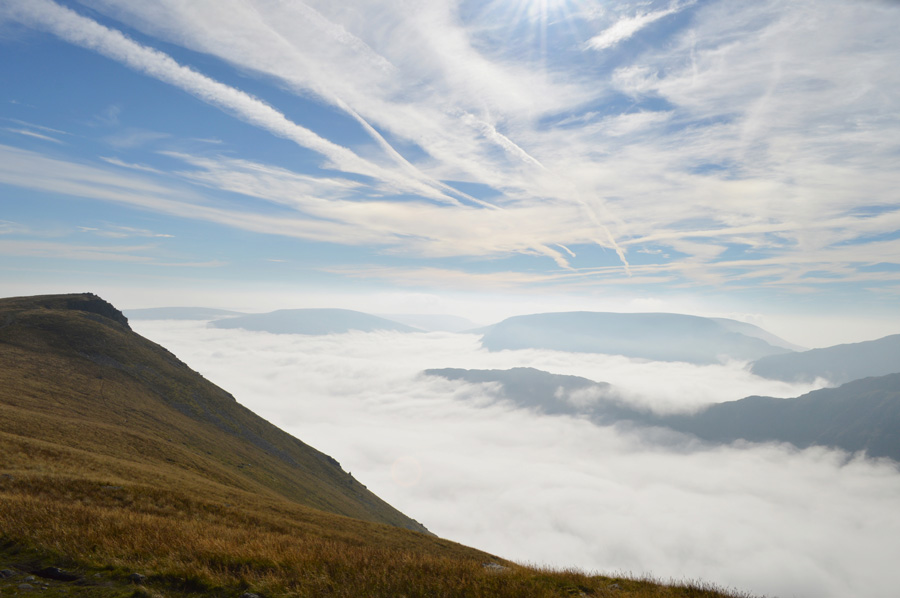
| Once again I was left staggered by the beauty of the surrounding valleys which were cloaked in cotton wool, here the cloud inversions extend all the way into the Dove and Deepdale Valleys ensuring anyone walking between Fairfield and Stybarrow Dodd will be getting their own idyllic views, I can only imagine, despite its summit possibly being over crowded that the views from Helvellyn right and anywhere along its main ridge, can only match my own. |
 |
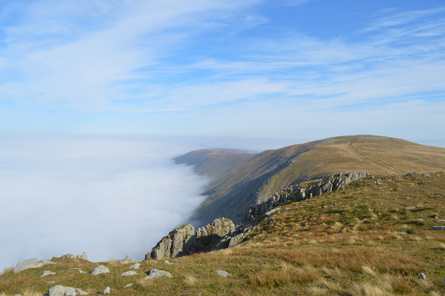
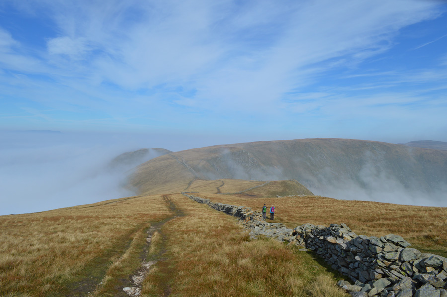
| The Straights of Riggindale. |
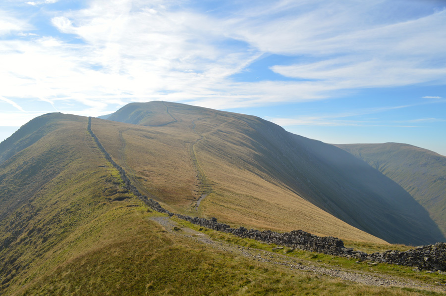
| Instead of heading straight for High Street summit I head further east over the Straights of Riggindale before collecting my first summit of the day in Kidsty Pike. |
 |
| Short Stile (foreground) High Street and Thornthwaite Crag from the Straights of Riggindale |
| I shall be retracing my steeps here after first collecting my next three summits of Kidsty Pike, High Raise and Rampsgill Head. |
 |
| Views into Riggindale. |
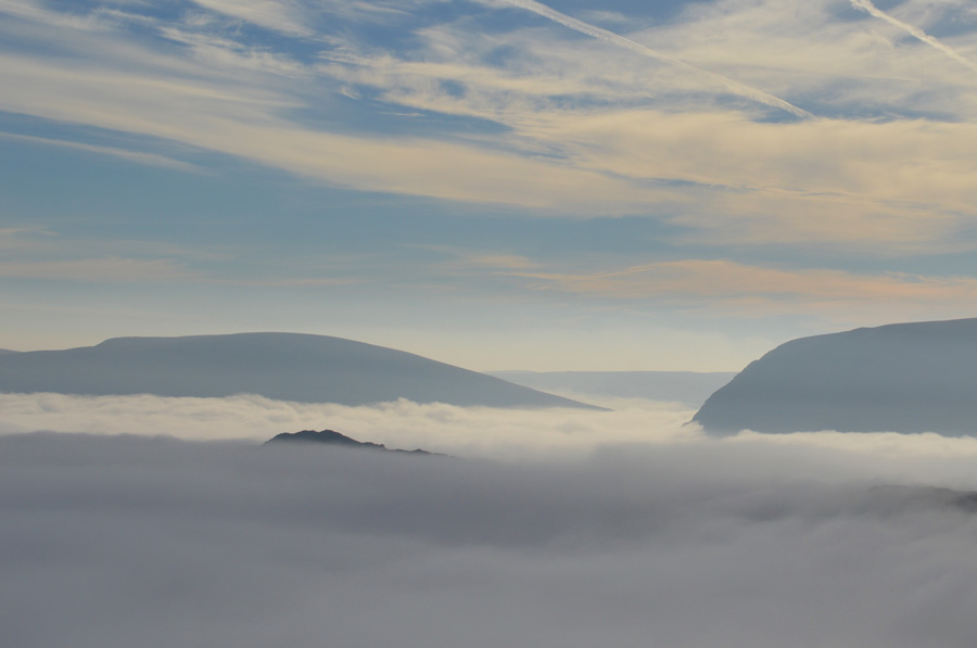
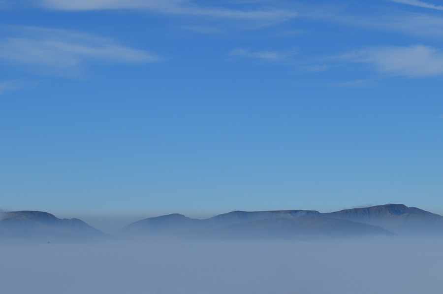
| The Short Stile ridge can be seen in the right of the photo, for now escaping the cloud inversion, I am still left staggered at how quickly the whole event took place over the course of just one hour which has left the far east, and eastern parts of the district under complete cloud. |
 |
| Kidsty Pike is just ahead with views of Selside Pike, Branstree, Harter Fell (Mardale) and Rough Crag, all peaking out above the cloud. |
| A truly wonderful sight to behold. |
 |
| Mardale III Bell, Long Stile, High Street and Short Stile from Kidsty Pike summit. |
The foot of Short Stile is well below the cloud by now but I am able to pick out that devilishly steep last ascent before the summit is reached, who knows, maybe one day I will return and descend from Kidsty Pike and ascend Short Stile taking in the Cirque that I had missed due to the inversion.
After a few moments spent at Kidsty Pike summit I turn my back on my mornings events and head out to High Raise, over some favoured walking territory. |
 |
| High Raise (Martindale) |
| On a day like today collecting the close knitted summits of Kidsty, High Raise and Rampsgill are a purely pleasurable experience, made more so when the sun is on your back and the skies are a deep blue above your head, talking of which, I think it's about time I took my jacket off and rolled up the sleeves. |
 |
| Views towards the Helvellyn range from High Raise (Martindale) summit cairn. |
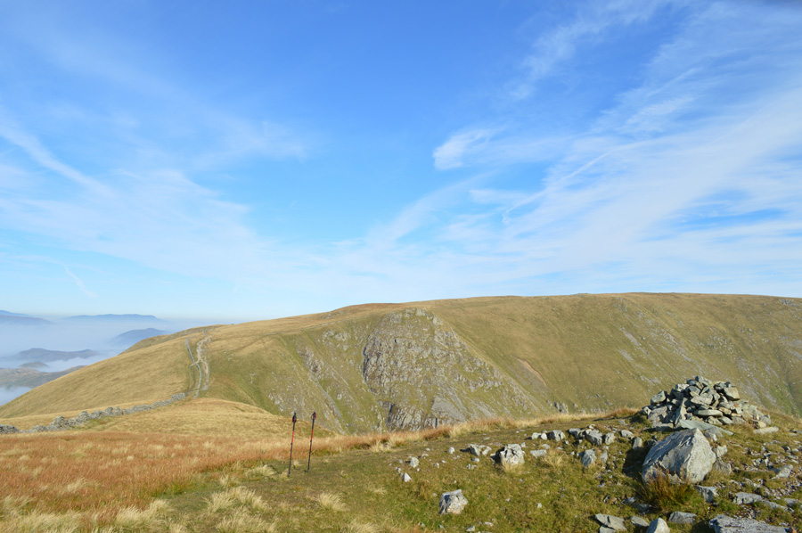
| After a short pull onto High Raise summit and before passing a walker on route to Rampsgill Head I soon find myself at the rocky arena that is High Raise, my views north east extended over the Wether Hill area of the District with the valleys of Rampsgill, Bannerdale and Martindale all under a sea of cloud, further east the lonely summit of Low Raise is clearly seen along with its ancient stone cairn. Despite it only being late morning I'm ready for an early lunch but seeing as I'm spoilt for choice on where to eat it I decided to stop at my next summit of Rampsgill Head. |
 |
| Heading out to Rampsgill Head shortly after leaving High Raise (Martindale) |
| The walker who I had passed on route to High Raise was now standing on the summit of Rampsgill Head, an elderly gent who walked with his hands folded behind his back. Ahead extended views of The Knott might question a summit, but I'll decide upon that after a spot of lunch. |
 |
| Rest Dodd from Rampsgill Head. |
Surely enough, just shy of the summit cairn I find myself a spot from where I take in the unfolding views before me, voices are heard and are traced to a couple and their dog making a direct ascent at the summit from the valley of Rampsgill, an ascent that can only be described as wickedly steep, the fellow holds a wooden walking cane, his wife, who seems to be a little more savey, takes pictures from a DSLR Camera 'no amount of pictures can grasp or capture that' she explains, I could only agree.
Despite feeling hungry I am unable to finish lunch, instead I'll try again whilst at the summit of High Street, perhaps, I am just to excited by the mornings events. |
 |
| Views back over High Raise (Martindale) Red Crag and Wether Hill. |
| Had I have taken my plan B walk today on the Fusedale Horseshoe, I still don't think I'd have been left disappointed. |
 |
| Rampsgill Head summit infront of Helvellyn in the far distance. |
| It's time to tramp my way back to the Straights of Riggindale. |
 |
| High Street and Two Penny Crag. |
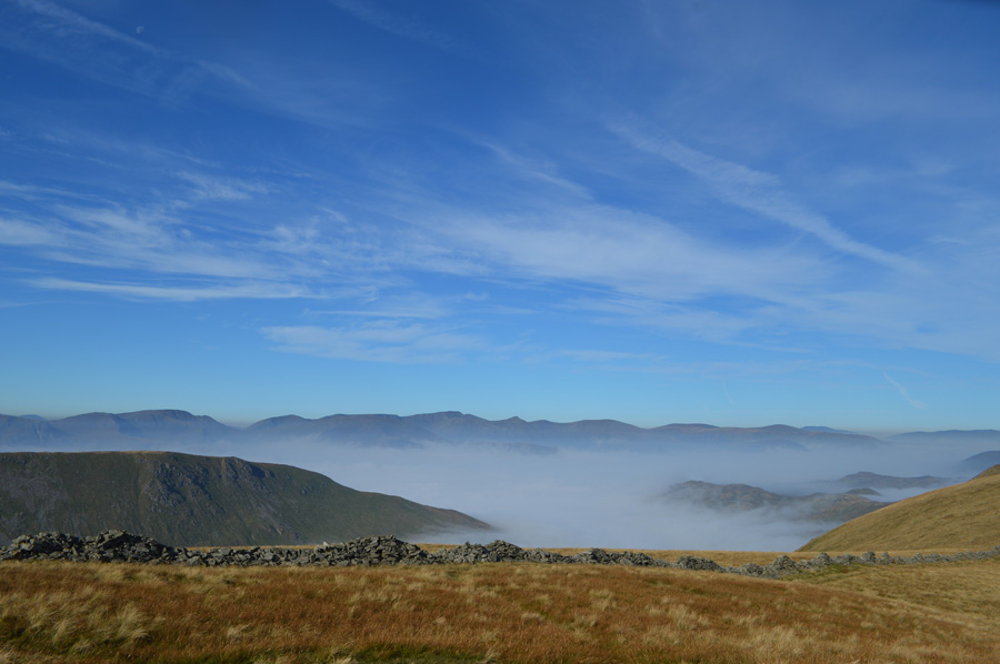
| With little to no wind the cloud had breached over the top of the Straights of Riggindale and was by now descending back down the Hayeswater side, cloud cover had also partially blocked the sun bringing with it low light, but all of this was mother nature doing what she does best, within a matter of minutes the Straights were clear again. |
 |
| Ahead, Short Stile and High Street. |
| My initial plan was to retrace my steps back to Short Stile but with limited views I cross the wall and ascend High Street from the right of the wall, rather than my favoured route off to the left. |
 |
| Here, views back over the Straights of Riggindale towards Short Stile, Kidsty Pike, High Raise, Rampsgill Head and The Knott. |
| By now it was approaching midday and once again I was looking forward to a short rest stop at the summit of High Street, more so because time allowed, something of which during this years walking was a rare thing. I plod on towards the summit passing two women as 'good mornings' are shared. |
 |
| Summit views from High Street. |
| Here I zoom in towards Fairfield, Dollywagon Pike, Cofa Pike, Nethermost Pike, Helvellyn and St Sunday Crag in the foreground. |
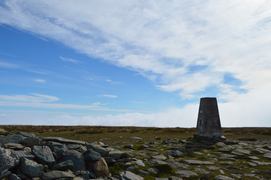 |
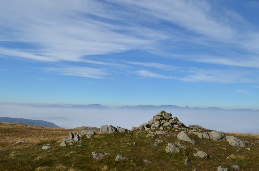
| High Street summit Trig Point. |
By the time I reach the summit of High Street as expected it was rather busy with those walkers who like to talk whilst standing next to the Trig Point, just off the summit two fell runners, a man and a woman pass on their good mornings as I take a wee wonder to take in the views, I take this photo on my return, by which time two elderly woman dressed in, I kid you not, jeans and cardigans are settling down to sandwiches, but I get the feeling they have been walking the fells much longer than I have so respect is shown with a hello and a smile.
I de shoulder and take out my lunch for a second time, this time feeling hungrier and accomplished I have no problems finishing off my cold flavoured rice washed down with Robinsons fruit juice with a Marathon for afters.
Soon the summit gets busy again and more walkers gather around the summit, what happened next was incredible and at times, I only wish I had the nerve to do the same, seeing said summit was over crowded by walkers over welcoming their stay one lone walker walks right up to the summit trig point which is surrounded with people, he then whips out his camera standing only three feet away and proceeds to snap away, I can tell you after that, they soon disbanded and the fellow returned for a second shoot, good on yer fella.
I laugh and think, that's the first time I have ever seen that, it wasn't rude just bloody hilarious!
The two elderly women are sitting only ten feet away from me, I bid them and the solo walker a good day before throwing my pack over my shoulder and heading out to take on the Rough Crag ridge. |
 |
| Not before one last photo from my lunch spot. |
| |
 |
| Descending Long Stile. |
| Blea Water was nowhere to be seen, hidden from view by the cloud making my descent all the more magical, at times I pass walkers making their ascents not knowing really what to say, I guess I was just too taken back and was merely taking it all in. |
 |
| Rough Crag emerges through the cloud helped along by a ray of sunlight. |
| |
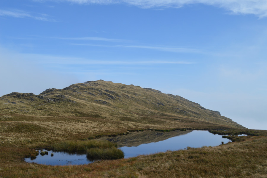 |
| Rough Crag from Caspel Gate Tarn. |
| More walkers are passed as I leave the path, instead, opting to have a walk around Caspel Gate Tarn, my timings couldn't of been better as through a gap in the cloud Rough Crag reflected a mirror image over the stillness of the water, moments later the cloud would return and the image vanished. |
 |
| Looking back on Long Stile and High Street from Caspel Gate Tarn. |
| A crowd of walkers had just descended Rough Crag, in fact I could see them peak out through the cloud at the summit, they by now were passing Caspel Gate as I get a wave from the leader of the group, with this I find my way back onto the path again, Rough Crag bound. |
 |
| Long Stile and High Street. |
| |
 |
| Left speachless along the Rough Crag Ridge eastward bound. |
| Having topped out at the summit of Rough Crag only to find my views limitless I decsend down the other side from where I would take on the remainder of the ridge in swirling cloud and mild afternoon sun, not before passing on my hello to a couple eating their lunch at the summit. |
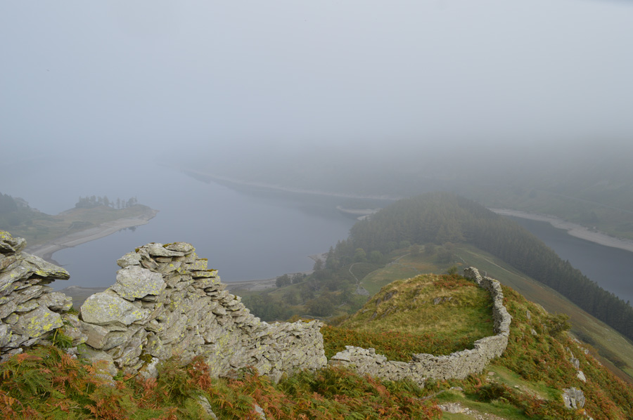 |
| Haweswater and The Rigg. |
| Views were becoming more and more fainter, by the time I had reached Swine Crag this was to be confirmed having left the dramatics behind me, all that was left was valley mist. |
 |
| Swine Crag and misty Riggindale. |
I had passed a number of walkers heading onto the ridge which made me wonder would they have the same experience that I had, something told me that they wouldn't and that the cloud would descend blocking out the sky, I hoped I was wrong.
In great stead I descend the remainder of the ridge in Swine Crag, from where views over Mardale Head are met with mist and a full to bursting car park, below me familes embark on the lake path along side Haweswater which coincidently, is looking worryingly low revealing the hidden structures and pastures of a village that once was Mardale. With my walk almost coming to an end I take in a days reflection, but how can one do this in just a matter of moments. |
|
| |
| Back to top |
 |
|