|
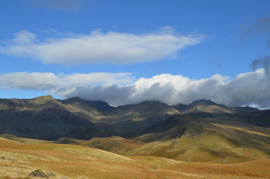
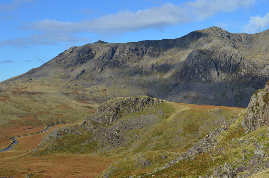
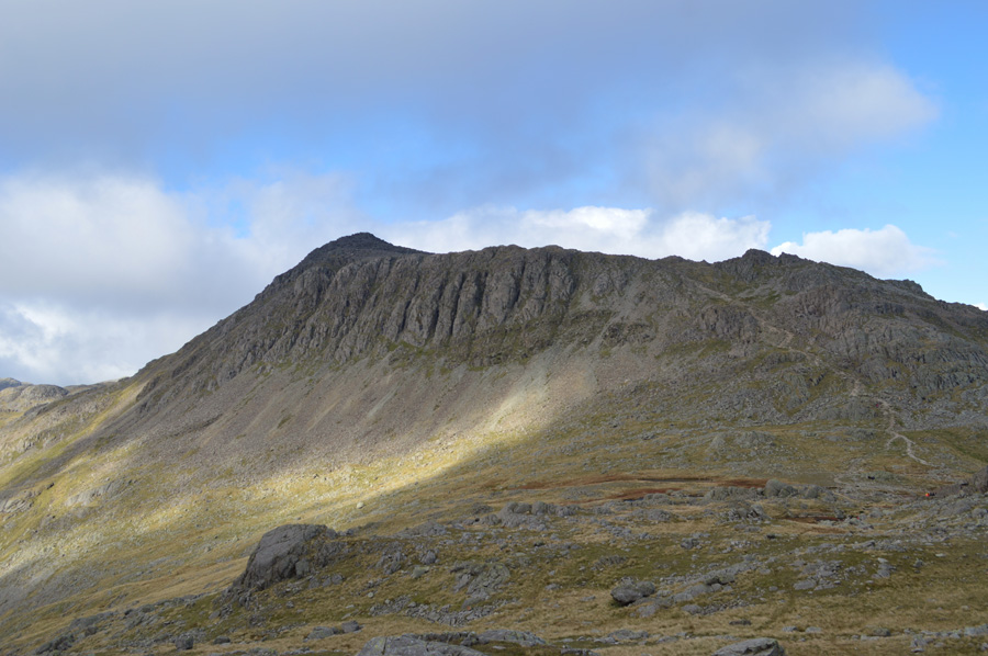
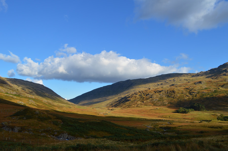
Esk Pike, Bowfell and Crinkle Crags from Cockley Beck |
 |
 |
12th October 2015 |
 |
|
It's fair to say that although my two thousand footer campaign is over trying to tell my mind and legs that I can now relax is becoming something of an issue, I guess what I am trying to say is I miss the arduous challenges and settling back into normal walking is going to take longer than I first thought. With this and, during a week off from work I put together this route which part of was first suggested to me by Ian 'S' a long time ago 'Paul you must try the Yeastyrigg Crags Ridge' or similar words to that effect. As mentioned I'm not even sure Ian will remember but I did, and, as always I put it on my 'to do list'
The season of Autumn above all else is my favourite season of the year, nature starts to slow down as the days get shorter, it is also the time of year we tend to get that crisp morning fresh air along with seasonal air quality meaning on a good day, a long distant view is just that with no haze and only the distant horizon or the shimmer of a far away sea. The colours of the grasses start to turn their Autumnal red as does the retreating Bracken which, on a day like today when the sun shines bright, turns the landscape into a sea of colour.
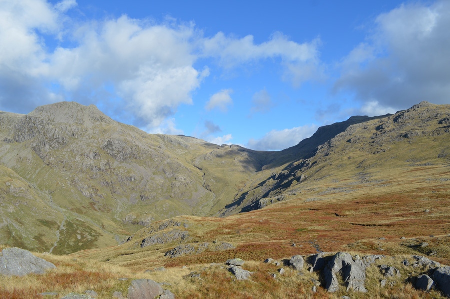
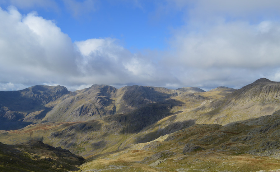
Although todays walk collects three Wainwright summits my route will see me take in eight summits altogether some of which I summited as part of my two thousand footer campaign, with the exception that today, my views are much more distant. I had initially planned to make Great Moss the walks singular objective summiting Esk Pike and Great End in the process until I was reminded of my previous summits of Hanging Knotts and the Bowfell Buttress when I couldn't see my hand in front of my face, which was all the sway I needed.
I couldn't have picked a better day for it. |
|
| Wainwright Guide Book Four |
 |
| The Southern Fells |
-Esk Pike
The outstanding feature is a lengthy south ridge, bounded by the River Esk westwards, and to the east, by Yeastyrigg Gill and Lingcove Beck: a ridge with many abrupt crags.
Did it but stand alone, away from such enticing neighbours, Esk Pike would rank highly among the really worth while mountain climbs. |
 |
|
|
| |
|
Overview |
|
|
| Ascent: |
3,332 Feet - 1,022 Meters |
| Wainwrights: |
3, Esk Pike - Bowfell - Crinkle Crags |
| Weather: |
Bright and Sunny to Start Turning Overcast Mid Afternoon, Brisk Across the Summits. Highs of 12°C Lows of 5°C |
| Parking: |
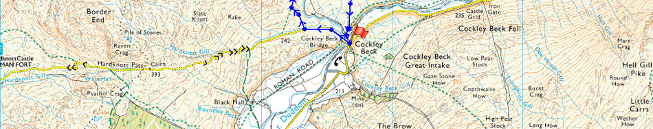
Roadside parking, Cockley Beck Bridge |
| Area: |
Southern |
| Miles: |
9.5 |
| Walking With: |
On My Own |
| Ordnance Survey: |
OL6 |
| Time Taken: |
6 Hours 20 Minutes |
| Route: |
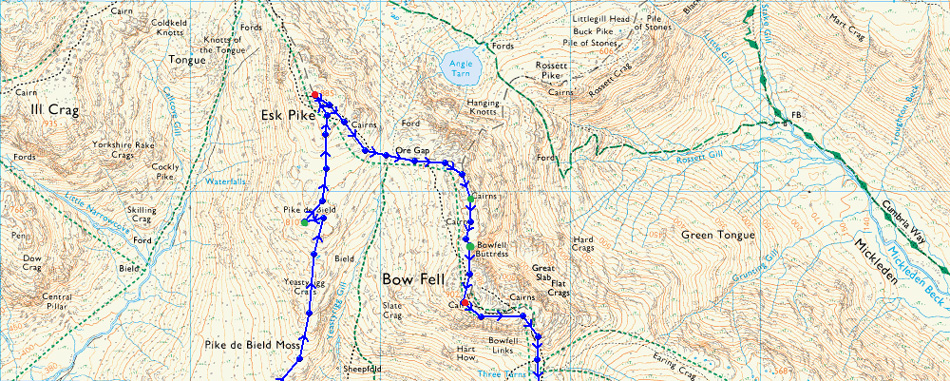
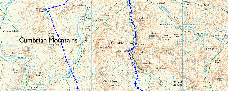
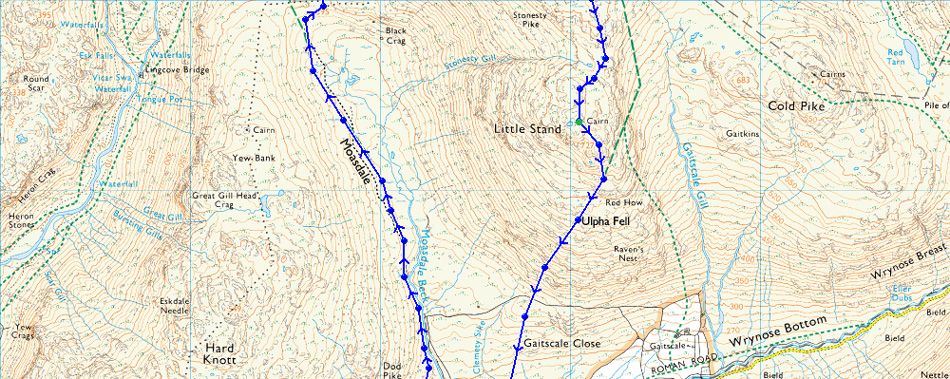
Cockley Beck Bridge - Mosedale - Lingcove Beck - High Gait Crags - Yeastyrigg Crags - Pike de Bield - Esk Pike - Ore Gap - Hanging Knotts - Bowfell Buttress - Bowfell - Three Tarns - Crinkle Crags - Stonesty Pike - Little Stand - Cockley Beck Bridge |
-
|
| |
|
Map and Photo Gallery |
|
|
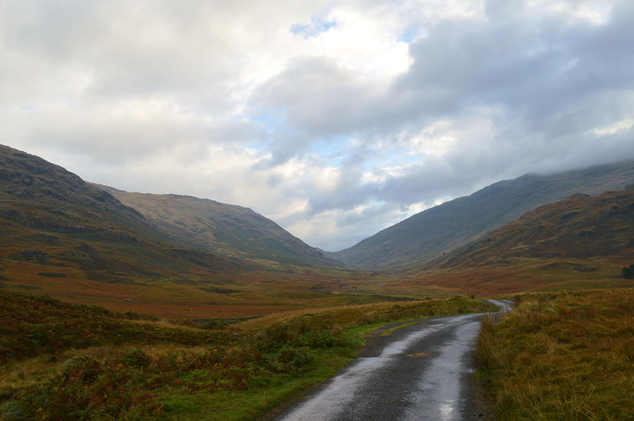 |
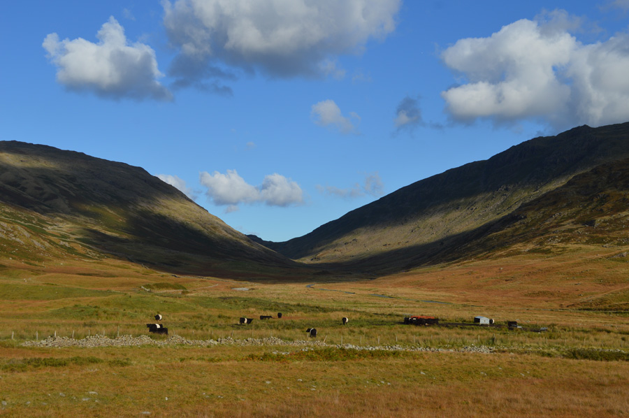
| Wrynose Bottom 9.15am 5°C |
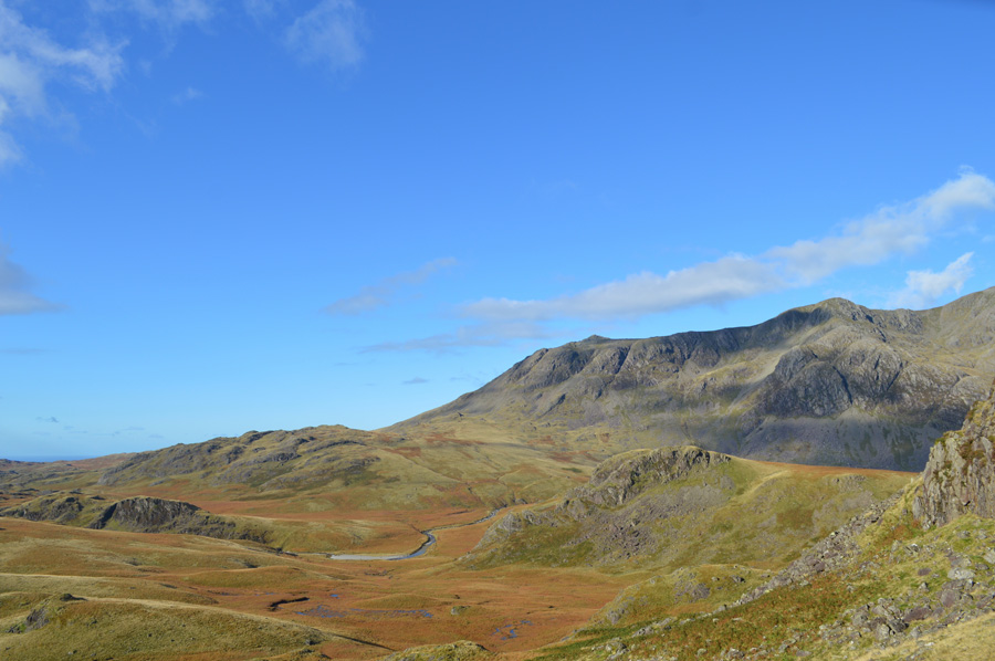
The forecast was for a bright day with long spells of sunshine after an overcast start, I guess I arrived between the two with low light but there was promise in the skies above, with this I had intentionally set out an hour later to let one weather front make way for the other, my timing couldn't have been better. After leaving the hustle of Ambleside behind I was soon taking in the narrow lanes of Little Langdale with no traffic either in front, or behind me until I reached the foot of Wrynose Pass where I was passed by a Landrover who had just come down the Pass, with this I put the car into first, then second gear and kept it there until I reached the Three Shire Stone found close to the top of Wrynose Pass all the while studying the pot holes that I had remembered their locations from previous visits, one terrible memory of which was when I thought I'd split my alloy wheel in two, so yeah, the notorious pot holes get remembered.
Despite arriving an hour later I was able to park easily as I reversed my car into a Lay-by close to Cockley Beck Farm, said lay-by is only wide enough for perhaps, two or three well parked cars, with this I start to kit up under low light yet blue hints between the cloud are everywhere if you look. Todays route will involve a crossing of Lingcove Beck and I wasn't sure of the spate I would find it in, I look down on my gaiters thinking should I or not? after all the crossing will be pretty early into the walk and I wouldn't want wet socks so early on, stubbornly I leave them behind, pah! extra weight I mutter, you haven't used them for at least two years, why change that now, anyway, find your best spot as always when crossing rivers and just go for it, I take my own, stubborn advise.
The car is locked as I take in the views along Wrynose Bottom back towards the top of the Pass taking note that a car hasn't passed me since arriving or during kit up, with this I walk along the centre of the road with only the Farmers Cows 'mooing' for company, minutes later a wooden stake is reached confirming the footpath for the Mosedale valley, and its start, is a muddy one. |
 |
| Distant views of the Scafells and Esk Pike from the Mosedale Valley. |
| I had kept a vigil eye on the forecast and couldn't remember seeing any rain, not at least any rain that could cause significant flooding which is why I couldn't explain why the path was so sodden and drenched, adding to this was the many cow pats that had to be negotiated as I am still reminded well into the valley by who had made them, their distant moo's still heard, however, over shadowing this was the sun which was gaining in strength as it rose beyond the Coniston Fells, with this the cloud that was masking the Scafells started to burn away and lift in front of my eyes. |
 |
| The Scafells and III Crag under cloud seen before I cross Lingcove Beck. |
As I venture further into the Mosedale valley it soon becomes apparent that I may have needed my gaiters after all as the ground underfoot is retaining water just beneath the valley head, my path runs straight into the bog where I am forced to negotiate lengthy detours before meeting back up with the path on the other side.
The head of Mosedale in now offering mouth watering views of the Scafells and I am struggling to put my camera down, ahead a sea of wild grasses in their Autumnal turn with lengthening dark shadows created by Lakeland giants, it's fair to say that I stayed fixed on this spot for a while if not only to study my route, but to also take it all in. |
 |
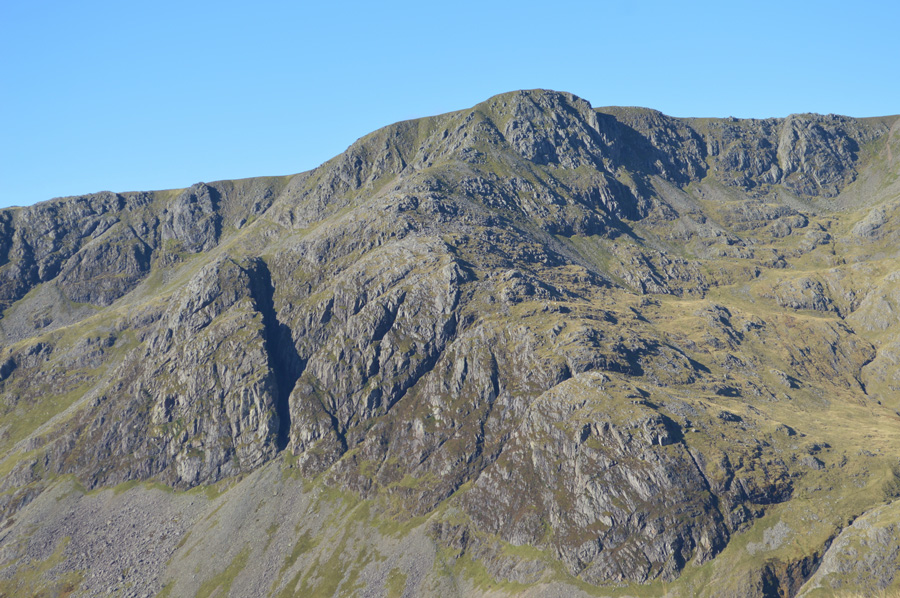
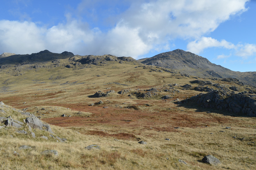
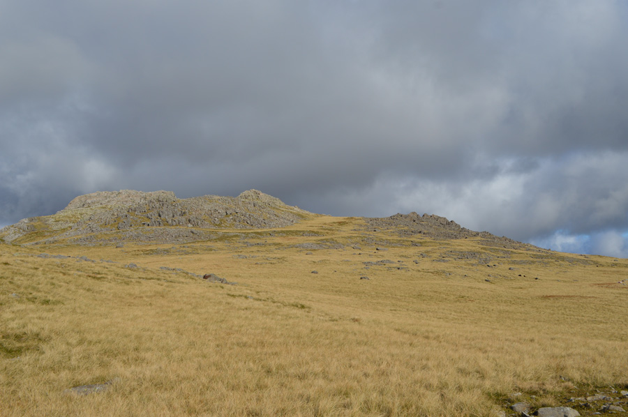
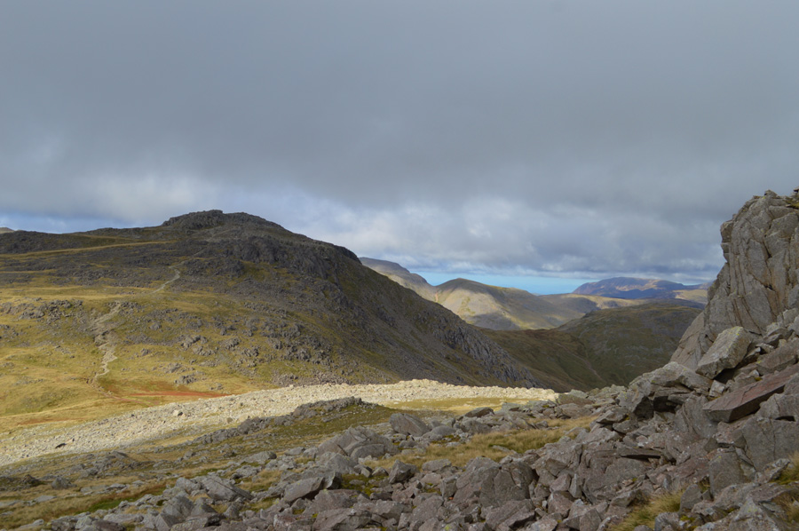
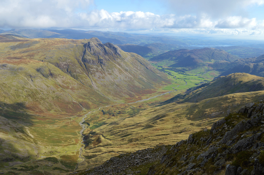
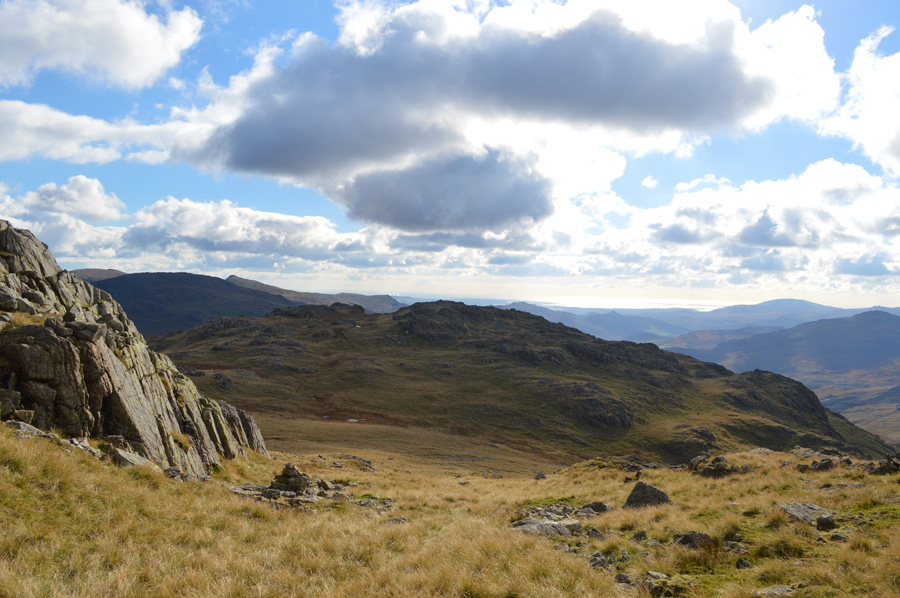
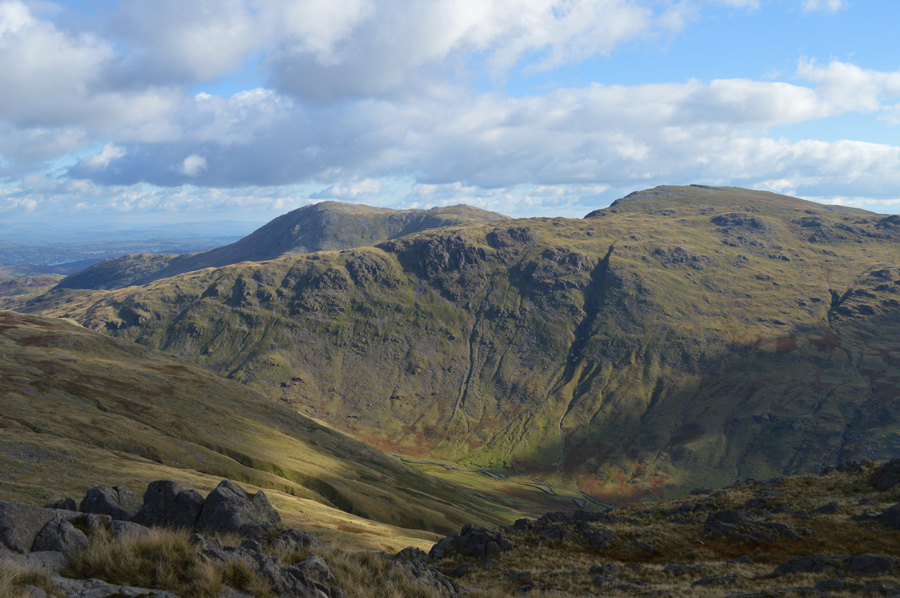
| III Crag, Esk Pike and the Yeastyrigg Crags Ridge seen with Bowfell over on the right. |
| This picture shows my route after crossing Lingcove Beck seen as the depression in the foreground. After making the crossing I climb steeply out of the valley flanking the crag to the left known as Planet Knott, I keep a bearing heading for first Low Gait Crags, and then High Gait Crags which can be seen ahead-under shadow, from High Gait Crags the Yeastrigg Crags ridge can be easily picked up and there after the summit of Esk Pike. With views as good as this it's fair to say that I was really looking forward to what lay ahead of me. |
 |
| The Scafells over Low Gait and High Gait Crags |
| My eyes and more so, my cameras lens just could not escape my plentiful views, so I guess I may warn you that there are heaps more photos of the Scafells in this report, you have been warned. |
 |
| Here, Cam Spout Crag, Scafell, Broad Stand, Mickledore and Scafell Pike. |
I couldn't but help be reminded of one of the last 'out and backs' from my two thousand footer campaign when myself and Rod Hepplewhite summited Cam Spout Crag from the top of the Scafell ridge, after collecting the summit we had to climb 700ft back onto ridge, a truly exhausting descent and re-ascent but great fun and even greater memories from my last walk within the challenge.
Time to stop day dreaming, Lingcove Beck won't cross itself. |
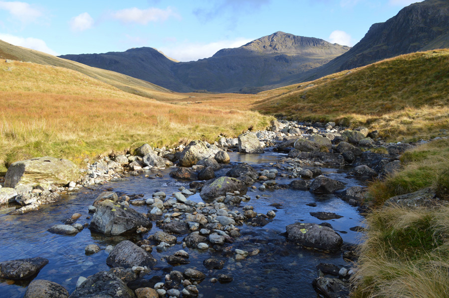 |
| Views of Esk Pike and Bowfell as I cross Lingcove Beck. |
| I hadn't realised just how much time I spent taking in my magnificent views, sure enough though it was long enough for the chill to set in. With this I make my descent to cross Lingcove Beck, where as it turns out there was no need for gaitors at all, in fact I was able to hop across right over to the other side without getting my boots wet. |
 |
| Views over the River Esk, Green Crag, Scar Lathing, Cam Spout Crag and Slight Side from Low Gait Crags. |
| |
 |
| A closer view of Scar Lathing and Slight Side. |
| |
 |
| Esk Pike and Bowfell. |
| Largely, both Esk Pike and Bowfell had been in shadow looking rather chilling and menacing, but by the time I reached Low Gait Crags the sun had started to fill the valley leaving both summits under warm morning sunshine. From here High Gait Crags is hidden from view by its subsidiary summit, the reason for this is of course, I'm still climbing taking in the steady ascent bit by bit which incidentally, is much steeper than it looks on the map. |
 |
| III Crag, Broad Crag and Scafell Pike. |
| I continue to follow a faint path which steadily levels out once Low Gait Crags is passed, all that is left is to reach High Gait Crags by following a faint footpath over grass. It is often said that the land south of Esk Pike which expands over Great Moss and Lingcove Beck can be quite an intimidating place, even to the seasoned fell walker which is why it is best explored on good weather days, I think if I'm right in saying it took me three years to gain the confidence to explore Great Moss and Lingcove Beck alone and, now that I have that confidence, the apprehensions that I first felt have given way to exploration, today was one of those days. |
 |
| Cam Spout Crag Scafell, East Buttress, Mickedore, Scafell Pike, Dow Crag, Pen and Rough Crag from High Gait Crags. |
I soon arrive at High Gait Crags summit, not before cross checking my position as two similar of height summits can be seen, the summit cairn confirms my position, there is no need to scramble nor climb, gaining High Gait Crags summit is done easily over grass before arriving at a small, but well put together stone cairn, the one thing that I had noted almost instantly was just how wide open the summit area actually is, up until now I had been shielded by outcrops or crags, now I am taking on the wind chill which causes me to take shelter behind a large outcrop before I de-shoulder and put my jacket on, the feeling of cold air on warm sweat presses against my skin but is soon forgotten about.
I venture out to the edge of the summit area where I scour the one end of Great Moss to the other looking for movement but spot nothing, beyond Great Moss up high on the Mickledore Ridge I spot three walkers heading in the direction of Scafell Pike and I wonder had they spotted me like I had them. |
 |
| A close view of Cam Spout Crag from High Gaits Crags. |
| A mental note is taken...Cam Spout north east ridge is placed on my 'to do list' |
 |
| Distant but clear views of III Crag, Cockly Pike, Esk Hause and Esk Pike. |
| |
 |
| Views over Scafell Pike seen with Little Narrowcove and III Crag from High Gait Crags. |
| |
 |
| Scafell, East Buttress, Broad Stand, Mickedore, Scafell Pike, Dow Crag, Pen and Rough Crag from High Gait Crags. |
| My time spent at High Gait Crags had to come to an end, I had fallen for the old trick and was captivated, as was my camera by the clearest of views over Great Moss and the Scafells, the windchill was nipping and now came the time to move on before I had to add more layers due to lack of movement, such the splendor of my views capturing the first windchill of the year was more than worth it. |
 |
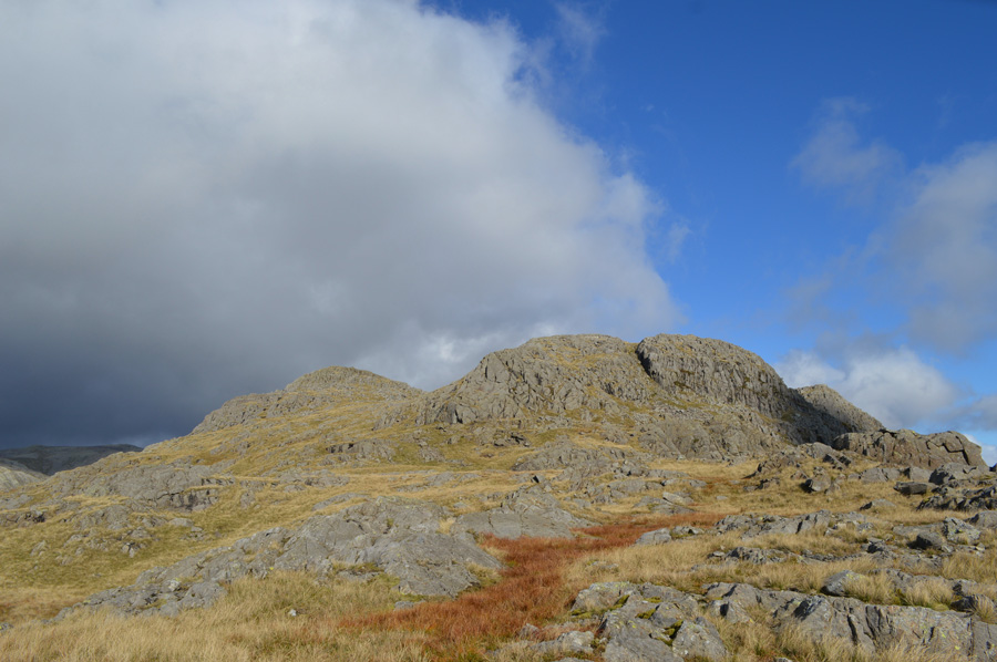
| Bowfell and the Yeastyrigg Crags ridge High Gait Crags. |
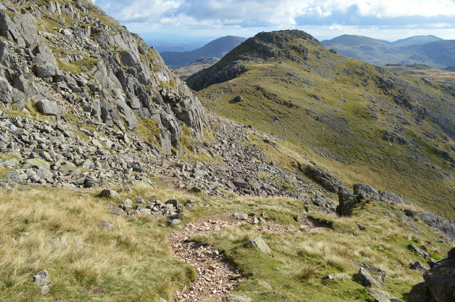
| I am lead naturally to the right of the ridge but question this as further on whilst ascending Yeastyrigg Crags I am lead far right which soon sees me taking in views over Bowfell and Ore Gap, I fear that I have not been paying attention and quickly correct my mistake by tucking myself back into Yeastyrigg Crags seen along the centre of the ridge. |
 |
| Too impossible to ignore. |
| |
 |
| Pike de Bield summit comes into view. |
| After topping out over Yeastyrigg Crags my first summit of the morning soon comes into view over on the left in Pike de Bield, however no matter how tempting it was to scale the gully over on the right I stick to my original route picking up on a faint grass path that lead between Pike de Bield and its subsidiary summit over to the right. |
 |
| The Scafells and III Crag seen from Pike de Beild summit. |
| By now I was feeling exposed again and with it I was fighting against the wind chill once more, the romance of it all soon left leaving me billowing warm air into cupped hands, very cold ears indeed and a constant drip at the end of my nose, oh have I missed that winter chill. |
 |
| Esk Pike seen shortly after leaving Pike de Bield summit. |
| With the wind chill I also seemed to be losing light which turned the flowing grasses to a faint brown, to my wide flank over Ore Gap I spot walkers with a dog heading for Esk Pike summit but I have the advantage of being much closer, and suspect I will pass them soon after leaving the summit myself. |
 |
| Esk Pike summit with a distant, and murky view of the Scafells. |
I exchanged grass for rock as I neared the summit of Esk Pike, finding no one there on arrival I check the time, it's close to midday which prompts me to think should the weather stay as it is, where else will I get shelter for lunch, despite not feeling too hungry I down pack once more and tuck into a cold chicken rice once the goo that had formed on my lips had been wiped away, I struggle to enjoy lunch, much less because I'm simply not hungry enough to eat it, in my lunch box I have also packed a Marathon Bar I force down which isn't like me at all.
Between the constant drip at the end of my nose, my gooey lips and no appetite at all I hope I'm not coming down with something, I lend myself to thinking it's the shock from the cold air! |
 |
| Views over Esk Hause towards Great End, Great Gable and Green Gable from Esk Pike. |
| Time to get a move on I think. |
 |
| Views towards Hanging Knotts and Bowfell over Ore Gap. |
| After leaving Esk Pike summit behind I pass the walkers who I had seen with the dog, it turns out they are a couple of teenagers, perhaps boyfriend and girlfriend but there are two dogs, not one. Further down the path I pass a trio of walkers where 'hi's' are exchanged. A strong sun causes me to cast my hand over eye in order to pick up the Hanging Knotts path from Ore Gap, soon a succession of large cairns are followed taking care over the boulder field (or ankle snappers as I like to call them) seen just beyond Ore Gap. |
 |
| Esk Pike over Ore Gap with the Gables and a distant Skiddaw beyond. |
| |
 |
| The Scafells and III Crag from Hanging Knotts summit cairn. |
| After picking myself over steep grass and boulder I soon found myself on the summit of Hanging Knotts, the last time I was here just a couple of months ago the only view I had was that of the cairn itself, yet even though it would seem I'm losing light every now and again, todays views are much more extensive. |
 |
| Views over Rossett Pike, the Langdale Pikes, High Raise and the Mickelden Valley |
| |
 |
| The Langstrath Valley shouldered by the Glaramara Ridge on the left and Rossett Pike on the right. |
| |
 |
| The Mickleden Valley and Great Langdale with a distant view of Windermere. |
| After time spent on the summit of Hanging Knotts I now head further south towards Bowfell Buttress. |
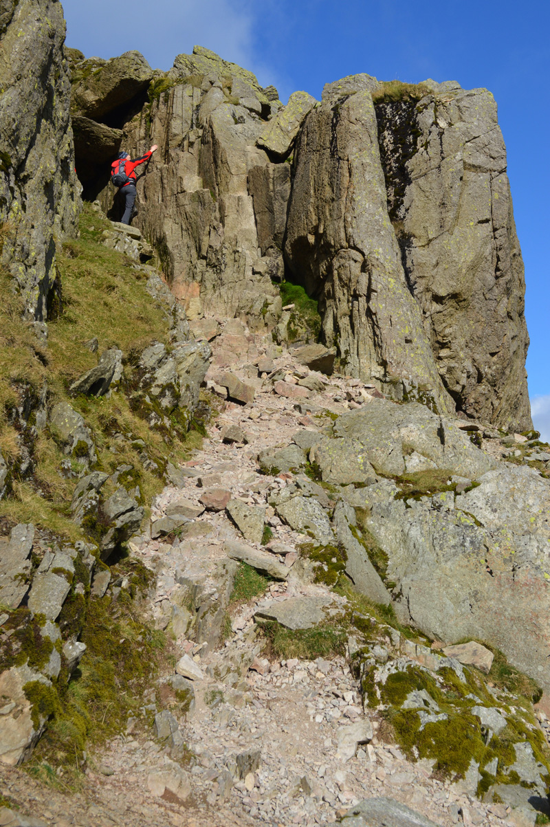
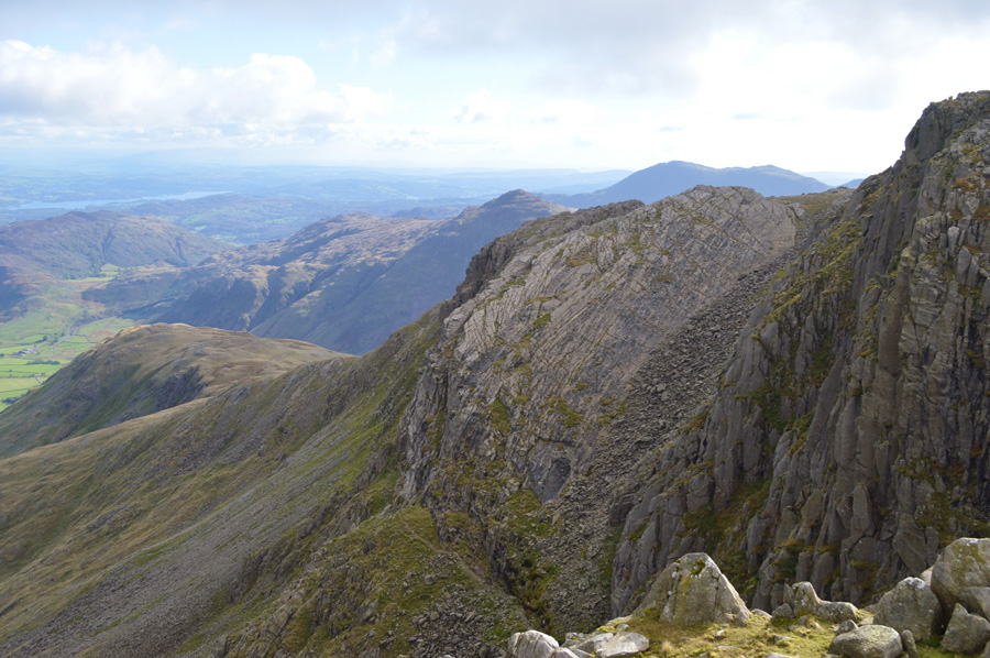 |
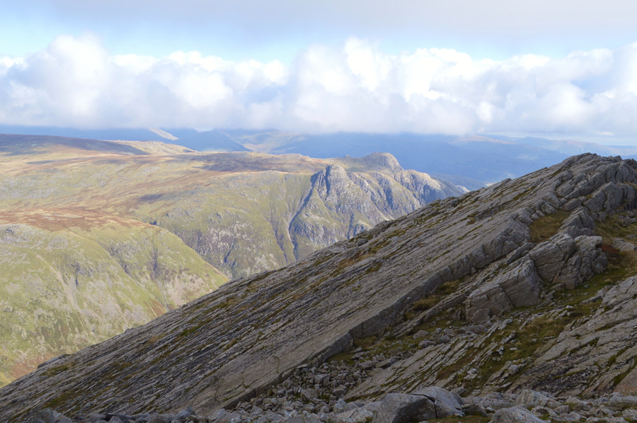
| The Great Slab as seen from Bowfell Buttress. |
| Having clambered to the summit of Bowfell Buttress I was once again treated to the amazing views over the Great Slab and the Climbers Traverse extending all the way back to The Band in the distance. From the Bowfell Buttress I can make out three walkers that are all stood on the summit of Bowfell while behind me The Scafells and Great End have a wisping of cloud cover over their summits, with the direction of the wind no doubt, Bowfell may soon be under the same cover, I make a move for it. |
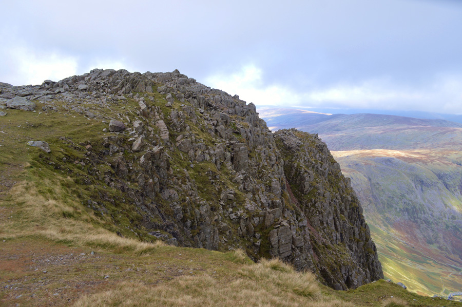 |
| Here, looking back on Bowfell Buttress, its summit cairn can be seen left. |
| It was while reading a chapter from Freeman of the Hills by A.H Griffin over the last summer did I pick up on the whereabouts of a climbers shelter thought to be found below the summit of Bowfell Buttress, only large enough to sustain one man its roof apparently can be seen from the summit top of the Buttress, with steep vertical crags all the way down I scoured the area below the summit but found nothing, perhaps the shelter had fell to ruin as back in the sixties Harry referred to it as crumbling, still, it was worth a look. |
 |
| Here, looking back on Hanging Knotts and Bowfell Buttress. |
| |
 |
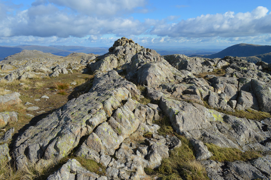
| Bowfell summit. |
The three walkers that I had spotted had now descended and were making the way towards Three Tarns meaning that I had the summit to myself, and that low cloud.
I pick my way over boulder remarking on the fact that despite numerous summits I never seem to choose the same route twice, the same applies today. By the time I reached the summit more cloud was heading my way which was now starting to partially obscure the Scafells, Esk Pike and Great End which were already below the cloud line yet despite this, I saw it as no threat just the way of the mountains, soon the cloud will clear but for now, I shall have to stick to my limited views. |
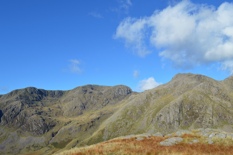
 |
| A fine view over Yeastyrigg Crags and Pike de Bield towards the Scafells from the summit of Bowfell. |
| |
 |
| The Great Slab. |
| Soon after leaving Bowfell summit I head out towards Three Tarns first passing more walkers all heading for the summit, Bowfell itself is still a little murky as the whole mountain seems to be in the shade, overhead I scour for the sun but only a dim light through thick cloud is sighted, beyond Bowfell however the Langdale Pikes are enjoying some sunshine and have been since I was on the summit of Hanging Knotts, very odd indeed, perhaps what the experts refer to as a micro climate...or possibly just the way the suns light escapes through the cloud. |
 |
| The Scafells from one of the Three Tarns. |
The descent of Bowfell is dealt with swiftly as I pass more and more walkers heading towards the summit, on arriving at Three Tarns I am met by a large group of walkers who are delighted to have reached Three Tarns, non more so than the leader of the group who rather annoyingly picks out each Tarn by number.
After a quick photo I head out over the Crinkles, having still not decided do I summit each, or just do a mix of both, I think I'll just go where my legs take me. |
 |
| Here, pausing to look back on the mighty Bowfell and Bowfell Links. |
| |
 |
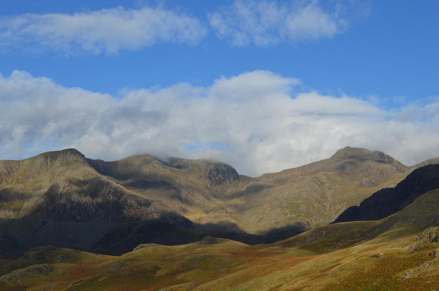
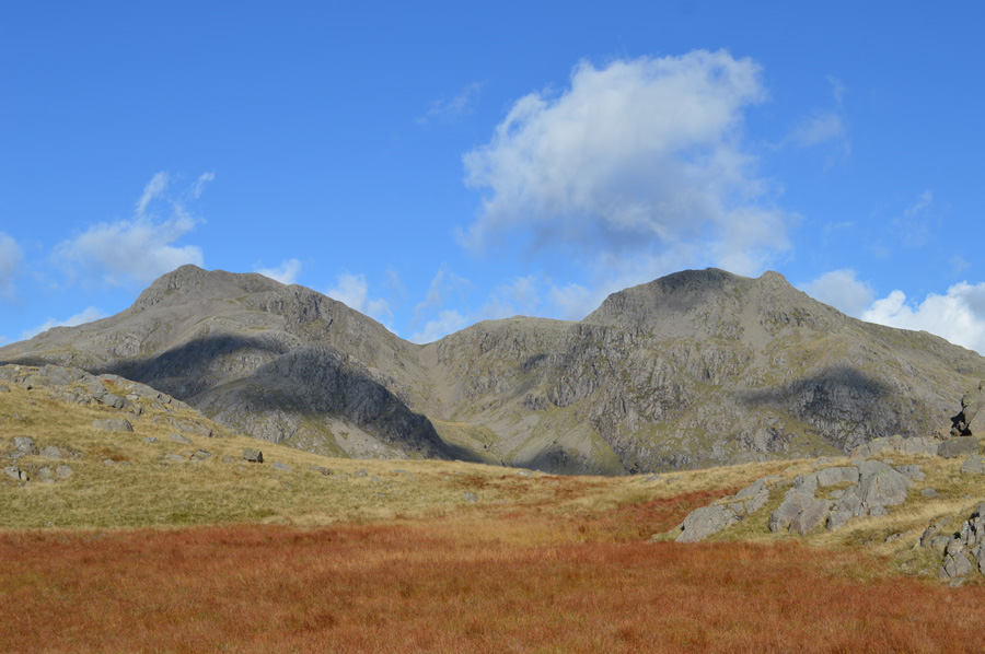
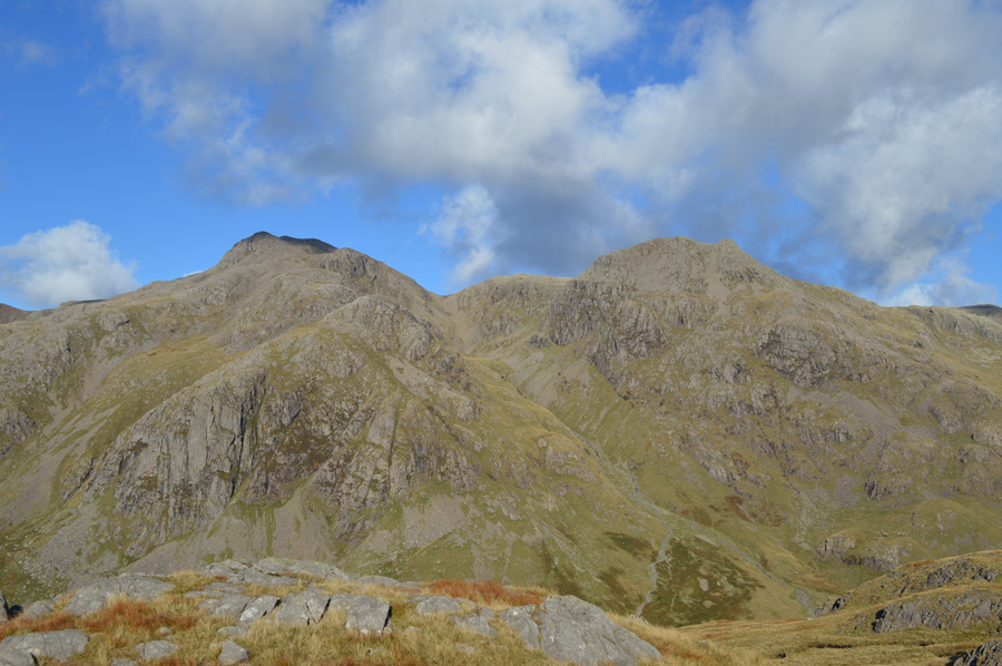
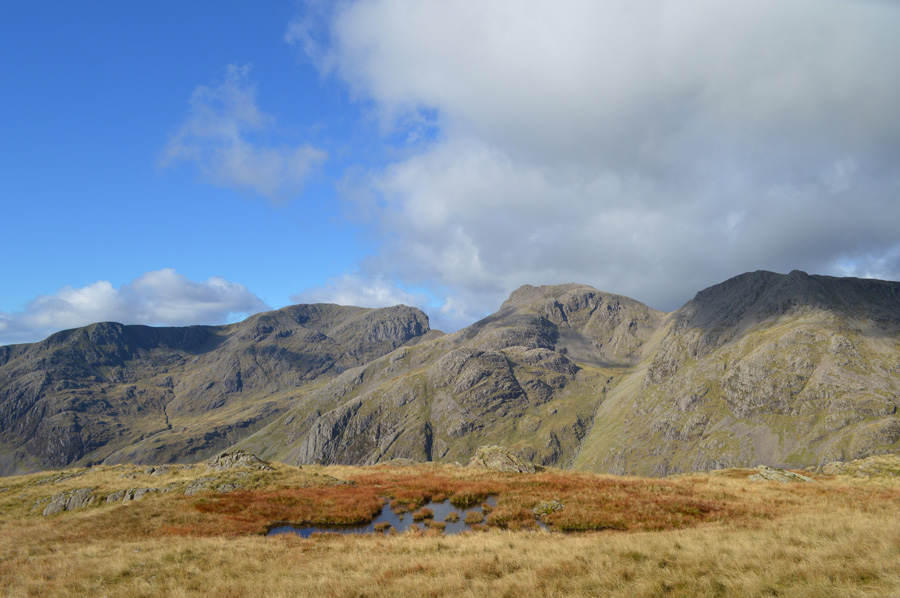
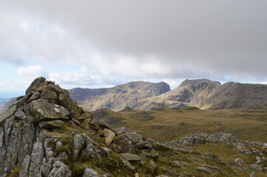
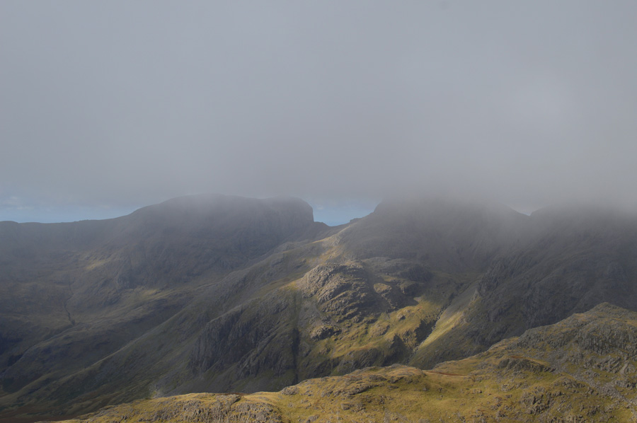
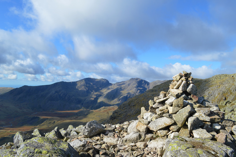
| The Scafells, the Yeastycrags Ridge, Pike de Bield, Esk Pike and Bowfell from Crinkle Crags. |
| I took this photo because I was reminded that most of todays walk and views can be seen in it, in the middle of the photo we have the Yeastyrigg Crags Ridge followed by Esk Pike and Bowfell to the right, it was pretty incredible to see just how up close you are with the Scafells from Yeastyrigg Crags, a rare treat under great skies. |
 |
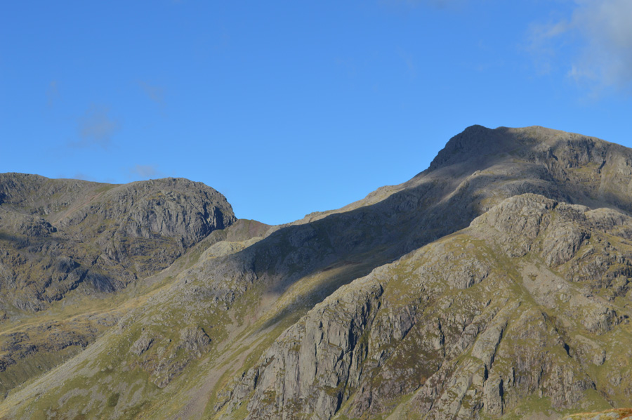
| Ascending the Second Crinkle looking back at the Third Crinkle (right) and Fourth Crinkle (left). |
| I stopped to have a brief chat with the couple in the foreground on Crinkle Four, the chap asked me my route and seemed surprised by it, I could only figure that they were amateur walkers from the clothing but sensible ones all the same, he told me they had set out to climb Bowfell from Wrynose but had lost track of time, there's no way we will make Bowfell now, there... I thought, that's all it takes, one decision and they stuck by it, lets hope we see more of the same this coming winter eh. |
 |
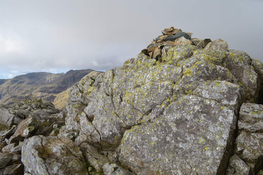
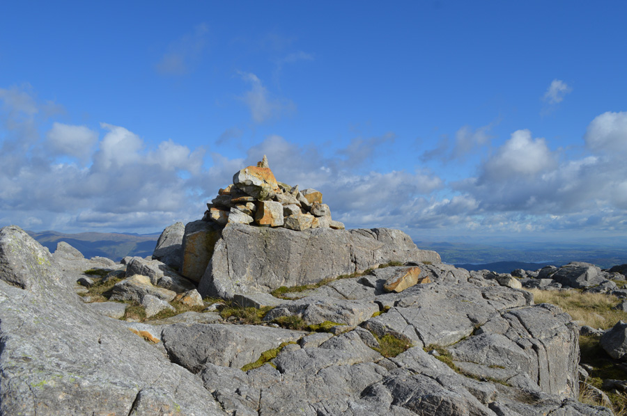
| Crinkle Crags summit cairn (Long Top) |
| The couple who I had been chatting with had stopped to chat to a woman walker who I had just passed, their voices carried on over the summit plateau where time spent here was minimal, after a quick photo I turned heel and headed west from the summit to descend the path around Crinkle Two thus avoiding descent by The Bad Step. |
 |
| Crinkle one as I descend Crinkle two using the path west from the summit. |
| |
 |
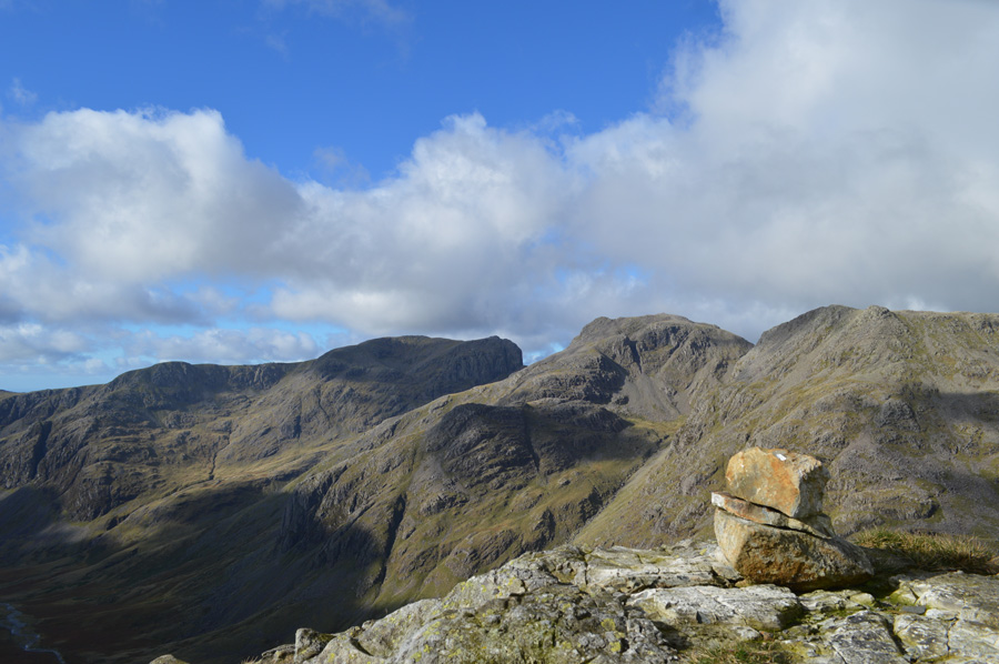
| The Bad Step. |
I soon reached the col between Crinkle two and Crinkle one where I always tend to stop for a photo, on arrival at the Bad Step I meet two walkers struggling to find a route up, I didn't want to seem rude at first as I hinted they might try ascent from a little lower down as this can be done in four easy steps, the chap thanked me as I continued my ascent on Crinkle one.
Just in case you were wondering, there's no shame in admitting I didn't descend The Bad Step myself, those days are probably behind me now not being as bendy as I used to be, however should I have been traveling in the opposite direction as always, I would ascend Crinkle Crags summit by the Bad Step if the conditions are right.
Now thats that cleared up! |
 |
| The Scafells as seen from Crinkle one. |
After the short pull onto Crinkle one my legs were just about starting to feel the burn of the ascent, I told them I hoped that they had gotten everything they had hoped for and maybe next time, i'll just go and do something normal, we'll just have to wait and see.
After leaving Crinkle one I head down steeply avoiding the main path, instead opting to break away to a grassy path on my right flank, this move will put me in good stead in order to reach my seventh summit of the day in Stonesty Pike. |
 |
| Stonesty Pike summit. |
| I broke away from Crinkle one prematurely with views under bright sun over Stonesty Pike and beyond in Little Stand, this was a welcoming treat as the grass underfoot provided some much needed cushioning for sore feet, on route to Stonesty Pike I pass a couple as we share our Hi's, on arrival I find the summit to myself. It's probably been a couple of hours since I tried to eat lunch on Esk Pike summit, now I was hungrier than ever for something to eat, I find myself a nice flat rock and de-shoulder and devour my cold rice followed by a pack of White Chocolate Buttons, subsequently followed by long sips of Robinsons Orange Juice, feeling refreshed and re-fuelled I was now ready to take my last summit of the day in Little Stand. |
 |
| Little Stand is just ahead. |
| |
 |
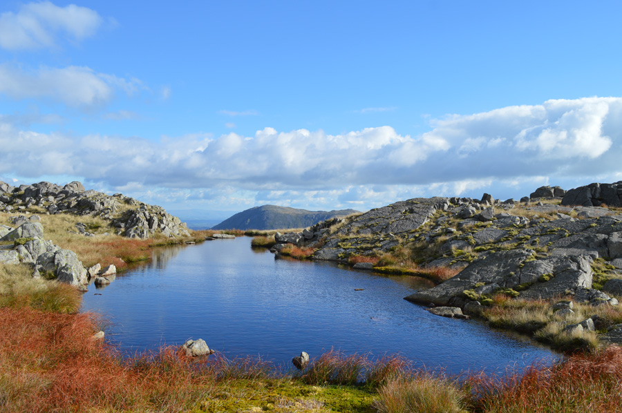
| Here, looking back on Stonesty Pike and Crinkle Crags from a pool found below Little Stand summit. |
| |
 |
| Little Stand summit cairn. |
| The sunlight was pretty sporadic casting large shadows over the fell side, I only hoped this wasn't the case when I reached the summit of Little Stand for one reason.... |
 |
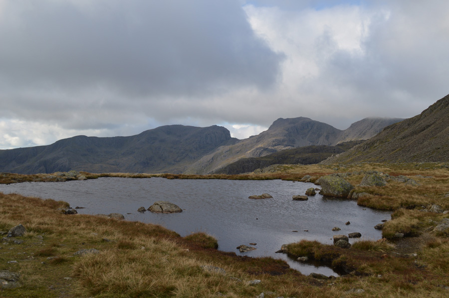
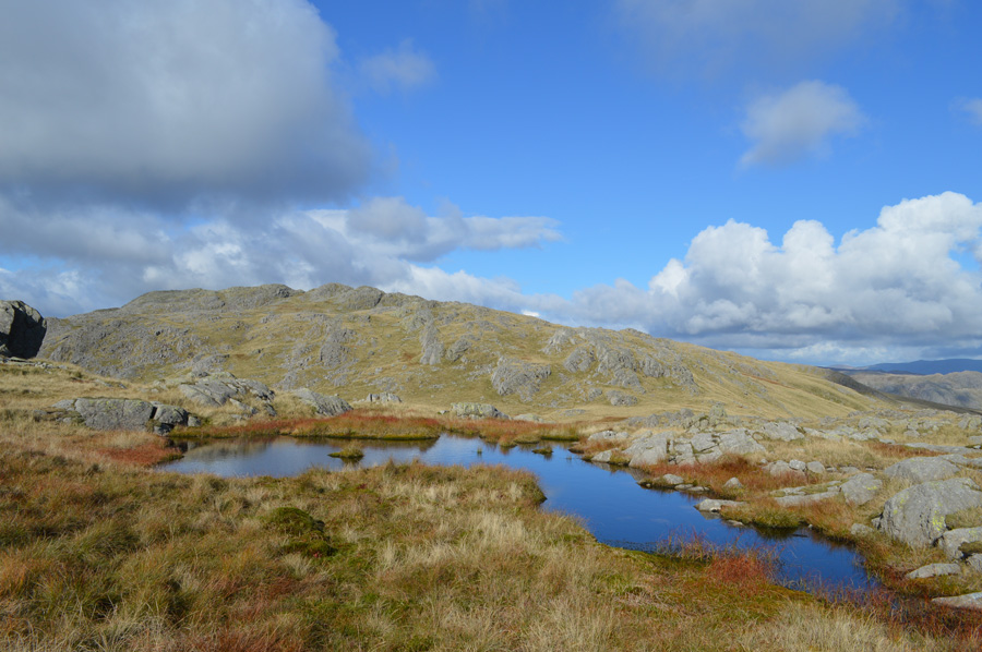
| The Tarn found next to Little Stand summit. |
| This Tarn found next to the summit area has a feeling of remoteness despite its closeness to Crinkle Crags, It's such a hidden gem especially when the sun is shining as it is now. |
 |
| Wetherlam over Wet Side Edge and Great Carrs. |
| Descending Little Stand can be tricky but thankfully I found a faint path on the other side of Little Stand's subsidiary summit, the path is narrow and a keen eye is needed in order to keep to it as it traverses across the waist of the fell side then steeply down, at times I lose the path, it simply isn't walked upon in numbers in order to keep it maintained but quickly pick it up again soon after. I can only assume that if the path is lost it may pay to consult a map as there are many over hanging crags with vertical descents found close to the area. |
 |
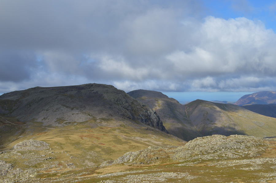
| Views over Harter Fell (Eskdale) the Dunnerdale Fells, and the Eskdale Valley. |
| |
 |
| The Scafells from Mosedale. |
| |
 |
| Brilliant light captures the wild grasses and the Scafells perfectly. |
| |
 |
| Wrynose Bottom. |
| |
 |
| The Wrynose Pass seen winding through Wrynose Bottom. |
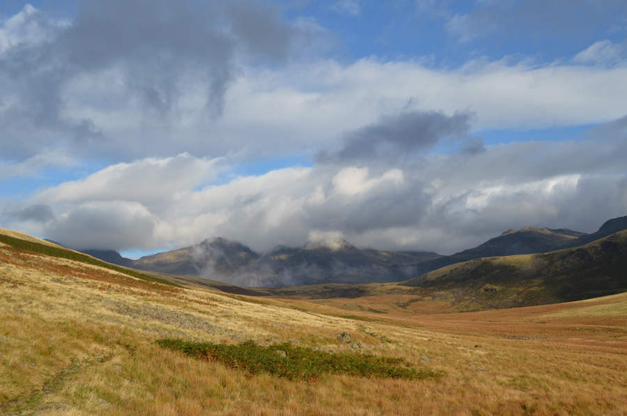
After a rather arduous descent from Little Stand I was able to gather myself with outstanding views back towards the Scafells through the beautiful valley of Mosedale whose grasses were set alight in their Autumnal glory, by now the sun was still high but I could see that it was sinking much faster than that of late, within two hours the temperatures will have dropped and mother nature will say good night to the fells for another day, me I've still got to tramp through all those cow pats again thanks to those guys bringing my walking day to an end.
Should this be my last biggie of the year I won't have anything to complain about, in fact it will be regarded as of one of the best of the year by far.
|
|
| |
| Back to top |
 |
|