|
Red Pike to Fleetwith Pike from Buttermere |
 |
 |
17th October 2015 |
 |
|
To bring my weeks holiday to a close David has invited me to join him on one of his remaining Tarn Walks, this walk which collects four tarns along the route and five summits starting at the hamlet of Buttermere, todays walk is a pretty tough one and commands a full day on the fells, as the days are drawing in David had to arrange the walk before the clocks went back.
Timing the walk went well yet despite this we ummed and ayed about extending the route to a full Buttermere Horseshoe but in the end despite feeling confident we would finish in daylight - any light left would have been minimal so the idea was shelved, instead we chopped and change the route to something that we could complete during the winter months. Our forecast wasn't brilliant but at least they said it would stay dry with any low cloud clearing after lunch, what we actually got was some very atmospheric cloud dramatics followed by strong sunlight which only faltered during last hours of the walk, we couldn't have asked for more on possibly one of the last biggies of 2015. |
|
| Wainwright Guide Book Seven |
 |
| The Western Fells |
-Fleetwith Edge The rather intimidating appearance of the ridge should not deter an active walker. From 1,000' upwards there is a succession of little rock steps, but nothing difficult. The view in retrospect is superb. There are no problems of route selection and no risk of going astray, a beautiful climb. Do It! |
 |
|
|
| |
|
Overview |
|
|
| Ascent: |
4,010 Feet - 1,403 Metres |
| Wainwrights: |
5, Red Pike (Buttermere) - High Stile - High Crag - Hay Stacks - Fleetwith Pike |
| Weather: |
Scattered Sunlight Through the Morning Turning Overcast. Windy Across the Summits. Highs of 12°C Lows of 4°C Feels Like -3.6°C |
| Parking: |
Roadside Parking, St James Church, Buttermere |
| Area: |
Western |
| Miles: |
10.4 |
| Walking With: |
David Hall |
| Ordnance Survey: |
OL4 |
| Time Taken: |
8 Hours 10 Minutes |
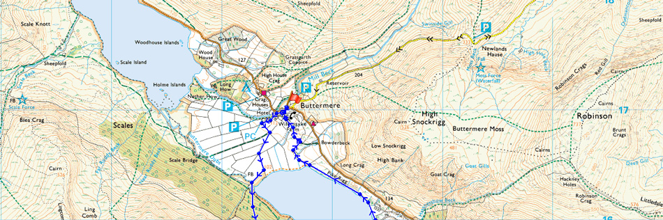
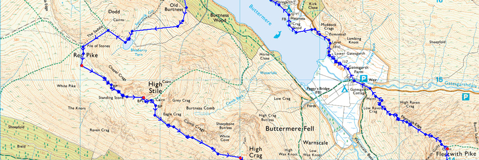
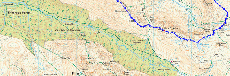
| Route: |
Buttermere - Old Burtness - Bleaberry Tarn - The Saddle - Red Pike (Buttermere) - High Stile - High Crag - Gamlin End - Seat - Top of Scarth Gap Pass - Haystacks - Innominate Tarn - Black Beck Tarn - Warnscale Beck - Dubs Hut - Fleetwith Pike - Fleetwith Edge - Gatesgarth Farm - Road back to Buttermere |
|
| |
|
Map and Photo Gallery |
|
|
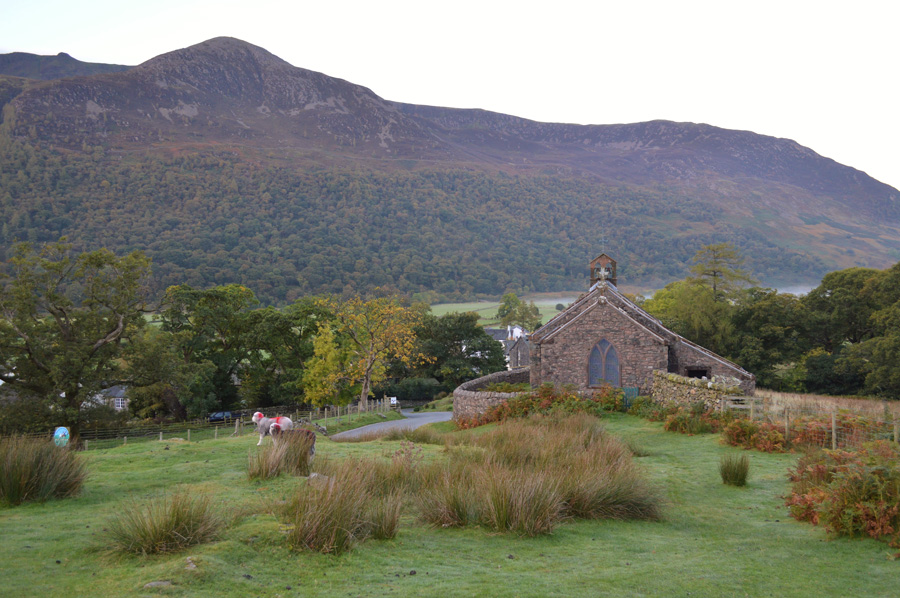 |
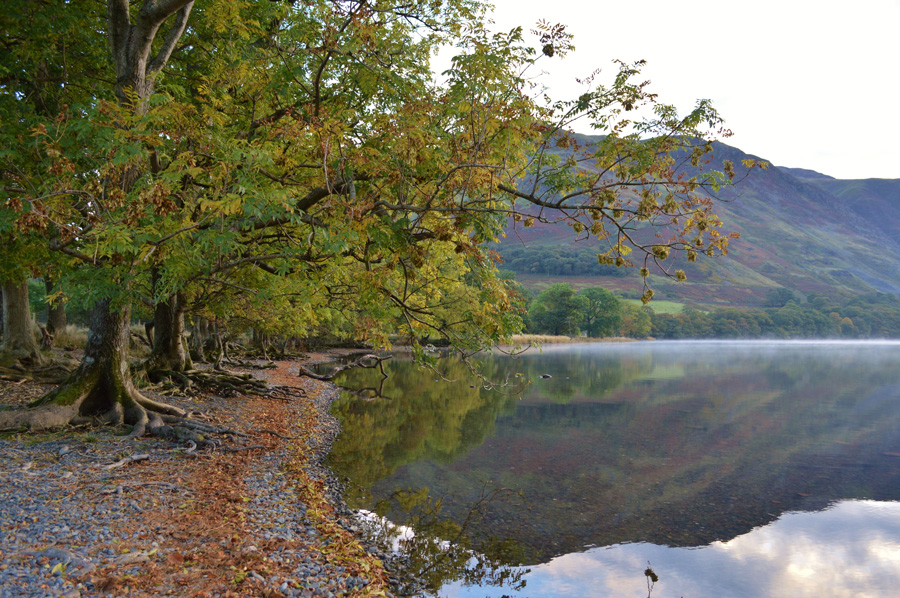
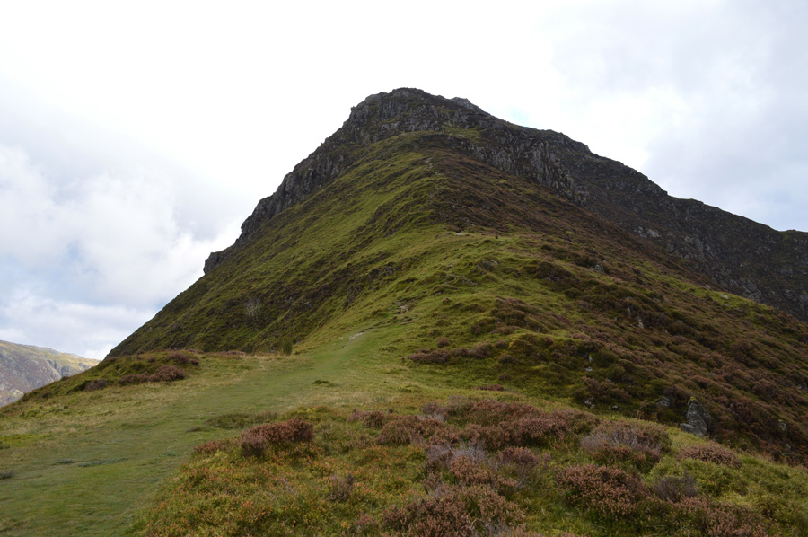
| Red Pike from St Peters Church, Buttermere 08:00am 5°C |
We had arranged to meet at our usual time of 08:00am which saw me running quite early, this however would all change once I drove through the outskirts of Braithwaite where I would then pick up the Newlands Pass before spotting a Road Closed Ahead Sign were I had no option other than to follow the detour which took me through Swinside, Ghyll Bank and Little Town, a lengthier detour but idyllic all the same, I arrive close to 07:55am
David had just parked up at the parking spaces close to St Peters Church and was half kitted up, I park easily as the spaces all but one other car, are plentiful, this certainly wasn't the case on our return, but I guess it's only to be expected. There is a mildness about the morning air as we both are pretty surprised that we can see our route noting from the Fell Top forecast, anything below 700' would be under cloud although the forecast did mention west would be best, they certainly got that bit right. The Fish Inn is passed with not a soul in site, only the bark from a farm dog disturbs the morning tranquility as we decide to take a detour to take in views up the lake, we wasn't to be disappointed. |
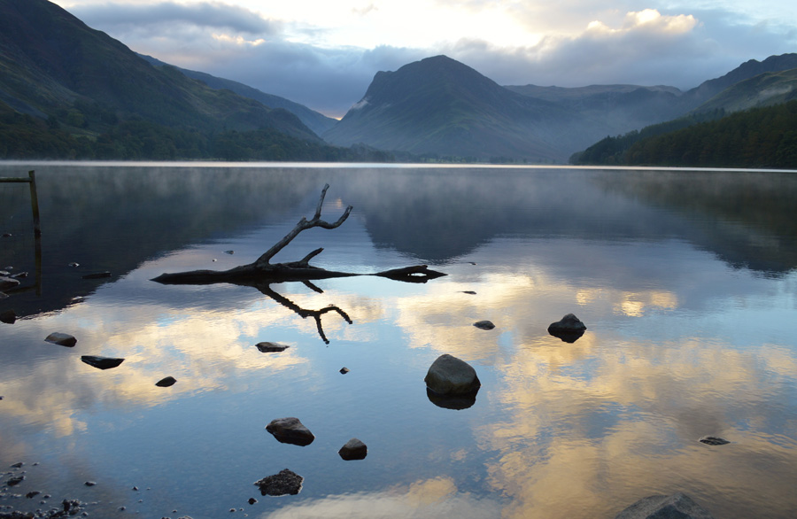 |
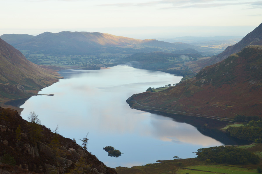
| Fleetwith Pike over Buttermere. |
| As far as being there at the right moment I don't think we could have timed our arrival any better, the waters surface reflected the blue skies above our heads and also had a thin layer of morning mist which despite there being no wind travelled across the surface quite quickly, it was mesmerising to watch to say the least. |
 |
| A moment in time. |
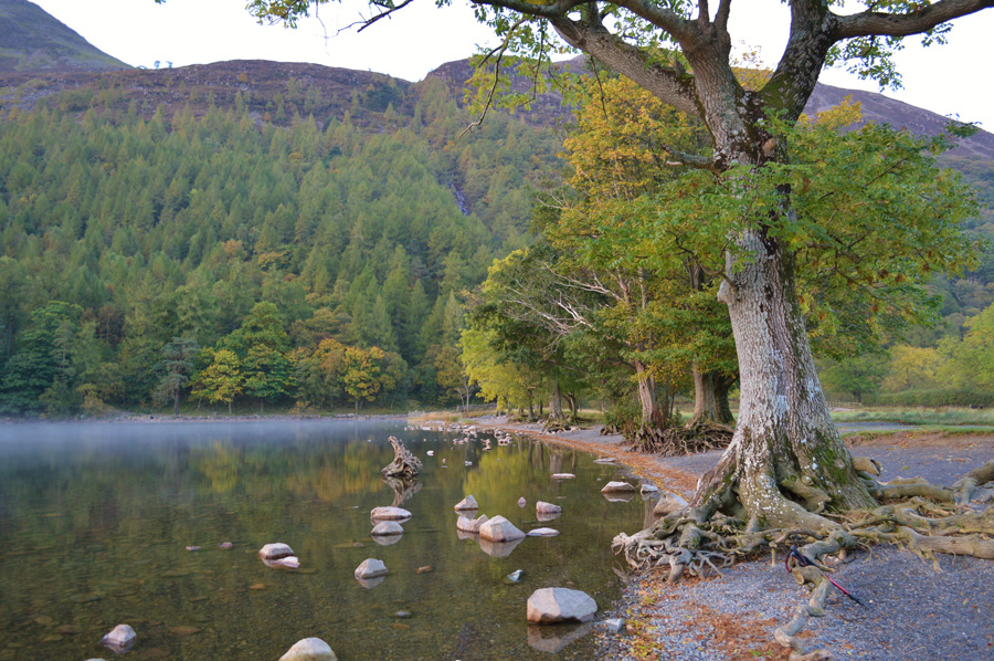
| Despite our best efforts we had to leave the calmness of Buttermere, we leave the waters edge and take a short cut through dew covered grass towards the wooden footbridge that crosses Buttermere's outflow, from here two paths are presented, the lake path or the steep path that climbs high through Old Burtness. |
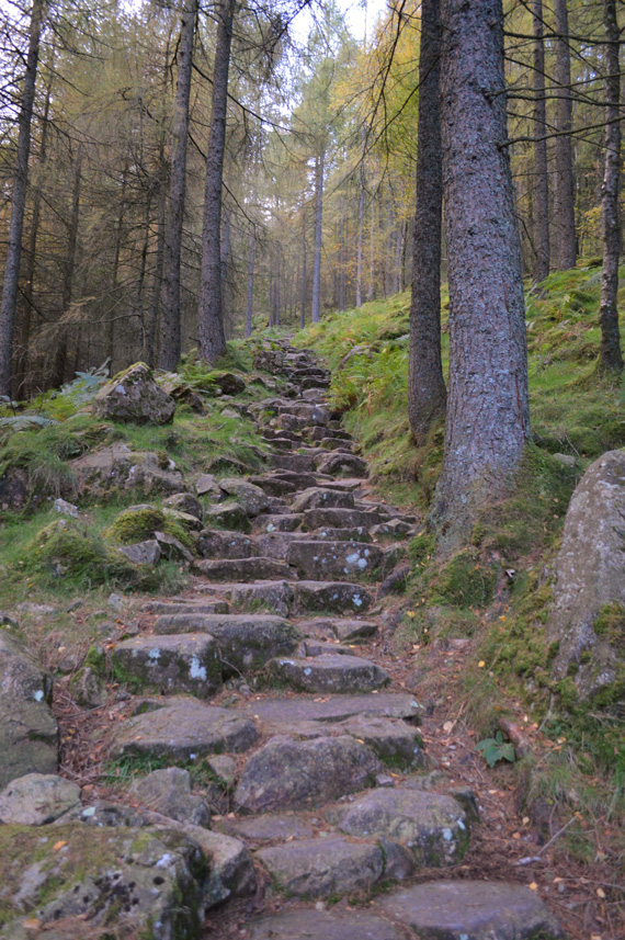 |
| Old Burtness. |
| We are soon met by the stone staircase that rises through Old Burtness almost straight from the start, it's a pretty unforgiving path that rises steeper towards the end, by which time you would have climbed above the tree tops enabling views to open up almost instantly. |
 |
| A close up of Crummock Water |
| After emerging through Old Burtness David delayers, me I'm also feeling it from the climb especially as it's so mild but a slight breeze brings the temperature down once onto open fell side. The steep climb isn't over as now we follow a stone path which rises towards Sourmilk Gill, from where the path levels out before Bleaberry Tarn is reached, but, that's in a little while just yet. |
 |
| Mirky views over Buttermere towards High Snockrigg and Robinson. |
| |
 |
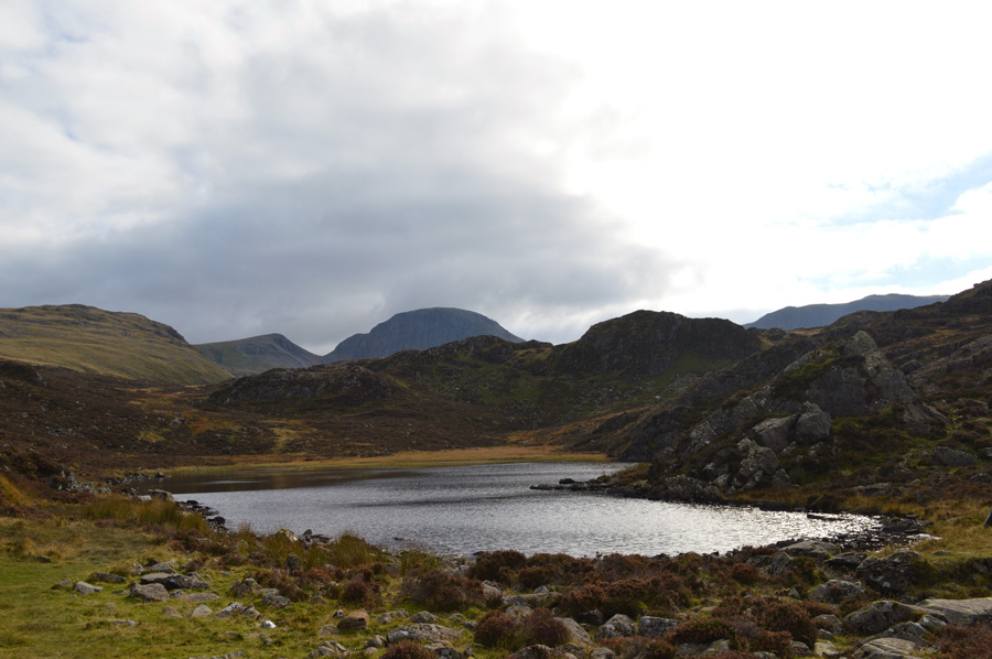
| Bleaberry Tarn. |
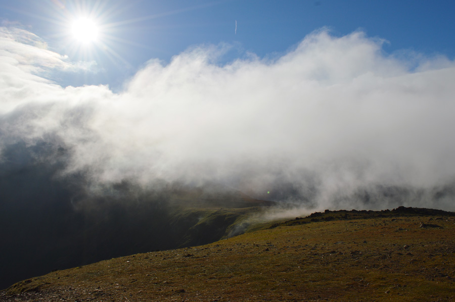
| The light had faded by the time we reached Bleaberry Tarn and the cloud had began to drop leaving us thinking that the whole ridge from Red Pike to Haystacks was going to walked under cloud, oh well, there's nowt we can do about it I guess. David claims his Tarn as we head out to take the steep path from Bleaberry Tarn to the summit of Red Pike, seen here in the right of the photo. |
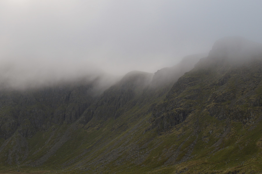 |
| Drifting cloud over Chapel Crags. |
| |
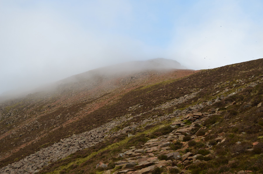 |
| Red Pike from the footpath. |
Every now and again we would see hints of blue appear through the gaps in the cloud teasing us into thinking that we might get our views once the summit was reached while over to our left cloud drifted over the ridge never revealing what its next move was going to be,
During our ascent we disturb a flock of Crows who had gathered at the Col between the summit and Dodd, soon after it was almost like a scene from a Alfred Hitchcock movie as any views that we had of a blue sky turned black leaving an eerie feel to the ascent. |
 |
| The sun pierces through the cloud revealing a bank of cloud that was quickly drifting over the ridge. |
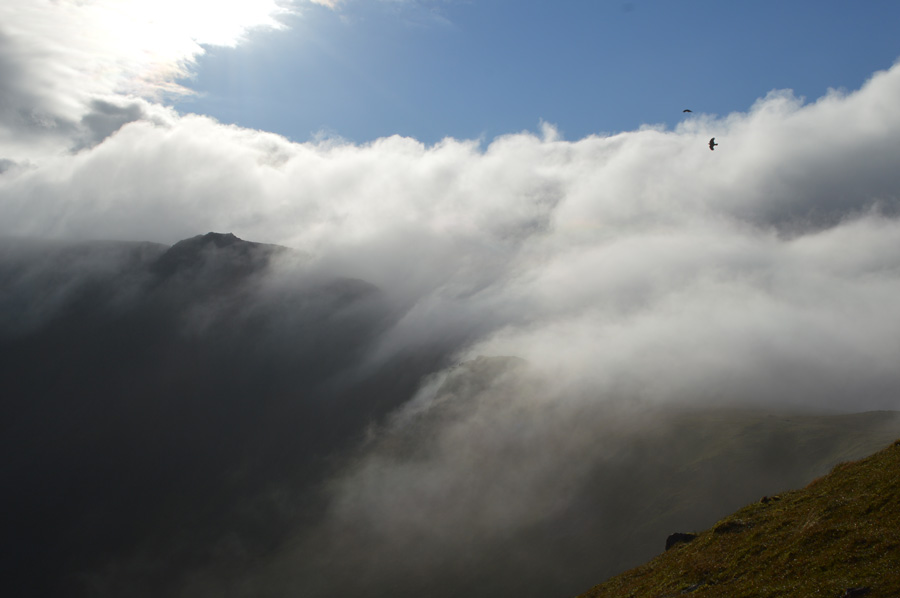
From just below the summit of Red Pike the sun managed to break through the cloud creating some rather atmospheric cloud dramatics along the ridge towards High Stile whose summit was still below cloud.
We broke over the shoulder of the summit and headed straight towards the summit shelter feeling the wind chill almost instantly, beyond the summit our views extended all the way to the Irish Sea as David points out the Light House at St Bees Head and the towns and villages between us and the Irish Sea 'reckon I can walk home from here' David laughs' |
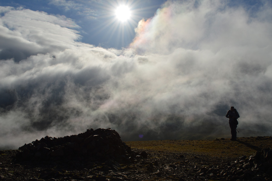 |
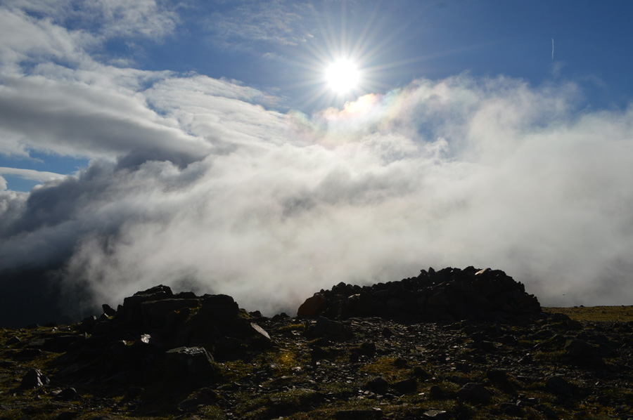
| Red Pike dramatics. |
Photos are quickly taken as we realise that in a matter of seconds we could be back under cloud again, David puts his jacket back on and takes out his Wind and Temperature meter while I add hat and gloves. We are not entirely surprised to discover that the meter told us here at the summit of Red Pike the wind-chill was -3.6°C helped along by 26mph winds. I guess we can both safely say that winter is just around the corner and dressing accordingly will soon become the norm.
I guess we best keep moving. |
 |
| Not before I take one last photo. |
| |
 |
| Leaving Red Pike (Buttermere) for High Stile. |
| After taking in the clearer views west we strike out towards High Stile only for the cloud to drop once again, despite this it does seem that the cloud is temporary and hopefully may clear for good later, lets hope that's the case. |
 |
| Gulp... |
| Not if this catches upto us. |
 |
| Views over Rannerdale Knotts, Whiteless Pike and Grasmoor. |
| The cloud that seemed to be heading our way took a sudden shift of direction and engulfed the summit of Red Pike then drifted out in the direction of Ennerdale, had we arrived ten minutes later I'm sure we wouldn't have seen the dramatics we had just witnessed. |
 |
| Red Pike (Buttermere) seen with Dodd. |
For me personally every time I return here I am going to reminded of the time I ran from Red Pike to Dodd, then back to the summit of Red Pike during my two thousand footers campaign in twenty one minutes, in fact I don't think this will be the first or last time great memories will come flooding back from the Spring and Summer 2015.
Onwards and upwards towards our second summit of the morning. |
 |
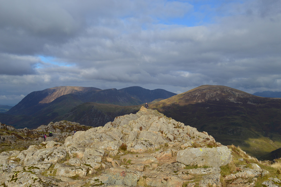
| High Stile summit. |
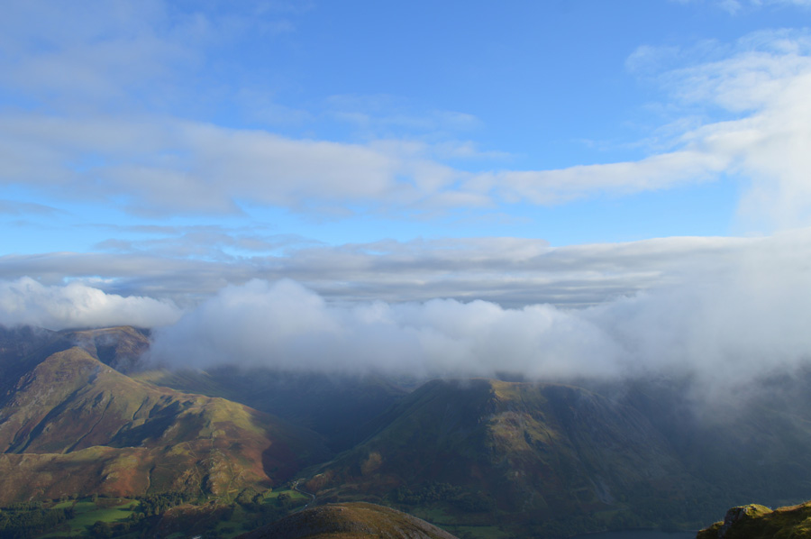
| We ascend steadily over boulder towards the summit of High Stile, behind us it looks like the cloud has all but vanished as does our view along the ridge towards High Crag. A lone walker is now standing on the summit of Red Pike and by the looks of it he has ascended Ennerdale before quickly disappearing from view in the direction of Starling Dodd, meanwhile the cloud has cleared over the whole High Stile ridge leaving our walk to High Crag to be done in beautiful sunshine despite that wind chill. |
 |
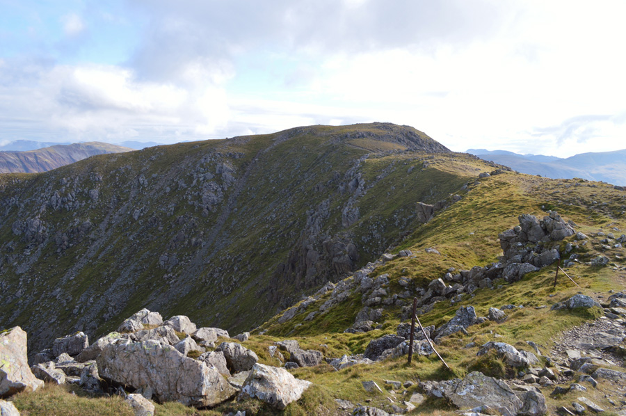
| High Crag, Fleetwith Pike and the Gable seen from the High Stile Ridge. |
| After leaving the High Stile summit behind we descend a little to rejoin the ridge which is perhaps one of the best known ridge walks in the Lake District all though you wouldn't have thought it this morning as we have haven't passed anyone along our travels as yet, we suspect it will get busier once we get closer to Haystacks though. |
 |
| High Crag is just ahead. |
| We take in the natural lay of the ridge sometimes in chat sometimes stopping to look down on at the rock scenery in both Burtness and White Cove (s) which never fail to impress where gullies fall away vertically all the way down to the bottom of the coves, it certainly isn't a place to stray off path when the cloud is down. |
 |
| Views back along the ridge over White and Burtness Cove (s) towards High Stile. |
| |
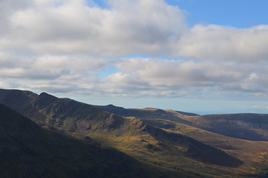 |
| Long Crag and Steeple seen over the Ennerdale Valley while beyond, Caw Fell and Iron Crag from High Crag summit. |
| |
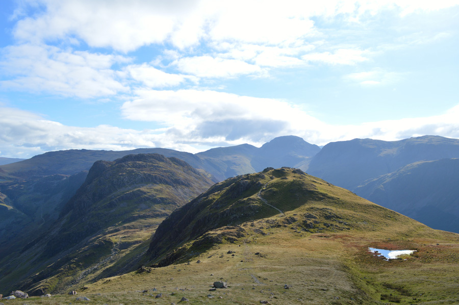 |
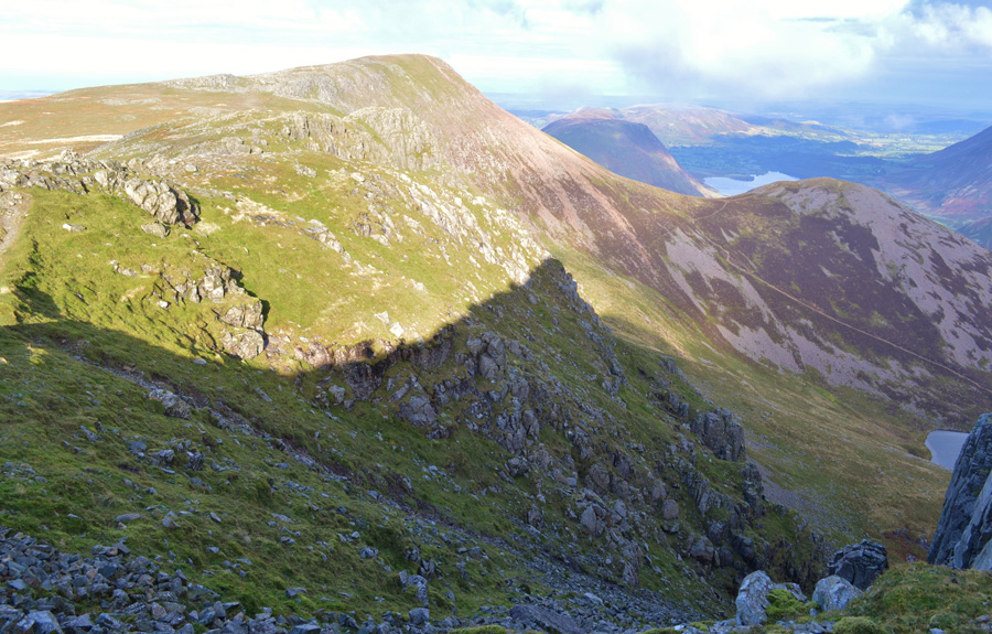
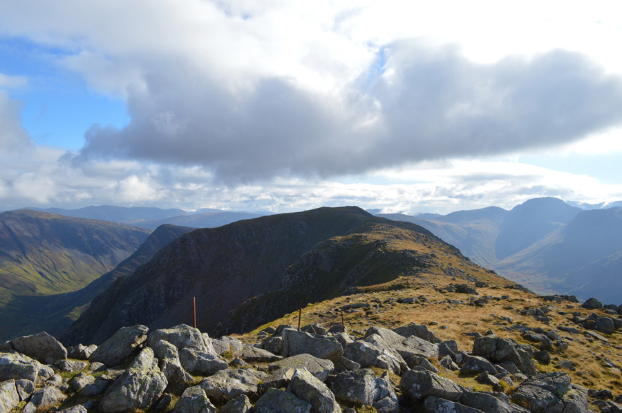
| Descending Gamlin End with views over Seat and Haystcks. |
The steep descent from High Crag via Gamlin End was as steep as expected, we had the descent to ourselves and took it in our own stride while David continued to entertain me quoting (or trying to through laughter) scenes from the Monty Python films, where descent by care was overtaken by laughter.
We soon arrive at the col between Seat and Gamlin End as we glance back at our descent, where, we witnessed two fell runners descend Gamlin End in what seemed less than one minute, we of course looked on through walkers eyes thinking just how did he just do that as he appeared to be falling, controllably.
Well done that man, but I wouldn't want your knees in ten years time! |
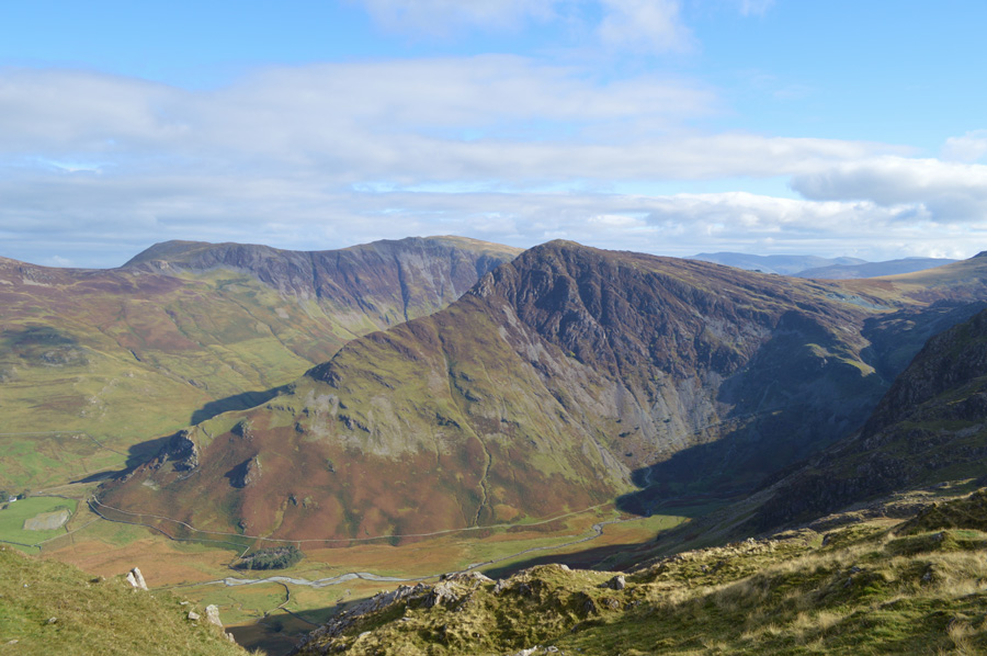 |
| Fleetwith Pike, Dale Head and Warnscale Bottom come into view as we pass over Seat. |
| |
 |
| Here, looking back over the top of Scarth Gap Pass towards Gamlin End, High Crag and the Grasmoor Fells. |
Having took in the slight descent from Seat we arrive at the top of a bustling Scarth Gap Pass were walkers and families converge all seemingly heading for Haystacks, already there are large amounts of walkers making their ascents, some couples but mostly families, one of which was a family of four who were helping Grandad with the scrambly bits of the ascent, at first David and I looked at one other and didn't say a thing, but we were both thinking the same, this gent should not be here, he was unsteady on the level so what chance would he have during the scrambles, his son let us pass as the gent laughed 'anyone got a tow rope!' we shared the laughter and even joked about an escalator which was all in good fun.
It was a tough one and I guess you just had to be there to see it with your own eyes.
We press on ourselves making light work of the little scrambles before emerging just beneath the summit, my legs muscles ached a little but I said nothing, not yet anyway, I put this down to my previous two walks over the last week which were all big walks really.
We push up towards the summit which had just cleared of walkers although we will have to be quick as more walkers were on our tails. |
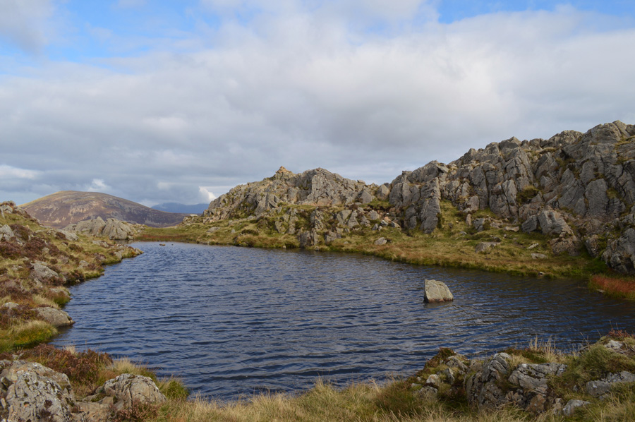 |
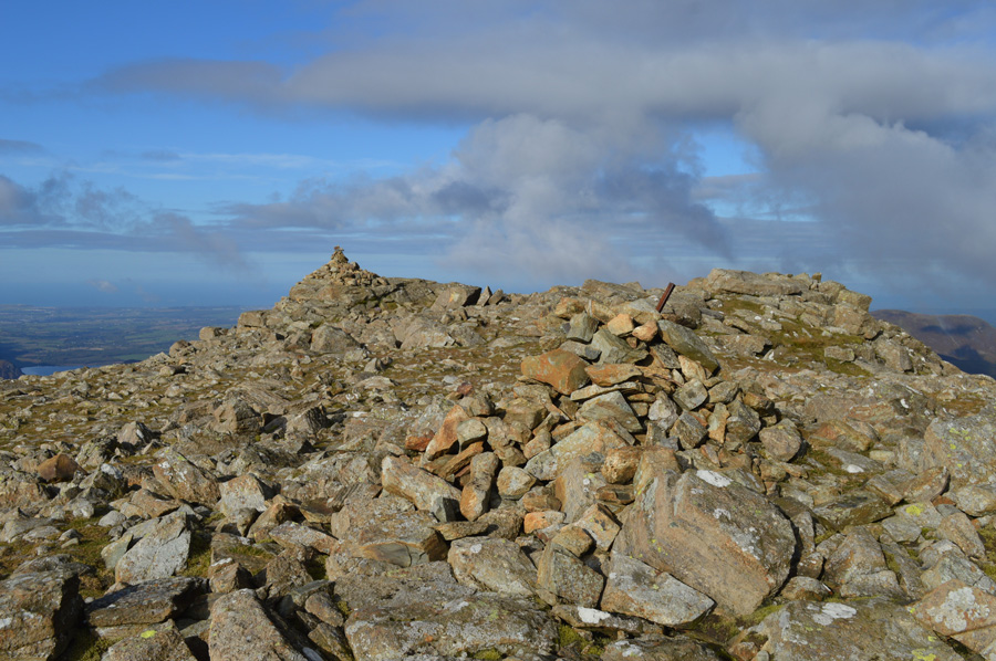
| David's second respective Tarn, found just below Haystacks summit. |
| |
 |
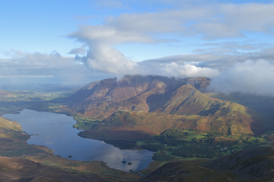
| Views over the Tarn towards Seat, Gamlin End and High Crag, in the distance Mellbreak Crummock Water and the Loweswater Fells. |
| |
 |
| Contrasting light changes over Robinson and the Grasmoor Fells from Haystacks summit. |
| Before leaving Haystacks we decided that now would be a good time to eat lunch, we just needed to find a sheltered spot out of the wind. |
 |
| Innominate Tarn from our Lunch Spot. |
We perch ourselves just off path finding two flat rocks from where we could enjoy lunch from. Walkers come and go and from our spot over looking Innominate Tarn Haystacks summit is starting to get busy indeed, I guess we left just at the right time. With walking so much on my own I guess I don't notice just how slowly I eat, something that has been picked up on at home too.
David wraps up lunch while I'm still finishing lunch off, I feel a little guilty so I throw over one of two Marathon Bars that I had brought with me, now I don't feel as bad and we can enjoy our views for a few minutes longer! |
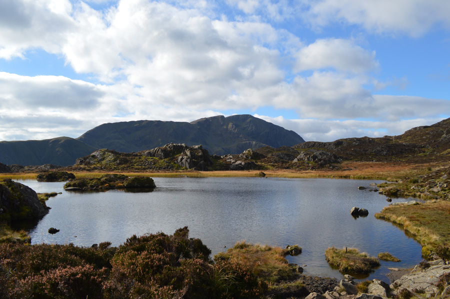 |
| Pillar from Innominate Tarn. |
| |
 |
| Buttermere, Crummock Water, The Loweswater Fells, Rannerdale Knotts, Grasmoor and High Snockrigg. |
The grandfather who had been brought by his family was making good ground and made up ground as we ate lunch no doubt, by the time we were heading for Black Beck Tarn he was only a short distance behind us. Here we would pass more walkers heading for Haystacks who had no doubt ascended via Warnscale Bottom and Warnscale Beck. As light hearted as it looked, most of the walkers that we passed here were ill equipped and not dressed for the conditions at all.
We press on taking in the fabulous views as we head down towards David's last Tarn in Black Beck Tarn. |
 |
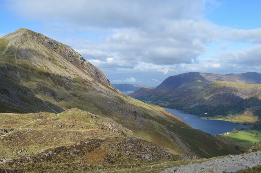
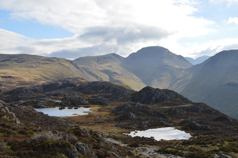
| Green Gable and Great Gable from Black Beck Tarn. |
| We are still a distance away from crossing Warnscale Beck which gave us time to have a think about extending our route to include the whole Buttermere Horseshoe, after checking our watches and thereafter using our fingers to calculate how long our extended route would take we agreed that we would have been fighting against the clock, and worse still, rushing back to St Peters in order to get back before dusk, seeing as neither of us wanted that we put it on our 'to do list' and further still, then came up with a cracker of a walk for the winter. Only two minutes earlier before our calculations in our heads we were both preparing for the full horseshoe, I guess that's how close we actually got to doing it. |
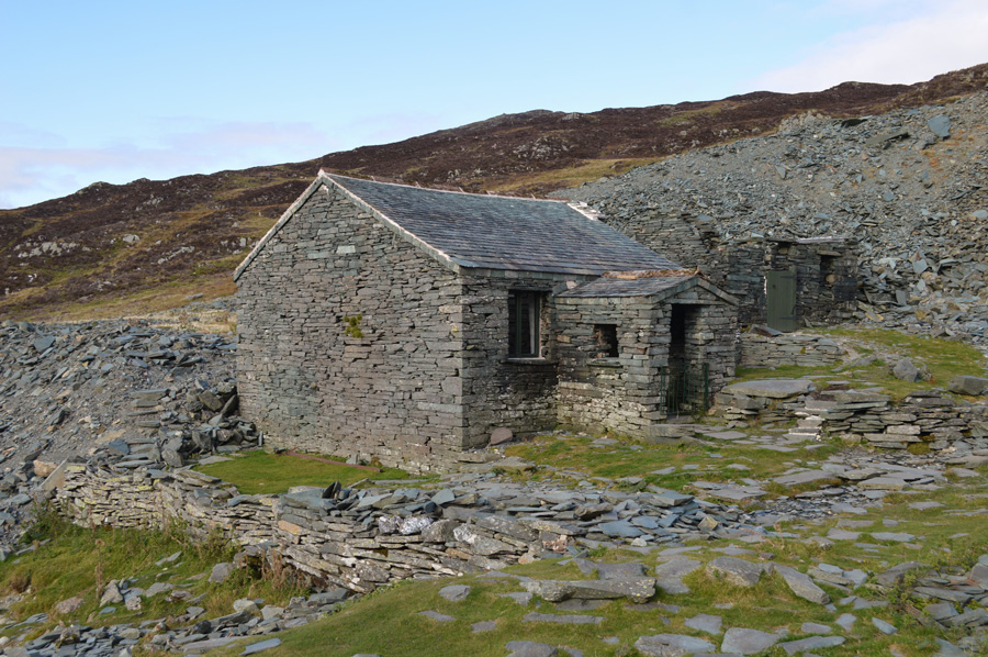 |
| Dubs Hut. |
We crossed Warnscale Beck using the large stepping stones and managed to stay completely dry in the process, now all that was needed was to reach Dubs Hut and pick up the path that travels almost horizontally towards Fleetwith Pike summit, a woman who was descending helped us pick out the whereabouts of the path, when the woman reached us she asked had we passed her sons who she had sent to make a summit on Haystacks, after which, she agreed to meet them back at Gatescarth Farm, well I'm sure we have we replied, it's quite busy back there.
With this we pick up the path directly above Dubs Quarries, we had noticed however a group of teenagers on our tails, I'm sure we were both thinking that it was going to be difficult trying to make up ground with fresh young legs behind us. We stop and gaze back at the vertical cliffs that form Haystacks north face, picking out old Mine Adits from which this whole area is famous for, the youngsters soon catch us up but prove that young legs are no match for the ones that regularly stomp this ground all collapsing to the ground as myself and David continue steadily towards Fleetwith Pike summit. |
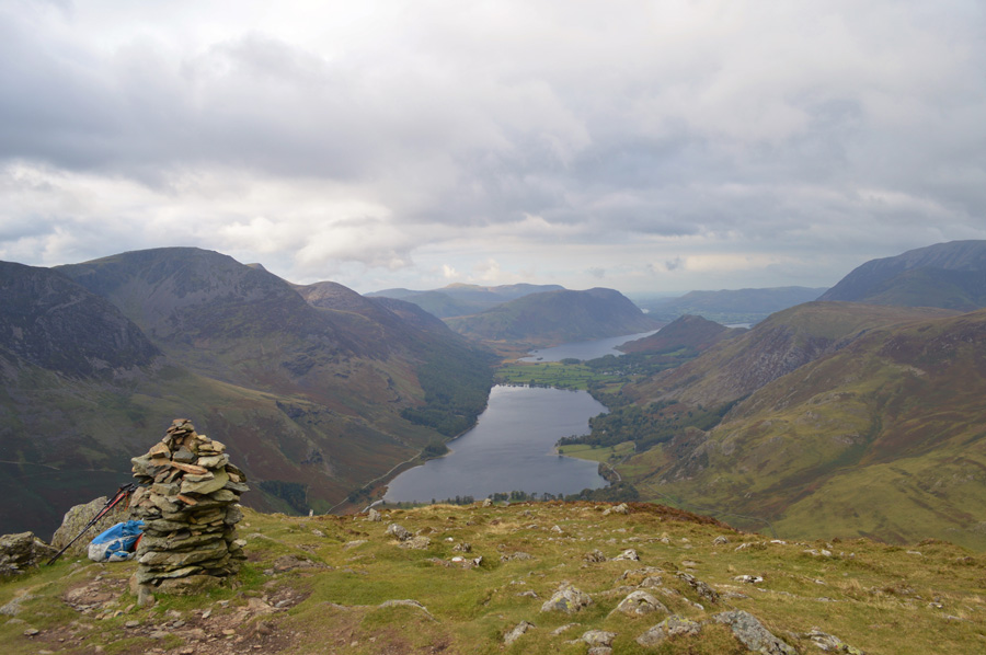 |
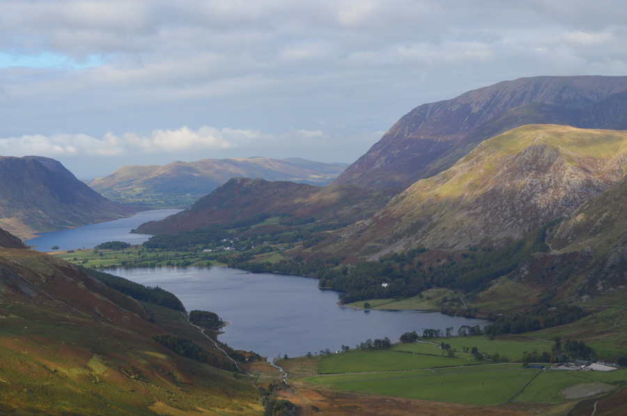
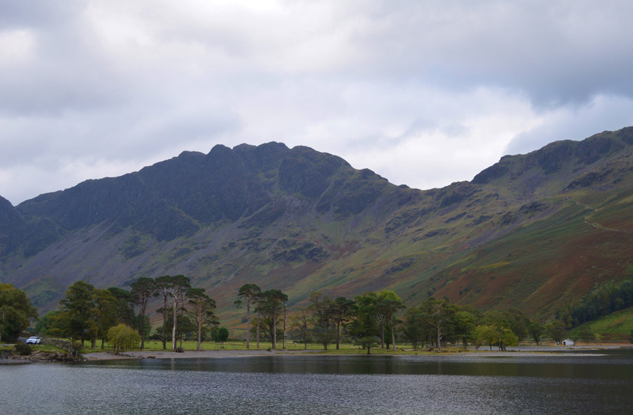
| Buttermere and Crummock Water from Fleetwith Pike summit. |
| By the time we arrived at Fleetwith Pike summit it had turned overcast and with this we lost a little light, I'm sure had we not pre-seen this back at Dubs Hut our complete horseshoe might have gone ahead. The summit is quite busy and in fact, can match just how busy our last summit of Haystacks was, with this we head down steeply to take on Fleethwith Edge. |
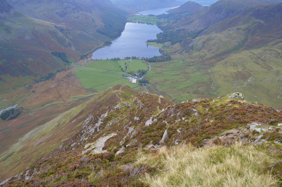 |
| Buttermere and Crummock water as we descend Fleetwith Edge. |
Fleetwith Edge is split into three sections with short ridges in between, from the summit what only can be described as a bull nose falls steeply onto the first ridge, the descent is marked by a good path but care is needed especially in wet conditions, today however the rock is dry and the path retains good grip, after our first descent I look back up on the ground we have just descended and struggle to pick out the path as it winds its way sharply over crag, a thoroughly great descent.
The second and third part of the descent is largely covered by crag and grass, the sharpness of the path continues as does the steepness but doesn't match what I referred to as the bulls nose found below the summit. |
 |
| The only view back towards Fleetwith Pike summit is determined by the steep crags above the ridge. |
| Once we lose descent we quickly lose view of the summit from the second, then the third section of the ridge. |
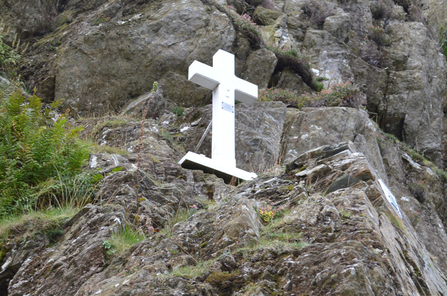 |
| The Fanny Mercer Memorial Cross found on Low Raven Crag close to the base of the ridge. |
| Fanny Mercer wasn't an accomplished walker and grew up in Rugby. Aged just 18 a servant of Rev P Bowden Smith, Fanny accidently died here when her staff jammed against a crag, throwing her to her death on 8th September 1887. |
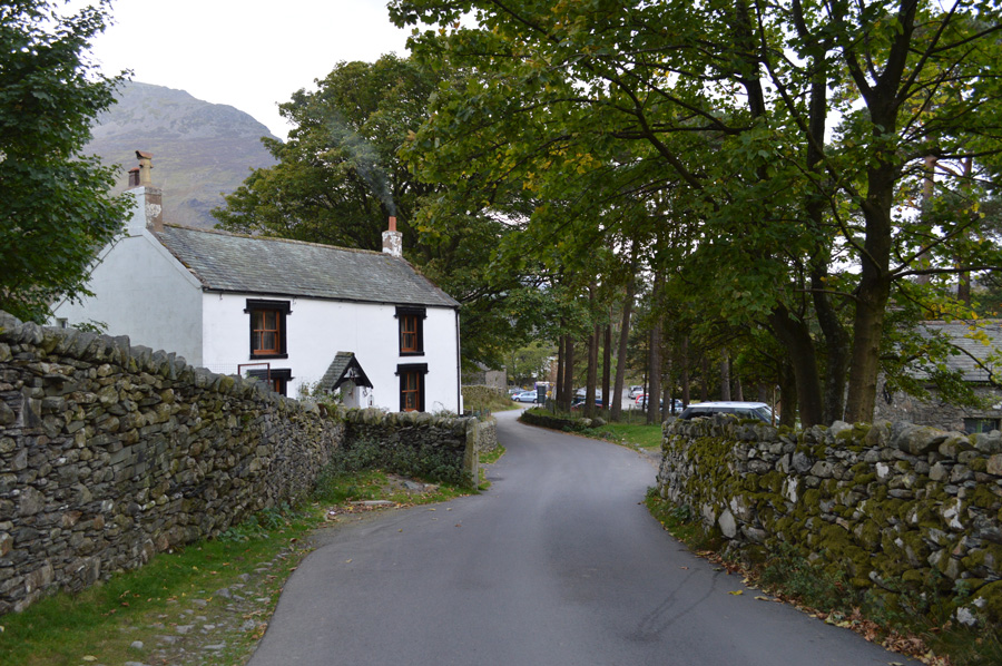 |
| Passing Gatescarth Cottage on route back to Buttermere. |
Smoke from a wood burner fills our nostrils as we pass Gatescarth Cottage, a grand cottage that has seen the test of time, beyond, the familiar ice cream van parked at Gatescarth Farm, the owner reads a paper from the drivers seat no doubt waiting for the walkers to return to their cars parked nearby. We make way for traffic as we make our way for the Lake path, familiar faces are spotted from the summit of Haystacks as one by one we all find our own ways back to Buttermere. |
 |
| Haystacks. |
Soon we are on the lake path passing day trippers three of whom stop us when we are asked 'which ones Haystacks' they are three elderly ladies in high spirits 'and which is the path we would use' we answer their questions and we get a thank you in return, on leaving one of the ladies is heard saying to the other 'no were not going up' it was quite funny, all very Last of the Summer Wine (esque)
Two amateur photographers have set up on the shoreline and are kneeling down looking through view-finders set upon tripods as I think the Buttermere Pines just aren't at their best on an afternoon like todays, we round the shoreline before arriving at the Walkers Tunnel that had been calved by hammer and chisel, its history is checkered.
We are asked by three gents who are sat together had we seen their wives, one laughs you'll know who they are they've probably talked you to death! in that case they are just behind us, I am once again reminded of a scene from Last of the Summer Wine but I guess you would had to have been there.
Before the Tunnel is reached we are stopped in our tracks by a family who help an elderly member over difficult tree routes, they thank us in their native tongue which sounded possibly Russian 'probably a strong fella when he was a young un David remarks, aye I reply.
Through a canopy of trees we continue our walk towards Buttermere, it's still mild and a world away from the chill we had felt whilst at the summit of Red Pike some hours earlier, Our path leads us through the pastures of Wilkinsyke Farm where Hens roam freely and Post Cards are on display in the Farm windows, we pass through the yard and emerge almost opposite The Fish Inn, the whole area is bustling with tourists and walkers alike, David bends down to take a photo of some old farm machinery while I glance over at an old farm dog who's days seem to be behind him gathering from his grey beard and tired eyes.
We climb the steep hill besides the Church talking of future walks as we smile and shake hands on arriving back at the cars, our legs know when they've had a good walk, and todays was no exception. |
|
| |
| Back to top |
 |
|