|
Walking the Wainwrights in 30 Walks Walk 16 - A St Johns-in-the-Vale Circuit |
 |
 |
5th June 2016 |
 |
|
It hadn't been the best of weeks since I turned my right ankle quite severely last weekend which saw my ankle swell and bruise to a point when I had to take a day off work come midweek, nevertheless I persevered with the ice-packs mostly in the evenings after work and kept up with the anti-inflammatory tablets which by Friday saw my ankle reduce in swelling and even the bruising started to fade.
I didn't have any option other than to rest when I could but this type of injury required both rest and use which I kept up with regular dog walks after work. By Saturday the limp had gone and that afternoon I treated the dogs to a four miler, it was only during the last mile did I get that dull ache normally associated with this type of injury but overall I was getting more and more satisfied in how after a relative short period of time the injury was improving.
I was in work during the Saturday morning and I planned some R&R for the afternoon which I also spent trying to convince myself that I might try to get out on not just a short walk, but to see if I could complete a project walk, of course my aim as always to complete any walk that I set out to do but not this one...I really had to hold back and take my time which was exactly what I did. Some may say I was foolish to get straight back into such a tough route, but me, I knew the call I had made, I called it soldieuring on.
This is a St Johns-in-the-Vale Circuit. |
|
| Wainwright Guide Book One |
 |
| The Eastern Fells |
-The Eastern Fells
Surely there is no other place in this whole wonderful world quite like Lakeland…no other so exquisitely lovely, no other so charming, no other that calls so insistently across a gulf of a distance. All who truly love Lakeland are exiles when away from it.
|
 |
|
|
| |
|
Overview |
|
|
| Ascent: |
4'243 Feet - 1'294 Meters
|
| Wainwrights: |
7, Clough Head - Great Dodd - Watson's Dodd - Stybarrow Dodd - Raise - White Side - High Rigg |
| Weather: |
Warm, Dry And Sunny Turning Overcast Mid-Afternoon With Some Light Showers. Highs of 26°C Lows of 15°C |
| Parking: |
Parkings Spaces B5322 Wanthwaite |
| Area: |
Eastern |
| Miles: |
12.8 |
| Walking With: |
On My Own |
| Ordnance Survey: |
OL5 |
| Time Taken: |
7 Hours 10 Minutes - 7:20am - 14:30pm |
| Route: |
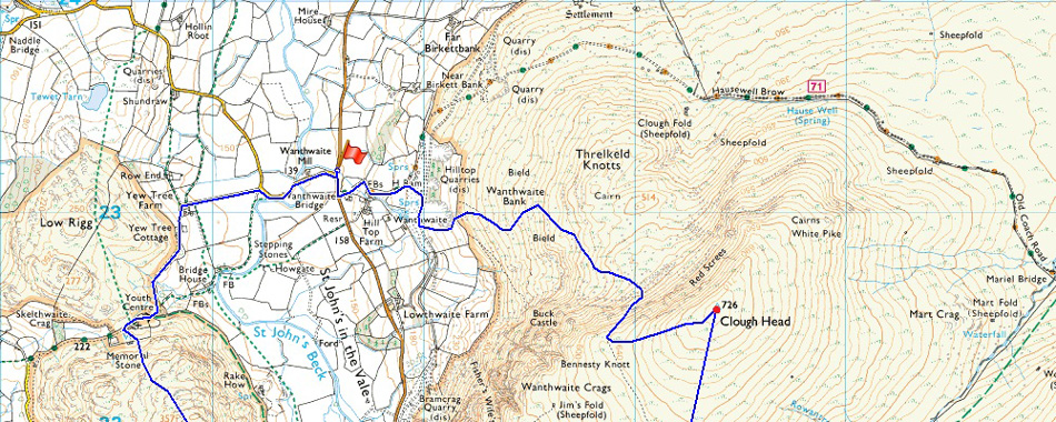
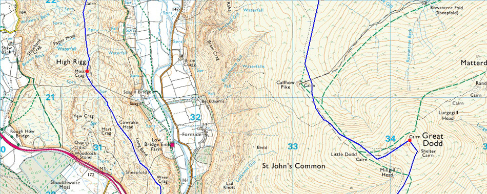
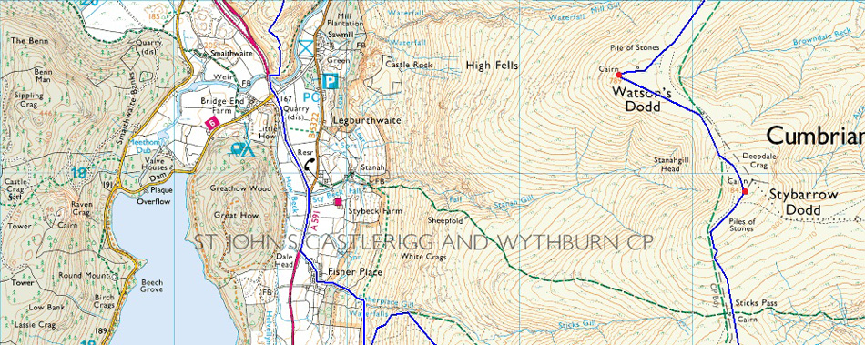
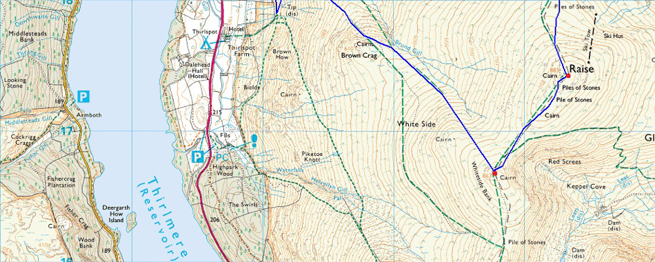
Wanthwaite - Wanthwaite Bank - Clough Head - Great Dodd - Watson's Dodd - Stybarrow Dodd - Sticks Pass – Raise – White Side – Brund Gill– Fisherplace Falls - Fisher Place - A591 - Legburthwaite - Long Band - High Rigg - St John's-in-the-Vale Church - Yew Tree Farm - Wanthwaite Bridge - Wanthwaite |
|
| |
|
Map and Photo Gallery |
|
|
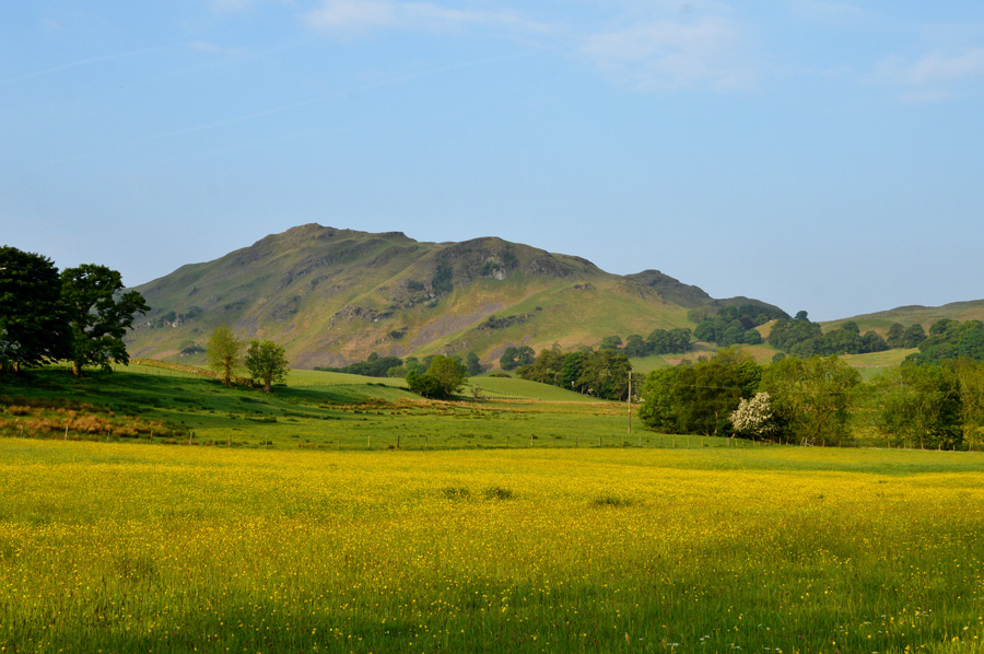 |
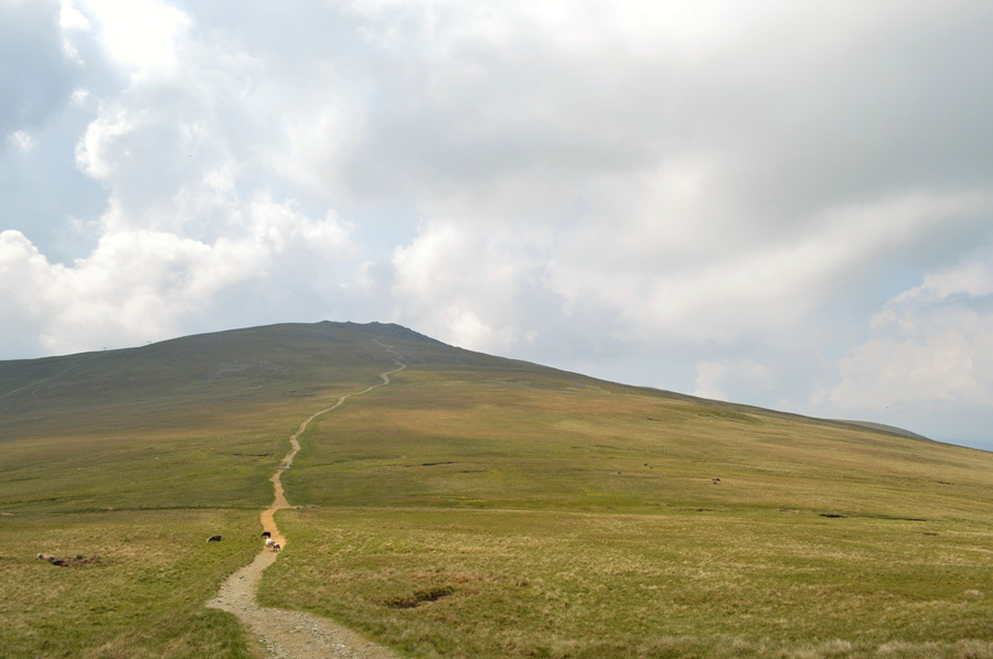
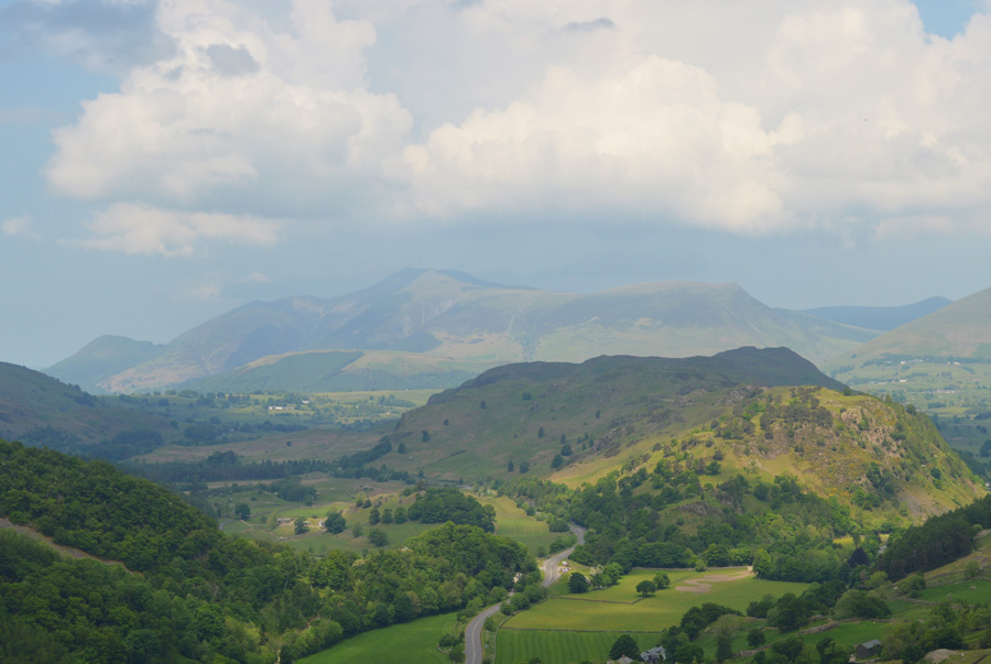
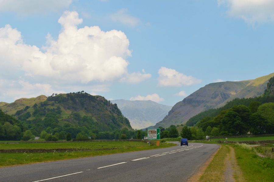
| High Rigg from Wanthwaite Bridge 07:20am 15°C |
With the promise of another fine day In Lakeland I arrived in Wanthwaite under cloudless skies with a bright sun bearing down on me, it was early but the sun was already warm yet the forecast for today had predicted the temperatures to rise into the mid twenties whilst heavy showers weren't to be ruled out. I hydrate myself by finishing off a litre of water coupled with the three that I have in my Camelbak but there's always that 'do I have enough' feeling after getting dehydrated some years ago, an experience while out on the fells I don't ever wish to repeat.
There isn't a breath of wind and the thoughts of any showers are put to the back of my mind, I lace up giving the laces, especially on my right boot a firm tug making sure the tongue is neatly tucked into place, this foot today is getting the presidential treatment, if it has to look after me, and I have to look after it. I couldn't help but notice the bright yellow buttercups which turned the pastures into seas of wild yellow, a beautiful summers contrast when set against a blue morning sky. With my boot locked I head out past the familiar sign post that had been lovingly painted in black and white, a feature to Wanthwaite as the red phone box is to Loweswater. |
 |
| Looking back on Blencathra before I take the Old Coach Road close to Hill Top Farm. |
After passing the sign post I head left onto the Old Coach Road before passing Hill Top Farm, here the ground underfoot is rough with some rocks the size of your fist that line the track more so in the middle where the farm machinery has compressed them into the ground. I keep left then swap right, whichever is the best side to walk to introduce my ankle back to rough ground, is this really what it comes to Paul? by eck lad.
Yes of course I was thinking what I am doing but each step gave me confidence and before I knew it I wasn't looking down at the ground but ahead where I had to cross a wooden sty. The sty soon came into view and I eased myself over without incident, ahead, a steep ascent is required before reaching the disused quarry. |
 |
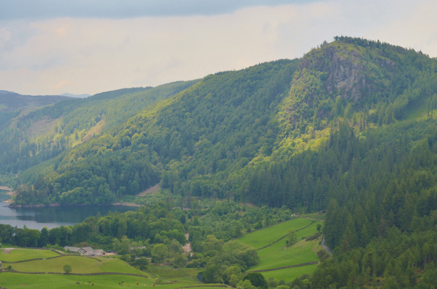
| Wanthwaite Crags from Wanthwaite Bank. |
Feeling more confident with each step I topped out onto the old quarry track before passing the site of the quarry. Despite gaining Clough Head many times I can only recall ascending from Wanthwaite maybe just the once or twice and this was some years ago, nevertheless it all came back to me and I remembered reading the serial numbers from the old farm machinery that has been left to rot in and around the quarry, the old machinery may look like junk but I like to look at the serial plates if only to see how old the are, some of which dated back to the 1940's.
I don't spend too long getting nostalgic though because there's another steep ascent required, here the quarry has been dug into the fell side and excavations have left the quarry with almost vertical sides in the shape of a horseshoe, from memory if I pass the quarry and ascend via a plantation to the right - a singular path will see me through onto open fell side. |
 |
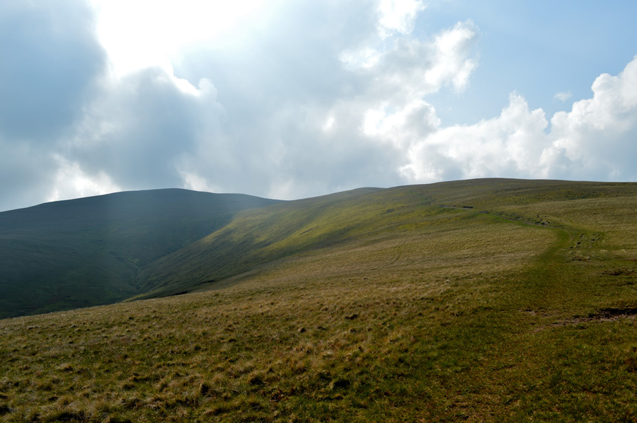
| Buck Castle and Bennesty Knott from the top of Wanthwaite Bank. |
The sun hadn't quite breached Clough Head but it's light was starting to seep through from the east and soon I would be ascending head long into a morning sunrise. I was feeling more than pleased with my ankles performance, so much so I had to tell someone so I text my wife 'ankle fairing well up to now' what I didn't include was just how steep the ascent of Wanthwaite Bank which saw me ouse sweat like I have never sweated before, the morning air was extremely muggy and with no wind I was at times left gasping for just a breath of wind to cool me down, it will come but not just yet.
My path will follow the grassy terrace in the foreground before veering left into the shade, an area of Clough Head known as Red Screes. From here I will ascend steeply onto the ridge before following a singular path that traces across the face of the crags seen in the photo, It had completely escaped me just how fantastic this ascent is, well, now that most of the hard work is behind me that is. |
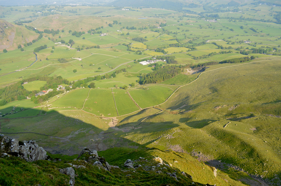 |
| Looking down over St Johns-in-the-Vale with distant views of Low Rigg and Tewit Tarn. |
| |
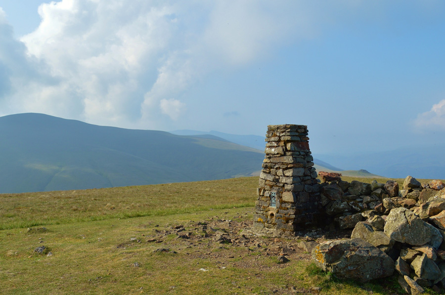 |
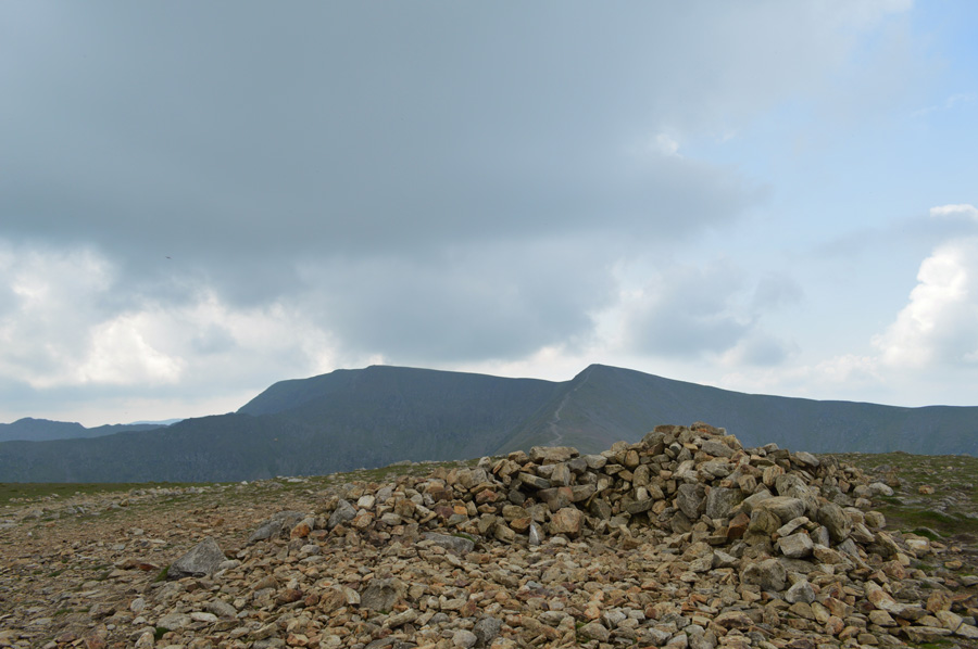
| Great Dodd from Clough Head summit Trig Point. |
After picking my way across the face of the crags I topped out onto Clough Head grassy west ridge by which time It felt like I had lost a stone in sweat alone. I was greeted by a drifting summit wind which didn't do much in the way of cooling me down but it was better than none at all I guess. From the my position I have a 600 yard haul over hummocky grass before I reach the summit and today the fell side is littered with grass flies which I disturb as I pass through, they buzz around me in their thousands and at one point I have to close my mouth through fear of swallowing them, every now and again I stop to rub my arms and legs free of the critters and thank my stars the buggers don't have teeth!
With the summit reached I place my walking poles beside the Trig Point and set about getting myself together, I de-shoulder and I get an instant cool down as the sweat on my back is exposed to the breeze. My baseball cap comes off which gets placed on the ground alongside my sunglasses which has a coating of sweat across the top of the rims, what I need right now is a beer and a cold shower, what I make do with is my Berghaus fleece which I use to erm, dampen me down...that'll have to get thrown in the wash but for now, it'll do.
From no-where a dog pants by quickly followed by two fell runners just wearing shorts and the shoes on their feet as a fleeting 'morning' is passed before they head down the ridge towards Great Dodd.
Which is were I'm heading next right after I collect my walking poles. |
 |
| Calfhow Pike and Great Dodd seen shortly after leaving Clough Head summit. |
The first descent of the day was dealt with cautiously as I make my way across the ridge that usually, even during the summer months can get quite boggy, yet today after days without rain and the continuous hot weather the bogs had dried up leaving them looking cracked and weathered, a good sign that summer is well and truly here. |
 |
| Pausing to look back on Clough Head as I flank Calfhow Pike. |
| I thought about taking the effortless detour to gain Calfhow Pike but decided otherwise due to how much I have already extended todays route by including both Raise and White Side into the walk, besides, I was feeling more and confident with my ankle as by now my focus had turned to Great Dodd. |
 |
| Great Dodd is just ahead caught here during a light burst. |
| I was feeling pleased with my ankle's progress but never over confident, ahead the summit of Great Dodd awaits not before a steady haul towards its summit. |
 |
| Calfhow Pike. |
| Just before I begin my ascent on Great Dodd I turn around to take this photo of Calfhow Pike. |
 |
| Looking back on Calfhow Pike and Great Dodd. |
| Despite clear views back along the ridge any long distant views were still hampered by the haze that hasn't lifted in some parts of the district for well over a week now. |
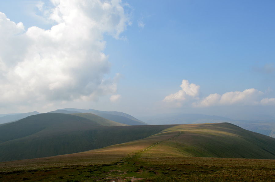 |
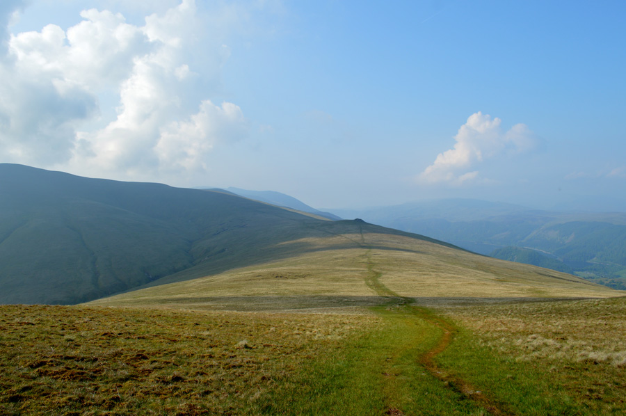
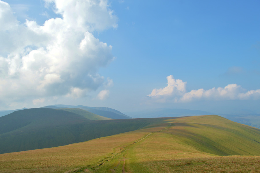
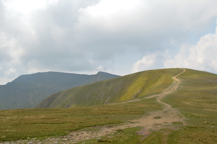
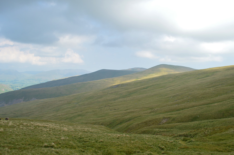
| Fantastic views over Watson's Dodd, Stybarrow Dodd, Raise, White Side. |
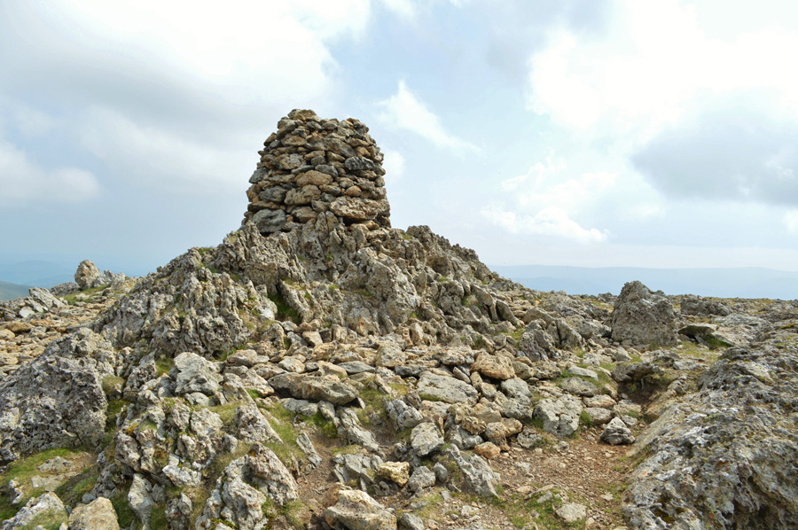
I gained the summit Great Dodd with a steady march feeling quite confident underfoot all under the cover of cloud which helped with any overheating issues. I arrived at the summit still in low light and gave the stone cairn a tap from my walking pole. I have a wander over to the edge of the summit with hopes of seeing the Randerside Ridge which extends into Matterdale but views are hampered once again by a mix of low light, haze and fleeting cloud, there is a noticeable temperature drop driven by the summit winds for which I'm thankful for.
I don't spend much time at the summit and then wander past the stone shelter as the Watson's Dodd ridge slowly begins to unfold in front of me, up ahead I can see the sun shinning through the gaps in a large black cloud and any moment now that cloud will hopefully pass revealing... |
 |
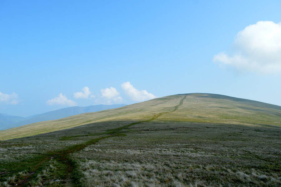
| Watson's Dodd and Stybarrow Dodd. |
| I had only dropped off the summit by a few yards when the sun broke through the cloud illuminating the whole ridge ahead of me, Stybarrow Dodd and the eastern ridge was still under cloud extending as far as Nevermost Pike but for now that didn't matter, this is one of Lakelands finest ridge walks and I was walking it on near perfect conditions, just fantastic. |
 |
| Looking back to Great Dodd from Watson's Dodd summit. |
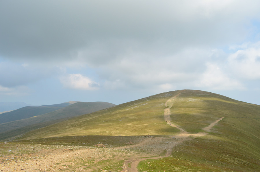
I continued along the ridge leaving the wide grassy path in favour of the singular path that lead gently towards Watson's Dodd summit cairn. I was feeling quite surprised that on a day like today I had only seen the two fell runners but in the same breath I wasn't complaining that I'd had the last three summits to myself.
Next, it's another short ridge crossing before taking the steady path towards Stybarrow Dodd summit. |
 |
| Stopping to look back on Watson's Dodd and Great Dodd before I begin my ascent on Stybarrow Dodd. |
| |
 |
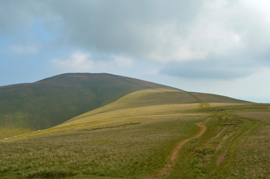
| Watson's Dodd and Great Dodd seen from Stybarrow Dodd summit. |
By the time I reached Stybarrow Dodd summit cairn the light had faded once more due to a covering of cloud that started to fill the skies overhead, previously I had checked the local weather which had forecasted heavy downpours from lunch time onwards and I guess the cloud build up was the start of things to come.
I leave the summit cairn and wander towards the edge once more taking in the views of Deepdale, a valley that I had only had the pleasure of walking through once on the cusp of Autumn, If I recall it was the last weekend I wore shorts for that year.
Good times. |
 |
| Raise seen as I cross the topof Sticks Pass. |
Stybarrow Dodd was the point that I left the comfort of grass underfoot behind in favour of a stone track, some of which would be rough in between Sticks Pass and White Side, I wont lie if I said that this particular section of the walk didn't lay heavy on the mind as it is steep and rough in sections.
Slow and steady it is. |
 |
| Raise summit cairn. |
I had been passed by a woman fell runner as I crossed the top of Sticks Pass and 'mornings' are shared, I found it a little unusual that she was shouldering a large pack, perhaps 45ltrs which swayed as she ran, nevertheless I could only look on thinking how can anyone run in this heat and also carry a large pack while doing so.
Ahead however, the heat must have eventually got the best of her as she slows to a walking pace and with hands on hips, she crests the summit and disappears out of view. I tramp on taking advantage of the grass verge which ran out close to the summit from where, a dusty rocky track provides the last eighty yards or so.
It was here came a point; although still very conscious of my ankle did I start to forget about it if that makes any kind of sense, with no pain, no pressure and no uneasiness I made my towards the summit cairn right about the same time the sun came back out. |
 |
| Helvellyn and Helvellyn Lower Man as I start to make my ascent on White Side. |
As I made my way across the top of Keppel Cove Helvellyn came into view along with Swirral Edge and Stridng Edge, it's been close to twelve months since I was last at Helvellyn's summit and I'm starting to get itchy feet about making a return. |
 |
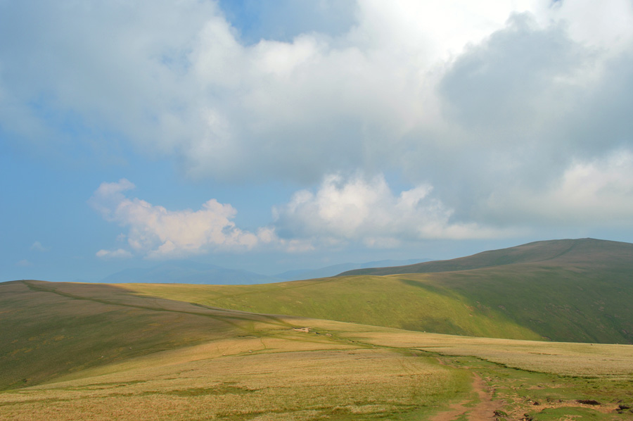
| Views back over Raise, Stybarrow Dodd, Watson's Dodd and Great Dodd. |
| |
 |
| Helvellyn Lower Man, Helvellyn, Swirral Edge and Striding Edge from White Side summit. |
After a steady push I soon arrived at White Side summit cairn not before studying my descent via Brund Gill as I traversed the Col. A route that was new to me and that I was very much looking forward to descending. From the summit cairn I turn my back on Helvellyn and head north east, here the ground is made up of rock and grass and reminds me very much of the summit of Nethermost Pike.
A faint grassy path below the rocky summit steers towards Brown Crag, there are only traces of trods towards the direction of Brund Gill, a path, or even a consistent trod would be handy as I take advantage as best I can of the lay of the land which was sometimes difficult when descending steadily over steep grassy bank. |
 |
| Views over Stybarrow Dodd, Watson's Dodd and Great Dodd from the top of Brund Gill. |
| |
 |
| Looking back up to Raise summit from Brund Gill. |
| My chosen line of descent somewhat sandwiched me in between White Side north west ridge and Brund Gill thus avoiding the summit of Brown Crag found on the spur of the ridge, my plan was to flank the outcrop, then manoeuver back in along the path below Brown Crag which worked out just as I had planned, feeling rather pleased with myself that most of the hard work was behind me I decided to stop for an early lunch just below Brown Crag summit. |
 |
| Lunch with a view over my final summit of High Rigg. |
| I hadn't intended to eat lunch so early but after stumbling across a boulder with a lovely seat calved into it I couldn't resist and de-shouldered my pack before taking time out whilst watching the world go by along the newly opened A591, it's still a wonderful view this morning despite the haze. |
 |
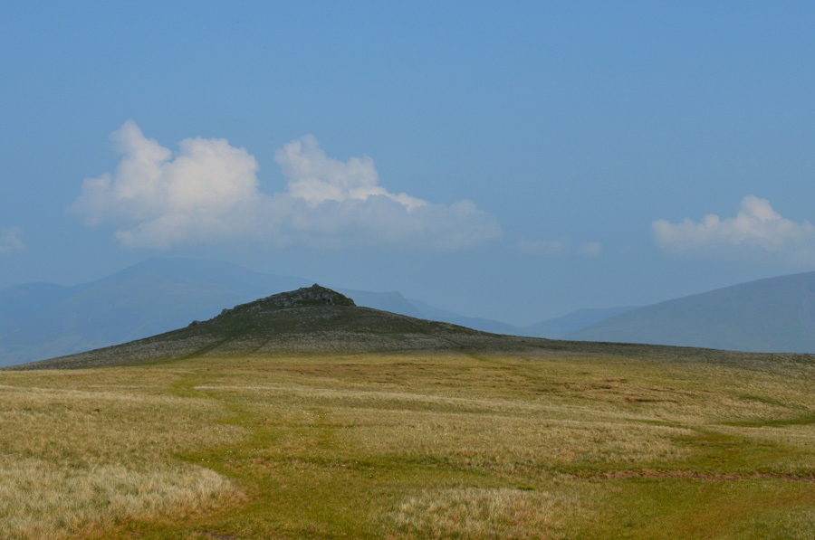
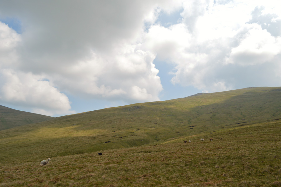
| A close up of High Rigg with Skiddaw and Dodd seen through the haze in the distance. |
| |
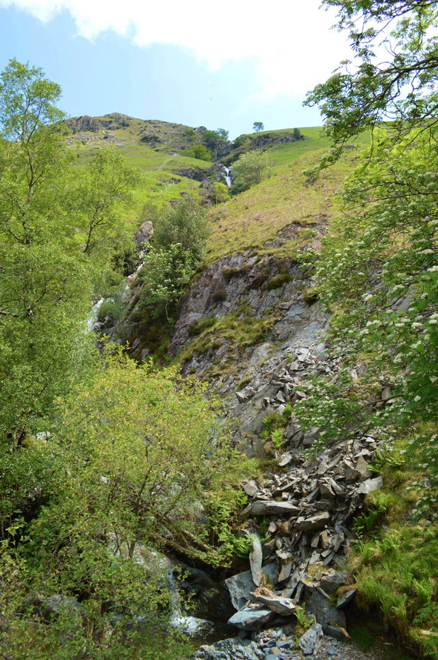 |
| Fishergill Waterfall. |
After lunch I re-shouldered and began my descent towards Fishergill flanked by both sides of the path by bracken which was starting to grow quite thick in places at times already begining to take over the narrow footpath. The closer I got to Fishergill I came across signs that the path had been washed away with rubble and boulders strewn across the path, ahead repair work to a new path on the other side of Fishergill had begun which looked inviting to use, however due to the many red triangular warning boards I didn't venture too near just in case they read 'out of use'
I was met first by the sound of Fishergill well before I reached the footbridge which crosses it, a sound too inviting to miss although at the height of summer the greenery tends to take over and close up views are limited. |
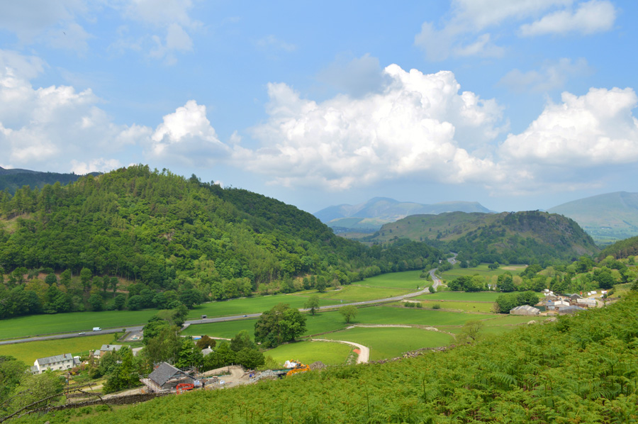 |
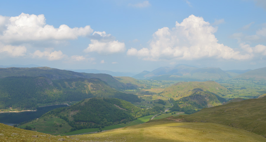
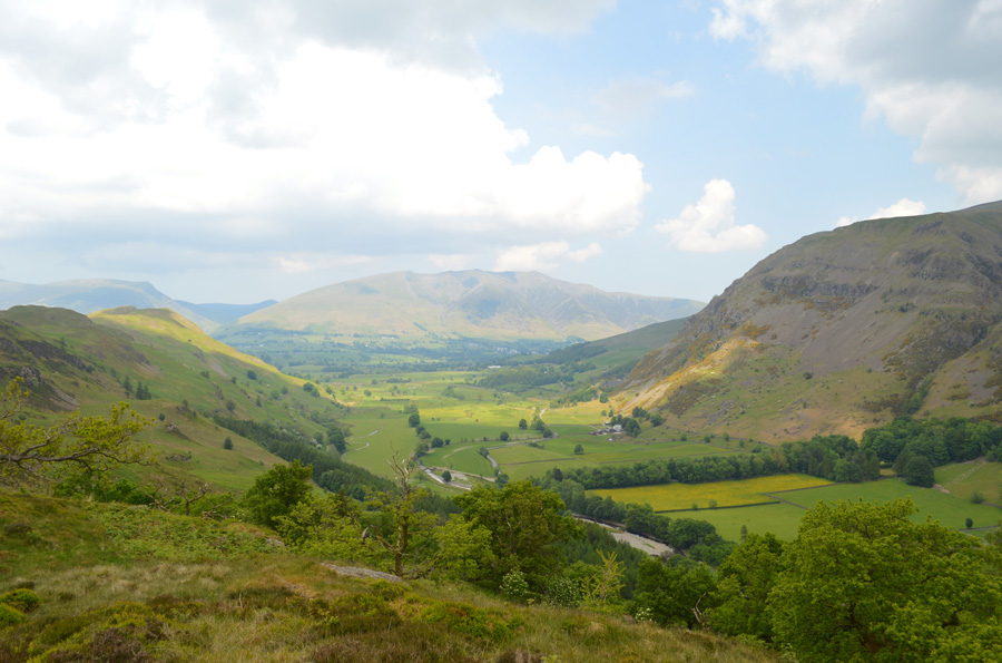
| Great How, High Rigg and the A591 seen from Fishergill. |
| My next plan was to follow the Aqueduct back to Stanah from where I would cross St John's Beck before gaining my last summit of the day in High Rigg, but, this was not to be the case as the footpath along the Aqueduct was closed off due to last December's storms which meant I had to make my way along a bustling A591 instead.
No Bother. |
 |
| High Rigg, Stybeck Farm and Castle Rock with a hazy Blencathra in the distance. |
| |
 |
| High Rigg and Bram Crag from the A591. |
I don't mind admitting that the path from Brown Crag to Fishergill was quite steep and extra care was taken during descent. With Fishergill now behind me I could concentrate on High Rigg as I strolled along the A591. I suppose this photo doesn't show just how busy the road was with cars vans and road bikes all taking advantage of the newly opened A591 which I thought was great to see especially with the revenue the tourists bring after such a bad winter. |
 |
| A peep through St John's-in-the-Vale from Stanah. |
| |
 |
| Castle Rock from Stanah. |
As I pass through Stanah a Road Bike Peloton are having road side checks carried out at a make shift service area, it seemed quite chaotic watching them as I passed but I still managed to get a few hi's in the process. Ahead, a wooden sty along the A591 will see me start my ascent on High Rigg. |
 |
| Looking back on Brown Crags, Browncove Crags and Helvellyn Lower Man with Stanah below. |
| |
 |
| A close up of Raven Crag and Thirlmere from the top of Wren Crag - on route towards High Rigg now. |
| |
 |
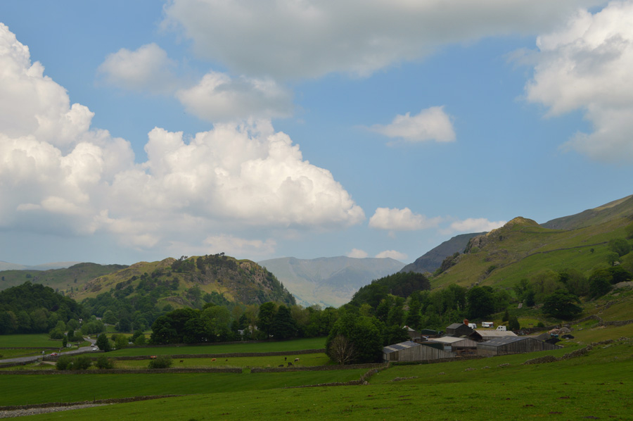
| St John's-in-the-Vale from Wren Crag. |
Most of my project walks usually involve a lonely, and not so lofty summit at the end of the walk and todays route was no different, I was quite pleased I didn't see too many people during the ascent as the air by now was so still and muggy It left me feeling breathless at times.
If the forecast is correct however, around about now some heavy downpours are due, I just hope they can wait until I'm on route back to the car first because it sure is starting to get grey above my head. |
 |
| Blencathra from High Rigg summit. |
| I think I had spoke to soon as just below the High Rigg summit I started to hear the pitter-patter of rain hitting the rocks and grass around me, then large droplets on my arms leaving me thinking I'm just about to get a holy soaking. |
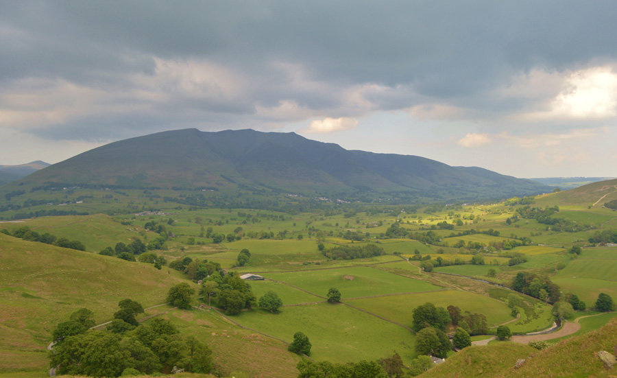 |
| Blencathra seen towering above St John's-in-the-Vale. |
| |
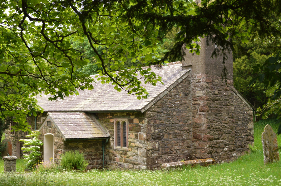 |
| St John's-in-the-Vale Church |
| After descending High Rigg I soon find myself back in reality and can hear the sound of kids playing as the voices carry from more children rock climbing on Skelthwaite Crag not far from Low Rigg summit, all that is left is one of those afternoon walks back to the car feeling content after another superb day on the fells and not only that, my faith has returned in my ankle and although it has not well and truly healed it's certainly on its way to recovery after a day of Lakeland medicine. |
 |
| Flash downpour over Lonscale Fell, Blease Fell and the A66 |
| It had been threatening for the last half hour and finally the downpour came but thankfully I escaped by a fields length not a two minute walk from my car, I have since spoken to two people who got caught in the downpour who described it as being so centralised people like me from just a few hundred meters away could look on a curtain of rain so heavy the white lines in the road became invisible, yet minutes later it was gone and all that was left was the spray from the cars and no doubt, some very wet folk wearing shorts and eating ice cream all wondering what the heck just happened. |
|
| |
| Back to top |
 |
|