|
Walking the Wainwrights in 30 Walks Walk 17 - Four Fells around Elterwater |
 |
 |
12th June 2016 |
 |
|
It's six months since I started my Wainwrights in 30 Walks project and this walk, walk seventeen marks the halfway point with 107 Wainwright summits collected. Back in December 2015 I had the task of drawing up all thirty routes which wasn't as easy as first thought, in fact it took me in-between work and weekends spent walking the whole month and this walk, was the most difficult to plan.
On paper the four summits that feature in the route Loughrigg Fell, Black Fell, Holme Fell and Lingmoor Fell are quite easily attainable from Grasmere, Elterwater or Little Langdale yet to reach all summits from Elterwater effectively, took more hours at the table than all of the other routes within the project.
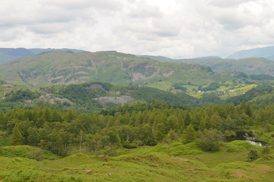
The walk starts and ends in Elterwater first summiting Loughrigg Fell easily within the hour, the next summit of Black Fell would see us enter Yewdale territory where Black Fell and Holme Fell are collected, the latter via Tarn Hows and Yew Tree Tarn, the last summit of Lingmoor Fell involves another lengthy road walk first passing Hodge Close quarry before we arrive in Little Langdale where the sight of Lingmoor Fell dominated our view long before we reached its flanks.
All summits collected today can be regarded as family summits, yet to collect them all in one day feels much harder than it looks on paper, in fact I would go so far to say that this walk, despite being one of the more diverse within the campaign, features high as one of the most challenging. |
|
|
|
| |
|
Overview |
|
|
| Ascent: |
4,800 Feet - 1,464 Meters |
| Wainwrights: |
4, Loughrigg Fell - Black Fell (Black Crag) - Holme Fell - Lingmoor Fell |
| Weather: |
Sunny Spells Throughout. Highs of 20°C Lows of 15°C with 70% Humidity |
| Parking: |
Car Park, Walthwaite, Elterwater |
| Area: |
Central and Southern |
| Miles: |
15.7 |
| Walking With: |
David Hall |
| Ordnance Survey: |
OL4 |
| Time Taken: |
9 Hours 20 Minutes 07:20 to 16:40pm |
| Route: |
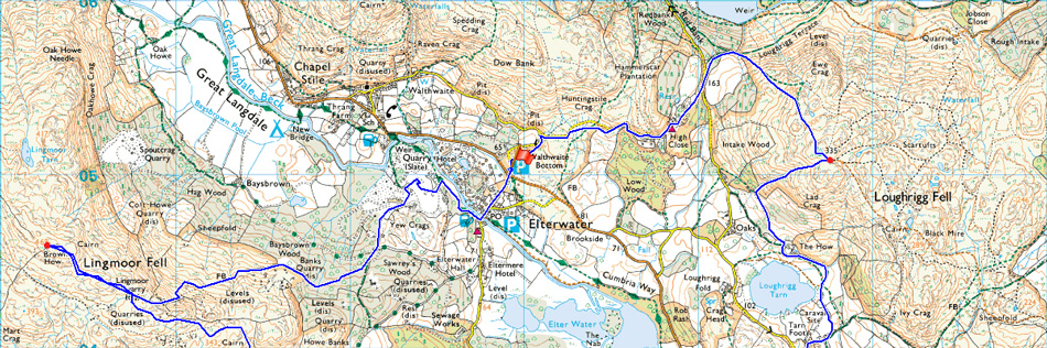
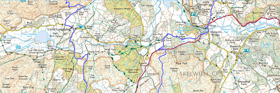
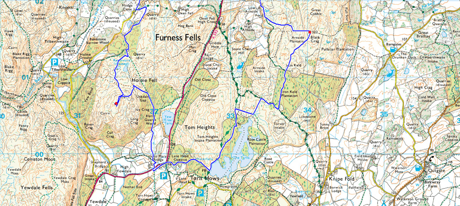
Walthwaite Bottom - High Close - Loughrigg Terrace - Loughrigg Fell - Loughrigg Tarn - Skelwith Bridge - A593 - Park Farm - Low Arnside - Black Crag - Arnside Plantation - Iron Keld Plantation - Tarn Hows - Glen Mary Bridge - Harry Gaurds Wood - Uskdale Gap - Holme Fell - Holme Ground - Hodge Close - Little Langdale - Dale End - Lingmoor Quarry - Lingmoor Fell - Lingmoor Quarry - Baysbrown Woods - Sawreys Woods - Burlington Quarry - Elterwater - Walthwaite Bottom |
|
| |
|
Map and Photo Gallery |
|
|
 |
| Low Wood 08:00am 15°C |
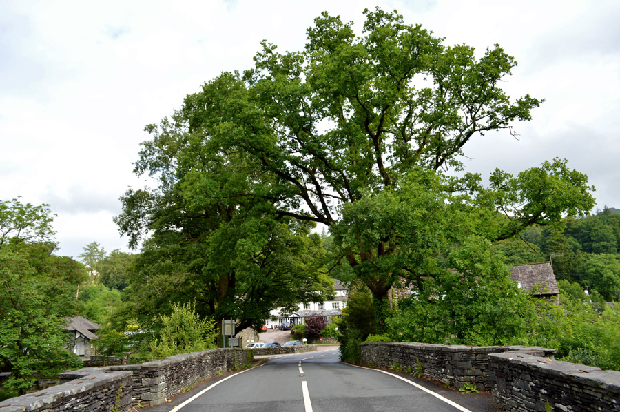
It was suggested that we start a little earlier than usual and agreed to meet just outside the village of Eltermere at the large carpark at Walthwaite Bottom, it's an area that I hadn't parked before and can be quite difficult to see from the main road. After turning right the car park soon came into view and I could see that one large, and one small camper van had spent the night there. I parked bonnet first against a grassy bank and saw David arrive soon after me, David chose to park close to the road so I backed my car up to Davids with both boots facing one another.
David went on to say that he too had left his car where I first parked, but got boxed in so badly he had to wait for an hour and half until he got out, hence why he parked so close to the road this morning, a wise decision.
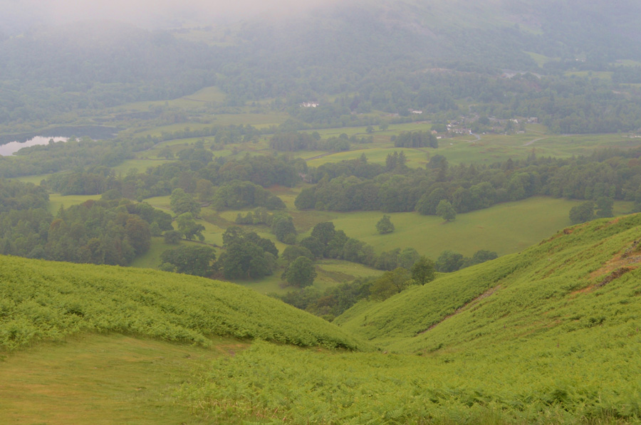
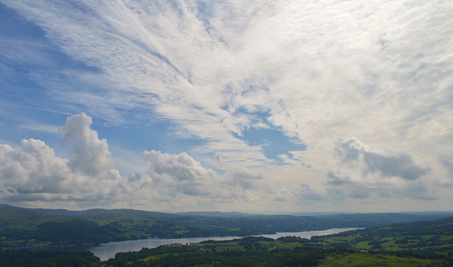
The morning light was low following a night of heavy rain and the cloud was clinging to the tops of Park Fell, and the summit of Black Fell which lay just beyond was under cloud which kinda set the scene in almost every direction, we remarked on how much it felt like an Autumn morning rather than the middle of Summer, we chatted and kitted up and before too long boots were locked as we strode out passing Walthwaite Bottom towards Low Wood, High Close and Loughrigg Terrace. |
 |
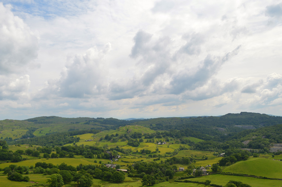
| Dunmail Raise seen over Grasmere. |
We continued along the lane through Low Wood and then High Close which was flanked by a mature tree canopy on both sides, at times the light would strike through the trees illuminating the rain drops still clinging onto an old steel fence which lined our route all the way through to Loughrigg Terrace.
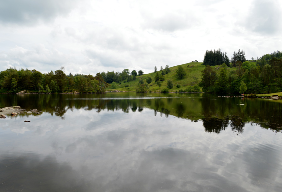
It was like someone had turned the light on by the time we reached Loughrigg Terrace as the grey morning cloud slowly melted into a haze of pastoral blues, views over Grasmere were still limited with the higher summits still under cloud which would soon burn away. Our path rises steadily leaving us no time to admire the views, instead we got stuck into the ascent trying to take advantage of what was left of the cool air which was rapidly warming up and with no wind whatsoever, just ten minutes into our first family summit of the day, we already found ourselves stopping to wipe sweated brows. |
 |
| Loughrigg Fell summit Trig Point. |
Despite the increasing humidity we maintained a steady pace and we soon reached Loughrigg Fell summit within the hour, we stopped again to wipe the sweat from foreheads as David noted that my back was also wet through something of which you would only normally associate after a steep haul on the more loftier summits, but it wasn't the case this morning, this morning we can blame the humidity, which I guess was only going to get worse..
Every now and again a slight breeze would blow which never went unnoticed, after a few moments we were about to leave the summit before being joined by a solo walker, a gent perhaps in his sixties who, after mornings are shared asked us were we regular fell walkers, after answering yes he introduced himself as a friend of Bill Birkett and a member of Mountain Rescue who lived in Coniston, he then asked us what our thoughts were on how the National Park managed path repairs inparticularly, repairs that don't last after good tax payers money had been spent on them.
This, a subject that David is particulary keen on.
His case was that he thought that the paths weren't being repaired to satisfactory condition and David agreed "I'd rather they fix one mile properly that ten mile badly"
Agreed? it's a tough subject because we all know that the Authorities are out there trying to please everyone, and that includeds people who pay good money just as you and I who want (and who could blame them) to push prams along side many a waters edge, what they don't realise is that they are repairing the paths with the same grit higher up, and this grit gets washed away because there is no real substance to it, which in turn ends up in the becks and streams which then flows into the rivers which unnaturally silt up and before you know it, we've got another flooded Keswick on our hands.
I don't think this chap ever thought that he would get such a convicted answer from two strangers but if that was what he was looking for he certainly found it this morning, it was a subject we all agreed on, but we are biased aren't we, we walk the fells every weekend and we can see what is happening, the big question is, what does the National Park think? because at the end of the day, they can't please everyone. |
 |
| Descending Loughrigg Fell on route to Loughrigg Tarn. |
The fellows conversation continued between myself and David during much of the descent towards Loughrigg Tarn, it's a subject close to both our hearts and it's easy to play the blame game I guess which is why both David and myself aren't particularly political about anything.
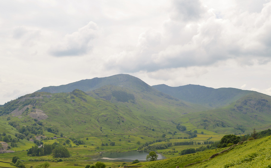
The light had faded the cloud lowered once more covering Lingmoor Fell and with this, momentarily, came a dip in temperature, this however was short lived and on a good note, our view towards Black Fell soon opened up over the stillness of Loughrigg Tarn. |
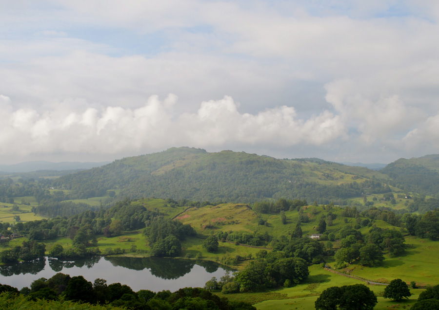 |
| Black Fell seen over Loughrigg Tarn. |
| |
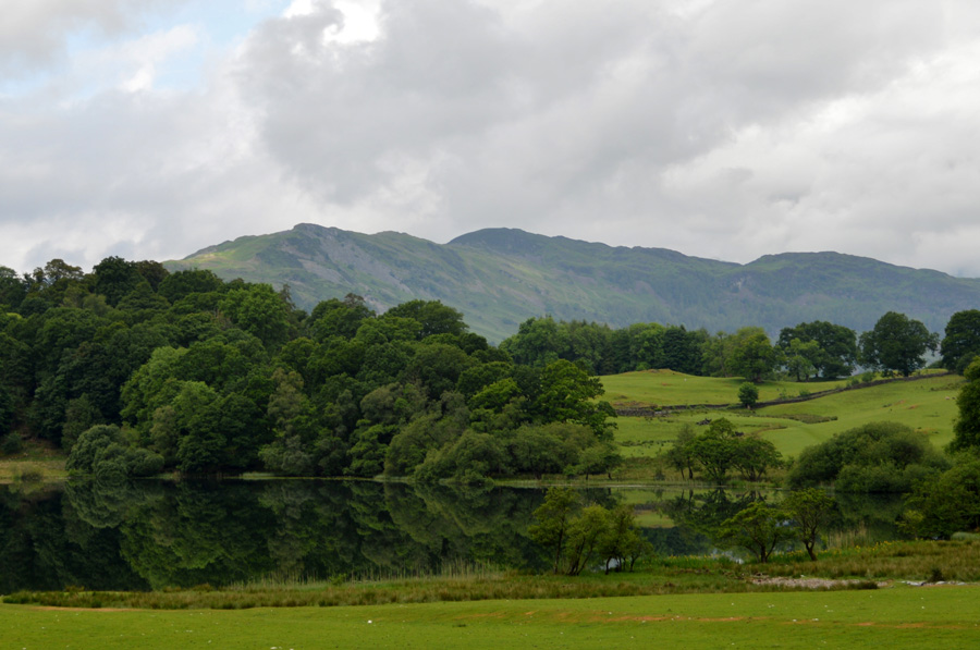 |
| Lingmoor Fell from Loughrigg Tarn. |
Despite my ankle feeling much better I am still carrying a slight swelling around the ankle bone which only through a matter of confidence made the first descent of the day a rather careful one.
With the descent now behind us we joined the path which navigates around the northern edge of Loughrigg Tarn soon passing early morning walkers along the way. By now the cloud had once again lifted and the light had started to return slightly but not in the same way we had ascended Loughrigg Fell by, it was now quite overcast and as the waters surface suggest, very still. |
 |
| Looking back on Loughrigg Fell from the path around Loughrigg Tarn. |
| |
 |
| Skelwith Bridge. |
After leaving Loughrigg Tarn behind we took on the quiet lanes with Neaum Crag, and indeed Neaum Cottage to our right flank which was heavily disguised within a coppice of trees. Our path starts to descend towards the familar A593 and of course the popular Chesters by the River Bar and Restaurant. It was still too early but we did manage to see some day trippers eating breakfast from the Holiday Cottages.
"It doesn't seem two minutes ago since I was driving along this road"
We pause halfway across the bridge where I stop to take this photo as David takes a shot of the River Brathey just before a large group of cyclist cross as Hi's and mornings are shared. |
 |
| Bridge How Coppice. |
After crossing Skelwith Bridge we needed to gain access to Park Fell and thereafter Black Fell, to do this we had two options, one of which was to dice with the traffic and follow the narrow A593 for around a mile, or the more pleasant option was to head towards Park Farm via this path which starts off at Bridge How Coppice.
Soon the leafy Coppice is left behind in favour of open fell side, it's still quite murky and hazy but our views open out over Lingmoor Fell and the Langdale Pikes beyond. Park Farm is reached where we are greeted by three residents of one of the barns that has since been converted into Holiday homes, ahead we could see through the trees the traffic travelling along the A593 which by now was just a short distance by track away.
I've never up until now walked along the A593 a stretch of road that links Ambleside to Little and Great Langdale not forgetting Coniston too, but what you don't notice is just how narrow the road actually is, I couldn't help but feel a tad guilty for holding any traffic up as we walked along, if only for a short while to the gate sign posted Low Arnside. |
 |
| The Langdale Pikes, Lingmoor Fell and Low Arnside. |
With the noise of the A593 left behind we pick up the path which flanked Park Fell way yonder to our left flank, the path climbs steadily as views open up over Low Arnside towards our final summit of the day in Lingmoor Fell, for now and since leaving Loughrigg Fell all we are doing now is heading further and further away from it, a subject that doesn't really get spoke about, after all, it's warm (and very humid) it's dry and it looks to stay this way for the duration at least for now.
A time to take things in our stride. |
 |
| Black Fell (Black Crag summit) |
We don't risk crossing the area around the top of Washfall Beck, an area known for its bogs, instead we opt to retain some height before finally crossing Washfall Beck crossing in a single stride before ascending the final yards steadily by following a stone wall all the way towards the summit. Earlier we had spotted a walker close to the Trig Point who by now is standing at the large cairn on Black Fell's subsidiary summit a short distance away.
Thankfully it would seem that the low cloud, and indeed the haze is lifting revealing a long distance view over Windermere. |
 |
| Windermere. |
Today is the day of the Great North Swim and in the distance we can hear the muffled commands being spoken through a tannoy, it's not possible to see in the photo but from the summit we could just make out the wash over the waters surface caused by the hundreds of swimmers all taking part in the swim...
Which is causing me to think I'd swap places if it meant I could cool down right about now!
We press on towards Tarn Hows now via the Arnside Plantation. |
 |
| Arnside Plantation. |
| After descending Black Fell slightly we follow a prominent grassy trod which you may be able to make out in the left of the photo, it's an area of Lakeland which is usually very peaceful and despite the ever popular Tarn Hows being so close by, it can feel like a whole different place in winter when snow is on the ground but if you like this sort of thing Arnside is the place to visit. |
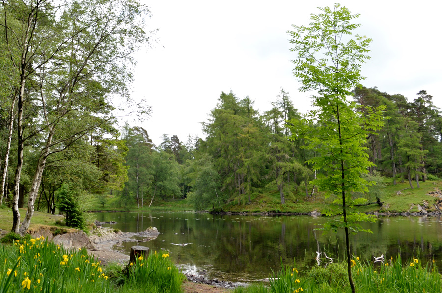 |
| Tarn Hows. |
With Black Fell now behind us we headed through Arnside Plantation passing two fell runners and a group of people riding those hybrid bikes that look like a Road Bike with narrow Mountain Bike tyres, out of all the group most of the riders were pushing their bikes over the rough path no doubt worried those narrow rims and tyres wont cope...I think I'd have done the same by the way they looked.
We soon caught site of Tarn Hows and followed a narrow path towards the northern end of the Tarn where a family looked to be enjoying a picnic whilst sat on a number of wooden benches. We followed the path around Tarn Hows as it passed through Tom Heights plantation, a path that I had never used which is flanked heavily by Scotts Pines all the while more and more day trippers were taking advantage of sunshine which made Tarn Hows a very busy place this morning. |
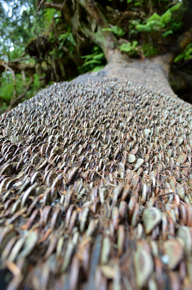 |
| Money does grow on trees after all. |
| The things you see when you haven't got yer pliers. |
 |
| Tarn Hows. |
| |
 |
| Tom Gill waterfalls |
| Tom Gill didn't resemble much further up stream with nothing more than a trickle in places so we were quite surprised to see so much water flowing by the time we arrived at the waterfalls. |
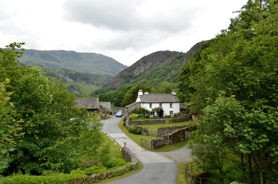 |
| Yewtree Farm. |
It didn't take long to reach Glen Mary Bridge then Yewtree Farm thereafter, instead of following the road from Glen Mary Bridge we passed through a wooden gate which opened out onto a horse paddock which had those bar obstacles designed for horses to jump over...this came at a time when the humidity started to affect David the most as he proceeded to jump the bars making horse noises...
I never really believed David when he told me that all he used to do at School was goof around...until now. |
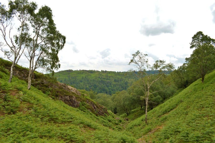 |
| Looking back on Uskdale Gap. |
Despite goofing around there did come about a seriousness to the walk which I guess started to show as we started our ascent on Uskdale Gap. By now the sun had gone in but the temperature was still in the mid twenties causing to what would normally feel like a steady walk to something much harder to deal with.
I hadn't checked just how humid it was but by the time we reached the top of Uskdale Gap after a rather slower ascent I decided to check which showed around 70% humidity, the want to push up a gear was always there, after all we never complained of how tired we felt just the total lack of pace that we couldn't overcome due to not being able to replenish the air in our lungs, there was simply nothing to breathe and by now, the two of us were suffering the same side affects, no air equals no engine, no engine equals no power.
We knew we were close to the summit as we both agreed a much needed refuel was required which came in the form of lunch. |
 |
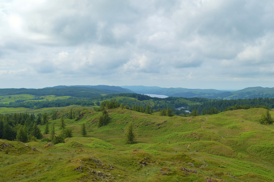
| Coniston from Holme Fell summit. |
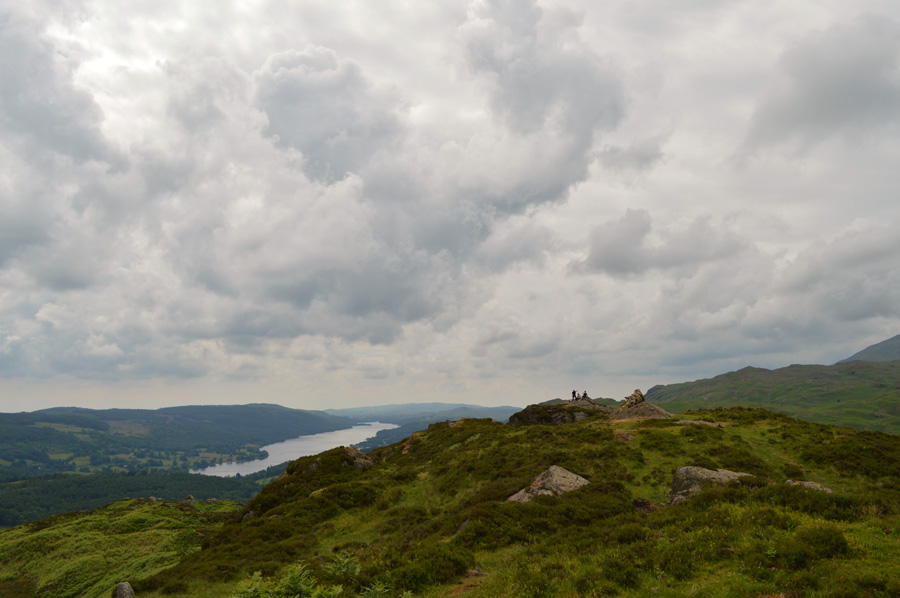
Slowly we picked away over the crags and found ourselves along the summit ridge where we were met by the slightest of breezes, there was no strength whatsoever to the breeze and it wasn't even consistent but it was enough to recognise. We deshouldered and sat down with views over previous summits of Black Fell and further north, Loughrigg Fell.
Lunch seemed to be over quickly but it probably lasted the standard time of around fifteen to twenty minutes, we shared a crack and it seemed that our energy at least for now had been restored, on a good note however, Loughrigg Fell was plainly in view, all we had to do was crack on with the three and a bit miles of road walking it would take before we would reach it.
We both agreed that Lingmoor Fell, was gonna be a tough one. |
 |
| Lingmoor Fell as we start our descent from Holme Fell. |
| |
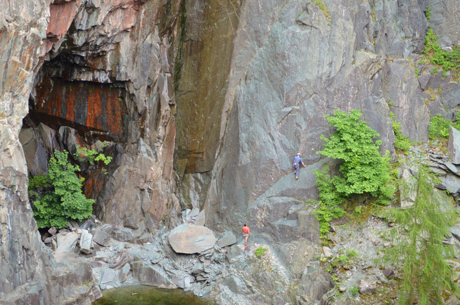 |
| Hodge Close quarry. |
With Black Fell now behind us we steered towards Hodge Close quarry where we gazed down on two rock climbers who were scaling the vertical walls watched on by David and myself and a family who had joined us who earlier had asked us for directions towards the quarry. Feeling slightly guilty that I had asked David would he mind we take a peek due to what was still ahead of us we pressed on in the direction of Little Langdale. |
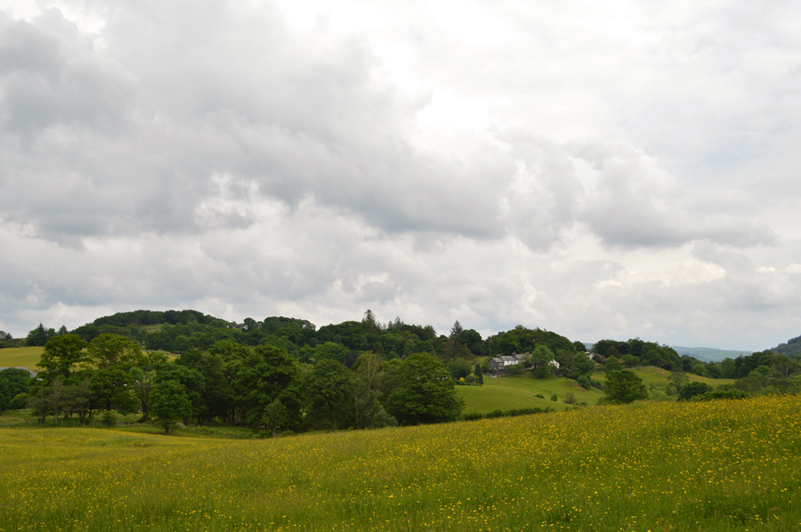 |
| Views over the Buttercups towards Wilsons Place, Little Langdale. |
The road walking kept up momentum at a steady pace as we crossed the River Brathey into Little Langdale, our track would now wind steadily towards the farms and cottages of Little Langdale situated within the shadow of Lingmoor Fell. In order to gain the lower slopes and thereafter the mine route we first had to head towards Little Langdale Tarn before taking a farm track to our right towards Dale Head Farm.
The sun by now was beating down and once again the humidity was stifling but we persevered along the farm track that at times seemed never ending, I kept an open eye out for the zig-zag path that would launch us up towards the quarries which was hidden between the Bracken. With Dale Head Farm reached our path onto open fell side soon opened up ahead passing a few walkers in descent as we steadily began the ascent on our last summit of the day.
David was right, it was a grueller. |
 |
| Little Langdale Tarn, Birk Fell, Wetherlam Edge, Steel Edge, Wetherlam, Swirl How and Great Carrs from the start of Lingmoor Fell ascent. |
| |
 |
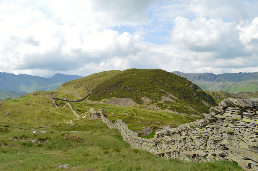
| A broad view of Black Fell seen left, and Holme Fell over on the right. |
| |
 |
| Lingmoor Fell summit. |
Our ascent through the quarries was slow which was to be expected given the humidity, we had since passed a group of young teenagers who we could see had just left the summit and we hoped as they passed they didn't comment too much on how much the day had turned us from spring chickens to farmyard relics.
We think we must have got away with it as smiles are disguised behind sunburnt faces, with the summit just up ahead we press on towards the final and possibly, hardest summit to reach of the day.
Reckon we've earned five minutes at the summit, which I guessed spurred us on even more. |
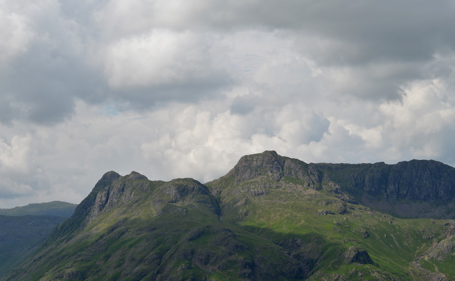 |
| The Langdale Pikes from Lingmoor Fell summit. |
We crested the last few yards and I tapped my walking pole on the summit cairn, I didn't really take notice of the view as I guess I just wanted to take the weight off for just a while and maybe replenish some engery for the descent. With packs de-shouldered we sat on the dry grass and took in the views over Great Langdale which seemed to be the clearest we'd seen all day.
David offers me a handful of mixed nuts and dates which should help with a much needed energy burst. Behind us we can see that the cloud is lowering over Bow Fell whose summit is almost topped by cloud, and with this a slight breeze blows across the summit ridge to the delight of myself and David.
It was probably time to leave but we spent a little extra time sat down anyway, then agreeing that we must make a start on our descent if we wished to get back to Elterwater by a decent time. Our downtime showed the moment we stood up as limbs ached almost instantly but we soon got back into the swing of things after a few moments re-shouldered. |
 |
| Descending Lingmoor Fell. |
I relished in the time spent descending Lingmoor Fell not just because it spelled the end of the walk but also because I had got to see a side of Lingmoor Fell that I had always looked on as it sweeps naturally into Great Langdale, and now, I could see that curve of the fell side beyond the disused mines, so much so I'm sure David thought it odd, that I stopped so many times to take it in,
Our path then abrubtly steers away from Little Langdale and opens out towards Elterwater when David suggested before we head back to the cars we pay a visit to Burlington Slate Mine which didn't require any detour as it was virtually on our way back anyway. A young girl is passed who walks with her Grandad, they too are also heading for the mine but we overtake them before arriving at the large Mine sheds, the smell of the Mine mixed with the afternoon heat instantly brings us back into reailty but I'm still keen to see the quarry as David describes it as much larger than Hodge Close.
He was right, Burlington Mine is vast as excavator tracks wind down into the ground in sweeps and curves, generators brought scale to the quarry and soon we are joined by an elderly couple who once remembered the place before it was a Mine, the lady spoke of a woman she knew, who kept ponies here.
We chat and talk commenting on the growth of the Mine and the effects they took before wishing them a good day as we took in that last mile back to Elterwater. |
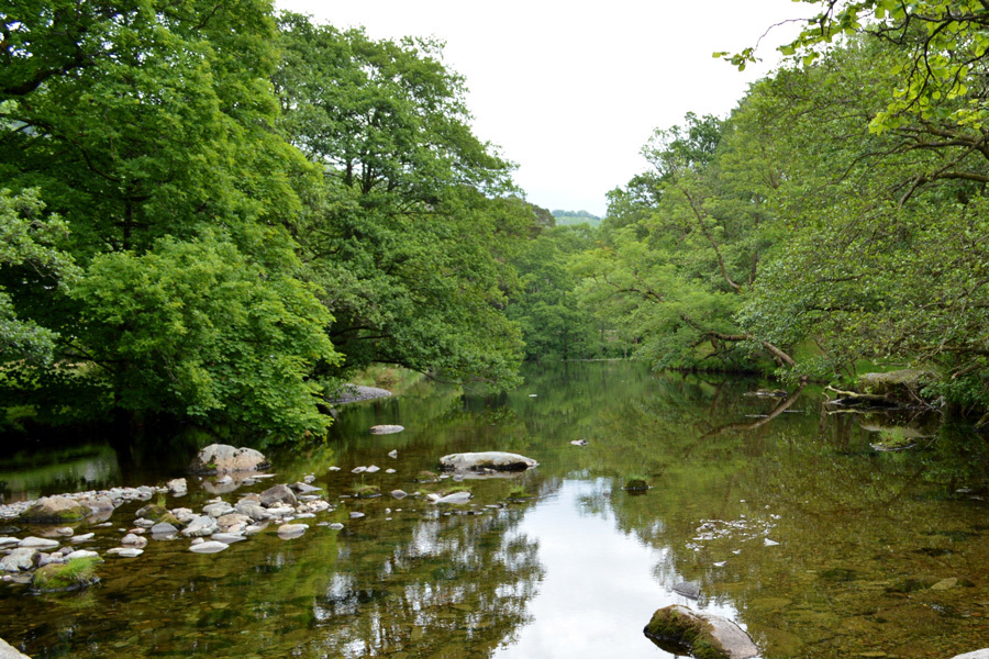 |
| Great Langdale Beck. |
| |
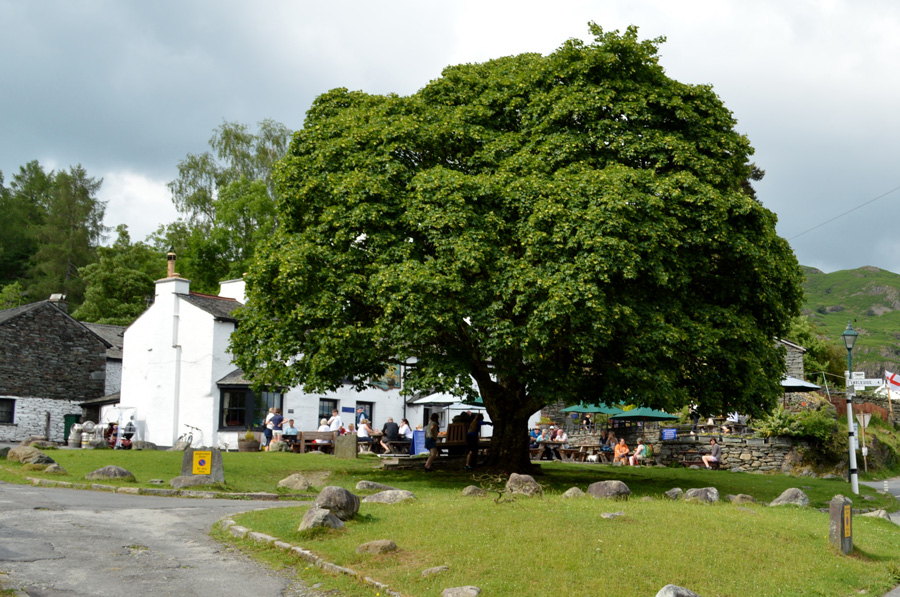 |
| The Brittania Inn, Elterwater. |
| Under a blazing sun we flanked Great Langdale Beck as I sipped on the last of my hydration before arriving back at Elterwater, I knew the cars were close by, the thought of which meant the walk was coming to an end. Outside the Britannia Inn folk eat and drink while watching the world go by and I wondered what they thought about the two sunburnt blokes who looked like they'd just lead a party up Everest when in actual fact, they just walked four fells around Elterwater. |
|
| |
| Back to top |
 |
|