|
Walking the Wainwrights in 30 Walks Walk 20 - Fourteen Fells east of Ullswater |
 |
 |
3rd July 2016 |
 |
|
Walk twenty of my Wainwright project is perhaps the challenging and grandest walk within the campaign which will see me collect fourteen Wainwright summits over twenty miles, it's a route that falls naturally circumnavigating the lonely valleys of Fusedale, Ramps Gill, Bannerdale and Boredale all the while maintaining a constant altitude in an area of Lakeland that I'm most closest too, the Far Eastern fells.
Back in December 2015 when this walk was first planned It stuck out for so many reasons the main one being I really needed to get more than my usual 'fell fit' before taking it on board as the route commanded a full day on foot which can also test ones mental agility and fitness, over the last few weeks I have deliberately pushed myself not with just arduous routes but my timings in between summits, which have built up my fitness maintaining focus on this one walk. At the end of May I had a knock back when I turned my right ankle which resulted in some severe swelling and bruising which kinda knocked my confidence physically and preparations took a slight dive.
However I was soon back on the fells and the physical confidence soon returned which saw me return to my peak, there was nothing holding me back now and with a green light from the forecasters I left home telling my wife, that I'd probably be later home than usual. |
|
| Wainwright Guide Book Two |
 |
| The Far Easten Fells |
‘A striking range in grandeur and wilderness’
The range forms across the eastern spirit of Lakeland, providing a splendid full days march at a consistently high altitude, but is, distant to the areas most favoured by the fell walker and is comparatively unfrequented, appealing mainly to the lovers of mountain solitude. |
 |
|
|
| |
|
Overview |
|
|
| Ascent: |
4,790 Feet - 1,460 Meters |
| Wainwrights: |
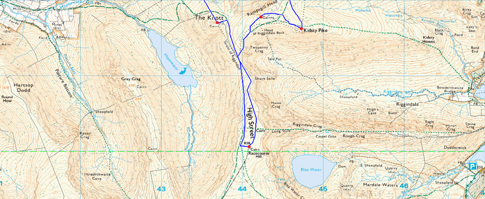
14, Bonscale Pike - Arthurs Pike - Loadpot Hill - Wether Hill - High Raise (Martindale) - Kidsty Pike - Rampsgill Head - High Street - The Knott - Rest Dodd - The Nab - Brock Crags - Angletarn Pikes - Beda Fell |
| Weather: |
Bright Start With Heavy Showers Throughout the Morning, Turning Brighter PM Highs of 14°C Lows of 12°C |
| Parking: |
Martindale New Church |
| Area: |
Far Eastern |
| Miles: |
19.9 |
| Walking With: |
On My Own |
| Ordnance Survey: |
OL5 |
| Time Taken: |
9 Hours 15 Minutes 07:25am - 16:40pm |
| Route: |
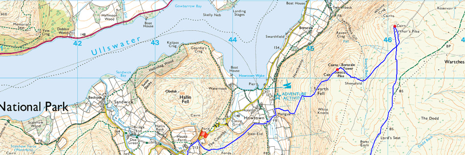
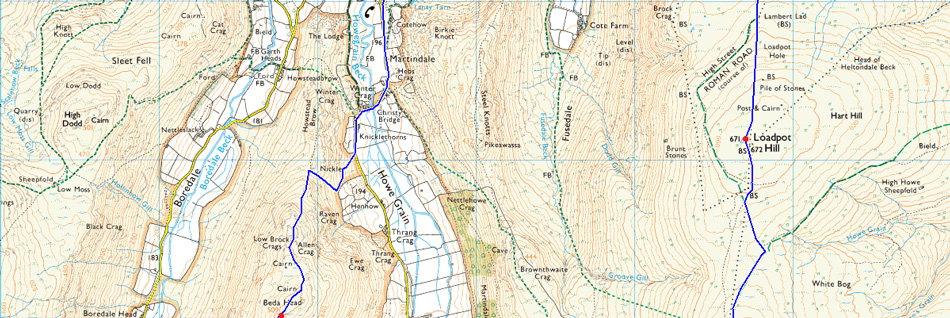
Martindale New Church - Mellgaurds - Bonscale Pike - Top of Swarth Beck - Arthurs Pike - Loadpot Hill - Wether Hill - Red Crag - High Raise (Martindale) - Rampsgill Head - Kidsty Pike - Straights of Riggindale - High Street - Straights of Riggindale - The Knott - Rest Dodd - The Nab - Satura Crag - Brock Crags - Angletarn Pikes - Heckbeck Head - Beda Knott - Beda Fell - Winter Crag - Martindale Old Church - Martindale New Church |
|
| |
|
Map and Photo Gallery |
|
|
 |
| Heading towards Mellgaurds 07:25am 12°C |
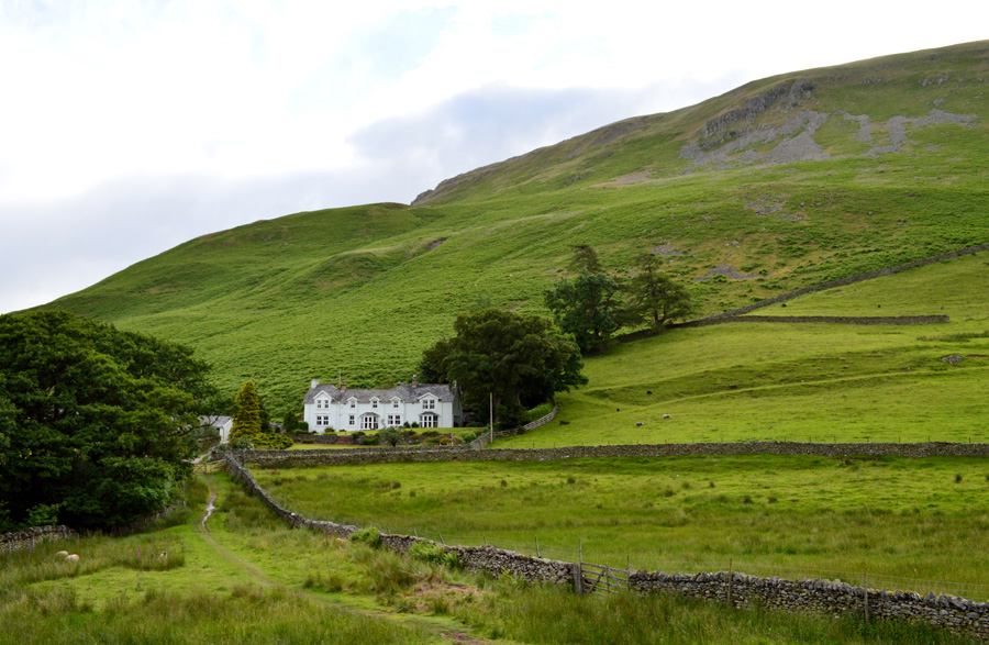
With the nature of todays walk I left home early and arrived at the parking spaces opposite Martindale New Church at around 07:20am. There was no one else on the car park although on the Church car park opposite it looked like two cars had been left over night, I reversed my car neatly towards a grass bank and started to kit up taking note on how heavy my pack feels with just the bare essentials inside if only to save on weight the rest of which was made up by hydration and the odd chocolate bar...or three to help keep up the strength...yeah right.
There's the slightest of breezes but it still feels mild, walking this type of route whilst the temperature is in the mid twenties would have been a nightmare and I'm pleased of the unseasonal dip in temperatures. Two large Transits mini buses reverse along side my car and I get a morning nod from both drivers although I did find it odd that there wasn't any passengers, with my laces pulled tight and double knotted I lock the car and strike out picking up the track behind Martindale New Church as views over Ullswater and my first summit of the day start to open out in front of me. |
 |
| |
| |
 |
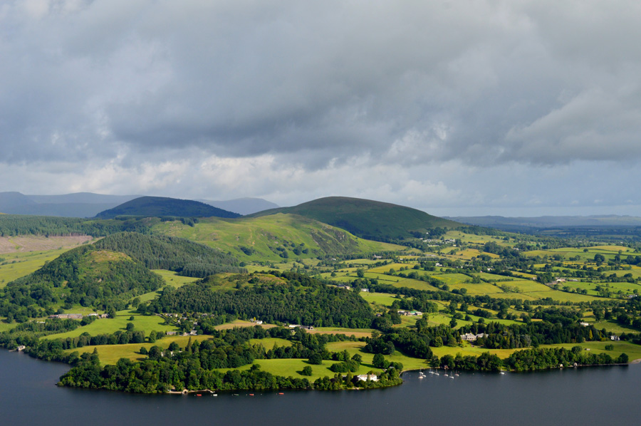
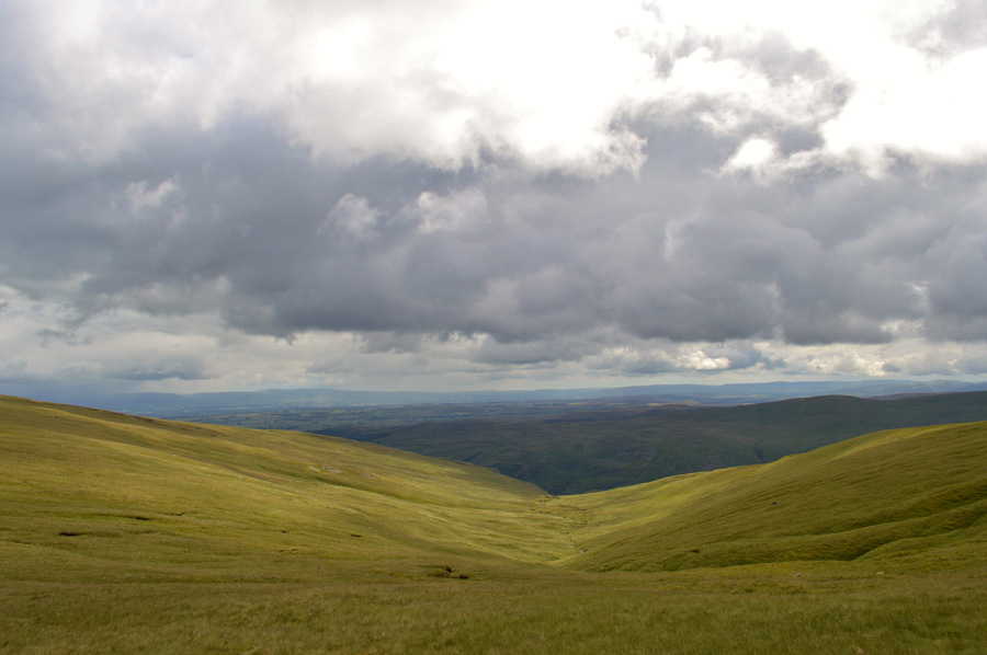
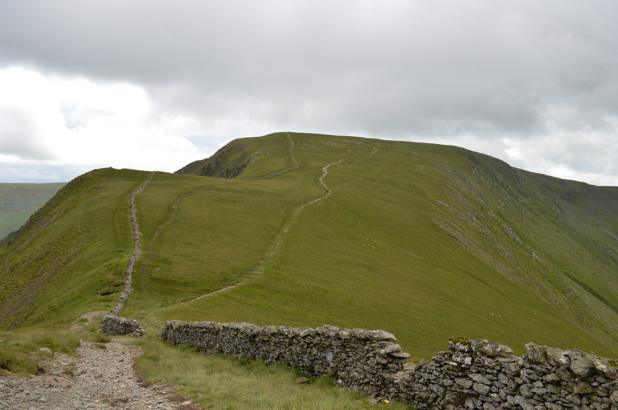
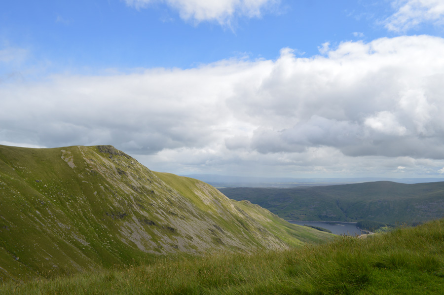
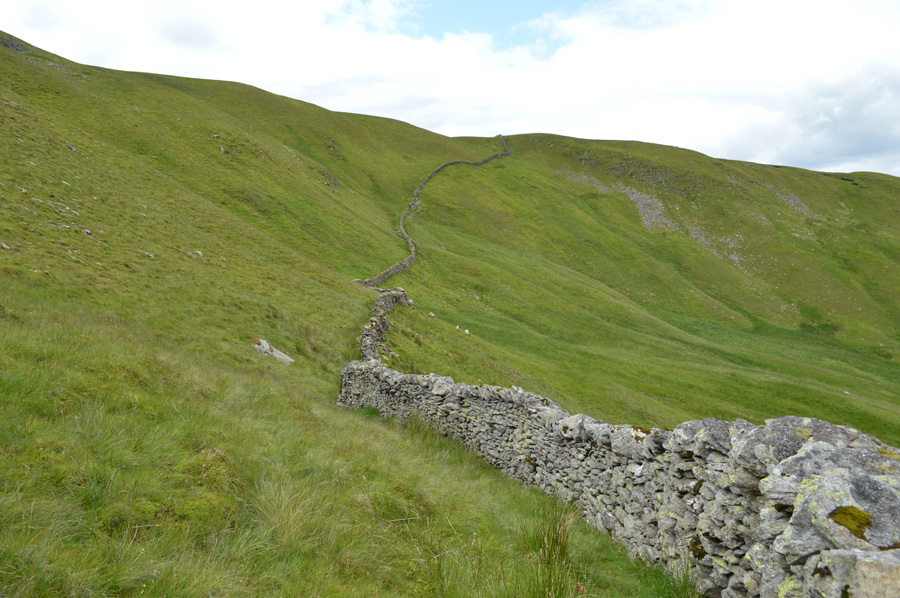
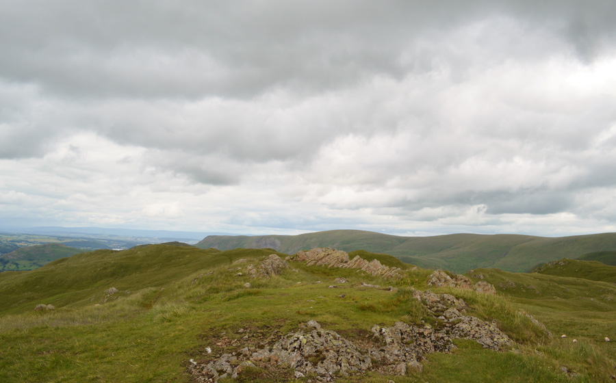
| The Fusedale Valley. |
| It had rained heavily the evening before and the path reflected this although I'm thankful to say it's looking much brighter than forecasted. With my view of Ullswater hidden for now I descend slightly into the Fusedale Valley passing sleeping sheep along the way. From the path I can clearly see various paths that ascend through the thick Bracken first over Swarth Fell before continuing towards Bonscale Pike. |
 |
| Swarth Fell and Bonscale Pike seen over Mellgaurds. |
I tried my best not to disturb the sleeping sheep but it didn't work and they all huddled off looking rather disgruntled at me, ahead is Mellgaurds and behind is where I'll pick up the path over Swarth Fell, it pays here to visualise from valley level where the paths are from a distance as once up close everything becomes entangled within a sea of green, as I'm soon about to find out.
I have a fascinating encounter with a young Roe Deer who is standing close to the corner where both stone walls meet at a wooden gate, the Deer looks at me and studies me but she is too far away for a close up (seen as a brown dot in the grass) as I advance further she bolts like lightening across the field at such a pace I struggle to track her before coming to a stop around four hundred yards away, it was a great highlight so early into the walk. |
 |
| Steel Fell (Pikeawassa) and Brownthwaite Crag taking shortly after passing through Mellgaurds |
I arrived at the gate where only minutes earlier I had encountered the young Deer and pass through another wooden gate which enables access onto open fell side. I pass a familiar narrow path that I had used to gain Arthur's Pike during my H.Griffin project last year but this wasn't the path that I was looking for...I stroll ahead passing a herd of Cows in a field and I'm starting to feel a little flustered because all I can see is a sea of green before me.
The Bracken is so thick it reveals nothing, up ahead I can see the path as it widens out over Swarth Fell but I can't trace it back due to the undergrowth...oh dear. I lean on a gate and spot this wonderful view back over Steel Fell and walk about thirty yards ahead, nope, I just know I'm going too far here, time to back track.
I find myself back at Mellgaurds and I again head out to where I know this path must be when just opposite I spot the narrowest of gaps between the Bracken, If I go for this and it turns out not to be the path I'm left with one heck of a fight ahead, I guess there's only one way to find out.
Thankfully I had chosen the right path and I was able to guide myself with walking poles out front over the steep ascent all the while feeling thankful that the Bracken which was at chest height, was at least semi-dry. |
 |
| Wonderful sun lit views into the Fusedale Valley. |
| |
 |
| Hallin Fell and Howtown Wyke are captured in the clearest of light. |
| Despite the staggeringly steep ascent, this one view over Hallin Fell made it all worth while. |
 |
| The Mell Fells seen with Great Meldrum in the foreground. |
The views over Ullswater and beyond were so clear I found it difficult to concentrate on the steep ascent, made more difficult when inevitably I lost the path through the sheer thickness of the Bracken, On a positive note however, I spotted a natural ledge just above me which ran across the fell side, if I'm going to find a path amongst this undergrowth surely I should find it there.
A sheep grazes at the base of the ledge and I tell it to hold its position 'don't move!' I joke as I wade through a foot of Bracken for which I'm thankful for, the crossing only lasted minutes and due to the Bracken being young it wasn't any trouble at all, the good news was I had landed on the path, a wide grassy terrace.
Yeee hah! |
 |
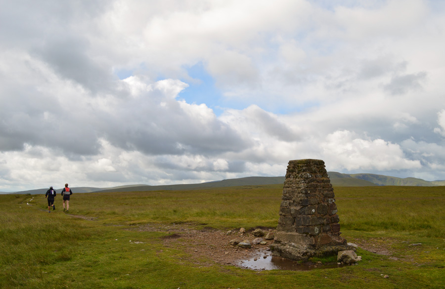
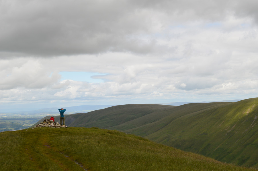
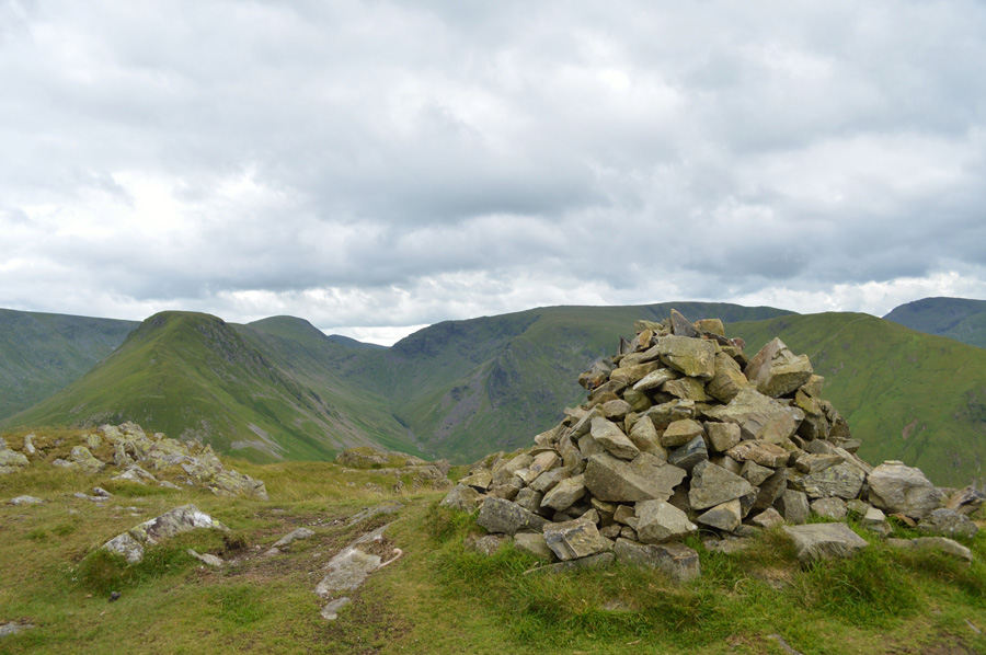
| Ullswater from Bonscale Pike summit cairn. |
| From the path I started to see chunks of sky above me as the path twisted steeply onto the shoulder of the fell, up ahead, and with no false summits, just a fantastic walk over a singular grassy trod towards the summit cairn with views extending out over Ullswater. |
 |
| Ullswater and Gowbarrow Fell from Bonscale Towers. |
After leaving the summit cairn I take the small detour towards Bowscale Towers wishing that I had the same light as I had during my ascent, oh well it wasn't to be, in fact, all of a sudden it's starting to get a bit dark o'yonder.
With my first summit collected, and thirteen remaining I start to make my way across the fell towards Swarth Beck, a depression in between Bonscale Pike and Arthur's Pike, and of course the origins of Swarth Beck. |
 |
| The ruined sheepfold found at the top of Swarth Beck. |
| |
 |
| Brooding skies over Arthur's Pike summit. |
The area around Swarth Beck can be at best boggy and today was no different but it didn't seem to bother the dozing sheep. From the ruined sheepfold I ascend steadily over wet ground while keeping a vigil on those darkening skies.
To my right two fell runners, a father and his young son both maps in hand run towards the summit before heading off along the ridge in the direction of Barton Fell.
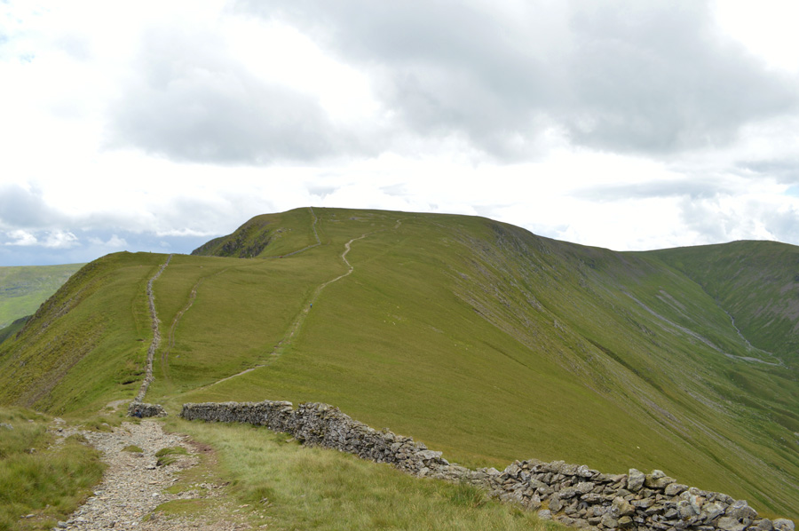
With two summits gained I could now concentrate on the ridge walk ahead, unlike last week todays walk has no game plan with the exception that I knew once confronted with both Rest Dodd and The Nab I'm going to have to start to dig deep, but, up until then passing the halfway mark in todays walk should be gained quite easily with good ground underfoot all the way to High Street summit.
Still keeping an eye on those dark clouds above. |
 |
| Dark cloud starts to build over Helvellyn and its surrounding summits. |
| The clould looks too dark and heavy to be localised and I wondered will I get lucky and avoid a drenching. |
 |
| It starts to rain, first over the Dodds in the distance. |
| Despite the rain only being a couple of miles away I can feel the rain droplets in the air but I remain hopeful that the wind will help to push the rain clouds further north, I couldn't but help feel sorry for anyone on the Dodds, or Helvellyn for that matter right now, it's absolutely emptying it down over there. |
 |
| Rain swept views back over Bonscale Pike (left) and Arthur's Pike (right) |
It was inevitable that the rain would soon catch up with me and it did soon after leaving Arthur's Pike summit, the showers were frequent and heavy as I quickly de-shoulder if only to take out my camera bag from my pack, in an effort to ease my load today I had left out my waterproof trousers...never mind.
More and more fell runners are passed and it looks like the race is for Fathers and their children which was great to see, especially when you see a drenched ten year old lad/girl map in hand out running with his/her dad, what a way to build character and confidence.
#Footnote: The decision to not pack waterproof trousers was done intentionally to ease pack weight, waterproof trousers, even during the summer months are an essential part of any fell walkers kit and should be carried at all times. |
 |
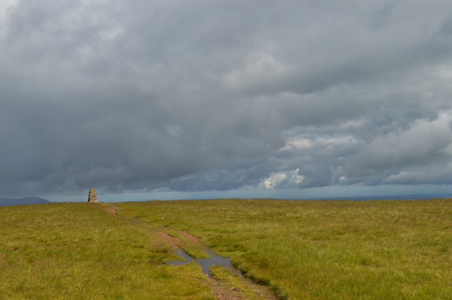
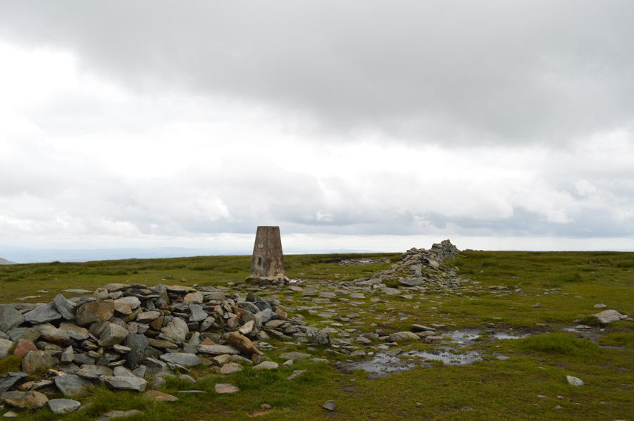
| Loadpot Hill summit Trig Point. |
I crested Loadpot Hill smooth grassy summit plateau about the same time it stopped raining, although the showers were so sporadic and frequent it could start to rain again anytime.
Two fell runners, a chap and his wife were on on my tail as I crested over the summit and soon picked up their pace after 'mornings' are shared, here seen heading over towards Wetner Hill which is where I'm heading next. |
 |
| Pausing to look back on Loadpot Hill summit during a brief sunny spell. |
| If the showers could leave one great thing behind it's the contrast of the fell when set against a stormy sky. |
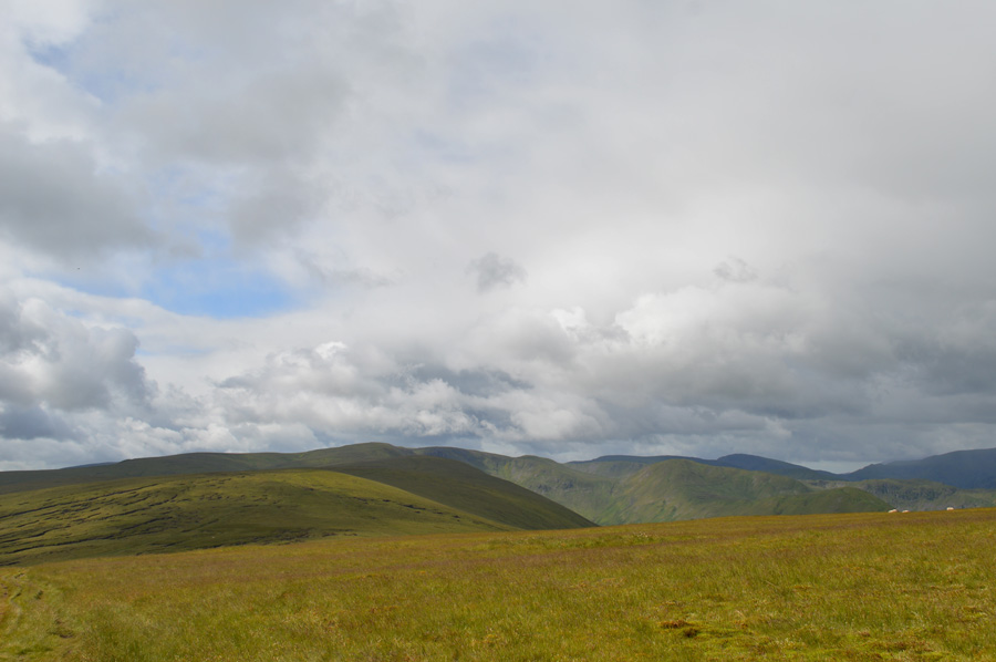 |
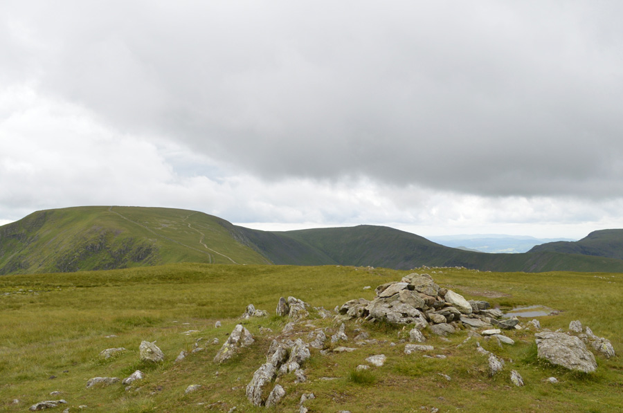
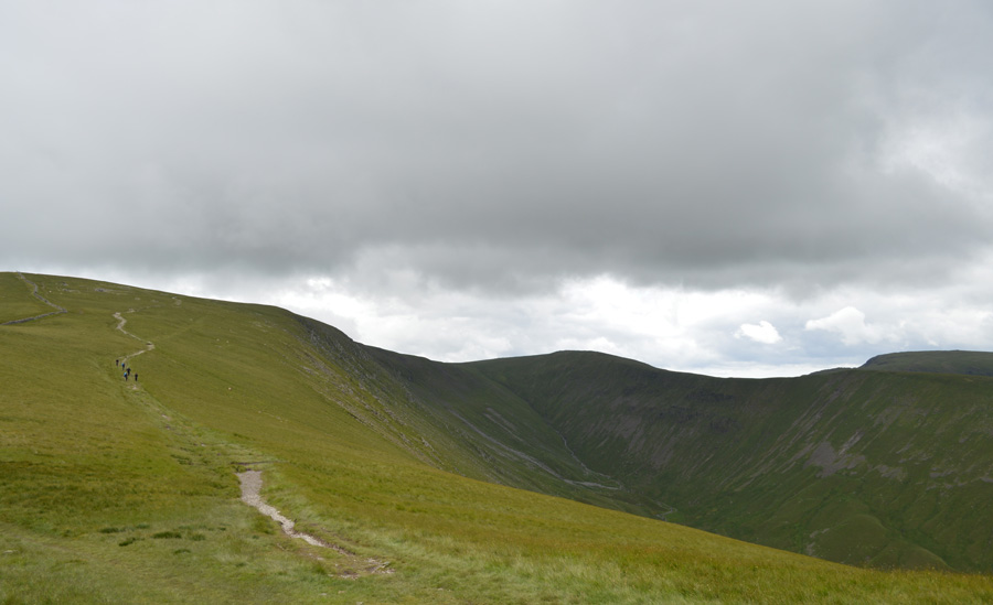
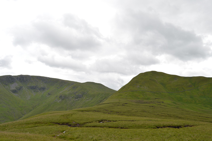
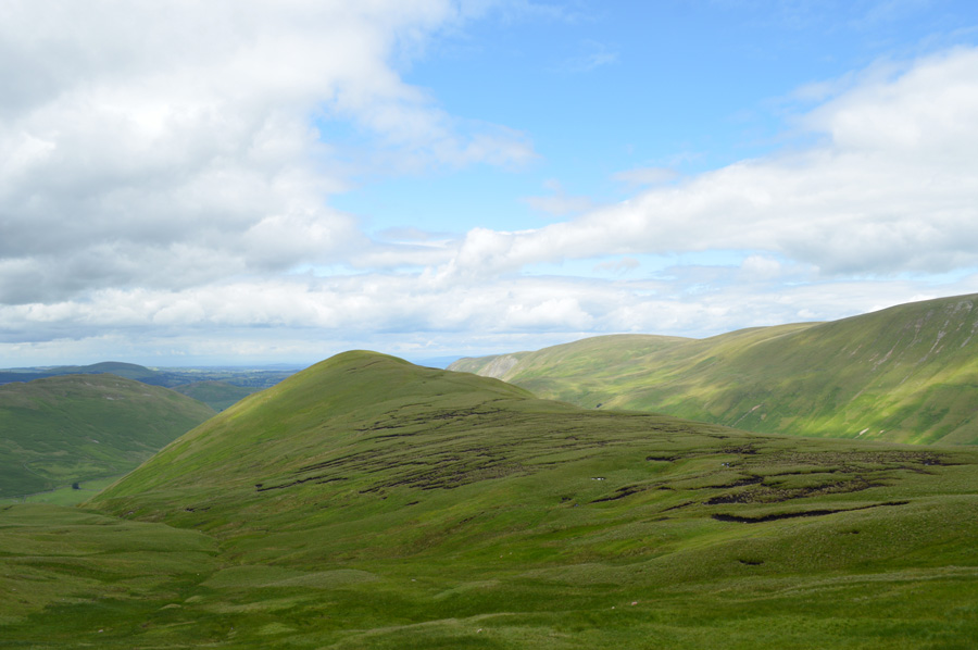
| Long distant views over Wetner Hill, High Raise (Martindale) The Knott, Rest Dodd and The Nab. |
| Ahead, a good view of what is in store over the next few hours, as previously mentioned this terrain is easily gained and the summits including Wetner Hill, High Raise, Kidsty Pike, and Rampsgill Head just seem to whiz by, but I try not to wish those summits away just yet, especially as it looks like more rain is heading my way. |
 |
| St Sunday Crag, Fairfield and Hart Crag just seem to vanish behind a wall of rain. |
Still as fascinating to watch as it was beautiful to see, I thankfully avoided this shower and watched it pass along the Kirkstone Pass towards Patterdale and Glenridding before the light returned and the grasses glistened under a warm sun.
It wasn't to last though. |
 |
| Wether Hill summit cairn. |
I had a brief spell of sunshine and I distinctly remember hearing the Larks return to song, but sadly it didn't last and by the time I reached Wether Hill summit I started to lose light again and down came the rain.
By now I was pretty soaked, more so on my right side which was the direction in which the showers approached by, but this soon spread all over. There was never a moment when I thought about calling the walk off, however, should the rain become more heavy and persistent, and more importantly should the cloud drop, todays walk is going to turn pretty miserable.
I keep faith that despite the showers not being forecasted I've been around long enough to know that they are just showers, which helps to keep up morale. |
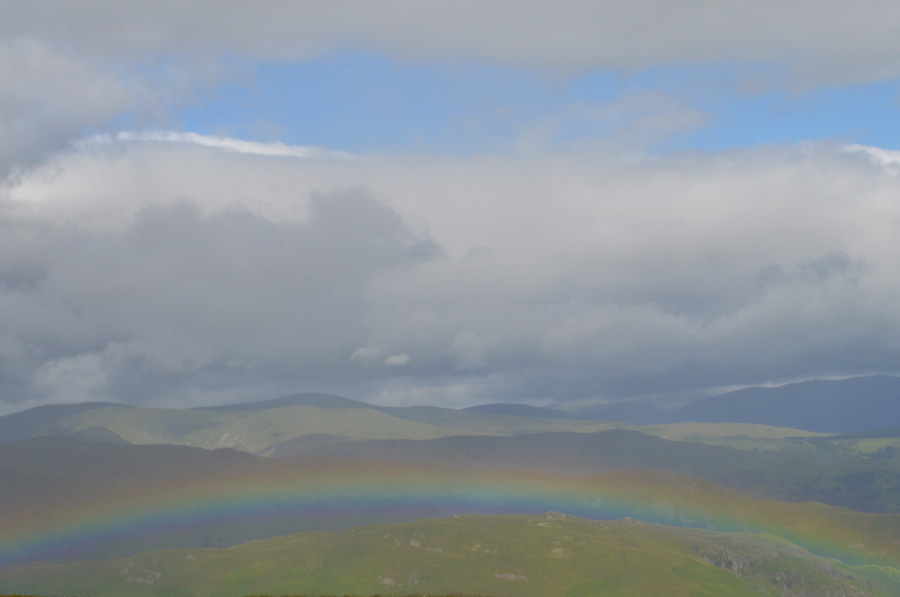 |
| Oh look a rainbow! |
| |
 |
| Red Crag lonely summit cairn. |
| With low cloud still clinging to Helvellyn and its satellite summit. |
 |
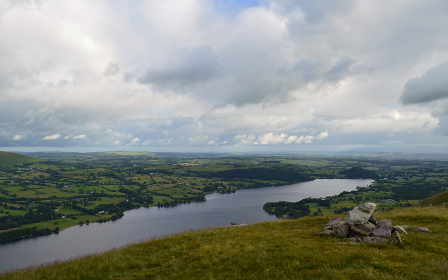
| A light rain shower passes over Longgrain Beck with a distant view of Haweswater. |
| Lets hope that's the last of the showers as chinks of blue become more and more apparent between the parting cloud. |
 |
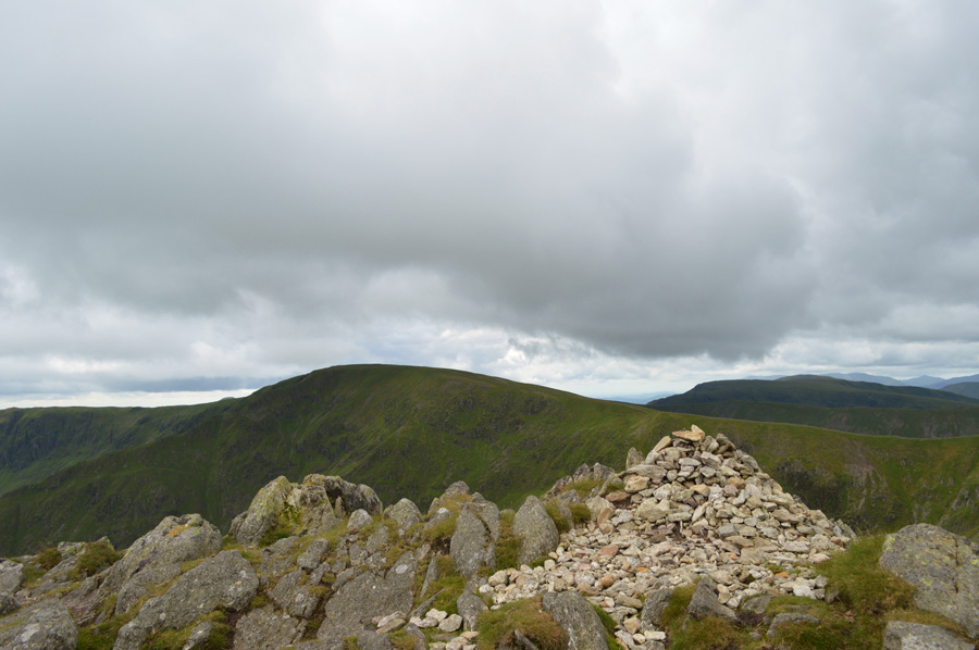
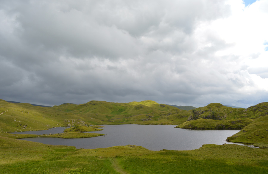
| High Raise (Martindale) Rampsgill Head, The Knotts and Rest Dodd seen from Red Crag Tarn. |
| |
 |
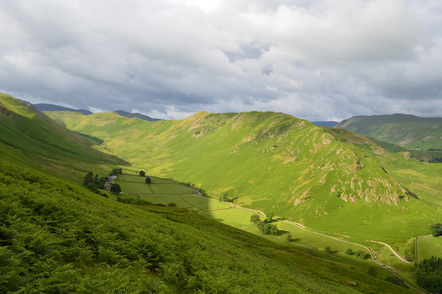
| Views over the Rampsgill Valley with Steel Fell (Pikawassa) (right) and Beda Fell (left) |
Since leaving Red Crag I only encountered one last brief shower which didn't last too long but I was left feeling rather damp, and with a cold summit wind, on the cold side too. I looked down on what was sunburnt skin this morning which had now turned to a pale white, the tips of my fingers stung so I started to make star fists with my hands to try and get some feeling back, helped along by blowing warm air into cupped fists, it's hard to imagine that this is the first week of July.
I warm up and slowly as my wet shorts dried out, there was no escaping the cold hands though as I begrudgingly pulled a pair of gloves over them, my next summit is High Raise and from my position just below the summit, I spot the ancient cairn on Low Raise and beyond, Selside Pike over the Haweswater Valley as I am reminded of my last outing there just last week. |
 |
| |
| |
 |
| High Street from High Raise (Martindale) summit cairn. |
The light continued to fade leaving the fell side in various shades of dark greens and browns which all seemed to intermingle into one at times, overhead the cloud was high and the threat of rain looked imminent as the cool summits cross winds took hold, thankfully I was wearing my gloves. I think back to those rain showers and I can't remember the last time I was rained on, not with such consistency anyway, despite grumbling about the rain and feeling cold during that time between the sporadic light it felt great to be out on the hill.
Okay, my next summit is Kidsty Pike, which is found just a short distance away. |
 |
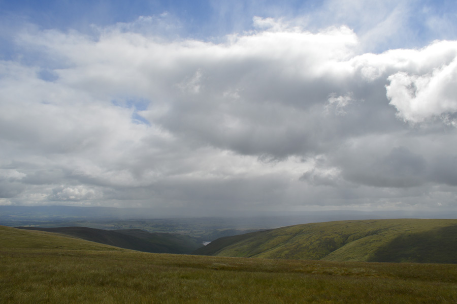
| Views over Randale Beck. |
| |
 |
| High Street from Kidsty Pike summit. |
Despite seeing quite a few fell runners this morning I'm yet to see a fell walker, with this I scour the Rough Crag ridge and High Street summit but spot no movement despite being able to view a packed Mardale Head carpark I can't help but wonder where is everyone?
Not that I'm complaining mind, I've had just about every summit to myself up until now. |
 |
| High Street and Thornthwaite Crag from Rampsgill Head summit cairn. |
It's fair to say that the trio of summits; High Raise, Kidsty Pike and Rampsgill Head are undoubtably the easiest summits to collect as all three are within less than a mile of one another which I guess is also where the walk now starts to get more challenging starting with the ascent on High Street.
Onwards and upwards as they say. |
 |
| Views over Harter Fell (Mardale) High Street, Short Stile, Long Stile, Thornthtwaite Crag and Two Penny Crag from Kidsty Pike. |
| |
 |
| Inspiring views of High Street from the Straights of Riggindale. |
If your allowed to say which Lakeland fell is your most favourite and which fell your the closest to mine would be High Street partly because of this view from The Straights of Riggindale, today marks my twentieth (recorded) ascent which probably explains why I love climbing the fell so much. It was here on High Street did I cut my teeth as a fell walker and it was here that all the fells 'came together' for me, it was also here that I broke down after my mother passed away after feeling in-human that I hadn't previously.
I owe this fell an awful lot. |
 |
| High Street, Thornthwaite Crag and Gray Crag from the Straights of Riggindale. |
| |
 |
| High Street summit Trig Point. |
| Under brooding skies I ascended High Street first passing the summit of Short Stile before continuing alongside the stone wall that shielded me against a prevailing cold wind. I had been thinking about stopping at the summit to take a proper rest and re-fuel although the weather had other plans as just shy of the summit within sight of the Trig Point it started to rain again causing me to shelve lunch until the rain had passed, by which time I was doubling back towards the Straights of Riggindale. |
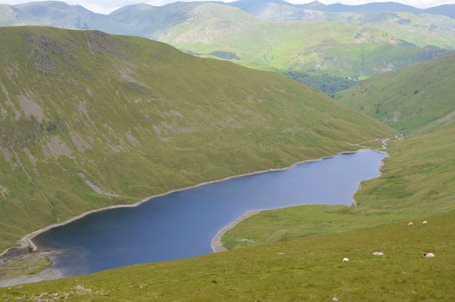 |
| Looking down on Hayeswater. |
| |
 |
| Lunch with a view. |
After reaching the Straights of Riggindale the rain shower cleared, the sun came back out and with it, the temperature rose comfortably enough for me to sit down behind the stone wall with views of Kidsty Pike staring right back at me.
By now I had started to see quite a few people all heading for High Street summit, some fell runners but mostly walkers, after lunch I re-shouldered leaving a Lion Bar to eat on the go, before leaving I mutter something along the lines of..."well, here comes the longest walk back to the car" laughed it off and started to make the steady climb towards The Knott. |
 |
| Not before one last turn around to take in my favorite Lakeland view. |
| |
 |
| High Street from The Knott. |
The last time I stood on the summit of The Knott was last summer during my H.Griffin two thousand footer challenge where back then I had the task of ascending Rest Dodd directly from The Knott summit, then to come all the way back again, I ran all the way there and back which took me forty four minutes, I'm only a year older now but I don't think I could do anything like that again although I guess it's because of days like that are the reason why I enjoy the more challenging walks today.
Is it me who finds this really annoying! |
 |
| Rest Dodd and The Nab seen during my descent of The Knott. |
I descend The Knott and cross the path at the same time a young family are making their way across, the mother is occupied with the children but I get a nod from the father, I continue my descent another three hundred feet into Well Gill which is the area below Rest Dodd summit, there is a good path that crosses the bogs sometimes by sticking close to the stone wall, other times I had no option than to detour the boggy bits.
I'm feeling in good spirits as I start the steep ascent trying not to look up instead looking down on my boots maintaining one foot in front of the other but it was no use, my pace slows down and for the first time today my breathing is loud even when I don't concentrate on listening to it.
From the direction of Satura Crag a fellow dressed in a white T-shirt starts his ascent much the same time as I do, we are almost parallel before he disappears around the fell side, I wondered who would get to the summit first. |
 |
| Rest Dodd summit. |
I had left the stone wall that I had been following behind in favour of a steep grassy trod which leads gently towards the summit, I back off pace slightly and take this photo of the summit cairn, the guy who I had been ascending much the same time as I has just gone walked past the summit cairn and like me, he's probably heading towards The Nab.
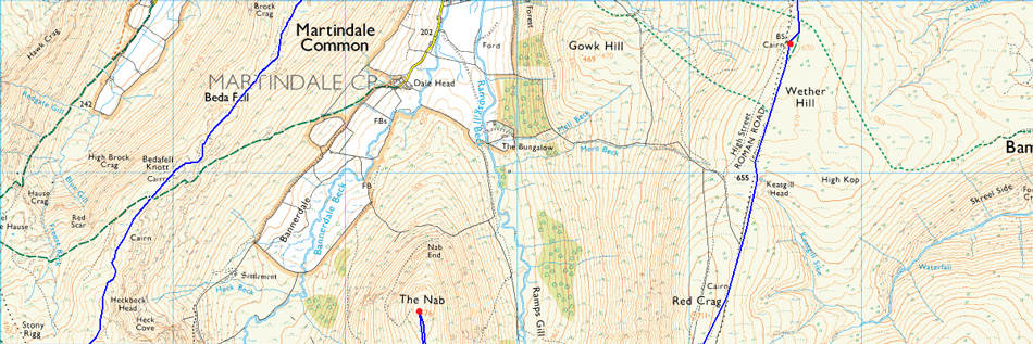
I cough close to the summit if only to let the two folk know I'm close, they turn around and we share hello's before I continue the steep descent towards an area of The Nab known as Deer Forest, an area reserved for hundreds of wild Deer, and, an area known for its peat hags and bogs, I have no other choice than to slow it down which suited me just fine! |
 |
| Looking back on Rampsgill Head, The Knott and Rest Dodd. |
| The chap wearing white walked with good pace and by the time I took this photo he was somewhere close to The Nab summit behind me. During my descent from Rest Dodd I picked out my route and stuck to it, yes the peat hags and bogs slowed me down and unlike my last visit here I didn't detour for miles to get around them, I simply and stubbornly walked right through them although the fact that it was summer did help. |
 |
| Rest Dodd from The Nab summit. |
| Not only did I pass the guy wearing white who was on his way back but I also met a elderly couple who were enjoying the views from the summit, we spoke a few words and they left me before descending the same way as I had came, for me The Nab is a summit I rarely visit and I hadn't expected to see three people while gaining it, I guess The Nab is more popular than I should have gave it credit for. |
 |
| Time to head back towards Rest Dodd. |
| For those of you with a keen eye spot the wall that runs below Rest Dodd summit towards the right, instead of re-ascending Rest Dodd I will flank below its summit by following the wall which will lead me towards Satura Crag, it's a route I haven't used before and I'm quite looking forward to it. |
 |
| The Stone Wall below Rest Dodd summit. |
| Not shown as very clearly but there is a nice trod that runs parallel with the wall before a sharp pull on't other side, but the views more than made up for it. |
 |
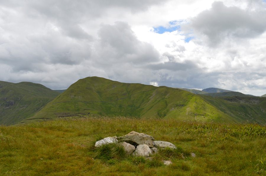
| The Nab with a distant view of Boncscale Pike, Wether Hill and Red Crag. |
| I had spotted herds of Deer in the valley below although too far away for a camera shot it was great to see them in their natural habitat. |
 |
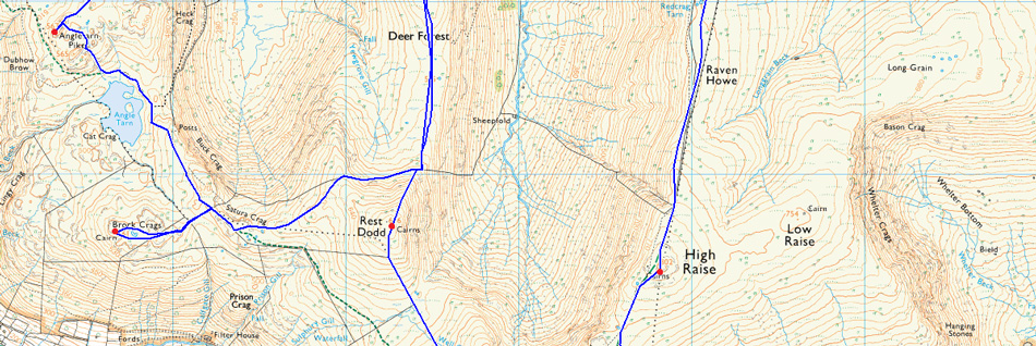
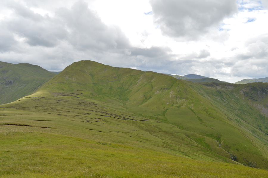
| Views over Satura Crag towards Brock Crags (left) and Angletarn Pikes (distant right) |
| My calfs were starting to stiffen and I tried to control this with hydration and even massage, but my left calf was having none of it, despite this I wasn't that uncomfortable besides the usual aches and pains normally associated with a long day on the fells. The chap in white was by now ahead of me and like me, was heading for Brock Crags, what I failed to mention earlier was that this guy was wearing normal summer clothes like you would find on the high street, but he knew his way around the fells, I guess that's what they call not judging a book by its cover. |
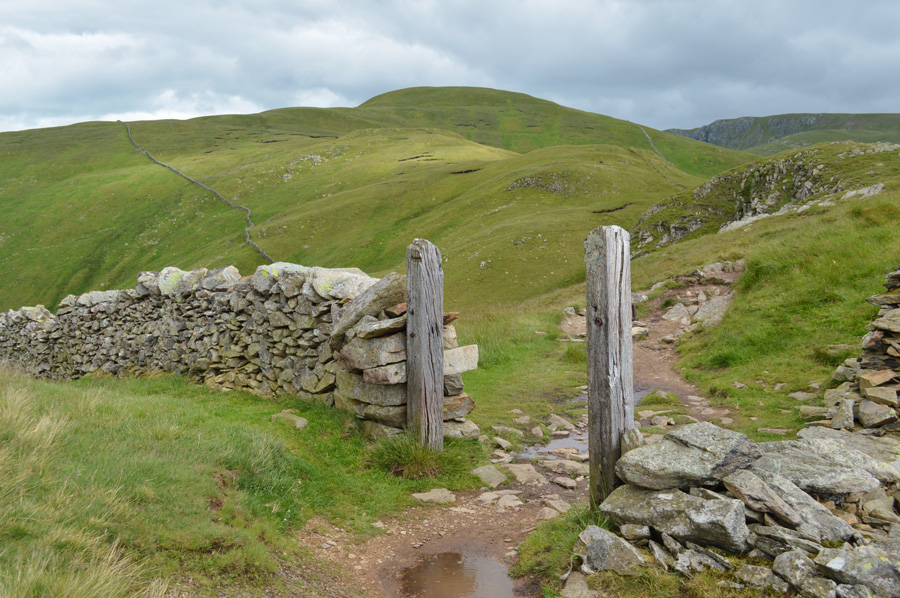 |
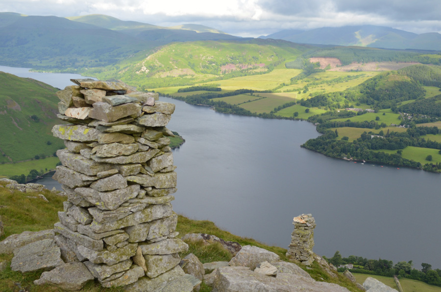
| Rest Dodd from the familiar gate post at Satura Crag. |
| You can see the stone wall in this photo, and the highest point were re-joined the path towards Satura Crag. |
 |
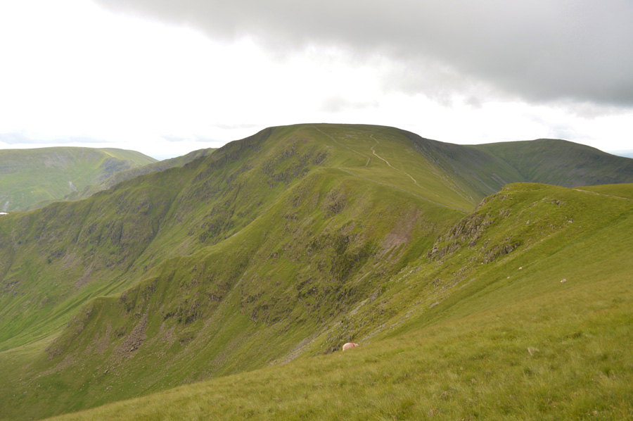
| Views towards Gray Crag, Thornthwaite Crag, Thresthtwaite Mouth, Stony Cove Pike, Caudale Moor, Red Screes and Hartsop Dodd from Brock Crags summit cairn. |
| I had passed three people during my ascent on Brock Crags one of which was the chap in white 'hello again' behind a bit of a grin. The ground is wet underfoot naturally around the Tarn found close to the summit where I re-think my route for the way back slightly. |
 |
| Brock Crags from seen over Angle Tarn. |
I retrace my route back to the path this time remembering to avoid the boggy section before finding a steady climb back onto the path which navigates around Angle Tarn. Two fishermen are fishing on the other side of the Tarn as I pass an elderly lady with a 'hello' I only hope I am able to walk around Angle Tarn when I reach her age.
I had choices in which route I would take in order to reach Angletarn Pikes summit which I initialy planned to gain by walking all the way around the Tarn and approach from the Dunhow Gill side which overlooks the Deepdale Valley, instead I opted for the more direct ascent by following a narrow stream directly below Angletarns Pike parent summit '565
This route was quite steep but I hit it with good stead where I soon found myself looking at the parent summit which I flanked to the right which lead me towards the bog section which lies between both summits, thankfully the bog was almost dry and cracked in places and I was able to walk around it without getting my feet wet were all that was left, was the short, steep climb to another much loved summit of mine, Angletarn Pikes. |
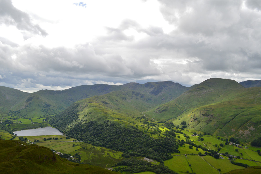 |
| Commanding views towards Brothers Water, Middle Dodd, High Hartsop Dodd, Dove Crag, Hart Crag, Fairfield, St Sunday Crag, Birks and Deepdale. |
I crested the summit as a late afternoon wind cooled me down, I thought that I had earned myself another rest so I jabbed my walking poles close to the summit and sat down on the rocks which overlooked my second choice ascent route. Despite today being a Sunday it's looking pretty quiet in the valleys and even along the Kirkstone Pass where the noise from a car disturbs the silence every once in a while.
It was on the 29th October 2011 did I claim my final Wainwright summit right on this spot, back then we celebrated with a bottle of Moet and I hid the cork after writing 214 with a marker pen before hiding it in the summit cairn, the cork, and even the stone cairn which marks the highest point has long gone, but the memories will always remain.
A few happy and nostalgic moments were spent remembering, if I recall about that bitterly cold day. |
 |
| Fairfield, St Sunday Crag, Birks, Nethermost Pike, Helvellyn, Catstye Cam, Lower Man and White Side from Angletarns Pikes. |
| |
 |
| One last look from Angletarn Pikes summit before I head off towards the final fell of the day. |
| |
 |
| Beda Knott and Beda Fell from Heckbeck Head. |
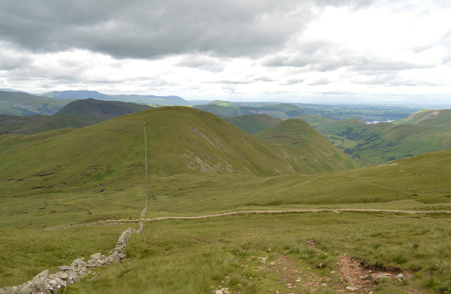
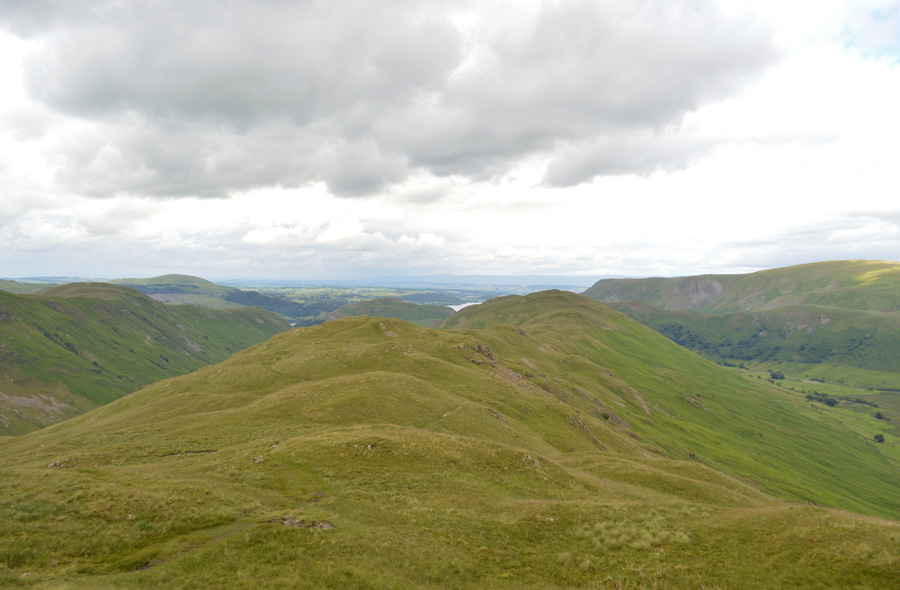
It had started to feel much warmer as the afternoon heat took hold despite there being a good amount of cloud cover I was feeling and no doubt looking like I'd spent a good day on the fells by the time I reached Heckbeck Head, to my right flank and over the micro valley of Bannerdale I could see The Nab thick in Bracken from valley to summit, I could only look on through a dull light trying to distinguish anything that wasn't green, while beyond, splashes of sunlight illuminated the summits of Wether Hill, Red Crag and High Raise.
Ahead is my final summit of the day in Beda Fell, it's actually starting to feel quite late now and, it's hard to imagine that I was standing on Bonscale Pike summit some eight hours ago, blimey, it is getting late. |
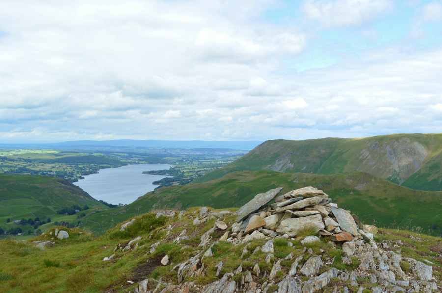 |
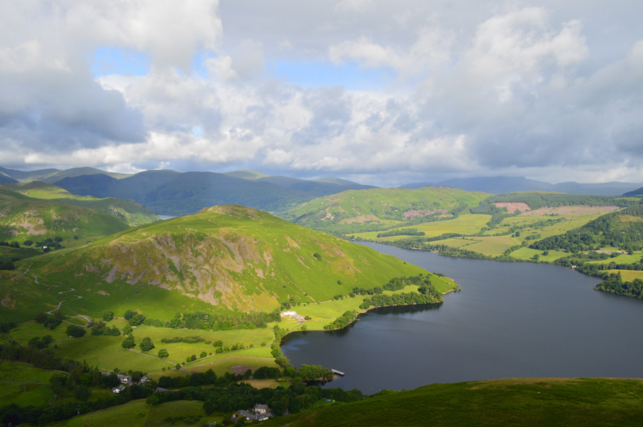
| Ullswater, Steel Fell (Pikawassa) and Bonscale Pike from Beda Fell summit. |
It felt much later than the time my watch told me which was probably due to the todays first summit of Bonscale Fell being in view since leaving Heckbeck Head. For some strange reason I'm always fascinated by the Beda Fell ridge, the sort of ridge which keeps even a tired mind occupied and todays crossing was no different. |
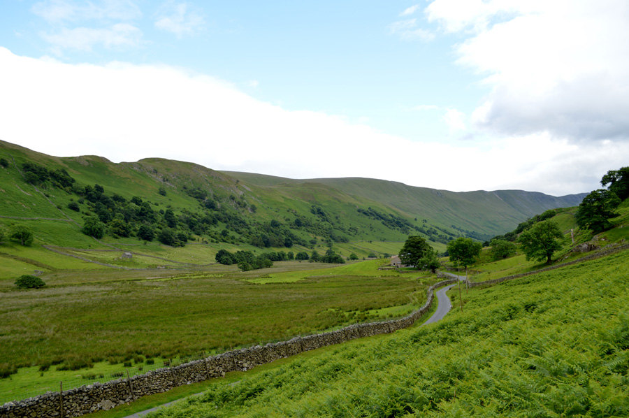 |
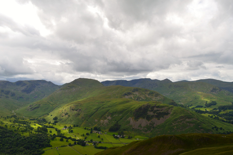
| Views along the Martindale Valley. |
I tap the summit cairn with my walking pole and begin the descent towards the col between Beda Fell and Winter Crag, but before I fully descend to the Col I spy a route through the thick Bracken before hand and make a mental note of it, after all I don't want to get bitten twice in one day, after a slow descent mainly due to own pace I arrive at the Col and find the path which descends steeply via an area of the fell side known as Nickels, I've used this path many times, mostly in winter which during todays descent I was once again, up to my armpits in Bracken.
The sound of a car engine travelling from one of the farms brings me back to reality as it passes on route towards the New Church, feet are kicked back into boots before I de-shoulder remembering that I still had a Yorkie bar left in the lid of my pack, re-shouldered I wrap my windproof around my waist for the final half mile while reflecting upon what a great day I've had on the fells.
Back when I penned the routes for the project somewhere in the back of my mind I knew I'd get the chance to spend a full day on the fells, I also knew some of the routes would be very demanding when combined into one day, it's only after during those first few moments when I started the car engine for the long drive home did I reflect on what a great day was had, which usually results in a rush of butterflies in the pit of your stomach. |
|
| |
| Back to top |
 |
|