 |
Walking the Wainwrights in 30 Walks Walk 24 - The Scafells and Illgill Head |
 |
 |
23rd July 2016 |
 |
|
Today we find ourselves on Englands highest on a walk worthy enough on which to finalise my Wainwright project on but a few weeks ago when I started to think about which walk, and in particular which summit was actually going to be the last I had a sudden change of plan although there are plenty of clues in todays report which suggest which summit I will complete on.
It's fair to say that during Spring and Summer I try to plan walks taking in the Scafells anything up to three or four times by now, yet due to this years project that number has been limited to just the one summit hence todays enthusiasm to get onto high ground on a walk that looks easily do-able when glancing over the map, although putting into practice especially during the midday heat caused one again, to dig deep although the reward for our efforts was the fantastic views right about the same time the sun came out.
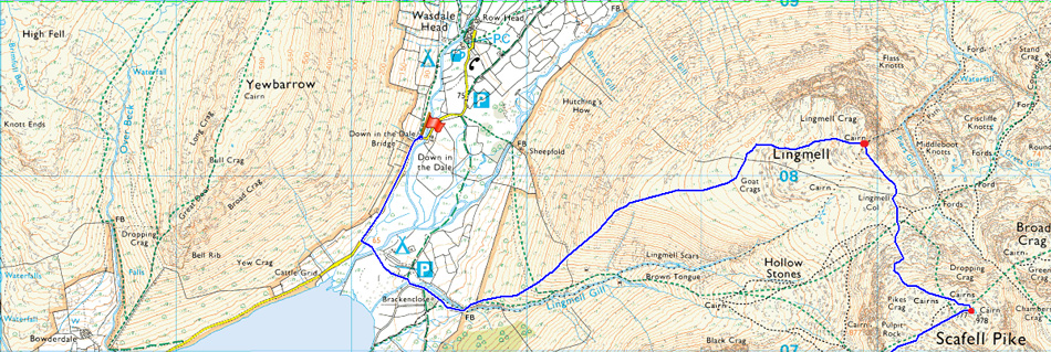
Todays walk was planned around using two cars one of which would be left close to Countess Bridge, and the other in Down-in-the-Dale close to Brackenclose. It was a gloomy start with cloud covering the head of Wasdale although we laid trust in the forecast which left us walking back to the cars after a good hour of sunshine which to the best of my knowledge, hadn't been forecasted.
Here's how we got on. |
|
| Wainwright Guide Book Four |
 |
| The Southern Fells |
-Mickledore
It does a man good to realise his own insignificance in the general scheme of things, and this is his experience here. |
 |
|
|
| |
|
Overview |
|
|
| Ascent: |
5,413 Feet - 1,650 Meters |
| Wainwrights: |
6, Lingmell - Scafell Pike - Scafell - Slight Side - IIIgill Head - Whin Rigg |
| Weather: |
Overcast with Bright Spells, Humid with a Light Breeze Across the Summits. Highs of 20°C Lows of 15°C |
| Parking using x2 cars |
Road Side Parking Countess Bridge/Wast Water - Parking Spaces, Down-in-the-Dale |
| Area: |
Southern |
| Miles: |
13 |
| Walking With: |
David Hall |
| Ordnance Survey: |
OL6 |
| Time Taken: |
9 Hours 20 Minutes |
| Route: |
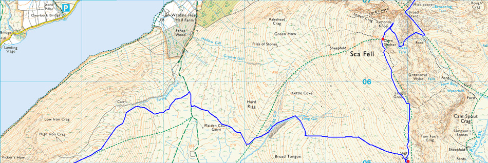
Down-in-the-Dale - Brackenclose - Lingmell - Lingmell Col - Scafell Pike - Mickledore - Foxs Tarn Gully - Foxs Tarn - Scafell - Long Green - Slight Side - Hardrigg Gill - Maiden Castle Cairn - IIIgill Head - Whin Rigg - Greathall Gill - Wast Water |
|
| |
|
Map and Photo Gallery |
|
|
  |
| |
| |
  |
| |
| |
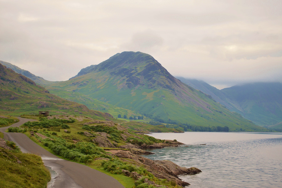 |
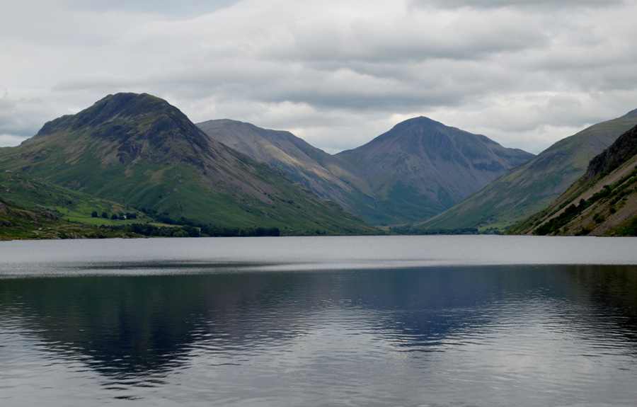
| Yewbarrow from Wast Water 07:45am 15°C |
It was arranged we would meet at the large parking spaces close to Countess Bridge at around 07:50am before swapping the gear from one car to another before continuing to Down-in-the-Dale where we would leave the second car. David was already there and kitting up by the time I arrived after leaving my house at a weary 05:15am a journey that I know like the back of my hand but one I always struggle with due to the length of time spent in the car.
I pull up along side David's car and after a friendly 'morning' It was decided that I would leave my car at Countess Bridge but first gear needed to be swapped over and boots laced up. With my car locked we were soon on our way travelling along the narrow road towards Wasdale Head taking note of the low cloud and the surface water which spilled over the road no doubt as a result after last nights rain. We were lucky to grab a parking space close to Down-in-the-Dale Bridge which David reversed into before extending poles and shouldering packs. I left quite a bit of unnecessary kit in David's boot if only to alleviate weight leaving just the essentials.
With David's car locked we headed out towards Brackenclose passing the campsite where people brushed teeth next to tents all the while being accompanied by the smell of bacon being cooked which left us almost slavering at the mouth! We crossed Lingmell Gill via the wooden footbridge and noticed a sign which read an alternative route to Scafell Pike just for Three Peaker's which flanked Lingmell Gill to the right, and not the usual left, this put in place to eliminate erosion on an already eroded path maybe. Up ahead the Three Peaker's are hard at it in large groups as they ascend towards Hollow Stones via Brown Tongue.
The forecasters had predicted a dry day with sunny spells and although we are missing the sunlight it's very humid leaving the air feeling sticky right about the time a nice cool wind would work wonders over the next forty minutes of ascent. |
 |
| Lingmell West Ridge. |
| There is no getting away from the steep ascent from Brackenclose which continues all the way to Goat Crags found on Lingmell upper shoulder. Is it really time to start digging deep this early into the walk! |
 |
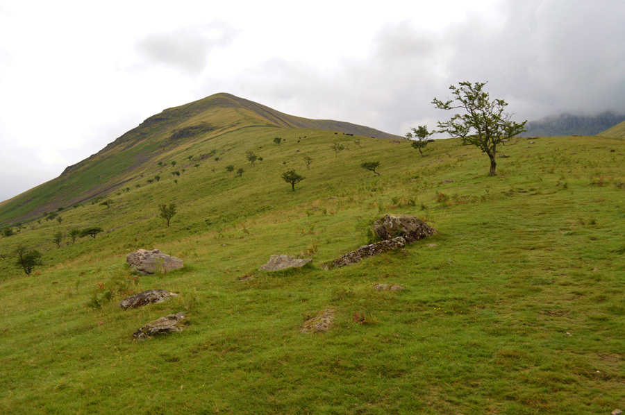
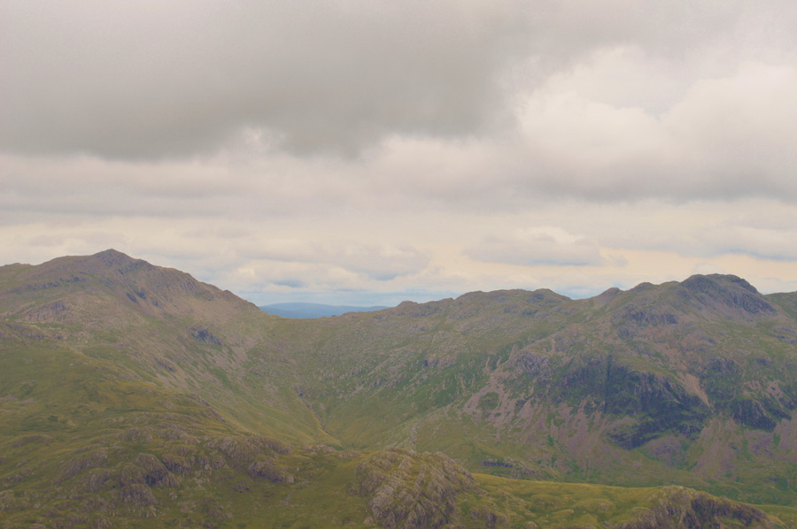
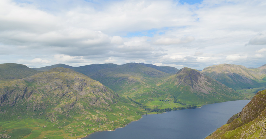
| Views back down the West Ridge over Brackenclose, Illgill Head, Wast Water, Middle Fell and Buckbarrow. |
| Just in case we gave the Cattle a wide berth opting to go around although judging by the looks on their faces we didn't seem to bother them at all. |
 |
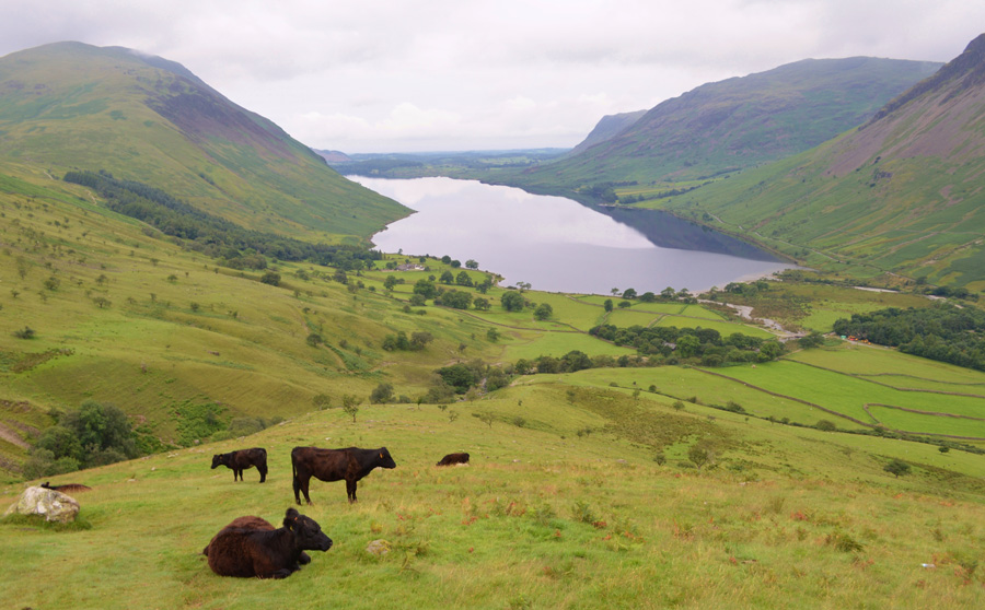
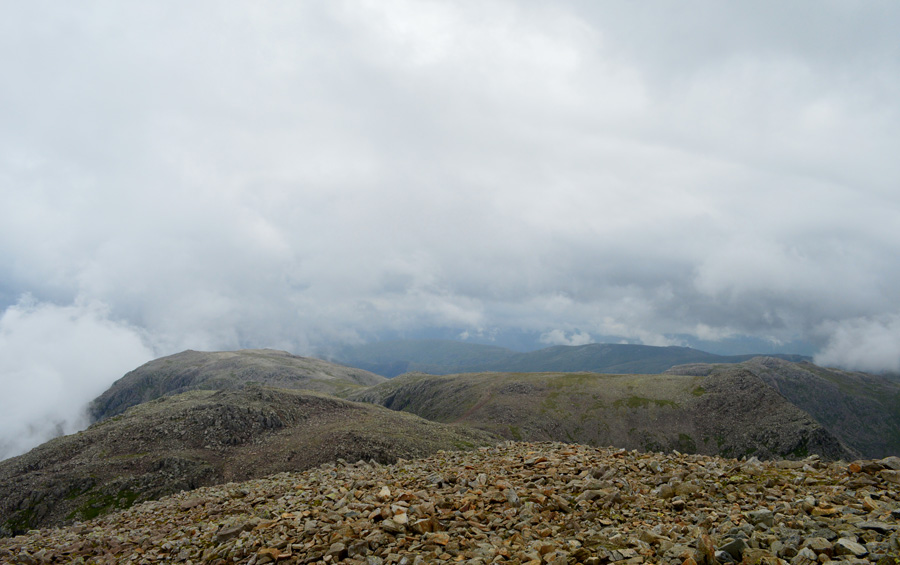
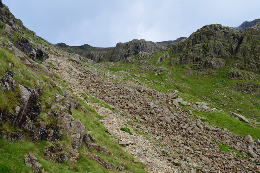
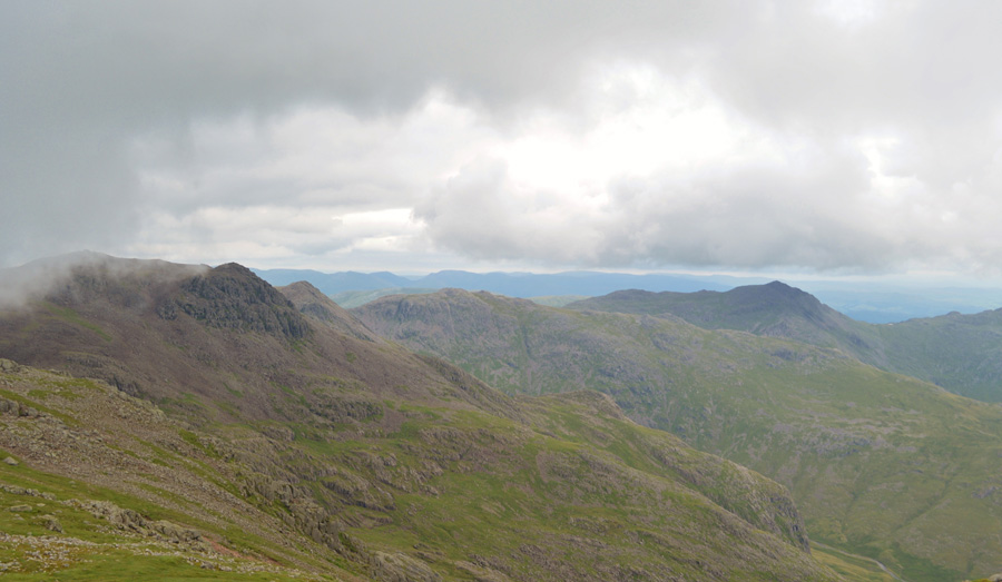
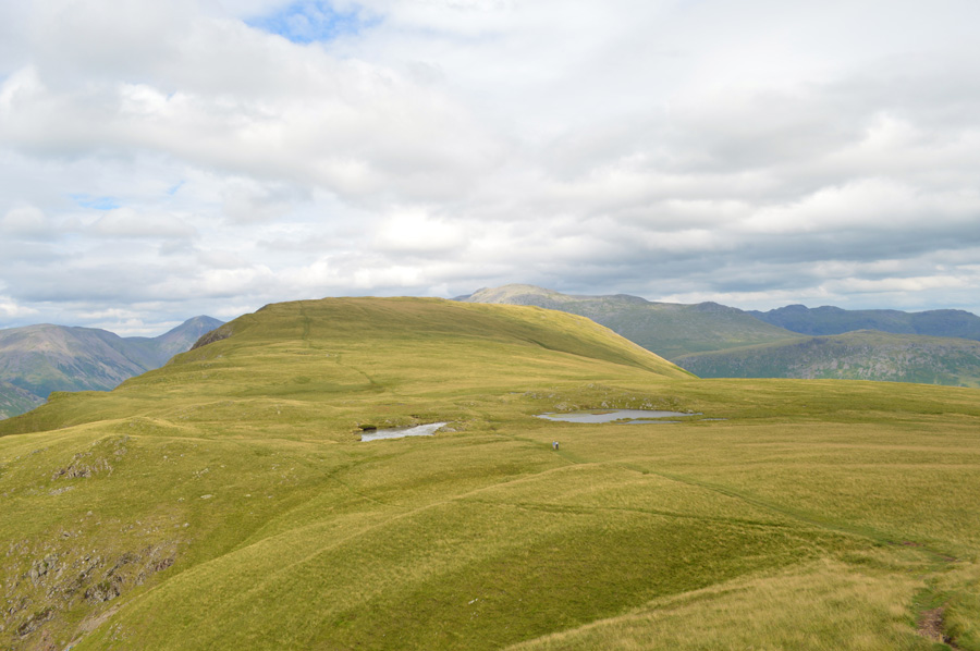
| Hollow Stones. |
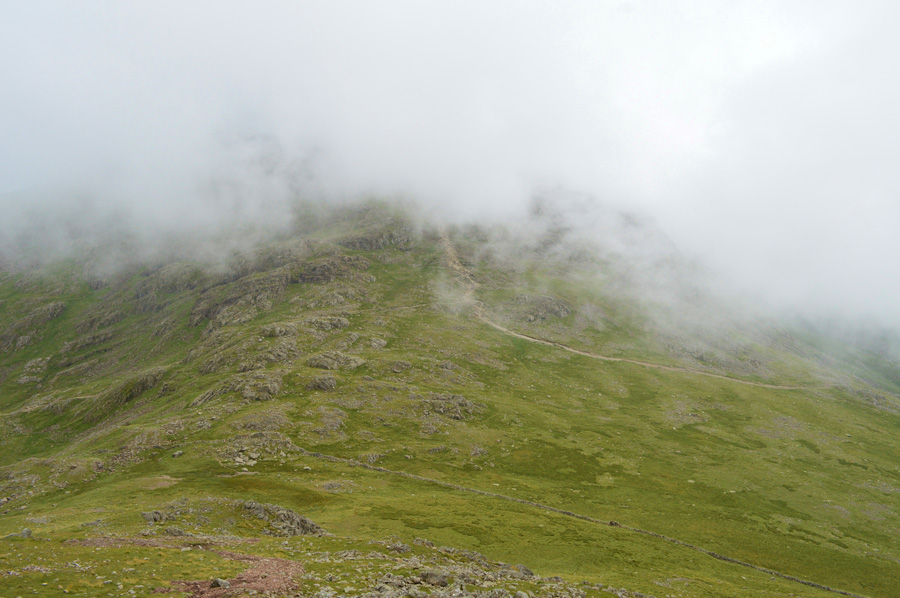
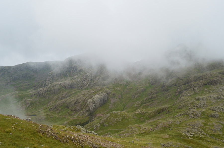
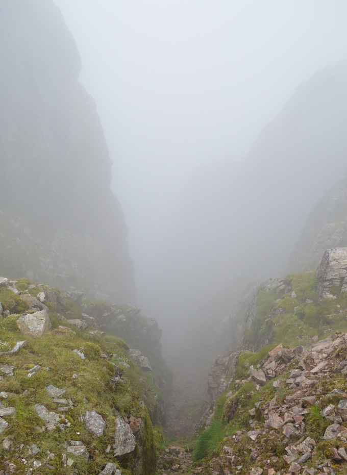
| We continued with the steep ascent all the while the cloud started to creep its way down obscuring the Mickledore Ridge towards Hollow Stones and in the distance, we even lost sight of IIIgill Head summit for a while. A familiar stone wall was reached which we crossed via even more familiar wooden sty where we stopped to get our breath back. The wind had picked up ever so slightly but it was just enough to help us cope with the heat and humidity during the steep ascent. |
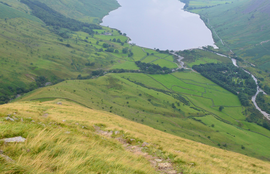 |
| Views back down IIIgill Head Western Ridge towards Wast Water. |
| Pheew wee it's a hot one. |
 |
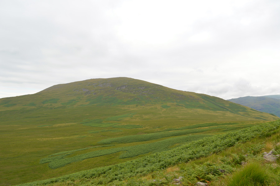
| IIIgill Head summit is just up ahead. |
Below the summit of Goat Crags our path ascended steeply through a boulder field via a series of short zig-zags which felt welcoming underfoot after the long and steep grassy ascent. We topped out on Lingmell's shoulder, a summit known as Goat Crag where we passed a large stone cairn before continuing towards Lingmell Summit which was still under cloud.
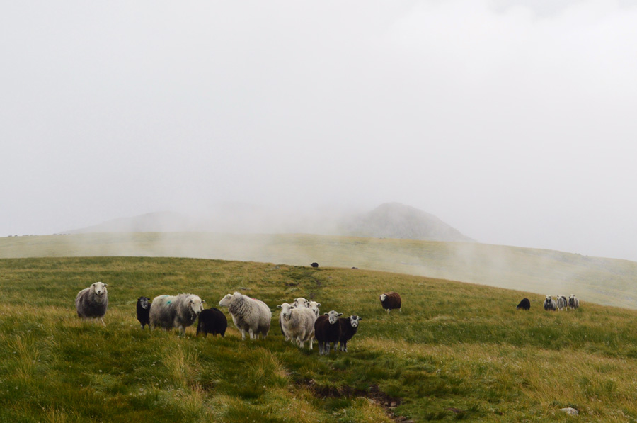
It would seem we weren't the only two people on Lingmell this morning as two farmers are herding sheep with their sheep dogs who we couldn't see due to the cloud but what we could hear, however was a series of rants towards the sheep dogs which started with the letter 'F' and sounded like the word duck.
The cloud thickened which saw us top out on Lingmell subsidiary summit first before crossing a grassy plateau when every now and again, the cloud would part revealing the summit, just up ahead. |
 |
| Limgmell Summit Cairn. |
We crossed the col between both summits still listening to one farmer rant away at his dog which was starting to get a little annoying. Just below the summit we spot a couple making slow progress towards the craggy outcrops, we summit first and hang around for a while if only for a friendly chat, it turns out the couple are Scottish and the chaps wife doesn't seem to be happy at all at her husband as he had been out drinking til 06:00am this morning, you've got to give it to the guy, you couldn't tell he'd only been up for three hours.
We spoke of our routes and explained we were heading for the Scafells, then IIIgill Head and the chap also said he to was heading for the Scafell Pike next, might see you there then we replied. |
 |
| Descending Lingmell towards Lingmell Col. |
| |
 |
| Broad Crag and The Corridor Route from Lingmell Col. |
We had left the summit in cloud and started our descent towards Lingmell Col where we had a brief glimpse of The Corridor Route below the dominance of Broad Crag whose summit was topped by fleeting cloud. On the Styhead side of Lingmell there was still a vast wall of unbroken cloud thick and menacing in stance while beyond it, more dark cloud leaving a rather dramatic contrast. |
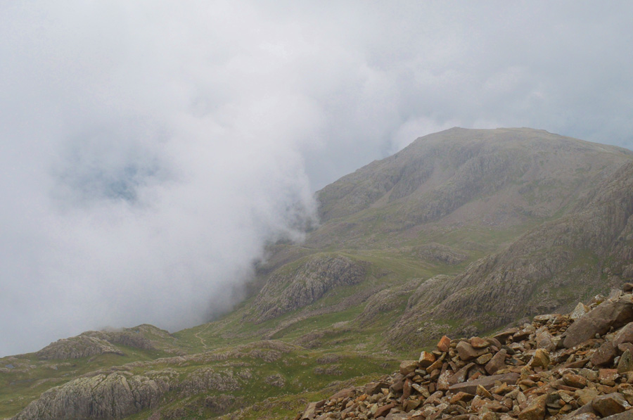 |
| Great End. |
| There is still thick cloud rising from the Styhead Pass side of the valley which was fantastic to watch as we made our ascent on Scafell Pike. It may be a little early for anyone on the Corridor Route at the moment while all the cloud was starting to break up but if they were they were in for a treat. |
 |
| Views back over Lingmell Col towards Lingmell, Piers Gill and Middleboot Knotts. |
| |
 |
| Broad Crag and Great End from Scafell Pike summit. |
We were met by some walkers making a descent from the summit but mostly we passed quite a few in ascent. Before reaching the summit plateau I looked back to find the Scotsman ascending on his own, perhaps his wife had finally fallen out with him, either way his late night antics didn't seem to phase him. |
 |
| Dramatic views over Broad Crag Col towards Broad Crag, Great End and III Crag. |
With the summit reached it was difficult to photograph the summit Trig Point or Shelter due to the masses of people who occupied the area some of which didn't seem to have any respect for others who had made the same ascent leaving unaccompanied packs and gear all around the area, despite no photos I would always tap the Trig Point with my pole but I couldn't manage that due to the strewn gear lying all over the place.
David stands on a high rock and starts to photograph Scafell over Mickledore while I take in the views from t'other side of the summit, feeling blessed with the views we re-group and plot a course via the stone cairns towards Mickledore. |
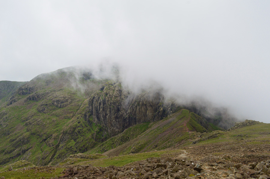 |
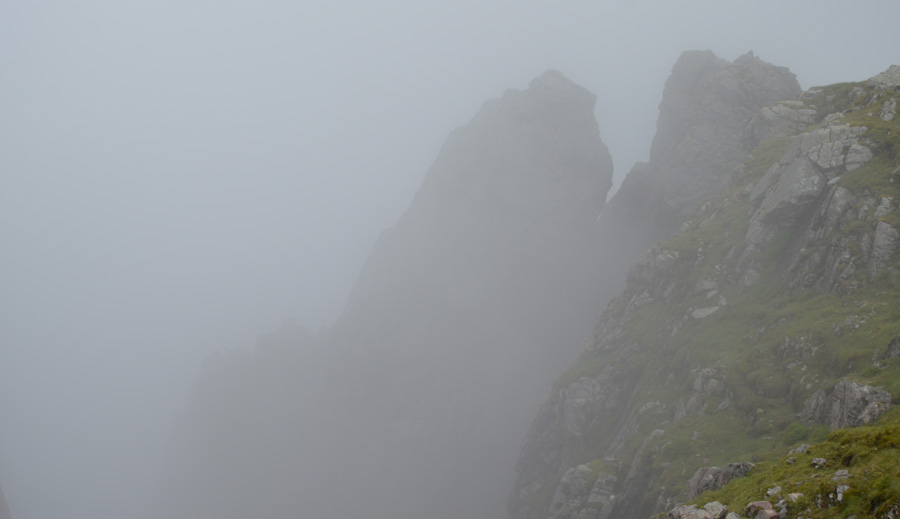
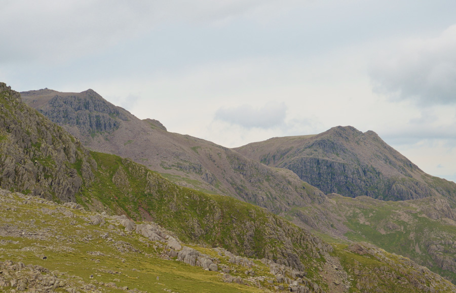
| Scafell, Broad Stand and Mickledore. |
Our route onto Scafell will be by Foxs Tarn Gully which can be seen in the lower left of the photo, it's a route that despite it being considered the 'tourist' route I've never actually tried before much because I have always favoured Lord's Rake or the West Wall Traverse instead.
I'm feeling quite eager to get in there and see what I've been missing. |
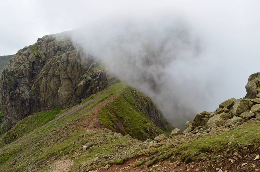 |
| Mickeldore. |
With the summit of Scafell Pike behind us we followed a series of stone cairns towards the Mickledore Ridge where we met a young group of walkers who we had seen before our ascent on Lingmell, we pass again with a hello before descending over loose stone towards the Stretcher Box.
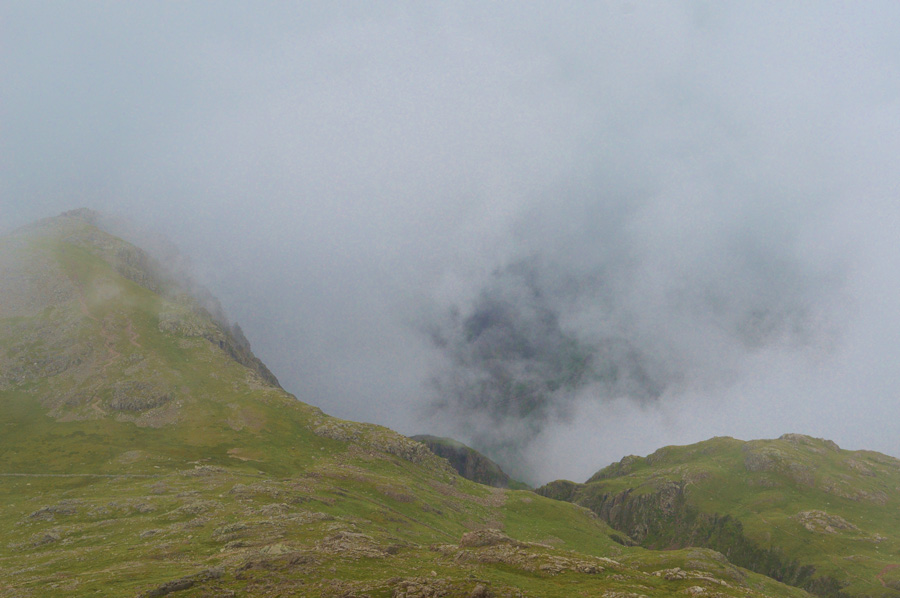
Cloud rose above the Mickledore Ridge and formed a huge wall of cloud before spilling and dispersing over the other side. Two young lads pass and 'mornings' are shared who then went onto ascend Scafell via Broad Stand, a route that had always appealed to me but don't think I have the nerve for. |
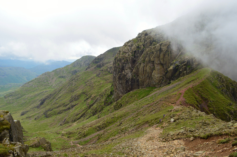 |
| Preparing to descend towards Foxs Tarn gully. |
We both couldn't help but be reminded of our last visit to Foxs Tarn Gully where after descent from Mickledore we had no option other than to reascend back to the the ridge due to the gully being overcome by a raging torrent of water, it was by far the safest decision and we made an ascent on Scafell via Lord's Rake instead.
Good memories of team play and camaraderie, especially during the tough ascent back to Mickledore. |
 |
| Mickledore from the base of Foxs Tarn Gully. |
| |
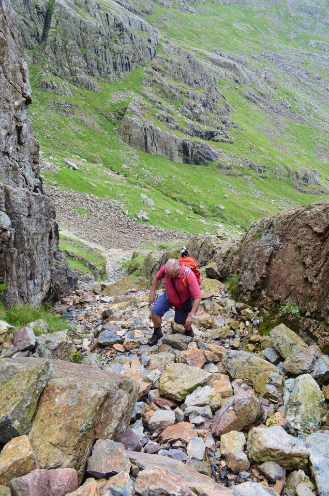 |
| David making light work of Foxs Tarn Gully. |
| We had a few minutes break at the base of the Gully if only to fuel up and strap away our walking poles onto the side of our packs. There is water flowing down through the rocks and at one point I cup a handful and take a drink. We ascend via the right of the Gully which is flanked by vertical stone which oozes water although at one point I was rained on from a miniature waterfall from above which was most welcoming. |
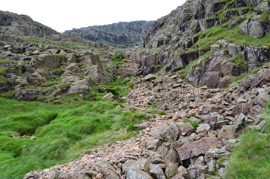 |
| Scafell from Foxs Tarn Gully. |
| Although still in the Gully we had left the enclosed vertical walls behind as the Gully started to open out while up ahead, there's still quite a lot of ascent needed before we reach Foxs Tarn. |
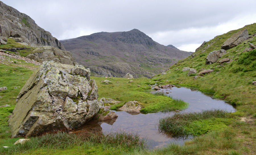 |
| Scafell Pike from Foxs Tarn. |
As a frequent visitor to Foxs Tarn David has seen the tarn reduce in size to how we see it today, there was a time when the water went all the way around the boulder and extended further on the other side too, that was until the mosses took over which has seen the tarn diminish to around less than half its original size.
We de-shoulder once more if only to unstrap our walking poles as there is a steep pull which tops out close to Symonds Knott with views into The West Wall Traverse which is where we are heading next. |
 |
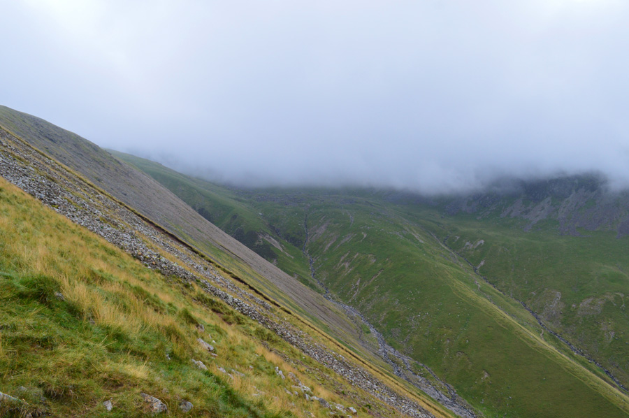
| Murky views into the Deep Gill and the West Wall Traverse. |
After this years Wainwright project is completed I'm quite looking forward to ascending Scafell Pike via Piers before continuing to Scafell via Lord's Rake, The West Wall Traverse and Deep Gill again only my next visit will hopefully under better conditions than my last when I couldn't see my hand in front of my face for the whole duration.
Enough of me muttering on, it's Scafell next but first a photo of the head of Deep Gill. |
 |
| The head of Deep Gill. |
| With the Pinnacle (left) and the Oracle (right) |
 |
| Scafell as we flank Symonds Knott to our right. |
| |
 |
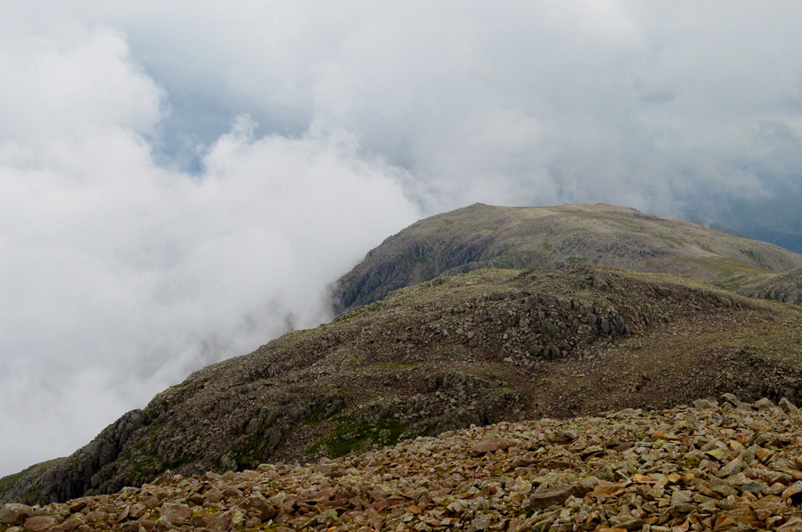
| Symonds Knott, the Head of Deep Gill and Scafell Pike from Scafell summit. |
| The cloud had cleared by the time we arrived at Scafell summit by which time we were met by a couple who were just finishing up lunch, we pass on our hi's before continuing along the stony summit plateau towards Long Green and Slight Side. |
 |
| Scafell Pike, III Crag, Esk Pike and Bowfell from Scafell summit. |
| |
 |
| Descending Scafell for Long Green with views towards Slight Side on the southern end of the ridge. |
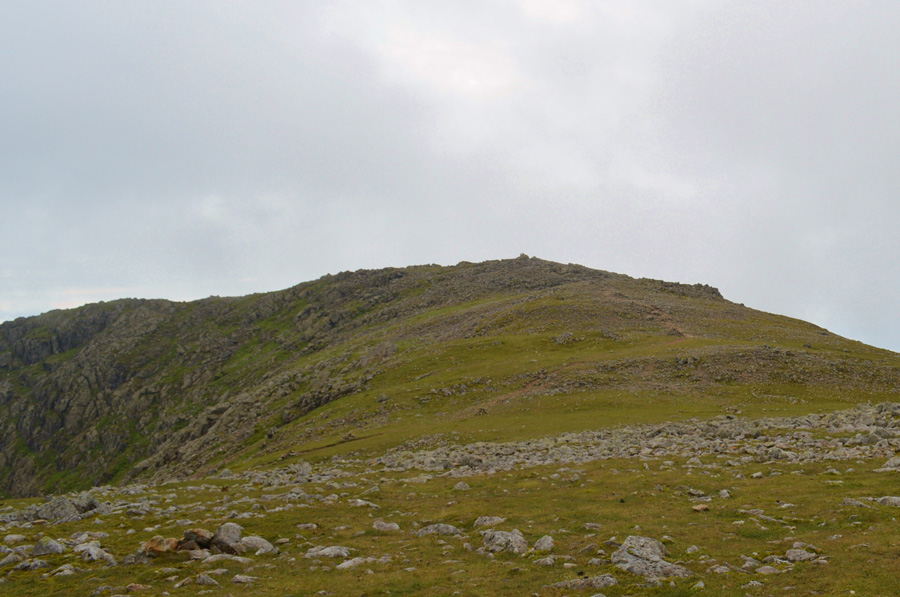
| Despite Slight Side being just a stones throw away gaining its summit from Scafell can be made slower by the tricky conditions underfoot mainly found between Scafell summit and Long Green where the path passes over unstable rock for much of the descent which can feel a little frustrating due to how slow progress is made between both summits, never-the-less we still needed to break for lunch which we decided to eat after we had summited Slight Side. |
 |
| Slight Side summit. |
| After a short pull we arrived at Slight Side summit and de-shouldered for lunch where memories came flooding back from last year when I completed the Lakeland Two Thousand footers right here on Slight Side summit, more projects are spoke about and even past ones that we had enjoyed and before we knew it half an hour had slipped by and it was time to re-shoulder again as we set out sights on a direct descent towards Hardrigg Gill and our final two summits of IIIgill Head and Whin Rigg. |
 |
| Views over Cam Spout Crag, Scafell and III Crag from Slight Side summit. |
| |
 |
| Looking North East we have III Crag, Esk Hause, Esk Pike and the upper Eskdale valley. |
| |
 |
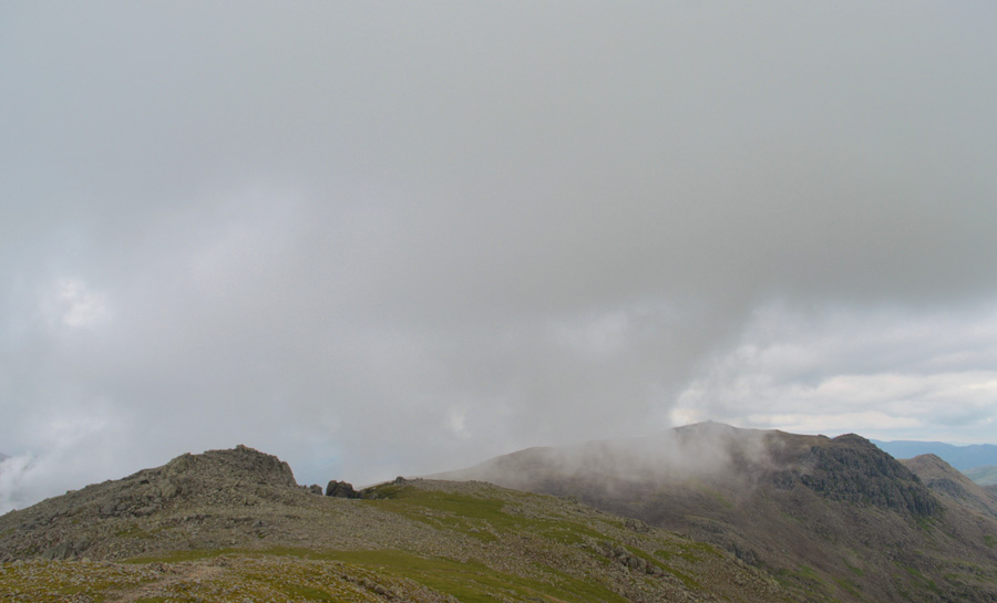
| Murky views towards Bowfell, Three Tarns and Crinkle Crags from Slight Side summit. |
| |
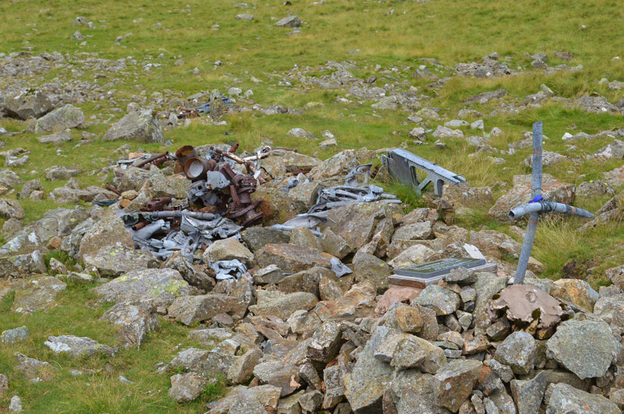 |
| WW2 Plane Wreckage. |
| At this sight in August 1941 two Polish Pilots who were on route to a training excersise from RAF Unsworth died after their Hawker Hurricans struck the mountain in low cloud. Wreckage from both planes can still be found only a short distance apart although it is at this sight where a Memorial was left by 1030 Whitehaven SQN Air Training Corps. |
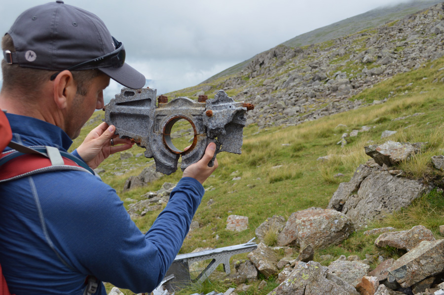 |
| Debris from one of the Hawker Hurricans. |
Wreckage from the engine of one of the planes is still at the site, it is clearly visible to see the crank, con rods and pistons. Here I hold what appears to be one of the main crank bearings. All around there is still clear evidence of landing gear and hydraulic piping with parts of air frame and wing although most of the significant wreckage was transported to RAF Millom Museum. |
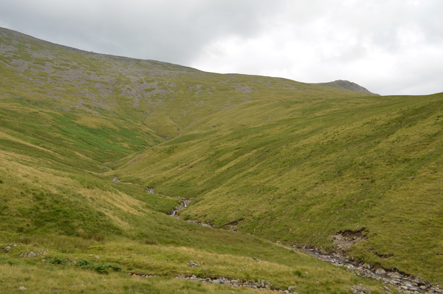 |
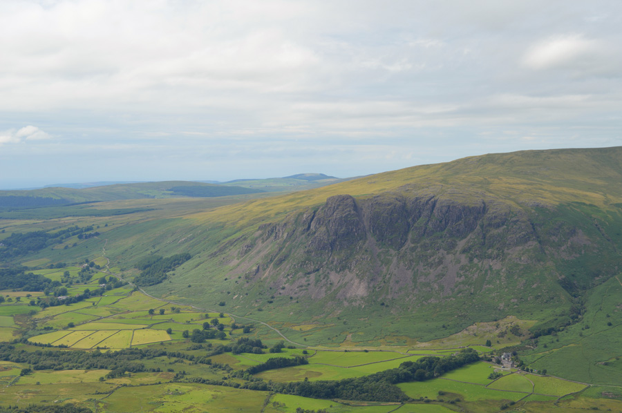
| Slight Side is seen after crossing Hardrigg Gill. |
| After leaving the crash site we made a direct pathless descent towards Hardrigg Gill which was thankfully relatively dry underfoot, despite this after tramping over hummock wild grasses for the best part of a mile it was nice to walk on path underfoot once we had made the easy crossing of Hardrigg Gill. |
 |
| IIIgill Head comes into view. |
Once we had crossed Hardrigg Gill we follow a faint track through Bracken as views start to open out over Burnmoor Tarn and the Miterdale Valley beyond, unfortunately this came at a time when the light was incredibly low meaning taking photos was quite difficult, although I couldn't be blamed for trying!
We skirt above Maiden Castle still passing through knee high bracken but eventually we arrived on the Burnmoor Tarn path, it was starting to get quite busy with walkers heading to and from Burnmoor Tarn. We had initially planned to ascend via the familiar stone wall where a good path can be found but we soon spotted a narrower path close to where we were standing. This path looked more direct and quite steep in places and as we are suckers for steep ascents, we thought one more wont hurt.
We were wrong. |
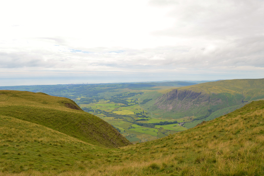 |
| Nether Wasdale from IIIgill Head. |
We hit the steep ascent with good stead but were soon slowed down as fatigue soon caught up with us leaving us to 'drop a gear'. We are passed by a couple on their way down who step aside and allow us to pass (they must have felt sorry for us) I could see the sky up ahead but I dare presume it was the summit shoulder and I was right...
It was all about perseverance and we finally topped out on the summit shoulder with the summit cairn in site with walking poles held back. An old chap occupies the summit shelter as we branch over to the 609' summit which I had confused with the main summit which is found a little further ahead, oddly at 604' the old gents wife awaits him right about the same time David pops the question "do you want me to get my nuts out?"
Bloody hell David I've only know you three years!
Followed by side splitting laughter.
Noooo!! I mean my bag of mixed nuts and raisons to eat!!
The amount of innuendos that follows could now fill a book.
On a serious note we needed that funny moment because that last ascent took it out of the pair of us. |
 |
| We take the path directly over the top of Wast Water Screes offering fantastic views towards the Cumbrian Coast. |
| |
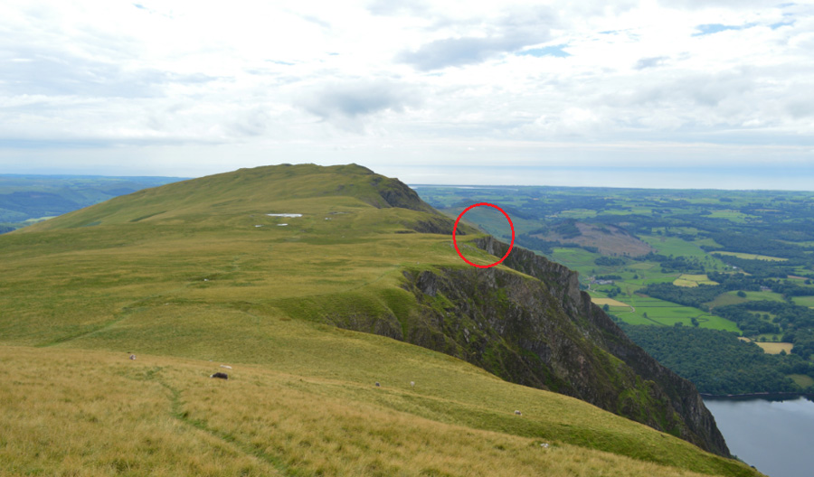 |
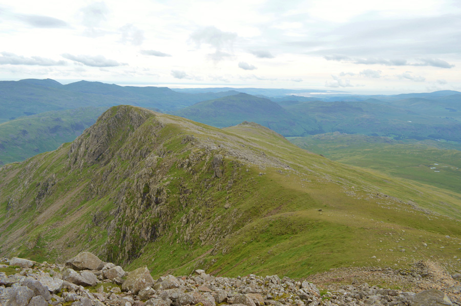
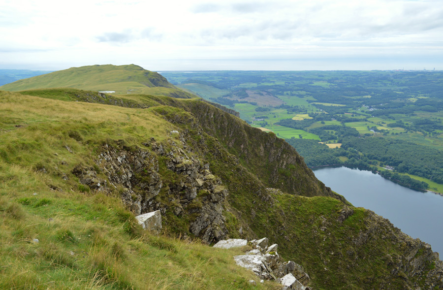
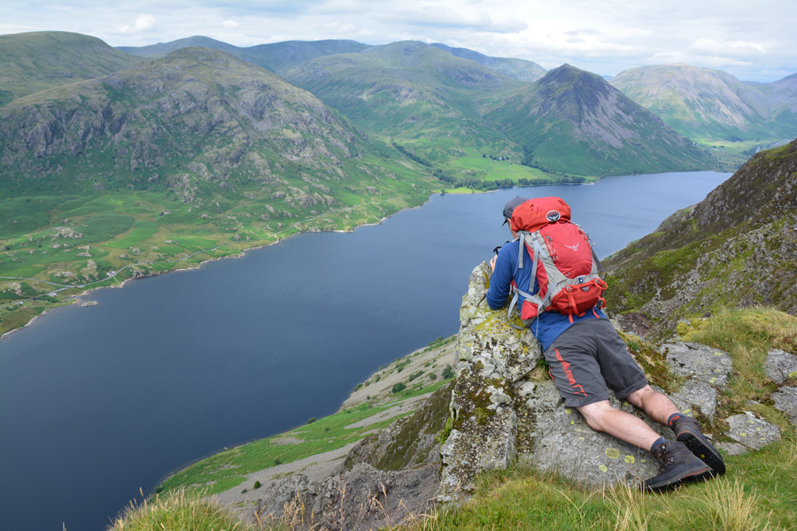
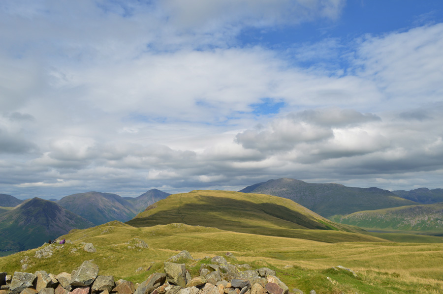
| Whin Rigg seen on the Western tip of the IIIgill Head Ridge. |
The sun had now come out which illuminated the wild grasses and with each moment passed our views back towards Wasdale Head were getting increasingly better.
David had informed me of a rock spur (circled) where, if brave enough you look over the edge to a vertical drop all the way down to Wast Water some 1,500ft below, it's not for the faint hearted it's a real leg wobbler.
And with that, we made our way over. |
 |
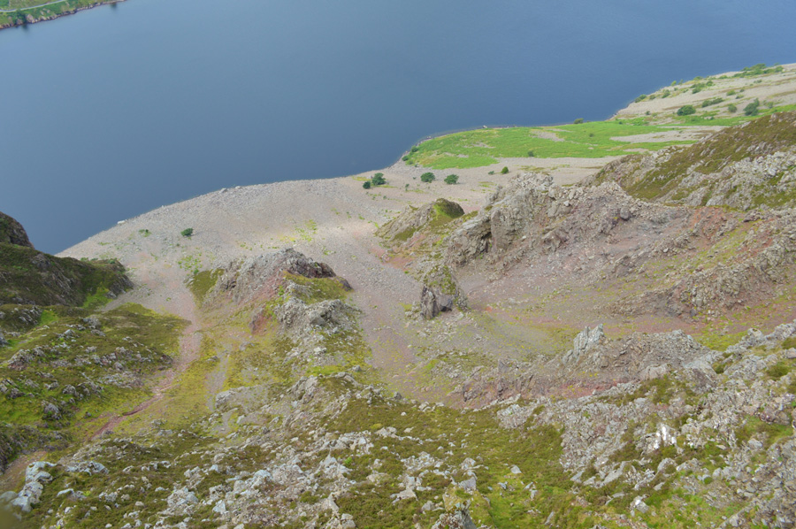
| Looking down on the Screes from the rock spur. |
David de-shoulders and went first, despite saying that he is afraid of exposure you wouldn't have thought so! soon followed by myself as I lowered my quivering body onto the rock and was soon left feeling almost paralysed with an uninterrupted view all the way down to the shore line where taking a photo just didn't do the view any justice but I gave it a go anyway.
Footnote:
Please do not attempt anything like this if you are afraid of heights or exposure. |
 |
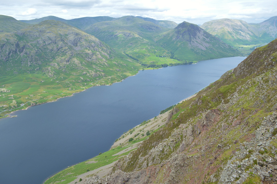
| Wast Water from the top of the Wast Water Screes. |
| The almost vertical crags descend into England's deepest lake a further 250ft all the way to the lake floor and it is said that the crags are above the waterline are in a state of decay which is enough reason for me to step slowly back and get on firmer ground, seriously though, what a rush I can still feel my heart thumping out of my chest! |
 |
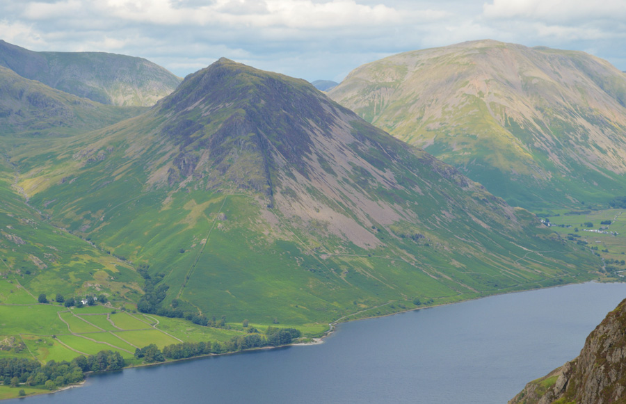
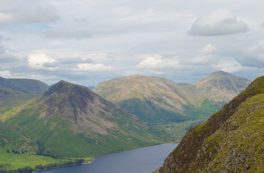
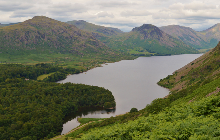
| Views over Wast Water towards Middle Fell, Yewbarrow, Haycock, Scoat Fell, Red Pike and Kirk Fell. |
| |
 |
| A close up of Yewbarrow and Kirk Fell. |
| |
 |
| In this photo Great Gable and Beck Head comes into view. |
| |
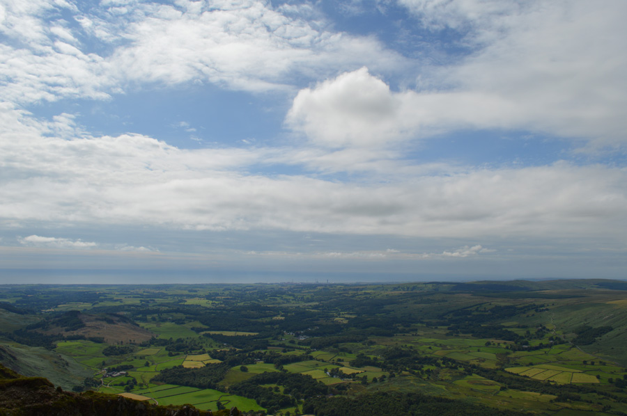 |
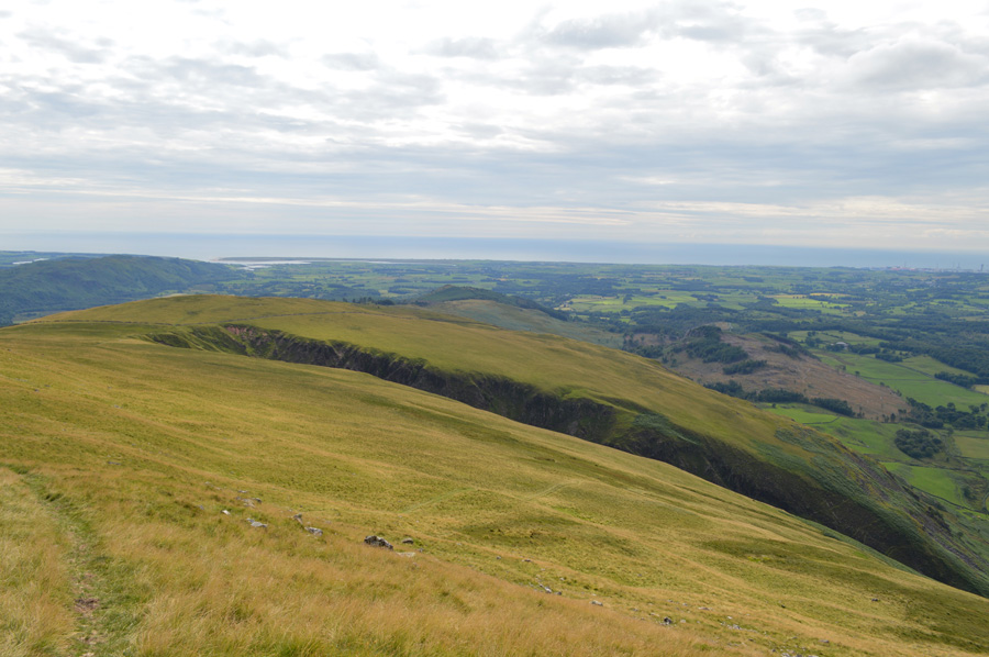
| The Cumbrian Coast beyond Nether Wasdale and Gosforth. |
| |
 |
| Looking back on Middle Fell, Haycock, Scoat Fell, Red Pike, Pillar, Yewbarrow and Kirk Fell. |
| |
 |
| The dominance of Buckbarrow above the hamlet of Greendale. |
| |
 |
| Looking back over the Tarns towards IIIgill Head summit. |
| We left the fantastic views from the rock spur behind and began our ascent on Whin Rigg by which time it started to feel like a real summers afternoon. There wasn't much pull needed in order to gain Whin Rigg summit where we took our time often muttering if only we had this weather for the duration, but I guess you could also say that the best of the weather was reserved until last, when it was more appreciated. |
 |
| IIIgill Head, Yewbarrow, Kirk Fell, Great Gable, Scafell Pike, Scafell and Slight Side from Whin Rigg summit shelter. |
| Sadly there wasn't enough time to appreciate our views and after only a few moments spent we left the summit and started to make our steep descent alongside Greathall Gill. |
 |
| Descending via Greathall Gill. |
| There are two paths either side of Greathall Gill both of which are quite steep, you might just be able to make out our route of descent in the foreground which runs across the fell side before steeply turning right. |
 |
| Middle Fell, Red Pike, Yewbarrow, Kirk Fell and Great Gable from our Greathall Gill descent. |
It would seem that although it was still incredibly sticky the sun had gone back in leaving our steep descent feeling very humid indeed and legs are starting to tire after recovering from more slips than I care to mention.
Below we can make the Lund Bridge and a youthful River Irt which flows beneath it. Our route back to Countess Bridge will be via Low Wood in the foreground which will then pass 'Englands favourite view' which I was quite looking forward too. From the view point we next pass Wast Water Hall before following the track to a new sty situated just below the road from where, it's just a short distant back to the car.
I could think of worse walks back to the car despite the aching feet and time pressing on, it was a walk to be done at our own pace. |
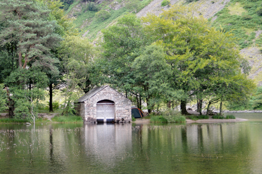 |
| The Boat House, Wast Water. |
After the steep descent it felt nice to have a good path underfoot as we left Greathall Gill behind in favour of the soft long grass which cushioned steps alongside the River Irt. We pass through two kissing gates before crossing Lund Bridge which is over shadowed by tall trees leaving the air a little cooled.
The Irt looked so inviting, infact if the pair of us hadn't of had to struggle through bramble and nettle I'm sure a good swill would have been in order but the nettles thought otherwise. We pass through Low Wood again in a welcomed cooler climate before emerging opposite the familiar Boat House, we take a wander down to the shoreline and take it all in for a few moments before re-joining the path which passes 'that view' |
 |
| Englands Favourite View. |
Couples sit on benches while one chap jokingly threatens to throw his girlfriend in the water, she steps back with a loud scream and we remark that it's all part of the courting process, or 'cooerting' where I come from. Wast Water Hall is passed and it's here we find swimmers taking advantage of high temperatures to cool off as I wonder do I have the nerve to do the same in my boxer shorts, probably not. |
 |
| Yewbarrow, Great Gable and Lingmell from Wast Water. |
We soon find ourselves back on the road which is busy with Three Peak mini buses with hopes of Snowdon as our walk is about to come to an end, we arrive back at my car and the first thing I do is turn the A/C on before throwing our gear into the boot for the short journey towards Down-in-the-Dale and David's car.
We soon reach David's car but not before passing more traffic coming in the opposite direction than I care to mention. I don't say a thing as we part with the mention of our next walk perhaps just only a week away, while in the back of my mind I can only hope that if my final Project walk turns out as great as todays I won't walk away wondering if I had made the wrong fell choice. |
|
| |
| Back to top |
 |
|
