|
Walking the Wainwrights in 30 Walks Walk 27 - The Back O' Blencathra |
 |
 |
16th August 2016 |
 |
|
Up until the last night todays walk had been planned to take in the summits of the Grasmoor and Coledale fells with David yet due to an emergency in work David contacted me to tell me that he couldn't make it, although I'd be lying if I said he wrote that e-mail with such good mannerism, to say David was peeved off would have been an understatement.
I had prepared myself both mentally and physically for the walk which could still be put to good use on another project walk which is why I choose an equally demanding route which takes on seven Wainwright summits and also includes quite alot of road walking which I was a little worried about due to my recent heel injury.
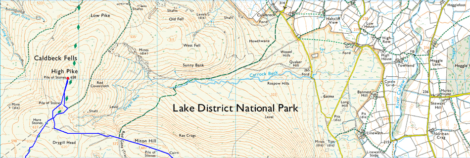
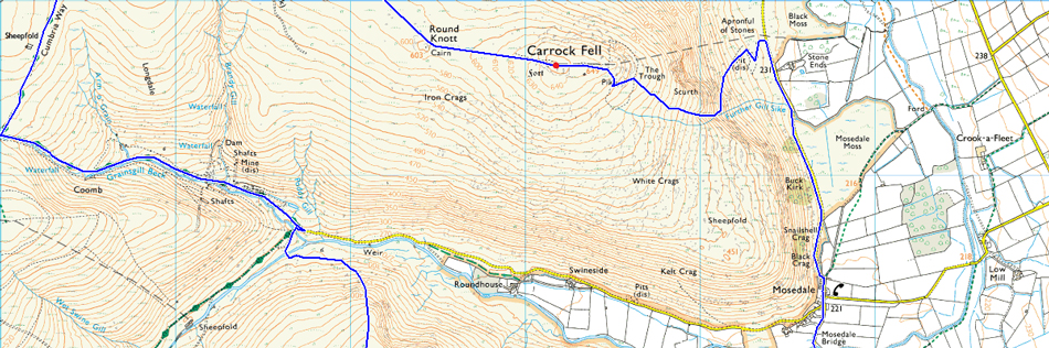
It's fair to say that I couldn't have chosen a better day to walk with afternoon temperatures rising into the mid twenties which I must admit, felt a tad uncomfortable but I'm not complaining after last Saturdays Bow Fell walk. I had planned todays walk to start and end in the village of Mungrisdale before taking in the hamlets of Bowscale and Mosedale before collecting my first summit of Carrock Fell, then continuing along the ridge to summit High Pike (Caldbeck) Lakelands most northerly summit. From High Pike I track south along the Cumbrian Way passing Lingy Hut until I descend towards the River Caldew via Carrock Mines.
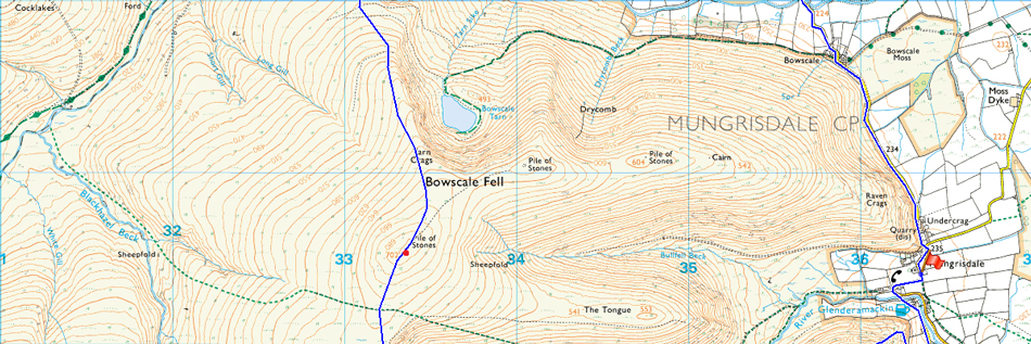
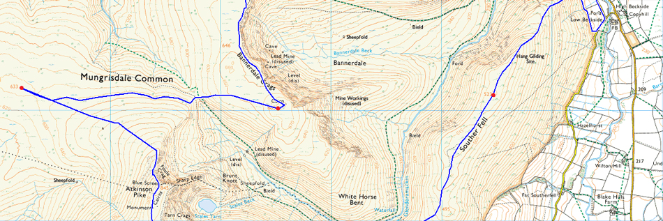
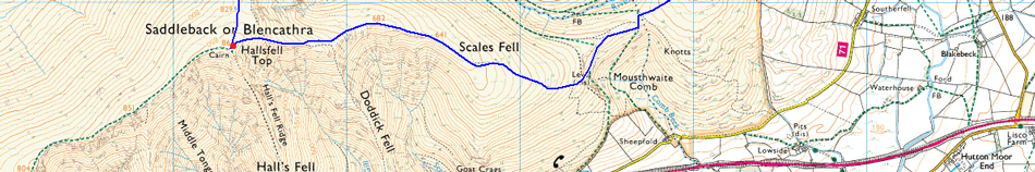
It's a tough pull onto Bowscale Fell summit via the north ridge but first I had to cross the Caldew before being rewarded with views over Bannerdale Crags and the mighty Blencathra. The lonely summit of Mungrisdale Common was next before ascending Blencathra via Atkinson Pike then I will descend Scales Fell continuing over Mousthwaite Comb to collect my final summit of Souther Fell before descending the ridge back to Mungrisdale. |
|
| Wainwright Guide Book Five |
 |
| The Northern Fells |
-Blencathra
This is a mountain that compels attention, even from those dull people whose eyes are not habitually lifted to the hills. To artists and photographers it is an obvious subject for their craft; to sightseers passing along the road or railway at its base, between Keswick and Penrith, its influence is magnetic. |
|
|
 |
|
|
| |
|
Overview |
|
|
| Ascent: |
4,805 Feet - 1,465 Meters
|
| Wainwrights: |
7, Carrock Fell - High Pike (Caldbeck) - Bowscale Fell - Bannerdale Crags - Mungrisdale Common - Blencathra - Souther Fell |
| Weather: |
Hot and Sunny, Light Winds Across The Summits, Highs of 26°C Lows of 12°C |
| Parking: |
Mungrisdale Village |
| Area: |
Northern |
| Miles: |
16.5 |
| Walking With: |
On My Own |
| Ordnance Survey: |
OL4 - OL6 |
| Time Taken: |
8 Hours 35 Minutes 07:25am - 16:00pm |
| Route: |
Mungrisdale - Bowscale - Mosedale - Further Gill Syke - Carrock Fell - Miton Hill - High Pike (Caldbeck) - Cumbrian Way - Grainsgill Beck - River Caldew - Bowscale Fell north ridge - Bowscale Fell - Bannerdale Crags - Glederamackin Col - Mungrisdale Common - Blencathra - Scales Fell - Top of Mousthwaite Comb - Souther Fell - Mosedale |
|
| |
|
Map and Photo Gallery |
|
|
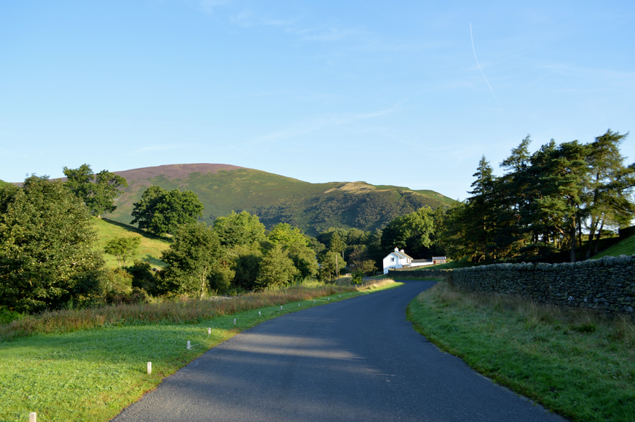 |
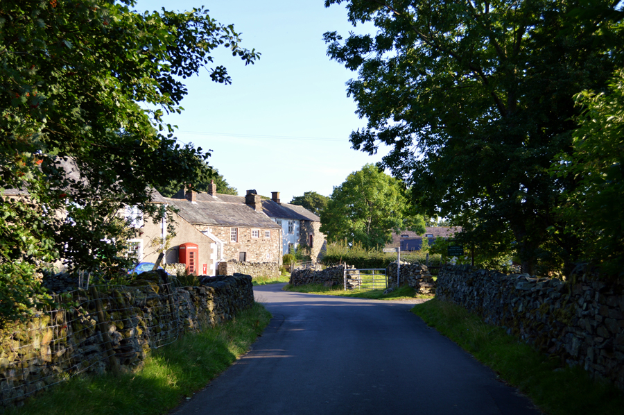
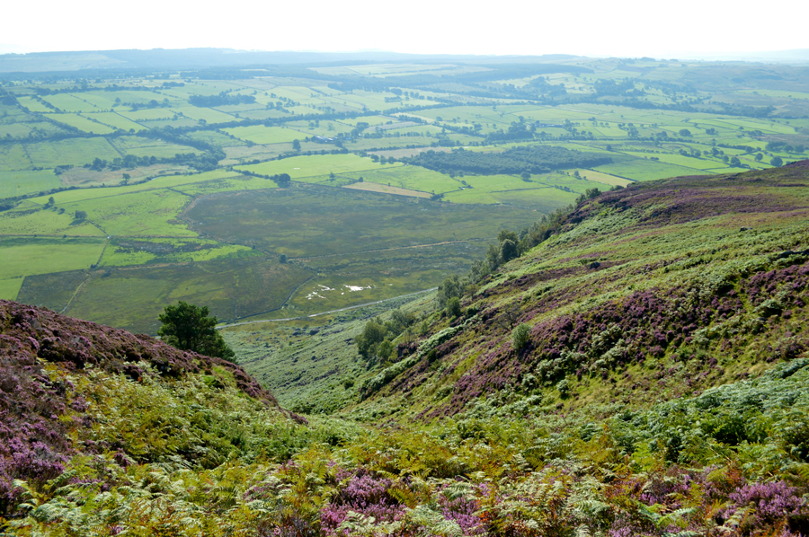
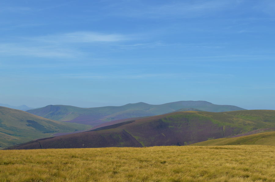
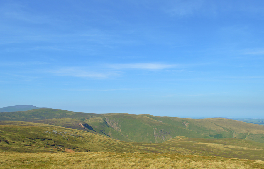
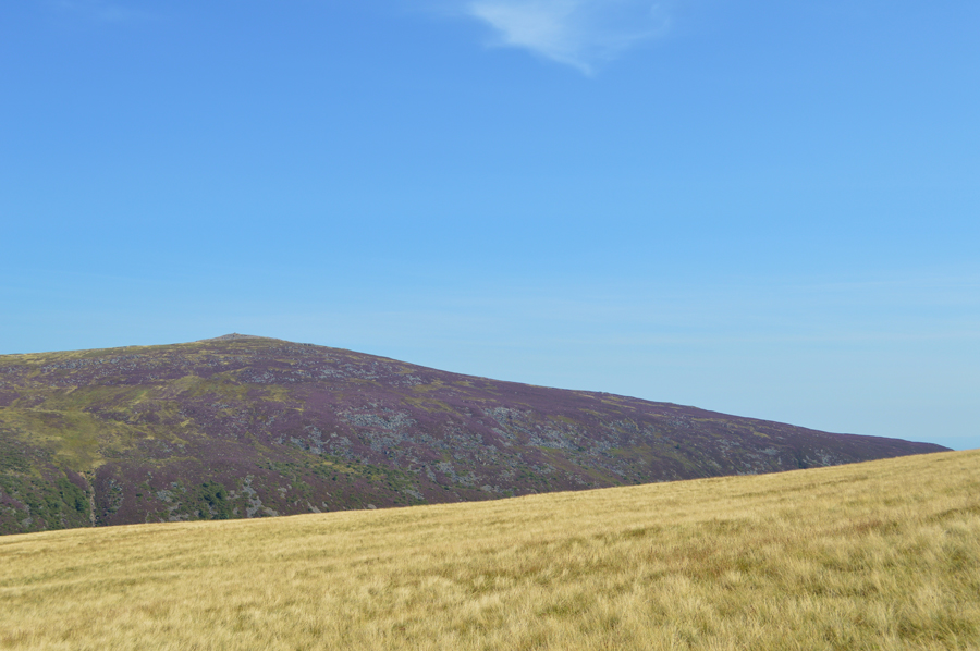
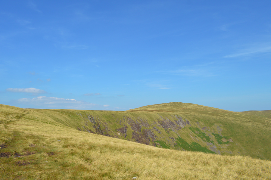
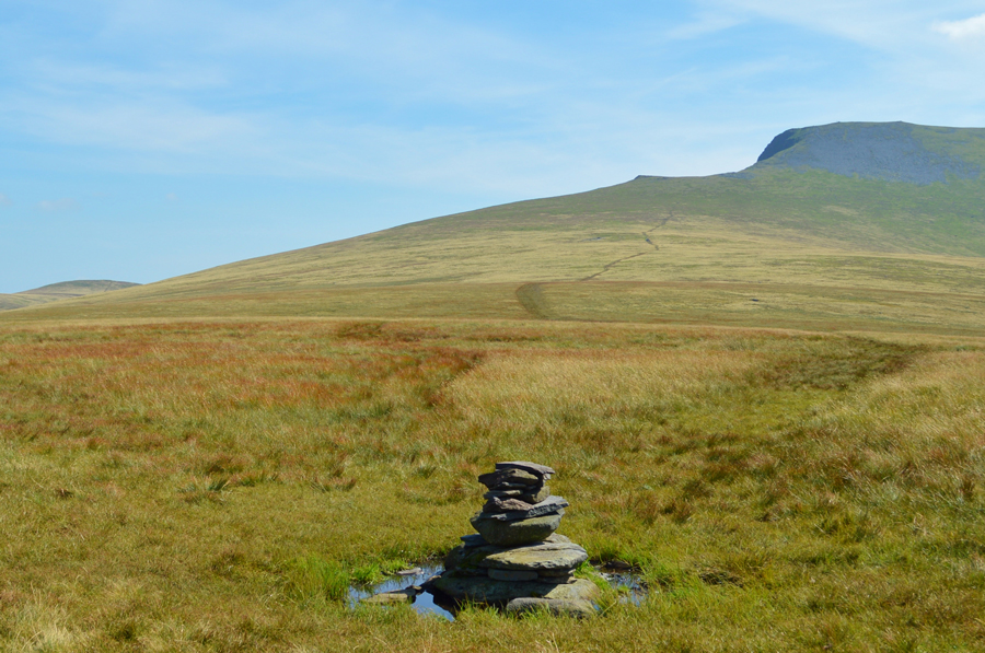
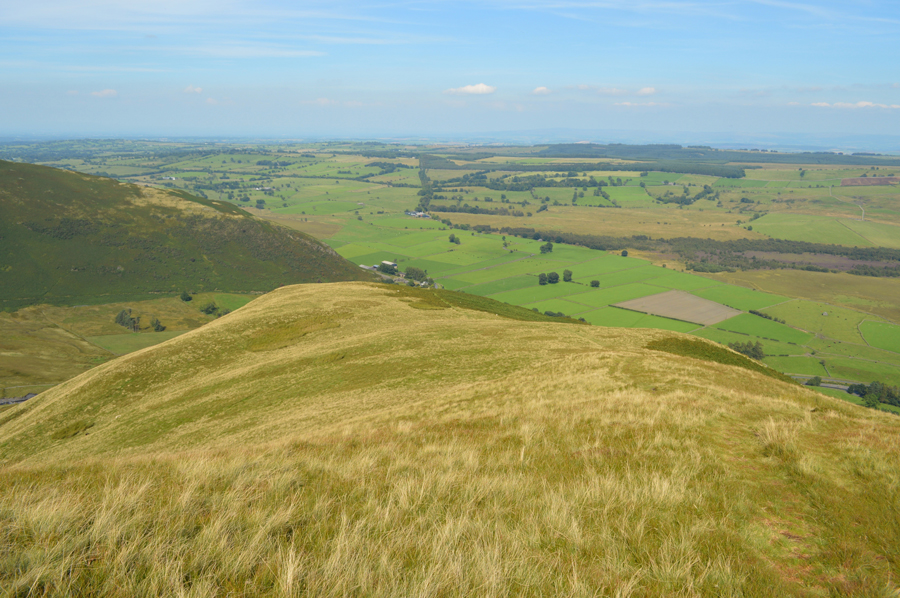
| Bowscale Fell East ridge from the outskirts of Mungrisdale village 07:25am 12°C |
It was noted how heavier the traffic was whilst travelling to Lakeland during the week but with this in mind I still arrived in Mungrisdale in good time which left parking easy close to the river bank of the Glenderamakin which incidently is still recovering from last years December storms which saw a foot bridge further upstream torn from its foundations and much of the river bank in lengthy stretches washed away. The repair work to the river bank had been done were a new stone bank replaces a natural earth bank.
A new sign has been posted 'ground seeded' at the sight of what once was a lay by which was also damaged during the storms, thankfully I manage to park further up the lane where I start my kit up at the back of the car remembering to pack my Gaiters which I will only add before I cross the River Caldew which I roll into a carrier bag which is placed under the lid of my pack for easy access. With the car locked and walking poles extended I strike out towards the village passing the sight of the wooden bridge that had been washed away then the Mill Inn on the other side of the River Glenderamackin, its all very quiet at the moment.
Once through the village my views start to open out over Bowscale Fell and Bullfell Beck which flanks The Tongue, further east a wide expanse of farmland which is coated with morning dew known as White Moss stretches out as far as Eycott Hill and beyond, the North Pennines. With Mungrisdale now behind me I head out towards the hamlet of Bowscale which is sign posted, a mile and quarter up ahead. |
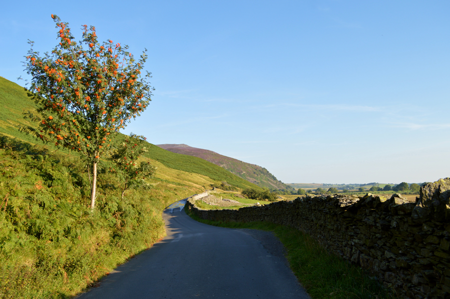 |
| Carrock Fell comes into view as I walk the narrow lane towards Bowscale. |
| |
 |
| Bowscale Hamlet. |
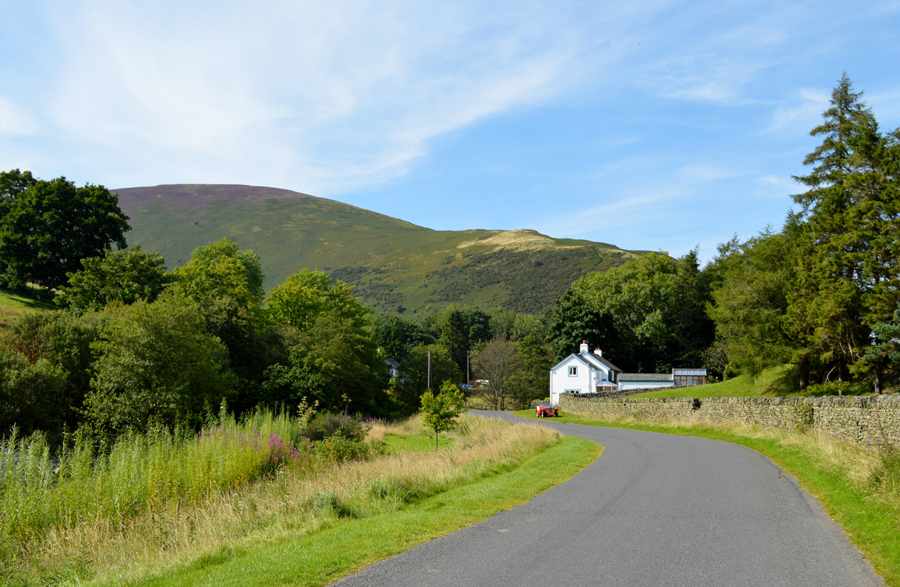
| Only two cars had passed me and I get a nod from both drivers as I stand aside to let them pass. The hamlet of Bowscale is reached where I spot a father and his young daughter who are carrying laiden packs from the direction of Bowscale Tarn, at a guess they have spent the night there and thoughts turn to the wonderful morning they had woken up to. |
 |
| Ahead, Stone Ends Farm. |
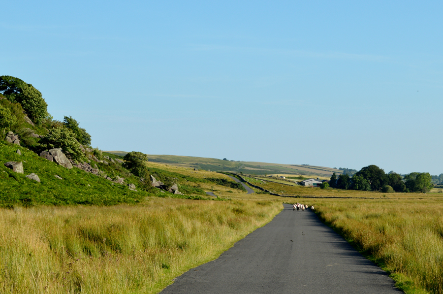
I had covered close to two miles of road walking since leaving Mungrisdale and in that time I have passed through the hamlets of both Bowscale and Mosedale flanked by Bowscale Moss and Mosedale Moss under what is turning out to be a rather hot morning. Up ahead a flock of sheep keep their distance and follow the road all the way beyond the brow up ahead, I found it quite comical that they would wait for me to get just a short distance away before making a run for it.
It's time to train the eyes onto the fell side now as I'm getting closer to my starting point marked on my map as Apronful of Stones from where the steep ascent onto Carrock Fell begins via Further Gill Syke. |
 |
| Further Gill Syke. |
I'm heading towards the bottom right of the photo from where I'll be able to pick up a narrow path which ascends steadily, then steeply towards the far left known as Further Gill Syke, the path then ascends steadily again before passing the two trees found half way up the path, the top half of the path which then ascends steeply into the fell side before cresting out on the shoulder of Carrock Fell.
I'm hoping that the path isn't too buried between the Bracken! |
 |
| Ascending towards Further Gill Syke. |
| Note, the two trees are now up ahead seen in the previous photograph. The Bracken was rather dense in places but didn't cause any issues at all. |
 |
| Phew! Looking back down from the top of Further Gill Syke. |
It may not look it but there is a good path here which runs from the bottom left towards the centre of the photograph before descending towards the two trees (which appear as one from this angle) down there on the left.
I'm still quite a distance from the summit just yet, but at least the gradient eases as I cross the shoulder of the fell. |
 |
| The unmistakable scent of Heather with extended views towards the Mell Fells. |
| I'll take the steep ascents time and time again if I am rewarded with views as good this. |
 |
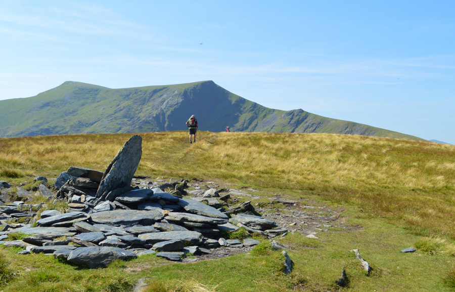
| Carrock Fell summit cairn. |
I pass a familiar ruined sheepfold found just below the summit as the gradient starts to ease right about the same time I am met by cool summit cross winds which worked wonders to help me cool down after the steep climb. From the sheepfold the summit cairn stands on a plinth of craggy rock surrounded by the ruined stone walling of the ancient Carrock Fell Fort.
The stone cairn receives a tap from my walking pole as I recall a previous visit when I experienced a Broken Spectre in the mist of winter which disappeared before I could take my camera out while on another visit I had experienced heavy snow during the month of May, today sweat is pouring down my face as I take a few moments to adjust to my surroundings, maybe with a grin etched across my face. |
 |
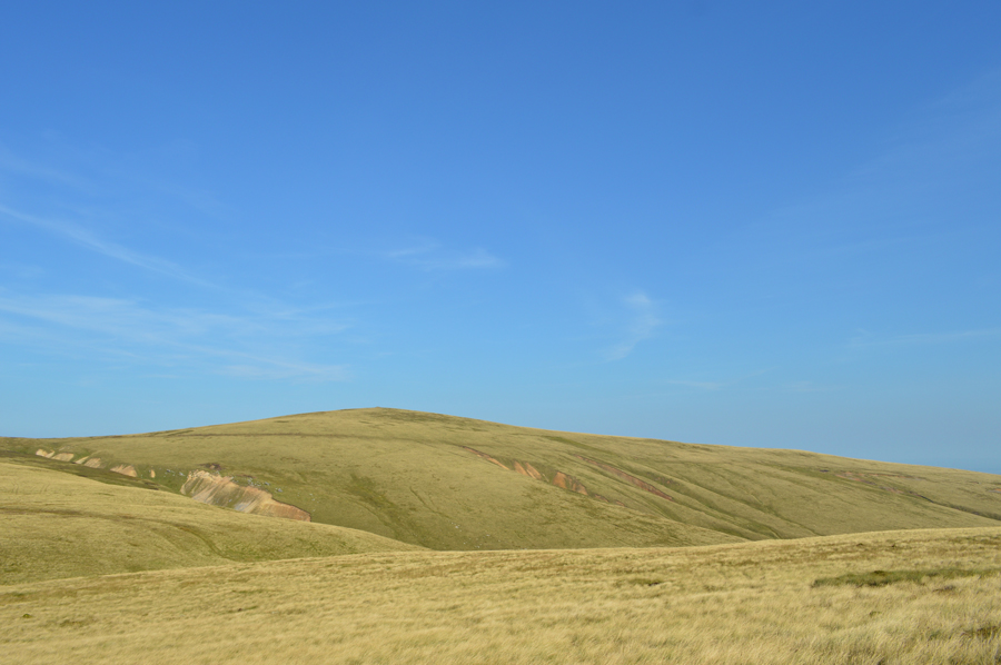
| Views towards High Pike (Caldbeck) as I descend Carrock Fell. |
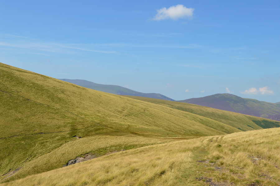
| With the descent of Carrock Fell top behind me I strike out across the ridge with a strong sun glaring on my back, the ridge appears to be pleasant underfoot but this couldn't be further from the truth as I skip, hop and jump the best part towards Miton Hill before the bogs finally give way for firmer ground with sights now set on summiting High Pike. |
 |
| Hazy views over Comb Height which extend towards Lonscale Fell, Lesser Man, Little Man, Skiddaw and finally Bakestall. |
| Incidently, I'll be descending along side Comb Height soon via Grainsgill Beck, where I'll be up close with all that lovely Heather again. |
 |
| High Pike (Caldbeck) seen over the top of Drygill Beck. |
| The contrast of the wild grasses when set against a bright blue sky was mesmerising. |
 |
| Crossing the top of Drygill Beck / Valley. |
| Okay, time to take on the gentle grassy slopes of High Pike now. |
 |
| High Pike (Caldbeck) summit. |
High Pike was soon reached where once again I had the cross winds to help keep things cool, sometimes too cool as I eased myself up the gentle grassy slope while ahead nothing but blue sky until the stone cairn appeared then shortly after a corner of the memorial bench. During the crossing of the ridge I had experienced the all too familiar dull ache from my right heel which seemed to be getting more tender and painful.
Besides my anti-inflammatories I'm also allowed to take pain killers which I was just about ready for which are stored away in a clever front zip pocket in my shorts, I guess two now should set me up for the best part of the walk washed down with a mouthful of Robinson Fruits Juice and a couple of wine gums for afters. |
 |
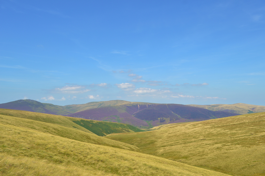
| Views over Roughton Gill towards Great Sca Fell, Little Sca Fell and Brae Fell from High Pike summit. |
| I spent more time than I should at High Pike, time spent just absorbing the place, remembering past walks whislt watching the wind blow through the wild grasses as I take one last look back at the summit before starting my descent onto the Cumbrian Way towards Lingy Hut and thereafter, the top of Grainsgill Beck. |
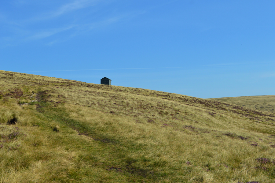 |
| Looking back on Lingy Hut as I start my descent down Grainsgill Beck. |
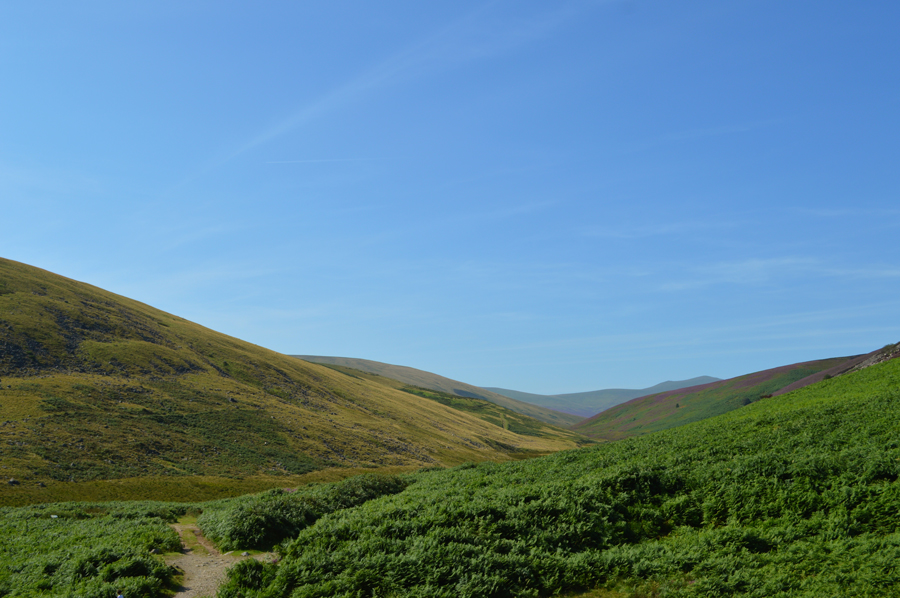
| I follow the Cumbrian Way for less than a mile taking in the views and absorbing the isolation which is disturbed by a single engine aeroplane as it flies overhead, half a dozen Herdwicks occupy the ground around Lingy Hut as I think about having a look around but my thoughts by now are occupied with a successful crossing of the Caldew, but before I get my feet wet, I need to descend Grainsgill Beck. |
 |
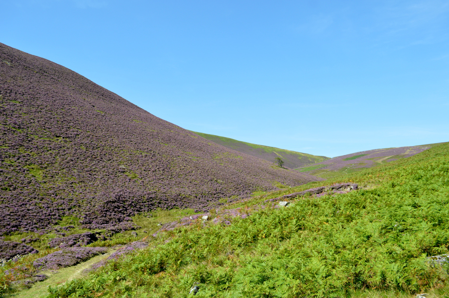
| Outstanding views along Grainsgill Beck into the Mosedale Valley. |
| The smell of the Heather was blooming fantastic! |
 |
| Stopping to look back towards the top of Grainsgill Beck. |
| My descent saw me follow Grainsgill Beck which was never far from earshot over sodden and sometimes, boulder-some ground which needed care especially where the Bracken had started to take over the path, down yonder I could see the remains of Carrock Mine while being completely unaware that I was walking over the top of its veins below my feet. |
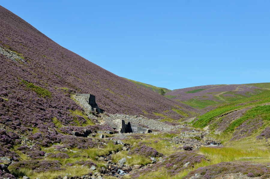 |
| Grainsgill Beck from the ruins of the World War l Tungsten Mill. |
Between 1906 - 1912 Tungsten was mined here which was used to make weapons and munitions for the British War effort, in the early days of the War the mine had been operated by two Germans William Boss and Frederick Boehm, it is understood that several 'sturdy' Cambrians captured a geologist from Geological Survey and 'roughed him up a bit' believing he was a German spy before bundling him into a local school for the night before informing the local Police.
A very interesting place that I wished I could have spent more time exploring. |
 |
| Long distant views along the Cumbrian Way towards Little Man and Skiddaw. |
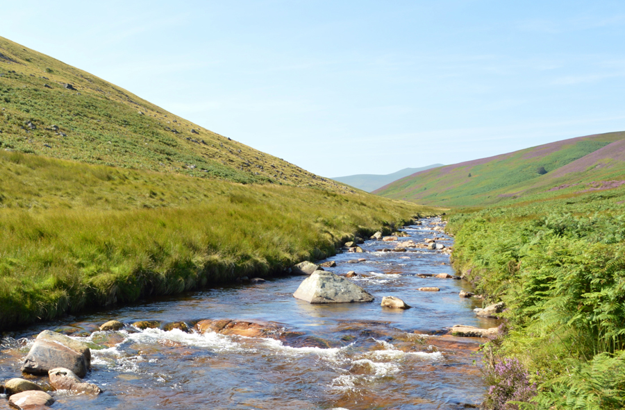
I was almost at the point where I needed to cross the River Caldew and I didn't want to waste anytime walking along its bank looking for the best place to cross which can be incredibly time consuming at a point when I couldn't afford to lose focus on Bowscale Fell north ridge, a steep ascent that had been playing on my mind since I penned the route.
I could hear, then see children playing who were wading in Grainsgill Beck whose family were enjoying a day out on the banks of the Caldew, kids being kids screamed while the adults threw stones which the family dog chased, it seemed a little intrusive of me as the spot they had picked to picnic was also the same spot I needed to cross the river, I pass two teenagers who are sunbathing and give a nod to the Dad and get one back in return. I've crossed the Caldew in this same spot on two previous occasions where the river flows at its widest and therefore, depending on rainfall, its shallowest. After de-shouldering I take my Gaiters out and place them around the bottom my legs, a great Gaiter made by Mountain Equipment which fasten just below the knee cap which had seen their fair share of action this past Winter. |
 |
| Crossing the River Caldew. |
I took this photo seconds before I lowered myself into the river from the bank watched on the family so I better not make a meal of it, the spot that I had chose to cross had a high bank and after testing the depth of the water which appeared around a foot deep, I couldn't vouch how deep it looked further across but it looked much the same with some exposed rock to negotiate by. After re-shouldering I secured my camera (just in case things went wrong) into my pack and eased myself down as I made a quick observation of the course I would take.
The first four steps saw me arrive in the centre of the river and I was a little taken back by how quick the current was by which time I could feel the water above my right Gaiter, the opposite side of the bank was just yards away and also the deepest as by now the water was seeping down both Gaiters into my boots, it all happened in what felt like seconds as I used my walking poles to get up onto the bank. Up ahead I had already spotted the area of the fell side which I wanted to start my ascent by which initially, was incredibly steep, I made for a large boulder at its base where I stop to remove the Gaiters before starting my ascent.
I could still hear the kids playing and the dog barking by the time I was ready to start my ascent, just o'yonder I spotted a wooden fence which I could see had a path by its side which abruptly continued left yet the path continued up ahead, I thow't its just as steep over there as it is here before looping my walking poles around my wrist and starting the steep climb, sometimes with my poles coming up to shoulder height which just goes to show how steep this part of the fell side actually was. |
 |
| Looking back towards High Pike (Caldbeck) from Bowscale Fell North Ridge. |
During the descent of Grainsgill Beck I had trained my eye on the most effective ascent along the north ridge which told me to keep on the Mosedale Valley side of the ridge and above Bowscale Tarn, steering towards that side of the ridge was also effective in that I wouldn't be ascending its broad expanse off course which was easy to do as initially, my view contained just grass and sky.
Using grazing sheep as marker points (please don't move) I kept a true line until the outline of the ridge started to appear, followed by the sight of Tarn Crags up ahead, it was pretty hard work but the views were plentiful and equally rewarding. |
 |
| Carrock Fell summit from Bowscale Fell North Ridge. |
| |
 |
| Views into Mosedale towards Carrock Fell. |
| |
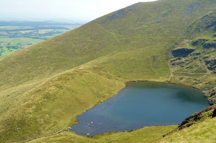 |
| A short detour from the ridge sees views over Bowscale Tarn. |
| Two walkers appeared along the ridge but not from the path which ascends from Bowscale Tarn, instead they had ascended much lower down the ridge and asked me was this as good as the path gets? I'm not quite sure what they were expecting and I'm sure they didn't mean it in a bad way as I replied yes, this is as good as the path gets all the way towards Bowscale Fell summit, my thoughts however, were just thankful that I was on the path after that long pathless ascent whilst training eyes on sheep and navigating around the bogs, this path was like heaven to me! |
 |
| Blencathra from Bowscale Fell summit cairn. |
By the time I reached Bowscale Fell summit I was ready for a quick rest which I used to re-adjust myself as for the last half hour or so my shorts had started to fall down and my midlayer had started to ride up my back which I find really annoying.
I de-shouldered and used the front of my midlayer to wipe my the sweat from face which exposed my stomach to a cool wind, ahhh...it was like that first pint on a warm summers evening.
After adjustments I re-shoulderd and started to make the short descent before crossing the top of Bannerdale Crags where I could see two walkers heading towards me, and two solo walkers making an ascent on Bannerdale Crags summit which is where I'm heading next. |
 |
| Bannerdale Crags and Bannerdale Crags East Ridge with Souther Fell in the distance. |
| |
 |
| Looking back towards Bowscale Fell as I cross the top of Bannerdale. |
| Despite the glorious sunshine it was still notoriously boggy below Bowscale Fell, a taster of things to come. |
 |
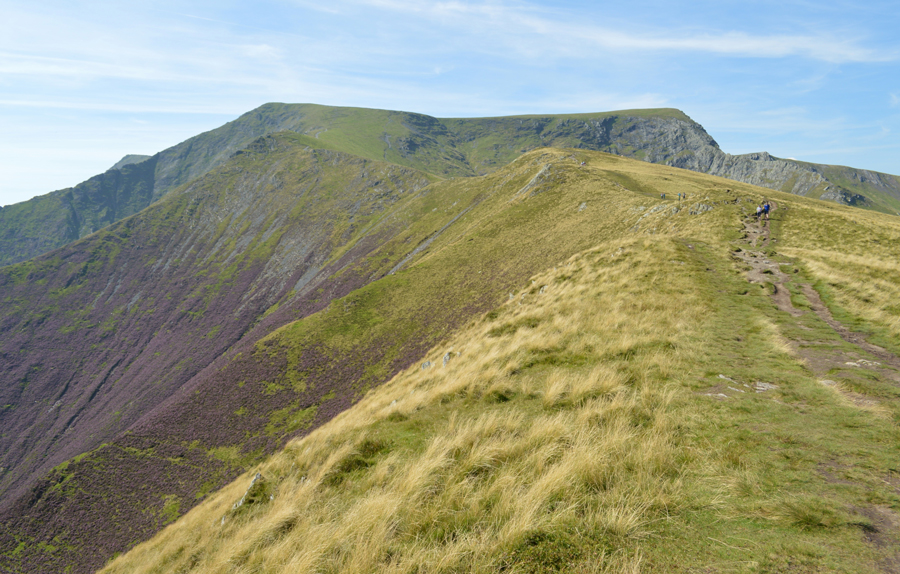
| Blencathra and Sharp Edge from Bannerdale Crags East Cairn. |
I arrived at the summit about five minutes after the walker you see in the photo who had stopped to rest before re-shouldering as I arrived, we shared our hello's and I leave soon after taking a photo from the east cairn and not from the actual summit cairn found a hundred yards further west as I could see and hear children at the main summit.
I press on passing the mother and children who are by now sat down looking at a map and appearing to decide where to go next. |
 |
| Descending towards Glenderamackin Col. |
| I followed the chap who I had just spoke with while at Bannerdale Crags who descends further into the Glenderamackin Valley seen here on the left. Up ahead is the path that I will use to reach Mungrisdale Common which doesn't appear from here, but it's incredibly wet and boggy. |
 |
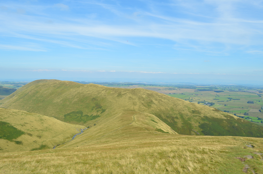
| Views over Blackhazel Beck towards Great Calva, Knott, Comb Height and High Pike. |
From Glenderamackin Col I pick up the path which I have to say, has exceptional views over towards the northern fells as High Pike starts to look quite a distance away. Up ahead I follow a faint path where I am slowed down for the first time during the walk by marshy bog which after a short time started to seep through my boots and get my socks wet, at a time when they had only just started to feel dry again after crossing the River Caldew hours earlier.
Bugger! |
 |
| Blencathra, Atkinson Pike and Bannerdale Crags from Mungrisdale Common summit. |
I had passed; who appeared to be two elderly brothers whilst on the path and hello's are shared. I must say that despite the general boggyness of the area you really feel isolated and away from the crowds which really appealed to me during my time on the path. Soon two more walker leave the summit of Mungrisdale Common and head towards the Cloven Stone which gave away the summit location if an otherwise flat landscape before the tiny dot of the summit cairn appeared just yonder.
I can hear voices but I can't see where they are coming from until the sight of the woman and her children who I had seen on Bannerdale Crags just earlier appear further behind, I could only guess from the childrens voices that they were enjoying the bogs much more than their mother! |
 |
| Blencathra and Atkinson Pike from Mungrisdale Common. |
Had the ground not been as wet as it was I would have sat down if only to absorb it all in, it was just so peaceful and commanded more viewing time but unfortunately this wasn't to be the case, that's if I didn't want a wet backside.
I strike out feeling the burn with heavy boots underfoot, it's no surprise that I've probably lost a pace or two just due to conditions underfoot, I look back and see that the mother and her children had arrived at the summit then I spot a fell runner walking hands on hips towards me, after a short while he catches me up half walk, half run and says "bet you didn't think it would be this wet when you set off" aye I say, followed with a tiring smile, he trots on and reaches the small stone shelter found between Atkinson Pike and the top of Foule Crag, me, I'm still wavering behind looking on quite envious but soon I too reach the shelter all the while cursing those bloody bogs.
I don't look back and start the ascent on Blencathra via a series of steep zig zags as I'm met by a perfectly timed summit wind. |
 |
| Blencathra summit is just up ahead as I pass the Stone Cross. |
| With walking poles flared outwards I strike towards the summit and I can swear that every once in a while I can see my breath as a cool chill descends which I dont quite recognise as my lungs are still recovering from the ascent. Up ahead the summit is looking very busy as I remembered that two of my Facebook friends had posted the evening before that they too, are heading up Blencathra today although the hopes of seeing them are pretty slim. |
 |
| Skiddaw Little Man, Skiddaw and Bakestall from Blencathra summit Tarn. |
| |
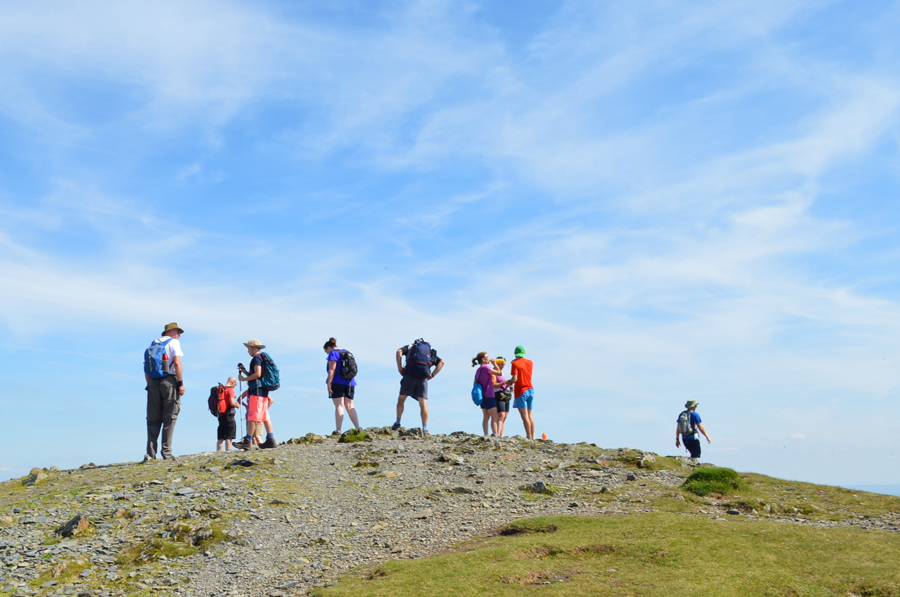 |
| Blencathra summit was pretty busy today. |
After a quick look around I couldn't spot Simon and Andy and found myself a spot to eat a late lunch which over looked Knowe Crags and Middle Tongue, I could still see walkers in their masses heading up via Knowe Crags which left the summit feeling exceptionally busier, possibly the most crowded I've ever seen it which just proves Blencathra's popularity.
I receive a text from Simon which read "On our way from Cloven Stone, Andy and Simon" which was sent over a hour eailer, I could only assume that they had summited and left by now.
An elderly couple pitch down besides me and break out lunch and through no fault of their own the summit is starting to get a little claustrophobic for my liking and I decide to pack up lunch and start my descent via Scales Fell, after all, this walk isn't over just yet as I still have one more summit to visit. |
 |
| Descending Scales Fell. |
| Fed and watered I re-shoulder my pack and begin the long descent via Scales Fell firstly crossing the top of the Doddick Fell ridge which can be seen in the foreground. |
 |
| Scales Fell and the Doddick Ridge with Doddick Gill far below |
| |
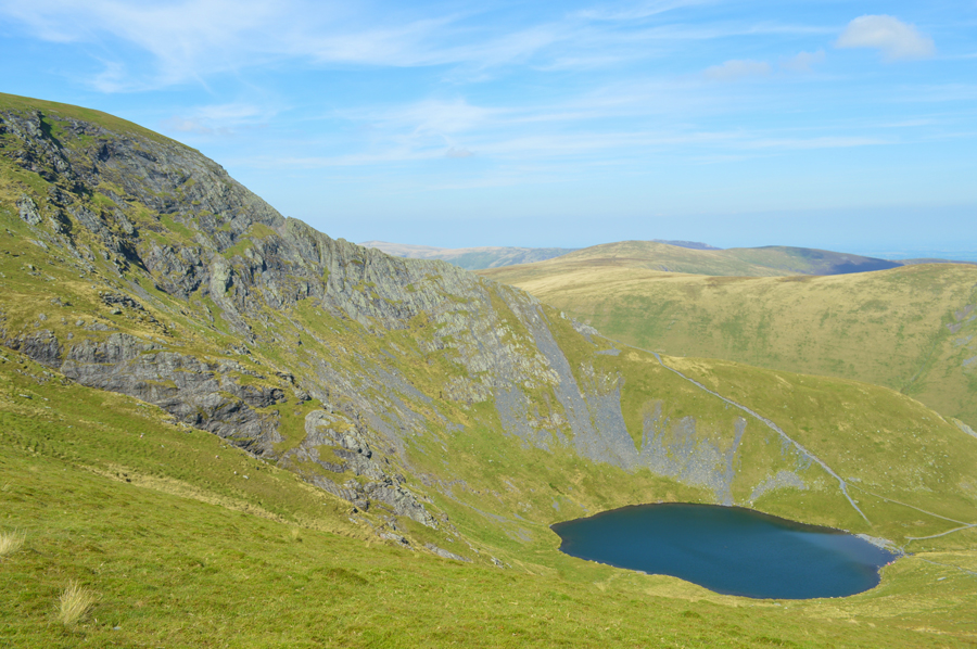 |
| Sharp Edge and Scales Tarn. |
| Despite the near perfect conditions I couldn't see anyone on Sharp Edge today but around Scales Tarn it was still quite busy. |
 |
| Stopping to look back towards Blencathra summit, the top of the Doddick Ridge, Foule Crag and Sharp Edge. |
| |
 |
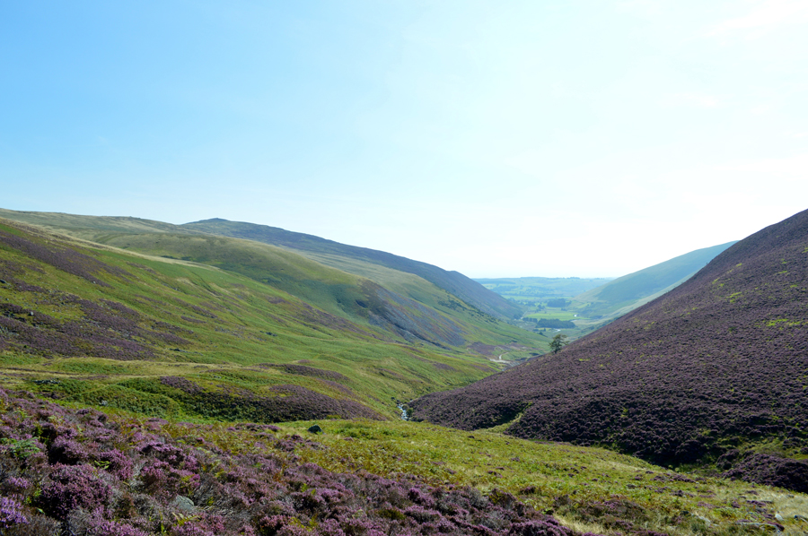
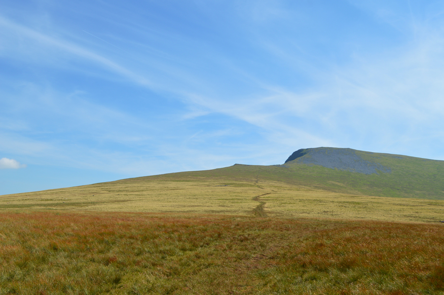
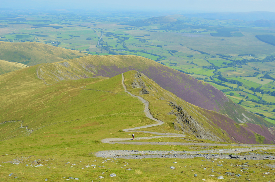
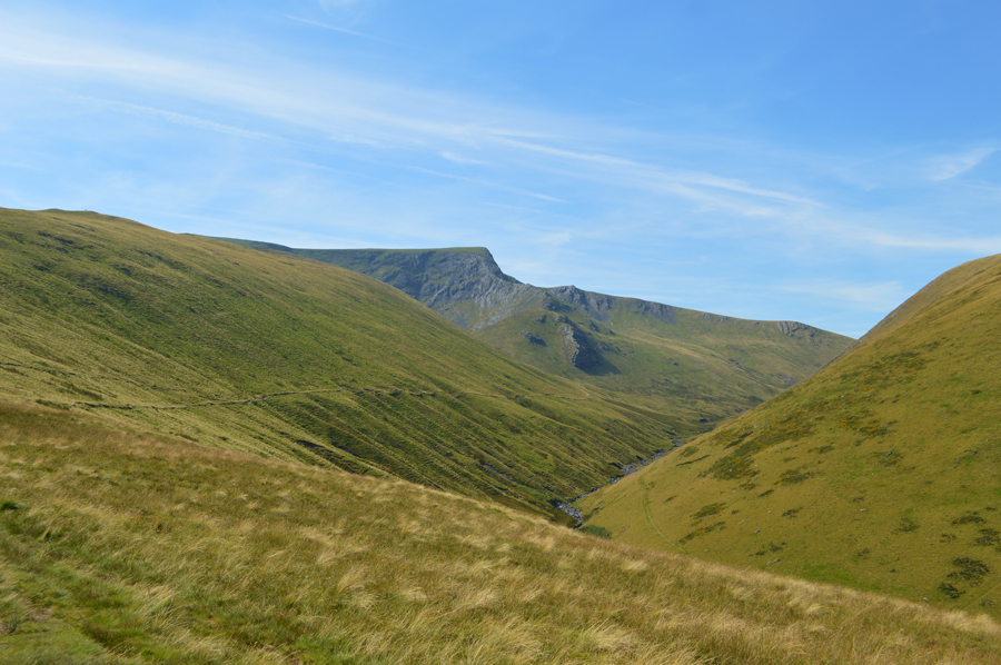
Souther Fell seen over Mousthwaite Comb seen as I descend Scales Fell. |
The smooth grassy descent that Scales Fell provided helped ease any aching limbs and more importantly provided cushioning to my heel which had started to feel a tad uncomfortable underfoot.
Ahead and over the summit of Souther Fell I spot two Paragliders using what little wind was about, they didn't seem to gain any real height before disappearing behind the flank of the hill side. |
 |
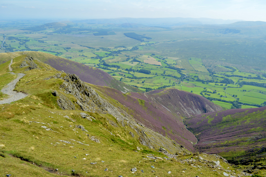
| Sharp Edge seen over the Glenderamackin Valley. |
| With the descent of Scales Fell behind me I cross Mousthwaite Comb under a scorching afternoon sun, so much so I am left holding my baseball cap in my hand purely because it's just too hot to keep on my head, I guess I just needed to sweat this last ascent out of me no matter how small. |
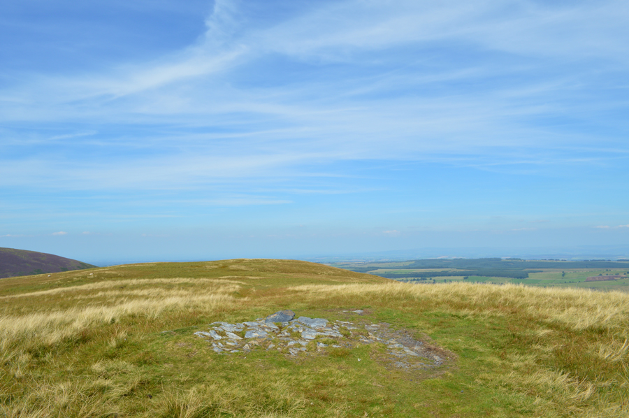 |
| Souther Fell summit. |
I crested the shoulder of Souther Fell with exceptionally clear views over White Horse Bent and Bannerdale Crags east ridge while beyond, I could still see walkers on Bowscale Fell summit. Further ahead, beyond the undulating grassy mounds the summit of Souther Fell appears as I am forced around the familiar bogs which make up its ridge, down to my right flank I can see the canopy of one paraglider which takes off after minutes of observation, however I'm not feeling too confident as I don't see it again after seeing it make a series of slow turns as the glider descends, I'm a little concerned and spot nothing for a few moments only to see it reappear further back down the fell side were it appears to have made a controlled landing onto the fell side.
I soon arrive at the summit and look back towards the Coledale Fells which appear through a shimmering haze as does Clough Head which is much closer despite the fine clarity further north. I tap the stones with my walking pole and strike out towards the northerly end of the ridge from where I'll start the steep descent back to Mungrisdale. |
 |
| Descending Souther Fell towards Mungrisdale. |
The warning sound of a tractor reversing brings my walk back into reality and so too did the sight of my car roof as I make the sometimes steep descent back to Mungrisdale, there are up to three rock steps that require negotiating before I reach the end of ridge all under the gaze of the visitors to the Mill Inn who sit outside on large wooden tables. |
 |
| Mungrisdale. |
From the base of the ridge narrow path flanked by the River Glenderamackin steers me towards Low Beckside where I cross the river and start to make my way back to the car as I go over in my head my kit down procedure which I find I have to do more and more often after tiring myself out on the fells.
I open the boot and feel the heat escaping then open both doors on the near side before throwing my gear into the boot making sure I haven't left anything behind, but before I switch the car's air conditioning on I have a better way of cooling down as I make my way down the river bank where I spoon handfuls of the Glenderamackin over my face before drinking from cupped fist. |
|
| |
| Back to top |
 |
|