|
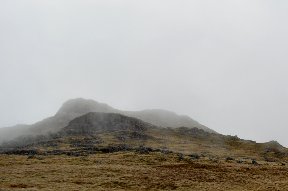
Harrison Stickle and High Raise from Great Langdale |
 |
 |
10th December 2016 |
 |
|
It's that time of year again when we all get together with work our colleagues and hold the annual Christmas do. This year as was the last our Christmas do was held in Manchester which is where most of my colleagues live with the exception of myself and a few others who might as well live in the next galaxy owing to the time it takes me to get to work each morning which can be anything from an hour and a half to two hours, yes that's two hours each way staring at the longest line of brake lights your ever likely to see, which can have its advantages because this is where I plan walks like todays.
The last time I walked the Howe Pike ridge in order to gain Harrison Stickle was back in February 2015 which doesn't seem that long ago but it's almost two years and that's two years too long. I remember thinking how delightful the ridge was with fantastic views over Dungeon Ghyll, Thorn Crag and of course the summit of Harrison Stickle, it would seem I'm not the only one who's keen on the route after hinting to my walking pal Rod in a e-mail earlier this week what I was upto who then returned my email with a hint of jealousy that it was also one of his favourite routes and, if the rock is dry enough ascent can be gained via the Ghyll itself where many a scramble can be found, good scrambling.
Unfortunately after a night of rainfall this wasn't to be the case but that isn't to say that I didn't enjoy a great mornings work while taking on one of Lakelands most distinctive peaks. |
|
| Wainwright Guide Book Three |
 |
| The Central Fells |
-Harrison Stickle
But let nothing derogatory be said of Harrison Stickle. The majesty of masculine strength of the Langdale front is itself quite enough to establish the fell as a firm favourite with all, even with those admirers who are content to stand on the road below and gape upwards. |
 |
|
|
|
| |
|
Overview |
|
|
| Ascent: |
2,752 Feet - 839 Meters |
| Wainwrights: |
4, Harrison Stickle - Thunacar Knott - Haigh Raise (Langdale) - Sergeant Man |
| Weather: |
Dry And Overcast, Breezy Over The Summits. Highs of 11°C Lows of 9°C Feels Like 2°C |
| Parking: |
Parking Spaces - Rossett Bridge - Great Langdale |
| Area: |
Central |
| Miles: |
6.5 |
| Walking With: |
On My Own |
| Ordnance Survey: |
OL6 |
| Time Taken: |
3 Hours 45 Minutes |
| Route: |
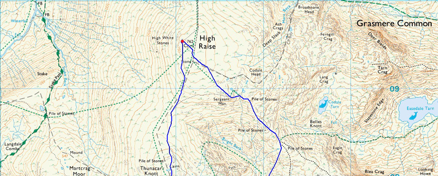
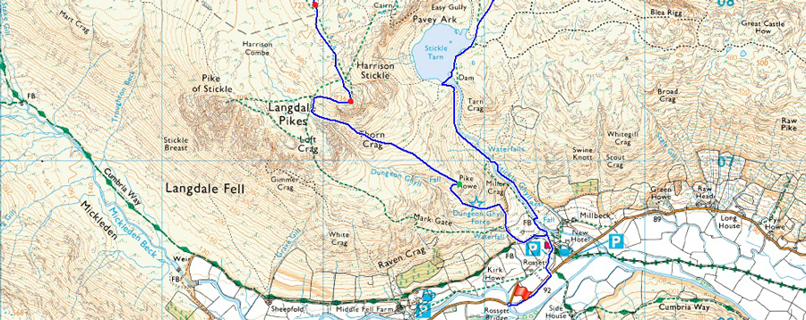
Rossett Bridge - New Dungeon Ghyll - Pike Howe - Dungeon Ghyll - Harrison Stickle - Thunacar Knott - High Raise (Langdale) - Segeant Man - Stickle Tarn - Stickle Ghyll - New Dungeon Ghyll - Rossett Bridge |
|
| |
|
Map and Photo Gallery |
|
|
  |
| |
| |
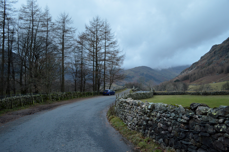 |
| The Band from Rossett Bridge, Great Langdale 08:15am 9°C |
I had driven through darkness and dawn still hadn't broke by the time I arrived at Rossett Bridge at around 08:00am. From the drivers seat I sat and watched the cloud which clung to the Crinkles, it was the same scene above the Mickledore valley as the same cloud base obscured the slopes of Bow Fell but thankfully the cloud was contained around the higher summits and not the Langdale Pikes whose peaks for now, are clear and remain to dominate the Great Langdale valley.
After five minutes (yes just five minutes) I started to become restless being the sort of bloke who isn't good at sitting still I started to kit up behind the car. Despite it nearing into double figures the wind causes the temperature to feel much cooler than it actually is although not cold enough just yet for hat and gloves. After adding my Gaiters I shouldered my pack before striking out towards New Dungeon Ghyll Hotel all the while peering over the top of a stone wall at my route ahead. |
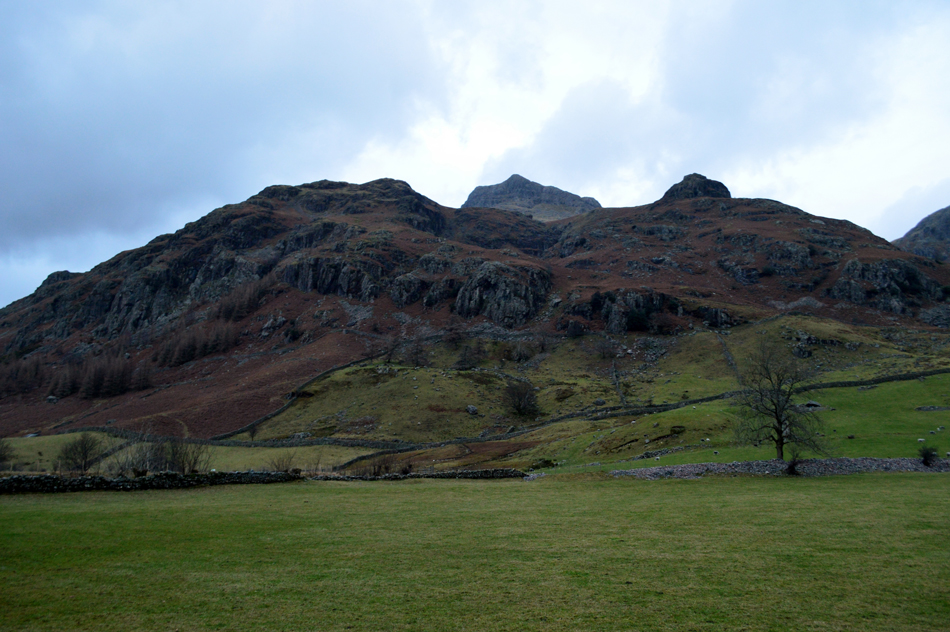 |
| Raven Crag, Pike Howe and Harrison Stickle from New Dungeon Ghyll Hotel. |
| Todays route of ascent will be via the Pike Howe ridge seen over on the right but in order to reach the start of the path I need to pass through New Dungeon Ghyll car park. |
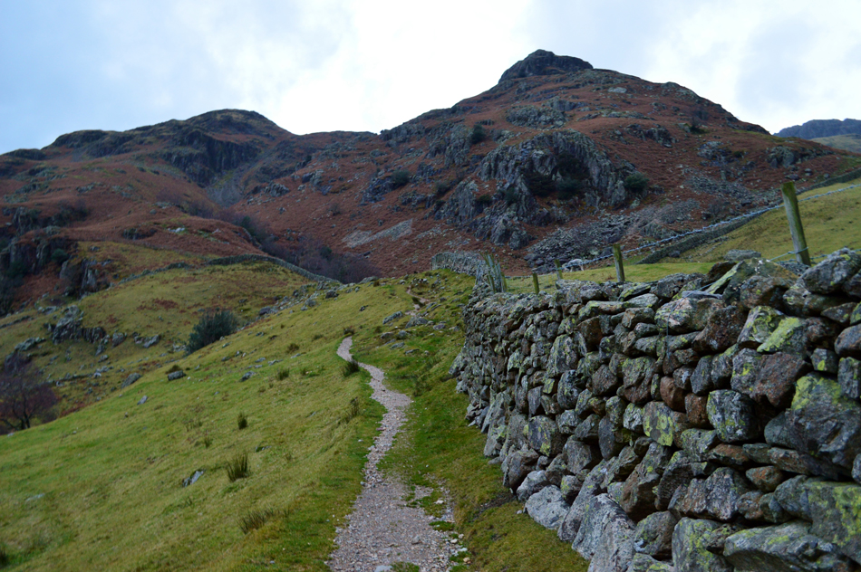 |
| Thorn Crag, Dungeon Ghyll, Miller Crag and Pike Howe. |
From the road I enter an almost deserted New Dungeon Ghyll car park with the exception of a camper van which was the same van I followed into Great Langdale from Elter Water. There are two paths which gain access to Dungeon Ghyll from the car park one of which was the first one I passed at the entrance which appeared saturated after the previous nights rainfall which saw me continue on towards a well worn path at the rear of the Hotel and after a steady start, I reached the stone wall as views of Pike Howe open out.
My route will see my pass below Miller Crag (seen lower right) before picking up a stepped path which follows the course of the ridge all the way towards Pike Howe summit. |
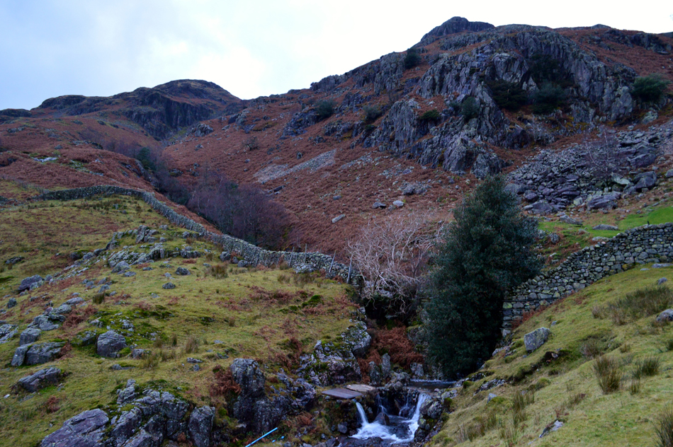 |
| Lower Dungeon Ghyll ravine, Thorn Crag, Miller Crag and Pike Howe. |
| After passing through a gate in the wall I head right. |
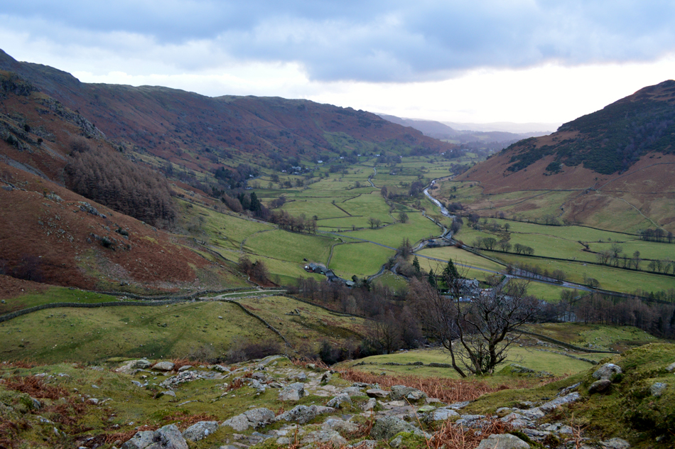 |
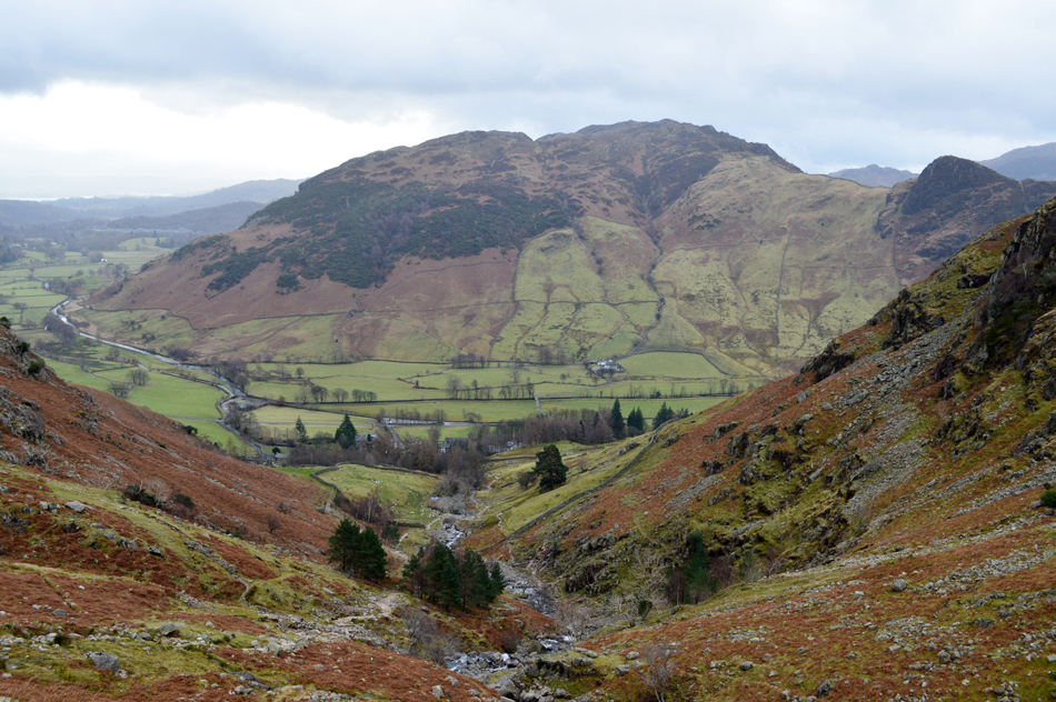
| Views over New Dungeon Ghyll Hotel into Great Langdale. |
The path is at first narrow and has grass and loose scree underfoot which rises steadily while flanking the stone wall, soon you are left with the options to continue ahead towards Stickle Tarn via Stickle Ghyll or head left as I did from where the stone staircase rises steadily as views open out over the Great Langdale valley.
Talking of Great Langdale, it sure feels very quiet in the valley this morning at a point when I can still see that my car is the only one occupying the parking spaces at Rossett Bridge. |
 |
| Views towards Mark Gate from the path. |
The morning light hadn't altered and remained the same since leaving the car well over half an hour ago despite the suns efforts to break though the cloud all it could muster was a tinge of orangy red afterglow through a gap in the cloud. The forecast was for sunny spells throughout the morning but I wasn't holding out much hope now.
Despite the mild air and lack of frost underfoot todays walk really has a 'Winter feel to it' brought on purely because of the low light. |
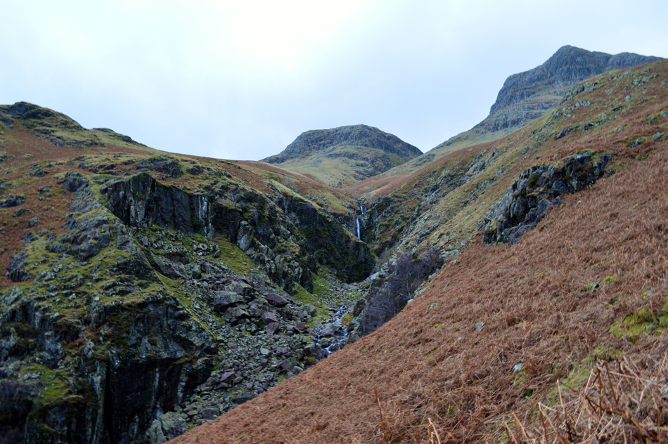 |
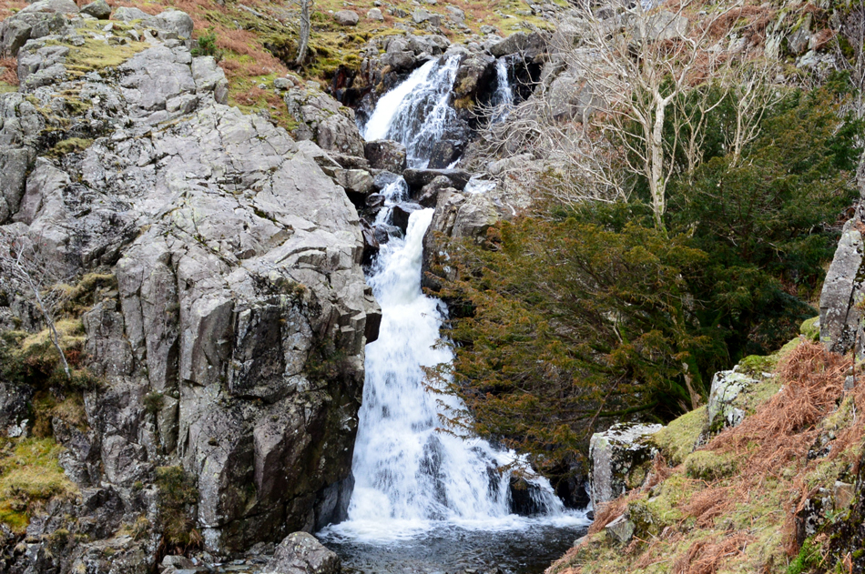
| Thorn Crag and Harrison Stickle seen domineering Dungeon Ghyll middle ravine. |
As far as impressive views go no matter the conditions you aren't going to get as impressive as Dungeon Ghyll middle ravine. It was here I stray off path just below the summit of Pike Howe from where I peer down into the ravine which is steeply flanked on both sides by almost vertical rock. Meanwhile up ahead I get my first view of the Waterfall which falls into a rock basin below, it's no wonder that this route is so popular with views as impressive as this. |
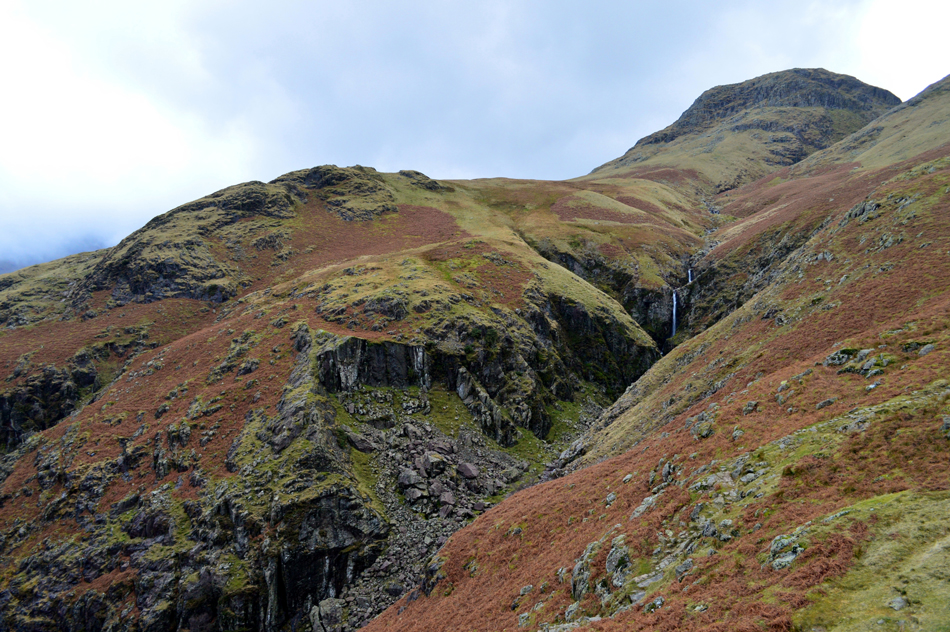 |
| Thorn Crag and Dungeon Ghyll middle ravine. |
| |
 |
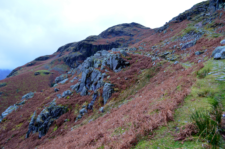
| Pike Howe summit. |
| After straying back onto the path I spotted a faint grassy trod which lead directly towards base of Pike Howe summit which in actual fact was a worn short cut, from the base of the craggy outcrop which gives the Pike its identity I begin to take in the views over Little and Great Langdale all the while the cloud which was lingering over the head of the valley is now starting to stray over the adjoining valleys but for now, Harrison Stickle remains cloud free, in fact there's even a hint of blue over the summit. |
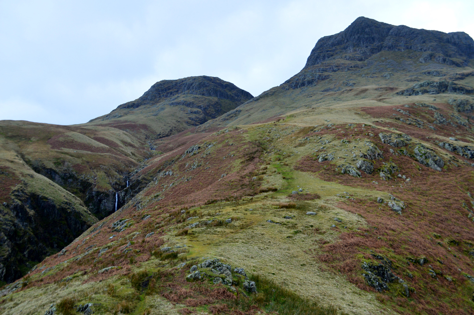 |
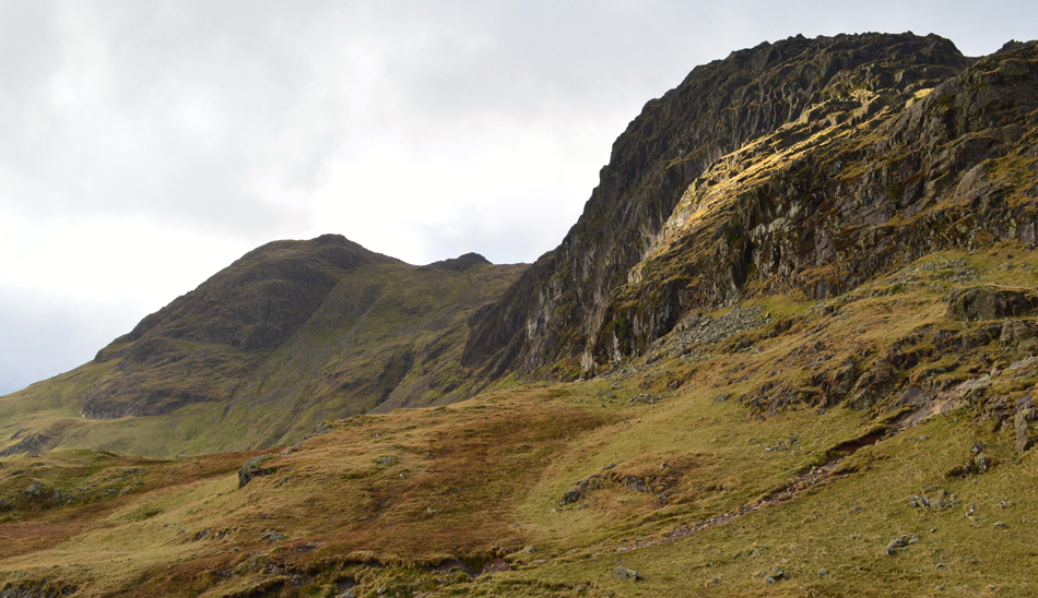
| Thorn Crag seen with Harrison Stickle |
| The path now steers steadily towards the gap between both summits known as Dungeon Ghyll upper ravine, this section of the walk between Pike Howe and the upper ravine was a fantastic highlight from the walk. |
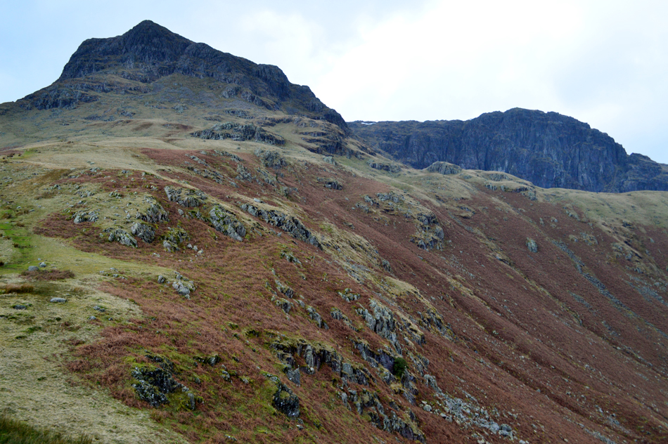 |
| Harrison Stickle seen with Pavey Ark. |
| |
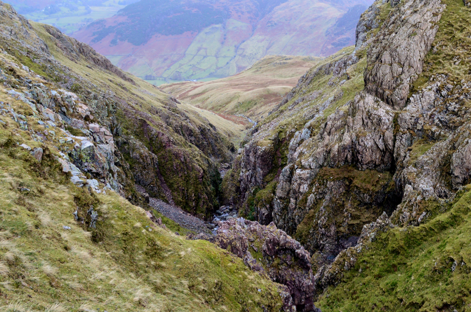 |
| Dungeon Ghyll upper ravine. |
| After following the grassy ridge I reached the scree section prior to the upper ravine. This section of the route can at times feel a little exposed as views fall steeply into Dungeon Ghyll below. Here many a walker has worn away two paths, one upper and one lower and are roughly both as prominent as the other. Today I decide to use the upper path for no particular reason other than the last time I was here I used the lower path. |
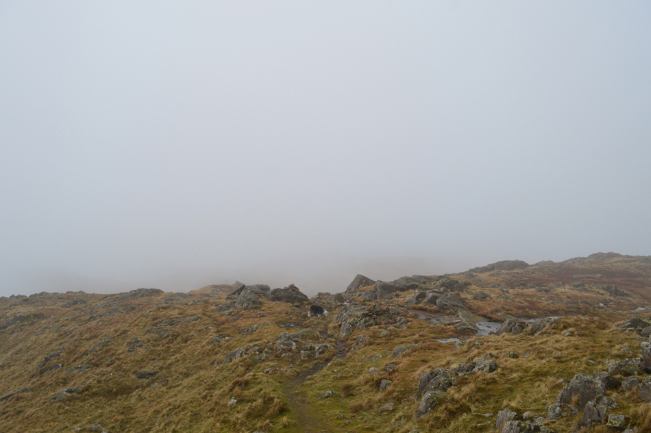 |
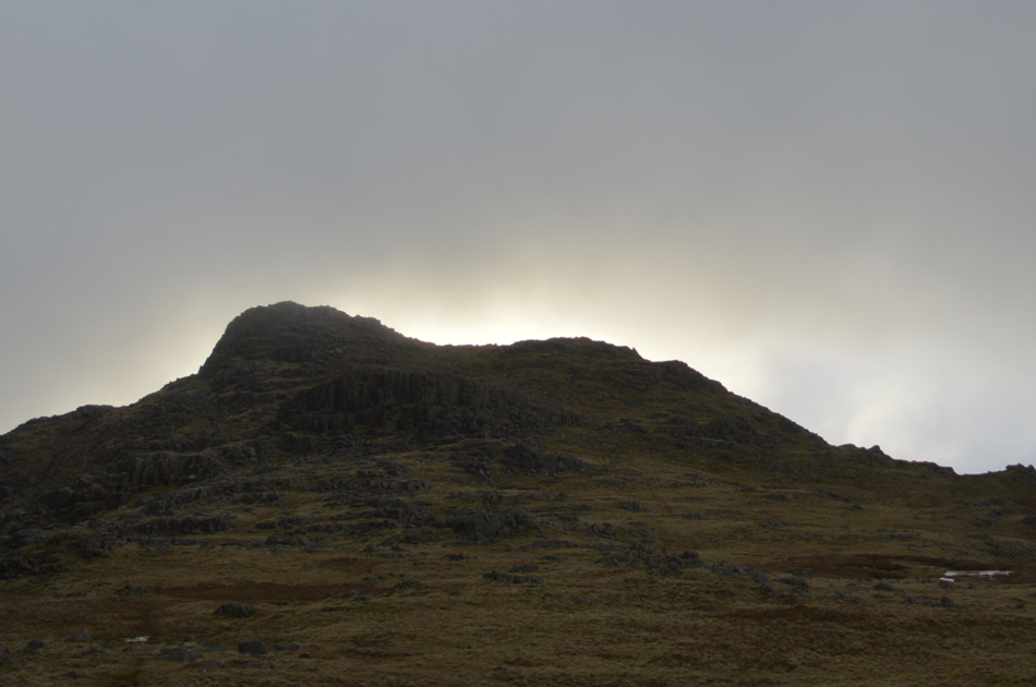
| Harrison Stickle summit shoulder. |
After taking in the views from the Upper Ravine I entered Harrison Comb which was cloud free although beyond Loft Crag and Pike O'Stickle the cloud still lurked above Bow Fell and the Crinkles. With this in mind I decided to head for the summit timing myself at twelve minutes from Harrison Combe to the stone cairn by which time the cloud which had been pushing into the valleys had made its way over Harrison Combe and soon took the summit with it although at least, I could see the brightness of the sun trying to pierce through the cloud which sadly, wouldn't amount to much. |
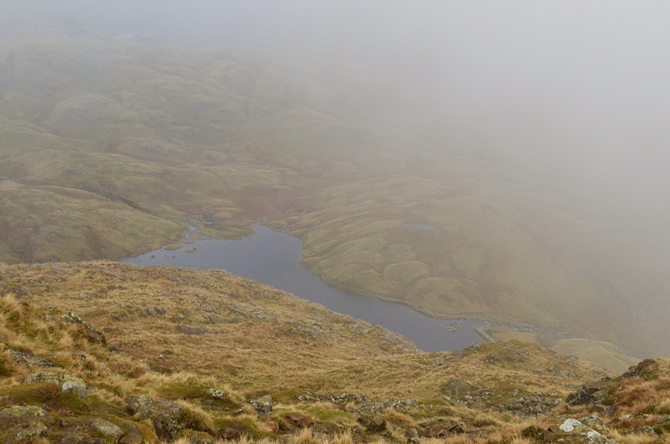 |
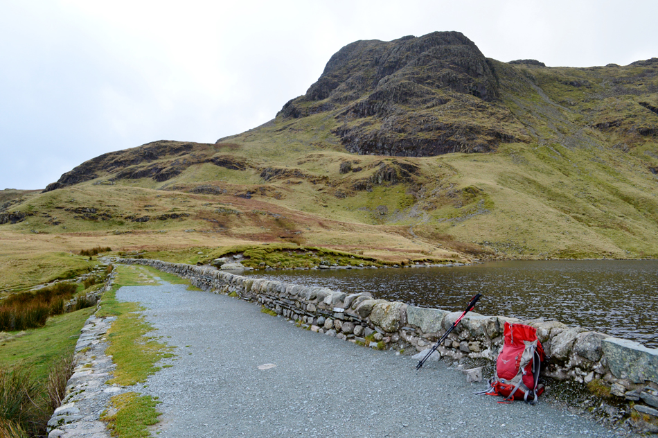
| Stickle Tarn from Harrison Stickle summit. |
I figured my hands had stood the chill long enough so while at the summit I de-shouldered and eased my chilled fingers into what felt like gloves that had been microwaved! It's cold, yet despite my beanie being tucked away in my map pocket I let my ears feel the chill, after all it wouldn't be a Winter walk if you didn't have cold ears and a leaking nose.
On reaching the stone cairn low cloud was still obscuring my views so I plotted where to head to next, had Loft Crag and Pike O'Stickle not been below cloud I would have summited both and descended back to the valley via Mark Gate but my options are now a little more limited so I choose to head to Thunacar Knott and High Raise instead, both worthy summits of those I decided against. |
 |
| Descending Harrison Stickle with views over Harrison Combe towards Loft Crag and Pike O'Stickle. |
| |
 |
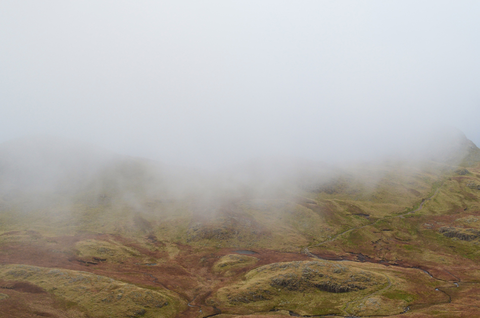
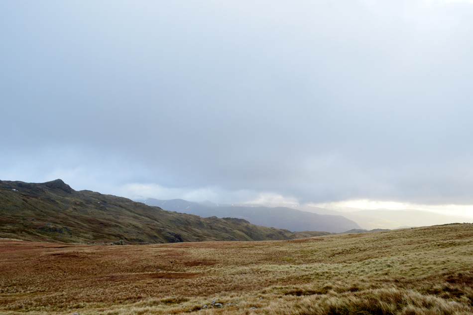
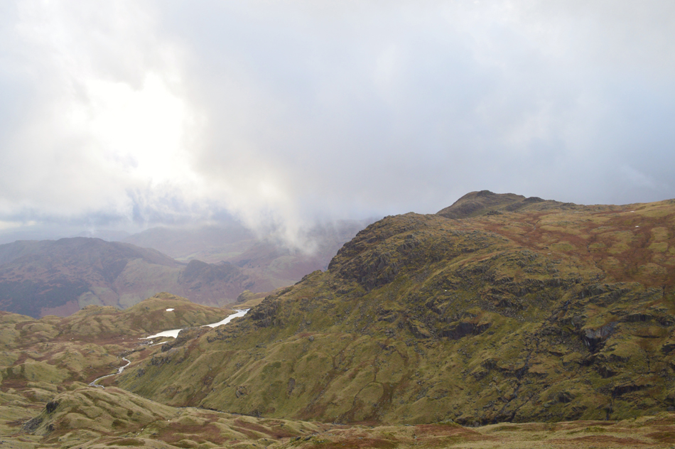
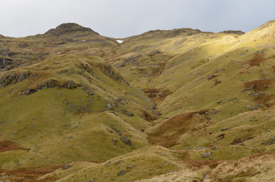
| The Glaramara ridge from Harrison Stickle. |
| The cloud started to partially clear during the descent revealing the distant summit of Glaramara seen over the Langstrath valley. At around 2,330 ft I decided rather than to descend towards Harrison Combe I followed a faint path which maintained a constant altitude towards the northern tip of Harrison Combe which eliminated any need to descend and re-ascend. |
 |
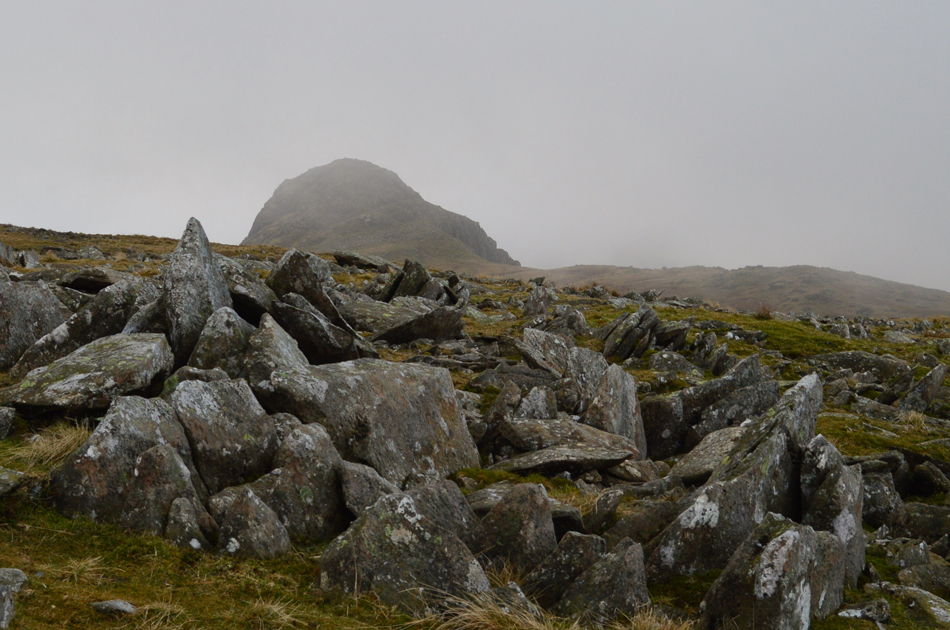
| Looking back on Harrison Stickle as the cloud starts to clear. |
| |
 |
| And even a slight show of light. |
| |
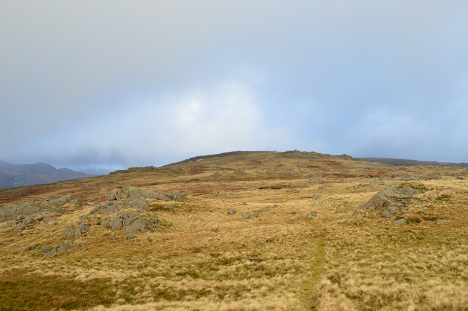 |
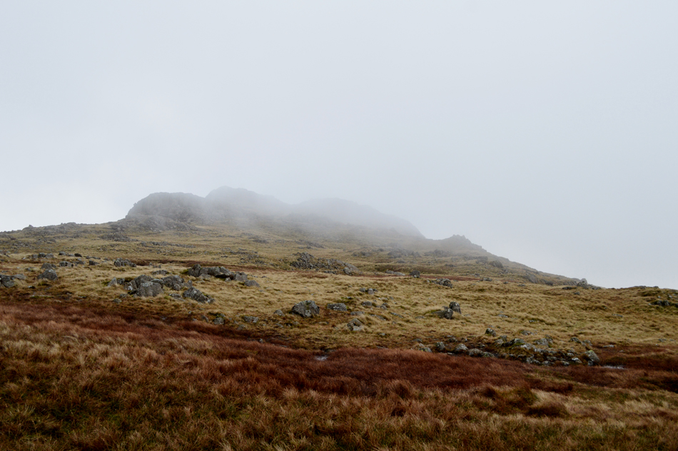
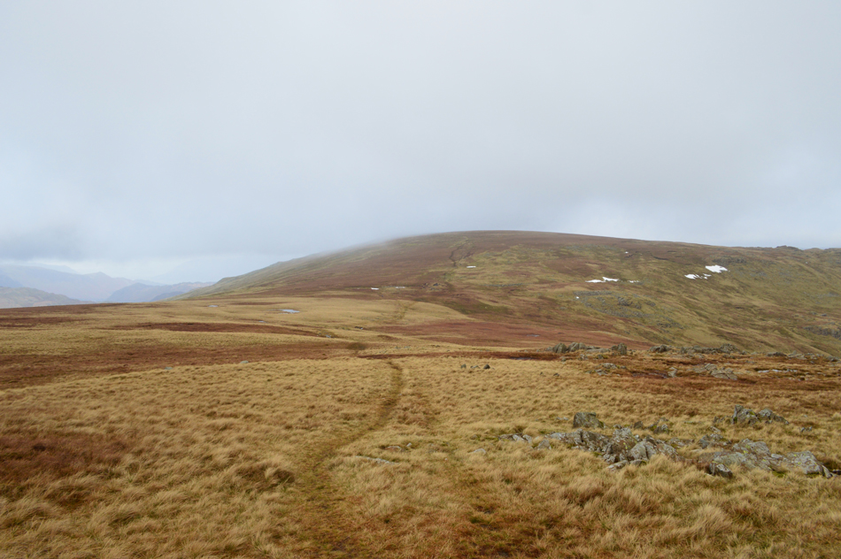
| Thunacar Knott is just ahead. |
| Not quite time to add the shades just yet but rewarding all the same. |
 |
| Pike O'Stickle from Thunacar Knott summit. |
| I hadn't been at the summit long when I heard a half a dozen footprints tramping over swollen ground, it was a fell runner who passes with a cheery 'morning' as I watched him fade into the low light and on towards High Raise which is where I'm heading next. |
 |
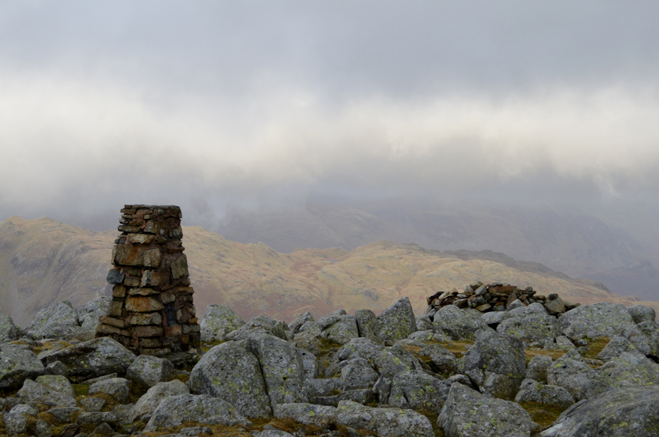
| High Raise (Langdale) |
I felt quite privileged to be on this particular section of path despite summiting Thunacar Knott and High Raise a number of times usually I would also summit Pavey Ark thus missing out on this short section of path between here and the last push towards the summit.
I'm going to make sure I enjoy these next five minutes or so. |
 |
| Views extend towards Sergeant Man with Nab Scar, Heron Pike and Great Rigg beyond. |
| It is here I finalise todays route with a summit on Sergeant Man before descending back to Stickle Tarn. |
 |
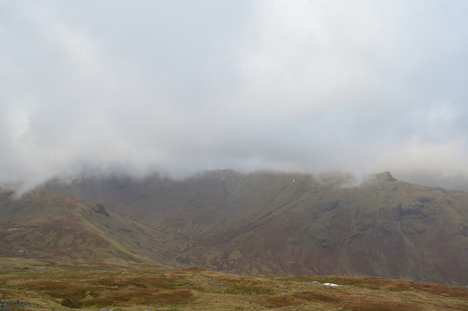
| Bessy Boot (Rosthwaite Fell) from High Raise (Langdale) |
| I have always held a special fondness for High Raise as it will always be remembered as one of my first solo Winter walks that day from Grasmere via Blea Rigg. My view although hazy was as distant as Bassenthwaite or less than a hundred yards as the cloud shifted and changed rapidly, through a gap in the cloud the top of Honister appears over Rosthwaite Cam but before I could reach for the camera, it had gone again. |
 |
| The Langstrath Valley from High Raise (Langdale) |
| |
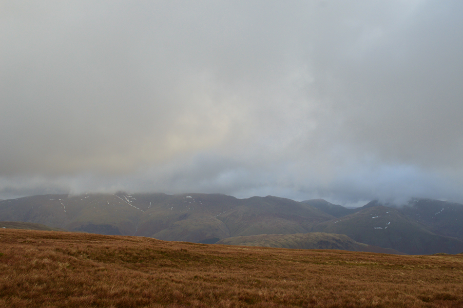 |
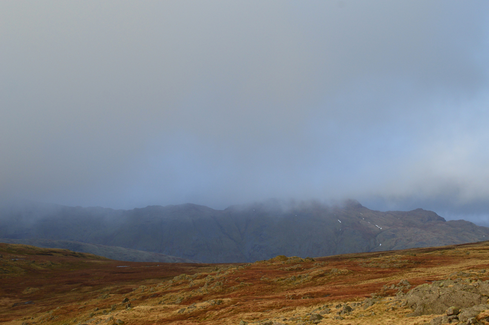
| Views over Steel Fell towards Fairfield, Dollywagon Pike, Nethermost Pike, Helvellyn and Lower Man. |
| |
 |
| Views over Bright Beck towards Stickle Tarn, Pavey Ark and Harrison Stickle from Sergeant Man summit. |
| After leaving High Raise summit I followed a faint grassy trod lined via a series of old fence posts, during which time three walkers top out on Sergeant Man summit which is quite a small area of ground, I expected it to be quite crowded by the time I arrived but minutes later they were ready to leave after adding layers, I managed a few moments at the summit taking in the views over Pavey Ark all the while watching the clouds hurry across the sky. |
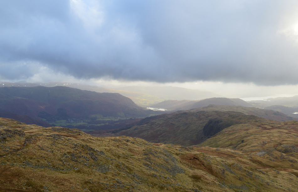 |
| Blea Rigg, Silver How, Loughrigg Fell, Nab Scar, Heron Pike, Grasmere and a distant Windermere from Sergeant Man summit. |
| |
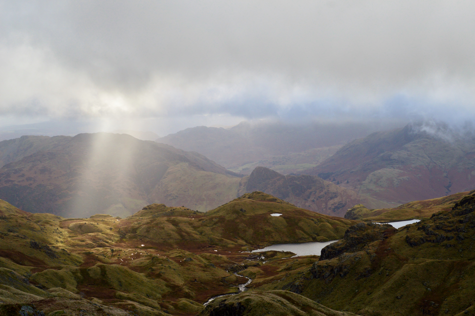 |
| "Angels torches" |
| It's not quite lunch time yet and with only a cereal bar inside of me for breakfast I reckon I'll stop for an early lunch back at Stickle Tarn where hopefully it might even start to brighten up. |
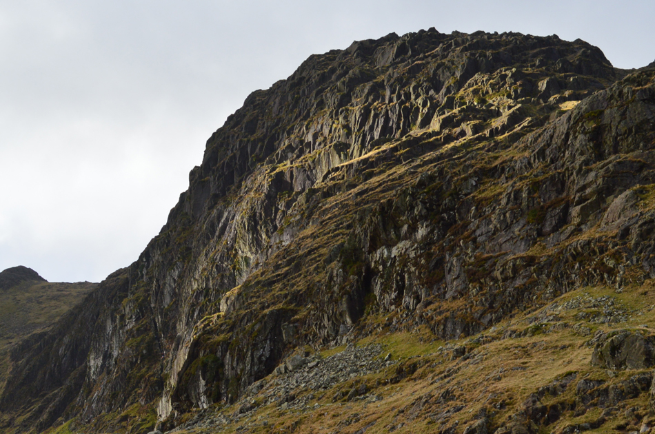 |
| Sunlight captured on Pavey Ark. |
| |
 |
| Now seen with Harrison Stickle which is now completely cloud free. |
| |
 |
| Stopping to look back over the morraines towards Sergeant Man and the odd patch of snow. |
| From Sergeant Man summit I descend at times steeply but manage to maintain a good pace while passing two couples making their own ascent on Sergeant Man, 'Mornings' are shared by which time it's starting to feel quite warm again and with little to no wind about I start to de-layer. |
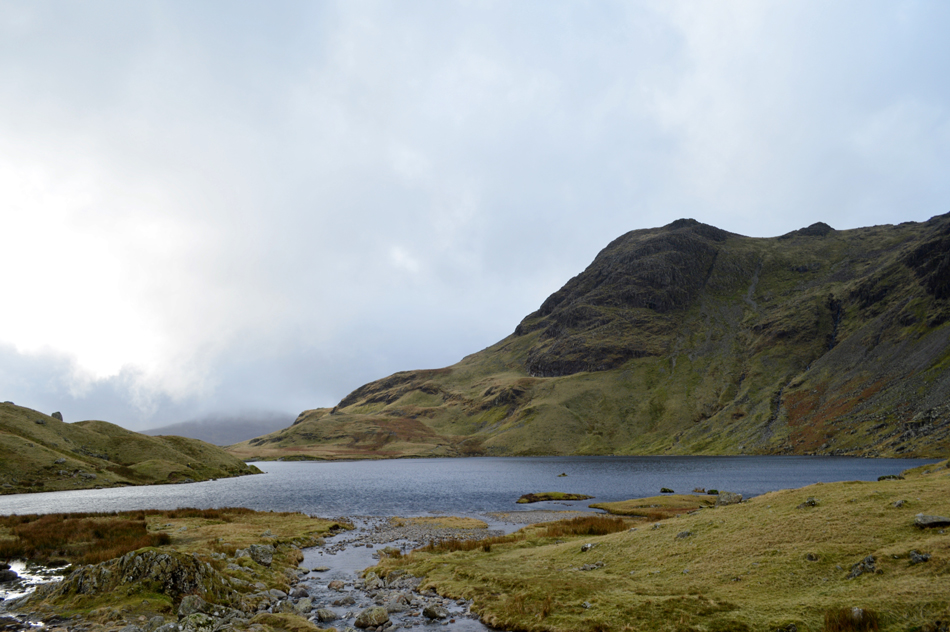 |
| Harrison Stickle from Stickle Tarn. |
| |
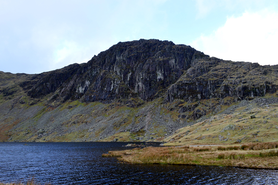 |
| Pavey Ark seen as I make make my way towards Stickle Dam. |
| By the time I arrived at Stickle Tarn and in what seemed like the click of a finger I had walked myself back into reality passing familes and groups of walkers all ascending Pavey Ark or Sergeant Man, of which the bravest took on Jack's Rake seen as the gully which traces left above the worn scree. |
 |
| Lunch with a view. |
| After carefully crossing the outflow via a series of semi submerged stepping stones I de-shoulder and call lunch. By now many of the groups are either ascending Pavey Ark or Sergeant Man and for a few short moments it would seem I had Stickle Tarn and its views to myself. |
 |
| Descending Stickle Ghyll with views over Lingmoor Fell and Great Langdale. |
| |
 |
| Stickle Ghyll. |
| If only I hadn't already eaten lunch, what a fantastic spot! |
 |
| Looking back on Pike Howe, Harrison Stickle, Pavey Ark and Tarn Crag from New Dungeon Ghyll Hotel. |
Despite todays walk being a rather short one it was one that I could take many highlights from like the ascent and views of Pike Howe or those momentary bursts of sunlight while descending Harrison Stickle but I guess all good things must come to an end as I shorten my walking poles and begin the short walk back to Rossett Bridge.
With my car reached I start to kit down which by now had been sandwiched in between two other cars but before I go home I take in the views from Rossett Bridge once more towards the head of Great Langdale where the low cloud seems to have settled in for the rest of the afternoon. |
|
| |
| Back to top |
 |
|