 |
The Outlying Fells, Potter Fell from Potter Fell Road |
 |
 |
7th January 2017 |
 |
|
Today marks the day I start my Outlying Fells project which after three months of route and website preparation I can honestly say I'm eager to get boot onto hill despite a rather abyssmal forecast. With this I was left guessing which area of Lakeland I thought might escape the predicted low cloud and mist and the eastern edge of the district faired better but confidence was still low.
I wasn't supposed to be walking at all today but after a change in my Saturday rota in work I found that I now had a free Saturday which saw me start my project a week earlier than anticipated, with this I sent David an e-mail asking would he like to join me and David replied thanking me because he hadn't quite worked out where to walk himself.
I had been following the forecast almost hourly for the weekend and was left with two walks to start the project by, this one and a walk around the Dunnerdale Fells and the forecast would choose which walk I would start by, either suited me I just wanted to get into unexplored territory, even if it meant we would couldn't see fifty yards ahead and that we would be navigating by map, something of which we both hadn't done in a long time. |
|
| Wainwright Guide Book |
 |
| The Outlying Fells |
-Potter Fell
Occasionally a stray visitor maybe met in the vicinity of Gurnal Dubs, but on the hills around never, North is a wilderness deeply enclosed by Kentmere and Longsleddale - a no-man's-wasteland. |
 |
|
|
|
| |
|
Overview |
|
|
| Ascent: |
1,572 Feet - 480 Metres |
| Outlying Fells: |
Potter Fell |
| Visiting: |
4, Nameless Summit 1,262' - Brunt Knott - Nameless Summit - 1,266' - Ulgraves |
| Weather: |
Low Cloud And Mist Throughout. Highs of 8°C Lows of 8°C |
| Parking: |
Parking Spaces, Potter Fell Road |
| Area: |
South Eastern |
| Miles: |
6.8 |
| Walking With: |
David Hall |
| Ordnance Survey: |
OL7 |
| Time Taken: |
5 Hours 20 Minutes |
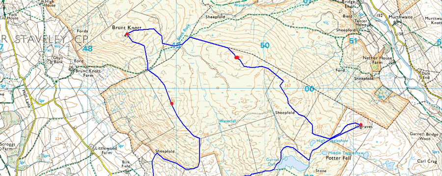
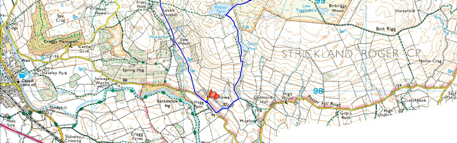
| Route: |
Potter Fell Road - Side House - Nameless Summit 1,262' - Brunt Knott - Black Beck - Nameless Summit 1,266' - Ulgraves - Middle Taggleshaw - Gurnal Dubs - Ghyll Pool - Hundhowe Farm - Potter Fell Road |
|
| |
|
Map and Photo Gallery |
|
|
  |
| |
| |
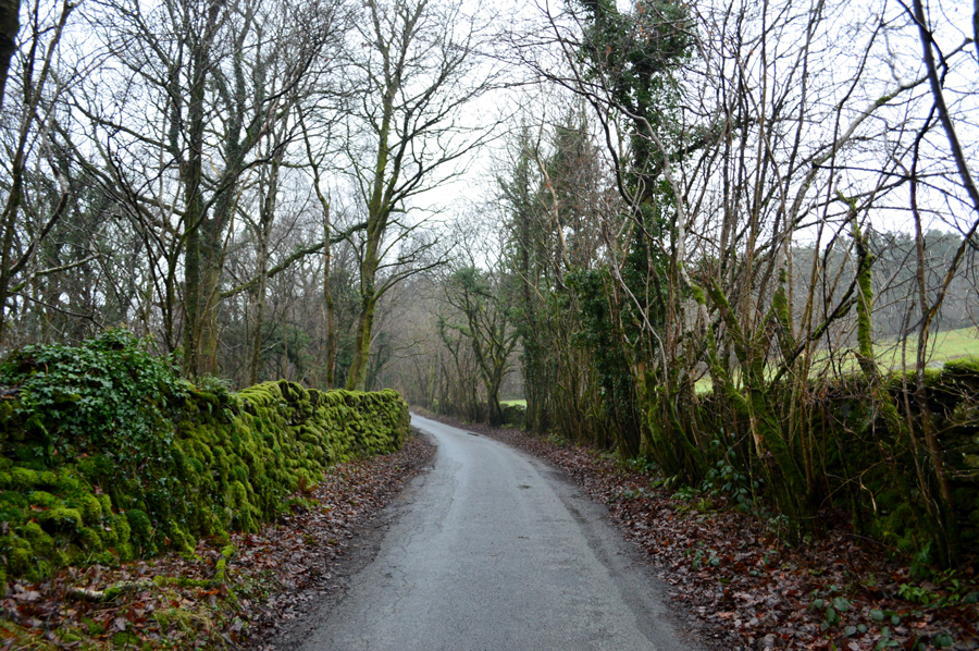 |
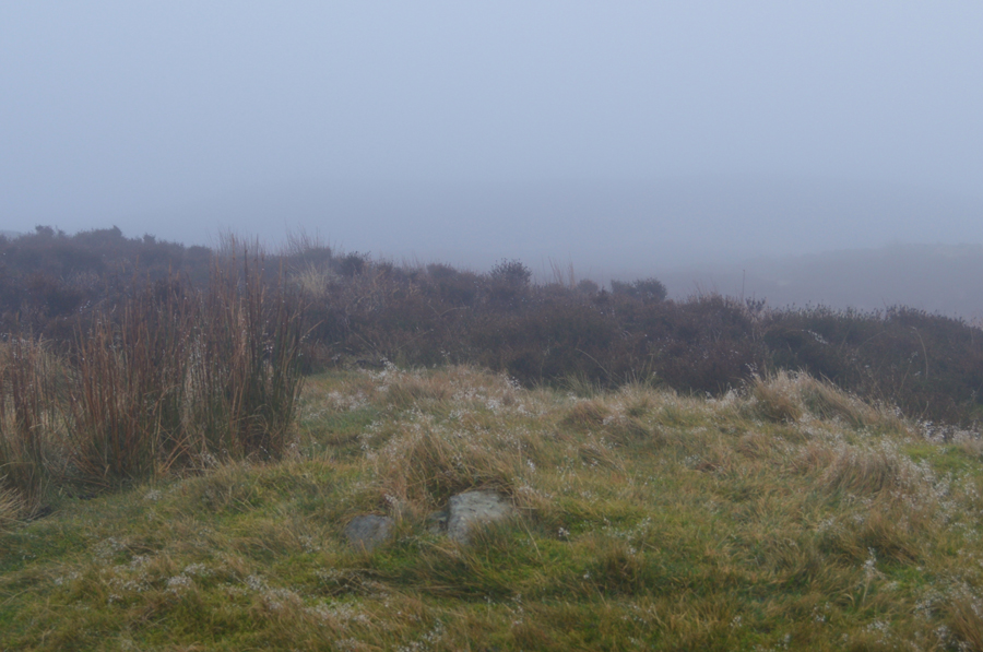
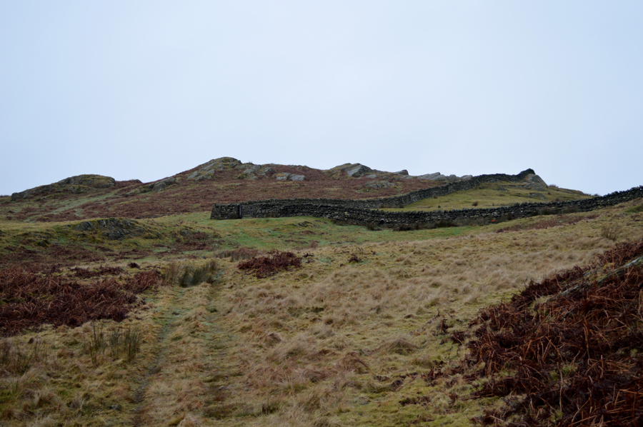
| Potter Fell Road 08:45am 8°C |
We had arranged to meet at Barley Bridge, Staveley at 08:30am but we arrived together roughly about 08:20am, David told me after driving over the top of Dunmail Raise that he could see Thilmere and the flanks of Helvellyn quite clearly and was shocked to find once he arrived at Grasmere that the mist was down to ground level. At Barley Bridge we spoke cross armed about options as the mist would clear revealing a house or a cottage o'yonder only for it to completely disappear again, although oddly between gaps we could see woodland clearing below Spy Crag on the other side of the Kent.
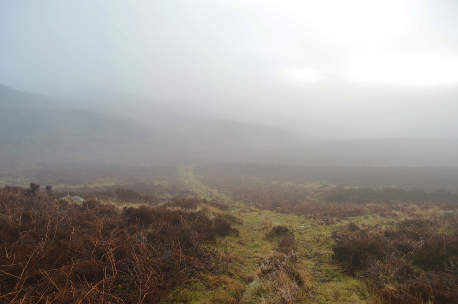
After agreeing to continue with the walk David unpacked his gear from his car and jumped into mine, I then stuck the car into reverse before crossing the River Kent via Barley Bridge and headed right onto Potter Fell Road. Dawn was breaking but the light was incredibly low so I took my time along the narrow lane before realising I was being followed by a Transit van who held back. We were on the look out for a layby close to the access road for Side House from where the walk would start from and we soon came across a muddied side cutting where I parked as close to a stone wall as possible, if only to allow traffic to pass by safely.
The Transit soon passed, span around further ahead and passed us while we were kitting up and came to a stop further down the lane at another layby and we guessed the driver was also out for a walk. The morning light had started to become a little lighter and once again beyond the wooded slopes above Hundhowe Farm the mist would clear leaving false security in my case that we just might get lucky but I know how mist and low cloud circulates and with a total lack of wind, in the back of my mind I knew it wouldn't be lifting anytime soon. |
 |
| Side House. |
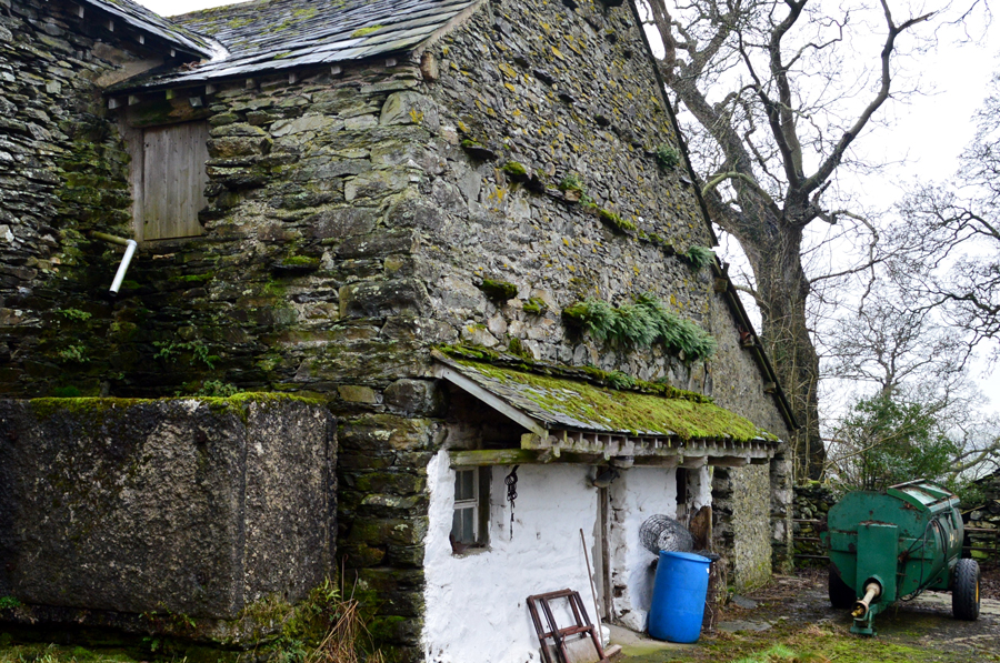
From Potter Fell road we continued back to the access road sign posted Potter Tarn and Side House. Here we head right and followed a tree lined lane which gave way for brambles with farmland either side. To our right a collection of outbuildings belonging to Side Farm from where two farm dogs charge down the field barking menacingly, I know dogs well enough to tell the difference between a playful bark and a territorial bark and this was most certainly the latter.
We soon lost sight of the dogs and visa-versa as the brambles thickened and we continued towards Side House not before our path 'dog legged' revealing a rather tired looking Side House now partially deserted with scrap metal including an old washing machine left scattered about the yard. After passing through Side House to our right a sign posted 'Potter Tarn' which is the direct route to Potter Tarn and Gurnal Dubs, but today we continue as Wainwright did towards the top of the lane marked 'sheepfold' on our map. |
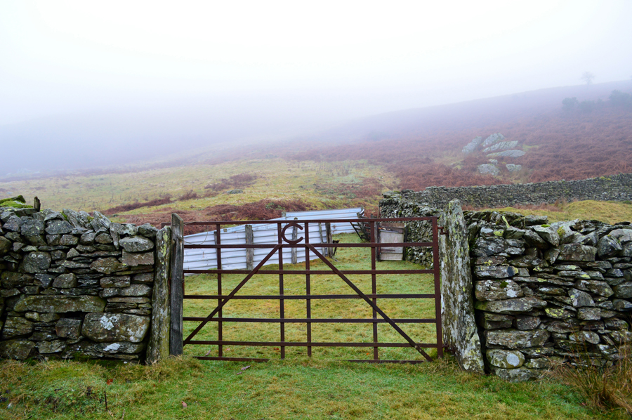 |
| The Sheepfold found at the top of the farm track. |
We climbed steadily towards the top of the lane along an old rutted farm track as the stillness of the morning was broken with the sound of farm machinery possibly from Stavely or even Kentmere and had we of had any long distant views, we could have peered down into. Once at the top of the track we arrived at the sheepfold which was accessed by passing through a large metal gate marked with the letter C. An old piece of rope secured the gate to a wooden post which after passing through we arrive at the sheepfold. We couldn't but help feel slightly disappointed that the stone sheepfold had completely gone and had been replaced by a metal sheeting.
The sheepfold marked a significant turning point from where we follow the stone wall keeping it to our right. |
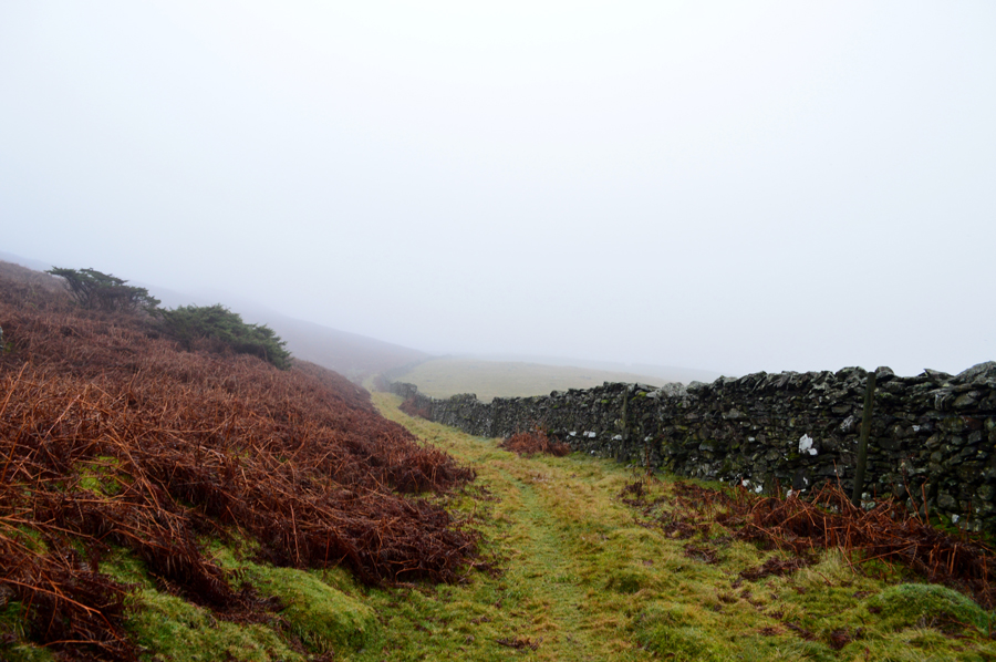 |
| Continuing to follow the stone wall. |
| There was a good path underfoot 'two abreast' in most places as we continued to follow the stone wall which rose steadily and turned abruptly north further along the path. |
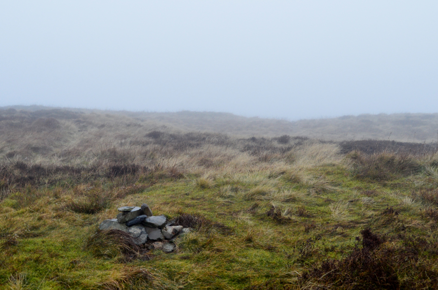 |
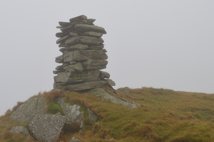
| Nameless summit at 1,262ft |
Once the stone wall started to head further north we left its flanks and climbed steadily once more as the Nameless summit of 1,262ft appeared through the mist and we made our way over via a faint grassy path passing through heather until the summit cairn was reached. Sadly the visibility meant we had no views whatsoever but it didn't really matter to me, officially it was my first summit of my Outlying Fells project.
Footnote: Please note that I am using the fell heights recorded by Alfred Wainwright in the Outlying Fells of Lakeland as reference and not from more recent Ordnance Survey Mapping. |
 |
| The small tarn below Brunt Knott. |
From the Nameless summit we had two options; one was to track back to the stone wall or second we could take a pathless route through heather towards this small nameless Tarn. The pathless route was more direct and was the one we went with keeping the stone wall within an 'eye shot' which would often disappear in the cloud.
The heather despite it being relatively low was wet and by the time we reached the nameless Tarn trousers were wet at a point when I was thankful for the Gaiters I had added earlier. This small Tarn is more famous for having a wall built right through it but also acts as a great navigational landmark for when walking in conditions such as we have today. |
 |
| Brunt Knott summit Trig Point. |
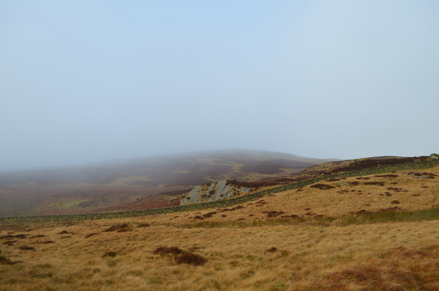
From the nameless Tarn we climbed steadily passing dozing sheep along the way, soon the trig point appeared upon a grassy mantel looming large the closer we got but sadly our visibility was still low. Behind the dense cloud the silhouette of the sun, and overhead, glimpses of blue "I reckon if we were any higher we might protrude out this cloud" David remarked. Further west the cloud broke oddly revealing more cloud, it was a strange sight which at first left us guessing was we looking at Lake Windermere, but couldn't have been, it was only after realisng what we were actually looking at was cloud which was tinged by a streak of sunlight.
After time spent gazing at, and through cloud we took a bearing and left Brunt Knott summit heading south east for Black Beck from where we would pick up a stone wall which oversees the Longsleddale Valley and thereafter, our next nameless summit. |
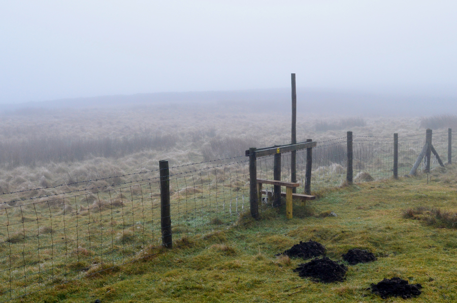 |
| Crossing this fence via a wooden sty. |
| The stone wall is just beyond in the distance. |
 |
| Nameless Summit 1,266ft appears through the cloud. |
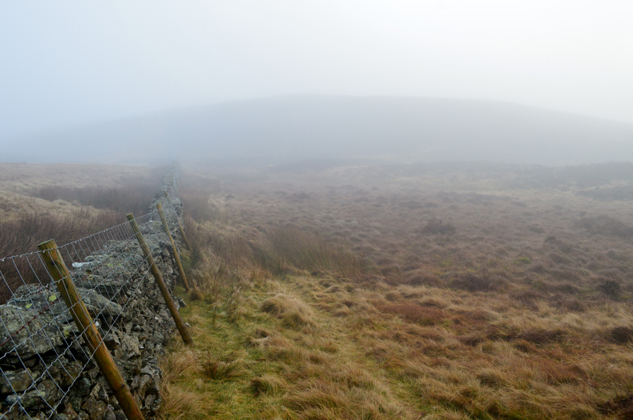
| We gained access to the lower slopes of our next nameless summit by means of a wooden sty yet through this short section of stone walling another sty and a wooden gate also provided access. This particular stone wall runs parallel to the Longsleddale valley which drops below to our left, however, in order to gain our next summit we are going to have to track a pathless route once height is gained further ahead. |
 |
| Nameless Summit 1,266ft |
We keep with the stone wall until we could go no further without losing height, then track towards the highest point through heather until a small collection of stones are reached marking the summit. From here we would have had a good view of the whole area but unfortunately the cloud was still low despite it feeling exceptionaly mild for January.
It would have been much easier to track back to the stone wall which could have led us all the way to Ulgraves summit just under a mile away, but this wasn't the original route Wainwright used opting to walk a sometimes pathless route to High Taggleshaw Tarn(s) before summiting Ulgraves.
After reviewing our map we steered south east out flanking numerous rocky outcrops to our left. |
 |
| Between the outcrops we found this wide grassy path which rose steadily towards another stone wall. |
| Where we were pleased to be blessed with such good visibility! |
 |
| Here stopping to look back on the Nameless Summit of at 1,266ft |
The wide path seen in the previous photo lead us towards this stone wall which had to be climbed over. Wainwright mentioned gaps in certain walls but these we could not see possibly due to being bricked up over the years. This stone wall was what I referred to as a 'double whammy' with a barbed wire fence just three foot from the stone wall. We found a point in the wall where the top half was missing and figured this would be our best vantage point as packs are de-shouldered along with any other equipment which might hinder the crossing.
With packs placed on top of the wall and walking poles thrown over I stepped down on the barbed wire and pulled as hard as I could allowing David enough a gap to squeeze through, he then did the same for me all the while laughing at the scene which looked like something from a Laurel and Hardy film and that most probably, there was a Gate not twenty yards away, our laughter shattering the surrounding silence. |
 |
| |
| |
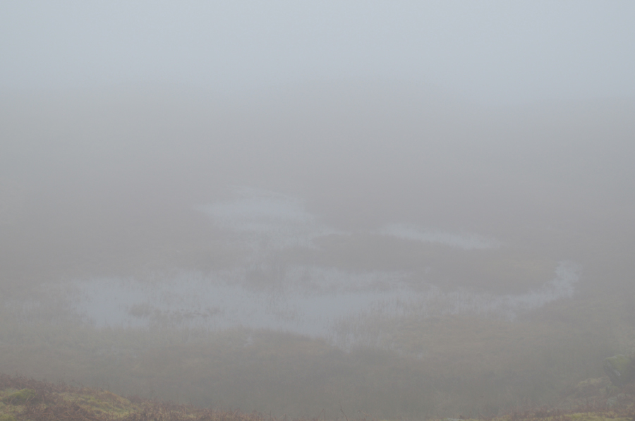 |
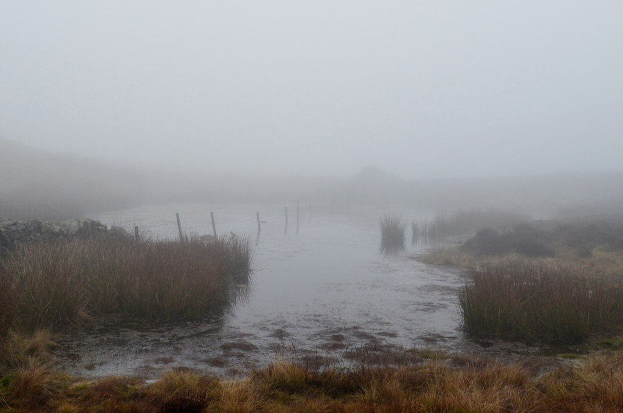
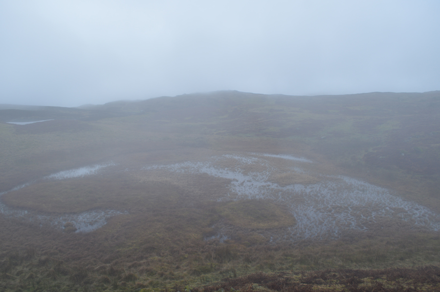
| Passing High Taggleshaw Tarn. |
| |
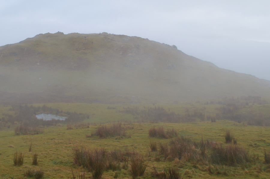 |
| Ulgraves appears through the cloud. |
| With High Taggleshaw Tarn passed we knew, despite not being able to see Ulgraves that we were close. Soon the wall that surrounds the fell appeared and in it, a wooden gate which we passed through right about the moment the cloud started to lift. Ulgraves was the first fell we had seen all morning and it made a welcome sight. |
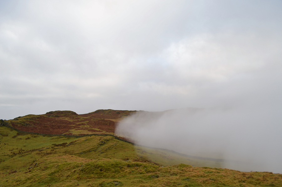 |
| But the break in the cloud is short lived as more cloud approached from the Longsleddale side of the valley. |
| |
 |
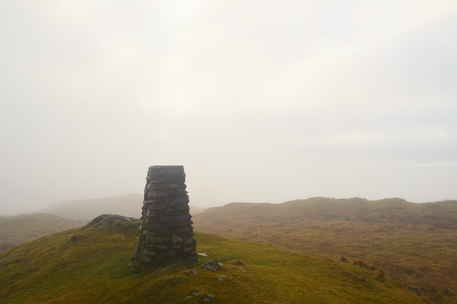
| Ulgraves summit. |
| Unfortunately by the time we had ascended the last push towards the summit the cloud had already descended thick and fast and we were unable to look back on trodden ground. Despite this morale was high especially for me knowing that I'd just summated the first of many Outliers within the project. It was now almost lunch time, we could have broke out lunch here but decided to wait untill Potter Tarn instead which is roughly around half an hour away which gave us time to work up more of a appetite. |
 |
| Here looking back at the gate and stone wall which surrounds Ulgraves summit. |
| Sadly Ulgraves is still lost in cloud out of shot towards the right. |
 |
| Passing Middle Taggleshaw Tarn. |
| With a glimpse of Gurnal Dubs upper left, which is where we are heading next. |
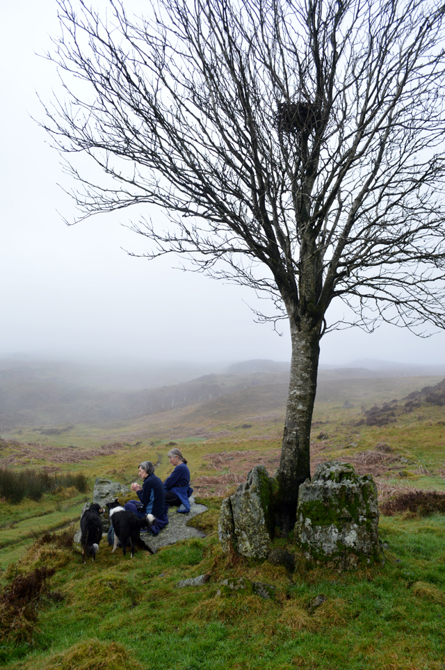 |
| Rock split by tree, Gurnal Dubs. |
| From Middle Taggleshaw Tarn we follow a much broader path which navigates around Gurnal Dubs which is soon reached after passing through a wooden gate. On any given day our view would normally extend over Gurnal Dubs but not today, only a thick mist over the waters surface. We continue along the path passing two women (possibly sisters) who had stopped on a large bolder to eat lunch, we spoke of the split rock behind them and never mentioned the low cloud before moving off in the direction of the Boathouse. |
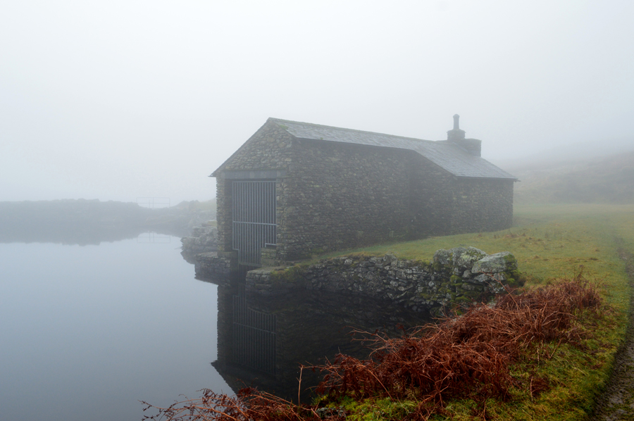 |
| The Boathouse, Gurnal Dubs. |
| |
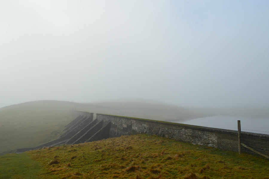 |
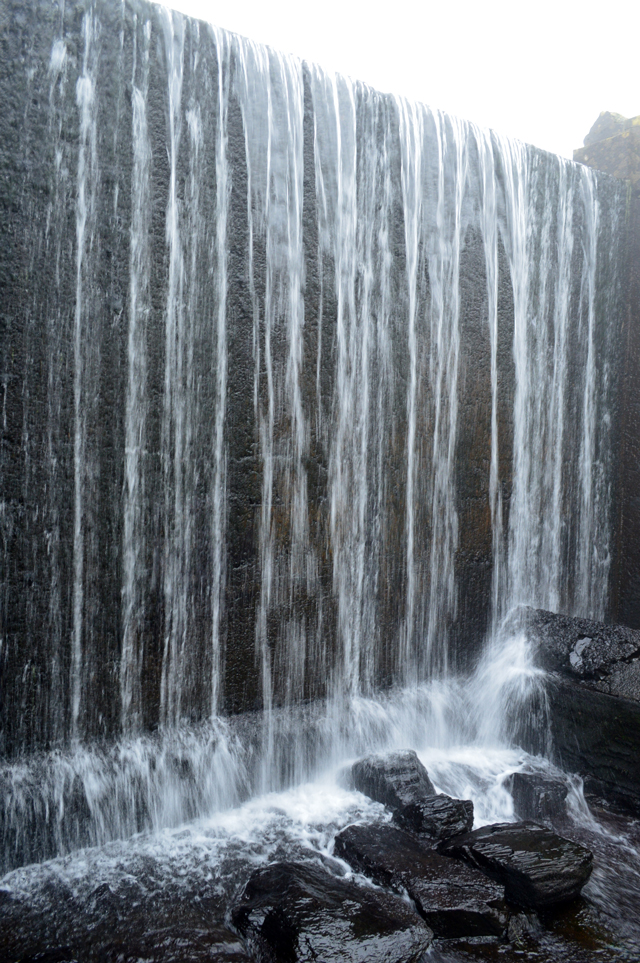
| The Dam, Potters Tarn. |
After leaving the Boathouse behind we pick up a prominent wide grassy track before passing over a wooden sty. The cloud was still low although by now the sun was trying its damnest to break all to no avail, but it did leave the air feeling exceptionally mild as by now David had been walking with sleeves rolled up for the last hour, possibly more. |
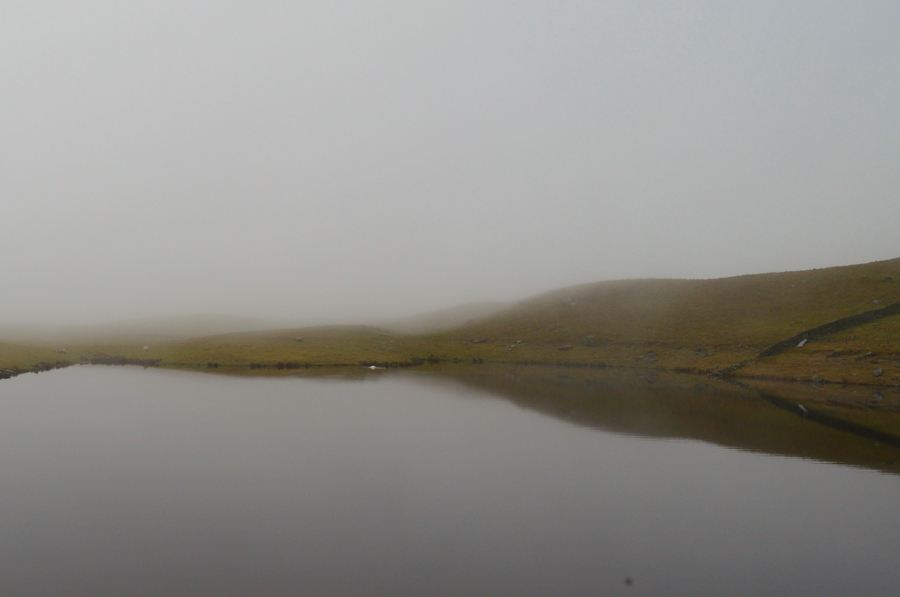 |
| Potters Tarn from the Dam Wall. |
| We broke out lunch on the Dam wall and listened to the eerie silence while we enjoyed lunch. It was spoke about would an attempt on Reston Scar (found just outside Staveley) be summited but was decided against after realising that this cloud wasn't going to lift for the rest of the day, I figured I could enjoy both Reston Scar together with Hugill Fell on another day when perhaps, I would have better visibility. |
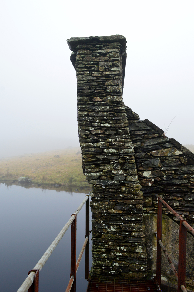 |
| The leaning Dam Wall. |
| Hidden forces at work which might one day see part of the wall collapse into the Tarn. |
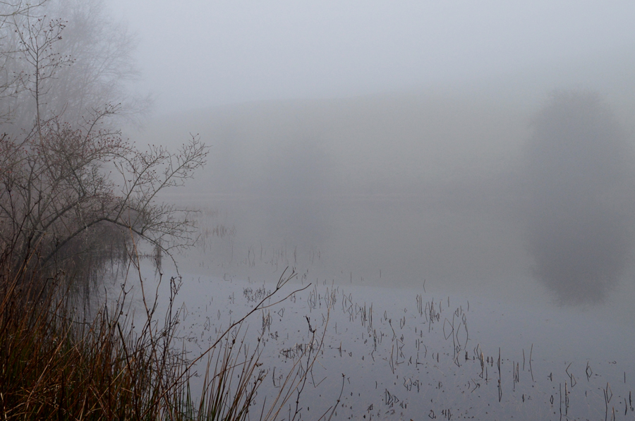 |
| Ghyll Pool. |
| Found just a short stroll away from Potters Tarn, eeriely silent today. |
 |
| Ghyll Pool outflow. |
| It was noted how nice it would be to see the outflow frozen. |
 |
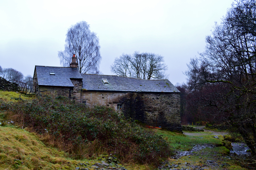
| Hundhowe Farm buildings. |
With lunch packed away we re-shoulder packs and explored the Dam for a while before being passed by a fell runner then by a young girl who heads towards the Dam. After a short visit to Ghyll Pool and its outflow we then descended back to Hundhowe Farm as a limited view opened out before us. With Hundhowe Farm reached we pass through its impressive farm buildings complete with stone water tank and back onto Potter Fell Road and back into civilization. We are accompanied by the sound of horses and geese as we walk the short distance back to the car where we kit down in the middle of the road without a hint of a car passing.
I turn my car around and we drive back to Staveley now passing a half a dozen dog walkers before crossing Barley Bridge once again where I park up alongside Davids car, we chat a while and take note that the cottage we could barely see just hours earlier can just be seen but the hill side above it, still hidden by murk. |
|
| |
| Back to top |
 |
|
