 |
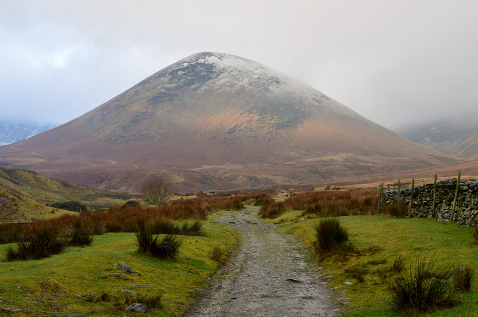
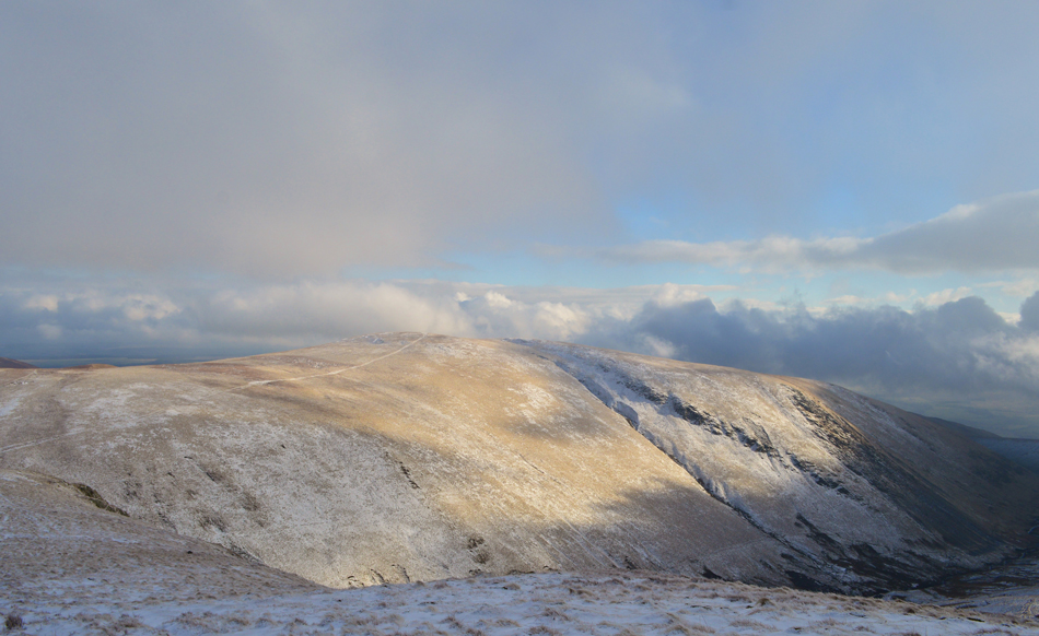
Blencathra from Mungrisdale |
 |
 |
5th February 2017 |
 |
|
A few weeks ago I came up with the idea to reserve my Sunday walking for the Outlying Fells which worked great knowing that I had work the next day thus hopefully, no achy limbs and making that arghhh sound every time I got up. A bright morning sunrise greeted me on my way into work on Saturday morning while Sundays forecast was to be more cloudy, bloody typical eh but it's something that as walkers, we are all accustomed too but seeing a bright sun is still enough even after all these years to set the bottom lip quivering.
I'm not sure why but I wanted to get up high and to put some miles in over trusted familiar ground while not having to concentrate too much on the route ahead, I guess it's fair to say that I just wanted to walk and get the lungs pumping. A few months ago David and Rod walked a similar route to this one which I had to miss due to work which I was quite disappointed about because I wouldn't have minded joining the guys on that particular walk.
Months on here I am to give it a go with the exception that I cut the walk short slightly opting to leave out Bowscale Fell after summiting Bannerdale Crags east ridge, from where Blencathra was gained via Atkinson Pike where I was met with almost zero visibility which only added to the dramatics of the day, here's how I got on. |
|
| Wainwright Guide Book Five |
 |
| The Northern Fells |
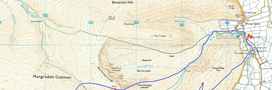
-Bannerdale Crags East Ridge
The most direct route and the one recommended, is that via the easy ridge – the obvious key to the ascent of the mile long escarpment. Towards the end this becomes a grand scramble in an impressive situation – a bit of real mountaineering. |
 |
|
|
|
| |
|
Overview |
|
|
| Ascent: |
2,850 Feet - 869 Metres |
| Wainwrights: |
Bannerdale Crags - Blencathra - Souther Fell |
| Weather: |
Highs of 6°C Lows of 2°C |
| Parking: |
Roadside Parking, Mungrisdale Village |
| Area: |
Northern |
| Miles: |
8 |
| Walking With: |
On My Own |
| Ordnance Survey: |
OL4 |
| Time Taken: |
4 Hours 30 Minutes |
| Route: |
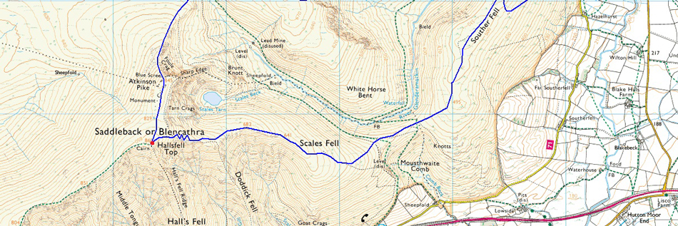
Mungrisdale - River Glenderamackin - Bannerdale Crags East Ridge - Bannerdale Crags - Atkinson Pike - Blencathra - Scales Fell - Top of Mousethwaite Comb - Souther Fell - Low Beckside - Mungrisdale |
|
| |
|
Map and Photo Gallery |
|
|
  |
| |
| |
 |
| Mungrisdale 09:00am 2°C |
I had left home later than usual in order to avoid any lingering mist but in saying this, confidence with hill fog remained low which was confirmed as I drove along the A66 passing a cloud topped Great Mell Fell and soon after, Souther Fell. Views, however were distant which told me that the low cloud which clung to the flanks of the fellsides would soon disperse but how soon with little to no wind remained a mystery. Mungrisdale was as expectedly quiet soon finding that I had arrived first as I secured my parking spot opposite Mungrisdale Village Hall before popping two pound into a collection box situated on the gable end of the building. The temperature felt much milder than the two degrees it actually was as I laced up behind the car while listening to the trickle of the Glenderamackin flowing just yonder while at the same time observing where the footbridge once crossed the river gaining easy access from the car park to the Mill Inn, the footbridge in question having being washed away during Storm Desmond, a sign is left stating what happened to the bridge although you only had to look down stream to see the damage to the embankments which collapsed due to the excessive flooding.
I make sure not to forget to add my gaiters despite yesterdays fine afternoon forecast that it actually rained quite heavily during the morning and the ground was bound to be boggy underfoot especially along a notoriously boggy section of the Glenderamackin which I'll get to later. It was mild enough to leave the car with hat and gloves still packed away but I knew all too well I would be reaching for them once height is gained. From the Village Hall I turn left and start to climb the hill where a traditional red phone box is sittuated on the edge of the village, it is here I turn left passing a sign posted Mungrisdale Common where I'm greeted instantly with views of The Tongue. |
 |
| Views towards The Tongue seen shortly after leaving Mungrisdale. |
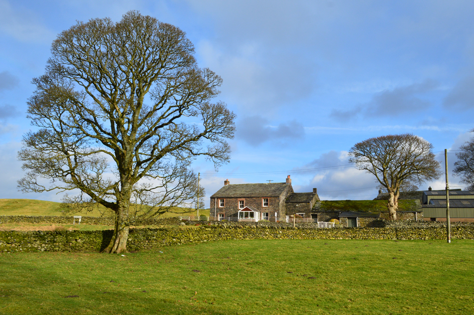
I pass the last outpost of the village 'Bannerdale View' a traditional cottage which appears to be a guest house with a neat little garden at the rear, up ahead a stone wall leads to a wide wooden gate from where open fell side awaits.
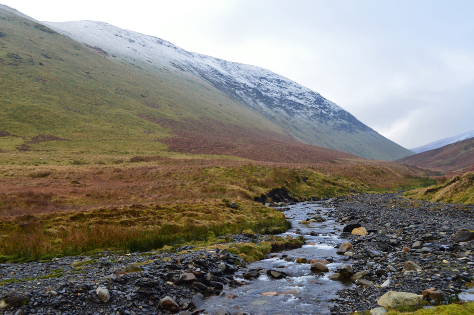
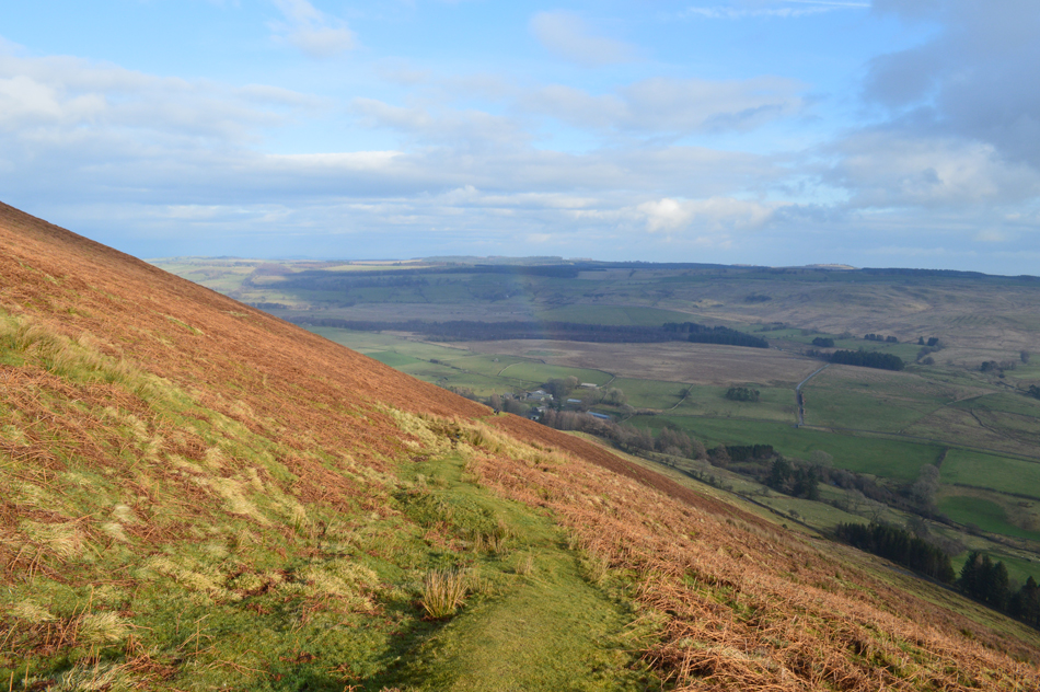
My route today will see me head to the far left of The Tongue as I follow the course of the River Glendramackin which winds its way through the valley below the prominent footpath in the left of the picture from where Bowscale Fell can be gained by.
It's plain walking for the next ten minutes or so while I soak up that 'Sunday morning on the hill atmosphere' |
 |
| Souther Fell seen after crossing the River Glenderamackin. |
I soon found myself at the point where Bullfell Beck flows into the River Glenderamackin, here my footpath abruptly ends having being washed away during last Decembers storms which saw me side step the steep river bank while trying to find a safe place to cross, the Glenderamackin was only around six to eight feet in width and after studying hard enough I spotted several good crossing points which had 'stepping stones' just below the waters surface, it was from the opposite side of the river could I now see why the path ended so abruptly, in fact about a fifty yard section of the path had collapsed and had been washed away, there were no signs of where the path used to trace, just a bank of earth and heaps of boulders.
Because I had crossed the Glenderamackin once I now found myself on the wrong side of the path where I needed to get back to which meant crossing it again which was done with ease over three or four steps, again using submerged yet sturdy stone footings. Here the path splits into two, one follows the course of the Glenderamackin and looks sodden, the other climbs steadily along side The Tongue, you can guess which was path I needed, yep the sodden one. |
 |
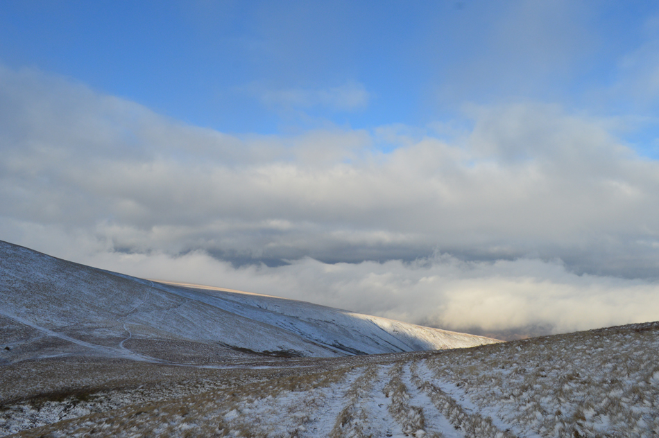
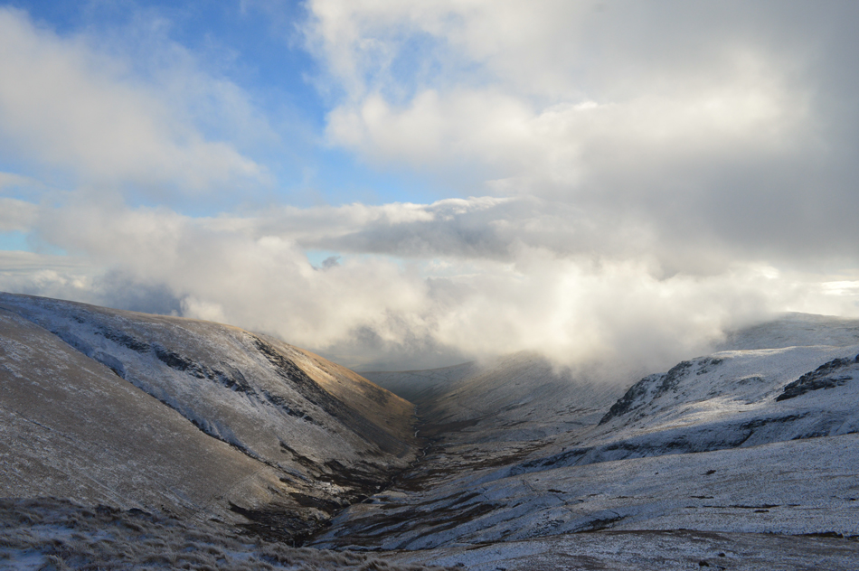
| Bowscale Fell East Ridge, the River Glenderamackin and Souther Fell as I begin my ascent on Bannerdale Crags East Ridge. |
From the base of the east ridge I climbed steadily into the snow line which was wet underfoot although with more height I could see that fresh snow had fallen overnight which was still quite powdery.
Up ahead two walkers gained the ridge from the direction of Mousthwaite Comb before l lost sight of them as they shouldered the ridge ahead, it was here my lungs and indeed my legs reminded me of how steep the ascent onto the ridge can feel. |
 |
| The head of Bannerdale seen from Bannerdale East Ridge. |
| |
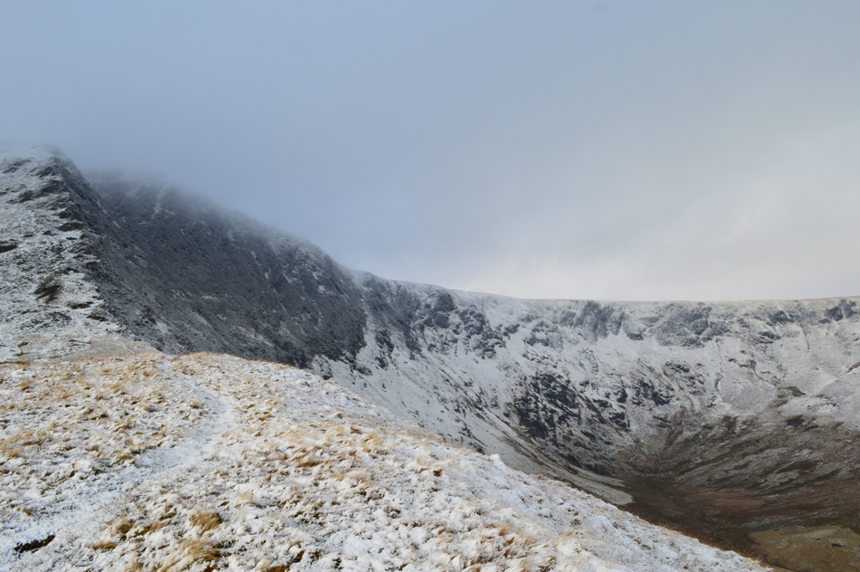 |
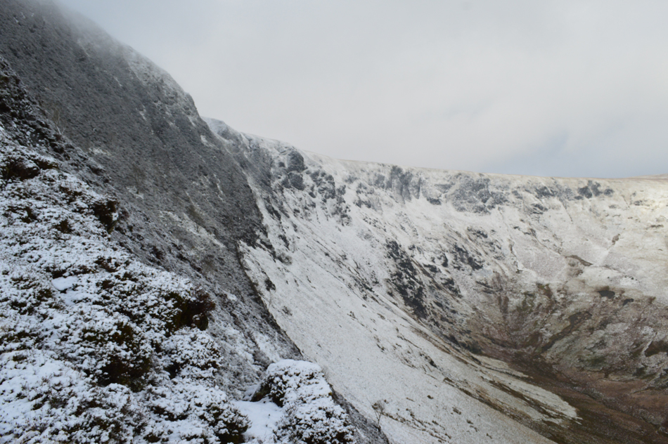
| Bannerdale Crags East Ridge. |
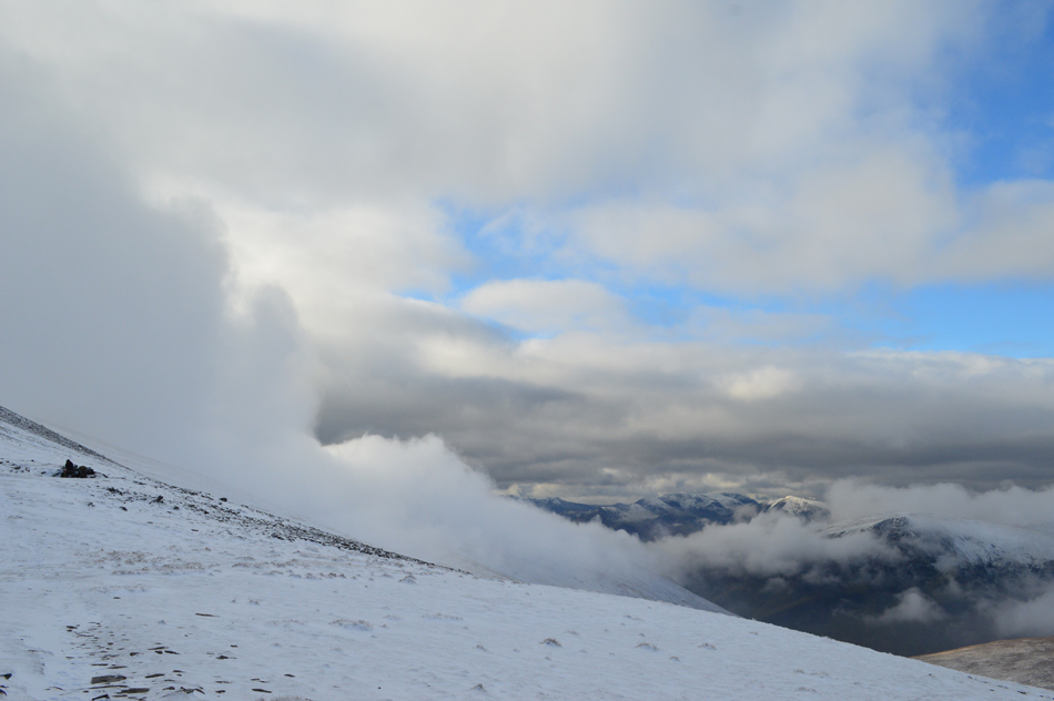
| Often the sun was obscured behind cloud leaving the fell side feeling, and indeed looking quite moody as light would escape through the cloud leaving beams of light over the eastern fells although such light displays in my direction was momentarily, nontheless when it did occur it usually saw me reaching for the camera. |
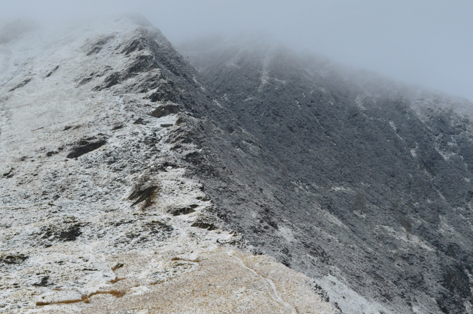 |
| The steep rib which forms the upper part of the East ridge. |
| The two walkers are now up ahead and are well into their ascents, try and spot them. |
 |
| More light and cloud dramatics before I take on the ascent of the East Ridge. |
| |
 |
| Bannerdale Crags East Ridge. |
| Two or even three paths make up the ascent on the east ridge, one being a direct ascent via the crags and old mine workings which in dry conditions makes up for a great scramble. Today however, my route of ascent will be via a stone/slate path which twists its way adjacent to the craggy outcrops which make up the top section of the ridge, here the snow defines the path from the base to around half way, clever stuff that snow. |
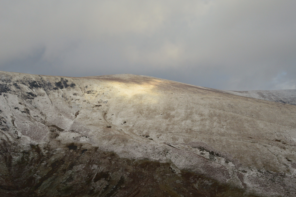 |
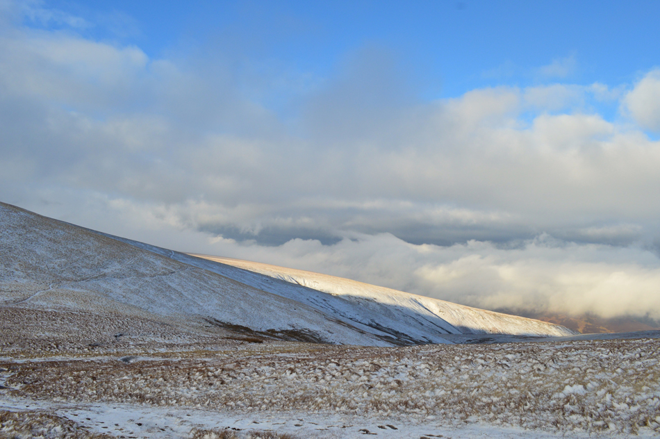
| Sunlight over Bowscale Fell summit. |
| |
 |
| Bannerdale Crags. |
Despite packing my Crampons there was no need to use them during my ascent the only issue being wet snow which often disguised the slippery slate below, even so it is always best to pack crampons or spikes and not need them than to need them only to discover you've left them in the boot of your car.
I press on. |
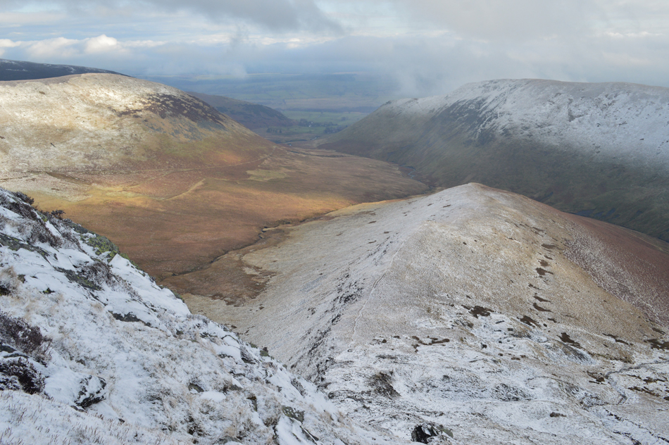 |
| Views down Bannerdale East ridge with The Tongue seen over the Bannerdale Valley, that's Souther Fell over on the right. |
Maintaining good footings during the course of the ascent was key to a safe summit which I continued with before gaining the top of the ridge all the while feeling quite surprised that I hadn't encountered any ice in any way shape or form during my ascent.
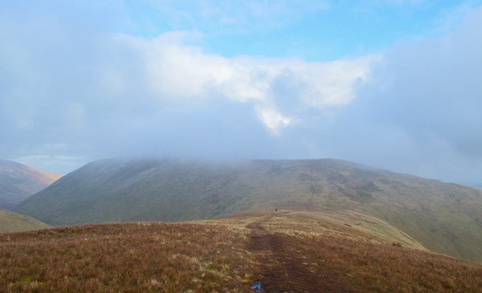
It was soon clear however, that I was about to lose my visibility. |
 |
| Bannerdale Crags subsidiary summit cairn. |
By the time I had reached the subsidiary summit the sun had faded behind a mass of thick grey cloud leaving a faint circular afterglow in an otherwise, featureless sky. It had only taken me moments to reach the stone cairn but the difference in conditions couldn't have been greater.
I wait around a while to see if the cloud might break, I had a 50/50 chance - the cloud really was that sporadic even taking the time to de-shoulder my pack which is placed on the stone cairn while I ease cold fingers into gloves and add my beanie.
I found it odd to discover that the footprints around the summit were my own and I wondered where the two walkers up ahead of me had progressed to, Bowscale Fell perhaps? but no footprints.
Feeling as snug as a bug I re-shoulder and start to head towards the summit cairn which receives a tap from my walking pole, still the lack of visibility continues all the while large gaps break up between the cloud revealing deep blue sky over head. |
 |
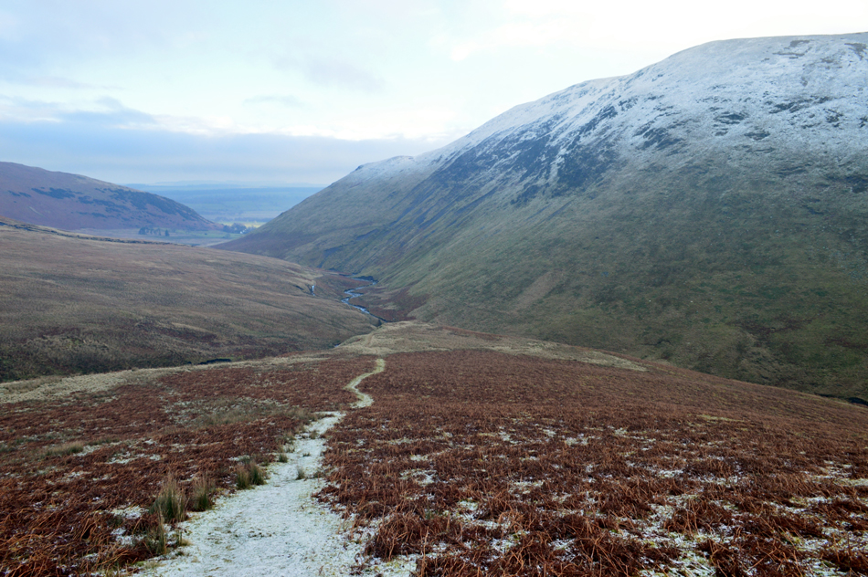
| Descending towards Glenderamackin Col. |
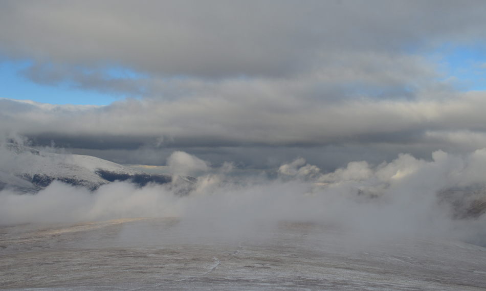
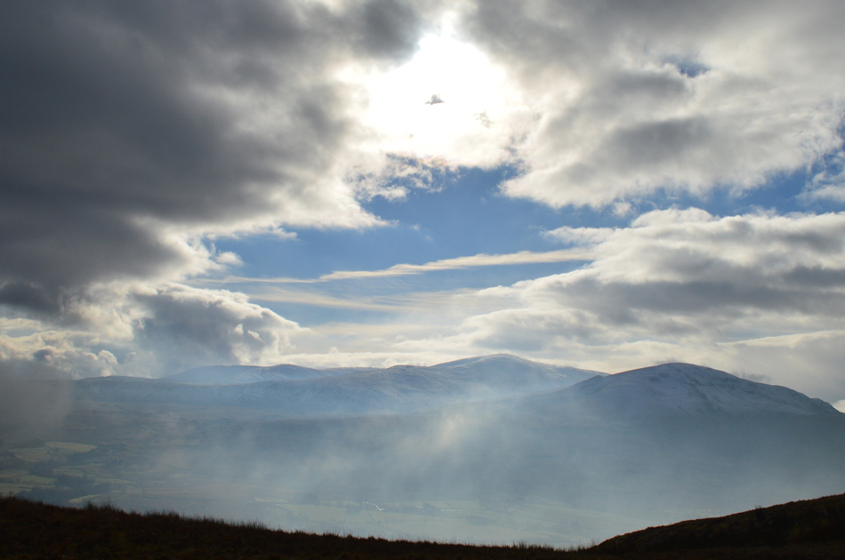
By the time I had descended towards Glenderamackin Col I was able to look back on Bannerdale Crags as the cloud began to lift from its summit while a strong sun broke through the cloud, it really was one of those moments that a camera simply couldn't record.
Here a bank of low cloud lies above Mungrisdale Common over the River Calder and extends as far north as High Pike. |
 |
| Sunlight over Mungrisdale Common. |
| |
 |
| Looking back towards Bowscale Fell. |
| The cloud really looks like its starting to break up now. |
 |
| Digging deep, ascent on Atkinson Pike. |
| Ahhh...spoke to soon. |
 |
| Now there's a view worth stopping for. |
| Before I took on the ascent of Atkinson Pike I stopped a while to admire the views along the course of the River Glenderamackin. The sunlight is quite bright over Brunt Knott and I wondered would the light break through over Sharp Edge too. |
 |
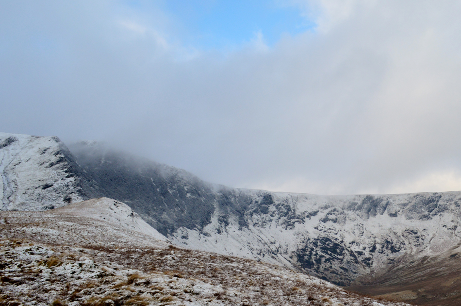
| Sharp Edge. |
| Maybe not, here comes the cloud again, the cloud appears to be creeping down from the top of Atkinson Pike and Blencathra's summit. |
 |
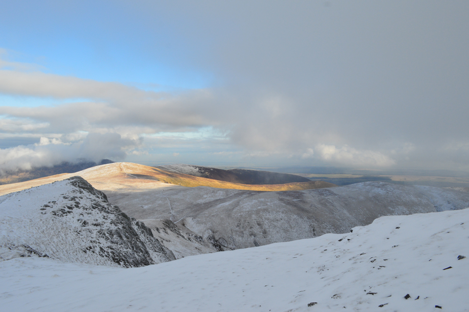
| That view again of Bowscale Fell this time with Carrock Pike in the distance. |
| The cloud is really starting to break up over the Caldbeck Fells though. |
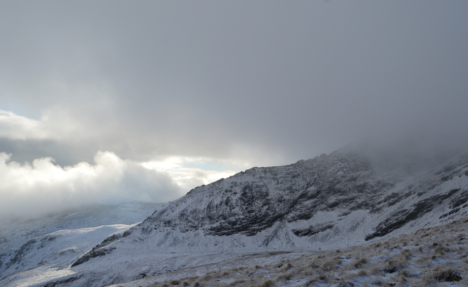 |
| Summit cloud creeps down on Sharp Edge. |
| There's actually a trio of walkers on Sharp Edge right now and after observing them over the last few minutes two of them seem to be waiting for the third prior to the crux slab; a layer of exposed polished rock which requires respect even in good conditions, it would seem however, that for now both mine, and their views are about to get swallowed up by advancing cloud. |
 |
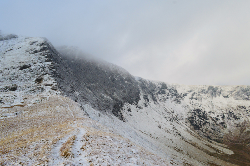
| Views back over a sun lit Bannerdale Crags. |
| |
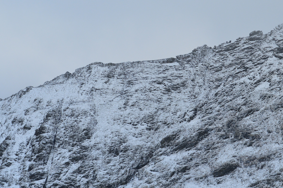 |
| The Sharp Edge shuffle. |
| One last image of Sharp Edge before the cloud engulfs the ridge, the walkers can be seen kneeling down in the top right of the photograph. |
 |
| Cloud dramtics over Mungrisdale Common with a snow capped Bakestall over on the left. |
| |
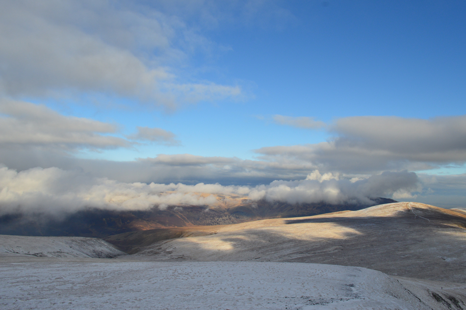 |
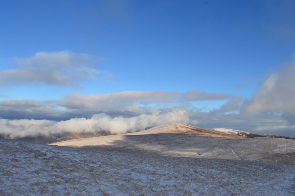
| High Pike may make an appearance today...meanwhile more wonderful views of Bowscale Fell. |
| It's been around fifteen minutes since I started my ascent from the top of Glenderamackin Col and in that time Bowscale Fell has been in constant sunshine almost making me wish I'd made an ascent after leaving Bannerdale Crags, but on second thoughts, I wouldn't have got these fantastic views if I had. |
 |
| Approaching the stone shelter below Atkinson Pike. |
Up ahead I had been advancing on a couple who I had been following who together with their terrier had stopped at the shelter and decided to add more layers, I stopped for a quick chat commenting on the fantastic light display and we both agreed it was a highlight of our respective walks, they spoke with Devon accents and went on to explain that they had caught the bus to Scales from Keswick and had made their ascent via the Glenderamackin Valley.
By now the wind was whipping up making conversation difficult so after saying "enjoy the rest of your walks" I left the couple in the shelter and started to make my ascent towards the top of Atkinson Pike with every foot forward easing me further into the cloud. |
 |
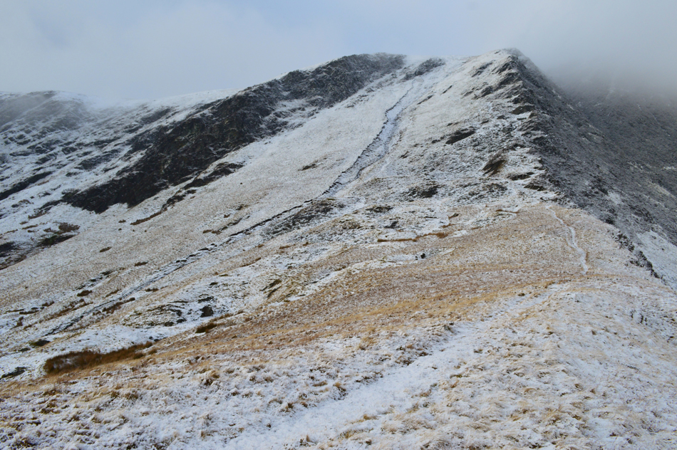
| Bowscale Fell and Bannerdale Crags from my ascent on Atkinson Pike. |
| |
 |
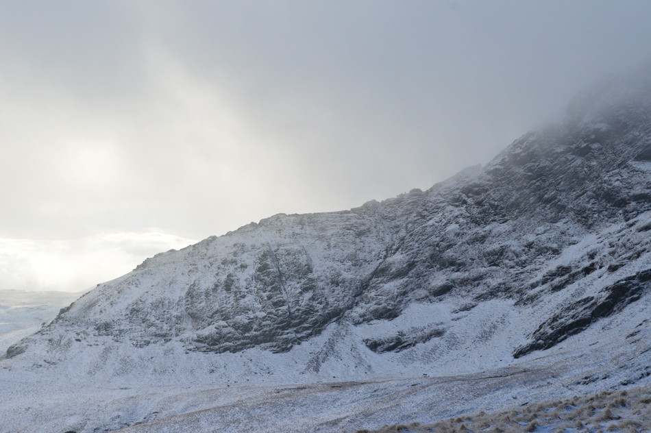
| Ascent on Atkinson Pike. |
| Within moments I was ascending through cloud with a thick flurry of snow underfoot I eased myself into the path which zigzagged towards the summit, here being reminded of my last ascent last Summer during my Wainwright in 30 project where If I recall, I had to dig much deeper than I had today, great memories of a fantastic year on the fells. |
 |
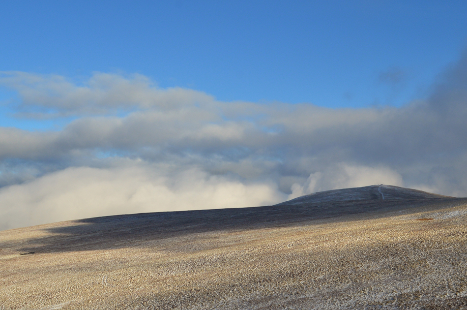
| High Pike from Atkinson Pike. |
| |
 |
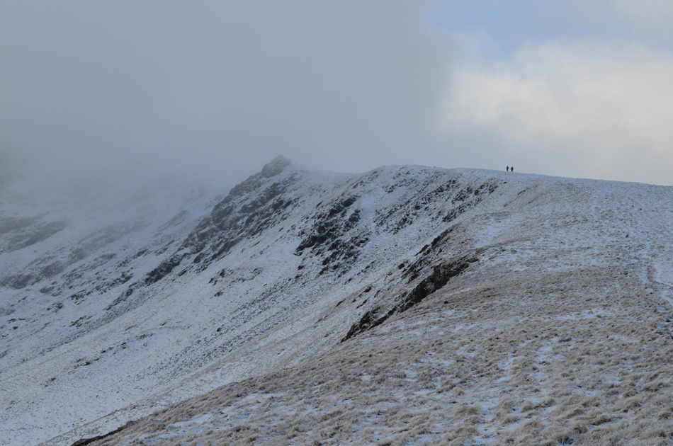
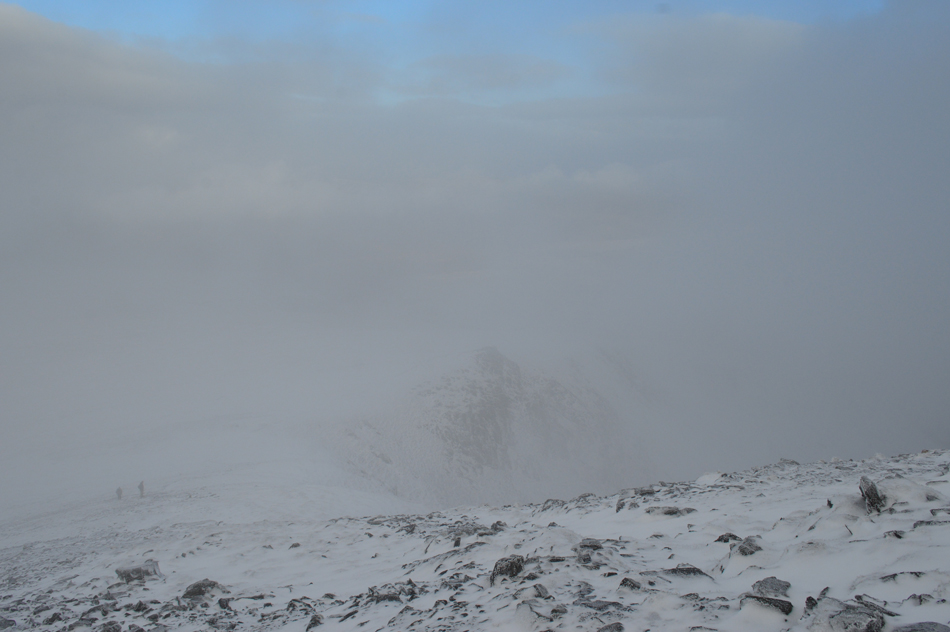
| There wasn't a soul about as I headed towards Blencathra summit. |
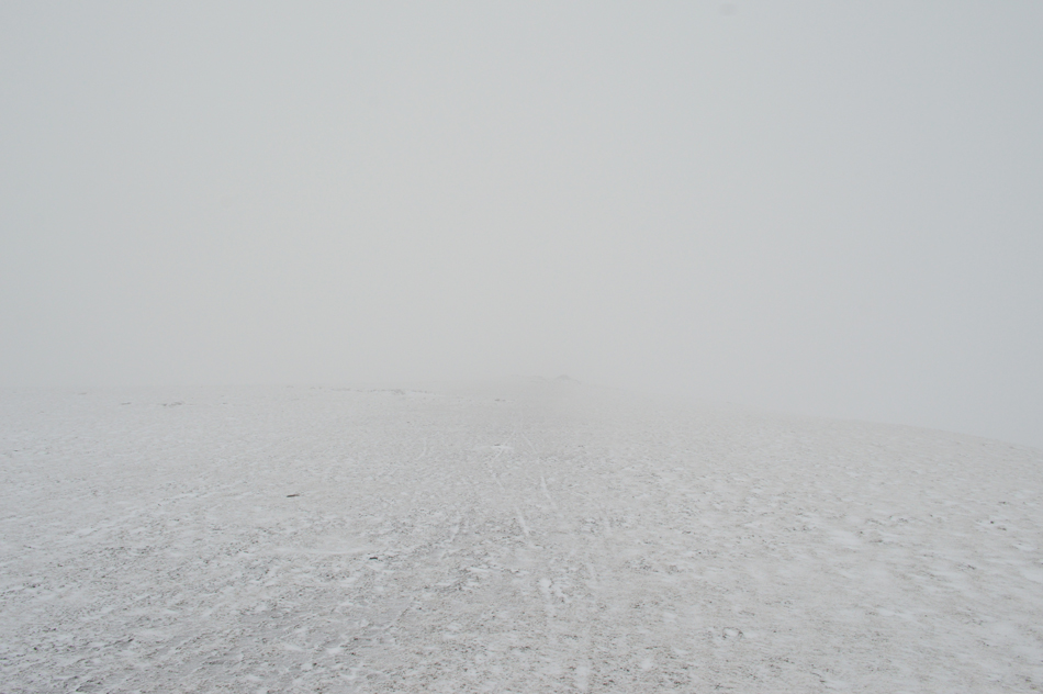
From the top of Glenderamackin Col it had taken me around twenty five minutes to reach Atkinson Pike summit, yes I know I shouldn't time myself but I just can't help it sometimes. The Saddle of the summit was eerily quiet with only the wind for company, not even a distant voice could be heard at a point when visibility shifted between 10 and 40 metres.
Up ahead on the left is the Blencathra's stone cross which at least told me I was walking in the right direction! I wouldn't have blamed even the experienced of walkers for pulling out their maps/compasses or G.P.S devices on the summit today. |
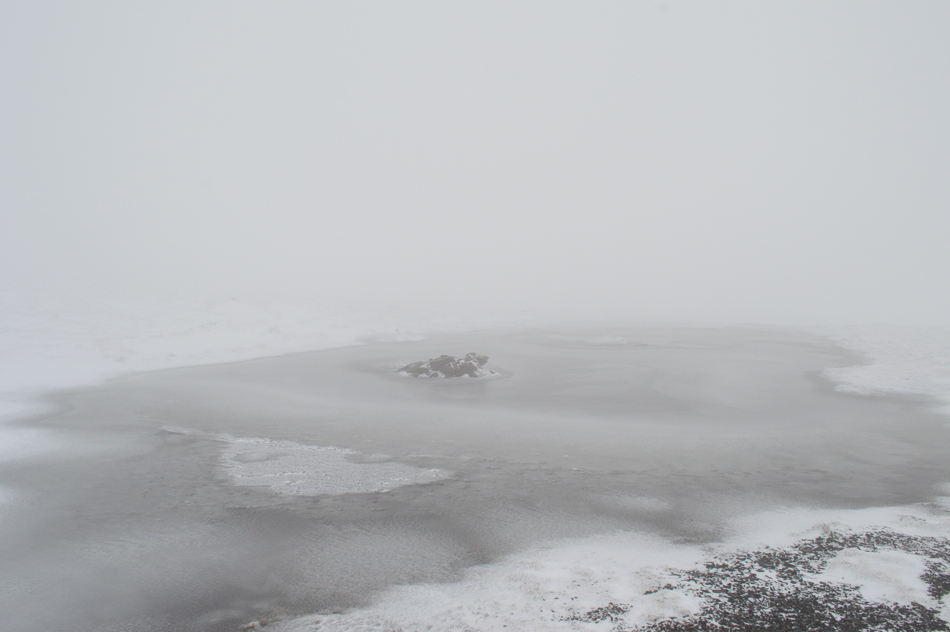 |
| Frozen Blencathra summit Tarn. |
| |
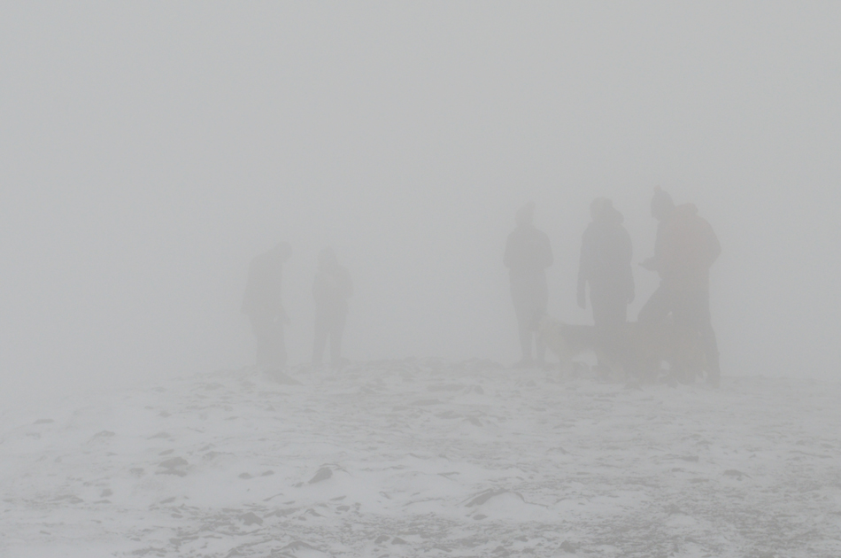 |
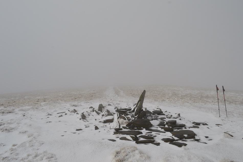
| Blencathra summit. |
I soon found myself at the summit and placed my foot on the almost buried circular trig point all the while the summit wind chill bit at exposed flesh and within the space of a minute I had made the decision to make my descent via Scales Fell when through the murk I spotted a large group stood around twenty feet away, under such the conditions neither of us would have seen each other until we were almost stood on each others toes and before I knew it they had advanced around the summit area, their voices fading into the distance as I started to descend via a series of zigzags before traversing over the head of Doddick Gill in the thickest of cloud I've encountered in a long time. |
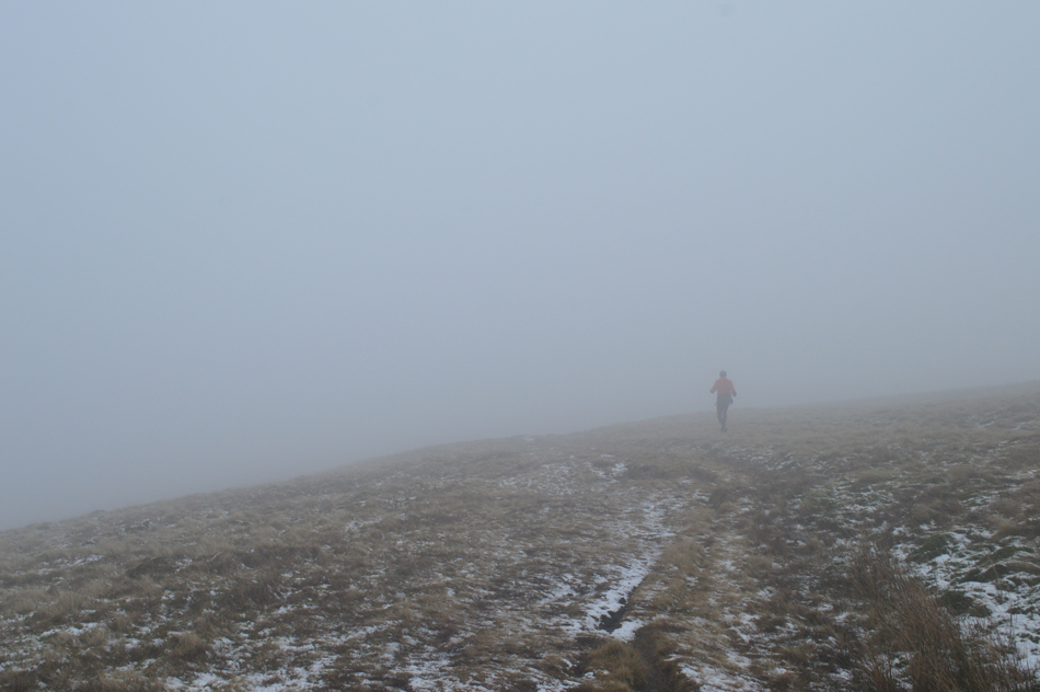 |
| Fell runner above Mousthwaite Comb. |
It felt like a lonely descent which I can sometimes relish in but even I wondered would a fellow walker loom out of the mist but saw no one until I had completely descended Scales Fell where I was passed by a fell runner who quietly spoke a Hi
He scared the living daylights out of me! |
 |
| Souther fell seen over Mousthwaite Coomb as the cloud begins to lift. |
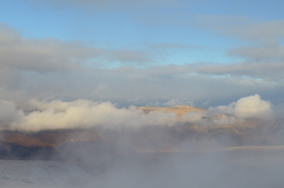
I watched the fell runner disappear into the cloud who then stopped further ahead of me to grab something from his pack before continuing with his run, although the cloud was still low I knew I must be close to the top of Mousthwaite Comb, the cloud departed over a matter of minutes which confirmed my thoughts.
Up ahead a young lass walks towards me with her dog and asked how was visibility at the summit? before I even got the chance to speak I guess my facial expression answered her question "mirky I replied" with this I turned around and saw that the cloud was indeed starting to slowly lift revealing Scales Fell, you might be in luck I smiled. |
 |
| Cloud dramatics over the Clough Head and the Dodds. |
| |
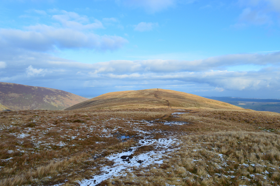 |
| Almost at Souther Fell summit. |
| In brilliant warm afternoon sunshine too. |
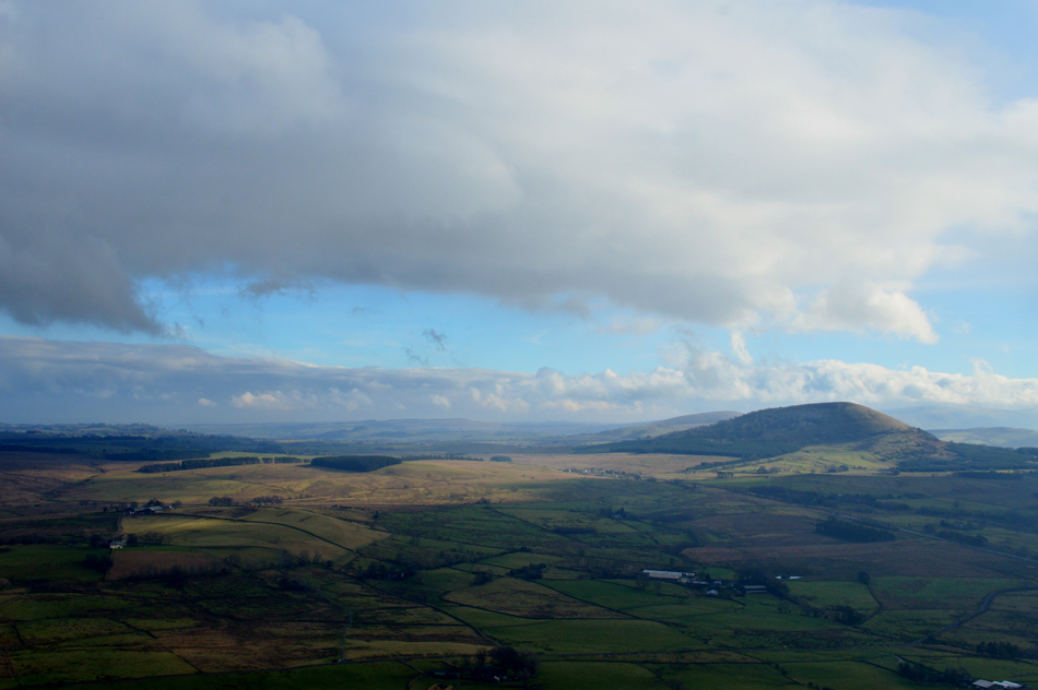 |
| Spring like views towards the Mell Fells. |
| |
 |
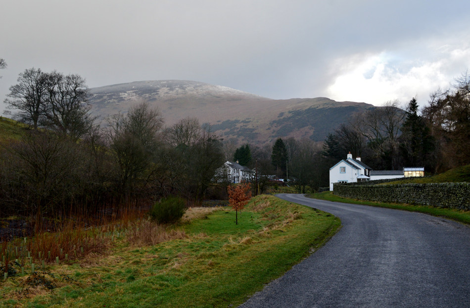
| Descending towards Mungrisdale in bright afternoon sunshine. |
| I had met two girls both with dogs close to Souther Fell summit while dodging the various boggy areas which make up the summit top, hi's and hello's are exchanged before I watched them disappear over the eastern flank of the fell which was also the same route I would be using to descend back into Mungrisdale by although I did let them get a healthy lead on me while I baked up the afternoon sun while I viewed Bannerdale Crags east ridge which still looked as chilled as I found it this morning. |
 |
| High Beckside. |
| |
 |
| Bowscale Fell East Ridge from Mungrisdale. |
The two girls had downed packs to delayer such the warmth from the afternoon sun and hi's are exchanged once more, me, I keep my layers on and sweat it out while I eased my pack off one shoulder and managed to take out a sausage roll which I took large bites out of before arriving at High Beckside where I would cross the Glenderamackin for the last time today.
In the short distance it took me to arrive back at the car a sun shower passes leaving droplets of water floating on the breeze and stops as quickly as it had started which is where todays walk ends, under the Spring like warmth of a Mungrisdale afternoon. |
|
| |
| Back to top |
 |
|
