 |
A bitterly cold day on Whiteside, Hopegill Head and Grasmoor |
 |
 |
10th February 2017 |
 |
|
It's difficult to think of no finer feeling than waking up on a work day knowing you aren't going to be sat behind an hour and a half worth of tail lights but knowing that your travelling to Lakeland to walk, that was how I felt this morning when my alarm woke me, granted a whole hour before I would usually wake up but that didn't matter, this morning I didn't have to rush around like something manic, this morning I can take things normal and there isn't a greater feeling than that, wait... hold that thought.
Because of the layout of the M6 close to my home in order to drive north to Lakeland I first have to drive south for one junction which on weekends normally takes less than a minute, however, said junction during my morning commute to work can take anything up to ten minutes which is an awful long time for around 600 metres of tarmac, this morning as I caught myself in the rear view mirror I wasn't wearing my shirt and tie, I was wearing base layers, my hair was messy and I was unshaven, there is no greater feeling than that.
It's fair to say that Lakeland has had a fair covering of snow this past week which mainly affected the eastern fells although most summits haven't escaped a dusting either. Due to the popularity of the eastern fells especially when there's snow on the ground I thought I'd plan a walk in an area of Lakeland where I haven't walked from for quite a few years, this area is Lanthwaite Green which is situated on the eastern shore of Crummock Water which is approximately a two and a half hour journey from home. This journey time however, can be narrowed slightly if I travelled via the Newlands Pass which this morning, wasn't accepting any visitors. |
|
| Wainwright Guide Six |
 |
| The North Western Fells |
-Whiteside
From the ridge above, or the stream below, the natural architecture of the face cannot be appreciated, and one needs to visit Grasmoor, directly opposite, to observe the repeated pattern of aretes and scree -runs. |
 |
|
|
|
| |
|
Overview |
|
|
| Ascent: |
3,311 Feet - 1,009 Metres |
| Wainwrights: |
3 Whiteside - Hopegill Head - Grasmoor |
| Weather: |
Overcast And Bitterly Cold Across The Summits With Snow Flurries Throughout. Highs of 4°C Lows of 2°C Feels Like -6°C |
| Parking: |
Car Park, Lanthwaite Greem |
| Area: |
North Western |
| Miles: |
7 |
| Walking With: |
On My Own |
| Ordnance Survey: |
OL4 |
| Time Taken: |
4 Hours 20 Minutes - 09:10am to 13:30pm |
| Route: |
Lanthwaite Green - Liza Beck - Whin Benn - Whiteside - Hopegill Head - Sand Hill - Coledale Hause - Grasmoor North East Ridge - Grasmoor - Lad Hows - Cinderdale Common - Lanthwaite Green |
|
| |
|
Map and Photo Gallery |
|
|
  |
| |
| |
 |
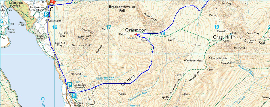
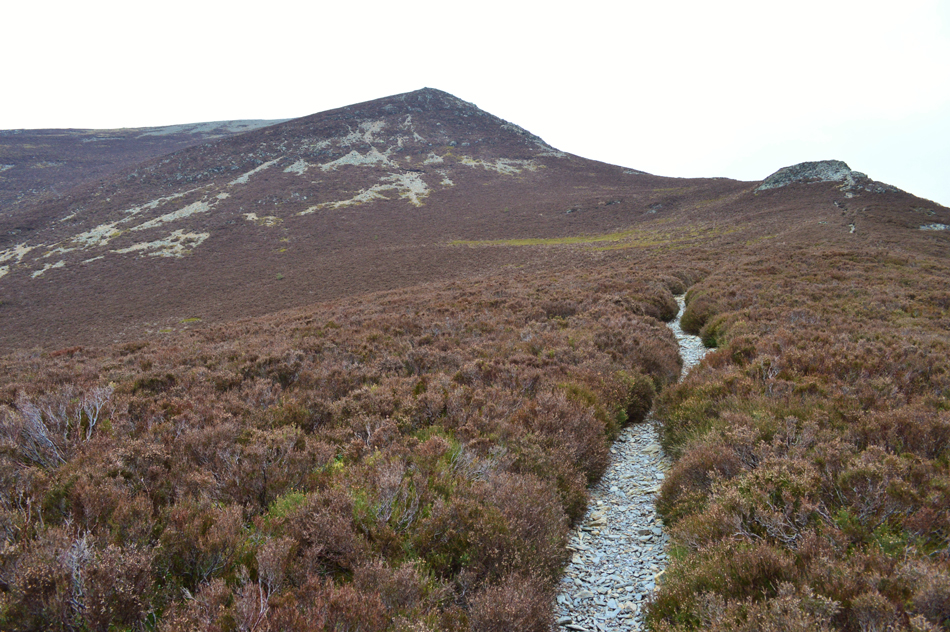
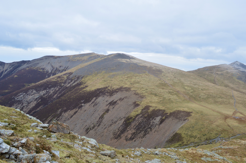
| Whin Ben and Whiteside from Lanthwaite Green 09:10am 2°C |
I'd like to say that this mornings journey to Lakeland was uneventful which it was until I reached the Newlands Pass, after passing through Braithwaite where early signs of iced up puddles lined the edges of the verges and by the time I had passed through Keskadale Farm leakage from the adjoining fell side was layering the pass and care had to taken as I drove over making it essential I spotted the ice spots before they took me by surprise. A farmers 4x4 passes me and nods are shared though the windscreens as I took in the views of Robinson with the summit of the pass dead ahead, it was here I was stopped in my tracks by a much larger ice patch situated just metres from the road pass summit, here the ice predominantly covered three quarters of the left hand side of the tarmac leaving only a narrow purchase on the right, deep down I knew I had to turn around as I didn't fancy writing off my four month old car but I thought I'd at least have to give it a go.
My first run was a test to see how far the ice extended along the narrow right of the road which was confirmed around thirty metres, with only my right front wheel taking grip I soon came to a stop not before my E.S.P warning light (Electronic Stability Program) was flashing me warning I had lost grip, feck. not helped by the fact I have a electronic handbrake, I put the car into neutral and let it slide back naturally while steering back into the centre of the road. My second run saw me pick up speed and I got much further than the first before I lost grip which now meant I had to slide back much further, my third run saw me equal my second but this time I had ventured closer to the right where I had grip the most but my front left wheel started to spin violently and with my brake pedal fully down, I slide uncontrollably backwards until I had purchase on the front left wheel, that was it, my heart was in my mouth and I eased the car into a three (or more like six) point turn and returned to Braithwaite with my tail between my legs, it was 08:30am
With my return to Braithwaite complete I picked up the Whinlatter Pass which had been treated with grit and salt and I was soon motoring through Lorton Vale onwards towards my destination of Lanthwaite Green which I reached around half an hour later where I found a fell runner kitting up on the car park and hi's are exchanged over the cars roofs. It's a bitterly cold morning and I waste no time adding more layers which are topped off by my new Rab Latok jacket which I bought after dropping down a peg in size, they're snug as a bug. It's dry but there's snow flakes in the air and although it may not look it, it's exceptionally chilly, hat and gloves finalise my winter kit as do my Crampons in my pack which I can almost guarantee, will not see daylight today. The fell runner has already left in the direction of Whin Ben and I too give chase, at a much slower pace of course! The ground underfoot is frozen solid and it's a delight to walk over. |
 |
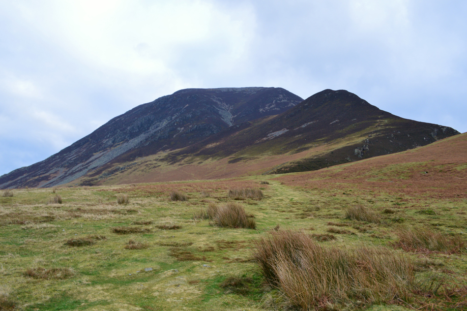
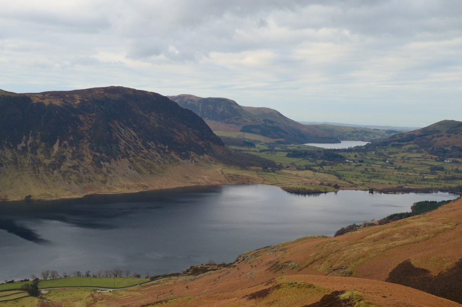
| Mellbreak and Crummock Water seen over Lanthwaite Green from my ascent on Whin Benn. |
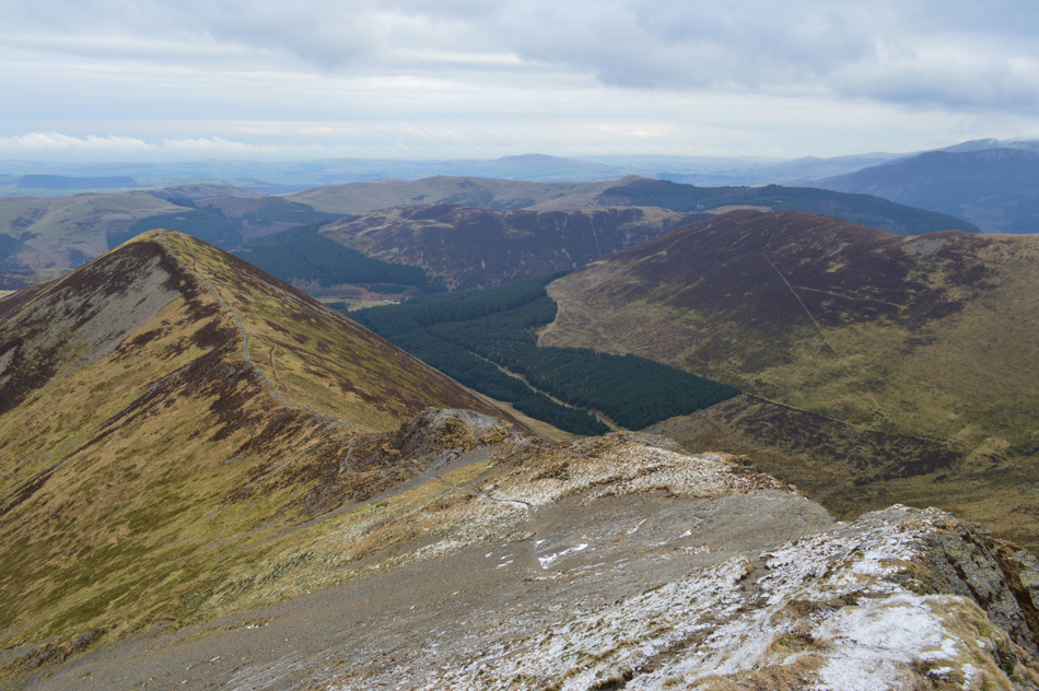
It's been quite a few years since I last ascended Whin Ben and I had forgotton just how steep it was, nevertheless I persevere as my path twists and turns offering views into Gasgale Gill and Grasmoor Dove Crag ridge which both appear moody in the low morning light.
The forecasters had predicted sunny spells throughout the morning extending into early afternoon for the north and west of the park as I found myself checking the cloud above which apeared to be full of snow, meanwhile the snow flurries continued thoughout much of my ascent without so much of a hint of sunlight. |
 |
| Whiteside from Whin Ben summit. |
| It's fair to say that once the summit of Whin Ben is reached a good proportion of the hard work is behind you as the path gradient eases below the rocky outcrop up ahead before the steady and final pull onto Whiteside summit. |
 |
| Views back down the ridge towards Whin Ben, Crummock Water, Mellbreak, Starling Dodd, Great Borne and Carling Knott. |
| |
 |
| Dove Crags and Dove Crags East Ridge seen over Gasgale Gill. |
| The cloud had been clinging to the summit of Grasmoor throughout my ascent but it appears to be clearing now revealing a dusting of snow along the top of Dove Crags. |
 |
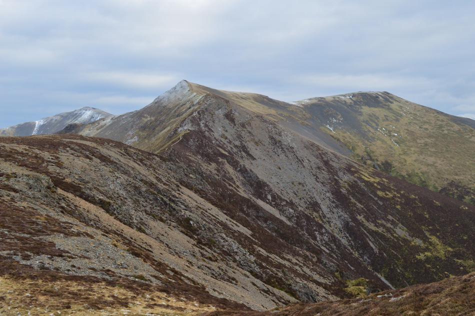
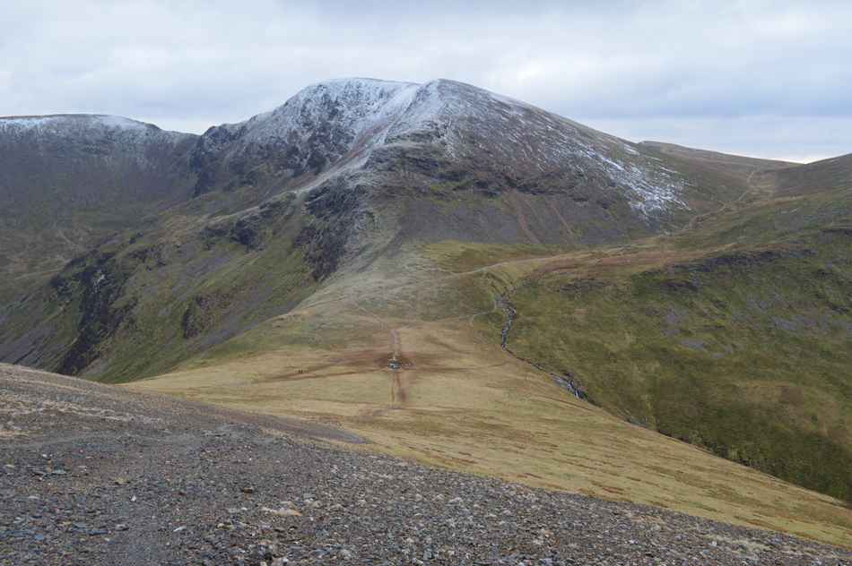
| Grisedale Pike, Hopegill Head and Sand Hill taken close to Whiteside summit. |
| After easily negotiating the rocky outcrop the path steadily rises with outstanding views over Gasgale Crags open out just below the summit of Whiteside. |
 |
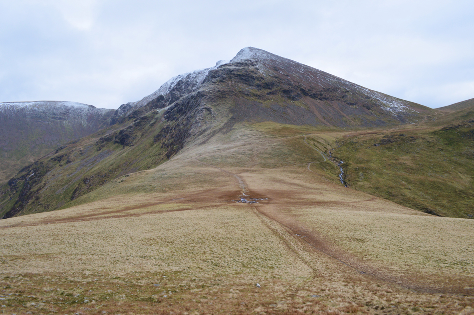
| Gasgale Crags, Grisedale Pike, Hopegill Head and Sand Hill. |
| |
 |
| Hopegill Head and Grisedale Pike from Whiteside summit. |
| After cresting the shoulder of the summit I walked towards the summit cairn instantly feeling the affects from a severe windchill, first came the shock, then the pins and needles shortly followed by numbness in the sides of face and chin. |
 |
| Views into Gasgale Gill from Whiteside with Sand Hill, Crag Hill, Sail and Scar Crags seen over Coledale Hause. |
| It's been sometime since I last wore my neck gaiter but it's about to make an appearance. |
 |
| Grisedale Pike and Hopegill Head taken from the Whiteside Ridge. |
| The forecasters had predicted a -6°C Windchill but it feels more like -10°C the windchill is enough to cut right through you. |
 |
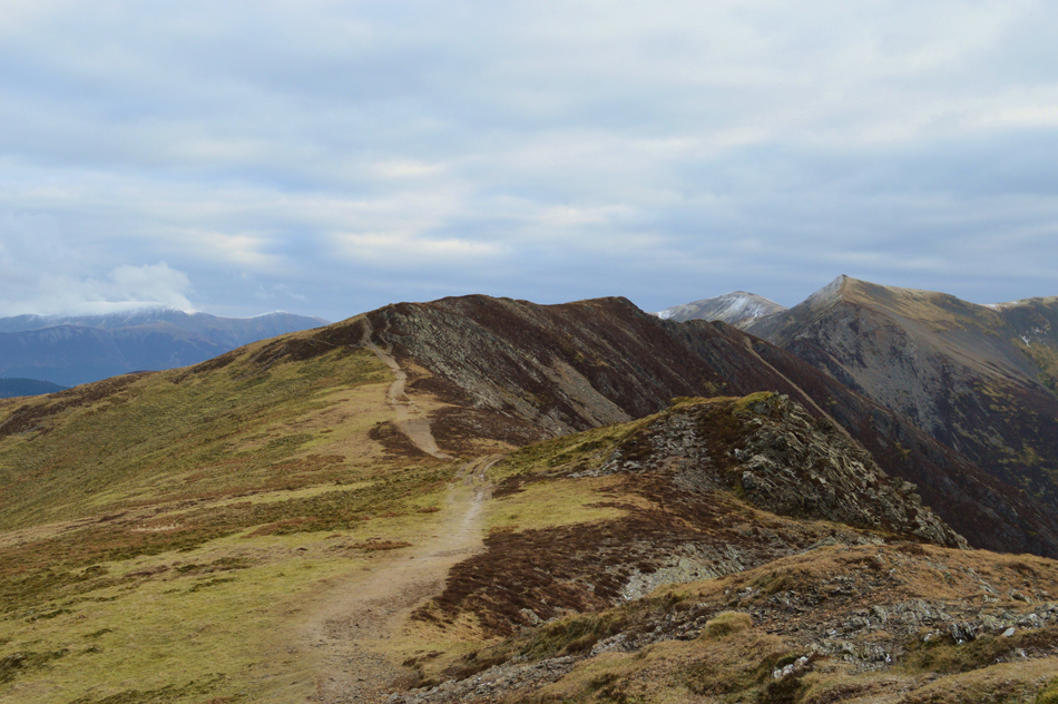
| Grisedale Pike, Hopegill Head and Sand Hill |
| As you can see the north western fells are completely clear of snow with the exception of a light dusting over the summits, it's incredible to think that just over 10 miles away on the Helvellyn range snow is drfiting up to 50cm in depth. |
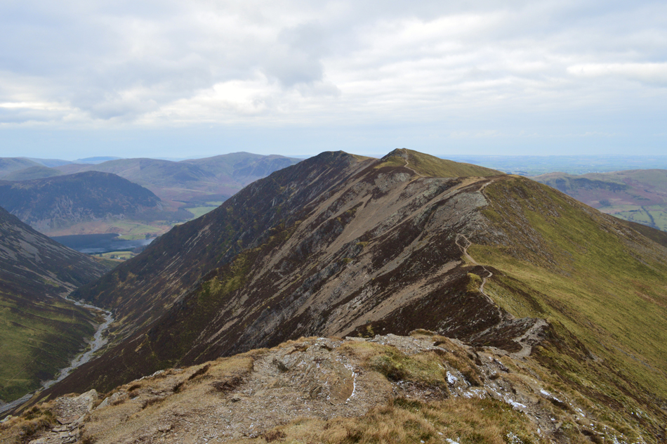 |
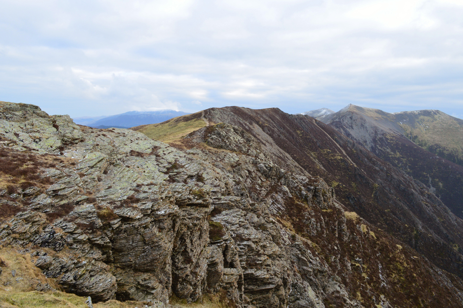
| Views back along the ridge towards Whiteside after negotiating the mini arete along the ridge. |
| The rock was completely dry and offered continuous grip along the whole ridge, despite the exposed windchill crossing the ridge in between Whiteside and Hopegill Head was a great highlight taken from the whole walk. |
 |
| Grisedale Pike and Causey Pike seen over the Hobcarton Valley from Hopegill Head summit. |
| From the mini arete the summit of Hopegill Head is just a short stroll away soon reached as views opened out over near fells while the snow capped peaks of the Hevellyn range appear through a mixture of low light and haze. Sadly it was too cold to hang around and take in the views, if I wanted to keep warm I better keep moving. |
 |
| Ladyside Pike from Hopegill Head summit. |
| Not before one photo of Ladyside Pike with the Lord's Seat Fells in the distance. |
 |
| A stone slab below Hopegill Head summit looked in the best condition I've seen it in all my ascents/descents. |
| If the dry rock along the ridge was anything to go by the stone slab which is notoriously slippy looked quite inviting today, it's only when I look back now do I wish I'd made the 'out and back' to Ladyside Pike today, there's always a next time. |
 |
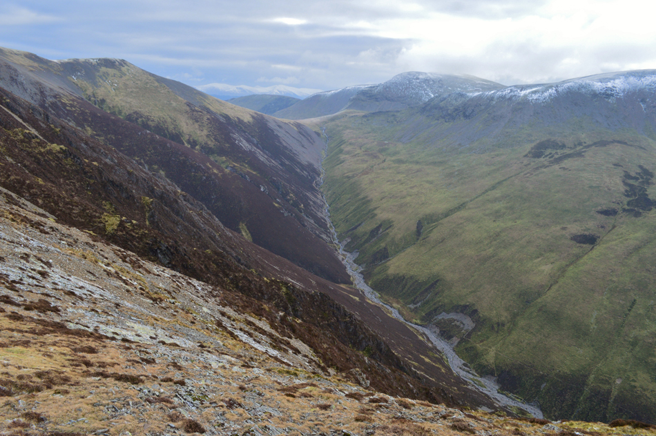
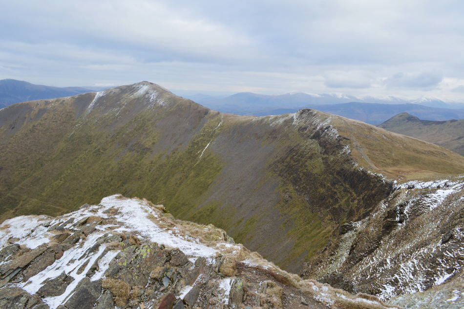
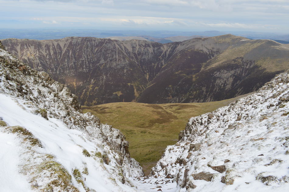
| Eel Crag (Crag Hill) and Sail seen over Coledale Hause. |
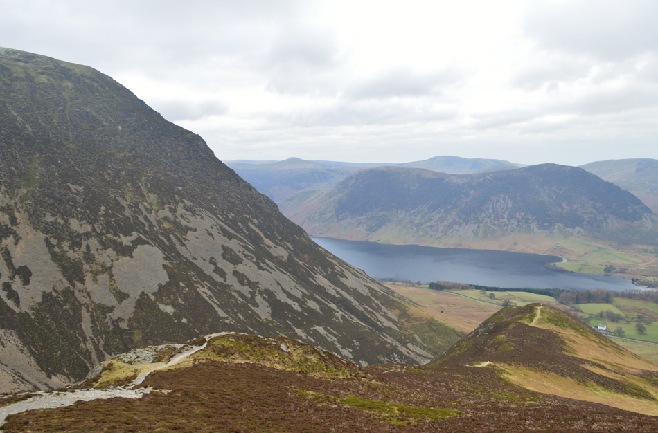
From the summit of Hopegill Head I traversed over Sand Hill spotting a group of walkers who had just summitted Grisedale Pike and two walkers with dogs seen crossing the Hause below heading for Grisedale Pike, the first people I'd seen since the fell runner back at the car park this morning. By now I had become accustomed to the cold and found it entertaining that no matter how many times I pinched my chin with my fingers I got no feeling back! My cheek bones, much the same.
I zigzagged my descent taking in the fantastic views over Coledale Hause under the gaze of a very wintery looking Crag Hill while reflecting my last visit here under warmer climates where blokes wore shorts and the girls wore short shorts. The wind subsided as I passed over the Hause and I could see the two walkers progress who by now still had a distance to go before reaching Grisedale Pike summit, meanwhile the group who I had seen earlier are now crossing over the top of Hobcarton Crag on route to Hopegill Head. |
 |
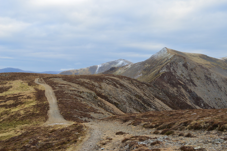
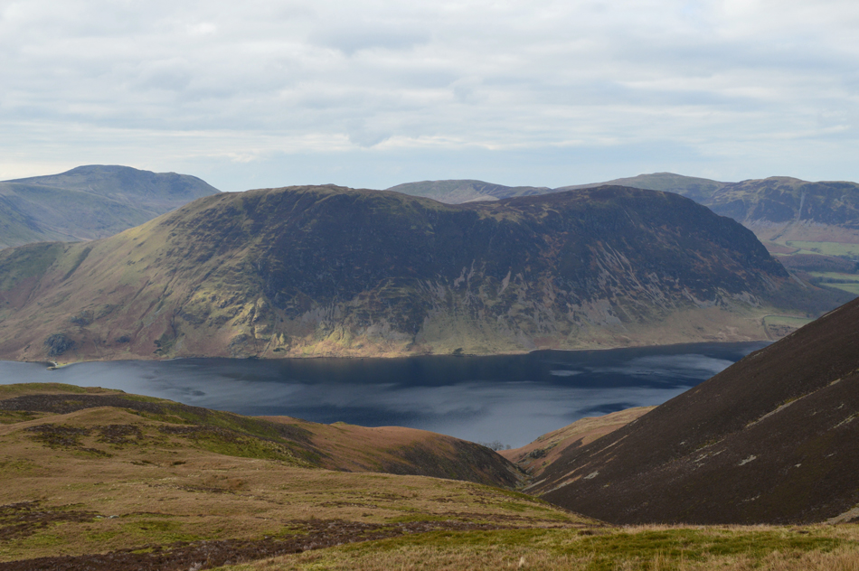
| Grasmoor seen over Coledale Hause. |
| My line of ascent onto Grasmoor will be via the ridge directly above Coledale Hause where after a steady pull offers fantastic views over Dove Crag and Gasgale Gill. |
 |
| Eel Crag (Crag Hill) from Coledale Hause. |
| One of my personal favourite views 'Eel Crag from Coledale Hause' and today, I have it all to myself. |
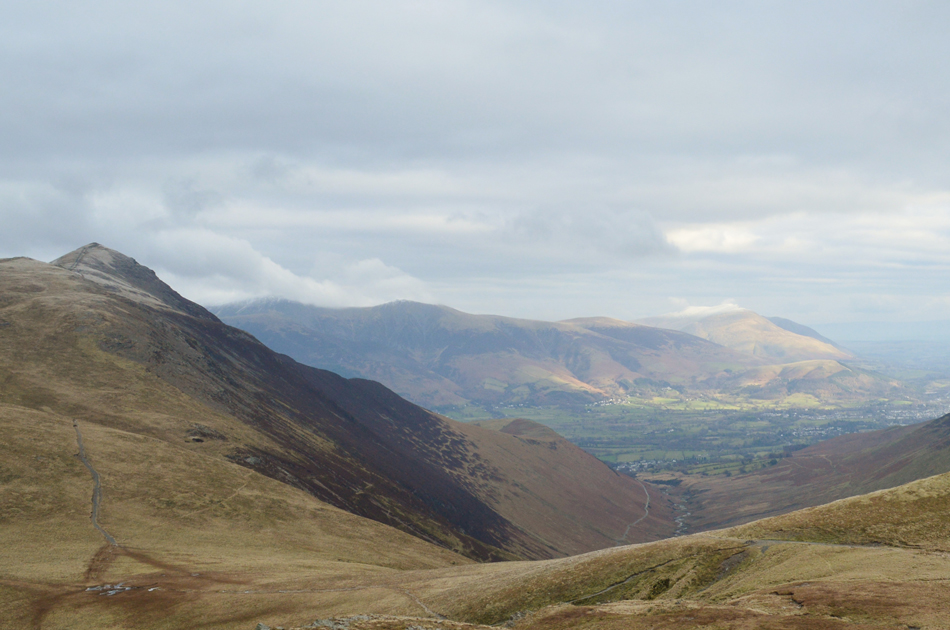 |
| Views back over Coledale Hause towards Grisedale Pike with the Coledale Valley below. |
| There even appears to be a hint of sun over Blencathra and Latrigg. |
 |
| Views over Gasgale Gill towards Hopegill Head and Sand Hill with Grisedale Pike over on the right. |
| After crossing Coledale Hause I climb steadily and cross another notoriously boggy section at the base of the ridge which today, was frozen solid underfoot, my boots still look like I've only just put them on under todays perfect walking conditions. The climb along the edge to Dove Crags starts steadily but soon steepens but this is for only a short period and eases once the summit shoulder is reached from where, there's still a distance to go before the summit is reached but the views more than make up for this. |
 |
| Views towards Gasgale Crags and Hopegill Head from the top of Dove Crags. |
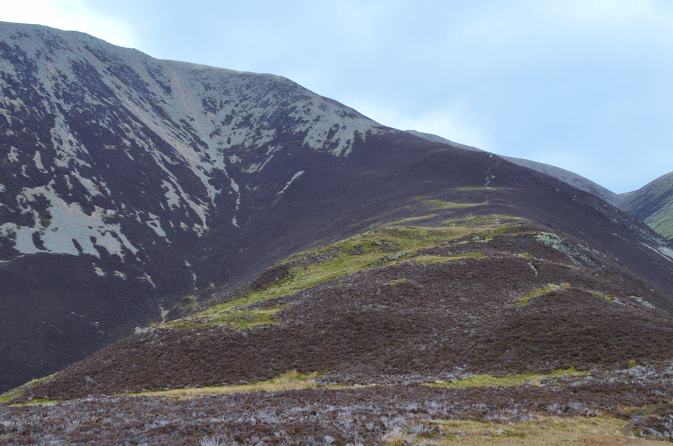
| I had by now entered the snow line at around 2,600 feet around 200 feet shy of Grasmoor's actual summit. Here fresh snow lies on top of old snow and only has a maximum depth of around 5cm. |
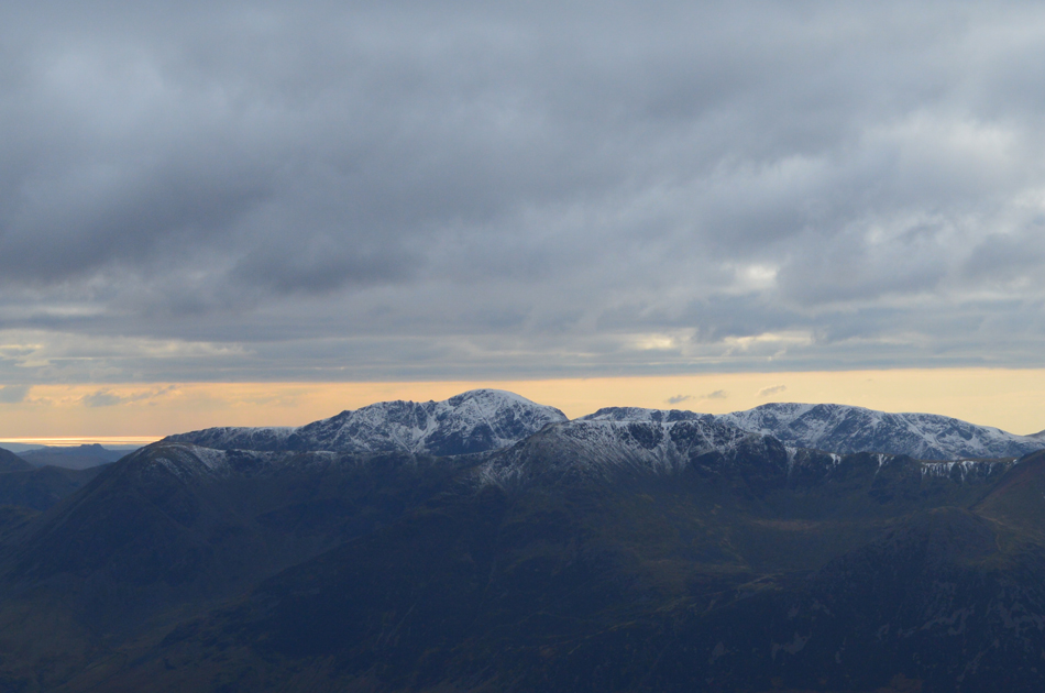 |
| Views over High Crag and High Stile towards Pillar, Scoat Fell and Caw Fell from Grasmoor summit. |
| |
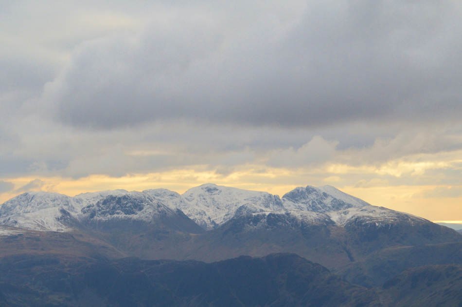 |
| Further south looking over the summit of Hay Stacks towards the Gables, Great End, Broad Crag, Scafell Pike, Sca Fell and Kirk Fell. |
| |
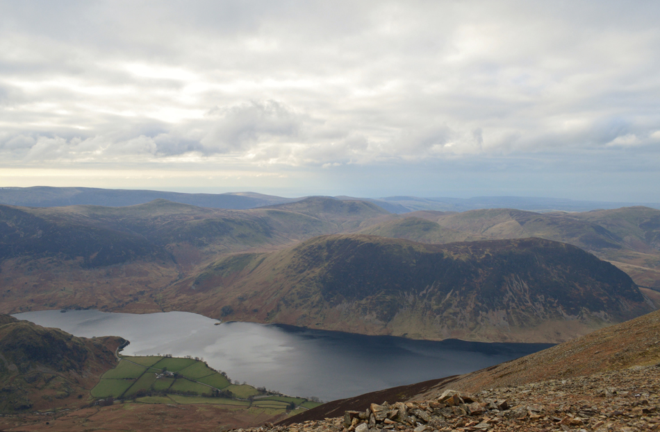 |
| Views over Crummock Water towards Rannerdale Knotts, Mellbreak, Starling Dodd, Great Borne, Gavel Fell, Blake Fell and Burnbank Fell. |
| From the top of Dove Crags I made my way towards the summit shelter where I was treated to a display of light as the sun broke through the cloud above briefly illuminating the dusting of snow across the summit. I soon reached the shelter and thought about settling down for lunch but the chill was too severe to stand within minutes of reaching the summit, I turned heel and started to head towards the top of the Lad Hows ridge. |
 |
| Descending Lad Hows. |
I soon reached the stone cairn marking the top of Lad Hows and started to make my descent instantly feeling the benefits of being out of the summit wind where I could pull my zip down a few inches exposing my lips and chin which thankfully had regained some feeling back! It was almost like I was on a different walk on a completely different day such the difference in temperature.
I was quite surprised to find a group of around five elderly chaps making an ascent via the Lad Hows ridge who were standing admiring the views, I soon reached them and we spoke of how fine a day it was and my reply was "it's biting on the summit" aye one chap says, "it's not too bad if your wrapped up though" and on the plus side, the frozen ground is a pleasure to walk over, he was right about the frozen ground although I wasn't too sure about the wrapping up part, no matter how many layers your wearing the windchill seemed to cut right through it.
Still, great to see a group of friends well into their sixties/seventies enjoying the fells, I only hope I'm still at it when I reach their age. |
 |
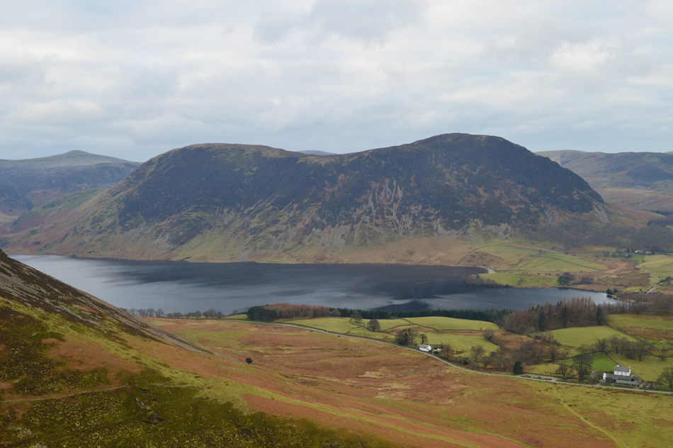
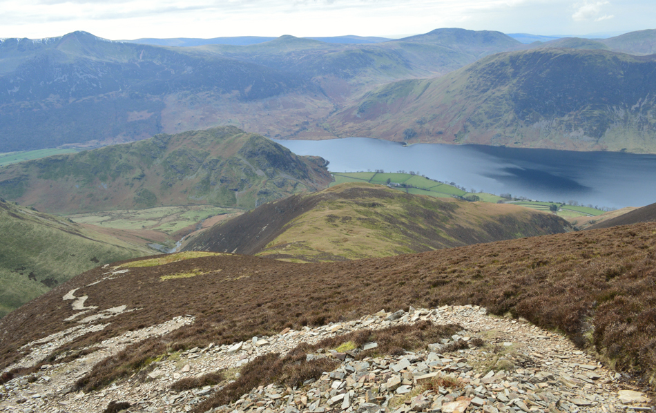
| Mellbreak seen towering above Crummock Water. |
| |
 |
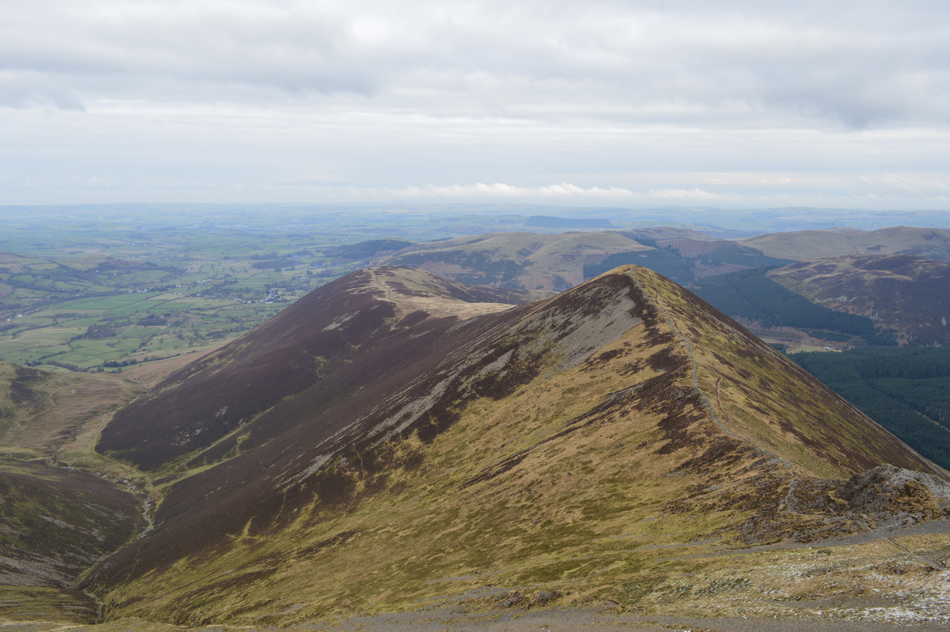
| Views back up the Lad Hows ridge. |
| Well, it's been a while since I last descended the Lad Hows ridge and I thoroughly enjoyed it, even feeling a little hot under my layers once most of the descent was behind me, now it's definitely time for lunch I just need to find a nice spot and if I'm lucky I might even get a little sunshine. |
 |
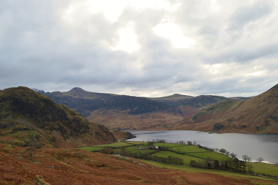
| Two lakes in one view. |
| ....Thats Loweswater in the distance, but you already knew that. |
 |
| Lunch with a view. |
Well the sunshine didn't last but it was mild enough to de-shoulder and break out lunch which I ate whilst perched on a nice dry rock overlooking Cinderdale Common with Cinderdale Beck just behind me, down below the car park is looking rather full with dog walkers walking their dogs and more walkers heading into Rannerdale and beyond. Despite it looking quite busy not one car passed in the time it took me to eat lunch leaving the valley feeling very quiet indeed.
With lunch packed away and my jacket pocket stuffed with a wrapped sausage roll which I would eat whilst walking back to the car I re-shouldred and started my final descent back to the road where I found that the ground underfoot was starting to thaw out a little causing a few un-controlled slides along the way. |
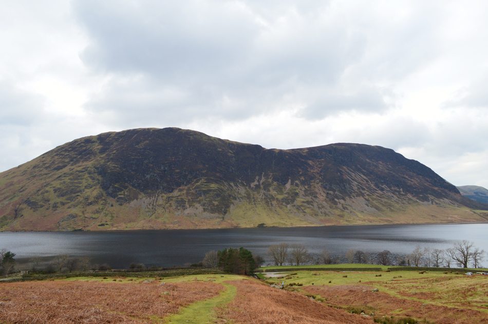 |
| Mellbreak. |
| |
 |
| Spring is just around the corner. |
| |
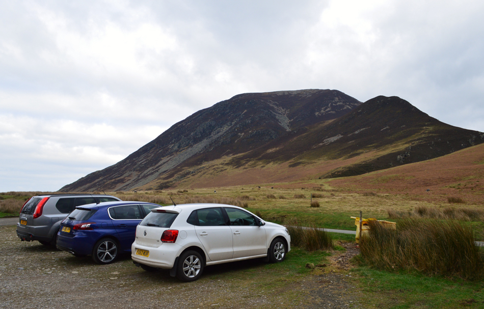 |
| Whin Ben and Whiteside from the car park at Lanthwaite Green. |
With Cinderdale behind me I started to walk the mile back to Lanthwaite Green along the twisting lanes stopping every now and again to take in the view over Rannerdale Knotts and Red Pike, I had all but given up hope of seeing a little sunshine during that last mile and I was right, snow flurries began to fall and the light began to fade. By the time I reached the car park two more cars had parked either side of me and the fell runners car had left, but, before I packed up completely I walked towards the rear of the car park and leant back on the stone wall while taking in the silence only disturbed by the tweet of a bird every few seconds somewhere in the woods below. |
|
| |
| Back to top |
 |
|
