|
Catstye Cam North West Ridge from Glenridding |
 |
 |
3rd March 2017 |
 |
|
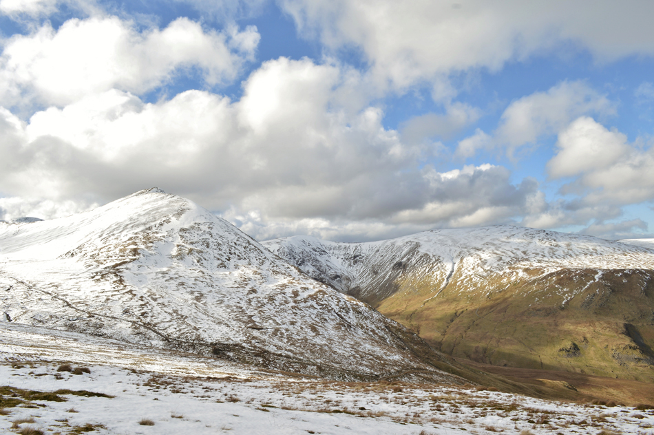
The tell tale signs are beginning to show that we are within the cusp of Spring in the Lakeland valleys with newborn lambs in the fields and pastures together with daffodils that line the country lanes yet despite the milder temperatures remain in the valleys the highest of the summits and ridges are in alpine condition but for how long? well that's uncertain. It's been almost seven weeks since I last enjoyed blue skies together with a bright sun on the fells and my general mood had started to dip to a point where I think I may have wandered into S.A.D (seasonal affective disorder) throughout the winter months where I started to feel the effects of light deficiency which has seen me cry out for a hint of sun, especially while out on the fells.
Todays forecast was as expected for early March where despite the mildness low cloud would linger below 600 metres but at least it was forecast to stay dry with the exception of a few localised rain, hail, and snow showers over the summits, I think the experts would call it unsettled and I tend to agree. It just seems to have been 'unsettled' for too long which is unsettling. Due to wet and windy weather last weekend I stayed at home while watching the rain pour down the windows, it was agreed a couple of weeks ago that David and I would walk today on one of David's project walks today although which one was dependable on the forecast where as it turns out I got my wish on a day which I considered to be a turning point where Winter has started to lose its grip in favour of Spring. |
|
| Wainwright Guide Book One |
 |
| The Eastern Fells |
-Catstye Cam North West Ridge
Walkers with red blood in their veins should give their attention to the north west ridge. This looks formidable (from White Side it looks impossible) but is actually an easy uphill walk without any difficulty other than steepness. |
 |
|
|
|
| |
|
Overview |
|
|
| Ascent: |
3,250 Feet - 992 Metres |
| Wainwrights: |
2, Catstye Cam - Birkhouse Moor |
| Weather: |
Overcast To Start Turning Warm Dry And Bright PM. Highs of 9°C Lows of 6°C Feels Like -4.3°C |
| Parking: |
Roadside Parking, Glenridding |
| Area: |
Eastern |
| Miles: |
8 |
| Walking With: |
David Hall |
| Ordnance Survey: |
OL5 |
| Time Taken: |
6 Hours 55 Minutes |
| Route: |
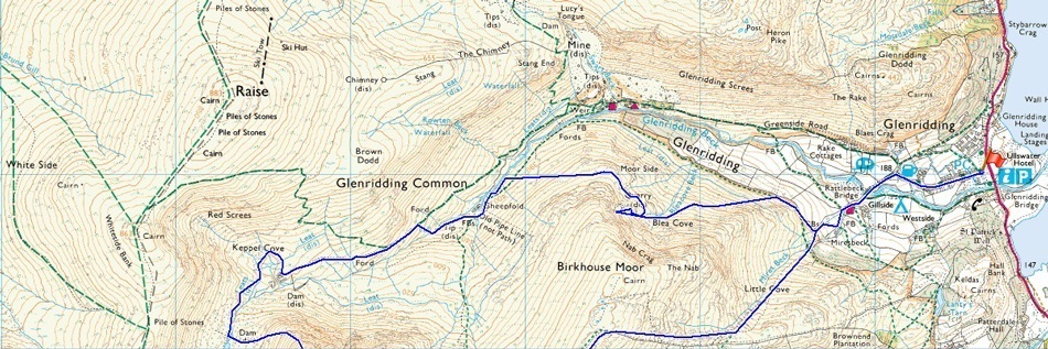
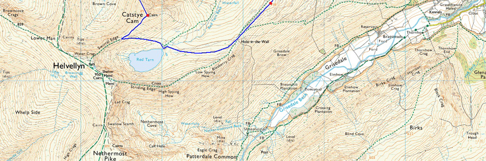
Glenridding – Blea Cove on Birkhouse Moor – Keppel Cove – Brown Cove – Catstye Cam North West Ridge – Red Tarn – Birkhouse Moor – Miresbeck - Little Cove – Glenridding |
|
| |
|
Map and Photo Gallery |
|
|
  |
| |
| |
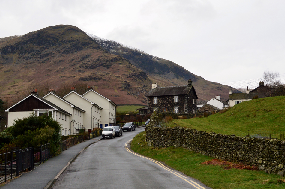 |
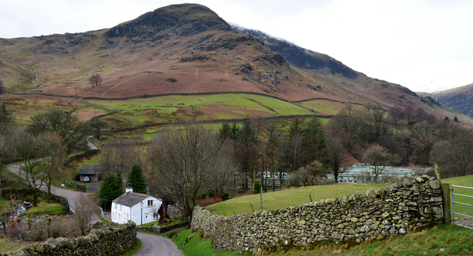
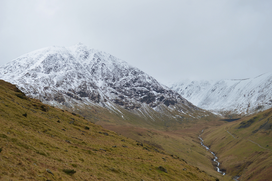
| Birkhouse Moor from Greenside Road, Glenridding 08:50am 6°C |
David and I had arranged to meet in Glenridding at 09:00am leaving time for any lingering showers to clear, I hadn't expected to see the summit of Birkhouse Moor from the village which came as a real surprise with low cloud predicted for the early hours of the morning. I arrived early and secured a parking place in the centre of the village. Glenridding was still quiet with only the odd dog walker milling about. Shermans General Store was open and awaiting visitors as were the Souvenir and Gear shops too, I suspect within an hour the place will be bustling. I start to kit up taking advantage of the path besides the car and soon spot David who parks up in front of my car. We greet with a handshake while taking in the view towards Birkhouse Moor summit "blimey, I didn't expect to see that" referring to the lack of cloud, it's not just good news, it's great news after expecting to be walking in cloud for the best part of the morning.
My pack feels heavy with my Winter kit and even after all but the essentials have been taken out I still get that 'thud' as I swing it around my back. With the cars locked we head out through the village via Greenside Road towards the Travellers Rest where we pass a solo walker who cheekily whips up "good job I'm not walking with you at that pace" our pace obviously must show our eagerness to get boot onto fell. After passing the Travellers Rest we leave the cottages behind and descend through a dip in the road passing Rattlebeck Cottage which brought us out at the rear of Gillside Campsite and after a steady slog we arrive at the stone wall which we follow below Birkhouse Moor north east ridge...our destination is Blea Cove and its quarry which is seen just above the cottage in the right of the photo. |
 |
| Birkhouse Moor seen towering above Rattlebeck Cottage. |
| After passing the Travellers Rest we leave the cottages behind and descend through a dip passing Rattle Beck Cottage which brought us out at the rear of Gillside Campsite where after a steady slog we arrived at a stone wall which we followed below Birkhouse Moor north east ridge.
By now quite a few walkers are spotted leaving Glenridding for the fells. |
 |
| The Glenrididng side of Sticks Pass seen with Sticks Gill. |
| As expected after recent rain this past week the fell side and the valleys are very wet underfoot and Sticks Gill reflected this which could be heard well before it could be seen. |
 |
| Abandoned quarry Blea Cove. |
We only had to follow the stone wall for a short distance before arriving at a faint singular track which would have been used by the miners who mined the quarry in Blea Cove which was part of the Greenside Mine. The track is swollen and at times steep but soon steadies out once the outskirts of Blea Cove was reached, here we get a view of just how large Blea Cove actually is as it rises up towards Nab Crag situated just below Birkhouse Moor summit. |
 |
| Views back over Blea Cove towards Glenridding Dodd, Glenridding, Place Fell and Ullswater. |
| We stop and study the lay of the cove and plot a route towards the spoil heaps which are easily visible from Glenridding some mile and a half away. Pathless we arrive at the spoil heaps and navigate through Juniper where we spend time exploring two ruined huts along with the remains of an excavated head wall where water disturbs the silence as it gushes down the rock face. We spend a few moments trying to imagine what it must have been like to work these quarries where life expectancy didn't reach past the age of 40 |
 |
| Birkhouse Moor north east ridge seen at the far end of Blea Cove. |
After time spent at the quarries we plan our descent which will first navigate across the nose of the Birkhouse Moor north ridge (directly above the old mine) before a crows eye descent back onto the path below from where Glenridding Beck will be crossed in order for us to reach our next objective of Keppel Cove, but that's all in a little while.
At the moment it's pretty uncertain what level the cloud base is at but it won't be long until Catstye Cam comes into view. |
 |
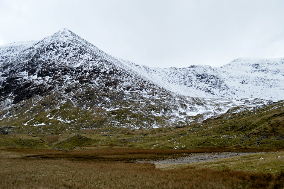
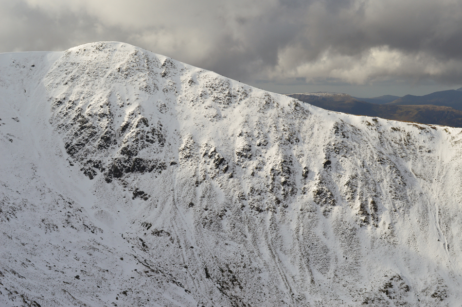
| Catstye Cam seen above Glenridding Beck. |
Well, what a view, no low cloud albeit a little lingering around Catstye Cam summit which was just perfect. It's looking mighty Wintery too at a point when we both consider de-layering due to how mild it felt here in the valley.
It's not clear from the photo, but there's plenty of people about on both paths either side of Glenridding Beck below which was great to see. |
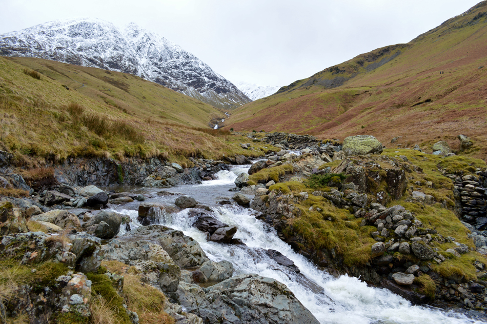 |
| Attempting to cross Glenridding Beck. |
From our pathless descent we made straight for Glenridding Beck which we had both reservations about after a week of rain and thaw would we find a safe place to cross. Feeling hopeful that we might spot a crossing place which came to no avail no matter how much we tramped upstream, although in doing so we were able to view several waterfalls not visible from the path above. |
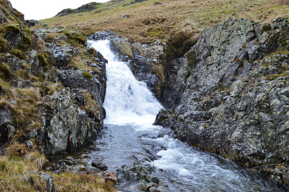 |
| Waterfall, Glenridding Beck. |
Finding a safe place to cross the beck was starting to get a little frustrating and we agreed to just keep walking up stream until we reached the familiar Sheepfold where we crossed Red Tarn Beck via the wooden footbridge. From the footbridge we had two choices whether to give up and walk alongside the bank until we reached the Dam below Catstye Cam north east ridge or to continue searching for that 'golden spot'
Further upstream after passing this waterfall the channel narrowed to around eight feet in width where we found not quite enough semi submerged rocks to act as stepping stones, on the other side of these, around three feet of fast flowing water. Without thinking and possibly partly through frustration I started to pick up more rocks closely followed by David and carefully placed them into the water until we had completed the stepping stones the full width of the beck, I went first and found that we had planted the rock so carefully (some rock so large they took two of us to carry) that there wasn't even a wobble as we crossed over.
After feeling pleased with our handy work all that was left was to scale the steep sided bank now on the Keppel Cove side of Glenridding Beck, now feeling exhausted we arrived on the path pretty much out of breath. |
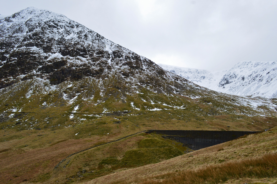 |
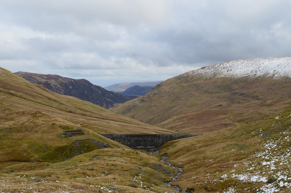
| Catstye Cam North East ridge with the remains of Keppel Cove Dam below. |
The Dam from here actually looks intact but it was Breached during a fierce storm on 29th October 1927 The resulting wave flooded the village of Glenridding damaging buildings causing extensive damage, sounds frighteningly familiar doesn't it.
Instead of heading for the north east ridge first we plan on having a look around Keppel Cove, then head out towards Brown Cove seen in the middle right of the photograph, where it's looking very Wintery indeed. |
 |
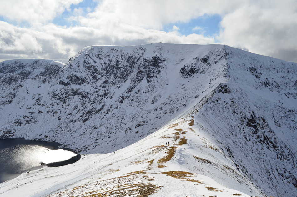
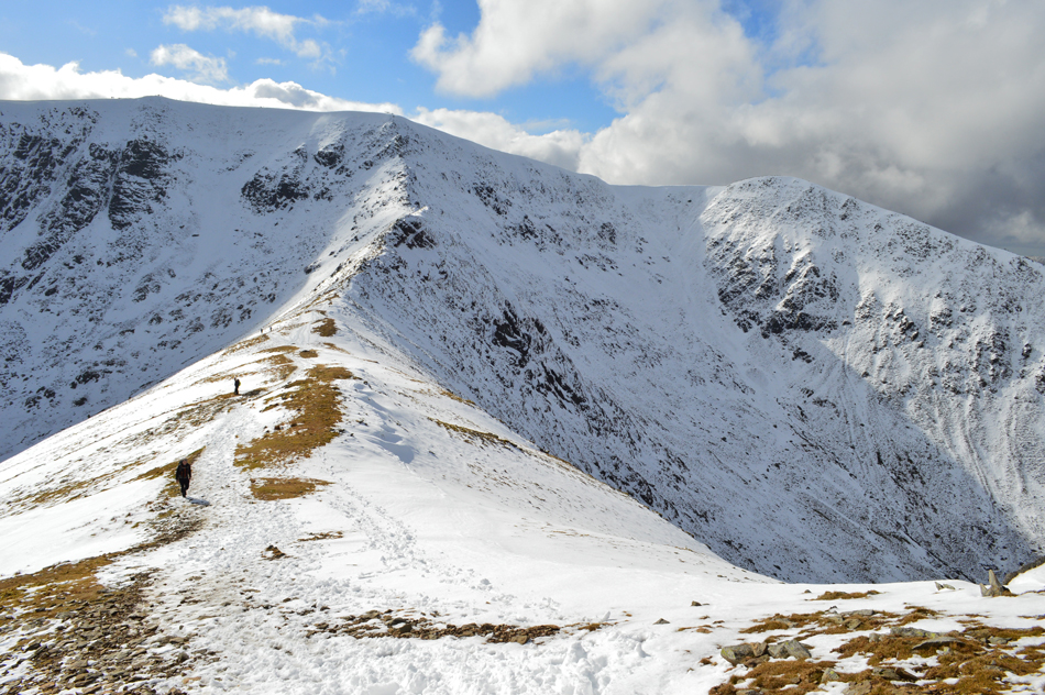
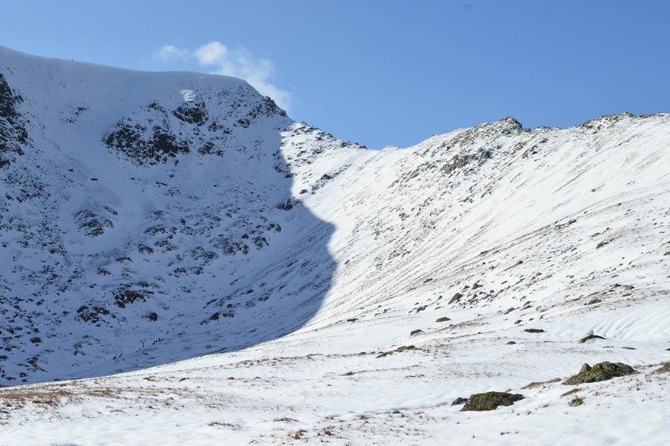
| Catstye Cam North East Ridge and Swirral Edge from Keppel Cove. |
We arrive at the familiar sheepfold and plan a circular route around Keppel Cove from where we are treated to grand views back on the north east ridge together with Swirral Edge. The cloud had lifted within the last twenty minutes or so revealing climbers edging their way over Swirral Edge.
I and we have been here many times before but have never actually navigated our way around the Cove which was surprisingly dry (ish) underfoot and gave a new perspective of the surrounding fells and ridges. It feels as remote as a place can get yet today their are dozens of walkers heading up the Keppel Cove zigzags behind us and there are also four walkers in Brown Cove ahead of us as it dawns on us we might not be the only ones taking on the north east ridge this morning. |
 |
| Views back through the valley as we head into Brown Cove towards Stang, Birkhouse Moor, Place Fell and a distant Loadpot Hill. |
From Brown Cove we are able to view our descent route from Birkhouse Moor north ridge seen between the rocky outcrops around half way up the ridge before descending further towards Glenridding Beck.
The snow line on Birkhouse Moor is at an estimated 650 metres which is a lot higher than Brown Cove where we found the snow line at around 450 metres. |
 |
| Swirral Edge from Brown Cove. |
From Keppel Cove we took in the slight ascent into Brown Cove under swollen ground predominantly caused by thaw. We steer towards the Dam where we spot two walkers (who we had seen earlier) sighted between Swirral Edge and the north east ridge making an ascent on Catstye Cam, they appear to be missing out on the ridge ascent altogether and continue with their ascent.
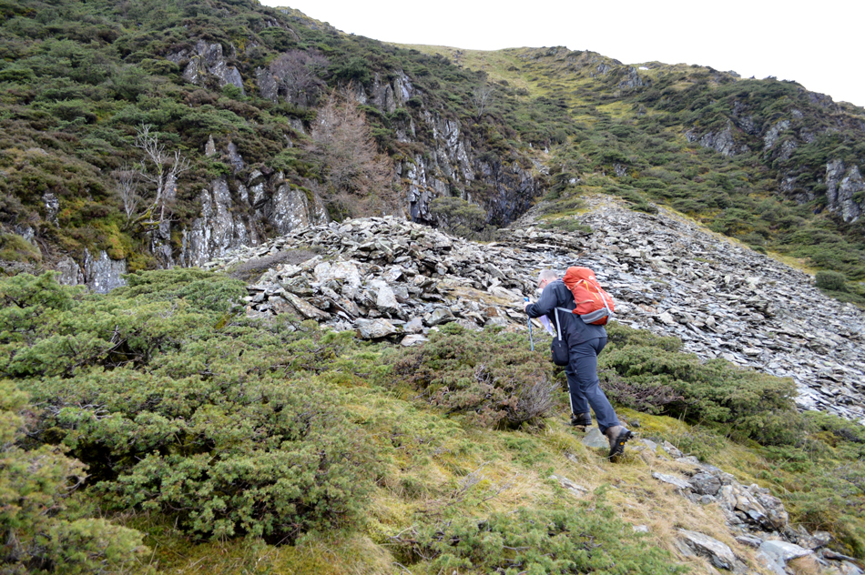
After crossing the Dam in Brown Cove we plot our route up the ridge, this being slightly more difficult as the path was under deep snow in places but having been here before we had the advantage of knowing the whereabouts of the path. From the start we pressed on through around 5-10cm of thawing snow then began our ascent using the tops of any rock that poked out above the snow all the while steering for the backbone of the ridge, I guess in those early moments we knew this wasn't going to be a breeze ascent, but after weeks of walking below the cloud it was exactly what was needed. |
 |
| Swirral Edge and Helvellyn Lower Man seen towering above Brown Cove. |
Once we had obtained the path progression became slightly easier although despite finding the path easier much of it was buried below a foot of snow in places, we took turns cutting through the thawing snow which didn't hold and was starting to become too slippery for boots, it was time to add spikes, or in my case, crampons.
The two guys who had mistakenly found their way almost below Swirral Edge had by now clawed their way back almost to our position, in fact had I have left them in their heads would have appeared in this photograph! They call a cheery hello and we return one back, now within chatting distance.
We re-shoulder as David adds spikes to his boots while my crampons take more time to add due to a build of ice/snow which prevented my boot finding position in the heel of the crampon and not made easy by the gradient of the slope and snow underfoot, they say to add crampons before you need them which works in practice but not always while out on the fell. I apologise for the length of time it took me to add which was probably around five minutes but it felt like more. Our down time gave the two guys a lead on us who pass with "first one at the bar gets the round in" or words to that effect. |
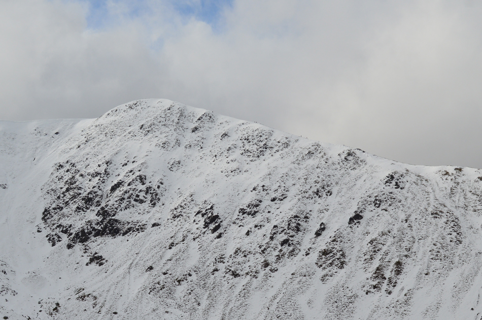 |
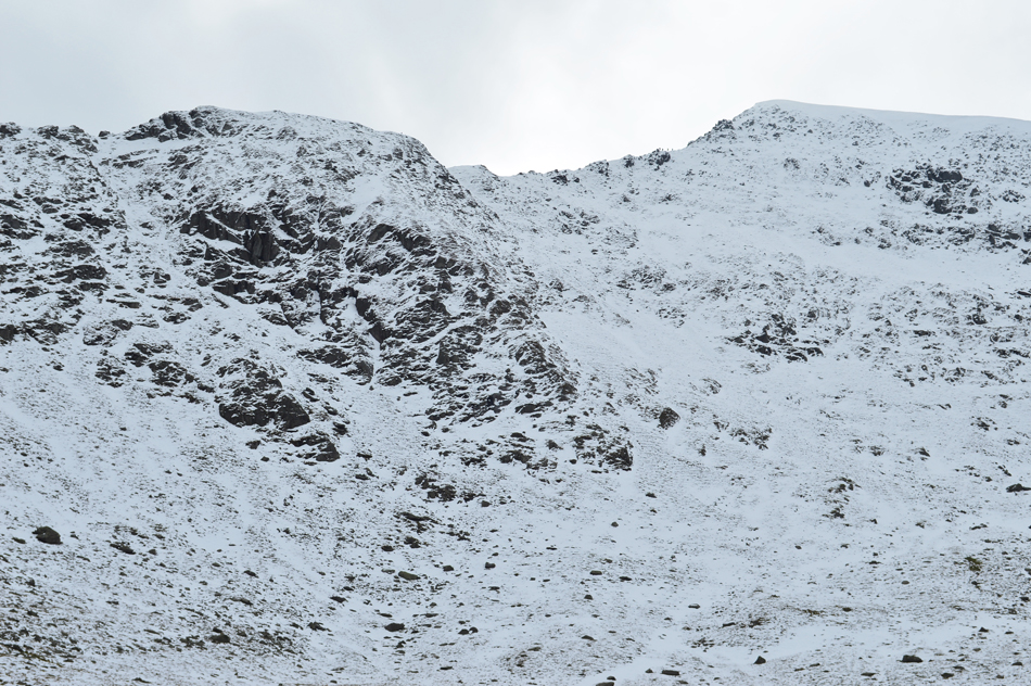
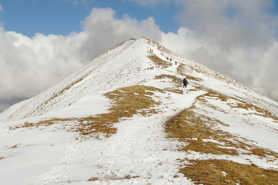
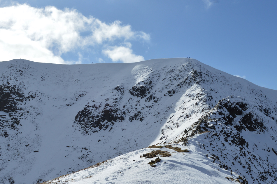
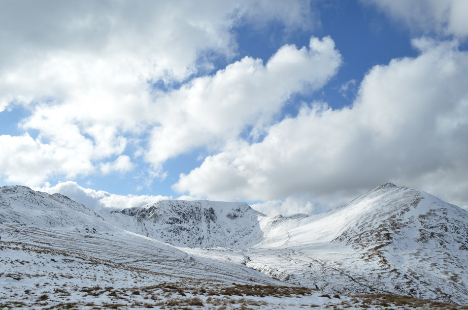
| Helvellyn Lower Man from the ascent of Catstye Cam North West Ridge. |
| Those of you with a keen eye may be able to spot the walkers heading towards the summit. |
 |
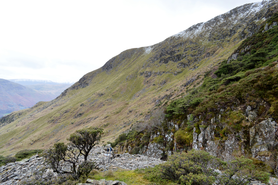
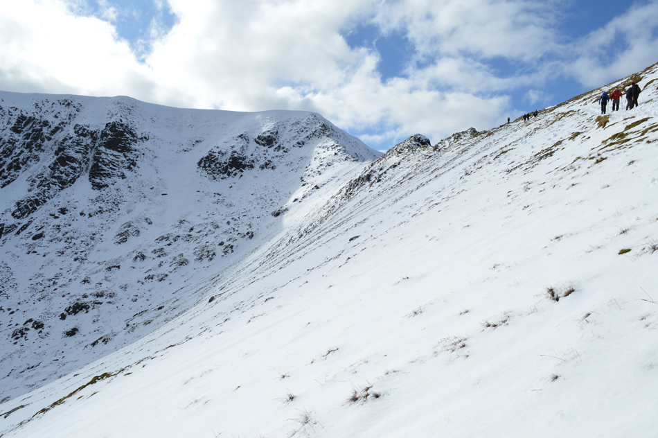
| Raise seen above the Keppel Cove zigzags. |
| The snowline above Keppel Cove is at a estimated 600 Metres. |
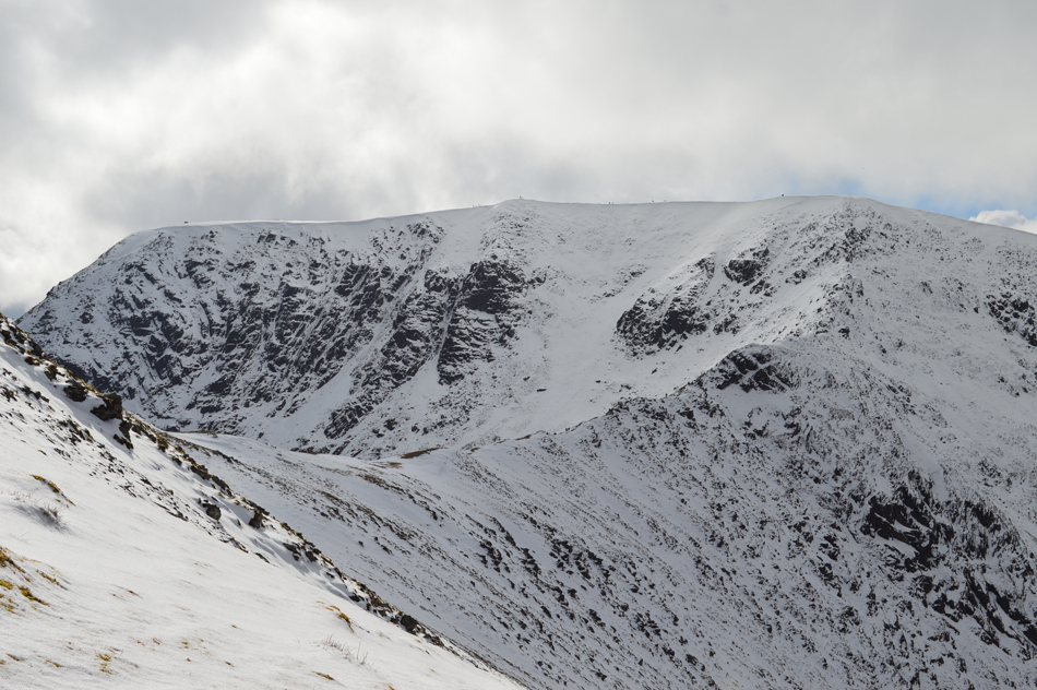 |
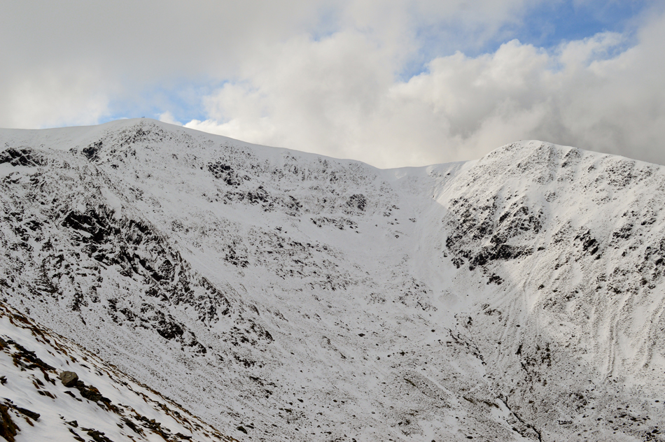
| Swirral Edge and Helvellyn from Catstye Cam North East Ridge. |
| Our timings as we looked across to Helvellyn as the cloud started to break up revealing hints of sun over Swirral Edge couldn't have been more perfect, from here the light intensifies and the cloud continues to break revealing chinks of blue overhead, just fantastic. |
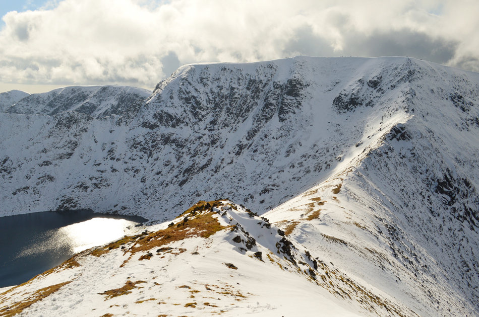 |
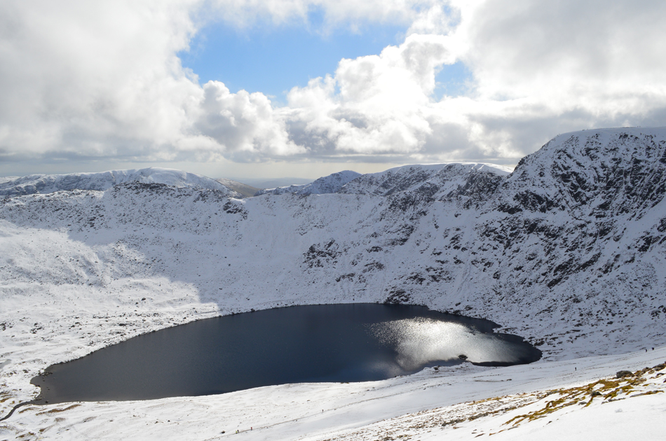
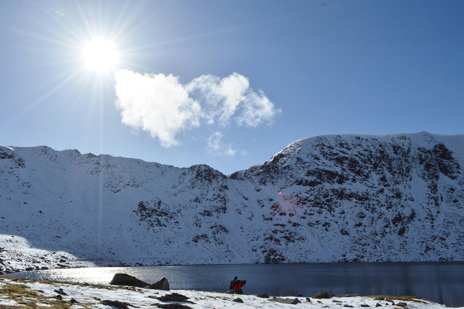
| Helvellyn, Swirral Edge, Red Tarn, Striding Edge and a distant Nethermost Pike from Catstye Cam summit. |
Having ascended one false summit, one still remained before reaching the summit cairn, here tiredness started to kick in and the last forty yards were possibly the slowest of the whole ascent, nevertheless we arrived and peaked out at the summit where we found a family sitting down enjoying the views whilst eating lunch with more arriving from the direction of Red Tarn by the minute. It was agreed during the ascent that, should we be able to withstand the windchill (recorded at -4.3°C) we would find a spot preferably out of the wind and break out lunch.
My mood was one of delight and although I cant speak for David I'm sure his was too being able to enjoy the view under clearing skies upon the grandest of mountain. Soon, however the windchill got too much for gloveless fingers and we started to pack up having not completely finished lunch.
The family behind us thought the same as they too started to gather their gear as more and more people started to arrive, it was agreed it was the busiest we'd ever seen Catstye Cam summit. |
 |
| Striking views over Red Tarn towards Striding Edge. |
| Here with Nethermost Pike, Dollywagon Pike, Fairfield and St Sunday Crag in the distance. |
 |
| A close up of High Spying How, Striding Edge, Nethermost Pike and Fairfield. |
| |
 |
| Helvellyn and Swirral Edge from Catstye Cam summit. |
| |
 |
| Descending Catstye Cam with views over Red Tarn, Helvellyn and Swirral Edge. |
The glow from a now warming sun continued to leave its light over Swirral Edge which changed minute by minute, it was a wonderful descent helped by much firmer snow underfoot which had compacted in places to around 3-4 cm in depth.
It was agreed that we would keep our spikes and crampons on until we reached Red Tarn although it wasn't completely necessary it did help with descent. |
 |
| Helvellyn Lower Man seen over Brown Cove seen from Catstye Cam. |
| |
 |
| Helvellyn, Swirral Edge and Helvellyn Lower Man seen over Brown Cove. |
| |
 |
| Views back towards Catstye Cam summit. |
| Only the two walkers in the foreground where in descent, the rest were heading for an already bustling summit. |
 |
| Swirral Edge and Helvellyn Lower Man seen over Brown Cove. |
| |
 |
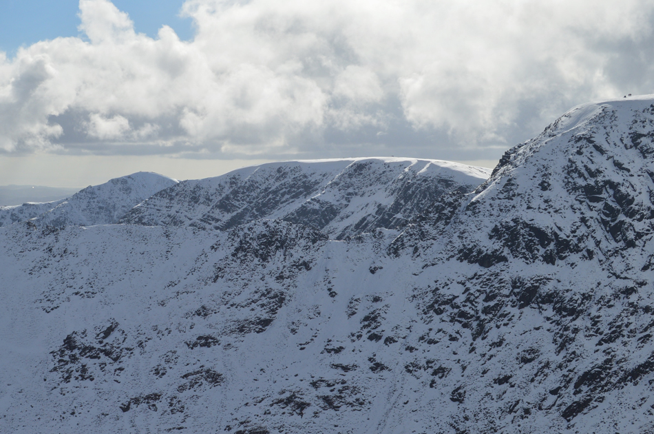
| Helvellyn and Swirral Edge. |
| Not only had the cloud cleared leaving blue skies but the clarity had started to improve too, here walkers at the top of Swirral Edge can clearly be seen. |
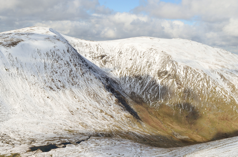 |
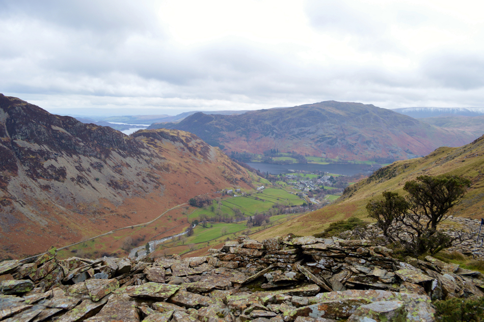
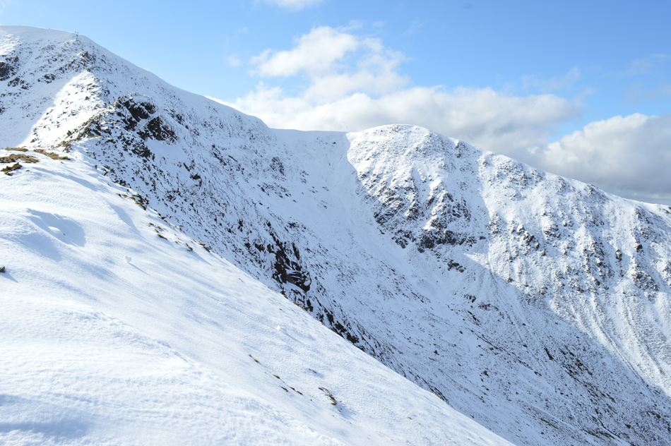
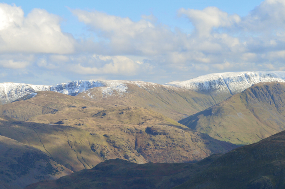
| Views over Brown Cove and Keppel Cove towards White Side and Raise. |
| You may just be able to spot Browncove Tarn together with the Dam from where we started our ascent on Catstye Cam north west ridge from. The lighter shade of brown over on the right in Keppel Cove shows the area we walked around ealier. |
 |
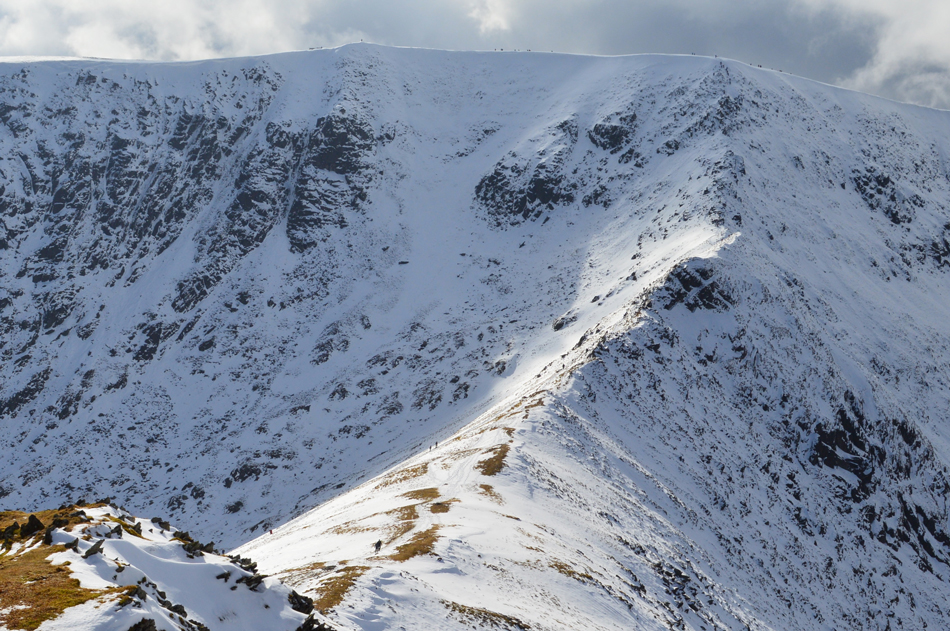
| Magnificent Swirral Edge as we descend towards Red Tarn. |
It was as equally busy as we descended towards Red Tarn with walkers heading for Catstye Cam and Swirral Edge and I suspect most of whom are heading for Catstye Cam which is about to get even busier.
We descend through thawing snow and slush passing many a walker heading with hi's and hello's before agreeing to make a small detour to Red Tarn, I mean, it would be rude not to on a day like today. |
 |
| Swirral Edge taken close to Red Tarn. |
| |
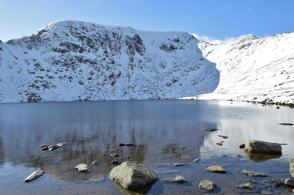 |
| Helvellyn from Red Tarn. |
| ...Speechless, |
 |
| Striding Edge and Helvellyn from Red Tarn. |
We had descended through snow which was thawing and rapidly turning to slush which made for a sometimes slippery ascent/descent for those without spikes. By the time we had reached Red Tarn a breeze had picked up but it was nothing like the chill we had felt whilst back on Catstye Cam summit. A calmness dawns over Red Tarn while we watch a spectacle of climbers traversing Striding Edge, each topping out as tiny black spots close to the Gough Memorial.
Despite our tranquil setting it was time to move on towards Birkhouse Moor but before we head off it's time to ditch the crampons and spikes. |
 |
| Birkhouse Moor is just up ahead. |
| It was agreed that there was no finer way to bring the walk to a end than to descend Birkshouse Moor via Little Cove, todays final cove of the walk. |
 |
| Looking back on Catstye Cam as we head towards Birkhouse Moor with Raise in the distance. |
| |
 |
| Striding Edge, Helvellyn, Swirral Edge and Catstye Cam from Birkhouse Moor. |
| |
 |
| The clarity continues here with views towards Angletarn Pikes, Brock Crags, Knott, Rampsgill Head, High Raise, High Street and Gray Crag. |
| |
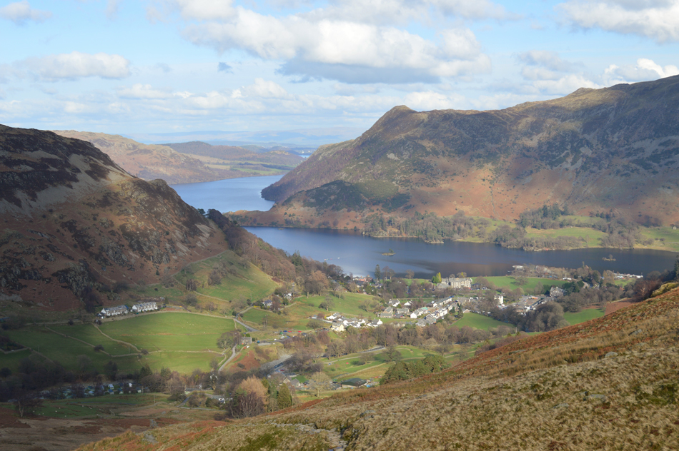 |
| Glenridding Dodd, Birk Fell, Ullswater and Glenridding from Little Cove. |
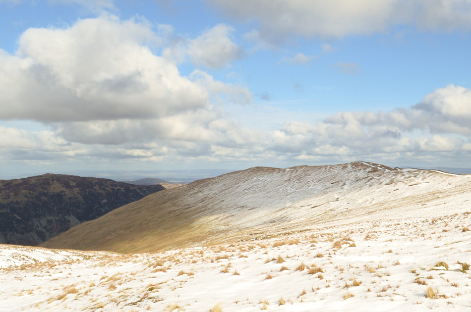
From the summit of Birkhouse Moor we started our descent in to Little Cove passing a trio of walkers, one of whom looked like he really didn't want to be there as he lagged behind while his friends would stop and wait for him which I thought was a shame because the fells and the weather provided some of the best Winter walking I've had the pleasure to experience.
Under a warm afternoon sun where it felt much more Spring like we descended through Little Cove all the while we could see the hustle of Glenridding below where the campsites had already started to fill up with large Motorhomes close to Gillside Campsite. We were now back on familiar ground having passed Rattlebeck Cottage where a incline lead us past the Travelers Rest before we arrive back in the village where plums of wood smoke leave the chimneys and fill the nostrils before arriving back at the parking spaces which had been filled from one end to the other.
A layer of sweat had formed between my midlayer and jacket, something that would normally occur during the Summer months which goes to show how mild the afternoon temperatures had reached. With a handshake we drive out of the village in our respective directions, mine back over the Kirkstone Pass where highlights of rain start to land on my windscreen under darkening skies, water pours through the walls and spills over the road and within minutes I am driving through cloud with my headlights switched on but right now all I can think of is how all of a sudden how hungry I've started to feel, no wonder when half your lunch is still in your pack which kinda brought me to the reason why we hurried lunch down the way we did, was it because it was too cold to withstand the chill, or was it simply because we didnt want to miss the views that had unfolded in front of us. |
|
| |
| Back to top |
 |
|